
Search


Limit your search
- Completely digitized✖[remove]28
- Public✖[remove]28
- Annotations (Provenance)--20th century✖[remove]28
- Maps13
- Military maps5
- Cadastral maps4
- Maps.3
- Nautical charts2
- Booksellers' labels (Provenance)1
- Cadastral maps.1
- Early maps1
- Engravings1
- Maps, Atlases & Globes✖[remove]28
- Pownall, Thomas, 1722-18053
- Great Britain. Hydrographic Department, author1
- Great Britain. War Office. General Staff. Geographical Section1
- Kitchin, Thomas, 1718-17841
- Månsson, Johan, -16591
- Münster, Sebastian, 1489-15521
- Paucker, Fred1
- Raspe, Gabriel Nicolaus, 1712-17851
- United States. Department of Commerce and Labor. Bureau of Statistics1
- Woods, Thomas S., Cartographer1
- World War, 1914-1918--France--Lorraine6
- World War, 1914-1918--Maps6
- British--America--Maps--Early works to 1800.3
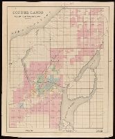
- Copper mines and mining--Michigan--Keweenaw County--Maps.3
- Electric lines2
- Copper mines and mining1
- Copper mines and mining--Michigan--Keweenaw Peninsula--Maps.1
- Copper mines and mining--Michigan--Ontonagon County--Maps.1
- Landowners1
- Landowners--Michigan--Keweenaw County--Maps.1
- Rickard, Richard H.,---1885--Ownership.5
- Brown, Horace--Stamp.3
- Laurie & Whittle3
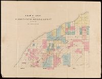
- St. Mary's Canal Mineral Land Company--Maps.3
- August Gast & Co1
- Ben-Gurion, David,--1886-1973--Autograph.1
- Dains, Barbara Richard--Autograph.1
- Daugherty, Connellee & Ammerman1
- Delaware Mining Company of Michigan--Maps.1
- Friend, Norman M., approximately 1815-1