
Search


Limit your search
- Completely digitized✖[remove]81
- Public81
- Maps, Atlases & Globes✖[remove]81
- Berry, William, fl. 1669-1708, creator29
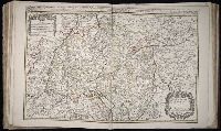
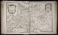
- Sanson, Nicolas, 1600-166725
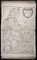
- Wit, Frederik de., creator9
- Blaeu, Joan, 1596-1673, creator5
- Browne, Christopher, fl. 1684-1712, bookseller5
- Morden, Robert, d. 1703, creator4
- Browne, Christopher, fl. 1684-1712, creator3
- Sanborn Map Company, issuing body3
- Sanson, Nicolas, 1600-1667, creator3
- Jaillot, Alexis Hubert, 1632?-17122
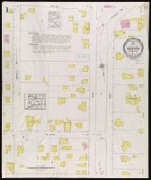
- Fire risk assessment--Connecticut--East Haven--Maps3
- Fire risk assessment--Connecticut--Hamden--Maps3
- Fire risk assessment--Connecticut--New Haven--Maps3
- Fire risk assessment--Connecticut--North Haven--Maps3
- Fire risk assessment--Connecticut--West Haven--Maps3
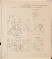
- Geological surveys--Wisconsin3
- Real property--Connecticut--East Haven--Maps3
- Real property--Connecticut--Hamden--Maps3
- Real property--Connecticut--New Haven--Maps3
- Real property--Connecticut--North Haven--Maps3
- Chamberlin, Thomas C. (Thomas Chrowder), 1843-19284
- Irving, R. D3
- Library of Congress Ownership3
- Strong, Moses McCure3
- K.K. Universitäts-Bibliothek Innsbruck Stamp2
- Garrett, John, -1720, publisher.1
- Harrison, John F1
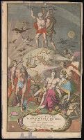
- Homann, Johann Baptist, 1663-1724. Atlas novus terrarum orbis imperia.1
- Irving, Roland Duer, 1847-18881
- Library of Congress Stamp1