Search
You Searched For
Search Results
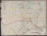
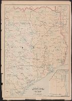
- Published / Created:
- 1880?]
- Call Number:
- 796gme 1880
- Container / Volume:
- BRBL_00531
- Image Count:
- 1
- Resource Type:
- Maps, Atlases & Globes
- Found in:
- Beinecke Rare Book and Manuscript Library > Map of the the Texas & Pacific Railway and connections.
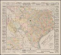
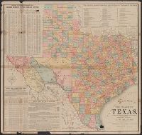
- Creator:
- Rand McNally and Company
- Published / Created:
- 1887
- Call Number:
- 796gme 1887
- Container / Volume:
- BRBL_00531
- Image Count:
- 1
- Resource Type:
- Maps, Atlases & Globes
- Found in:
- Beinecke Rare Book and Manuscript Library > Rand McNally & Co.'s new enlarged scale railroad and county map of Texas : compiled from the latest and most accurate surveys.
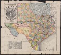
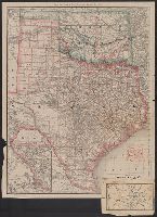
- Published / Created:
- [1890?]
- Call Number:
- 796gme 1890
- Container / Volume:
- BRBL_00531
- Image Count:
- 1
- Resource Type:
- Maps, Atlases & Globes
- Found in:
- Beinecke Rare Book and Manuscript Library > A geographically correct map of the state of Texas.
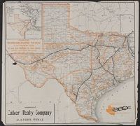
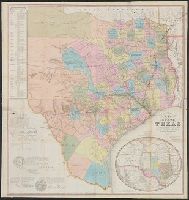
- Creator:
- Poole Brothers
- Published / Created:
- c1909.
- Call Number:
- 796gme 1909
- Container / Volume:
- BRBL_00531
- Image Count:
- 1
- Resource Type:
- Maps, Atlases & Globes
- Found in:
- Beinecke Rare Book and Manuscript Library > Iron mountain route to all parts of Texas : the way to Texas.
- Published / Created:
- 1860?]
- Call Number:
- 796gme 1860
- Container / Volume:
- BRBL_00531
- Image Count:
- 1
- Resource Type:
- Maps, Atlases & Globes
- Found in:
- Beinecke Rare Book and Manuscript Library > A geographically correct map of the Red River, Sabine & Western Railway (under construction) and connections : showing distribution of pine forests (compiled from maps of U.S. government), also location of coal, iron, and oil deposits.
- Creator:
- Asher & Adams
- Published / Created:
- [1878?]
- Call Number:
- 796fb 1878A
- Container / Volume:
- BRBL_00530
- Image Count:
- 1
- Resource Type:
- Maps, Atlases & Globes
- Found in:
- Beinecke Rare Book and Manuscript Library > Asher & Adams' Texas : eastern portion.
- Creator:
- Rand McNally and Company
- Published / Created:
- December 1st, 1882.
- Call Number:
- 796 1882A
- Container / Volume:
- BRBL_00526
- Image Count:
- 1
- Resource Type:
- Maps, Atlases & Globes
- Found in:
- Beinecke Rare Book and Manuscript Library > Official map of the state of Texas : to accompany the statistical and descriptive work, "Resources, soil and climate of Texas" / prepared under the direction of A.W. Spaight, Commissioner of Insurance, Statistics and History.
- Creator:
- Creuzbaur, Robert
- Published / Created:
- 1853
- Call Number:
- 796 1853
- Container / Volume:
- BRBL_00525
- Image Count:
- 1
- Resource Type:
- Maps, Atlases & Globes
- Found in:
- Beinecke Rare Book and Manuscript Library > J. De Cordova's map of the state of Texas / compiled from the records of the general land office of the state by Robert Creuzbaur ; engraved by J.M. Atwood.
- Creator:
- Rand McNally and Company
- Published / Created:
- 1886
- Call Number:
- 796 1886A
- Container / Volume:
- BRBL_00526
- Image Count:
- 1
- Resource Type:
- Maps, Atlases & Globes
- Found in:
- Beinecke Rare Book and Manuscript Library > Map of Texas and the Indian Territory.
- Creator:
- Rand McNally and Company
- Published / Created:
- 1914
- Call Number:
- 796 1914
- Container / Volume:
- BRBL_00526
- Image Count:
- 1
- Resource Type:
- Maps, Atlases & Globes
- Found in:
- Beinecke Rare Book and Manuscript Library > The Rand McNally new commercial atlas map of Texas.