
You Searched For
1 - 7 of 7
Search Results
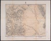
2.
- Creator:
- Geographical Surveys West of the 100th Meridian (U.S.)
- Published / Created:
- [1876]
- Call Number:
- 842 1876C
- Container / Volume:
- BRBL_00598
- Image Count:
- 1
- Resource Type:
- Maps, Atlases & Globes
- Description:
- "Atlas sheet no. 83."
- Publisher:
- [U.S. Geographical Surveys West of the 100th Meridian],
- Subject (Geographic):
- Arizona--Surveys--Maps and New Mexico--Surveys--Maps
- Subject (Name):
- Wheeler, George M. (George Montague), 1842-1905
- Subject (Topic):
- Surveys
- Found in:
- Beinecke Rare Book and Manuscript Library > Parts of eastern and southeastern Arizona, western and southwestern New Mexico, Parts of eastern and southeastern Arizona, western and southwestern New Mexico / U.S. Geographical Surveys West of the 100th Meridian.
3.

- Creator:
- Geographical Surveys West of the 100th Meridian (U.S.)
- Published / Created:
- 1871-72.
- Call Number:
- WA Photos Folio 56
- Image Count:
- 13
- Abstract:
- Mounted photographs of Arizona, Nevada, and Utah created by Timothy H. O'Sullivan, with a single photographic print by William Bell, that document the Geographical Surveys West of the 100th Meridian led by George Montague Wheeler for the United States...
- Description:
- Accompanied by a box list.
- Subject (Geographic):
- Arizona, Black Canyon (Ariz. and Nev.), Colorado River (Colo.-Mexico), Grand Canyon (Ariz.), Logan (Nev.), Marble Canyon (Coconino County, Ariz. : Canyon), Nevada, Paria River (Utah and Ariz.), United States, and Utah
- Subject (Name):
- Bell, William, 1830-1910., Gilbert, Grove Karl, 1843-1918., O'Sullivan, Timothy H., 1840-1882, Wheeler, George M. 1842-1905. (George Montague),, Geographical Surveys West of the 100th Meridian (U.S.), and United States. War Department.
- Subject (Topic):
- Architecture, Details, Exploring expeditions, and Surveys
- Found in:
- Beinecke Rare Book and Manuscript Library > Photographs of Arizona, Nevada, and Utah
4.
- Creator:
- Geological and Geographical Survey of the Territories (U.S.)
- Published / Created:
- 1873.
- Call Number:
- WA Photos Folio 53
- Container / Volume:
- Volume (copy 1)
- Image Count:
- 93
- Abstract:
- Two versions of a viewbook distributed by the United States Geological and Geographical Survey of the Territories in 1873 with mounted photographic prints created by William Henry Jackson of camps, geothermal features, and landscape primarily in Yello...
- Description:
- Each photograph is accompanied by a guard sheet with descriptive letter-press captions.
- Publisher:
- Government Printing Office
- Subject (Geographic):
- Yellowstone National Park., Blackmore, Mount (Mont.), Bridger Canyon (Mont.), Firehole River (Wyo.), Fort Hall (Idaho : Fort), Gallatin Canyon (Mont.), Gallatin River (Wyo. and Mont.), Grand Teton (Wyo.), Grand Teton National Park (Wyo.), Idaho, Lower Falls of the Yellowstone River (Wyo.), Mammoth Hot Springs (Wyo.), Montana, Teton Range (Wyo. and Idaho), Tower Creek (Wyo.), Upper Falls of the Yellowstone River (Wyo.), Upper Geyser Basin (Wyo.), Utah, Wasatch Range (Utah and Idaho), Wyoming, Yellowstone National Park, Yellowstone River, and Yellowstone River Valley
- Subject (Name):
- Jackson, William Henry, 1843-1942. and Geological and Geographical Survey of the Territories (U.S.)
- Subject (Topic):
- Discoveries in geography, American, Rock formations, United States, Discovery and exploration, and Surveys
- Found in:
- Beinecke Rare Book and Manuscript Library > Photographs of the Yellowstone National Park and views in Montana and Wyoming territories
5.

- Creator:
- Geological and Geographical Survey of the Territories (U.S.)
- Published / Created:
- 1873.
- Call Number:
- WA Photos Folio 53
- Container / Volume:
- Volume (copy 2)
- Image Count:
- 94
- Abstract:
- Two versions of a viewbook distributed by the United States Geological and Geographical Survey of the Territories in 1873 with mounted photographic prints created by William Henry Jackson of camps, geothermal features, and landscape primarily in Yello...
- Description:
- Each photograph is accompanied by a guard sheet with descriptive letter-press captions.
- Publisher:
- Government Printing Office
- Subject (Geographic):
- Yellowstone National Park., Blackmore, Mount (Mont.), Bridger Canyon (Mont.), Firehole River (Wyo.), Fort Hall (Idaho : Fort), Gallatin Canyon (Mont.), Gallatin River (Wyo. and Mont.), Grand Teton (Wyo.), Grand Teton National Park (Wyo.), Idaho, Lower Falls of the Yellowstone River (Wyo.), Mammoth Hot Springs (Wyo.), Montana, Teton Range (Wyo. and Idaho), Tower Creek (Wyo.), Upper Falls of the Yellowstone River (Wyo.), Upper Geyser Basin (Wyo.), Utah, Wasatch Range (Utah and Idaho), Wyoming, Yellowstone National Park, Yellowstone River, and Yellowstone River Valley
- Subject (Name):
- Jackson, William Henry, 1843-1942. and Geological and Geographical Survey of the Territories (U.S.)
- Subject (Topic):
- Discoveries in geography, American, Rock formations, United States, Discovery and exploration, and Surveys
- Found in:
- Beinecke Rare Book and Manuscript Library > Photographs of the Yellowstone National Park and views in Montana and Wyoming territories
6.

- Creator:
- Geographical Surveys West of the 100th Meridian (U.S.)
- Published / Created:
- 1871-1874.
- Call Number:
- WA Photos Folio 55
- Image Count:
- 68
- Abstract:
- Album of mounted photographic prints created by Timothy H. O'Sullivan and William Bell, and later compiled by the United States War Department. Photographs document the Geographical Surveys West of the 100th Meridian led by George Montague Wheeler, 1...
- Description:
- Copy of album in WA MSS S-744 described in finding aid for collection.
- Subject (Geographic):
- Apache Lake (Ariz.), Arizona, Black Canyon (Ariz. and Nev.), Bull Run Mountains (Nev.), Canyon de Chelly National Monument (Ariz.), Colorado River (Colo.-Mexico), El Morro National Monument (N.M.), Fort Apache (Ariz.), Fort Defiance (N.M.), Grand Canyon (Ariz.), Iceberg Canyon (Ariz. and Nev.), Inscription Rock (N.M.), Kanab Canyon (Ariz.), Logan (Nev.), Marble Canyon (Coconino County, Ariz. : Canyon), Nevada, New Mexico, North Fork Canyon (Ariz.), Paria River (Utah and Ariz.), Salt Creek Canyon (Utah), San Juan River (Colo.-Utah), Sierra Nevada (Calif. and Nev.), Southwest, New, United States, Utah, West (U.S.), White Mountains (Ariz.), White River (Nev.), and Zuni (N.M.)
- Subject (Name):
- Bell, William, 1830-1910., Cooley, Corydon Eliphalet, O'Sullivan, Timothy H., 1840-1882, Mission San Miguel (Santa Fe, N.M.), Nuestra Señora de Guadalupe (Mission : Zuni, N.M.), Geographical Surveys West of the 100th Meridian (U.S.), and United States. War Department.
- Subject (Topic):
- Homes & haunts, Indians of North America, Navajo Indians, Paiute Indians, Pueblo Indians, Pueblos, Saguaro, Western Apache Indians, Exploring expeditions, and Surveys
- Found in:
- Beinecke Rare Book and Manuscript Library > Photographs showing landscapes, geological and other features, of portions of the western territory of the United States : obtained in connection with geographical and geological explorations and surveys west of the 100th meridian, seasons of 1871, 1872, and 1873
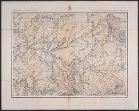
7.
- Creator:
- Geographical Surveys West of the 100th Meridian (U.S.)
- Published / Created:
- [approximately 1876]
- Call Number:
- 834 1876C
- Container / Volume:
- BRBL_00587
- Image Count:
- 1
- Resource Type:
- Maps, Atlases & Globes
- Description:
- "Atlas sheet no. 61(C)."
- Publisher:
- [U.S. Geographical Surveys West of the 100th Meridian],
- Subject (Geographic):
- Colorado--Surveys--Maps
- Subject (Name):
- Wheeler, George M. (George Montague), 1842-1905
- Subject (Topic):
- Surveys
- Found in:
- Beinecke Rare Book and Manuscript Library > Southwestern Colorado [cartographic material] / U.S. Geographical Surveys West of the 100th Meridian.