Skip to search
Skip to main content
Skip to first result
Search
You Searched For
"New England"
Format
cartographic
Genre
Illustrations
Genre
Maps
New Search
Search Results
Creator:
Published / Created:
1624
Call Number:
2003 +39
Collection Title:
The generall historie of Virginia, New -England , and the Summer Iles ...
Image Count:
1
Abstract:
Inset portrait of John Smith
Description:
Engraved by Simon Paseus, Facing p. 203, and Printed by Geor. Low
Publisher:
Printed by I.D. and I.H. for Michael Sparkes
Subject (Geographic):
New England --Maps--Early works to 1800
Subject (Topic):
New England --History--Colonial period
Collection Created:
London : Printed by I.D. and I.H. for Michael Sparkes, 1624
Found in:
Beinecke Rare Book and Manuscript Library > New England
Call Number:
1978 +73
Collection Title:
The ecclesiastical history of New -England from its first planting in the year 1620 unto the year of
Image Count:
1
Resource Type:
Books, Journals & Pamphlets
Description:
Verso blank.
Subject (Geographic):
New England --Biography
Collection Created:
London, Printed for Thomas Parkhurst, at the Bible and Three Crowns in Cheapside, 1702
Found in:
Beinecke Rare Book and Manuscript Library > An exact mapp of New England and New York
Creator:
Published / Created:
[1732]
Call Number:
E1015 M66 1732
Collection Title:
Atlas minor: or a set of sixty-two new and correct maps, of all parts of the world. All composed
Image Count:
1
Description:
Autograph of Gravely. Autograph of Baldock. Autograph of Aston. Autograph of W. Alington.
Subject (Geographic):
America--Maps--Early works to 1800
Subject (Topic):
Atlases--Early works to 1800
Collection Created:
London :
Found in:
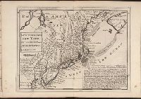
Beinecke Rare Book and Manuscript Library > New England, New York, New Jersey and Pensilvania. By H. Moll geographer.
Creator:
Published / Created:
1795 February 7
Call Number:
1986 102
Collection Title:
An historical, geographical, commercial, and philosophical view of the American United States, and
Image Count:
1
Description:
Engraved by Russell, Constitution R., Grays Inn La. and Facing p. 2.
Publisher:
Publish'd as the Act directs, by H.D. Symonds, No. 20 Pater Noster Row
Subject (Geographic):
New England --Maps --Early works to
Collection Created:
London, Printed for the editor; J. Ridgway [etc.] 1795
Found in:
Beinecke Rare Book and Manuscript Library > Map of the northern, or, New England states of America. Comprehending Vermont, New Hampshire, District of Main, Massachusetts, Rhode-Island, and Connecticut
Published / Created:
1776
Call Number:
Cb23 27
Collection Title:
The American military pocket atlas : being an approved collection of correct maps, both general and
Image Count:
1
Alternative Title:
, Newfoundland, Nova-Scotia, New -England , New -York
Description:
14th August 1776. and Teaching resource: Professor John Mack Faragher, History 141: The American West.
Publisher:
Printed for Robt. Sayer & Jno. Bennett, Map and Sea Chartsellers, No. 53, Fleet Street, as the Act directs
Subject (Geographic):
New England --Maps --Early works to
Collection Created:
London : Printed for R. Sayer and J. Bennet, [1776]
Found in:
Beinecke Rare Book and Manuscript Library > A General map of the northern British colonies in America. which comprehends the province of Quebec, the government of Newfoundland, Nova-Scotia, New-England and New-York. From the maps published by the Admiralty and Board of Trade regulated by the astronomic and trigonometric observations of M. von Holland and corrected from Governor Pownall's late map 1776.
Published / Created:
1776
Call Number:
Cb23 27
Collection Title:
The American military pocket atlas : being an approved collection of correct maps, both general and
Image Count:
1
Alternative Title:
The Seat of war in the middle British colonies, containing Virginia, Maryland, the Delware counties, &ca
Description:
15th Oct. 1776., Inset: A Sketch of the upper parts of Canada., and Teaching resource: Professor John Mack Faragher, History 141: The American West.
Publisher:
Printed for R. Sayer & J. Bennett, Map, Chart & Printsellers, No. 53, Fleet Street, as the Act directs
Subject (Geographic):
New England --Maps --Early works to
Collection Created:
London : Printed for R. Sayer and J. Bennet, [1776]
Found in:
Beinecke Rare Book and Manuscript Library > A general map of the middle British colonies in America. Containing Virginia, Maryland, the Delaware counties, Pennsylvania and New Jersey. With the addition of New York, and of the greatest part of New England, as also of the bordering parts of the province of Quebec, improved from several surveys made after the late war, and corrected from Governor Pownall's late map 1776.
Call Number:
Ck44 23
Collection Title:
Kort beskrifning om provincien Nya Swerige uti America : som nu foertjden af the Engelske kallas
Image Count:
1
Description:
Between p. 52 & p. 53., Engraved by Holm, Thomas Campanius, ca. 1670-1702., and Teaching resource: Professor John Mack Faragher, History 141: The American West.
Subject (Geographic):
New England --Maps --Early works to
Collection Created:
Stockholm : Tryckt uti Kongl. boktr. hos S. Wankijfs ankia, med egen bekostnad, af J. H. Werner, 1702
Found in:
Beinecke Rare Book and Manuscript Library > Virginiae N. Angliae N. Hollandiae nec non Nova Sueviae delineatio
Branch:v1.61.6 ,Deployed:2024-06-12T09:55:31-04:00