Search
You Searched For
Search Results
- Creator:
- Jefferys, Thomas, d. 1771
- Call Number:
- 1977 Folio 96
- Collection Title:
- The West-India atlas: or, A compendious description of the West-Indies: illustrated with forty
- Image Count:
- 1
- Resource Type:
- Maps, Atlases & Globes
- Subject (Geographic):
- Santo Domingo (Dominican Republic)
- Found in:
- Beinecke Rare Book and Manuscript Library > The harbour of Bluefields.
- Creator:
- Bordiga, Giovanni Battista, 1799-
- Published / Created:
- 1823
- Call Number:
- 70 1823
- Container / Volume:
- BRBL_00358
- Image Count:
- 1
- Resource Type:
- Maps, Atlases & Globes
- Subject (Geographic):
- Dominican Republic--Maps
- Found in:
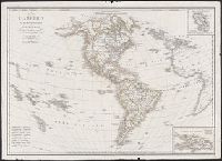
- Beinecke Rare Book and Manuscript Library > L'America settentrionale e meridionale : secondo le sue ultime scoperte e divisione politiche / costrutta ed incisa da Gio. Batt. Bordiga sopra quella di H. Brué.
- Creator:
- Frezier, Amedee Francois, 1682-1773
Robert de Vaugondy, Gilles, 1688-1766, creator
- Published / Created:
- avec privilege 1749
- Call Number:
- 2003 Folio 85
- Image Count:
- 1
- Subject (Geographic):
- Dominican Republic -- Maps -- Early
- Found in:
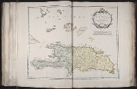
- Beinecke Rare Book and Manuscript Library > Carte de l'isle de Saint-Domingue: dressee d'apres la carte originale de Mr. Frezier
- Creator:
- Jefferys, Thomas, d. 1771
- Call Number:
- C6 033c
- Collection Title:
- The natural and civil history of the French dominions in North and South America : with an
- Image Count:
- 1
- Resource Type:
- Maps, Atlases & Globes
- Subject (Geographic):
- Santo Domingo (Dominican Republic)
- Found in:
- Beinecke Rare Book and Manuscript Library > An authentic plan of the town and harbour of Cap Francois in the isle of St. Domingo. By Thomas Jefferys geographer to his Royal Highness the Prince of Wales
- Creator:
- Jefferys, Thomas, d. 1771
- Call Number:
- C6 033c
- Collection Title:
- The natural and civil history of the French dominions in North and South America : with an
- Image Count:
- 1
- Resource Type:
- Maps, Atlases & Globes
- Subject (Geographic):
- Santo Domingo (Dominican Republic)
- Found in:
- Beinecke Rare Book and Manuscript Library > The island of Hispaniola called by the French St. Domingo. Subject to France and Spain. from the best authorities by Thomas Jeffreys, geographer to his Royal Highness the Prince of Wales
- Call Number:
- 1973 Folio 67
- Collection Title:
- The West-India pilot: containing piloting directions for Port Royal and Kingston harbours in
- Image Count:
- 1
- Subject (Geographic):
- Santo Domingo (Dominican Republic
- Found in:
- Beinecke Rare Book and Manuscript Library > Plan de la Rade du Port Paix
- Call Number:
- Z6 4e
- Collection Title:
- Summario de la generale historia de l’Indie Occidentali. Part 1
- Image Count:
- 1
- Subject (Geographic):
- Dominican Republic --Maps
- Found in:
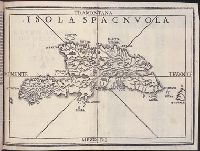
- Beinecke Rare Book and Manuscript Library > Isola Spagnvola
- Call Number:
- 1978 Folio 10
- Collection Title:
- The English pilot: describing the West-India navigation, from Hudson's-Bay to the river Amazones
- Image Count:
- 1
- Subject (Geographic):
- Dominican Republic --Maps
- Found in:
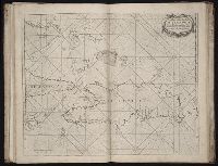
- Beinecke Rare Book and Manuscript Library > A chart of the island of Hispaniola
- Call Number:
- 1973 Folio 76
- Collection Title:
- The English pilot: describing the sea-coasts, capes, head-lands, rivers, bays, roads, havens
- Image Count:
- 1
- Subject (Geographic):
- Dominican Republic --Maps, Manuscript
- Found in:
- Beinecke Rare Book and Manuscript Library > A chart of the iland of Hispaniola
- Call Number:
- 1973 Folio 116
- Collection Title:
- The English pilot: describing the West-India navigation, from Hudson's-Bay to the river Amazones
- Image Count:
- 1
- Subject (Geographic):
- Dominican Republic --Maps, Manuscript
- Found in:
- Beinecke Rare Book and Manuscript Library > A correct chart of Hispaniola with the Windward Passage