Search
You Searched For
Search Results
- Published / Created:
- [ca. 1850]
- Call Number:
- 40gme 1850
- Container / Volume:
- BRBL_00230
- Image Count:
- 8
- Resource Type:
- Maps, Atlases & Globes
- Found in:
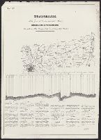
- Beinecke Rare Book and Manuscript Library > Topografia della zona di terrano corsa della strada : Profilo di livellazione delle pendenze della Strada, e della linea battuta della Strada.
- Published / Created:
- 1788
- Call Number:
- 39 SE84 1788
- Container / Volume:
- BRBL_00191
- Image Count:
- 8
- Resource Type:
- Maps, Atlases & Globes
- Found in:
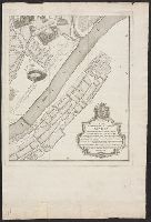
- Beinecke Rare Book and Manuscript Library > Plano geométrico de la ciudad de Sevilla ... / por Don Thomás Lopez de Vargas y Machuca ...
- Creator:
- Maury, Matthew Fontaine, 1806-1873
- Published / Created:
- [1854?]-1856.
- Call Number:
- 11cfk 1850A-5
- Container / Volume:
- BRBL_00769
- Image Count:
- 8
- Resource Type:
- Maps, Atlases & Globes
- Found in:
- Beinecke Rare Book and Manuscript Library > Maury's wind and current chart, Indian Ocean [cartographic material].
- Creator:
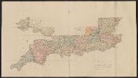
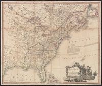
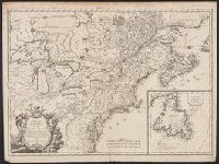
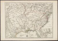
- Mitchell, John, 1711-1768
- Published / Created:
- [1775?]
- Call Number:
- 71 1755A
- Container / Volume:
- BRBL_00363
- Image Count:
- 8
- Resource Type:
- Maps, Atlases & Globes
- Found in:
- Beinecke Rare Book and Manuscript Library > A map of the British colonies in North America : with the roads, distances, limits, and extent of the settlements, humbly inscribed to the Right Honourable the Earl of Halifax, and the other Right Honourable the Lords Commissioners for Trade & Plantations
- Creator:
- Mexico. Comisión Geográfico-Exploradora
- Published / Created:
- 1908
- Call Number:
- 8816 1908
- Container / Volume:
- BRBL_00651
- Image Count:
- 8
- Resource Type:
- Maps, Atlases & Globes
- Found in:
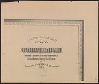
- Beinecke Rare Book and Manuscript Library > Carta general del Estado de Tamaulipas / levantada á iniciativa de su actual gobernador, co., Pedro Argüelles, por la Comisión Geográfico-Exploradora.
- Creator:
- Holtedahl, Olaf, 1885-1975
- Published / Created:
- 1940
- Call Number:
- 344cea 1940
- Container / Volume:
- BRBL_00095
- Image Count:
- 8
- Resource Type:
- Maps, Atlases & Globes
- Found in:
- Beinecke Rare Book and Manuscript Library > Dybdekart over de norske kystfarvann med tilgrensende havstrok.
- Published / Created:
- ca. 1860?]
- Call Number:
- 40 1858
- Container / Volume:
- BRBL_00201
- Image Count:
- 8
- Resource Type:
- Maps, Atlases & Globes
- Found in:
- Beinecke Rare Book and Manuscript Library > Carta corografica strategica dell' alta Italia alla scala di 1 a 600000.
- Creator:
- Giunta, I.R
- Published / Created:
- 1847
- Call Number:
- 40 V55 1847A
- Container / Volume:
- BRBL_00223
- Image Count:
- 8
- Resource Type:
- Maps, Atlases & Globes
- Found in:
- Beinecke Rare Book and Manuscript Library > Mappa del comune censuario di S. Croce : porzione della citta di Venezia, distretto I, provincia di Venezia, rettificata nell' anno 1842.
- Creator:
- Maury, Matthew Fontaine, 1806-1873
- Published / Created:
- 1849-[1856?]
- Call Number:
- 11cfk 1850A-1
- Container / Volume:
- BRBL_00767
- Image Count:
- 10
- Resource Type:
- Maps, Atlases & Globes
- Found in:
- Beinecke Rare Book and Manuscript Library > Wind and current chart of the North Pacific [cartographic material] / by M.F. Maury, A.M. Lieut. U.S. Navy, Superint'dt. of U.S.N. Observatory ; compiled from materials in the Bureau of Ordnance and Hydrography, Commodore Lewis Warrington ; drawn by P.M. Lardner Gibbon, U.S.N. ; tracks projected by Lieut. A.W. Johnson, U.S. Navy.
- Creator:
- Maury, Matthew Fontaine, 1806-1873
- Published / Created:
- 1851-1859.
- Call Number:
- 11cfk 1850C-6
- Container / Volume:
- BRBL_00771
- Image Count:
- 10
- Resource Type:
- Maps, Atlases & Globes
- Found in:
- Beinecke Rare Book and Manuscript Library > Pilot chart of the South Pacific [cartographic material] / by M.F. Maury, L.L.D., Lieut. U.S. Navy ; Superin'dt. of U.S.N. Observatory ; compiled from materials in the Bureau of Ordnance and Hydrography, Commodre Charles Morris, Chief of Bureau.
- Creator:
- Russia. Armii͡a. Voenno-topograficheskoe depo
Russia. Армия. Военно-топографическое депо
- Published / Created:
- 1884
- Call Number:
- 54 1884
- Container / Volume:
- BRBL_00290
- Image Count:
- 10
- Resource Type:
- Maps, Atlases & Globes
- Found in:
- Beinecke Rare Book and Manuscript Library > Karta Azīi︠a︡tskoĭ Rossīi s prilegai︠u︡shchimi k neĭ vladi︠e︡nii︠a︡mi [cartographic material] / sostavlena pri Voenno Topograficheskom otdi︠e︡li︠e︡ Glavnago Shtaba ; pod redakt︠s︡. gener. M. Bolʹsheva.
- Creator:
- Oliver, William T
- Published / Created:
- c1893.
- Call Number:
- 764gmb 1893
- Container / Volume:
- BRBL_00462
- Image Count:
- 10
- Resource Type:
- Maps, Atlases & Globes
- Found in:
- Beinecke Rare Book and Manuscript Library > Cyclists' road map of Massachusetts / prepared expressly for the Mass. Div. L.A.W., by William T. Oliver.
- Published / Created:
- [1789]
- Call Number:
- 38 1789
- Container / Volume:
- BRBL_00152
- Image Count:
- 25
- Resource Type:
- Maps, Atlases & Globes
- Found in:
- Beinecke Rare Book and Manuscript Library > Carte générale de la France par départements ... de Cassini et des 25 Flles de celle de la Belgique de Ferraris. Par Ch. Picquet, Geog. e. Graveur ...
- Creator:
- Cartes Taride (Firm)
- Published / Created:
- 1901-
- Call Number:
- Series 38gmb 1920
- Container / Volume:
- BRBL_00038A
- Image Count:
- 25
- Resource Type:
- Maps, Atlases & Globes
- Found in:
- Beinecke Rare Book and Manuscript Library > Carte routière pour automobilistes & cyclistes [cartographic material] : [France].
- Creator:
- Tuttle-Ayers-Woodward Co
- Call Number:
- 816ad K134 1925
- Container / Volume:
- BRBL_00563
- Image Count:
- 29
- Resource Type:
- Maps, Atlases & Globes
- Found in:
- Beinecke Rare Book and Manuscript Library > Atlas of Kansas City, Missouri, and environs, 1925.
- Creator:
- Argentina. Comisión Argentina Demarcadora de Limites con el Brasil
- Published / Created:
- 1904]
- Call Number:
- 911fab 1904A
- Container / Volume:
- BRBL_00671
- Image Count:
- 32
- Resource Type:
- Maps, Atlases & Globes
- Found in:
- Beinecke Rare Book and Manuscript Library > Planos topográficos: Islas del Río Uruguay, islas del Rio Iguazú.
- Creator:
- Great Britain. Ordnance Survey
- Published / Created:
- Novr. 9th, 1843 [i.e. ca. 1853-1874?]
- Call Number:
- 32 1873
- Container / Volume:
- BRBL_00743
- Image Count:
- 35
- Resource Type:
- Maps, Atlases & Globes
- Found in:
- Beinecke Rare Book and Manuscript Library > [Old series Ordnance Survey maps of England and Wales] / engraved at the Ordnance Map Office, Southampton ...
- Creator:
- Chishitsu Chōsajo (Japan)
- Published / Created:
- 1912-15.
- Call Number:
- 57 1915
- Container / Volume:
- BRBL_00302
- Image Count:
- 24
- Resource Type:
- Maps, Atlases & Globes
- Found in:
- Beinecke Rare Book and Manuscript Library > Imperial Geological Survey of Japan topographical map : Division I-[V].
- Creator:
- James, Edwin, 1797-1861
- Call Number:
- Zc20 +822ja
- Image Count:
- 41
- Resource Type:
- Maps, Atlases & Globes
- Found in:
- Beinecke Rare Book and Manuscript Library > Account of an expedition from Pittsburgh to the Rocky Mountains : performed in the years 1819 and '20, by order of the Hon. J.C. Calhoun, Sec'y of War ; under the command of Major Stephen H. Long : from the notes of Major Long, Mr. T. Say, and other gentlemen of the exploring party / compiled by Edwin James, botanist and geologist for the expedition ; in two vols., with an atlas.
- Creator:
- Comisión Chilena de Límites
- Published / Created:
- 1912?]
- Call Number:
- 96 1908
- Container / Volume:
- BRBL_00766
- Image Count:
- 41
- Resource Type:
- Maps, Atlases & Globes
- Found in:
- Beinecke Rare Book and Manuscript Library > Mapas de la región Andina [cartographic material] / [por la Comisión Chilena de Límites].
- Creator:
- Zamyslovskīĭ, E. (Egor), 1841-1896
- Published / Created:
- 1887
- Call Number:
- 1978 Folio 3
- Image Count:
- 31
- Found in:
- Beinecke Rare Book and Manuscript Library > Uchebnyií atlas po russkoií istoriíãi / sostavlen i izdan pod red. E. Zamyslovskago.
- Creator:
- Sanborn Map Company, issuing body
- Published / Created:
- 1926
- Call Number:
- 766 M31 1926
- Image Count:
- 36
- Resource Type:
- Maps, Atlases & Globes
- Found in:
- Beinecke Rare Book and Manuscript Library > Insurance maps of Manchester, including part of Highland Park and Manchester Green, Hartford Co., Connecticut.
- Published / Created:
- 1882
- Call Number:
- 812 1882
- Container / Volume:
- BRBL_00555
- Image Count:
- 27
- Resource Type:
- Maps, Atlases & Globes
- Found in:
- Beinecke Rare Book and Manuscript Library > Atlas of the geological survey of Wisconsin / T.C. Chamberlin, chief geologist ; R.D. Irving, Moses Strong, assistant geologists ; W.I.L. Nicodemus, topographical assistant ; T.B. Brooks ... [et al.], contributors.
- Creator:
- Hollar, Wenceslaus, 1607-1677
- Call Number:
- 1973 265
- Image Count:
- 27
- Resource Type:
- Maps, Atlases & Globes
- Found in:
- Beinecke Rare Book and Manuscript Library > The kingdome of England & principality of Wales : exactly described whith euery sheere & the small townes in euery one of them, in six mappes, portable for euery mans pocket ... : vsefull for all comanders for quarteringe of souldiers, & all sorts of persons, that would be informed, where the armies be, neuer so commodiously drawne before this, 1644, described by one that trauailed throughout the whole kingdome, for its purpose / W. Hollar, fecit.
- Creator:
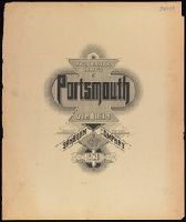
- Sanborn Map Company
- Published / Created:
- 1920
- Call Number:
- 783 P83 1920
- Container / Volume:
- BRBL_00510
- Image Count:
- 30
- Resource Type:
- Maps, Atlases & Globes
- Found in:
- Beinecke Rare Book and Manuscript Library > Insurance maps of Portsmouth, Virginia.
- Creator:
- Salway, Joseph.
- Published / Created:
- 1899-1903.
- Call Number:
- LTS 32 L84 1811/1903
- Image Count:
- 30
- Resource Type:
- Maps, Atlases & Globes
- Found in:
- Beinecke Rare Book and Manuscript Library > Plan of the road from Hyde Park Corner to Counter's Bridge / made for the Kensington Turnpike Trustees by their surveyor Joseph Salway in the year 1811.
- Published / Created:
- 1896
- Call Number:
- 777cbf B21 1894
- Container / Volume:
- BRBL_00504
- Image Count:
- 36
- Resource Type:
- Maps, Atlases & Globes
- Found in:
- Beinecke Rare Book and Manuscript Library > City of Baltimore topographical survey / made under the direction of H.T. Douglas, chief engineer.
- Creator:
- Habenicht, Hermann, 1844-1917
- Published / Created:
- 1887
- Call Number:
- 60 1887
- Container / Volume:
- BRBL_00327
- Image Count:
- 27
- Resource Type:
- Maps, Atlases & Globes
- Found in:
- Beinecke Rare Book and Manuscript Library > Spezial-Karte von Afrika im Massstab von 1:4 000 000 / entworfen von Hermann Habenicht ; bearbeitet von demselben, Bruno Domann und Dr. Richard Lüddecke ; aut. von C. Barich und P. Ihle.
- Creator:
- Sanborn Map Company, issuing body
- Published / Created:
- 1925
- Call Number:
- 766 M59 1925
- Image Count:
- 31
- Resource Type:
- Maps, Atlases & Globes
- Found in:
- Beinecke Rare Book and Manuscript Library > Insurance maps of Milford, New Haven County, Connecticut, including Woodmont, Merwin's Point, Bay View, Fort Trumbull Beach, Silver Sands, Seaside, Myrtle Beach, Meadows End, Walnut Beach, Wildmere Beach, Laurel Beach, Cedar Beach, Devon and Rivercliff.
- Creator:
- L'Isle, Joseph Nicolas de, 1688-1768
- Published / Created:
- 1745
- Call Number:
- 1978 Folio 48
- Image Count:
- 31
- Found in:
- Beinecke Rare Book and Manuscript Library > Russischer Atlas, welcher in einer General-Charte und neuzehen Special-Charten das gesamte Russische Reich und dessen angraíöntzende Laíönder, nach den Regeln der Erd-Beschreibung und den neuesten Observationen vorstellig macht. Entworffen bey der Kayserl
- Published / Created:
- [1892]
- Call Number:
- 36 F84 +1892
- Container / Volume:
- BRBL_00123A
- Image Count:
- 43
- Resource Type:
- Maps, Atlases & Globes
- Found in:
- Beinecke Rare Book and Manuscript Library > Geometrischer Plan von Frankfurt a/Main / herausgegeben im Auftrage des Magistrats vom Tiefbau-Amt.
- Creator:
- Rocque, John, -1762
- Published / Created:
- 1746. and 1913-1919.
- Call Number:
- 32 L84 1746/1919
- Container / Volume:
- BRBL_00738
- Image Count:
- 49
- Resource Type:
- Maps, Atlases & Globes
- Found in:
- Beinecke Rare Book and Manuscript Library > A plan of the cities of London and Westminster, and borough of Southwark, with the contiguous buildings; from an actual survey, taken by John Rocque and engraved by John Pine.
- Creator:
- Austro-Hungarian Monarchy. Militärgeographisches Institut
- Published / Created:
- 1882-1886.
- Call Number:
- 304 1886
- Container / Volume:
- Series Box 1
- Image Count:
- 49
- Resource Type:
- Maps, Atlases & Globes
- Found in:
- Beinecke Rare Book and Manuscript Library > Übersichts-Karte von Mittel-Europa, im Masse 1:750.000 der Natur / bearbeitet und herausgegeben vom K.K. Militär-geographischen Institute.
- Creator:
- Duval, P. (Pierre), 1619-1682.
- Published / Created:
- 1671
- Call Number:
- 1973 Folio 31
- Image Count:
- 78
- Resource Type:
- Maps, Atlases & Globes
- Found in:
- Beinecke Rare Book and Manuscript Library > Cartes de geographie, les plus nouvelles et les plus fideles, auecque leurs diuisions régulieres, par P. du Val ...
- Creator:
- Survey of India.
- Published / Created:
- 1827-1904.
- Call Number:
- Series 59 1827
- Image Count:
- 61
- Resource Type:
- Maps, Atlases & Globes
- Found in:
- Beinecke Rare Book and Manuscript Library > [Indian atlas 1:253 440, full sheets] / Survey of India.
- Published / Created:
- ca. 1794
- Call Number:
- 2017 812
- Image Count:
- 62
- Found in:
- Beinecke Rare Book and Manuscript Library > [Plat book showing numbered lots of 27 townships of the (new) military tract in New York State].
- Creator:
- Dépôt de la guerre (France)
- Published / Created:
- 1837-1869.
- Call Number:
- 38 1848
- Container / Volume:
- BRBL_00747-762
- Image Count:
- 253
- Resource Type:
- Maps, Atlases & Globes
- Found in:
- Beinecke Rare Book and Manuscript Library > [Carte de France de l'Etat-Major] / levée par les Officiers du Corps d'Etat-Major ... gravée et publiée par le Dépôt de la Guerre.
- Creator:
- Hood, Washington, 1808-1840
- Published / Created:
- before 1835
- Call Number:
- WA MSS S-2687
- Collection Title:
- Washington Hood papers
- Container / Volume:
- 5 Broadside
- Image Count:
- 1
- Resource Type:
- Maps, Atlases & Globes
- Found in:
- Beinecke Rare Book and Manuscript Library > Manuscript map of Nebraska and Iowa
- Creator:
- Fairfax, Wilson M. C.
McMurtrie, W. B. (William Birch)
- Published / Created:
- 1853
- Call Number:
- WA MSS S-2369
- Collection Title:
- Franz R. and Kathryn M. Stenzel Research Files on Western American Art
- Container / Volume:
- bsd | Folder 1612
- Image Count:
- 1
- Resource Type:
- Maps, Atlases & Globes
- Found in:
- Beinecke Rare Book and Manuscript Library > McMurtrie, William B. "Reconnaissance of the Western Coast of the United States [Lower Sheet] San Francisco to San Diego." Engraving (in Series I)
- Creator:
- De Lacy, W. W. (Walter Washington), 1819-1892
- Call Number:
- WA MSS 443
- Collection Title:
- Isaac Ingalls Stevens papers
- Container / Volume:
- Box 1 | Folder 29
- Image Count:
- 1
- Resource Type:
- Maps, Atlases & Globes
- Found in:
- Beinecke Rare Book and Manuscript Library > Plan of the battle of Grande Ronde fought Jul 17, 1856.
- Creator:
- Lindenkohl, A.
McMurtrie, W. B. (William Birch)
- Published / Created:
- 1854
- Call Number:
- WA MSS S-2369
- Collection Title:
- Franz R. and Kathryn M. Stenzel Research Files on Western American Art
- Container / Volume:
- bsd | Folder 1612
- Image Count:
- 1
- Resource Type:
- Maps, Atlases & Globes
- Found in:
- Beinecke Rare Book and Manuscript Library > McMurtrie, William B. "Reconnaissance of the Western Coast of the United States. Middle Sheet From San Francisco to Umpquah River." Engraving (in Series I)
- Creator:
- Lindenkohl, A
McMurtrie, W. B. (William Birch)
- Published / Created:
- 1855
- Call Number:
- WA MSS S-2369
- Collection Title:
- Franz R. and Kathryn M. Stenzel Research Files on Western American Art
- Container / Volume:
- bsd | Folder 1612
- Image Count:
- 1
- Resource Type:
- Maps, Atlases & Globes
- Found in:
- Beinecke Rare Book and Manuscript Library > McMurtrie, William B. "Reconnaissance of the Western Coast of the United States [Northern Sheet] From Umpquah River to the Boundary." Engraving (in Series I)
- Creator:
- L'Isle, Guillaume de, 1675-1726
- Published / Created:
- [1730?]
- Call Number:
- 755 1730
- Container / Volume:
- BRBL_00426
- Image Count:
- 1
- Resource Type:
- Maps, Atlases & Globes
- Found in:
- Beinecke Rare Book and Manuscript Library > Carte de la Louisiane et du cours du Mississipi / dressée sur un grand nombre de memoires entr'autres sur ceux de Mr. le Maire, par Guillme. de L'Isle de l'Academie Rle. des Sciences.
- Published / Created:
- [1796?]
- Call Number:
- 755 1800A
- Container / Volume:
- BRBL_00437
- Image Count:
- 1
- Resource Type:
- Maps, Atlases & Globes
- Found in:
- Beinecke Rare Book and Manuscript Library > Bowles's New one-sheet map of the United States of America; with the territories belonging to Great Britain and Spain.
- Published / Created:
- [1800?]
- Call Number:
- 755 1800B
- Container / Volume:
- BRBL_00437
- Image Count:
- 1
- Resource Type:
- Maps, Atlases & Globes
- Found in:
- Beinecke Rare Book and Manuscript Library > Carte de la Partie Septentrionale des Etats Unis, comprenant le Canada, la Nouvelle Ecosse ... et de New-Jersey. Tardieu Sculp. André Scrip.
- Published / Created:
- 1805
- Call Number:
- 755 1805B
- Container / Volume:
- BRBL_00437
- Image Count:
- 1
- Resource Type:
- Maps, Atlases & Globes
- Found in:
- Beinecke Rare Book and Manuscript Library > A new map of the United States of North America ... with Upper and Lower Canada &c ... by John Cary, Engraver.
- Creator:
- Kitchin, Thomas, d. 1784
- Published / Created:
- 1780?]
- Call Number:
- 755 1760
- Container / Volume:
- BRBL_00428
- Image Count:
- 1
- Resource Type:
- Maps, Atlases & Globes
- Found in:
- Beinecke Rare Book and Manuscript Library > British dominions in America : drawn from the latest and best authorities / by Thos. Kitchin, hydrographer to his majesty.
- Creator:
- Seutter, Matthaeus, 1678-1756
- Published / Created:
- 1730?]
- Call Number:
- 755 1735B
- Container / Volume:
- BRBL_00426
- Image Count:
- 1
- Resource Type:
- Maps, Atlases & Globes
- Found in:
- Beinecke Rare Book and Manuscript Library > Recens edita totius Novi Belgii in America Septentrionali siti / delineatio cura et sumptibus Matthaei Seutteri, Sac. Caes. Maj. Geographi August. Vind.
- Published / Created:
- [1800?]
- Call Number:
- 755 1800E
- Container / Volume:
- BRBL_00437
- Image Count:
- 1
- Resource Type:
- Maps, Atlases & Globes
- Found in:
- Beinecke Rare Book and Manuscript Library > Bowles's new one-sheet map of the independent States of Virginia, ... Rhode Island, &c ... Habitations and hunting countries of the Confederate Indians; by Lewis Evans.
- Published / Created:
- 1805
- Call Number:
- 755 1805B
- Container / Volume:
- BRBL_00437
- Image Count:
- 1
- Resource Type:
- Maps, Atlases & Globes
- Found in:
- Beinecke Rare Book and Manuscript Library > A new map of the United States of North America ... with Upper and Lower Canada &c ... by John Cary, Engraver.
- Creator:
- Rhode, Johann Christoph, cartographer
- Call Number:
- 755 1755AA
- Container / Volume:
- BRBL_00427
- Image Count:
- 1
- Resource Type:
- Maps, Atlases & Globes
- Found in:
- Beinecke Rare Book and Manuscript Library > Theatrum belli in America Septentrionali / II. foliis comprehensum jussu Acad. Reg. Scient. et Eleg. Litt. exhibet I. C. Rhode Ac: Geogr. ; Berger, sculpsit berol.
- Published / Created:
- [1734?]
- Call Number:
- 755 1734
- Container / Volume:
- BRBL_00426
- Image Count:
- 1
- Resource Type:
- Maps, Atlases & Globes
- Found in:
- Beinecke Rare Book and Manuscript Library > Novissima tabula regionis Ludovicianae, gallice dictae la Louisiane ... / delineata ... â Guil. Insulano ... ; M.L. [?] sc.
- Published / Created:
- 1813
- Call Number:
- 755 1813C
- Container / Volume:
- BRBL_00439
- Image Count:
- 1
- Resource Type:
- Maps, Atlases & Globes
- Found in:
- Beinecke Rare Book and Manuscript Library > An improved Map of the United States by Shelton & Kensett. Engraved by A. Doolittle, New Haven. AE 60. Copyright secured & entered according to Act of Congress, Nov. 8th 1813.
- Published / Created:
- 1806
- Call Number:
- 755 1806A
- Container / Volume:
- BRBL_00438
- Image Count:
- 1
- Resource Type:
- Maps, Atlases & Globes
- Found in:
- Beinecke Rare Book and Manuscript Library > A new map of part of the United States of North America ... by John Cary, Engraver.
- Published / Created:
- [1801?]
- Call Number:
- 755 1801
- Container / Volume:
- BRBL_00437
- Image Count:
- 1
- Resource Type:
- Maps, Atlases & Globes
- Found in:
- Beinecke Rare Book and Manuscript Library > Carte de la Partie Septentrionale des Etats-Unis. Gravé par Tardieu.
- Creator:
- Homann, Johann Baptist, 1663-1724
- Published / Created:
- 1759?]
- Call Number:
- 755 1759A
- Container / Volume:
- BRBL_00428
- Image Count:
- 1
- Resource Type:
- Maps, Atlases & Globes
- Found in:
- Beinecke Rare Book and Manuscript Library > Nova Anglia septentrionali Americae implantata Anglorumque coloniis florentissima geographice exhibita / [cartographic material] / a Ioh. Baptista Homann ...
- Published / Created:
- [1806?]
- Call Number:
- 755 1806C
- Container / Volume:
- BRBL_00438
- Image Count:
- 1
- Resource Type:
- Maps, Atlases & Globes
- Found in:
- Beinecke Rare Book and Manuscript Library > Carte Générale des États-Unis de L'Amerique Septentrionale, rensemant aussi, quelquis Provinces Angloises adjacentes. André Scrip. Tardieu Sculp.
- Published / Created:
- 1806
- Call Number:
- 755 1806
- Container / Volume:
- BRBL_00438
- Image Count:
- 1
- Resource Type:
- Maps, Atlases & Globes
- Found in:
- Beinecke Rare Book and Manuscript Library > A map of the United States and Canada, New Scotland, New Brunswick and Newfoundland. Dresée par Lapie ... Gravée par P.A.F. Tardieu. Ecrit par J.J. Pachoux.
- Published / Created:
- 1809
- Call Number:
- 755 1809
- Container / Volume:
- BRBL_00438
- Image Count:
- 1
- Resource Type:
- Maps, Atlases & Globes
- Found in:
- Beinecke Rare Book and Manuscript Library > The United States of North America : with the British territories and those of Spain.
- Published / Created:
- 1816
- Call Number:
- 755 1816
- Container / Volume:
- BRBL_00439
- Image Count:
- 1
- Resource Type:
- Maps, Atlases & Globes
- Found in:
- Beinecke Rare Book and Manuscript Library > Northern Section of the United States including Canada, etc., by John Melish. Second edition with Additions and improvements.
- Creator:
- Palairet, Jean, 1697-1774
- Published / Created:
- 1756
- Call Number:
- 755 1756D
- Container / Volume:
- BRBL_00428
- Image Count:
- 1
- Resource Type:
- Maps, Atlases & Globes
- Found in:
- Beinecke Rare Book and Manuscript Library > Carte des possessions angloises & françoises du continent de l'Amérique septentrionale / par I. Palairet, Londres ; Thos. Kitchin, sculpt.
- Published / Created:
- 1817
- Call Number:
- 755 1817
- Container / Volume:
- BRBL_00439
- Image Count:
- 1
- Resource Type:
- Maps, Atlases & Globes
- Found in:
- Beinecke Rare Book and Manuscript Library > Northern Provinces of the United States. Hewitt Sc., London.
- Published / Created:
- July 6th 1813.
- Call Number:
- 755 1813B
- Container / Volume:
- BRBL_00438
- Image Count:
- 1
- Resource Type:
- Maps, Atlases & Globes
- Found in:
- Beinecke Rare Book and Manuscript Library > An improved map of the United States by Shelton & Kensett. Engraved by A. Doolittle, New Haven, & T. Kensett, Cheshire ...
- Published / Created:
- [1817?]
- Call Number:
- 755 1817A
- Container / Volume:
- BRBL_00439
- Image Count:
- 1
- Resource Type:
- Maps, Atlases & Globes
- Found in:
- Beinecke Rare Book and Manuscript Library > Southern provinces of the United States. [engr. for Thomson's "New General Atlas".]
- Published / Created:
- [1820?]
- Call Number:
- 755 1820A
- Container / Volume:
- BRBL_00439
- Image Count:
- 1
- Resource Type:
- Maps, Atlases & Globes
- Found in:
- Beinecke Rare Book and Manuscript Library > United States of America. J. & G. Menzies Sculpt. Edinr.
- Published / Created:
- 1823
- Call Number:
- 755 1823A
- Container / Volume:
- BRBL_00439
- Image Count:
- 1
- Resource Type:
- Maps, Atlases & Globes
- Found in:
- Beinecke Rare Book and Manuscript Library > United States of America. Neele & Son Sculpt.
- Published / Created:
- 1830
- Call Number:
- 755 1830
- Container / Volume:
- BRBL_00440
- Image Count:
- 1
- Resource Type:
- Maps, Atlases & Globes
- Found in:
- Beinecke Rare Book and Manuscript Library > Map of the territories of Michigan and Ouisconsin on a scale of 30 geographical miles to an inch by John Farmer of Detroit, Engraved by Rawdon Clark & Co., Albany, NY.
- Published / Created:
- 1819
- Call Number:
- 755 1819
- Container / Volume:
- BRBL_00439
- Image Count:
- 1
- Resource Type:
- Maps, Atlases & Globes
- Found in:
- Beinecke Rare Book and Manuscript Library > A new map of part of the United States, exhibiting the North West, Michigan, Indiana, and Illinois territory the States of Kentucky, Ohio, Virginia, Maryland and Pennsylvania ... John Cary, Engraver.
- Published / Created:
- [1820?]
- Call Number:
- 755 1820
- Container / Volume:
- BRBL_00439
- Image Count:
- 1
- Resource Type:
- Maps, Atlases & Globes
- Found in:
- Beinecke Rare Book and Manuscript Library > Map of North and South Carolina and Georgia, constructed from the latest authorities.
- Published / Created:
- 1817
- Call Number:
- 755 1817
- Container / Volume:
- BRBL_00439
- Image Count:
- 1
- Resource Type:
- Maps, Atlases & Globes
- Found in:
- Beinecke Rare Book and Manuscript Library > Northern Provinces of the United States. Hewitt Sc., London.
- Published / Created:
- 1832
- Call Number:
- 755 1832
- Container / Volume:
- BRBL_00440
- Image Count:
- 1
- Resource Type:
- Maps, Atlases & Globes
- Found in:
- Beinecke Rare Book and Manuscript Library > The United States of North America with the British Territories.
- Published / Created:
- [1778?]
- Call Number:
- 755 1778H
- Container / Volume:
- BRBL_00432
- Image Count:
- 1
- Resource Type:
- Maps, Atlases & Globes
- Found in:
- Beinecke Rare Book and Manuscript Library > The Theatere of War in North America, with the roads and a table of Distances.
- Published / Created:
- [1780?]
- Call Number:
- 755 1780D
- Container / Volume:
- BRBL_00433
- Image Count:
- 1
- Resource Type:
- Maps, Atlases & Globes
- Found in:
- Beinecke Rare Book and Manuscript Library > Bowles's new pocket map of the middle British Colonies in America, ... habitations and hunting countries of the confederate Indians: by Lewis Evans.
- Published / Created:
- 1781
- Call Number:
- 755 1781A
- Container / Volume:
- BRBL_00433
- Image Count:
- 1
- Resource Type:
- Maps, Atlases & Globes
- Found in:
- Beinecke Rare Book and Manuscript Library > Carte Générale des Colonies Angloises, dans l'Amerique Septentrionale. Par M. Phelippeaux, Ingénr. Géographe ... E. Laysard, Sculp.
- Published / Created:
- 1778
- Call Number:
- 755 1778G
- Container / Volume:
- BRBL_00432
- Image Count:
- 1
- Resource Type:
- Maps, Atlases & Globes
- Found in:
- Beinecke Rare Book and Manuscript Library > Mapa geografica que comprehende la Nueva Inglaterra, Nueva York, Nueva Jersey, Pensilvania, Maryland y parte de Virginia.
- Published / Created:
- 1778
- Call Number:
- 755 1778A
- Container / Volume:
- BRBL_00432
- Image Count:
- 1
- Resource Type:
- Maps, Atlases & Globes
- Found in:
- Beinecke Rare Book and Manuscript Library > Il Canadá, le colonie Inglesi con la Luigiana, Florida di nuova projezione.
- Published / Created:
- 1780
- Call Number:
- 755 1780J
- Container / Volume:
- BRBL_00433
- Image Count:
- 1
- Resource Type:
- Maps, Atlases & Globes
- Found in:
- Beinecke Rare Book and Manuscript Library > Position der Königel; Grossbrittanischen und dem Jerseys in Nord America im Jahr 1780.
- Published / Created:
- 1783
- Call Number:
- 755 1783Q
- Container / Volume:
- BRBL_00434
- Image Count:
- 1
- Resource Type:
- Maps, Atlases & Globes
- Found in:
- Beinecke Rare Book and Manuscript Library > Carte generale des colonies angloises dans l'Amerique septentrionale pour l'Intelligence de la Guerre presente d'apres des manuscrit anglais par J.B. Nolin ... corrigé ... par R. Phelipeau ... 1783.
- Published / Created:
- 1780
- Call Number:
- 755 1780C
- Container / Volume:
- BRBL_00433
- Image Count:
- 1
- Resource Type:
- Maps, Atlases & Globes
- Found in:
- Beinecke Rare Book and Manuscript Library > Carte Nouvelle des possessions Angloises en Amerique ... traduite de l'Anglois d'après Thos. Jefferys, revue et corrigée par M. Moithey ... 1780.
- Published / Created:
- 1784?]
- Call Number:
- 755 1784C
- Container / Volume:
- BRBL_00435
- Image Count:
- 1
- Resource Type:
- Maps, Atlases & Globes
- Found in:
- Beinecke Rare Book and Manuscript Library > Carte Générale des Trieze Etats-Unis indépendants ... d'aprés M. Bonne Ingenieur Hydrographe de la Marine de France.
- Published / Created:
- 1778
- Call Number:
- 755 1778B
- Container / Volume:
- BRBL_00432
- Image Count:
- 1
- Resource Type:
- Maps, Atlases & Globes
- Found in:
- Beinecke Rare Book and Manuscript Library > Carte du Canada et des Etats-Unis de l'Amerique Septentrionale par le Sr. Robert de Vangondy ...
- Published / Created:
- [1780?]
- Call Number:
- 755 1780E
- Container / Volume:
- BRBL_00433
- Image Count:
- 1
- Resource Type:
- Maps, Atlases & Globes
- Found in:
- Beinecke Rare Book and Manuscript Library > Carte des Provinces Sept. les des États-Unis.
- Published / Created:
- 1781?]
- Call Number:
- 755 1781C
- Container / Volume:
- BRBL_00433
- Image Count:
- 1
- Resource Type:
- Maps, Atlases & Globes
- Found in:
- Beinecke Rare Book and Manuscript Library > Map for the Interior Travels through America, delineating the march of the army. T. Conder Sculpsit.
- Published / Created:
- 1783
- Call Number:
- 755 1783P
- Container / Volume:
- BRBL_00434
- Image Count:
- 1
- Resource Type:
- Maps, Atlases & Globes
- Found in:
- Beinecke Rare Book and Manuscript Library > Carte generale des états unis de l'Amerique septentrionale avec les limites de chacun des dits Etats convenus par le traité provisionel du mois de Novembre 1782, par J.B. Eliot.
- Published / Created:
- 1782
- Call Number:
- 755 1782
- Container / Volume:
- BRBL_00433
- Image Count:
- 1
- Resource Type:
- Maps, Atlases & Globes
- Found in:
- Beinecke Rare Book and Manuscript Library > Carte de la Louisiane et du Cours du Mississippi Avec Les Colonies Anglaises.
- Published / Created:
- 1782
- Call Number:
- 755 1782A
- Container / Volume:
- BRBL_00433
- Image Count:
- 1
- Resource Type:
- Maps, Atlases & Globes
- Found in:
- Beinecke Rare Book and Manuscript Library > Carte du Théatre de la Guerre Entre les Anglais et les Américains ... Par M. Brion de las Tour Ingr. Geographe du Roi.
- Published / Created:
- 1783
- Call Number:
- 755 1783M
- Container / Volume:
- BRBL_00434
- Image Count:
- 1
- Resource Type:
- Maps, Atlases & Globes
- Found in:
- Beinecke Rare Book and Manuscript Library > Carte des Etats-Unis D'Amerique, et du Cours du Mississippi ... avec Les Nouvelles Limites Générales fixées par les articles préliminaires de paix ... 1783. Cette carte composée par le Sr. Brion de la Tour, Inq. Géographe du Roi ...
- Published / Created:
- [1780]
- Call Number:
- 755 1780G
- Container / Volume:
- BRBL_00433
- Image Count:
- 1
- Resource Type:
- Maps, Atlases & Globes
- Found in:
- Beinecke Rare Book and Manuscript Library > Partie Meridionale de la Louisiane, avec la Floride, la Caroline, et la Virginie. Par le Sr. D'Anville.
- Published / Created:
- 1786
- Call Number:
- 755 1786
- Container / Volume:
- BRBL_00435
- Image Count:
- 1
- Resource Type:
- Maps, Atlases & Globes
- Found in:
- Beinecke Rare Book and Manuscript Library > A new map of Nova Scotia and Cape Breton Island with the adjacent parts of New England and Canada ...
- Published / Created:
- 1777
- Call Number:
- 755 1777C
- Container / Volume:
- BRBL_00431
- Image Count:
- 1
- Resource Type:
- Maps, Atlases & Globes
- Found in:
- Beinecke Rare Book and Manuscript Library > Theatre de la Guerre en Amérique.
- Creator:
- Homann Erben (Firm)
- Published / Created:
- 1777
- Call Number:
- 755 1777B
- Container / Volume:
- BRBL_00431
- Image Count:
- 1
- Resource Type:
- Maps, Atlases & Globes
- Found in:
- Beinecke Rare Book and Manuscript Library > America Septentrionalis a Domino d'Anville in Galliis edita nunc in Anglia : coloniis in interiorem Virginiam deductis nec non Fluvii Ohio cursu aucta notisque geographicis et historicis illustrata et ad bellum praesentis temporis accomodata / sumptibus Homannianorum Heredum.
- Creator:
- Le Rouge, Georges-Louis
- Published / Created:
- 1777
- Call Number:
- 755 1777G
- Container / Volume:
- BRBL_00431
- Image Count:
- 1
- Resource Type:
- Maps, Atlases & Globes
- Found in:
- Beinecke Rare Book and Manuscript Library > Theatre de la guerre en Amérique / par le Sr. le Rouge, ingenieur, geographe du Roy.
- Published / Created:
- 1777
- Call Number:
- 755 1777L
- Container / Volume:
- BRBL_00431
- Image Count:
- 1
- Resource Type:
- Maps, Atlases & Globes
- Found in:
- Beinecke Rare Book and Manuscript Library > Carte de l'Amérique Septle. pour fervir à l'intelligence de la Guerre entre les Anglois et les insurgents Dédiée à Mgr de Sartine ... Par M. le Chr. de Beaurain.
- Creator:
- Faden, William, 1749-1836, cartographer.
- Published / Created:
- 1777]
- Call Number:
- 755 1777E
- Image Count:
- 1
- Resource Type:
- Maps, Atlases & Globes
- Found in:
- Beinecke Rare Book and Manuscript Library > The British Colonies in North America. Engraved by William Faden.
- Creator:
- Lotter, Matthäus Albrecht, 1741-1810
- Published / Created:
- 1776?]
- Call Number:
- 755 1778D
- Container / Volume:
- BRBL_00432
- Image Count:
- 1
- Resource Type:
- Maps, Atlases & Globes
- Found in:
- Beinecke Rare Book and Manuscript Library > Carte nouvelle de l'Amérique angloise contenant tout ce que les Anglois possedent sur le continent de l'Amérique septentrionale savoir le Canada : la Nouvelle Ecosse ou Acadie, les treize provinces unies qui font : les quatres colonies de la Nouvelle An
- Creator:
- Imbert, J. Leopold
- Published / Created:
- 1777
- Call Number:
- 755 1777K
- Container / Volume:
- BRBL_00431
- Image Count:
- 1
- Resource Type:
- Maps, Atlases & Globes
- Found in:
- Beinecke Rare Book and Manuscript Library > Carte des possessions angloises dans l'Amérique septentrionale : pour servir d'intelligence à la guerre presente / traduite de l'Anglois par J. Leopold Imbert.
- Published / Created:
- 1777]
- Call Number:
- 755 1777F
- Container / Volume:
- BRBL_00431
- Image Count:
- 1
- Resource Type:
- Maps, Atlases & Globes
- Found in:
- Beinecke Rare Book and Manuscript Library > The British Colonies in North America. Engraved by William Faden.
- Published / Created:
- 1778
- Call Number:
- 755 1778C
- Container / Volume:
- BRBL_00432
- Image Count:
- 1
- Resource Type:
- Maps, Atlases & Globes
- Found in:
- Beinecke Rare Book and Manuscript Library > Carte du Théatre de la Guerre Entre les Anglais et les Américains. Dressée par M. Brion de la Tour ...
- Creator:
- Pownall, Thomas, 1722-1805
- Published / Created:
- March 25th, 1776.
- Call Number:
- 755 1776P
- Container / Volume:
- BRBL_00430
- Image Count:
- 1
- Resource Type:
- Maps, Atlases & Globes
- Found in:
- Beinecke Rare Book and Manuscript Library > A map of the middle British colonies in North America [cartographic material] : First published by Lewis Evans, of Philadelphia, in 1755 ; and since corrected and improved, as also extended, with the addition of New England, and bordering parts of Canada
- Creator:
- Robert Sayer and John Bennett (Firm)
- Call Number:
- 755 1776K
- Container / Volume:
- BRBL_00430
- Image Count:
- 1
- Resource Type:
- Maps, Atlases & Globes
- Found in:
- Beinecke Rare Book and Manuscript Library > A general map of the northern British colonies in America : which comprehends the province of Quebec, the government of Newfoundland, Nova-Scotia, New-England and New-York, from the maps published by the Admiralty and Board of Trade, regulated by the astr