Search
You Searched For
Search Results
- Published / Created:
- 1755]
- Call Number:
- 755 1755A
- Container / Volume:
- BRBL_00690
- Image Count:
- 1
- Resource Type:
- Maps, Atlases & Globes
- Found in:
- Beinecke Rare Book and Manuscript Library > A map of the British & French Plantations in North America.
- Creator:
- Kitchin, Thomas, 1718-1784
- Published / Created:
- 1756
- Call Number:
- 755 1765A
- Container / Volume:
- BRBL_00690
- Image Count:
- 1
- Resource Type:
- Maps, Atlases & Globes
- Found in:
- Beinecke Rare Book and Manuscript Library > A map of the eastern part of the Province of New York : with part of New Jersey &c. / drawn from the best authorities by T. Kitchin geogr.
- Creator:
- Pownall, Thomas, 1722-1805
- Published / Created:
- 12th May 1794.
- Call Number:
- 71 1794P
- Container / Volume:
- BRBL_00726
- Image Count:
- 2
- Resource Type:
- Maps, Atlases & Globes
- Found in:
- Beinecke Rare Book and Manuscript Library > A new map of North America with the West India Islands : divided according to the preliminary articles of peace, signed at Versailles, 20 Jan. 1783, wherein are particularly distinguished the United States, and the several provinces, governments &ca which
- Published / Created:
- [1754]
- Call Number:
- 755 1754
- Container / Volume:
- BRBL_00728
- Image Count:
- 1
- Resource Type:
- Maps, Atlases & Globes
- Found in:
- Beinecke Rare Book and Manuscript Library > An accurate map of the English colonies in North America, bordering on the river Ohio.
- Creator:
- Great Britain. Hydrographic Department, author
- Call Number:
- 254cea 1886
- Container / Volume:
- BRBL_00021
- Image Count:
- 1
- Resource Type:
- Maps, Atlases & Globes
- Found in:
- Beinecke Rare Book and Manuscript Library > Australia, Coral Sea and Great Barrier Reefs, showing the Inner and Outer routes to Torres Strait. Sheet 2 / engraved by Edwd. Weller.
- Published / Created:
- [1859?]
- Call Number:
- BrSides Folio 2018 134
- Image Count:
- 1
- Resource Type:
- Maps, Atlases & Globes
- Found in:
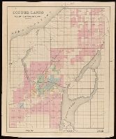
- Beinecke Rare Book and Manuscript Library > Copper lands of St. Mary's Canal Mineral Land Co. shaded red.
- Published / Created:
- [1859?]
- Call Number:
- BrSides Folio 2018 136
- Image Count:
- 1
- Resource Type:
- Maps, Atlases & Globes
- Found in:
- Beinecke Rare Book and Manuscript Library > Copper lands of St. Mary's Canal Mineral Land Co. shaded red.
- Creator:
- Borja, Juan de, b. 1533.
- Published / Created:
- Anno 1697.
- Call Number:
- 2000 2488
- Image Count:
- 1
- Resource Type:
- Books, Journals & Pamphlets
- Found in:
- Beinecke Rare Book and Manuscript Library > Emblemata moralia / scripta quondam hispanice a Johanne de Boria, latinitate autem donata a L.C.C.P.
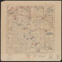
- Creator:
- Great Britain. War Office. General Staff. Geographical Section
- Published / Created:
- 1918
- Call Number:
- 36ed 1918
- Container / Volume:
- BRBL_00127
- Image Count:
- 2
- Resource Type:
- Maps, Atlases & Globes
- Found in:
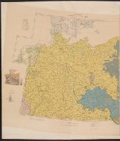
- Beinecke Rare Book and Manuscript Library > Ethnographical map [cartographic material].
- Published / Created:
- 1918?]
- Call Number:
- 38hc 1918A Sep. folder
- Container / Volume:
- BRBL_00172
- Image Count:
- 1
- Resource Type:
- Maps, Atlases & Globes
- Found in:
- Beinecke Rare Book and Manuscript Library > Fernsprechleitungen der Schaltstellen.
- Published / Created:
- 1918?]
- Call Number:
- 38hc 1918C
- Container / Volume:
- BRBL_00172
- Image Count:
- 1
- Resource Type:
- Maps, Atlases & Globes
- Found in:
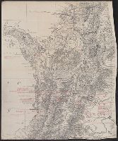
- Beinecke Rare Book and Manuscript Library > Grabenkarte.
- Published / Created:
- 1918?]
- Call Number:
- 38hc 1918B
- Container / Volume:
- BRBL_00172
- Image Count:
- 6
- Resource Type:
- Maps, Atlases & Globes
- Found in:
- Beinecke Rare Book and Manuscript Library > Grabenkarten.
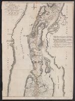
- Creator:
- Raspe, Gabriel Nicolaus, 1712-1785
- Published / Created:
- [1777]
- Call Number:
- 771 1777C
- Container / Volume:
- BRBL_00729
- Image Count:
- 1
- Resource Type:
- Maps, Atlases & Globes
- Found in:
- Beinecke Rare Book and Manuscript Library > Grundriss des nördlichen Theils der Neujorks Insel : nebst den am 16. Novbr. 1776 eroberten Fort Washington, nun das Fort Knijphausen genannt, und dem Fort Lee.
- Published / Created:
- 1918?]
- Call Number:
- 38hc 1918D
- Container / Volume:
- BRBL_00172
- Image Count:
- 2
- Resource Type:
- Maps, Atlases & Globes
- Found in:
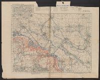
- Beinecke Rare Book and Manuscript Library > Gruppe Gorz, Ic/IId No. 62 geh. Artillerie-Wochenkarte mit Truppen und Fliegerbilderkundung.
- Published / Created:
- [1859?]
- Call Number:
- BrSides Folio 2018 135
- Image Count:
- 1
- Resource Type:
- Maps, Atlases & Globes
- Found in:
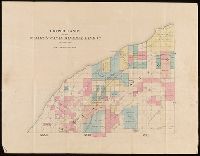
- Beinecke Rare Book and Manuscript Library > Lands of the St. Mary's Canal Mineral Land Co. shaded red.
- Published / Created:
- [1900?]
- Call Number:
- 796 St44 1900
- Container / Volume:
- BRBL_00528
- Image Count:
- 1
- Resource Type:
- Maps, Atlases & Globes
- Found in:
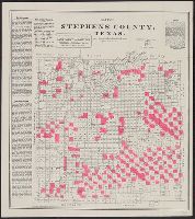
- Beinecke Rare Book and Manuscript Library > Map of Stephens County, Texas / lithographed by August Gast & Co.
- Published / Created:
- [1859?] and [between 1880 and 1889?]
- Call Number:
- BrSides Folio 2018 138
- Image Count:
- 1
- Resource Type:
- Maps, Atlases & Globes
- Found in:
- Beinecke Rare Book and Manuscript Library > Map of a portion of Point Keweenaw, L.S. : showing the lands &c. of the Pennsylvania & Delaware Mining Co's.
- Creator:
- Moore, Marianne, 1887-1972
- Published / Created:
- [1923]
- Call Number:
- Za M785 923M
- Image Count:
- 1
- Found in:
- Beinecke Rare Book and Manuscript Library > Marriage.
- Published / Created:
- 1918?]
- Call Number:
- 38hc 1918E
- Container / Volume:
- BRBL_00172
- Image Count:
- 1
- Resource Type:
- Maps, Atlases & Globes
- Found in:
- Beinecke Rare Book and Manuscript Library > Minenwerfer-Karte, Div. "H".
- Published / Created:
- [1915]
- Call Number:
- Marinetti +M317 69
- Image Count:
- 4
- Resource Type:
- Books, Journals & Pamphlets
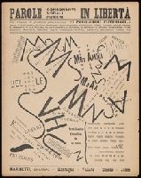
- Found in:
- Beinecke Rare Book and Manuscript Library > Parole, consonanti, vocali, numeri in libertà : dal volume di prossima pubblicazione "I Paroliberi futuristi" ...
- Creator:
- United States. Department of Commerce and Labor. Bureau of Statistics
- Published / Created:
- [1905?]
- Call Number:
- BrSides Double Folio 2018 91
- Image Count:
- 1
- Resource Type:
- Maps, Atlases & Globes
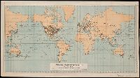
- Found in:
- Beinecke Rare Book and Manuscript Library > Principal transportation routes of the world.
- Creator:
- Woods, Thomas S., Cartographer
- Published / Created:
- [1913]
- Call Number:
- BrSides Box 2018 75
- Image Count:
- 1
- Resource Type:
- Maps, Atlases & Globes
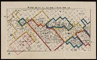
- Found in:
- Beinecke Rare Book and Manuscript Library > Properties on the Kearsarge Lode, Michigan.
- Published / Created:
- 1926-30
- Call Number:
- Eisenman +S86
- Image Count:
- 24
- Found in:
- Beinecke Rare Book and Manuscript Library > SA : Sovremennai︠a︡ arkhitektura = Architektur Dergegenwart = L'Architecture contemporaine.
- Published / Created:
- 1906 April 26
- Call Number:
- 2006 +S4
- Image Count:
- 8
- Resource Type:
- Books, Journals & Pamphlets
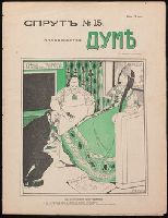
- Found in:
- Beinecke Rare Book and Manuscript Library > Sprut.
- Creator:
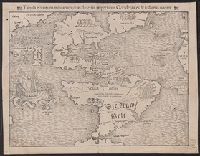
- Münster, Sebastian, 1489-1552
- Published / Created:
- 1559?]
- Call Number:
- 70 1559
- Container / Volume:
- BRBL_00685
- Image Count:
- 2
- Resource Type:
- Maps, Atlases & Globes
- Found in:
- Beinecke Rare Book and Manuscript Library > Tabula nouarum insularum, quas diuersis respectibus Occidentales & Indianas uocant.
- Creator:
- Dryden, John, 1631-1700
Malone, Edmond, 1741-1812
- Published / Created:
- 1800
- Call Number:
- Osborn pd118
- Image Count:
- 987
- Found in:
- Beinecke Rare Book and Manuscript Library > The critical and miscellaneous prose works of John Dryden, now first collected: with notes and illustrations; an account of the life and writings of the author, grounded on original and authentick documents; and a collection of his letters, the greater part of which has never before been published. By Edmond Malone, esq.
- Creator:
- Dryden, John, 1631-1700
Malone, Edmond, 1741-1812
- Published / Created:
- 1800
- Call Number:
- Osborn pd284
- Image Count:
- 577
- Found in:
- Beinecke Rare Book and Manuscript Library > The critical and miscellaneous prose works of John Dryden, now first collected: with notes and illustrations; an account of the life and writings of the author, grounded on original and authentick documents; and a collection of his letters, the greater part of which has never before been published. By Edmond Malone, esq.
- Creator:
- Dryden, John, 1631-1700
Malone, Edmond, 1741-1812
- Published / Created:
- 1800
- Call Number:
- Osborn pd284
- Image Count:
- 695
- Found in:
- Beinecke Rare Book and Manuscript Library > The critical and miscellaneous prose works of John Dryden, now first collected: with notes and illustrations; an account of the life and writings of the author, grounded on original and authentick documents; and a collection of his letters, the greater part of which has never before been published. By Edmond Malone, esq.
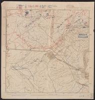
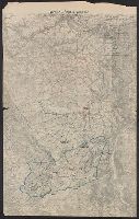
- Published / Created:
- 1918
- Call Number:
- 38hc 1918 Sep. folder
- Container / Volume:
- BRBL_00172
- Image Count:
- 1
- Resource Type:
- Maps, Atlases & Globes
- Found in:
- Beinecke Rare Book and Manuscript Library > Verdun-Point-à-Mousson.
- Published / Created:
- 151-?]
- Call Number:
- Commedia dell'arte 51
- Image Count:
- 14
- Resource Type:
- Books, Journals & Pamphlets
- Found in:
- Beinecke Rare Book and Manuscript Library > Vn viazo che ha fatto misser Pedrol bergamasco : qual narra li paesi che lha visto, & le sue virtu : cosa molto piaceuole e ridiculosa.
- Published / Created:
- 191-?]
- Call Number:
- 11hcf 1919D-60
- Image Count:
- 3
- Resource Type:
- Maps, Atlases & Globes
- Found in:
- Beinecke Rare Book and Manuscript Library > [Adriatic Sea.]
- Creator:
- Månsson, Johan, -1659
- Call Number:
- Double Covers 303cea +1645
- Image Count:
- 7
- Resource Type:
- Maps, Atlases & Globes
- Found in:
- Beinecke Rare Book and Manuscript Library > [Chart of the Baltic Sea] / Siegismuntlus von Vogell fecit.
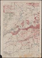
- Published / Created:
- [1918]
- Call Number:
- 38hc R283 1918
- Container / Volume:
- BRBL_00173
- Image Count:
- 10
- Resource Type:
- Maps, Atlases & Globes
- Found in:
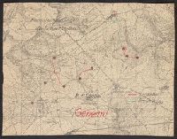
- Beinecke Rare Book and Manuscript Library > [Collection of maps related to raid of the Second Battalion Infantry Regiment 134 near Remenauville during the night of April 27/28 1918].
- Published / Created:
- 1920?].
- Call Number:
- 902 1920A
- Container / Volume:
- BRBL_00665
- Image Count:
- 1
- Resource Type:
- Maps, Atlases & Globes
- Found in:
- Beinecke Rare Book and Manuscript Library > [Map of Colombia].
- Creator:
- Paucker, Fred
- Published / Created:
- 1957
- Call Number:
- 51 1957
- Image Count:
- 1
- Resource Type:
- Maps, Atlases & Globes
- Found in:
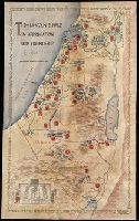
- Beinecke Rare Book and Manuscript Library > [Map of Israel] / Fred Paucker.