Skip to search
Skip to main content
Skip to first result
Search
You Searched For
Access
Public
Repository
Beinecke Rare Book and Manuscript Library
Genre
Engravings
Genre
Hand coloring
Subject (Topic)
Atlases --Early works to 1800
New Search
Search Results
Call Number:
1976 1233
Collection Title:
Forty-two new maps of Asia, Africa, and America ... : all engrav’d, according to the latest
Image Count:
1
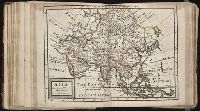
Alternative Title:
Asia in general
Description:
In ink on verso: 1.
Subject (Geographic):
Asia --Maps --Early works to 1800
Subject (Name):
Nicholson, John, d. ca. 1717, bookseller
Subject (Topic):
Atlases --Early works to 1800
Collection Created:
London : Printed for J. Nicholson ..., 1716 ...
Found in:
Beinecke Rare Book and Manuscript Library > Asia according to ye newest observations
Call Number:
1976 1233
Collection Title:
Forty-two new maps of Asia, Africa, and America ... : all engrav’d, according to the latest
Image Count:
1
Alternative Title:
A map of ye island of Bermudos, divided into its tribes w.th the castles, forts &c and Carolina and Bermudos
Description:
In pencil on verso: 40. and Table of contents for maps 2-20 in section "America" misnumbered.
Subject (Geographic):
Bermuda Islands --Maps --Early works to 1800, North Carolina --Maps --Early works to 1800, and South Carolina --Maps --Early works to 1800
Subject (Name):
Nicholson, John, d. ca. 1717, bookseller
Subject (Topic):
Atlases --Early works to 1800
Collection Created:
London : Printed for J. Nicholson ..., 1716 ...
Found in:
Beinecke Rare Book and Manuscript Library > Carolina
Published / Created:
1756
Call Number:
1973 Folio 119
Collection Title:
Atlas universel, par M. Robert ... et par M. Robert de Vaugondy son fils ...
Image Count:
1
Resource Type:
Maps, Atlases & Globes
Description:
Stamped on verso: "Lorraine" on right and left sides.
Subject (Geographic):
Lorraine (France) --Maps --Early works to 1800
Subject (Name):
Robert de Vaugondy, Didier, 1723-1786
Subject (Topic):
Atlases --Early works to 1800
Collection Created:
Paris, Chez les auteurs, quay de l’Horloge du Palais; Boudet libraire imprimeur du roi, rue St. Jacques, 1757[-58]
Found in:
Beinecke Rare Book and Manuscript Library > Carte de la Lorraine et Du Barrois dans laquelle se trouvent la generalite de metz et autres enclaves; dresseepour la lecture du memoire de M. Durival l'aine, et dediee au Roy de Pologne Duc de Lorraine et de bar par le Sr. Robert de Vaugondy ...
Published / Created:
1753
Call Number:
1973 Folio 119
Collection Title:
Atlas universel, par M. Robert ... et par M. Robert de Vaugondy son fils ...
Image Count:
1
Resource Type:
Maps, Atlases & Globes
Description:
Stamped on verso: "Egypte" on right and left sides.
Subject (Geographic):
Egypt --Maps --Early works to 1800
Subject (Name):
Robert de Vaugondy, Didier, 1723-1786
Subject (Topic):
Atlases --Early works to 1800
Collection Created:
Paris, Chez les auteurs, quay de l’Horloge du Palais; Boudet libraire imprimeur du roi, rue St. Jacques, 1757[-58]
Found in:
Beinecke Rare Book and Manuscript Library > Carte de la l'Egypte ancienne et moderne, dressee sur celle du R.P. Sicard et autres, assujielles aux observations astronomiques par le Sr. Robert de Vaugondy ...
Creator:
Published / Created:
1785
Call Number:
1983 Folio 23
Collection Title:
[Atlas factice of 50 maps, primarily by Johann Baptist Homann and/or issued by the Homann Erben
Image Count:
1
Alternative Title:
Charte de la Moldavie & de la Valachie and Charte de la Moldavie et de la Valachie
Description:
Number 14 of 50 works bound together.
Publisher:
Bey denen Homaennischen Erben
Subject (Geographic):
Moldavia --Maps --Early works to 1800 and Wallachia --Maps --Early works to 1800
Subject (Topic):
Atlases --Early works to 1800
Collection Created:
[Nuremberg : Homann Erben, 1710-1786]
Found in:
Beinecke Rare Book and Manuscript Library > Charte von der Moldau und Walachey [cartographic material] : nach den Astronomischen Beobachtungen des Russisch-Kayserl. Majors Jslenief und denen Charten und Beschreibung des H. Hauptm. Sulzer, ingl. den Charten des ehmal. Russ. Kaysl. Gen.-Lieut. v. Bau
Call Number:
1976 1233
Collection Title:
Forty-two new maps of Asia, Africa, and America ... : all engrav’d, according to the latest
Image Count:
1
Alternative Title:
Natolia
Description:
In ink on verso: 3.
Subject (Geographic):
Asia --Maps --Early works to 1800 and Turkey --Maps
Subject (Name):
Nicholson, John, d. ca. 1717, bookseller
Subject (Topic):
Atlases --Early works to 1800
Collection Created:
London : Printed for J. Nicholson ..., 1716 ...
Found in:
Beinecke Rare Book and Manuscript Library > Chersonesi quae hodie Natolia descriptio
Call Number:
1976 1233
Collection Title:
Forty-two new maps of Asia, Africa, and America ... : all engrav’d, according to the latest
Image Count:
1
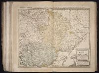
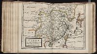
Alternative Title:
China
Description:
In ink on verso: 10.
Subject (Geographic):
China --Maps --Early works to 1800
Subject (Name):
Nicholson, John, d. ca. 1717, bookseller
Subject (Topic):
Atlases --Early works to 1800
Collection Created:
London : Printed for J. Nicholson ..., 1716 ...
Found in:
Beinecke Rare Book and Manuscript Library > China according to the newest and most exact observations
Call Number:
1982 Folio 10
Collection Title:
[Composite atlas of hand-colored maps by William Faden, Thomas Kitchin, Robert Sayer, Jean Baptiste
Image Count:
1
Description:
42 maps on 51 sheets, Armorial bookplate: Charles Abbot., and Numbering from [Table of] Contents page follows map count, not sheet count.
Subject (Topic):
Atlases --Early works to 1800
Collection Created:
[1743-1792]
Found in:
Beinecke Rare Book and Manuscript Library > Contents
Published / Created:
Undated
Call Number:
1976 1233
Collection Title:
Twenty four new and accurate maps of the several parts of Europe ... : all (except the last) new
Image Count:
1
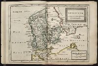
Alternative Title:
Denmark
Description:
In pencil on verso: 4.
Subject (Geographic):
Denmark --Maps --Early works to 1800
Subject (Name):
Barker, B. (Benjamin), d. 1764, bookseller, Clements, Henry, d. 1719, bookseller, King, Charles, d. 1735, bookseller, Nicholson, John, d. ca. 1717, bookseller, Parker, Richard, fl. 1692-1725, bookseller, and Tooke, Benjamin, d. 1716, bookseller
Subject (Topic):
Atlases --Early works to 1800
Collection Created:
[London] : Sold by J. Nicholson at the King’s-Arms in Little Britain, Benj. Barker and Charles King ..., Benj. Tooke ..., Hen. Clements ..., R. Parker and Ralph Smith under the Royal-Exchange ..., [1715?]
Found in:
Beinecke Rare Book and Manuscript Library > Denmark according to the newest observations
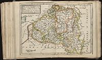
Published / Created:
Undated
Call Number:
1976 1233
Collection Title:
Twenty four new and accurate maps of the several parts of Europe ... : all (except the last) new
Image Count:
1
Alternative Title:
Flanders, or the Spanish Netherlands; with the bishopricks of Cambray and Liege
Description:
In pencil on verso: 14.
Subject (Geographic):
Flanders (Belgium) --Maps --Early works to 1800
Subject (Name):
Barker, B. (Benjamin), d. 1764, bookseller, Clements, Henry, d. 1719, bookseller, King, Charles, d. 1735, bookseller, Nicholson, John, d. ca. 1717, bookseller, Parker, Richard, fl. 1692-1725, bookseller, and Tooke, Benjamin, d. 1716, bookseller
Subject (Topic):
Atlases --Early works to 1800
Collection Created:
[London] : Sold by J. Nicholson at the King’s-Arms in Little Britain, Benj. Barker and Charles King ..., Benj. Tooke ..., Hen. Clements ..., R. Parker and Ralph Smith under the Royal-Exchange ..., [1715?]
Found in:
Beinecke Rare Book and Manuscript Library > Flanders or the Spanish Netherlands with ye archbishoprick of Cambresis and bishoprick of Lyege
Branch:v1.61.8 ,Deployed:2024-06-20T11:14:48-04:00