Skip to search
Skip to main content
Skip to first result
Yale University Library
Ask Yale Library
Reserve Rooms
Places to Study
Research
Quicksearch
Search Library Catalog (Orbis)
Search Law Library Catalog (MORRIS)
Search Borrow Direct
Search WorldCat
Search Articles+
Search Digital Collections
Search Archives at Yale
Research Guides
Find Databases by Title
Find eJournals by Title
Guide to Using Special Collections
Services
Your Personal Librarian
Subject Specialists
Research Support and Workshops
Citation Tools
OverDrive: Popular Audio and eBooks
Get It @ Yale (Borrow Direct, Interlibrary Loan, Scan & Deliver)
Course Reserves
Off-Campus Access
EliScholar
OverDrive: Popular Audio and eBooks
Bass Media Equipment
Libraries & Collections
Arts Library
Bass Library
Beinecke Library
Classics Library
Divinity Library
Film Study Center
Fortunoff Archive
Humanities Collections
International Collections
Law Library
Lewis Walpole Library
Library Collection Services
Manuscripts & Archives
Map Collection
Marx Science & Social Science Library
Medical Library
Music Library
Sterling Library
Yale Center for British Art
Information & Policies
Library Hours
Departments & Staff
Borrowing & Circulation
Services for Persons with Disabilities
Copyright Basics
Scanning, Printing & Copying
Computers & Wireless
Library Policies
About the Library
Giving to the Library
Purchase Request
Working at the Library
Terms Governing Use of Materials
Search in
All Fields
Creator
Title
Call Number
Date
Subject
Orbis ID
Full Text
Description
Full text
search for
Search
Search
Advanced Search
Digital Collections
Search
You Searched For
Genre
Illustrations
Genre
Hand coloring
Genre
Maps
New Search
1
-
38
of
38
Sort
by Creator (Z --> A)
relevance
Creator (A --> Z)
Creator (Z --> A)
Title (A --> Z)
Title (Z --> A)
Year (ascending)
Year (descending)
Number of results to display per page
60
per page
9
per page
30
per page
60
per page
99
per page
View results as:
List
List
Gallery
Gallery
Search Results
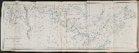
Map to illustrate Mr. Kane's travels in the territory of the Hudson's Bay Company
Plan of the city of New Haven taken in 1748
Die Vereinigten Staaten von Nord America. nach der von Wm Faden 1783
A General map of the southern British colonies, in America, comprehending North and South Carolina
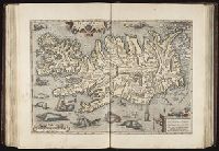
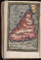
Islandia
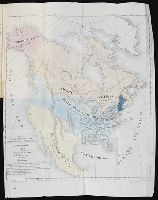
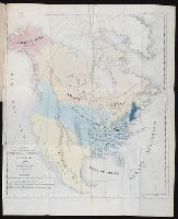
Mapa para la obra intitulada De la Democracia en America por A. de Tocqueville
Mapa para la obra intitulada De la Democracia en America por A. de Tocqueville
Civitates orbis terrarvm ...
North America as divided amongst the European powers
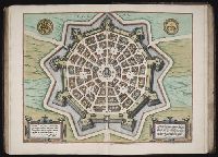
Palma
A Survey of Lake Champlain, including Lake George, Crown Point and St. John. Surveyed by order of
Voyages & [i.e., et] aventures d’un Berrichon a la recherche d’une position sociale, par A. Artaud ...
A map exhibiting a general view of the roads and inland navigation of Pennsylvania, and part of the
10. Map of Connecticut
A General map of the northern British colonies in America. which comprehends the province of Quebec
A general map of the middle British colonies in America. Containing Virginia, Maryland, the
A new map of Maine
A new map of Maine
A new map of Maine
A new map of Maine
Africa
Asia
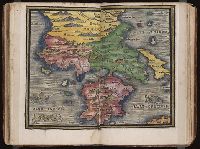
Asia Minor
Die gantse welt
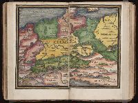
Gallia
Germania
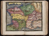
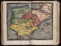
Hispania
Historia Imperii Romano-Germanici, nec non finitimarum Regionum In Mappa exhibita, ac aeri incisa a
Italia
Muster and History of Browlia
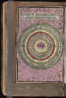
Ordo planetarvm cvm aspectibvs
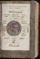
Regiones et nomina ventorvm
Sarmatia
Sicilia
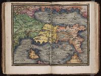
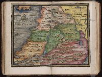
Syria
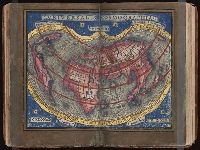
Vniversalis cosmographia
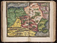
[Map of the Balkan Peninsula including Macedonia and Greece]
[Map of the Balkan Peninsula including Macedonia, Blugaria, Moldova]
Limit your search
Extent of Digitization
Partially digitized
27
Unspecified
7
Completely digitized
4
Access
Public
38
Repository
Beinecke Rare Book and Manuscript Library
38
Format
cartographic
35
still image
2
mixed material
1
Genre
Hand coloring
✖
[remove]
38
Illustrations
✖
[remove]
38
Maps
✖
[remove]
38
Maps in books
31
Manuscripts
17
Illuminated manuscripts
15
Engravings
14
Atlases
5
Drawings
3
Cityscapes (Representations)
2
more
Genre
»
Resource Type
Maps, Atlases & Globes
11
Books, Journals & Pamphlets
2
Language
English
15
Latin
4
Spanish; Castilian
2
French
1
German
1
Italian
1
Creator
Houbloup, L
2
Adlum, John, 1759-1836
1
Artaud, A.
1
Brasier, William
1
Braun, Georg, 1540 or 1-1622
1
Cicogna, Pasquale, 1509-1595
1
Dunn, Samuel
1
Hierat, Anton, fl.1597-1627
1
Hogenberg, Abraham, fl. 1608-1653
1
Hogenberg, Franz, d. 1590?
1
more
Creator
»
Subject (Topic)
Cosmography
15
Early maps
15
Geography, Medieval
15
Atlases --Early works to 1800
2
Cities and towns, Medieval
2
Democracy
2
Atlases, German
1
California --Gold discoveries
1
Canals --Pennsylvania --Maps --Early works to 1800
1
Imaginary creatures
1
more
Subject (Topic)
»
Subject (Name)
Sanchez de Bustamante, D. A
2
Hierat, Anton, fl.1597-1627
1
Hogenberg, Abraham, fl. 1608-1653
1
Hogenberg, Franz, d. 1590?
1
Mifflin, Thomas, 1744-1800
1
Ortelius, Abraham, 1527-1598. Nomenclatur Ptolemaicus
1
Ortelius, Abraham, 1527-1598. Parergon
1
Wallis, John, 1734-1793
1
Publication Place
London
5
Philadelphia
2
Bourges
1
[Philadelphia]
1
Date Created
View distribution
Current results range from
1542
to
1900
Date Created range begin
Date Created range end
View larger »
[Missing]
4