


- None1
Search
Limit your search
- Public✖[remove]195
- cartographic192
- Homann Erben (Firm)41
- Homann, Johann Baptist, 1663-172430
- Berry, William, fl. 1669-1708, creator29
- Sanson, Nicolas, 1600-166725
- Faden, William, 1749-1836, creator13
- Hase, Johann Matthias, 1684-174213
- Mayer, Tobias, 1723-176210
- Faden, William, 1749-18369
- Lotter, Tobias Conrad, 1717-17779
- Wit, Frederik de., creator9
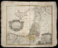
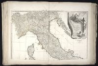
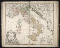
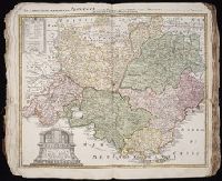
- Atlases, German --Early works to 180072
- World maps --Early works to 18006
- Atlases--Early works to 18004
- Religion --Maps --Early works to 18002
- Spanish Succession, War of, 1701-1714 --Maps2
- Atlases, German1
- Coasts --Africa, North --Maps --Early works to 18001
- Coasts --Africa, West --Maps --Early works to 18001
- Coasts --England --Maps --Early works to 18001
- Coasts --England, Southern --Maps --Early works to 18001