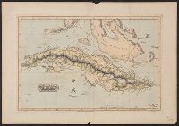
From Lucas's A general atlas containing distinct maps of all the known countries in the world, map # 81., Prime meridian: London., and Relief shown by hachures.
Publisher:
[F. Lucas, Jr.],
Subject (Geographic):
Cuba--Maps
Subject (Name):
B.T. Welch & Co and Lucas, Fielding, Jr., 1781-1854. A general atlas containing distinct maps of all the known countries in the world
Imprint date from R.V. Tooley's French mapping of the Americas, item 50., Prime meridian: Ferro., Relief shown pictorially., and Yale's copy stamped on verso: Yale University Library, Karpinski-Von Wieser Map Collection.
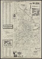
North-American pilot for New England, New York, Pensilvania, Maryland, and Virginia.
Description:
A Scale of 5 "English Miles" is given below the title at upper left., Below the scale: The Light-House of Sandy Hook is 40d. 27m. North Latitude., Coordinates not present on map and are approximated., Depths shown by soundings. Relief shown by hachures., First state., Includes note., Issued separately and in the first edition of Sayer & Bennett's North American Pilot for New England, New York, Pensilvania, Maryland, and Virginia. 1777., Sailing chart of the area around New York Harbor and Long Island; centered on Staten Island, York's Bay and Constable Point, extending north to Hells Gate, New York Island, Netwon Inlet, Bushwick Inlet, Wallabout Bay, Crown Point, the Battery and Ship Yards and south to the Shrewsbury River. The map extends East to include Amboy and the Raritan River, noting (Samuel?) Holland's House and east to Jamaica Bay and Plumb Island., and Watermarks.
Publisher:
Printed for Robt. Sayer & John Bennett, sea chart & map-sellers, No. 53, in Fleet Street. Published as the Act directs,
Subject (Geographic):
Atlantic Ocean--Lower Bay, Atlantic Ocean--Upper Bay, New Jersey--Sandy Hook, New York Harbor (N.Y. and N.J.) Maps--Early works to 1800., New York Region--Maps--Early works to 1800., and Sandy Hook (N.J.)
Subject (Name):
Robert Sayer and John Bennett (Firm), printmaker, printseller
Subject (Topic):
Nautical charts, Nautical charts--Hudson River Estuary (N.Y. and N.J.)--Early works to 1800., Nautical charts--Lower Bay (N.Y. and N.J.)--Early works to 1800., and Nautical charts--Upper Bay (N.Y. and N.J.)--Early works to 180