Search
You Searched For
Search Results
- Creator:
- Maury, Matthew Fontaine, 1806-1873
- Published / Created:
- [1847?]-1853.
- Call Number:
- 11cfk 1850A-3
- Container / Volume:
- BRBL_00768
- Image Count:
- 4
- Resource Type:
- Maps, Atlases & Globes
- Found in:
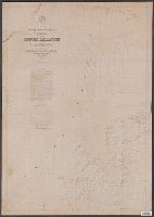
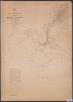
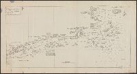
- Beinecke Rare Book and Manuscript Library > Wind and current chart of the South Atlantic [cartographic material] / by M.F. Maury, L.L.D.U.S. Navy, Superindt. of U.S.N. Observatory ; compiled from materials in the Bureau of Ordnance and Hydrography, Commodore Charles Morris, Chief of Bureau.
- Creator:
- Maury, Matthew Fontaine, 1806-1873
- Published / Created:
- 1852
- Call Number:
- 11cfk 1850D-2
- Container / Volume:
- BRBL_00773
- Image Count:
- 4
- Resource Type:
- Maps, Atlases & Globes
- Found in:
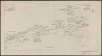
- Beinecke Rare Book and Manuscript Library > Wind and current chart of the South Atlantic [cartographic material] / by M.F. Maury, L.L.D. Lieut. U.S. Navy, Superint'dt. of U.S.N. Observatory ; compiled from materials in the Bureau of Ordnance and Hydrography, Commodore Charles Morris, Chief of Bureau.
- Creator:
- Maury, Matthew Fontaine, 1806-1873
- Published / Created:
- 1852-[1859?]
- Call Number:
- 11cfk 1850A-2
- Container / Volume:
- BRBL_00767
- Image Count:
- 4
- Resource Type:
- Maps, Atlases & Globes
- Found in:
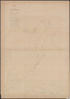
- Beinecke Rare Book and Manuscript Library > Maury's wind and current chart [cartographic material] : South Pacific / drawn by Lardner Gibbon, P.M. U.S.N.
- Creator:
- Maury, Matthew Fontaine, 1806-1873
- Published / Created:
- 1852
- Call Number:
- 11cfk 1850D-2
- Container / Volume:
- BRBL_00773
- Image Count:
- 4
- Resource Type:
- Maps, Atlases & Globes
- Found in:
- Beinecke Rare Book and Manuscript Library > Wind and current chart of the South Atlantic [cartographic material] / by M.F. Maury, L.L.D. Lieut. U.S. Navy, Superint'dt. of U.S.N. Observatory ; compiled from materials in the Bureau of Ordnance and Hydrography, Commodore Charles Morris, Chief of Bureau.
- Creator:
- Maury, Matthew Fontaine, 1806-1873
- Published / Created:
- 1850
- Call Number:
- 11cfk 1850D-1
- Container / Volume:
- BRBL_00773
- Image Count:
- 4
- Resource Type:
- Maps, Atlases & Globes
- Found in:
- Beinecke Rare Book and Manuscript Library > Wind and current chart of the North Atlantic [cartographic material] : thermal sheet / by M.F. Maury, A.M. Lieut. U.S. Navy, Superint'dt. of U.S.N. Observatory ; compiled from materials in the Bureau of Ordnance and Hydrography, Commodore Lewis Warrington, Chief of Bureau ; drawn by Lt. Benjn. S. Gantt, U.S.N.
- Creator:
- Månsson, Johan, -1659
- Call Number:
- Double Covers 303cea +1645
- Image Count:
- 7
- Resource Type:
- Maps, Atlases & Globes
- Found in:
- Beinecke Rare Book and Manuscript Library > [Chart of the Baltic Sea] / Siegismuntlus von Vogell fecit.
- Creator:
- Maury, Matthew Fontaine, 1806-1873
- Published / Created:
- 1850
- Call Number:
- 11cfk 1850D-1
- Container / Volume:
- BRBL_00773
- Image Count:
- 8
- Resource Type:
- Maps, Atlases & Globes
- Found in:
- Beinecke Rare Book and Manuscript Library > Wind and current chart of the North Atlantic [cartographic material] : thermal sheet / by M.F. Maury, A.M. Lieut. U.S. Navy, Superint'dt. of U.S.N. Observatory ; compiled from materials in the Bureau of Ordnance and Hydrography, Commodore Lewis Warrington, Chief of Bureau ; drawn by Lt. Benjn. S. Gantt, U.S.N.
- Creator:
- Maury, Matthew Fontaine, 1806-1873
- Published / Created:
- [1854?]-1856.
- Call Number:
- 11cfk 1850A-5
- Container / Volume:
- BRBL_00769
- Image Count:
- 8
- Resource Type:
- Maps, Atlases & Globes
- Found in:
- Beinecke Rare Book and Manuscript Library > Maury's wind and current chart, Indian Ocean [cartographic material].
- Creator:
- Maury, Matthew Fontaine, 1806-1873
- Published / Created:
- 1849-[1856?]
- Call Number:
- 11cfk 1850A-1
- Container / Volume:
- BRBL_00767
- Image Count:
- 10
- Resource Type:
- Maps, Atlases & Globes
- Found in:
- Beinecke Rare Book and Manuscript Library > Wind and current chart of the North Pacific [cartographic material] / by M.F. Maury, A.M. Lieut. U.S. Navy, Superint'dt. of U.S.N. Observatory ; compiled from materials in the Bureau of Ordnance and Hydrography, Commodore Lewis Warrington ; drawn by P.M. Lardner Gibbon, U.S.N. ; tracks projected by Lieut. A.W. Johnson, U.S. Navy.
- Creator:
- Maury, Matthew Fontaine, 1806-1873
- Published / Created:
- 1851-1859.
- Call Number:
- 11cfk 1850C-6
- Container / Volume:
- BRBL_00771
- Image Count:
- 10
- Resource Type:
- Maps, Atlases & Globes
- Found in:
- Beinecke Rare Book and Manuscript Library > Pilot chart of the South Pacific [cartographic material] / by M.F. Maury, L.L.D., Lieut. U.S. Navy ; Superin'dt. of U.S.N. Observatory ; compiled from materials in the Bureau of Ordnance and Hydrography, Commodre Charles Morris, Chief of Bureau.
- Creator:
- Furgerson, Samuel
- Published / Created:
- 1809-1811
- Call Number:
- WA MSS 207
- Image Count:
- 104
- Resource Type:
- Archives or Manuscripts
- Found in:
- Beinecke Rare Book and Manuscript Library > Journal of a voyage from Boston to the North-West Coast of America
- Creator:
- Great Britain. Hydrographic Department, author
- Call Number:
- 254cea 1886
- Container / Volume:
- BRBL_00021
- Image Count:
- 1
- Resource Type:
- Maps, Atlases & Globes
- Found in:
- Beinecke Rare Book and Manuscript Library > Australia, Coral Sea and Great Barrier Reefs, showing the Inner and Outer routes to Torres Strait. Sheet 2 / engraved by Edwd. Weller.
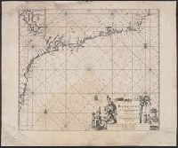
- Creator:
- Jefferys, Thomas, -1771
- Published / Created:
- 20 Feby., 1775.
- Call Number:
- 792cea 1775C
- Container / Volume:
- BRBL_00519
- Image Count:
- 1
- Resource Type:
- Maps, Atlases & Globes
- Found in:
- Beinecke Rare Book and Manuscript Library > The island of Cuba with part of the Bahama banks & the Martyrs / by Thos. Jefferys.
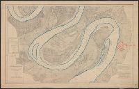
- Creator:
- United States. Mississippi River Commission
- Published / Created:
- 1879-
- Call Number:
- BrSides Double Folio 2018 85
- Image Count:
- 1
- Resource Type:
- Maps, Atlases & Globes
- Found in:
- Beinecke Rare Book and Manuscript Library > Survey of the Mississippi River / made under the direction of the Mississippi River Commission.
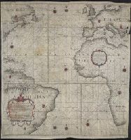
- Creator:
- Vooght, Claes Janszoon, -1696
- Published / Created:
- [ca. 1685]
- Call Number:
- 911cea C111 1685
- Container / Volume:
- BRBL_00670
- Image Count:
- 1
- Resource Type:
- Maps, Atlases & Globes
- Found in:
- Beinecke Rare Book and Manuscript Library > Paskaart van de zee-kusten van Brazilia, tusschen C.S. Thome en I.S. Catharina / door Vooght geometra.
- Creator:
- Pinheiro, Simão Antônio da Rosa
- Published / Created:
- anno de 1786.
- Call Number:
- Art Storage 1006
- Container / Volume:
- BRBL_00700
- Image Count:
- 1
- Resource Type:
- Maps, Atlases & Globes
- Found in:
- Beinecke Rare Book and Manuscript Library > Carta reduzida, e em muijte parte reformada, pelas observacoens mais justificadas dos melhores authores, astronomos modernos, [que] pareceraõ mais coherentes, pelas exaetissimas averiguacoens de pilotos eruditos, e do roterro portugues : em que se compre
- Creator:
- E. & G.W. Blunt (Firm)
- Published / Created:
- 1861
- Call Number:
- 754cea 1854
- Container / Volume:
- BRBL_00418
- Image Count:
- 1
- Resource Type:
- Maps, Atlases & Globes
- Found in:
- Beinecke Rare Book and Manuscript Library > The coast of the United States sheet no. 1. : From Point Judith to Cape Lookout, from the U.S. Coast Surveys.
- Published / Created:
- 19--]
- Call Number:
- 76cea 1887
- Container / Volume:
- BRBL_00446
- Image Count:
- 1
- Resource Type:
- Maps, Atlases & Globes
- Found in:
- Beinecke Rare Book and Manuscript Library > Portion of a map of New England in the Public Record Office, London, Eng. : Copied for Chas. Hervey Townshend, Esq. of "Raynham," New Haven, Connecticut, U.S.A. by L.M. Byrne, April, 1887.