Great Britain. War Office. General Staff. Geographical Section
Published / Created:
1945
Call Number:
5681 1945
Container / Volume:
BRBL_00300
Image Count:
2
Resource Type:
Maps, Atlases & Globes
Alternative Title:
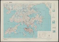
GSGS (Series), Hong Kong and Lema Islands, Hong Kong and Lema Islands., and Hong Kong and New territory.
Description:
"7-45.", "8-45.", "Reproduced under the direction of the Chief of Engineers by the Army Map Service (AM), U.S. Army ... 1945, from Kodalines of GSGS Second Edition 1945...", and North sheet. Hong Kong and New territory -- South sheet. Hong Kong and Lema Islands.
Publisher:
Army Map Service, U.S. Army,
Subject (Geographic):
Hong Kong (China)--Maps and New Territories (China)--Maps
"To accompany the Commissioner's joint report dated November 26, 1951. Upon the establishment of the boundary from Tongass Passage to Mount St. Elias in accordance with the convention of January 24, 1903, the award of the tribunal, appointed under the convention signed at London October 20, 1903 ..."
Publisher:
U.S. G.P.O.,
Subject (Geographic):
Alaska--Boundaries--Canada--Maps, Canada--Boundaries--United States--Maps, and United States--Boundaries--Canada--Maps
Geographical Surveys West of the 100th Meridian (U.S.)
Published / Created:
1879
Call Number:
834 1879B
Container / Volume:
BRBL_00587
Image Count:
1
Resource Type:
Maps, Atlases & Globes
Description:
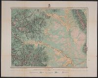
"By Order of the Honorable The Secretary of War. Under the, "Expeditions of 1873, '74, '75 & '76 under the command of 1st. Lieut. Geo. M. Wheeler, Corps of Engineers, U.S. Army.", On verso: 4., and Shows geographical features, roads, settlements, and distances.
Publisher:
U.S. Geographical Surveys West of the 100th Meridian,
Subject (Geographic):
Colorado--Surveys--Maps
Subject (Name):
United States. Army. Corps of Engineers, Weyss, Lang & Herman, Del, Wheeler, George M. (George Montague), 1842-1905, and Wright, Horatio Gouverneur, 1820-1899
Subject (Topic):
Land capability for agriculture--Colorado--Maps and Land use--Colorado--Maps
"Surveyed in 1911.", Includes "Index to shafts" listed alphabetically and by number on map., Map showing responsibility for topography in lower margin., and Relief shown by contours and spot heights.
Publisher:
The Survey,
Subject (Geographic):
Leadville (Colo.)--Maps
Subject (Name):
Davis, E. P., Marshall, R. B. (Robert Bradford), 1867-1949., Robertson, R. B., Semper, C. H., Tatum, Sledge., and Taylor, S. E.
Subject (Topic):
Mines and mineral resources--Colorado--Leadville--Maps.
Great Britain. Army. Royal Engineers. Fd. Survey Coy., 512
Published / Created:
1943
Call Number:
493 1943
Container / Volume:
BRBL_00270
Image Count:
2
Resource Type:
Maps, Atlases & Globes
Alternative Title:
Geographical Section, General Staff ; no. 3859, Great Britain. Army. Middle East Forces. M.D.R ; 582., and GSGS (Series) ; 3859.
Description:
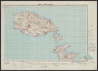
"[Gt. Brit. Army. Middle East Forces.] M.D.R. 582.", Includes glossary., Inset on sheet 2: Island of Fifia., Marginal maps: Reliability diagram -- Actual position of Fifia., Relief shown by contours, "interval 25 feet" ; depths shown by isolines., and Shows five c
Publisher:
Army Map Service, U.S. Army,
Subject (Geographic):
Gozo Island (Malta)--Maps and Malta--Maps
Subject (Name):
Great Britain. War Office. General Staff. Geographical Section and United States. Army Map Service
"Index map showing areas covered by topographic maps, August 1913"., "Recent survey publications" text on verso., Includes inset of the Aleutian Islands and chart of "Maps of Alaska for sale by U.S. Geological Survey.", and Relief shown by hachures and spot heights.