Search
You Searched For
Search Results
- Creator:
- United States. Army Map Service
- Published / Created:
- 1943
- Call Number:
- 533gm 1943
- Container / Volume:
- BRBL_00288
- Image Count:
- 1
- Resource Type:
- Maps, Atlases & Globes
- Found in:
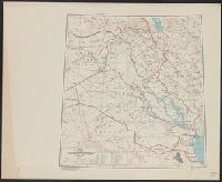
- Beinecke Rare Book and Manuscript Library > ʻIrāq [cartographic material] : special strategic map.
- Call Number:
- 783 1673D
- Container / Volume:
- BRBL_00507
- Image Count:
- 1
- Resource Type:
- Maps, Atlases & Globes
- Found in:
- Beinecke Rare Book and Manuscript Library > virginia and Maryland. As it is planted and inhabited this present year 1670. Surveyed and Exactly Drawne by ... Augustin Herrman, 1673.
- Call Number:
- 771 OS9 1836
- Container / Volume:
- BRBL_00490
- Image Count:
- 1
- Resource Type:
- Maps, Atlases & Globes
- Found in:
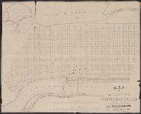
- Beinecke Rare Book and Manuscript Library > map of the Village of Oswego Falls to be Sold on hte Premises by Jas. Bleecker & Sons on the 18th October 1836.
- Published / Created:
- March 1880.
- Call Number:
- 11 1584
- Container / Volume:
- BRBL_00722
- Image Count:
- 2
- Resource Type:
- Maps, Atlases & Globes
- Found in:
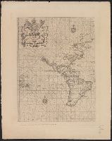
- Beinecke Rare Book and Manuscript Library > [World map].
- Published / Created:
- March 1880.
- Call Number:
- 11 1600
- Container / Volume:
- BRBL_00002
- Image Count:
- 1
- Resource Type:
- Maps, Atlases & Globes
- Found in:
- Beinecke Rare Book and Manuscript Library > [World map].
- Published / Created:
- March 1880.
- Call Number:
- 11 1600
- Image Count:
- 1
- Resource Type:
- Maps, Atlases & Globes
- Found in:
- Beinecke Rare Book and Manuscript Library > [World map].
- Published / Created:
- [1700]
- Call Number:
- 11 1700A
- Container / Volume:
- BRBL_00004
- Image Count:
- 1
- Resource Type:
- Maps, Atlases & Globes
- Found in:
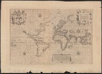
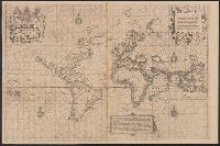
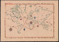
- Beinecke Rare Book and Manuscript Library > [World Map] Portugal - The Country that has contributed most to geographic knowledge of the Globe in the course of one century she discovered and explored nearly two-thirds of the inhabited Globe.
- Published / Created:
- 1845
- Call Number:
- 54635cea 1845
- Container / Volume:
- BRBL_00290
- Image Count:
- 2
- Resource Type:
- Maps, Atlases & Globes
- Found in:
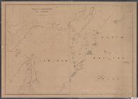
- Beinecke Rare Book and Manuscript Library > [Whaling] Chart of Kamscatka, and the Sea of Ochotsk. Copied from the best Russian Authorities. ... respectfully dedicated to the Whaling Fleet of the United States.
- Published / Created:
- 1855
- Call Number:
- 811ca 1855
- Container / Volume:
- BRBL_00554
- Image Count:
- 1
- Resource Type:
- Maps, Atlases & Globes
- Found in:
- Beinecke Rare Book and Manuscript Library > [Western part of upper peninsula, Michigan].
- Published / Created:
- [1940?]
- Call Number:
- 38gmp B833 1940
- Container / Volume:
- BRBL_00171
- Image Count:
- 1
- Resource Type:
- Maps, Atlases & Globes
- Found in:
- Beinecke Rare Book and Manuscript Library > [View taken above Bruges].
- Published / Created:
- c1902.
- Call Number:
- 75gme 1915
- Container / Volume:
- BRBL_00414A
- Image Count:
- 1
- Resource Type:
- Maps, Atlases & Globes
- Found in:
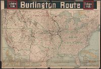
- Beinecke Rare Book and Manuscript Library > [United States] Burlington Route / Burlington R.R.
- Published / Created:
- [1920?].
- Call Number:
- 75 1920
- Container / Volume:
- BRBL_00407A
- Image Count:
- 2
- Resource Type:
- Maps, Atlases & Globes
- Found in:
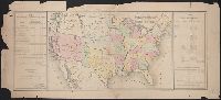
- Beinecke Rare Book and Manuscript Library > [United States] / printed by Rand McNally & Company for free distribution through the newspapers represented by Frederic J. Haskin ; photographs by Harris & Ewing.
- Published / Created:
- 1866
- Call Number:
- 75 1866H
- Container / Volume:
- BRBL_00403
- Image Count:
- 1
- Resource Type:
- Maps, Atlases & Globes
- Found in:
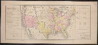
- Beinecke Rare Book and Manuscript Library > [United States] / drawn by A. Lindenkohl ; Chas. G. Krebs, Litho.
- Published / Created:
- 1848?]
- Call Number:
- 75 1848C
- Container / Volume:
- BRBL_00399
- Image Count:
- 1
- Resource Type:
- Maps, Atlases & Globes
- Found in:
- Beinecke Rare Book and Manuscript Library > [United States Treaties] E. Gilman, draftsman. P.S. Duval's Steam lith. press, Philadelphia.
- Published / Created:
- 1848?]
- Call Number:
- 75 1848B
- Container / Volume:
- BRBL_00399
- Image Count:
- 1
- Resource Type:
- Maps, Atlases & Globes
- Found in:
- Beinecke Rare Book and Manuscript Library > [United States Treaties] E. Gilman, draftsman. P.S. Duval's Steam lith. press, Philadelphia.
- Published / Created:
- 1840-1844.
- Call Number:
- 23 1844
- Container / Volume:
- BRBL_00020
- Image Count:
- 3
- Resource Type:
- Maps, Atlases & Globes
- Found in:
- Beinecke Rare Book and Manuscript Library > [U.S. Exploring Expedition Pacific Ocean] Engraved by Sherman and Smith, New York. By the U.S. Ex.Ex.
- Published / Created:
- 188-]
- Call Number:
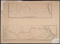
- 754GM 1880
- Container / Volume:
- BRBL_00419
- Image Count:
- 1
- Resource Type:
- Maps, Atlases & Globes
- Found in:
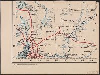
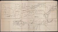
- Beinecke Rare Book and Manuscript Library > [Two maps showing the southern Atlantic states to point out the transportation routes to the Seaboard Central and Seaboard Southern routes].
- Published / Created:
- 1825
- Call Number:
- 23cea 1825A
- Container / Volume:
- BRBL_00021
- Image Count:
- 2
- Resource Type:
- Maps, Atlases & Globes
- Found in:
- Beinecke Rare Book and Manuscript Library > [Two charts of the Pacific Ocean, showing the Northwestern America and Sandwich Islands and ports].
- Published / Created:
- 1873?]
- Call Number:
- 844cbf 1873A
- Container / Volume:
- BRBL_00613
- Image Count:
- 1
- Resource Type:
- Maps, Atlases & Globes
- Found in:
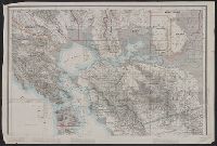
- Beinecke Rare Book and Manuscript Library > [Topographical map of central California].
- Published / Created:
- 1863
- Call Number:
- 783 Or1 1863
- Container / Volume:
- BRBL_00510
- Image Count:
- 1
- Resource Type:
- Maps, Atlases & Globes
- Found in:
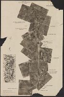
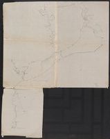
- Beinecke Rare Book and Manuscript Library > [Topographic military map of region around Orange Courthouse, south to Mechanicsburg, east to Robertson's tavern, north to Madison C.H. and west to Burtonsville] / Office of Surveys and Maps for the Army of the Potomac.
- Published / Created:
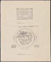
- [19--]
- Call Number:
- 11 1482
- Image Count:
- 1
- Resource Type:
- Maps, Atlases & Globes
- Found in:
- Beinecke Rare Book and Manuscript Library > [The World according to Pomponius Mela. Venice, 1482].
- Published / Created:
- 1918.]
- Call Number:
- 11hc 1917L
- Container / Volume:
- BRBL_00010D
- Image Count:
- 1
- Resource Type:
- Maps, Atlases & Globes
- Found in:
- Beinecke Rare Book and Manuscript Library > [The Western front Situation Map.]
- Published / Created:
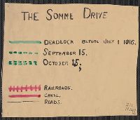
- 1916
- Call Number:
- 11hc 1916
- Container / Volume:
- BRBL_00010C
- Image Count:
- 1
- Resource Type:
- Maps, Atlases & Globes
- Found in:
- Beinecke Rare Book and Manuscript Library > [The Somme Drive.]
- Creator:
- Des Barres, Joseph F. W. (Joseph Frederick Wallet), 1722-1824
- Published / Created:
- 1775?-1781?]
- Call Number:
- 1983 Folio 25
- Image Count:
- 3
- Resource Type:
- Maps, Atlases & Globes
- Found in:
- Beinecke Rare Book and Manuscript Library > [The Atlantic Neptune : published for the use of the Royal Navy Great Britain / by Joseph F.W. Des Barres, esq.].
- Published / Created:
- [1650?]
- Call Number:
- 18 1650
- Container / Volume:
- BRBL_00012
- Image Count:
- 1
- Resource Type:
- Maps, Atlases & Globes
- Found in:
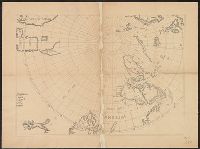
- Beinecke Rare Book and Manuscript Library > [The Arctic Regions].
- Published / Created:
- [187-?]
- Call Number:
- 582 B22 187X
- Container / Volume:
- BRBL_00707
- Image Count:
- 1
- Resource Type:
- Maps, Atlases & Globes
- Found in:
- Beinecke Rare Book and Manuscript Library > [Thailand, from Bangkok west to Phet Buri].
- Published / Created:
- c1949.
- Call Number:
- 846 P837 1949A
- Container / Volume:
- BRBL_00622
- Image Count:
- 4
- Resource Type:
- Maps, Atlases & Globes
- Found in:
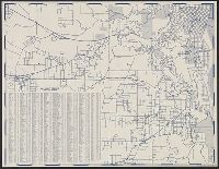
- Beinecke Rare Book and Manuscript Library > [Street map of Portland, Or.].
- Published / Created:
- [1890?]
- Call Number:
- 32 R119 1890
- Container / Volume:
- BRBL_00054
- Image Count:
- 1
- Resource Type:
- Maps, Atlases & Globes
- Found in:
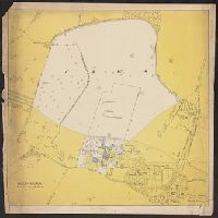
- Beinecke Rare Book and Manuscript Library > [St. Peter's College] Radley Bounds [Berkshire].
- Published / Created:
- 191-.
- Call Number:
- 11hcf 1919E-31
- Container / Volume:
- BRBL_00010ZA
- Image Count:
- 1
- Resource Type:
- Maps, Atlases & Globes
- Found in:
- Beinecke Rare Book and Manuscript Library > [Spalato and envrions.]
- Published / Created:
- 1919?]
- Call Number:
- 11hcf 1919C-4-3
- Container / Volume:
- BRBL_00010V
- Image Count:
- 1
- Resource Type:
- Maps, Atlases & Globes
- Found in:
- Beinecke Rare Book and Manuscript Library > [Southwestern portion of Map of Europe].
- Published / Created:
- 1921
- Call Number:
- 261 1921
- Container / Volume:
- BRBL_00022
- Image Count:
- 2
- Resource Type:
- Maps, Atlases & Globes
- Found in:
- Beinecke Rare Book and Manuscript Library > [Southern part of Queensland].
- Published / Created:
- [1912?].
- Call Number:
- 754 1912
- Container / Volume:
- BRBL_00417
- Image Count:
- 1
- Resource Type:
- Maps, Atlases & Globes
- Found in:
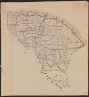
- Beinecke Rare Book and Manuscript Library > [South Atlantic States].
- Published / Created:
- [1930?]
- Call Number:
- 766 M86 1930
- Container / Volume:
- BRBL_00711
- Image Count:
- 1
- Resource Type:
- Maps, Atlases & Globes
- Found in:
- Beinecke Rare Book and Manuscript Library > [Sleeping Giant State Park, Conn.].
- Published / Created:
- 185-?]
- Call Number:
- 846hc 1850
- Container / Volume:
- BRBL_00624
- Image Count:
- 1
- Resource Type:
- Maps, Atlases & Globes
- Found in:
- Beinecke Rare Book and Manuscript Library > [Six route operations of a United States military company in Oregon Territory].
- Published / Created:
- 1940?]
- Call Number:
- 836gcg Sa585 1940
- Container / Volume:
- BRBL_00593
- Image Count:
- 1
- Resource Type:
- Maps, Atlases & Globes
- Found in:
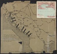
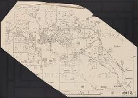
- Beinecke Rare Book and Manuscript Library > [Shows proposed range management plan for a 194,000 acre area (unit 11B) of San Rafael Grazing District].
- Published / Created:
- 1880?]
- Call Number:
- 824 1880
- Container / Volume:
- BRBL_00570
- Image Count:
- 1
- Resource Type:
- Maps, Atlases & Globes
- Found in:
- Beinecke Rare Book and Manuscript Library > [Sectional land map of the B. & M.R.R. lands for sale in eastern Nebraska].
- Published / Created:
- 191-.
- Call Number:
- 11hcf 1919D-36
- Container / Volume:
- BRBL_00010X
- Image Count:
- 1
- Resource Type:
- Maps, Atlases & Globes
- Found in:
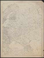
- Beinecke Rare Book and Manuscript Library > [Russia.]
- Creator:
- Western Australia. Department of Lands and Surveys
- Published / Created:
- 1921
- Call Number:
- 2651 R197 1921
- Container / Volume:
- BRBL_00023
- Image Count:
- 1
- Resource Type:
- Maps, Atlases & Globes
- Found in:
- Beinecke Rare Book and Manuscript Library > [Ravensthorpe].
- Published / Created:
- 1908
- Call Number:
- 319gm 1908
- Container / Volume:
- BRBL_00042
- Image Count:
- 1
- Resource Type:
- Maps, Atlases & Globes
- Found in:
- Beinecke Rare Book and Manuscript Library > [Railway, steamship and highway routes in the British Isles].
- Published / Created:
- 186-]
- Call Number:
- 754gme 1860B
- Container / Volume:
- BRBL_00420
- Image Count:
- 1
- Resource Type:
- Maps, Atlases & Globes
- Found in:
- Beinecke Rare Book and Manuscript Library > [Railroads of the Northern United States from Iowa to Boston, Massachusetts]
- Published / Created:
- 1850
- Call Number:
- 754gme 1850
- Container / Volume:
- BRBL_00419
- Image Count:
- 1
- Resource Type:
- Maps, Atlases & Globes
- Found in:
- Beinecke Rare Book and Manuscript Library > [Railroads of the Lake States, from Great Lakes to Ohio River]
- Published / Created:
- 1780?]
- Call Number:
- 786 C38 1780
- Container / Volume:
- BRBL_00516
- Image Count:
- 1
- Resource Type:
- Maps, Atlases & Globes
- Found in:
- Beinecke Rare Book and Manuscript Library > [Proof copy of a map of Charleston, South Carolina].
- Creator:
- Pownall, Thomas, 1722-1805
- Published / Created:
- between 1783 and 1799?]
- Call Number:
- 71 1785C
- Container / Volume:
- BRBL_00366
- Image Count:
- 2
- Resource Type:
- Maps, Atlases & Globes
- Found in:
- Beinecke Rare Book and Manuscript Library > [Pownall's map of North America and the West Indies].
- Published / Created:
- 1915]
- Call Number:
- 811gfc P831 1915
- Container / Volume:
- BRBL_00554
- Image Count:
- 1
- Resource Type:
- Maps, Atlases & Globes
- Found in:
- Beinecke Rare Book and Manuscript Library > [Portage Lake Mines].
- Creator:
- Bradshaw (Publisher)
- Published / Created:
- 1891]
- Call Number:
- 38 M35 1898
- Container / Volume:
- BRBL_00158
- Image Count:
- 1
- Resource Type:
- Maps, Atlases & Globes
- Found in:
- Beinecke Rare Book and Manuscript Library > [Plans of the major cities and towns of continental Europe] [cartographic material].
- Creator:
- Bradshaw (Publisher)
- Published / Created:
- 1891]
- Call Number:
- 38 P21 1898
- Container / Volume:
- BRBL_00164
- Image Count:
- 1
- Resource Type:
- Maps, Atlases & Globes
- Found in:
- Beinecke Rare Book and Manuscript Library > [Plans of the major cities and towns of continental Europe] [cartographic material].
- Creator:
- Trudeau, Charles Laveau, ca. 1750-1816
- Published / Created:
- 1808]
- Call Number:
- BrSide4o Zc22 808thha
- Image Count:
- 4
- Resource Type:
- Maps, Atlases & Globes
- Found in:
- Beinecke Rare Book and Manuscript Library > [Plans of New Orleans to accompany J.B.S. Thierry's Examen des droits des Etats Unis et des pretentions de Mr. Edouard Livingston sur la batture de Mr. Edouard Livingston sur la batture en face du faubourg Ste. Marie].
- Published / Created:
- [1749]
- Call Number:
- BrSides Box 2019 18
- Image Count:
- 1
- Resource Type:
- Maps, Atlases & Globes
- Found in:
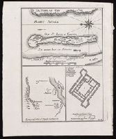
- Beinecke Rare Book and Manuscript Library > [Plan of the island of St. Louis, Senegal] ; Egnen fra fortet St. Joseph til Galam ; Grundridsning of fortet St. Joseph.
- Published / Created:
- 1915
- Call Number:
- 11ba 1915A
- Container / Volume:
- BRBL_00010A
- Image Count:
- 1
- Resource Type:
- Maps, Atlases & Globes
- Found in:
- Beinecke Rare Book and Manuscript Library > [Philips' 4 inch graphic globe.]
- Call Number:
- 11ba 1915
- Container / Volume:
- BRBL_00010A
- Image Count:
- 1
- Resource Type:
- Maps, Atlases & Globes
- Found in:
- Beinecke Rare Book and Manuscript Library > [Philips' 12 inch terrestrial globe.]