Search
You Searched For
Search Results
- Call Number:
- 783 1673D
- Container / Volume:
- BRBL_00507
- Image Count:
- 1
- Resource Type:
- Maps, Atlases & Globes
- Found in:
- Beinecke Rare Book and Manuscript Library > virginia and Maryland. As it is planted and inhabited this present year 1670. Surveyed and Exactly Drawne by ... Augustin Herrman, 1673.
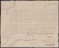
- Call Number:
- 771 OS9 1836
- Container / Volume:
- BRBL_00490
- Image Count:
- 1
- Resource Type:
- Maps, Atlases & Globes
- Found in:
- Beinecke Rare Book and Manuscript Library > map of the Village of Oswego Falls to be Sold on hte Premises by Jas. Bleecker & Sons on the 18th October 1836.
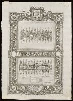
- Creator:
- Coronelli, Vincenzo, 1650-1718
- Call Number:
- Lanman 11 1693
- Image Count:
- 1
- Resource Type:
- Maps, Atlases & Globes
- Found in:
- Beinecke Rare Book and Manuscript Library > [Terrestrial and celestial globe gore maps] / aut. il. P. Coronelli ad uso dell' Academia Cosmografica degli Argonauti.
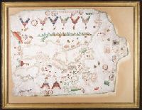
- Call Number:
- 32cea 1550
- Container / Volume:
- BRBL_00701
- Image Count:
- 2
- Resource Type:
- Maps, Atlases & Globes
- Found in:
- Beinecke Rare Book and Manuscript Library > [Section of a portolan chart spanning Great Britain in the west to the Adriatic Sea in the east.]
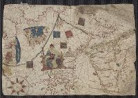
- Creator:
- Oliva, Joan, fl. 1580-1615
- Call Number:
- Art Storage 30cea 1555
- Image Count:
- 2
- Resource Type:
- Maps, Atlases & Globes
- Found in:
- Beinecke Rare Book and Manuscript Library > [Portolan chart of the Mediterranean Sea, the North Atlantic Ocean, the Baltic Sea, and the northwestern African coast].
- Creator:
- Maggiolo, Vesconte, active 1504-1549.
- Call Number:
- Art Storage 1980 156
- Image Count:
- 2
- Resource Type:
- Maps, Atlases & Globes
- Found in:
- Beinecke Rare Book and Manuscript Library > [Portolan chart of the Mediterranean Sea, the North Atlantic Ocean, the Baltic Sea, and the West African coast].
- Call Number:
- 11ba 1915
- Container / Volume:
- BRBL_00010A
- Image Count:
- 1
- Resource Type:
- Maps, Atlases & Globes
- Found in:
- Beinecke Rare Book and Manuscript Library > [Philips' 12 inch terrestrial globe.]
- Creator:
- Colorado Midland Railway Company
- Published / Created:
- undated
- Call Number:
- WA MSS S-1741 BrSides
- Collection Title:
- Colorado Midland Railway Company maps
- Container / Volume:
- Folder 8
- Image Count:
- 11
- Resource Type:
- Maps, Atlases & Globes
- Found in:
- Beinecke Rare Book and Manuscript Library > [Maps of Pitkin and Eagle Counties, Colorado]
- Creator:
- Colorado Midland Railway Company
- Published / Created:
- undated
- Call Number:
- WA MSS S-1741 BrSides
- Collection Title:
- Colorado Midland Railway Company maps
- Container / Volume:
- Folder 7
- Image Count:
- 10
- Resource Type:
- Maps, Atlases & Globes
- Found in:
- Beinecke Rare Book and Manuscript Library > [Maps of Pitkin and Eagle Counties, Colorado]
- Creator:
- Colorado Midland Railway Company
- Published / Created:
- undated
- Call Number:
- WA MSS S-1741 BrSides
- Collection Title:
- Colorado Midland Railway Company maps
- Container / Volume:
- Folder 6
- Image Count:
- 13
- Resource Type:
- Maps, Atlases & Globes
- Found in:
- Beinecke Rare Book and Manuscript Library > [Maps of Park and Chaffee Counties, Colorado]
- Creator:
- Colorado Midland Railway Company
- Published / Created:
- undated
- Call Number:
- WA MSS S-1741 BrSides
- Collection Title:
- Colorado Midland Railway Company maps
- Container / Volume:
- Folder 5
- Image Count:
- 12
- Resource Type:
- Maps, Atlases & Globes
- Found in:
- Beinecke Rare Book and Manuscript Library > [Maps of Park and Chaffee Counties, Colorado]
- Creator:
- Colorado Midland Railway Company
- Published / Created:
- undated
- Call Number:
- WA MSS S-1741 BrSides
- Collection Title:
- Colorado Midland Railway Company maps
- Container / Volume:
- Folder 4
- Image Count:
- 11
- Resource Type:
- Maps, Atlases & Globes
- Found in:
- Beinecke Rare Book and Manuscript Library > [Maps of Park and Chaffee Counties, Colorado]
- Creator:
- Colorado Midland Railway Company
- Published / Created:
- undated
- Call Number:
- WA MSS S-1741 BrSides
- Collection Title:
- Colorado Midland Railway Company maps
- Container / Volume:
- Folder 3
- Image Count:
- 15
- Resource Type:
- Maps, Atlases & Globes
- Found in:
- Beinecke Rare Book and Manuscript Library > [Maps of Lake County, Colorado]
- Creator:
- Colorado Midland Railway Company
- Published / Created:
- undated
- Call Number:
- WA MSS S-1741 BrSides
- Collection Title:
- Colorado Midland Railway Company maps
- Container / Volume:
- Folder 2
- Image Count:
- 10
- Resource Type:
- Maps, Atlases & Globes
- Found in:
- Beinecke Rare Book and Manuscript Library > [Maps of Garfield County, Colorado]
- Creator:
- Colorado Midland Railway Company
- Published / Created:
- undated
- Call Number:
- WA MSS S-1741 BrSides
- Collection Title:
- Colorado Midland Railway Company maps
- Container / Volume:
- Folder 1
- Image Count:
- 8
- Resource Type:
- Maps, Atlases & Globes
- Found in:
- Beinecke Rare Book and Manuscript Library > [Maps of Garfield County, Colorado]
- Creator:
- Colorado Midland Railway Company
- Published / Created:
- undated
- Call Number:
- WA MSS S-1741 BrSides
- Collection Title:
- Colorado Midland Railway Company maps
- Container / Volume:
- Folder 9
- Image Count:
- 22
- Resource Type:
- Maps, Atlases & Globes
- Found in:
- Beinecke Rare Book and Manuscript Library > [Maps of Aspen Branch, Jerome Park Branch, Pitkin-Garfield Counties, Colorado]
- Call Number:
- 1971 Folio 602
- Collection Title:
- Carte topographique de lEgypte et de plusiers parties des pays limitrophes; levee pendant
- Image Count:
- 1
- Resource Type:
- Maps, Atlases & Globes
- Found in:
- Beinecke Rare Book and Manuscript Library > [Map of Egypt, the Red Sea, Palestine, the Sinai Peninsula and other Middle Eastern landmarks]. pl. 2.
- Call Number:
- 771hc B796 1776A
- Container / Volume:
- BRBL_00495
- Image Count:
- 1
- Resource Type:
- Maps, Atlases & Globes
- Found in:
- Beinecke Rare Book and Manuscript Library > [Map of Brooklyn, N.Y., showing the battle in this area in 1776, superimposed upon a modern street map.]
- Creator:
- Russia. Turkestanskiĭ Voennyĭ Okrug Voenno Topograficheskiĭ Otdel
Россия. Туркестанский Военный Округ Военно Топографический Отдел
- Call Number:
- 547 1897
- Container / Volume:
- BRBL_00291
- Image Count:
- 6
- Resource Type:
- Maps, Atlases & Globes
- Found in:
- Beinecke Rare Book and Manuscript Library > [Karta desi︠a︡tiverstnai︠a︡ Turkestanskogo Voennogo Okruga].
- Call Number:
- 1977 +435
- Collection Title:
- Geografia; cioè, Descrittione vniversale della terra. Partita in due volumi, nel primo de' quali si
- Image Count:
- 1
- Resource Type:
- Maps, Atlases & Globes
- Found in:
- Beinecke Rare Book and Manuscript Library > [Geographia. Italian]
- Call Number:
- 1977 +435
- Collection Title:
- Geografia; cioè, Descrittione vniversale della terra. Partita in due volumi, nel primo de' quali si
- Image Count:
- 1
- Resource Type:
- Maps, Atlases & Globes
- Found in:
- Beinecke Rare Book and Manuscript Library > [Geographia. Italian]
- Call Number:
- 1977 +379
- Collection Title:
- Geografia; cioè, Descrittione vniversale della terra. Partita in due volumi, nel primo de' quali si
- Image Count:
- 1
- Resource Type:
- Maps, Atlases & Globes
- Found in:
- Beinecke Rare Book and Manuscript Library > [Geographia. Italian]
- Call Number:
- Gfp94 +Gi597
- Collection Title:
- Geografia; cioè, Descrittione vniversale della terra. Partita in due volumi, nel primo de' quali si
- Image Count:
- 1
- Resource Type:
- Maps, Atlases & Globes
- Found in:
- Beinecke Rare Book and Manuscript Library > [Geographia. Italian]
- Call Number:
- 766 N46 1917
- Container / Volume:
- BRBL_00473A
- Image Count:
- 15
- Resource Type:
- Maps, Atlases & Globes
- Found in:
- Beinecke Rare Book and Manuscript Library > [City of New Haven] 1913-1917.
- Creator:
- Månsson, Johan, -1659
- Call Number:
- Double Covers 303cea +1645
- Image Count:
- 7
- Resource Type:
- Maps, Atlases & Globes
- Found in:
- Beinecke Rare Book and Manuscript Library > [Chart of the Baltic Sea] / Siegismuntlus von Vogell fecit.
- Creator:
- Dong, Chun (Cartographer), cartographer.
董醇 (Cartographer), cartographer.
- Call Number:
- Covers 5615 +1857
- Image Count:
- 2
- Resource Type:
- Maps, Atlases & Globes
- Found in:
- Beinecke Rare Book and Manuscript Library > Zhi li Da Qing He yuan liu zong tu / Qing he dao Dong Chun.
- Creator:
- Russia. Turkestanskiĭ Voennyĭ Okrug Voenno Topograficheskiĭ Otdel
Россия. Туркестанский Военный Округ Военно Топографический Отдел
- Call Number:
- 547 1892A
- Container / Volume:
- BRBL_00291
- Image Count:
- 3
- Resource Type:
- Maps, Atlases & Globes
- Found in:
- Beinecke Rare Book and Manuscript Library > Zakaspīiskoĭ Oblasti.
- Published / Created:
- Undated
- Call Number:
- 1978 595
- Collection Title:
- El atlas abreviado, o Compendiosa geografia, del mvndo antigvo, y nvevo, segun esta oy dividido
- Image Count:
- 1
- Resource Type:
- Maps, Atlases & Globes
- Found in:
- Beinecke Rare Book and Manuscript Library > Yslas Britanicas enque se comprehenden los reynos de Ynglaterra, Escocia, e Yrlanda
- Creator:
- Sanborn Map Company, issuing body
- Published / Created:
- 1919
- Call Number:
- 766 W73 1919
- Image Count:
- 22
- Resource Type:
- Maps, Atlases & Globes
- Found in:
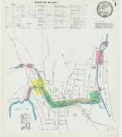
- Beinecke Rare Book and Manuscript Library > Winsted, Litchfield County, Connecticut.
- Creator:
- Sanborn-Perris Map Co., issuing body
- Published / Created:
- 1897
- Call Number:
- 766 W73 1897
- Image Count:
- 9
- Resource Type:
- Maps, Atlases & Globes
- Found in:
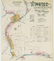
- Beinecke Rare Book and Manuscript Library > Winsted and West Winsted, Connecticut.
- Creator:
- Sanborn-Perris Map Co., issuing body
- Published / Created:
- 1892
- Call Number:
- 766 W73 1892
- Image Count:
- 7
- Resource Type:
- Maps, Atlases & Globes
- Found in:
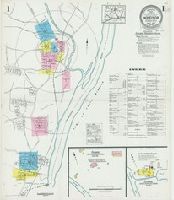
- Beinecke Rare Book and Manuscript Library > Winsted and West Winsted, Connecticut.
- Creator:
- Sanborn Map & Publishing Co., issuing body
- Published / Created:
- 1887
- Call Number:
- 766 W73 1887
- Image Count:
- 6
- Resource Type:
- Maps, Atlases & Globes
- Found in:
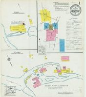
- Beinecke Rare Book and Manuscript Library > Winsted and West Winsted, Connecticut.
- Creator:
- Sanborn Map Company, issuing body
- Published / Created:
- 1927
- Call Number:
- 766 W725 1927
- Image Count:
- 11
- Resource Type:
- Maps, Atlases & Globes
- Found in:
- Beinecke Rare Book and Manuscript Library > Windsor, Hartford County, Connecticut.
- Creator:
- Sanborn Map Company, issuing body
- Published / Created:
- 1921
- Call Number:
- 766 W725 1921
- Image Count:
- 9
- Resource Type:
- Maps, Atlases & Globes
- Found in:
- Beinecke Rare Book and Manuscript Library > Windsor, Hartford County, Connecticut.
- Creator:
- Sanborn Map Company, issuing body
- Published / Created:
- 1925
- Call Number:
- 766 W728 1925
- Image Count:
- 7
- Resource Type:
- Maps, Atlases & Globes
- Found in:
- Beinecke Rare Book and Manuscript Library > Windsor Locks, Hartford County, Connecticut.
- Creator:
- Sanborn Map Company, issuing body
- Published / Created:
- 1912
- Call Number:
- 766 W728 1912
- Image Count:
- 6
- Resource Type:
- Maps, Atlases & Globes
- Found in:
- Beinecke Rare Book and Manuscript Library > Windsor Locks, Hartford County, Connecticut.
- Creator:
- Sanborn Map Company, issuing body
- Published / Created:
- 1905
- Call Number:
- 766 W728 1905
- Image Count:
- 3
- Resource Type:
- Maps, Atlases & Globes
- Found in:
- Beinecke Rare Book and Manuscript Library > Windsor Locks, Hartford Co., Connecticut.
- Creator:
- Sanborn-Perris Map Co., issuing body
- Published / Created:
- 1897
- Call Number:
- 766 W728 1897
- Image Count:
- 2
- Resource Type:
- Maps, Atlases & Globes
- Found in:
- Beinecke Rare Book and Manuscript Library > Windsor Locks, Hartford Co., Conn.
- Creator:
- Sanborn-Perris Map Co., issuing body
- Published / Created:
- 1892
- Call Number:
- 766 W728 1892
- Image Count:
- 2
- Resource Type:
- Maps, Atlases & Globes
- Found in:
- Beinecke Rare Book and Manuscript Library > Windsor Locks, Hartford Co., Conn.
- Creator:
- Sanborn Map & Publishing Co., issuing body
- Published / Created:
- 1885
- Call Number:
- 766 W728 1885
- Image Count:
- 2
- Resource Type:
- Maps, Atlases & Globes
- Found in:
- Beinecke Rare Book and Manuscript Library > Windsor Locks, Conn.
- Creator:
- Sanborn Map Company, issuing body
- Published / Created:
- 1924
- Call Number:
- 766 W677 1924
- Image Count:
- 26
- Resource Type:
- Maps, Atlases & Globes
- Found in:
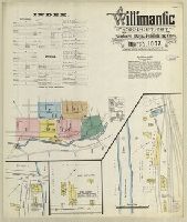
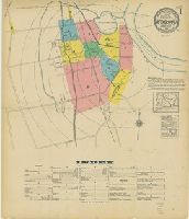
- Beinecke Rare Book and Manuscript Library > Willimantic, including South Coventry, Storrs, South Windham, and Mansfield Center, Windham County, Connecticut.
- Creator:
- Sanborn Map & Publishing Co., issuing body
- Published / Created:
- 1887
- Call Number:
- 766 W677 1887
- Image Count:
- 7
- Resource Type:
- Maps, Atlases & Globes
- Found in:
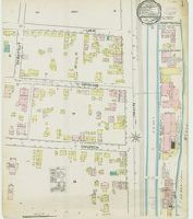
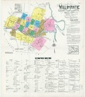
- Beinecke Rare Book and Manuscript Library > Willimantic, Connecticut.
- Creator:
- Sanborn Map Company, issuing body
- Published / Created:
- 1922
- Call Number:
- 766 W53 1922
- Image Count:
- 11
- Resource Type:
- Maps, Atlases & Globes
- Found in:
- Beinecke Rare Book and Manuscript Library > Wethersfield, Hartford County Connecticut.
- Creator:
- Sanborn Map Company, issuing body
- Published / Created:
- 1923
- Call Number:
- 766 W527 1923
- Image Count:
- 12
- Resource Type:
- Maps, Atlases & Globes
- Found in:
- Beinecke Rare Book and Manuscript Library > Westport, Fairfield County, Connecticut.
- Creator:
- Sanborn Map Company, issuing body
- Published / Created:
- 1910
- Call Number:
- 766 W527 1910
- Image Count:
- 7
- Resource Type:
- Maps, Atlases & Globes
- Found in:
- Beinecke Rare Book and Manuscript Library > Westport, Fairfield County, Connecticut.
- Creator:
- Sanborn-Perris Map Co., issuing body
- Published / Created:
- 1896
- Call Number:
- 766 W527 1896
- Image Count:
- 3
- Resource Type:
- Maps, Atlases & Globes
- Found in:
- Beinecke Rare Book and Manuscript Library > Westport, Fairfield Co., Conn.
- Creator:
- Sanborn Map & Publishing Co., issuing body
- Published / Created:
- 1885
- Call Number:
- 766 W527 1885
- Image Count:
- 1
- Resource Type:
- Maps, Atlases & Globes
- Found in:
- Beinecke Rare Book and Manuscript Library > Westport, Conn.
- Creator:
- Sanborn-Perris Map Co., issuing body
- Published / Created:
- 1901
- Call Number:
- 766 W527 1901
- Image Count:
- 6
- Resource Type:
- Maps, Atlases & Globes
- Found in:
- Beinecke Rare Book and Manuscript Library > Westport and Saugatuck, Fairfield Co., Conn.
- Creator:
- Sanborn-Perris Map Co., issuing body
- Published / Created:
- 1891
- Call Number:
- 766 W527 1891
- Image Count:
- 2
- Resource Type:
- Maps, Atlases & Globes
- Found in:
- Beinecke Rare Book and Manuscript Library > Westport and Saugatuck, Fairfield Co., Conn.
- Creator:
- Imray, James F. (James Frederick), 1829?-1891, cartographer
James Imray and Son, issuing body
- Call Number:
- 23cea 1886
- Container / Volume:
- BRBL_00021
- Image Count:
- 2
- Resource Type:
- Maps, Atlases & Globes
- Found in:
- Beinecke Rare Book and Manuscript Library > Western Pacific. Chart No. 2 / compiled by James F. Imray F.R.G.S.