Search
You Searched For
Search Results
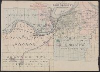
- Creator:
- Hunnius, Ado
- Published / Created:
- 1876
- Call Number:
- 825gmb L487 1876
- Container / Volume:
- BRBL_00576
- Image Count:
- 1
- Resource Type:
- Maps, Atlases & Globes
- Found in:
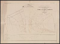
- Beinecke Rare Book and Manuscript Library > Plan of the city of Leavenworth, Kansas / by Ado Hunnius.
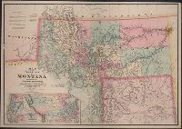
- Creator:
- De Lacy, W. W. (Walter Washington), 1819-1892
- Published / Created:
- 1878
- Call Number:
- 831 1878
- Container / Volume:
- BRBL_00579
- Image Count:
- 1
- Resource Type:
- Maps, Atlases & Globes
- Found in:
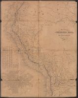
- Beinecke Rare Book and Manuscript Library > Map of the territory of Montana with portions of the adjoining territories / compiled and drawn by W.W. De Lacy, civil engineer & surveyor, Helena, M.T.
- Published / Created:
- c1889.
- Call Number:
- 825fb K134 1889
- Container / Volume:
- BRBL_00575
- Image Count:
- 1
- Resource Type:
- Maps, Atlases & Globes
- Found in:
- Beinecke Rare Book and Manuscript Library > Kansas City, Kansas / Everts & Howell, engravers, Phila., Pa.
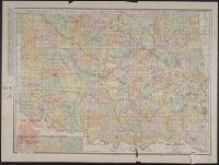
- Creator:
- Rand McNally and Company
- Published / Created:
- 1911
- Call Number:
- 827 1911
- Container / Volume:
- BRBL_00577
- Image Count:
- 1
- Resource Type:
- Maps, Atlases & Globes
- Found in:
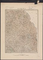
- Beinecke Rare Book and Manuscript Library > Oklahoma.
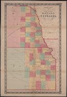
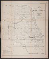
- Creator:
- Johnson, A. J. (Alvin Jewett), 1827-1884
- Published / Created:
- 1858
- Call Number:
- 825fb 1858
- Container / Volume:
- BRBL_00575
- Image Count:
- 1
- Resource Type:
- Maps, Atlases & Globes
- Found in:
- Beinecke Rare Book and Manuscript Library > Johnson's county, township, and sectional Kansas and Nebraska.
- Published / Created:
- 188-?]
- Call Number:
- 825 K134 188X
- Container / Volume:
- BRBL_00574
- Image Count:
- 1
- Resource Type:
- Maps, Atlases & Globes
- Found in:
- Beinecke Rare Book and Manuscript Library > Map of the vicinity of Kansas City in Kansas and Missouri / compliments of H.C. Lloyd & Co., real estate brokers and builders ... Kansas City, Mo. ; MacCormac eng. Phila.
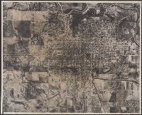
- Published / Created:
- 1945?]
- Call Number:
- 825am C654 1945
- Container / Volume:
- BRBL_00575
- Image Count:
- 1
- Resource Type:
- Maps, Atlases & Globes
- Found in:
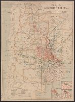
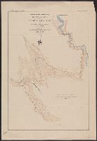
- Beinecke Rare Book and Manuscript Library > [Aerial photo of Coffeyville, Kansas].
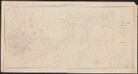
- Creator:
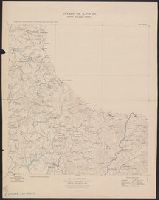
- U.S. Army Command and General Staff College
- Published / Created:
- [1907?]
- Call Number:
- 825 L487 1907
- Container / Volume:
- BRBL_00574
- Image Count:
- 1
- Resource Type:
- Maps, Atlases & Globes
- Found in:
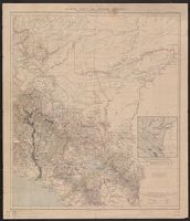
- Beinecke Rare Book and Manuscript Library > Map of Fort Leavenworth, Kas. and vicinity / compiled from surveys made by the staff class of 1904-05, 1905-06 ; under the direction of the commandant of the Infantry and Cavalry School, Signal School and Staff College.
- Published / Created:
- 1909?]
- Call Number:
- 825 L487 1909
- Container / Volume:
- BRBL_00574
- Image Count:
- 1
- Resource Type:
- Maps, Atlases & Globes
- Found in:
- Beinecke Rare Book and Manuscript Library > Map of Fort Leavenworth, Kansas and vicinity.
- Creator:
- U.S. Army Command and General Staff College
- Published / Created:
- [1907?]
- Call Number:
- 825 L487 1907
- Container / Volume:
- BRBL_00574
- Image Count:
- 1
- Resource Type:
- Maps, Atlases & Globes
- Found in:
- Beinecke Rare Book and Manuscript Library > Map of Fort Leavenworth, Kas. and vicinity / compiled from surveys made by the staff class of 1904-05, 1905-06 ; under the direction of the commandant of the Infantry and Cavalry School, Signal School and Staff College.
- Creator:
- United States. General Land Office
- Published / Created:
- 1866
- Call Number:
- 825fcm 1866
- Container / Volume:
- BRBL_00575
- Image Count:
- 1
- Resource Type:
- Maps, Atlases & Globes
- Found in:
- Beinecke Rare Book and Manuscript Library > Map showing the progress of the public surveys in Kansas and Nebraska / Surveyor General's Office ; Department of the Interior, General Land Office, Oct. 2nd, 1866.
- Creator:
- United States. Surveyor General
- Published / Created:
- 1862?]
- Call Number:
- 825fcm 1862
- Container / Volume:
- BRBL_00575
- Image Count:
- 1
- Resource Type:
- Maps, Atlases & Globes
- Found in:
- Beinecke Rare Book and Manuscript Library > Map showing the progress of the public surveys in Kansas and Nebraska : to accompany annual report of the Surveyor General, 1862 / Surveyor General's Office, Leavenworth, Kansas.
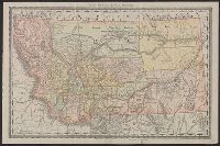
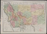
- Creator:
- De Lacy, W. W. (Walter Washington), 1819-1892
- Published / Created:
- 1872
- Call Number:
- 831 1872
- Container / Volume:
- BRBL_00579
- Image Count:
- 1
- Resource Type:
- Maps, Atlases & Globes
- Found in:
- Beinecke Rare Book and Manuscript Library > Map of the territory of Montana : with portions of the adjoining territories / compiled and drawn by W.W. De Lacy, civil engineer & surveyor, Helena, M.T.
- Creator:
- Tulsa (Okla.). Office of the City Engineer
- Published / Created:
- [1950]
- Call Number:
- 827 T829 1950A
- Container / Volume:
- BRBL_00578
- Image Count:
- 1
- Resource Type:
- Maps, Atlases & Globes
- Found in:
- Beinecke Rare Book and Manuscript Library > Tulsa, Oklahoma / Office of the City Engineer.
- Creator:
- Rand McNally and Company
- Published / Created:
- 1891
- Call Number:
- 831 1891
- Container / Volume:
- BRBL_00580
- Image Count:
- 1
- Resource Type:
- Maps, Atlases & Globes
- Found in:
- Beinecke Rare Book and Manuscript Library > Rand McNally & Co.'s Montana.
- Creator:
- American Publishing Co. (Milwaukee, Wis.)
- Published / Created:
- 1890
- Call Number:
- 831 H36 1890
- Container / Volume:
- BRBL_00580
- Image Count:
- 1
- Resource Type:
- Maps, Atlases & Globes
- Found in:
- Beinecke Rare Book and Manuscript Library > Perspective map of the city of Helena, Mont. : capital of state, county seat of Lewis & Clarke Co. / compliments of Kessler's Brewery.
- Creator:
- La Fromboise, Conrad
- Published / Created:
- 1979
- Call Number:
- 831 1979
- Container / Volume:
- BRBL_00580
- Image Count:
- 1
- Resource Type:
- Maps, Atlases & Globes
- Found in:
- Beinecke Rare Book and Manuscript Library > Si-ksi-kay-tsi-ta-pi, sin-na-ki-sin, nita-ta-tsi ki mi-sta-ki-tsi : Blackfeet language map, rivers and mountains / compiled by Conrad La Fromboise.
- Published / Created:
- 1882
- Call Number:
- 831 J89 1882
- Container / Volume:
- BRBL_00580
- Image Count:
- 1
- Resource Type:
- Maps, Atlases & Globes
- Found in:
- Beinecke Rare Book and Manuscript Library > Map of Judith Basin, Montana Ter. / Northern Transcontinental Survey, Raphael Pumpelly, director ; Department of Topography, A.D. Wilson, chief topographer ; lettering by F.D. Owen.
- Creator:
- United States. Bureau of the Census
- Published / Created:
- 1934
- Call Number:
- 831fb 1930
- Container / Volume:
- BRBL_00581
- Image Count:
- 1
- Resource Type:
- Maps, Atlases & Globes
- Found in:
- Beinecke Rare Book and Manuscript Library > Montana, minor civil divisions : 1930 / Bureau of the Census.
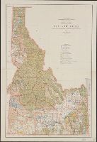
- Creator:
- United States. General Land Office
- Published / Created:
- c1939.
- Call Number:
- 832cbf 1939
- Container / Volume:
- BRBL_00583
- Image Count:
- 1
- Resource Type:
- Maps, Atlases & Globes
- Found in:
- Beinecke Rare Book and Manuscript Library > State of Idaho / compiled from the official records of the General Land Office and other sources ; compiled and drawn by H. Ruh ; revised by T.W. Gales ; relief by D.E. Walker.
- Creator:
- Rand McNally and Company
- Published / Created:
- [1932]
- Call Number:
- 831 1932A
- Container / Volume:
- BRBL_00580
- Image Count:
- 1
- Resource Type:
- Maps, Atlases & Globes
- Found in:
- Beinecke Rare Book and Manuscript Library > Rand McNally standard map of Montana with air trails ; Rand McNally standard map of Montana.
- Creator:
- Rand McNally and Company
- Published / Created:
- 1911
- Call Number:
- 831 1911
- Container / Volume:
- BRBL_00580
- Image Count:
- 1
- Resource Type:
- Maps, Atlases & Globes
- Found in:
- Beinecke Rare Book and Manuscript Library > Montana.
- Creator:
- Nicholson, W. L
- Published / Created:
- 1882?]
- Call Number:
- 831 1882
- Container / Volume:
- BRBL_00579
- Image Count:
- 1
- Resource Type:
- Maps, Atlases & Globes
- Found in:
- Beinecke Rare Book and Manuscript Library > Preliminary post route map of the territories of Montana, Idaho, Wyoming, Utah, Arizona, New Mexico and state of Colorado, with parts of adjacent states and territories / designed and constructed under the orders of Postmaster General D.M. Key by W.L. Nic
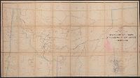
- Creator:
- Woodruff, Thomas Mayhew, d. 1899
- Published / Created:
- 187-?]
- Call Number:
- 831 1878B
- Container / Volume:
- BRBL_00579
- Image Count:
- 1
- Resource Type:
- Maps, Atlases & Globes
- Found in:
- Beinecke Rare Book and Manuscript Library > Map showing a portion of the marches of troops under Genl. N.A. Miles command 1876-1878 / drawn by Thom. M. Woodruff, Lt. 5th Inftry A.A.D.C., March 1st 1878.
- Creator:
- Reeder & Helmick
- Published / Created:
- [18--?]
- Call Number:
- 831 H36 18XX
- Container / Volume:
- BRBL_00580
- Image Count:
- 1
- Resource Type:
- Maps, Atlases & Globes
- Found in:
- Beinecke Rare Book and Manuscript Library > Map showing property adjacent to the city of Helena / compiled by Jno. S.M. Neil ; drawn by Reeder & Helmick.
- Creator:
- United States. General Land Office
- Published / Created:
- 1879
- Call Number:
- 831 1879
- Container / Volume:
- BRBL_00579
- Image Count:
- 1
- Resource Type:
- Maps, Atlases & Globes
- Found in:
- Beinecke Rare Book and Manuscript Library > Montana Territory / compiled from the official records of the General Land Office and other sources by C. Roeser, principal draughtsman G.L.O.
- Creator:
- Reeder & Helmick
- Published / Created:
- 1890
- Call Number:
- 831 1890
- Container / Volume:
- BRBL_00580
- Image Count:
- 1
- Resource Type:
- Maps, Atlases & Globes
- Found in:
- Beinecke Rare Book and Manuscript Library > Ide's map of Montana / compiled & drawn by Reeder & Helmick.
- Published / Created:
- [1749?]
- Call Number:
- 935cea 1749
- Container / Volume:
- BRBL_00674
- Image Count:
- 1
- Resource Type:
- Maps, Atlases & Globes
- Found in:
- Beinecke Rare Book and Manuscript Library > Carte de la Partie Meridionale de L' Amerique Meridionale Avec la Route du Centurion depuis l'Ile Ste. Catherine Jusqu'a l'Ile de Juan Fernandes.
- Published / Created:
- [1830?]
- Call Number:
- 96 1830
- Container / Volume:
- BRBL_00676
- Image Count:
- 1
- Resource Type:
- Maps, Atlases & Globes
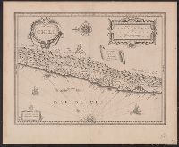
- Found in:
- Beinecke Rare Book and Manuscript Library > Chili.
- Published / Created:
- 1775
- Call Number:
- 966 1775
- Container / Volume:
- BRBL_00676
- Image Count:
- 1
- Resource Type:
- Maps, Atlases & Globes
- Found in:
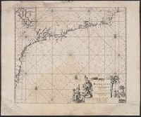
- Beinecke Rare Book and Manuscript Library > A chart of the Straits of Magellan. Inlarged from a chart published at Madrid in 1769, by Don Juan de la Cruz Cano y Olmedilla ... and improved from the observations and surveys of Captns. Byron, Wallis and Carteret ...
- Published / Created:
- 1823
- Call Number:
- 94 1823
- Container / Volume:
- BRBL_00675
- Image Count:
- 1
- Resource Type:
- Maps, Atlases & Globes
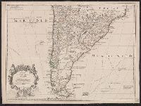
- Found in:
- Beinecke Rare Book and Manuscript Library > Vereinigte Provinzen von Süd America.
- Published / Created:
- 1656
- Call Number:
- 97 1656
- Container / Volume:
- BRBL_00677
- Image Count:
- 1
- Resource Type:
- Maps, Atlases & Globes
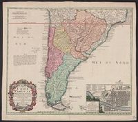
- Found in:
- Beinecke Rare Book and Manuscript Library > Le Perou et le cours dela Riviere Amazone... par N. Sanson d' Abbeville.
- Published / Created:
- 1890
- Call Number:
- 96gfc 1890
- Container / Volume:
- BRBL_00676
- Image Count:
- 1
- Resource Type:
- Maps, Atlases & Globes
- Found in:
- Beinecke Rare Book and Manuscript Library > Plano en Seccion Horizontal de la Mina de la Compañia Inglesa Chile o yuruary limitada / por M.E. Palacio C.M.E.
- Creator:
- Blaeu, Willem Janszoon, 1571-1638
- Published / Created:
- [ca. 1630]
- Call Number:
- 97 1631
- Container / Volume:
- BRBL_00677
- Image Count:
- 1
- Resource Type:
- Maps, Atlases & Globes
- Found in:
- Beinecke Rare Book and Manuscript Library > Peru.
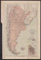
- Creator:
- Buenos Aires (Argentina). Dept. of Public Works
- Published / Created:
- 1910
- Call Number:
- 94 B86 1910
- Container / Volume:
- BRBL_00675
- Image Count:
- 1
- Resource Type:
- Maps, Atlases & Globes
- Found in:
- Beinecke Rare Book and Manuscript Library > Plan of the city of Buenos Aires, capital of the Argentine Republic [cartographic material] : with the general deliniation of squares / Department of Public Works of the municipality.
- Published / Created:
- 1910
- Call Number:
- 94g 1910A
- Container / Volume:
- BRBL_00675
- Image Count:
- 1
- Resource Type:
- Maps, Atlases & Globes
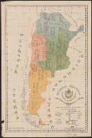
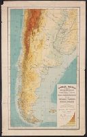
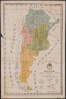
- Found in:
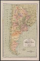
- Beinecke Rare Book and Manuscript Library > Republica Argentina : superficie, población, ferro-carriles, cultivos y ganados.
- Published / Created:
- 1914
- Call Number:
- 94g 1914A
- Container / Volume:
- BRBL_00675
- Image Count:
- 1
- Resource Type:
- Maps, Atlases & Globes
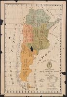
- Found in:
- Beinecke Rare Book and Manuscript Library > Republica Argentina : superficie, población, ferro-carriles, cultivos y ganados.
- Published / Created:
- [1830?]
- Call Number:
- 97 1830
- Container / Volume:
- BRBL_00677
- Image Count:
- 1
- Resource Type:
- Maps, Atlases & Globes
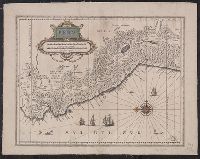
- Found in:
- Beinecke Rare Book and Manuscript Library > Peru
- Published / Created:
- [1748?]
- Call Number:
- 935cea 1748
- Container / Volume:
- BRBL_00674
- Image Count:
- 1
- Resource Type:
- Maps, Atlases & Globes
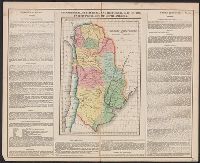
- Found in:
- Beinecke Rare Book and Manuscript Library > A chart of the Southern Part of South America With the Track of the Centurion from the Island of St. Catherines to the Island of Juan Fernandes In which is inserted the Variation and Soundings observ'd on board her, Together with her Deviation from her es
- Published / Created:
- [1830?]
- Call Number:
- 94 1830
- Container / Volume:
- BRBL_00675
- Image Count:
- 1
- Resource Type:
- Maps, Atlases & Globes
- Found in:
- Beinecke Rare Book and Manuscript Library > United Provinces of South America.
- Creator:
- Blaeu, Willem Janszoon, 1571-1638
- Published / Created:
- [ca. 1630]
- Call Number:
- 96 1667
- Container / Volume:
- BRBL_00676
- Image Count:
- 1
- Resource Type:
- Maps, Atlases & Globes
- Found in:
- Beinecke Rare Book and Manuscript Library > Chili [cartographic material].
- Published / Created:
- 1656
- Call Number:
- 935 1656
- Container / Volume:
- BRBL_00674
- Image Count:
- 1
- Resource Type:
- Maps, Atlases & Globes
- Found in:
- Beinecke Rare Book and Manuscript Library > Le Paraguayr, Le Chili, la terre, et les isles Magellaniques, tirées de diverses relations, par N. Sanson d'Abbeville... Somer Pruth sculp.
- Published / Created:
- .
- Call Number:
- 9417 1913M
- Container / Volume:
- BRBL_00675
- Image Count:
- 1
- Resource Type:
- Maps, Atlases & Globes
- Found in:
- Beinecke Rare Book and Manuscript Library > República Argentina : Informe sobre el estado de la minería en el territorio de los Andes / por ... Luciano Caplain.
- Published / Created:
- 1671]
- Call Number:
- 97 1671
- Container / Volume:
- BRBL_00677
- Image Count:
- 1
- Resource Type:
- Maps, Atlases & Globes
- Found in:
- Beinecke Rare Book and Manuscript Library > Perv [by William Blaeu, adapted by Jacob van Meurs].
- Creator:
- Argentina. Ministerio de Obras Públicas
- Published / Created:
- [1908]
- Call Number:
- 94gme 1908P
- Container / Volume:
- BRBL_00675
- Image Count:
- 1
- Resource Type:
- Maps, Atlases & Globes
- Found in:
- Beinecke Rare Book and Manuscript Library > Mapa de los ferro carriles de la República Argentina, enero de 1908 [cartographic material] / Ministerio de Obras Públicas.
- Published / Created:
- [1840?]
- Call Number:
- 935 1840
- Container / Volume:
- BRBL_00674
- Image Count:
- 1
- Resource Type:
- Maps, Atlases & Globes
- Found in:
- Beinecke Rare Book and Manuscript Library > Karte v. La Plata, Chili, Paraguay, Uruguay, u. Patagonien.
- Creator:
- Edward Stanford Ltd
- Published / Created:
- [1912?]
- Call Number:
- 96 1912
- Container / Volume:
- BRBL_00676
- Image Count:
- 1
- Resource Type:
- Maps, Atlases & Globes
- Found in:
- Beinecke Rare Book and Manuscript Library > Chile.
- Creator:
- American Geographical Society of New York
- Published / Created:
- 1929
- Call Number:
- 923 1929
- Container / Volume:
- BRBL_00673
- Image Count:
- 1
- Resource Type:
- Maps, Atlases & Globes
- Found in:
- Beinecke Rare Book and Manuscript Library > Map of the Chaco Boreal [cartographic material] / compiled by the American Geographical Society of New York.
- Creator:
- L'Isle, Guillaume de, 1675-1726
- Published / Created:
- 1703 [i.e. between 1708-1718]
- Call Number:
- 935 1703A
- Container / Volume:
- BRBL_00674
- Image Count:
- 1
- Resource Type:
- Maps, Atlases & Globes
- Found in:
- Beinecke Rare Book and Manuscript Library > Carte du Paraguay, du Chili, du Detroit de Magellan &c : dressée sur les descriptions des PP. Alfonse d'Ovalle, et Nicolas Techo, et sur les relations et memoires de Brouwer, Narbouroug, Mr. de Beauchesne &c. / par Guillaume De l'Isle, Geographe de l'Aca
- Published / Created:
- 1921
- Call Number:
- 94cbf 1914
- Container / Volume:
- BRBL_00675
- Image Count:
- 1
- Resource Type:
- Maps, Atlases & Globes
- Found in:
- Beinecke Rare Book and Manuscript Library > Ministerio de agricultura, Dirección general de minas, geología e hidrología : Mapa hipsométrico de la República Argentina y regiones limitrofes / construido en la seccion topografia con los datos de su archivo.
- Creator:
- Blaeu, Willem Janszoon, 1571-1638
- Published / Created:
- [ca. 1630]
- Call Number:
- 97 1631
- Container / Volume:
- BRBL_00677
- Image Count:
- 1
- Resource Type:
- Maps, Atlases & Globes
- Found in:
- Beinecke Rare Book and Manuscript Library > Peru.
- Creator:
- Seutter, Matthaeus, 1678-1756
- Published / Created:
- [ca. 1735]
- Call Number:
- 911 1735
- Container / Volume:
- BRBL_00669
- Image Count:
- 1
- Resource Type:
- Maps, Atlases & Globes
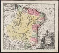
- Found in:
- Beinecke Rare Book and Manuscript Library > Recens elaborata mappa geographica, Regni Brasiliae in America meridionali / maxime celebris accuratae delineata per Matth. Seutterum.
- Published / Created:
- 1907].
- Call Number:
- 91125 1907
- Container / Volume:
- BRBL_00670
- Image Count:
- 1
- Resource Type:
- Maps, Atlases & Globes
- Found in:
- Beinecke Rare Book and Manuscript Library > Territorio de Misiones : Ministerio de Agricultura.
- Published / Created:
- [1830?]
- Call Number:
- 911 1830
- Container / Volume:
- BRBL_00669
- Image Count:
- 1
- Resource Type:
- Maps, Atlases & Globes
- Found in:
- Beinecke Rare Book and Manuscript Library > Brazil.
- Published / Created:
- 1911
- Call Number:
- 91139 M71 1911
- Container / Volume:
- BRBL_00670
- Image Count:
- 1
- Resource Type:
- Maps, Atlases & Globes
- Found in:
- Beinecke Rare Book and Manuscript Library > Estado de S. Paulo, Brazil.
- Published / Created:
- [1902?]
- Call Number:
- 911gmc 1890
- Container / Volume:
- BRBL_00672
- Image Count:
- 1
- Resource Type:
- Maps, Atlases & Globes
- Found in:
- Beinecke Rare Book and Manuscript Library > Brazil, provincial railroads [cartographic material].
- Published / Created:
- [1920?].
- Call Number:
- 911 1920
- Container / Volume:
- BRBL_00669
- Image Count:
- 1
- Resource Type:
- Maps, Atlases & Globes
- Found in:
- Beinecke Rare Book and Manuscript Library > Official map of Brazil / by Joao Chrockatt de Sa, John Pereira de Castro and Eduardo A.G. Thompson.
- Published / Created:
- 1904]
- Call Number:
- 911fab 1904
- Container / Volume:
- BRBL_00671
- Image Count:
- 1
- Resource Type:
- Maps, Atlases & Globes
- Found in:
- Beinecke Rare Book and Manuscript Library > Plano de la frontera entre la Republica Argentina n los Estados Unidos del Brasil, 1900-04 [cartographic material].
- Published / Created:
- 1670]
- Call Number:
- 911 1670
- Container / Volume:
- BRBL_00668
- Image Count:
- 1
- Resource Type:
- Maps, Atlases & Globes
- Found in:
- Beinecke Rare Book and Manuscript Library > Brasilia.
- Creator:
- Oficina de Límites (Chile)
- Published / Created:
- 1905
- Call Number:
- 9617 1905
- Container / Volume:
- BRBL_00676
- Image Count:
- 1
- Resource Type:
- Maps, Atlases & Globes
- Found in:
- Beinecke Rare Book and Manuscript Library > Mapa jeografico de la Puna de Atacama [cartographic material].
- Published / Created:
- [1830?]
- Call Number:
- 966 1830
- Container / Volume:
- BRBL_00676
- Image Count:
- 1
- Resource Type:
- Maps, Atlases & Globes
- Found in:
- Beinecke Rare Book and Manuscript Library > Kaart van Straat Magellaan, Straat le Maire, Het Vuurland en Kaap Hoorn.
- Published / Created:
- 1900
- Call Number:
- 935 1900
- Container / Volume:
- BRBL_00674
- Image Count:
- 1
- Resource Type:
- Maps, Atlases & Globes
- Found in:
- Beinecke Rare Book and Manuscript Library > Map of Argentina and adjoining states : to illustrate "Argentina" by W.A. Hirst.
- Published / Created:
- [1912?].
- Call Number:
- 935gme 1912
- Container / Volume:
- BRBL_00674
- Image Count:
- 1
- Resource Type:
- Maps, Atlases & Globes
- Found in:
- Beinecke Rare Book and Manuscript Library > Mapa de los ferrocarriles de la República Argentina, Chile, Uruguay y Paraguay.
- Published / Created:
- [1913?]
- Call Number:
- 94gme 1913
- Container / Volume:
- BRBL_00675
- Image Count:
- 1
- Resource Type:
- Maps, Atlases & Globes
- Found in:
- Beinecke Rare Book and Manuscript Library > Railway map of Argentine Republic.
- Published / Created:
- [1860?].
- Call Number:
- 97 1860
- Container / Volume:
- BRBL_00677
- Image Count:
- 1
- Resource Type:
- Maps, Atlases & Globes
- Found in:
- Beinecke Rare Book and Manuscript Library > Mapa general del Peru, Ecuador y Bolivia : corregido y aumentado considerablemente, con el Plano de la Capital del Peru.
- Creator:
- Colussi, J. M
- Published / Created:
- 1920
- Call Number:
- 94 1920
- Container / Volume:
- BRBL_00675
- Image Count:
- 1
- Resource Type:
- Maps, Atlases & Globes
- Found in:
- Beinecke Rare Book and Manuscript Library > Mapa de la Republica Argentina [cartographic material] : anexo al anuario publicado por Ernesto Tornquist & Cía. Lda. / Oficina Cartográfica de J.M. Colussi.
- Creator:
- Vooght, Claes Janszoon, -1696
- Published / Created:
- [ca. 1685]
- Call Number:
- 911cea C111 1685
- Container / Volume:
- BRBL_00670
- Image Count:
- 1
- Resource Type:
- Maps, Atlases & Globes
- Found in:
- Beinecke Rare Book and Manuscript Library > Paskaart van de zee-kusten van Brazilia, tusschen C.S. Thome en I.S. Catharina / door Vooght geometra.
- Creator:
- Reyes, José Maria, 1803-1864
- Published / Created:
- c1893.
- Call Number:
- 93 1893
- Container / Volume:
- BRBL_00674
- Image Count:
- 1
- Resource Type:
- Maps, Atlases & Globes
- Found in:
- Beinecke Rare Book and Manuscript Library > Carta geográfica de la Republica Oriental del Uruguay [cartographic material] / reduccion dela del general ingeniero Don José M. Reyes. Aumentada y correjida en parte con antecedentes del archivo dela direccion gral de obras publicas por el vocal dela s
- Published / Created:
- 1913?]
- Call Number:
- 94gme 1913B
- Container / Volume:
- BRBL_00675
- Image Count:
- 1
- Resource Type:
- Maps, Atlases & Globes
- Found in:
- Beinecke Rare Book and Manuscript Library > [Railway map of Northern Argentina.]
- Creator:
- Mision Atilio Peña Machain en Santiago de Chile
- Published / Created:
- 1930
- Call Number:
- 923 1930
- Container / Volume:
- BRBL_00673
- Image Count:
- 1
- Resource Type:
- Maps, Atlases & Globes
- Found in:
- Beinecke Rare Book and Manuscript Library > Mapa historico de los derechos y Titulos del Paraguay sobre el Gran Chaco [cartographic material] / confeccionado por Juan Marshall, con documentos de la Biblioteca Nacional, Sala Medina y Archivo Nacional de Santiago de Chile.
- Call Number:
- 94fb 1869
- Container / Volume:
- BRBL_00675
- Image Count:
- 1
- Resource Type:
- Maps, Atlases & Globes
- Found in:
- Beinecke Rare Book and Manuscript Library > Proyecto de la limitacion de las Provincias de la Republica de Argentina y Demarcacion de los Territorios Nacionales presentado al Honorable Congreso por el Senador D. Nicasio Oroño,1869. Lit. á vapor, Moreno 130 Bs. As.
- Published / Created:
- [1635]
- Call Number:
- 966 1635
- Container / Volume:
- BRBL_00676
- Image Count:
- 1
- Resource Type:
- Maps, Atlases & Globes
- Found in:
- Beinecke Rare Book and Manuscript Library > Tabula Magellanico, qua Tierrae del fuego, cum celerrimis fretis a F. Magellano et L. Le Maire detectis novissima et accuratissimo descriptio exhibetur.
- Published / Created:
- 1888
- Call Number:
- 94eh P27 1888
- Container / Volume:
- BRBL_00675
- Image Count:
- 1
- Resource Type:
- Maps, Atlases & Globes
- Found in:
- Beinecke Rare Book and Manuscript Library > Missioni Salesiane della Patagonia Settentrionale.
- Creator:
- L'Isle, Guillaume de, 1675-1726
- Published / Created:
- 1703 [i.e. between 1708-1718]
- Call Number:
- 935 1703
- Container / Volume:
- BRBL_00674
- Image Count:
- 1
- Resource Type:
- Maps, Atlases & Globes
- Found in:
- Beinecke Rare Book and Manuscript Library > Carte du Paraguay, du Chili, du Detroit de Magellan &c : dressée sur les descriptions des PP. Alfonse d'Ovalle, et Nicolas Techo, et sur les relations et memoires de Brouwer, Narbouroug, Mr. de Beauchesne &c. / par Guillaume De l'Isle, Geographe de l'Aca
- Creator:
- Ovalle, Alonso de, 1601-1651
- Published / Created:
- A. MDCCXXXIII [1733]
- Call Number:
- 935 1733A
- Container / Volume:
- BRBL_00674
- Image Count:
- 1
- Resource Type:
- Maps, Atlases & Globes
- Found in:
- Beinecke Rare Book and Manuscript Library > Typus geographicus : Chili a Paraguay freti Magellanici &c., ex. PPbg. Alfonso d'Ovalle & Nicol. Techo nec non de Brouwer, Narbouroug, de Beauchesne &c., a Guiliel de l'Islio descripta, insuperque secundum recentiores du Frezier relationes rectificata cui
- Published / Created:
- 1918
- Call Number:
- 94g 1918
- Container / Volume:
- BRBL_00675
- Image Count:
- 1
- Resource Type:
- Maps, Atlases & Globes
- Found in:
- Beinecke Rare Book and Manuscript Library > Republica Argentina : superficie, población, ferro-carriles, cultivos y ganados.
- Published / Created:
- 1890
- Call Number:
- 9214 1890
- Container / Volume:
- BRBL_00673
- Image Count:
- 1
- Resource Type:
- Maps, Atlases & Globes
- Found in:
- Beinecke Rare Book and Manuscript Library > Plano demostrativo de la primera seccion del "Alto Parana" comprendida entre "Corrientes" y "Corpus".
- Published / Created:
- 1928
- Call Number:
- 92 As93 1928
- Container / Volume:
- BRBL_00673
- Image Count:
- 1
- Resource Type:
- Maps, Atlases & Globes
- Found in:
- Beinecke Rare Book and Manuscript Library > Plano de Asuncion : segun datos dle Departmento de Obras Pública Municipal.
- Creator:
- Portillo, Pedro
- Published / Created:
- 1907
- Call Number:
- 97 1907
- Container / Volume:
- BRBL_00677
- Image Count:
- 1
- Resource Type:
- Maps, Atlases & Globes
- Found in:
- Beinecke Rare Book and Manuscript Library > Mapa del alto Yurua y alto Purus que comprende las ultimas exploraciones y estudios verificados desde 1900 hasta 1906 [cartographic material] / mandado levantar por el Coronel D. Pedro Portillo indicando en tinta roja el ruḿbo de su viaje en 1900 y el ú
- Published / Created:
- 1909
- Call Number:
- 97 1909
- Container / Volume:
- BRBL_00678
- Image Count:
- 1
- Resource Type:
- Maps, Atlases & Globes
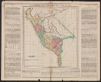
- Found in:
- Beinecke Rare Book and Manuscript Library > Mapa general del Peru : trazado, correjido y aumentado segun los mapas oficiales.
- Published / Created:
- [1913]
- Call Number:
- 97 1913
- Container / Volume:
- BRBL_00678
- Image Count:
- 1
- Resource Type:
- Maps, Atlases & Globes
- Found in:
- Beinecke Rare Book and Manuscript Library > F.-C. del S. Mapa del Sur del Perú y Parte de Bolivia.
- Published / Created:
- 1835
- Call Number:
- 97 L62 1685
- Container / Volume:
- BRBL_00678
- Image Count:
- 1
- Resource Type:
- Maps, Atlases & Globes
- Found in:
- Beinecke Rare Book and Manuscript Library > View of Lima. "The City of Kings." before its destruction by the great earthquake of 1746.
- Creator:
- Bingham, Hiram, 1875-1956
- Published / Created:
- 1915]
- Call Number:
- 97 1915
- Container / Volume:
- BRBL_00678
- Image Count:
- 1
- Resource Type:
- Maps, Atlases & Globes
- Found in:
- Beinecke Rare Book and Manuscript Library > Field map of the Peruvian expeditions of Yale University and the National Geographic Society [cartographic material] / Hiram Bingham, Director.
- Published / Created:
- 1904
- Call Number:
- 97 Ic1 1904A
- Container / Volume:
- BRBL_00678
- Image Count:
- 1
- Resource Type:
- Maps, Atlases & Globes
- Found in:
- Beinecke Rare Book and Manuscript Library > Cuerpo de Ingenieros de Minas del Perú : Plano expedito de la acequias y areas cultivadas y cultivables de Valle de Ica / por Carlos W. Sutton.
- Published / Created:
- 1894
- Call Number:
- 98 1894
- Container / Volume:
- BRBL_00679
- Image Count:
- 1
- Resource Type:
- Maps, Atlases & Globes
- Found in:
- Beinecke Rare Book and Manuscript Library > Del mapa geográfico y corográfico de la República de Bolivia / por D. Justo Leigue Moreno.
- Published / Created:
- 1904
- Call Number:
- 97 Ic1 1904C
- Container / Volume:
- BRBL_00678
- Image Count:
- 1
- Resource Type:
- Maps, Atlases & Globes
- Found in:
- Beinecke Rare Book and Manuscript Library > Cuerpo de Ingenieros de Minas del Perú : Proyecto para irrigar el Valle de Ica plana perfil y corte represa de la laguna de Choclococha / por Carlos W. Sutton.
- Published / Created:
- [1928].
- Call Number:
- 97 1928A
- Container / Volume:
- BRBL_00678
- Image Count:
- 1
- Resource Type:
- Maps, Atlases & Globes
- Found in:
- Beinecke Rare Book and Manuscript Library > Cajamarca
- Published / Created:
- 1904
- Call Number:
- 97 Ic1 1904B
- Container / Volume:
- BRBL_00678
- Image Count:
- 1
- Resource Type:
- Maps, Atlases & Globes
- Found in:
- Beinecke Rare Book and Manuscript Library > Cuerpo de Ingenieros de Minas del Perú : Proyecto de un canal para irrigar el Valle de Ica con agua de la laguna de Choclococha / por Carlos W. Sutton.
- Published / Created:
- 1909
- Call Number:
- 97 M11 1909
- Container / Volume:
- BRBL_00678
- Image Count:
- 1
- Resource Type:
- Maps, Atlases & Globes
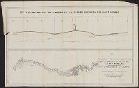
- Found in:
- Beinecke Rare Book and Manuscript Library > Ruinas de Macchupichu : Linea No. 1 K 130 - K 140 / E.B. Sanderson, Ingenerio en Jefe de los Estudios.
- Published / Created:
- 1755
- Call Number:
- 97 L62 1755
- Container / Volume:
- BRBL_00678
- Image Count:
- 1
- Resource Type:
- Maps, Atlases & Globes
- Found in:
- Beinecke Rare Book and Manuscript Library > A Scenographic Plan of the City of the Kings, otherwise called Lima, the capital of the Kingdonm of Peru ... as it was before the late earthquakes.
- Published / Created:
- [1910]
- Call Number:
- 97 1910
- Container / Volume:
- BRBL_00678
- Image Count:
- 1
- Resource Type:
- Maps, Atlases & Globes
- Found in:
- Beinecke Rare Book and Manuscript Library > South Peru and north Bolivia [cartographic material] : including the rubber yielding montaña.
- Published / Created:
- [1910]
- Call Number:
- 97 1910A
- Container / Volume:
- BRBL_00678
- Image Count:
- 1
- Resource Type:
- Maps, Atlases & Globes
- Found in:
- Beinecke Rare Book and Manuscript Library > South Peru and north Bolivia [cartographic material] : including the rubber yielding montaña.
- Published / Created:
- [1910]
- Call Number:
- 97 1910
- Container / Volume:
- BRBL_00678
- Image Count:
- 1
- Resource Type:
- Maps, Atlases & Globes
- Found in:
- Beinecke Rare Book and Manuscript Library > South Peru and north Bolivia [cartographic material] : including the rubber yielding montaña.
- Creator:
- Sociedad Geográfica de Lima
- Published / Created:
- 1906
- Call Number:
- 97 1906A
- Container / Volume:
- BRBL_00677
- Image Count:
- 1
- Resource Type:
- Maps, Atlases & Globes
- Found in:
- Beinecke Rare Book and Manuscript Library > Mapa que comprende las últimas exploraciones y estudios verificados desde 1900 hasta 1906.
- Published / Created:
- 1904
- Call Number:
- 97 1904
- Container / Volume:
- BRBL_00677
- Image Count:
- 1
- Resource Type:
- Maps, Atlases & Globes
- Found in:
- Beinecke Rare Book and Manuscript Library > Mapa indicando el resultado de las ultimas exploraciones en los rios Paucartambo y Madre de Dios.
- Published / Created:
- 1906
- Call Number:
- 97 1906
- Container / Volume:
- BRBL_00677
- Image Count:
- 1
- Resource Type:
- Maps, Atlases & Globes
- Found in:
- Beinecke Rare Book and Manuscript Library > Mapa de las vias nacionales entre el Pacifico v el Rio Madre de Dios.
- Published / Created:
- 1904
- Call Number:
- 97 1904A
- Container / Volume:
- BRBL_00677
- Image Count:
- 1
- Resource Type:
- Maps, Atlases & Globes
- Found in:
- Beinecke Rare Book and Manuscript Library > Archivo especial de limites : croquis de la region Madre de Dios-Manu, Paucartambo y Ucayali / por Jorge M. Von Hassel.
- Published / Created:
- [1840?]
- Call Number:
- 97 1840
- Container / Volume:
- BRBL_00677
- Image Count:
- 1
- Resource Type:
- Maps, Atlases & Globes
- Found in:
- Beinecke Rare Book and Manuscript Library > Karte von Peru und Bolivia.
- Creator:
- Villavicencio, Manuel, 1822-1871
- Published / Created:
- 1858
- Call Number:
- 99 1858
- Container / Volume:
- BRBL_00679
- Image Count:
- 1
- Resource Type:
- Maps, Atlases & Globes
- Found in:
- Beinecke Rare Book and Manuscript Library > Carta corografica de la republica del Ecuador / Manuel Villavicencio ; lit. é imp. de F. Mayer y Ca.
- Creator:
- Geological Survey of California
- Published / Created:
- 1989
- Call Number:
- 844gcr Si17 1867
- Container / Volume:
- BRBL_00615
- Image Count:
- 1
- Resource Type:
- Maps, Atlases & Globes
- Found in:
- Beinecke Rare Book and Manuscript Library > Map of a portion of the Sierra Nevada adjacent to the Yosemite Valley / from surveys made by Chs. F. Hoffmann and J.T. Gardner, 1863-1867 ; Geological Survey of California ; J.D. Whitney, State Geologist.