Skip to search
Skip to main content
Skip to first result
Search
You Searched For
Subject (Geographic)
Middle Atlantic States--Maps--Early works to 1800
New Search
Search Results
Creator:
Published / Created:
1771
Call Number:
755 1771C
Container / Volume:
BRBL_00429
Image Count:
1
Resource Type:
Maps, Atlases & Globes
Found in:
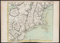
Beinecke Rare Book and Manuscript Library > A general map of the middle British colonies in America : viz. Virginia, Maryland, Delaware, Pensilvania, New-Jersey, New York, Connecticut & Rhode-Island : of Aquanishuonigy the country of the confederate Indians comprehending Aquanishuonigy proper, thei
Creator:
Published / Created:
[1676?]
Call Number:
755 1675E
Container / Volume:
BRBL_00423
Image Count:
1
Resource Type:
Maps, Atlases & Globes
Found in:
Beinecke Rare Book and Manuscript Library > A map of New England, New Yorke, New Jersey, Mary-land & Virginia / Gr. King sculpsit.
Creator:
Published / Created:
1787
Call Number:
1977 Folio 177
Image Count:
2
Resource Type:
Maps, Atlases & Globes
Found in:
Beinecke Rare Book and Manuscript Library > A map of the country between Albemarle Sound, and Lake Erie [cartographic material] : comprehending the whole of Virginia, Maryland, Delaware and Pensylvania, with parts of several other of the United States of America / engraved by S.J. Neele.
Published / Created:
1776]
Call Number:
755 1776R
Container / Volume:
BRBL_00728
Image Count:
1
Resource Type:
Maps, Atlases & Globes
Found in:
Beinecke Rare Book and Manuscript Library > A map of the country round Philadelphia : including part of New Jersey, New York, Staten Island & Long Island.
Creator:
Published / Created:
1794
Call Number:
783 1794
Container / Volume:
BRBL_00507
Image Count:
1
Resource Type:
Maps, Atlases & Globes
Found in:
Beinecke Rare Book and Manuscript Library > A map of the most inhabited part of Virginia containing the whole province of Maryland with part of Pensilvania, New Jersey and North Carolina / drawn by Joshua Fry & Peter Jefferson in 1775.
Published / Created:
1777
Call Number:
755 1777S
Container / Volume:
BRBL_00728
Image Count:
1
Resource Type:
Maps, Atlases & Globes
Found in:
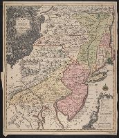
Beinecke Rare Book and Manuscript Library > A map of the provinces of New-York and New-Jersey ... from the topographical observations of C.J. Sauthier / engraved ... by Matthew Albert Lotter.
Creator:
Published / Created:
[1673?]
Call Number:
755 1682B
Container / Volume:
BRBL_00424
Image Count:
1
Resource Type:
Maps, Atlases & Globes
Found in:
Beinecke Rare Book and Manuscript Library > A mapp of Virginia, Mary-land, New-Jarsey, New-York, & New England.
Creator:
Published / Created:
1722?]
Call Number:
755 1722
Container / Volume:
BRBL_00425
Image Count:
1
Resource Type:
Maps, Atlases & Globes
Found in:
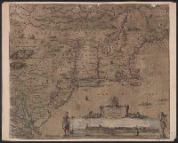
Beinecke Rare Book and Manuscript Library > A new map of the most considerable plantations of the English in America : dedicated to His Highness William Duke of Glocester / Sutton Nichols sculp.
Published / Created:
[1755?]
Call Number:
71 1755G
Container / Volume:
BRBL_00363
Image Count:
1
Resource Type:
Maps, Atlases & Globes
Found in:
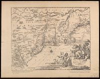
Beinecke Rare Book and Manuscript Library > Carta d'una parte dell' America Settentrionale : che serve per ben poter intendere le pretensioni delli Inglesi, esposte ne loro memoriali in occasione della regolazione de limiti con la Francia nell' America svdetta.
Creator:
Published / Created:
1764].
Call Number:
755 1764
Container / Volume:
BRBL_00429
Image Count:
1
Resource Type:
Maps, Atlases & Globes
Found in:
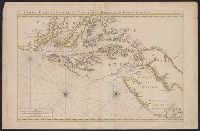
Beinecke Rare Book and Manuscript Library > Carte de la Nouvelle Angleterre : New York, Pensilvanie et Nouveau Jersay suivant les cartes angloises.
Published / Created:
[between 1693 and 1710?]
Call Number:
783 1711
Container / Volume:
BRBL_00691
Image Count:
1
Resource Type:
Maps, Atlases & Globes
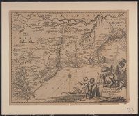
Found in:
Beinecke Rare Book and Manuscript Library > Carte particuliere de Virginie, Maryland, Pennsilvanie, la Nouvelle Iarsey orient et occidentale.
Creator:
Published / Created:
163-?]
Call Number:
755 1635
Container / Volume:
BRBL_00422
Image Count:
1
Resource Type:
Maps, Atlases & Globes
Found in:
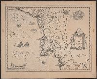
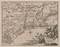
Beinecke Rare Book and Manuscript Library > Nova Belgica et Anglia Nova.
Creator:
Published / Created:
1655?]
Call Number:
75 1655
Container / Volume:
BRBL_00689
Image Count:
1
Resource Type:
Maps, Atlases & Globes
Found in:
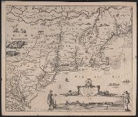
Beinecke Rare Book and Manuscript Library > Novi Belgii, Novaeque Angliae nec non partis Virginiae tabula / [cartographic material] / multis in locis emendata a Nicolao Joannis Visschero.
Creator:
Published / Created:
1655?]
Call Number:
755 1655
Container / Volume:
BRBL_00423
Image Count:
1
Resource Type:
Maps, Atlases & Globes
Found in:
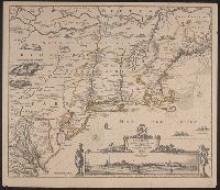
Beinecke Rare Book and Manuscript Library > Novi Belgii, Novaeque Angliae nec non partis Virginiae tabula / [cartographic material] / multis in locis emendata a Nicolao Joannis Visschero.
Creator:
Published / Created:
1671?]
Call Number:
755 1671B
Container / Volume:
BRBL_00680
Image Count:
1
Resource Type:
Maps, Atlases & Globes
Found in:
Beinecke Rare Book and Manuscript Library > Novi Belgii, quod nunc Novi Jorck vocatur, Novae q[ue] Angliae & partis Virginiae : accuratissima et novissima delineatio.
Creator:
Published / Created:
1671?]
Call Number:
755 1671B
Container / Volume:
BRBL_00423
Image Count:
1
Resource Type:
Maps, Atlases & Globes
Found in:
Beinecke Rare Book and Manuscript Library > Novi Belgii, quod nunc Novi Jorck vocatur, Novae q[ue] Angliae & partis Virginiae : accuratissima et novissima delineatio.
Creator:
Published / Created:
1876
Call Number:
755.8907249
Container / Volume:
BRBL_00423
Image Count:
1
Resource Type:
Maps, Atlases & Globes
Found in:
Beinecke Rare Book and Manuscript Library > Novi Belgii, quod nunc Novi Jorck vocatur, Novae q[ue] Angliae & partis Virginiae [cartographic material] : accuratissima et novissima delineatio.
Creator:
Published / Created:
1760?]
Call Number:
755 1760E
Container / Volume:
BRBL_00428
Image Count:
1
Resource Type:
Maps, Atlases & Globes
Found in:
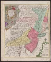
Beinecke Rare Book and Manuscript Library > Pensylvania, Nova Jersey et Nova York cum regionibus ad Fluvium Delaware in America sitis / nova delineatione ob oculos posita per Tob. Conr. Lotter, geographum Aug. Vind. ; Tob. Conr. Lotter sculps. Aug. V.
Creator:
Published / Created:
1760?]
Call Number:
75 1730
Container / Volume:
BRBL_00689
Image Count:
1
Resource Type:
Maps, Atlases & Globes
Found in:
Beinecke Rare Book and Manuscript Library > Pensylvania, Nova Jersey et Nova York cum regionibus ad Fluvium Delaware in America sitis / nova delineatione ob oculos posita per Tob. Conr. Lotter, geographum Aug. Vind. ; Tob. Conr. Lotter sculps. Aug. V.
Branch:v1.60.98 ,Deployed:2024-04-24T10:14:35-04:00