Search
You Searched For
Search Results
- Creator:
- Moll, Herman, -1732
- Call Number:
- 304 1712
- Container / Volume:
- BRBL_00033
- Image Count:
- 1
- Resource Type:
- Maps, Atlases & Globes
- Found in:
- Beinecke Rare Book and Manuscript Library > A new map of Germany, Hungary, Transilvania & the Suisse cantons : with many remarks not extant in any map : according to ye newest and most exact observations / by Herman Moll, geographer.
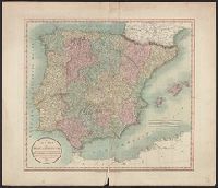
- Creator:
- Cary, John, approximately 1754-1835
- Call Number:
- 39 1801
- Container / Volume:
- BRBL_00186
- Image Count:
- 1
- Resource Type:
- Maps, Atlases & Globes
- Found in:
- Beinecke Rare Book and Manuscript Library > A new map of Spain and Portugal : divided into their respective kingdoms and provinces from the latest authorities / by John Cary, engraver.
- Creator:
- Cary, John, approximately 1754-1835
- Call Number:
- 3614 1799
- Container / Volume:
- BRBL_00135
- Image Count:
- 1
- Resource Type:
- Maps, Atlases & Globes
- Found in:
- Beinecke Rare Book and Manuscript Library > A new map of the Kingdom of Prussia : with its divisions into provinces and governments ; from the latest authorities / by John Cary, engraver, 1799.
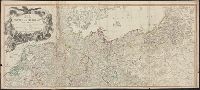
- Creator:
- Delamarche, Charles François, 1740-1817
Groux, Charles Jacques
Robert de Vaugondy, Didier, 1723-1786
- Call Number:
- 36 1792
- Container / Volume:
- BRBL_00118
- Image Count:
- 1
- Resource Type:
- Maps, Atlases & Globes
- Found in:
- Beinecke Rare Book and Manuscript Library > Carte de l'empire d'Allemagne : dessinée d'après les cartes nationales et assujetties aux observations astronomiques par Robert de Vaugondy ; corrigée et divisée en IX cercles, suivant les divisions politiques actuelles, avec les parties adjacentes et
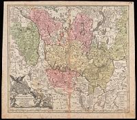
- Creator:
- Robert de Vaugondy, Gilles, 1688-1766
- Call Number:
- 3635 1752
- Collection Title:
- Atlas universel
- Container / Volume:
- BRBL_00142
- Image Count:
- 1
- Resource Type:
- Maps, Atlases & Globes
- Found in:
- Beinecke Rare Book and Manuscript Library > Cercle de Basse Saxe : où sont distingués les Etats de Brunswich, les Duchés de Holstien [sic], de Mecklenbourg et des Evêchés d'Hildesheim, et d'Halberstadt / par le Sr. Robert, Géographe ordinaire du Roy. Avec privilege, 1752.
- Creator:
- Seutter, Matthaeus, 1678-1756
- Published / Created:
- [1740?]
- Call Number:
- BrSides Double Folio 2019 23
- Image Count:
- 1
- Resource Type:
- Maps, Atlases & Globes
- Found in:
- Beinecke Rare Book and Manuscript Library > Electoratus sive Marchia Brandenburgensis : juxta novissimam delineationem in mappa geographica / accuratae aeri incisa opera et sumptibus Matthaei Seutteri S. Caes. et Reg. Cath., maj. geogr.
- Creator:
- Robert de Vaugondy, Gilles, 1688-1766
- Published / Created:
- [1751?]
- Call Number:
- 3614 1751
- Container / Volume:
- BRBL_00135
- Image Count:
- 1
- Resource Type:
- Maps, Atlases & Globes
- Found in:
- Beinecke Rare Book and Manuscript Library > La Prusse divisée en Prusse Royale, et Prusse Ducale : laquelle a eté érigée en Royaume par l'Empereur Leopold en faveur de Frederic I. Elect. de Brandebourg couronée en Janvier 1701 / par le Sr. Robert, géographe.
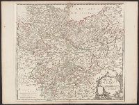
- Creator:
- Delarochette, L. (Louis), 1731-1802
Kitchin, Thomas, 1718-1784. New universal atlas. 1804
Laurie & Whittle
- Call Number:
- 36 1794B
- Container / Volume:
- BRBL_00119
- Image Count:
- 2
- Resource Type:
- Maps, Atlases & Globes
- Found in:
- Beinecke Rare Book and Manuscript Library > Map of the Empire of Germany : including all the states comprehended under that name: with the Kingdom of Prussia, &c. / by L. Delarochette ; T. Kitchin sculpt.
- Creator:
- Thomson, John, active 19th century
- Call Number:
- 361 1817
- Container / Volume:
- BRBL_00135
- Image Count:
- 1
- Resource Type:
- Maps, Atlases & Globes
- Found in:
- Beinecke Rare Book and Manuscript Library > Prussian Dominions / drawn and engraved for Thomson's New General atlas.
- Creator:
- Homann, Johann Baptist, 1663-1724
- Published / Created:
- between 1701 and 1709?]
- Call Number:
- 3614 1715
- Container / Volume:
- BRBL_00135
- Image Count:
- 1
- Resource Type:
- Maps, Atlases & Globes
- Found in:
- Beinecke Rare Book and Manuscript Library > Regnum Borussiae : gloriosis auspicÿs serenissimi et potentissimi Prin. Friderici III. Primi Borussiae Regis, March. et Elect. Bran. inauguratum die 18. Ian. a. 1701 / geographice cum vicinis regionibus adumbratum a Ioh. Baptista Homanno.
- Call Number:
- 39 1795
- Container / Volume:
- BRBL_00186
- Image Count:
- 1
- Resource Type:
- Maps, Atlases & Globes
- Found in:
- Beinecke Rare Book and Manuscript Library > Spain and Portugal, from the best authorities.
- Call Number:
- 39 1795
- Container / Volume:
- BRBL_00186
- Image Count:
- 1
- Resource Type:
- Maps, Atlases & Globes
- Found in:
- Beinecke Rare Book and Manuscript Library > Spain and Portugal, from the best authorities.
- Creator:
- Roberts, John, engraver and geographer
- Call Number:
- 3614 1794
- Collection Title:
- New universal atlas.
- Container / Volume:
- BRBL_00135
- Image Count:
- 1
- Resource Type:
- Maps, Atlases & Globes
- Found in:
- Beinecke Rare Book and Manuscript Library > The kingdom of Prussia, and its newly incorporated province of Polish Prussia now named Western Prussia : with the territory of Dantzick / by John Roberts, Geographer.