Search
You Searched For
Search Results
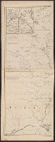
- Creator:
- Mitchell, John, 1711-1768
- Published / Created:
- 1776]
- Call Number:
- 71 1776D
- Container / Volume:
- BRBL_00365
- Image Count:
- 8
- Resource Type:
- Maps, Atlases & Globes
- Subject (Geographic):
- North America--Maps--Early works to
- Found in:
- Beinecke Rare Book and Manuscript Library > Amérique septentrionale avec les routes : distances en miles, villages, et etablissements françois et anglois / par le docteur Mitchel ; traduit de l'Anglois à Paris par Le Rouge, ingr. géographe du roy, Rue des Grands Augustins 1756.
- Creator:
- Mitchell, John, 1711-1768
- Published / Created:
- 1777?]
- Call Number:
- 71 1777C
- Container / Volume:
- BRBL_00365
- Image Count:
- 4
- Resource Type:
- Maps, Atlases & Globes
- Subject (Geographic):
- North America--Maps--Early works to
- Found in:
- Beinecke Rare Book and Manuscript Library > Amérique septentrionale avec les routes: distances en miles, villages et etablissements françois et anglois / par le docteur Mitchel ; traduit de l'Anglois à Paris par Le Rouge, ingr. géographe du roy, rue des Grands Augustins 1777.
- Creator:
- Bowen, Emanuel, -1767
- Published / Created:
- 2d. July 1772.
- Call Number:
- 71 1763
- Container / Volume:
- BRBL_00364
- Image Count:
- 4
- Resource Type:
- Maps, Atlases & Globes
- Subject (Geographic):
- North America--Maps--Early works to
- Found in:
- Beinecke Rare Book and Manuscript Library > An accurate map of North America [cartographic material] : Describing and distinguishing the British and Spanish dominions on this great continent; according to the definitive treaty concluded at Paris 10th Feby. 1763. Also all the West India Islands belo
- Creator:
- Pownall, Thomas, 1722-1805
- Published / Created:
- between 1783 and 1799?]
- Call Number:
- 71 1785C
- Container / Volume:
- BRBL_00366
- Image Count:
- 2
- Resource Type:
- Maps, Atlases & Globes
- Alternative Title:
- Map of North America and the West
- Description:
- An issue of the Pownall map of North
- Subject (Geographic):
- North America--Maps--Early works to
- Found in:
- Beinecke Rare Book and Manuscript Library > [Pownall's map of North America and the West Indies].
- Creator:
- Robert de Vaugondy, Didier, 1723-1786
- Published / Created:
- 1753
- Call Number:
- 755 1760D
- Container / Volume:
- BRBL_00428
- Image Count:
- 1
- Resource Type:
- Maps, Atlases & Globes
- Subject (Topic):
- Indians of North America--Maps--Early
- Found in:
- Beinecke Rare Book and Manuscript Library > Carte des pays connus sous le nom de Canada : dans laquelle sont distinguées les possessions françoises, & angl? Dédiée et présentée a monseigneur le Comte d'Argenson, ministre sécrétaire d'Etat pour le département de la guerre / par le Sr. Rober
- Creator:
- Gibson, J. (John)
- Published / Created:
- 1758
- Call Number:
- 755 1758
- Container / Volume:
- BRBL_00428
- Image Count:
- 1
- Resource Type:
- Maps, Atlases & Globes
- Subject (Geographic):
- North America--Maps--Early works to
- Found in:
- Beinecke Rare Book and Manuscript Library > A general map of the middle British colonies in America : viz. Virginia, Maryland, Delaware, Pensilvania, New-Jersey, New-York, Connecticut and Rhode-Island : of Aquanishuonigy the country of the confederate Indians comprehending Aquanishuonigy proper, th
- Creator:
- Overton, Henry, 1675 or 6-1751
- Published / Created:
- [1755?]
- Call Number:
- 755 1756F
- Container / Volume:
- BRBL_00428
- Image Count:
- 1
- Resource Type:
- Maps, Atlases & Globes
- Subject (Geographic):
- North America--Maps--Early works to
- Found in:
- Beinecke Rare Book and Manuscript Library > An accurate map of the British colonies in North America bordering on the river Ohio.
- Creator:
- Tirion, Isaak
- Published / Created:
- [1769]
- Call Number:
- 755 1755F
- Container / Volume:
- BRBL_00427
- Image Count:
- 1
- Resource Type:
- Maps, Atlases & Globes
- Subject (Geographic):
- North America--Maps--Early works to
- Found in:
- Beinecke Rare Book and Manuscript Library > Nieuwe kaart van de grootbrittannische Volkplantingen in Noort America .../ Isaak Tirion 1755.
- Creator:
- Tirion, Isaak
- Published / Created:
- [1769]
- Call Number:
- 755 1755Z
- Container / Volume:
- BRBL_00427
- Image Count:
- 1
- Resource Type:
- Maps, Atlases & Globes
- Subject (Geographic):
- North America--Maps--Early works to
- Found in:
- Beinecke Rare Book and Manuscript Library > Nieuwe kaart van de grootbrittannische Volkplantingen in Noort America .../ Isaak Tirion 1755.