Skip to search
Skip to main content
Skip to first result
Search
You Searched For
"United States.--Congress"
New Search
Search Results
Creator:
Published / Created:
[1847?]
Call Number:
88hc 1847D
Container / Volume:
BRBL_00649
Image Count:
1
Resource Type:
Maps, Atlases & Globes
Alternative Title:
Senate document (United States
Description:
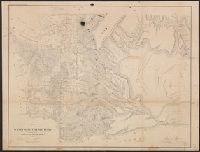
Appears in Senate document 1, 30th Congress, 1st session., In upper right margin: Page 133., Includes index to position of troops., Oriented with north to bottom., and Relief shown by hachures.
Publisher:
Lith. of P.S. Duval,
Subject (Name):
Duval, Peter S., 1804 or 5-1886
Subject (Topic):
Buena Vista (Mexico), Battle of, 1847--Maps and Mexican War, 1846-1848--Maps
Found in:
Beinecke Rare Book and Manuscript Library > Plan of the battle of Buena-Vista : fought February 22nd and 23rd, 1847 / surveyed by Capt. Linnard & Lieuts. Pope & Franklin, Corps T. Engrs. ; drawn by Capt. T.B. Linnard, Corps of T.E.
Creator:
Published / Created:
[1847?]
Call Number:
88hc M57 1847B
Container / Volume:
BRBL_00649
Image Count:
1
Resource Type:
Maps, Atlases & Globes
Alternative Title:
States . Congress . Senate) ; 30th Congress
Description:
Appears in Senate executive document, 30th Congress, 1st session, no. 1., Indexed., and Relief shown by hachures.
Publisher:
P.S. Duval's Lith.,
Subject (Geographic):
Mexico City (Mexico)--History--American occupation, 1847-1848--Maps
Subject (Name):
Duval, Peter S., 1804 or 5-1886, McClellan, George Brinton, 1826-1885, and Turnbull, Wm. (William), 1800-1857
Subject (Topic):
Mexican War, 1846-1848--Maps
Found in:
Beinecke Rare Book and Manuscript Library > Battles of Mexico : line of operations of the U.S. Army under the command of Major General Winfield Scott on the 8th, 12th and 13th of September, 1847 / surveyed by Maj. Turnbull, Capt. McClellan, and Lieut. Hardcastle, Corps of Top. Engineers ; drawn by
Creator:
Published / Created:
1850?]
Call Number:
816 1850
Container / Volume:
BRBL_00561
Image Count:
1
Resource Type:
Maps, Atlases & Globes
Alternative Title:
States . Congress . Senate) ; 31st Congress
Description:
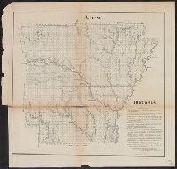
"M. Lewis Clark, Surveyor General.", Appears in Senate executive document 2, 31st Congress, 2nd session., and At head of title: (G).
Publisher:
s.n.,
Subject (Geographic):
Missouri--Maps
Subject (Name):
Clark, M. Lewis
Found in:
Beinecke Rare Book and Manuscript Library > Diagram of the state of Missouri : accompanying report of 20th Novr. 1850 / Office of the Surveyor General for Illinois and Missouri, St. Louis, 20th Novr. 1850.
Creator:
Published / Created:
1859
Call Number:
847 1859A
Container / Volume:
BRBL_00625
Image Count:
1
Resource Type:
Maps, Atlases & Globes
Alternative Title:
States . Congress . Senate) ; 36th Congress
Description:
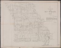
"Sen. Ex. Doc. No. 2, 1st session 36th Congress.", Relief shown by hachures., Shows surveys, reservations and trails., and Signed by Surveyor General.
Publisher:
Surveyor General's Office?],
Subject (Geographic):
Washington (State)--Maps
Subject (Name):
Bien, Julius, 1826-1909
Found in:
Beinecke Rare Book and Manuscript Library > Map of a part of Washington Territory : to accompany the report of the Surveyor General.
Creator:
Published / Created:
1866
Call Number:
844fcm 1866
Container / Volume:
BRBL_00615
Image Count:
1
Resource Type:
Maps, Atlases & Globes
Alternative Title:
House executive document (United States
Description:
"House R. Ex. Doc. No. 1, 38th Cong., 1st Sess.", Includes "List of private grants finally surveyed.", Relief shown by hachures., and Shows drainage, townships, railroads, mines, oil springs, land grants, etc.
Publisher:
Department of the Interior, General Land Office,
Subject (Geographic):
California--Maps and California--Surveys--Maps
Subject (Name):
Bien, Julius, 1826-1909
Subject (Topic):
Land grants--California--Maps and Mines and mineral resources--California--Maps
Found in:
Beinecke Rare Book and Manuscript Library > Map of public surveys in California & Nevada : to accompany report of Commissioner of the General Land Office, 1866.
Branch:v1.61.8 ,Deployed:2024-06-20T11:15:15-04:00