Search
You Searched For
Search Results
- Creator:
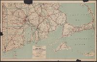
- Rand McNally and Company
- Published / Created:
- [1911]
- Call Number:
- 764 1911
- Container / Volume:
- BRBL_00453
- Image Count:
- 1
- Resource Type:
- Maps, Atlases & Globes
- Subject (Geographic):
- Massachusetts--Maps
- Subject (Topic):
- Railroads--Massachusetts--Maps
- Found in:
- Beinecke Rare Book and Manuscript Library > Massachusetts.
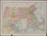
- Creator:
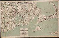
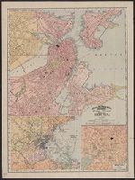
- Rand McNally and Company
- Published / Created:
- [1921]
- Call Number:
- 764 1921
- Container / Volume:
- BRBL_00453
- Image Count:
- 2
- Resource Type:
- Maps, Atlases & Globes
- Alternative Title:
- Standard map of Massachusetts
- Description:
- Verso: Rand McNally Main Highway map of
- Subject (Geographic):
- Massachusetts--Maps
- Subject (Topic):
- Railroads--Massachusetts--Maps
- Found in:
- Beinecke Rare Book and Manuscript Library > Rand McNally standard map of Massachusetts.
- Creator:
- Oliver, William T
- Published / Created:
- c1893.
- Call Number:
- 764gmb 1893
- Container / Volume:
- BRBL_00462
- Image Count:
- 10
- Resource Type:
- Maps, Atlases & Globes
- Subject (Geographic):
- Massachusetts--Maps
- Subject (Topic):
- Bicycle trails--Massachusetts--Maps
- Found in:
- Beinecke Rare Book and Manuscript Library > Cyclists' road map of Massachusetts / prepared expressly for the Mass. Div. L.A.W., by William T. Oliver.
- Creator:
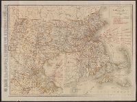
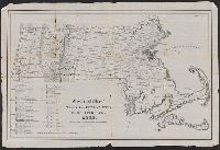
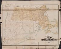
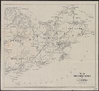
- Massachusetts. Board of Railroad Commissioners
- Published / Created:
- 1882
- Call Number:
- 764gme 1882
- Container / Volume:
- BRBL_00462
- Image Count:
- 1
- Resource Type:
- Maps, Atlases & Globes
- Subject (Geographic):
- Massachusetts--Maps
- Subject (Topic):
- Railroads--Massachusetts--Maps
- Found in:
- Beinecke Rare Book and Manuscript Library > Map of the railroads of the state of Massachusetts : accompanying the report of the Railroad Commissioners.
- Creator:
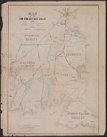
- Ferguson, W. E
- Published / Created:
- 1850
- Call Number:
- 764gme 1850
- Container / Volume:
- BRBL_00462
- Image Count:
- 1
- Resource Type:
- Maps, Atlases & Globes
- Subject (Topic):
- Railroads--Massachusetts--Maps
- Found in:
- Beinecke Rare Book and Manuscript Library > Map of the Old Colony Rail Road with its branches & connecting roads, prepared under the direction of the Committee of Investigation, Jany. 1850, S. Dwight Eaton, Engr.
- Creator:
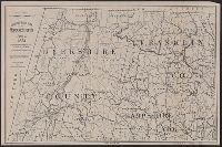
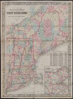
- Colton, G. Woolworth (George Woolworth), 1827-1901
- Published / Created:
- 1866, c1860.
- Call Number:
- 753 1866C
- Container / Volume:
- BRBL_00415
- Image Count:
- 1
- Resource Type:
- Maps, Atlases & Globes
- Subject (Geographic):
- Massachusetts--Maps
- Subject (Topic):
- Railroads--Massachusetts--Maps
- Found in:
- Beinecke Rare Book and Manuscript Library > G. Woolworth Colton's railroad, township & distance map of New England : with adjacent portions of New York, Canada & New Brunswick.
- Creator:
- Massachusetts. Board of Railroad Commissioners
- Published / Created:
- 1874
- Call Number:
- 764gme 1874
- Container / Volume:
- BRBL_00462
- Image Count:
- 1
- Resource Type:
- Maps, Atlases & Globes
- Subject (Geographic):
- Massachusetts--Maps
- Subject (Topic):
- Railroads--Massachusetts--Maps
- Found in:
- Beinecke Rare Book and Manuscript Library > Map of the railroads of the state of Massachusetts : accompanying the report of the railroad commissioners. 1874.
- Published / Created:
- [1833?]
- Call Number:
- 764CA 1833
- Container / Volume:
- BRBL_00460
- Image Count:
- 1
- Resource Type:
- Maps, Atlases & Globes
- Subject (Geographic):
- Massachusetts--Maps
- Found in:
- Beinecke Rare Book and Manuscript Library > Geological map of Massachusetts By Edw. D. Hitchcock 1833 ...
- Published / Created:
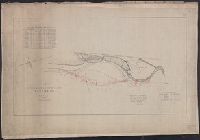
- [1886].
- Call Number:
- 764gme D86 1886
- Container / Volume:
- BRBL_00462
- Image Count:
- 1
- Resource Type:
- Maps, Atlases & Globes
- Subject (Geographic):
- Massachusetts--Maps
- Found in:
- Beinecke Rare Book and Manuscript Library > Location of the Providence, Webster, and Springfield Railroad Extension in Dudley [Massachusetts].
- Published / Created:
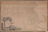
- 1801
- Call Number:
- 764FB 1801
- Container / Volume:
- BRBL_00462
- Image Count:
- 1
- Resource Type:
- Maps, Atlases & Globes
- Subject (Geographic):
- Massachusetts--Maps
- Found in:
- Beinecke Rare Book and Manuscript Library > Map of Massachusetts proper compiled from actual surveys made by Order of the General Court. And under the inspection of Agents of their Appointment. By Osgood Carleton.
- Published / Created:
- 1884
- Call Number:
- 764gme 1884
- Container / Volume:
- BRBL_00462
- Image Count:
- 1
- Resource Type:
- Maps, Atlases & Globes
- Subject (Geographic):
- Massachusetts--Maps
- Found in:
- Beinecke Rare Book and Manuscript Library > Map of the railroads of the state of Massachusetts : accompanying the report of the Railroad Commissioners.
- Published / Created:
- c1891
- Call Number:
- 764 P74 1891
- Container / Volume:
- BRBL_00459
- Image Count:
- 1
- Resource Type:
- Maps, Atlases & Globes
- Subject (Geographic):
- Massachusetts--Maps
- Found in:
- Beinecke Rare Book and Manuscript Library > Massachusetts atlas plate no. 6 [Southern Norfolk and Plymouth counties].
- Creator:
- Massachusetts. Metropolitan Park Commission
- Published / Created:
- 1908
- Call Number:
- 764 B65 1908
- Container / Volume:
- BRBL_00456
- Image Count:
- 1
- Resource Type:
- Maps, Atlases & Globes
- Subject (Geographic):
- Massachusetts--Maps
- Found in:
- Beinecke Rare Book and Manuscript Library > Plan for proposed park and parkways : from Charles River Reservation to West Roxbury Parkway connecting the northern and southern group of metropolitan parks.
- Published / Created:
- 1837
- Call Number:
- 764gme 1837
- Container / Volume:
- BRBL_00462
- Image Count:
- 2
- Resource Type:
- Maps, Atlases & Globes
- Subject (Geographic):
- Massachusetts--Maps
- Found in:
- Beinecke Rare Book and Manuscript Library > Route of the Western Rail Road ... Enlarged from the Map of the State.
- Published / Created:
- [1886?].
- Call Number:
- 764gme 1886
- Container / Volume:
- BRBL_00462
- Image Count:
- 2
- Resource Type:
- Maps, Atlases & Globes
- Subject (Geographic):
- Massachusetts--Maps
- Found in:
- Beinecke Rare Book and Manuscript Library > [Maps of the locations of the Providence, Webster, and Springfield Railroad Company within Massachusetts].
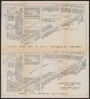
- Creator:
- Shurtleff, Arthur A. (Arthur Asahel), 1870-1957
- Published / Created:
- [1909]
- Call Number:
- 764 B65 1909E
- Container / Volume:
- BRBL_00456A
- Image Count:
- 1
- Resource Type:
- Maps, Atlases & Globes
- Subject (Topic):
- City planning--Massachusetts--Boston
- Found in:
- Beinecke Rare Book and Manuscript Library > [Boston, Mass., Cambridge Bridge to North Station : proposed redevelopment] / Arthur A. Shurtleff.
- Creator:
- Barnes, Oliver W
- Published / Created:
- 1868
- Call Number:
- 771 1868A
- Container / Volume:
- BRBL_00479
- Image Count:
- 1
- Resource Type:
- Maps, Atlases & Globes
- Subject (Geographic):
- Massachusetts--Maps
- Subject (Topic):
- Railroads--Massachusetts--Maps
- Found in:
- Beinecke Rare Book and Manuscript Library > Map of portions of New York and New England showing the routes of the Dutchess and Columbia & Connecticut Western Rail Roads / Oliver W. Barnes.
- Creator:
- Geological Survey (U.S.)
- Published / Created:
- 1921
- Call Number:
- 766gfb 1921
- Container / Volume:
- BRBL_00475
- Image Count:
- 1
- Resource Type:
- Maps, Atlases & Globes
- Subject (Topic):
- Electric lines--Massachusetts--Maps
- Found in:
- Beinecke Rare Book and Manuscript Library > Stations and transmission lines used in public service : [Massachusetts, Rhode Island and Connecticut] / Department of the Interior, U.S. Geological Survey ; compiled by G.D. Thomas.
- Published / Created:
- 1835
- Call Number:
- 764 B65 1835
- Container / Volume:
- BRBL_00455
- Image Count:
- 1
- Resource Type:
- Maps, Atlases & Globes
- Subject (Topic):
- City planning--Massachusetts--Boston
- Found in:
- Beinecke Rare Book and Manuscript Library > The South Cove territory, comprising every part which is coloured on this map.
- Creator:
- Rand McNally and Company
- Published / Created:
- 1909
- Call Number:
- 764 B65 1909M
- Container / Volume:
- BRBL_00456A
- Image Count:
- 2
- Resource Type:
- Maps, Atlases & Globes
- Description:
- On verso: Trolley maps of Massachusetts
- Subject (Geographic):
- Massachusetts--Maps
- Subject (Topic):
- --Massachusetts--Boston--Maps
- Found in:
- Beinecke Rare Book and Manuscript Library > Boston.
- Creator:
- Rand McNally and Company
- Published / Created:
- c1903.
- Call Number:
- 764 B65 1903
- Container / Volume:
- BRBL_00456
- Image Count:
- 1
- Resource Type:
- Maps, Atlases & Globes
- Subject (Topic):
- --Massachusetts--Boston--Maps
- Found in:
- Beinecke Rare Book and Manuscript Library > Boston.
- Creator:
- Rand McNally and Company
- Published / Created:
- 1907
- Call Number:
- 764 B65 1907A
- Container / Volume:
- BRBL_00456
- Image Count:
- 2
- Resource Type:
- Maps, Atlases & Globes
- Description:
- Verso: Trolley map of Massachusetts
- Subject (Geographic):
- Massachusetts--Maps
- Found in:
- Beinecke Rare Book and Manuscript Library > Boston.
- Creator:
- Barber, John Warner, 1798-1885
Brown, Samuel E., -approximately 1860
- Published / Created:
- 1839?]
- Call Number:
- 1977 2018
- Image Count:
- 21
- Subject (Geographic):
- Massachusetts --Maps
- Found in:
- Beinecke Rare Book and Manuscript Library > Dorr, Howland & Co., Worcester Mass. propose to publish by subscription, a work entitled Massachusetts historical collections : being a general collection of interesting facts, traditions, biographical sketches, anectdotes, etc. relating to the history and antiquities of every town in Massachusetts, with geographical descriptions / illustrated by a map and two hundred engravings ; by John Warner Barber.
- Creator:
- Hobbs, C. W
- Published / Created:
- 1901
- Call Number:
- 764 B65 1901
- Container / Volume:
- BRBL_00456
- Image Count:
- 2
- Resource Type:
- Maps, Atlases & Globes
- Subject (Geographic):
- Massachusetts--Maps
- Found in:
- Beinecke Rare Book and Manuscript Library > Guide map of Boston.
- Creator:
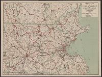
- C.S. Hammond & Company
- Published / Created:
- [1917].
- Call Number:
- 76gmb 1917
- Container / Volume:
- BRBL_00446
- Image Count:
- 1
- Resource Type:
- Maps, Atlases & Globes
- Subject (Geographic):
- Massachusetts--Maps
- Found in:
- Beinecke Rare Book and Manuscript Library > Hammond's new road map of Rhode Island and southeastern Massachusetts.
- Creator:
- C.S. Hammond & Company
- Published / Created:
- [1917].
- Call Number:
- 76gmb 1917
- Container / Volume:
- BRBL_00446
- Image Count:
- 1
- Resource Type:
- Maps, Atlases & Globes
- Subject (Geographic):
- Massachusetts--Maps
- Found in:
- Beinecke Rare Book and Manuscript Library > Hammond's new road map of Rhode Island and southeastern Massachusetts.
- Published / Created:
- 1917
- Call Number:
- 764gmb 1917
- Container / Volume:
- BRBL_00462
- Image Count:
- 1
- Resource Type:
- Maps, Atlases & Globes
- Subject (Geographic):
- Massachusetts--Maps
- Found in:
- Beinecke Rare Book and Manuscript Library > Hammonds New road map of eastern Massachusetts and southern New Hampshire.
- Creator:
- Walker Lith. & Pub. Co
- Published / Created:
- 1909
- Call Number:
- 764 B65 1909
- Container / Volume:
- BRBL_00456
- Image Count:
- 1
- Resource Type:
- Maps, Atlases & Globes
- Subject (Geographic):
- Massachusetts--Maps
- Found in:
- Beinecke Rare Book and Manuscript Library > Map of Boston proper.
- Creator:
- Brown, Charles D
- Published / Created:
- 1897
- Call Number:
- 764 G515 1897
- Container / Volume:
- BRBL_00457
- Image Count:
- 1
- Resource Type:
- Maps, Atlases & Globes
- Subject (Geographic):
- Massachusetts--Maps
- Found in:
- Beinecke Rare Book and Manuscript Library > Map of Gloucester & vicinity / published for Chas. D. Brown, Gloucester, Mass.
- Creator:
- Geo. H. Walker & Co
- Published / Created:
- 1893
- Call Number:
- 764 M32 1893
- Container / Volume:
- BRBL_00458
- Image Count:
- 1
- Resource Type:
- Maps, Atlases & Globes
- Subject (Geographic):
- Massachusetts--Maps
- Found in:
- Beinecke Rare Book and Manuscript Library > Map of Marblehead, Mass.
- Creator:
- Walker, Alexander
- Published / Created:
- c1889.
- Call Number:
- 764 W6752 1889
- Container / Volume:
- BRBL_00460
- Image Count:
- 1
- Resource Type:
- Maps, Atlases & Globes
- Subject (Geographic):
- Massachusetts--Maps
- Found in:
- Beinecke Rare Book and Manuscript Library > Map of Williamstown, Mass. / compiled from town records and surveys by Alexander Walker, C.E.
- Creator:
- Sampson, Murdock & Co
- Published / Created:
- 1910
- Call Number:
- 764 L43 1910
- Container / Volume:
- BRBL_00457
- Image Count:
- 1
- Resource Type:
- Maps, Atlases & Globes
- Subject (Geographic):
- Massachusetts--Maps
- Found in:
- Beinecke Rare Book and Manuscript Library > Map of the city of Lawrence and vicinity / by Sampson & Murdock Co.
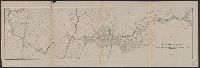
- Published / Created:
- 1877
- Call Number:
- 764 H76 1877
- Container / Volume:
- BRBL_00457
- Image Count:
- 1
- Resource Type:
- Maps, Atlases & Globes
- Subject (Geographic):
- Massachusetts--Maps
- Found in:
- Beinecke Rare Book and Manuscript Library > Profile of Hoosac Mountain showing tunnel, 1877.
- Creator:
- Rand McNally and Company
- Published / Created:
- c1891.
- Call Number:
- 764 B65 1891
- Container / Volume:
- BRBL_00456
- Image Count:
- 1
- Resource Type:
- Maps, Atlases & Globes
- Subject (Geographic):
- Massachusetts--Maps
- Found in:
- Beinecke Rare Book and Manuscript Library > Rand, McNally & Co.'s indexed atlas of the world map of Boston.
- Creator:
- Shurtleff, Arthur A. (Arthur Asahel), 1870-1957
- Published / Created:
- [1909]
- Call Number:
- 764 B65 1909D
- Container / Volume:
- BRBL_00456A
- Image Count:
- 1
- Resource Type:
- Maps, Atlases & Globes
- Subject (Topic):
- City planning--Massachusetts--Boston
- Found in:
- Beinecke Rare Book and Manuscript Library > [Boston, Mass., Providence R.R. property : proposed redevelopment] / Arthur A. Shurtleff.
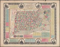
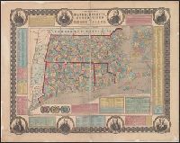
- Creator:
- Ensign, Bridgman & Fanning
- Published / Created:
- 1855
- Call Number:
- 76 1855
- Container / Volume:
- BRBL_00445
- Image Count:
- 1
- Resource Type:
- Maps, Atlases & Globes
- Subject (Geographic):
- Massachusetts--Maps
- Subject (Topic):
- Cities and towns--Massachusetts--Maps
- Found in:
- Beinecke Rare Book and Manuscript Library > Township map of Massachusetts, Connecticut and Rhode Island.
- Creator:
- E.P. Dutton (Firm)
- Published / Created:
- 1865
- Call Number:
- 764 B65 1865
- Container / Volume:
- BRBL_00455
- Image Count:
- 1
- Resource Type:
- Maps, Atlases & Globes
- Subject (Geographic):
- Massachusetts--Maps
- Found in:
- Beinecke Rare Book and Manuscript Library > Chart of Boston Harbor and Massachusetts Bay : with map of the adjacent country / published at the Boston Map Store.
- Published / Created:
- 1781
- Call Number:
- 764cea C17 1781
- Container / Volume:
- BRBL_00461
- Image Count:
- 1
- Resource Type:
- Maps, Atlases & Globes
- Subject (Geographic):
- Massachusetts--Maps--Early works to
- Found in:
- Beinecke Rare Book and Manuscript Library > [A chart of the harbours of Hampton, Newbury, Ipswick, Jebeka, Squam, Cape Ann, Manchester, Beverly, Salem, Marblehead &c. Surveyed by Samuel Holland.
- Creator:
- Aitken, Robert, 1735-1802
- Published / Created:
- 1775]
- Call Number:
- 764 B65 1775N
- Container / Volume:
- BRBL_00455
- Image Count:
- 1
- Resource Type:
- Maps, Atlases & Globes
- Subject (Topic):
- Fortification--Massachusetts--Boston
- Found in:
- Beinecke Rare Book and Manuscript Library > A new and correct plan of the town of Boston.
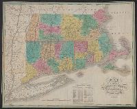
- Published / Created:
- 1825
- Call Number:
- 76 1825A
- Container / Volume:
- BRBL_00444
- Image Count:
- 1
- Resource Type:
- Maps, Atlases & Globes
- Subject (Geographic):
- Massachusetts--Maps.
- Found in:
- Beinecke Rare Book and Manuscript Library > Map of Massachusetts Connecticut and Rhode Island [cartographic material] : constructed from the latest authorities. 1825. / Drawn by D.H. Vance. Engraved by J.H. Young.
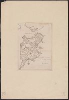
- Published / Created:
- 1753
- Call Number:
- 764 G297 1753
- Container / Volume:
- BRBL_00710
- Image Count:
- 1
- Resource Type:
- Maps, Atlases & Globes
- Subject (Geographic):
- Massachusetts--Maps, Manuscript--Early
- Found in:
- Beinecke Rare Book and Manuscript Library > Plan of George's Island [in Boston Harbor].
- Published / Created:
- 1764
- Call Number:
- 764 1764
- Container / Volume:
- BRBL_00710
- Image Count:
- 1
- Resource Type:
- Maps, Atlases & Globes
- Subject (Geographic):
- Massachusetts--Maps, Manuscript--Early
- Found in:
- Beinecke Rare Book and Manuscript Library > [Manuscript map of the Western boundaries of Massachusetts] sworn this line has bin measured this year 1764 ... a true copy N. Dwight. Saml. Messinger surveyor.
- Creator:
- Geo. W. Stadly & Co., cartographer
- Published / Created:
- ©1896.
- Call Number:
- 764 B65 +1896
- Image Count:
- 1
- Resource Type:
- Maps, Atlases & Globes
- Subject (Topic):
- --Massachusetts--Boston--Maps
- Found in:
- Beinecke Rare Book and Manuscript Library > Map of the Central Business District of Boston [cartographic material] / from actual surveys and official plans.
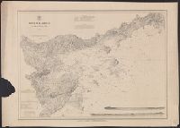
- Creator:
- United States Coast Survey
- Published / Created:
- [1875]
- Call Number:
- 764cea SA32 1875
- Container / Volume:
- BRBL_00461
- Image Count:
- 1
- Resource Type:
- Maps, Atlases & Globes
- Subject (Topic):
- Harbors--Massachusetts--Salem--Maps
- Found in:
- Beinecke Rare Book and Manuscript Library > Salem harbor, Massachusetts / United States Coast Survey ; topography by F. Dankworth ; sand by H.M. Knight ; lettering by J. Knight & S.E. Stull ; views by G. McCoy.
- Published / Created:
- 1889?].
- Call Number:
- 764 B65 1889A
- Container / Volume:
- BRBL_00456
- Image Count:
- 1
- Resource Type:
- Maps, Atlases & Globes
- Subject (Geographic):
- Massachusetts--Boston--Maps
- Found in:
- Beinecke Rare Book and Manuscript Library > Boston and adjacent cities.
- Creator:
- Johnson, A. J. (Alvin Jewett), 1827-1884
- Published / Created:
- [1866?]
- Call Number:
- 76 1866
- Container / Volume:
- BRBL_00445
- Image Count:
- 2
- Resource Type:
- Maps, Atlases & Globes
- Subject (Topic):
- Counties--Massachusetts--Maps
- Found in:
- Beinecke Rare Book and Manuscript Library > Johnson's Vermont, New Hampshire, Massachusetts, Rhode Island, and Connecticut.
- Creator:
- Jocelyn, N
- Published / Created:
- 1828
- Call Number:
- 767gma 1828
- Container / Volume:
- BRBL_00476
- Image Count:
- 1
- Resource Type:
- Maps, Atlases & Globes
- Subject (Geographic):
- /Massachusetts)--Maps
- Found in:
- Beinecke Rare Book and Manuscript Library > Map exhibiting the Farmington & Hampshire & Hampden canals [map] : together wth the line of their proposed continuation through the Valley of the Connecticut River to Canada / engraved ... by N. & S.S. Jocelyn.
- Creator:
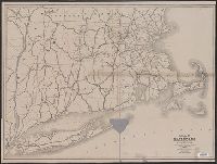
- American Automobile Association
- Published / Created:
- c1917.
- Call Number:
- 76gmb 1917A
- Container / Volume:
- BRBL_00446
- Image Count:
- 2
- Resource Type:
- Maps, Atlases & Globes
- Subject (Geographic):
- Massachusetts--Maps
- Found in:
- Beinecke Rare Book and Manuscript Library > Lower New England / prepared by Touring Information Board American Automobile Association.
- Creator:
- Nicholson, Walter L
- Published / Created:
- 19--?].
- Call Number:
- 76GMD 1866
- Container / Volume:
- BRBL_00446A
- Image Count:
- 1
- Resource Type:
- Maps, Atlases & Globes
- Subject (Topic):
- Postal service--Massachusetts--Maps
- Found in:
- Beinecke Rare Book and Manuscript Library > Post route map [of the states of] New Hampshire, Vermont, Massachusetts, Rhode Island, Connecticut, and parts of New York and Maine / designed and constructed under the orders of Postmaster General Wm. Dennison and Second Ass't Postmaster Gen'l Geo. Wm. M