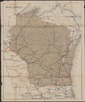
Atlas accompanying geological survey of Wisconsin. and Geology of Wisconsin. Survey of 1873-1879.
Description:
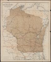
Accompanies: Geology of Wisconsin. Survey of 1873-1879. 4 v. ; 27 cm., Cover title: Atlas accompanying ... geological survey of Wisconsin., Imperfect: library has only plates 3, 4, 5, 6, and 7 (Moses Strong) and plates 3 and 9 (T.C., and Includes cross-sections.
Publisher:
Wisconsin Geological Survey,
Subject (Geographic):
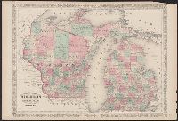
Wisconsin--Maps
Subject (Name):
Chamberlin, Thomas C. (Thomas Chrowder), 1843-1928, Irving, Roland Duer, 1847-1888, Milwaukee Lith. & Engr. Co, and Strong, Moses, 1846-1877
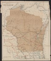
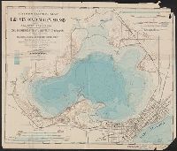
"Entered according to Act of Congress in the Year 1864, by A.J. Johnson in the Clerks Office of the District Court of the United States for the Southern District of New York.", In upper margins: 56, 57., and Includes notes on elevation, water depths, and area in square miles in selected parts of map.
At head of cover-title: no.8., Explanation of map on 2d and 4th pages of cover., and Scale 3 1/16 inches to a mile; 1 15/16 inches to 1,000 meters. Contour interval of the hydrography=5 ft. Contour interval of the topography=10 ft. Datum plane is lake level.
Subject (Name):
Smith, Leonard Sewall, 1864- and Wisconsin. University
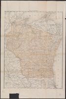
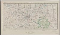
"Work Projects Administration project. Prepared under the direction of the Chief of Engineers, U.S. Army, by Engineer Reproduction Plant, the Army War College.", Coverage includes portions of Minnesota and Wisconsin., and Shows up to 7 classes of roads, 3 classes of railroads, and 4 classes of airfields.
Publisher:
Army Map Service,
Subject (Geographic):
Wisconsin--Maps
Subject (Name):
United States. Army Map Service and United States. Work Projects Administration
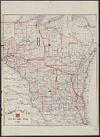
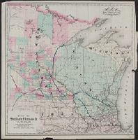
Company changed name to Southern Minnesota Railroad Company in 1857; reorg. 1877 as Southern Minnesota Railway Company (source: LC auth. record)., Prime meridians: Greenwich and Washington., and Shows routes primarily in Minnesota and Wisconsin.