Search
You Searched For
Search Results
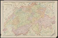
- Creator:
- Germany. Heer. Abteilung für Kriegskarten- und Vermessungswesen. IV. Mil.-Geo
- Published / Created:
- 1942
- Call Number:
- 32 M312 1942
- Container / Volume:
- BRBL_00052
- Image Count:
- 14
- Resource Type:
- Maps, Atlases & Globes
- Found in:
- Beinecke Rare Book and Manuscript Library > Manchester.
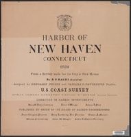
- Published / Created:
- 1876
- Call Number:
- 766cea N46 1876
- Container / Volume:
- BRBL_00474
- Image Count:
- 15
- Resource Type:
- Maps, Atlases & Globes
- Found in:
- Beinecke Rare Book and Manuscript Library > Harbor of New Haven, Connecticut.
- Creator:
- International Boundary Commission
- Published / Created:
- 1952]
- Call Number:
- 848fab 1951
- Container / Volume:
- BRBL_00635
- Image Count:
- 15
- Resource Type:
- Maps, Atlases & Globes
- Found in:
- Beinecke Rare Book and Manuscript Library > Joint maps of the international boundary between United States and Canada from Cape Muzon to Mount St. Elias.
- Published / Created:
- 1853
- Call Number:
- 3627 1853
- Container / Volume:
- BRBL_00139
- Image Count:
- 15
- Resource Type:
- Maps, Atlases & Globes
- Found in:
- Beinecke Rare Book and Manuscript Library > Uebersichtskarte Königsreiches Bayern : diessseits des Rheins in 15 Blättern, im Maassstabe Terrainkarte 1:250000 \ gefertigt im topographischen Bureau des k. Generalquartiermeisterstabes in den Jahren 1849-1853.
- Creator:
- Sanborn Map Company
- Published / Created:
- June, 1919.
- Call Number:
- 776 D75 1919
- Container / Volume:
- BRBL_00502
- Image Count:
- 15
- Resource Type:
- Maps, Atlases & Globes
- Found in:
- Beinecke Rare Book and Manuscript Library > Dover, Kent County, Delaware.
- Creator:
- Chishitsu Chōsajo (Japan)
- Published / Created:
- 1899
- Call Number:
- 57 1899A
- Container / Volume:
- BRBL_00302
- Image Count:
- 15
- Resource Type:
- Maps, Atlases & Globes
- Found in:
- Beinecke Rare Book and Manuscript Library > Topographical map of the Japanese Empire, 1899 / Imperial Geological Survey of Japan ; drawn by T. Togawa and K. Suzuki ; engraved by N. Matsudaira.
- Call Number:
- 766 N46 1917
- Container / Volume:
- BRBL_00473A
- Image Count:
- 15
- Resource Type:
- Maps, Atlases & Globes
- Found in:
- Beinecke Rare Book and Manuscript Library > [City of New Haven] 1913-1917.
- Creator:
- Sanborn Map Company
- Published / Created:
- Nov. 1919.
- Call Number:
- 776 M59 1919
- Container / Volume:
- BRBL_00502
- Image Count:
- 15
- Resource Type:
- Maps, Atlases & Globes
- Found in:
- Beinecke Rare Book and Manuscript Library > Milford, Kent and Sussex Co., Delaware.
- Published / Created:
- 1878
- Call Number:
- 32 L84 1741A
- Container / Volume:
- BRBL_00048
- Image Count:
- 16
- Resource Type:
- Maps, Atlases & Globes
- Found in:
- Beinecke Rare Book and Manuscript Library > Environs of London By John Rocque 1741-1745. London, 1746-63.
- Creator:
- United States. Congress. House. Committee on the Public Lands
- Published / Created:
- [1878?].
- Call Number:
- 75 1878
- Container / Volume:
- BRBL_00406
- Image Count:
- 16
- Resource Type:
- Maps, Atlases & Globes
- Found in:
- Beinecke Rare Book and Manuscript Library > 1876 Centennial map of the United States and territories : showing the extent of public surveys, indian and military reservations, land grant R.R. rail roads, canals, cities, towns & other details / compiled from the official surveys of the General Land O
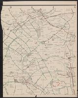
- Creator:
- Allied Forces
Great Britain. War Office. General Staff. Geographical Section
- Published / Created:
- 1943-
- Call Number:
- 11hd 1942D-44
- Image Count:
- 14
- Resource Type:
- Maps, Atlases & Globes
- Found in:
- Beinecke Rare Book and Manuscript Library > Central Europe 1:100,000.
- Creator:
- Dépôt de la guerre (France)
- Published / Created:
- 1837-1869.
- Call Number:
- 38 1848
- Container / Volume:
- BRBL_00755-759
- Image Count:
- 14
- Resource Type:
- Maps, Atlases & Globes
- Found in:
- Beinecke Rare Book and Manuscript Library > [Carte de France de l'Etat-Major] / levée par les Officiers du Corps d'Etat-Major ... gravée et publiée par le Dépôt de la Guerre.
- Creator:
- Rocque, John, -1762.
- Published / Created:
- 1746
- Call Number:
- 2002 Folio 94
- Image Count:
- 16
- Resource Type:
- Maps, Atlases & Globes
- Found in:
- Beinecke Rare Book and Manuscript Library > An exact survey of the city's of London and Westminster, ye borough of Southwark and the country near ten miles round : begun in 1741, finished in 1745, and published in 1746, according to act of Parliament / by John Rocque ; engrav'd by Richard Parr and printed by W. Pratt ... = Urbium maxime insignium Londini et Westmonasterii nec non municipii Sudovercencis, regionumque ad decem quasi milliaria circumjacentium : delineatio ichnographica anno 1741 incohata 1745 absoluta / a Johanne Rocque ... = Carte topographique des villes de Londres, Westminster, et bourg de Southwark et de leurs environs : levée très exactement sur les lieux, en 1741, achevée en 1745, et publieé selon un acte de Parlement en 1746 / par Jean Rocque.
- Published / Created:
- 1882
- Call Number:
- 812 1882
- Container / Volume:
- BRBL_00555
- Image Count:
- 16
- Resource Type:
- Maps, Atlases & Globes
- Found in:
- Beinecke Rare Book and Manuscript Library > Atlas of the geological survey of Wisconsin / T.C. Chamberlin, chief geologist ; R.D. Irving, Moses Strong, assistant geologists ; W.I.L. Nicodemus, topographical assistant ; T.B. Brooks ... [et al.], contributors.
- Creator:
- Jouvin, Albert, active 1672
- Published / Created:
- 1908
- Call Number:
- 38 P21 1675
- Image Count:
- 17
- Resource Type:
- Maps, Atlases & Globes
- Found in:
- Beinecke Rare Book and Manuscript Library > Paris vers 1675 [cartographic material] : grand plan de Paris et de ses environs / par Jouvin de Rochefort, dédié à Messire Simon Arnaud.
- Published / Created:
- [1750?]
- Call Number:
- 38cea 1750
- Container / Volume:
- BRBL_00169
- Image Count:
- 17
- Resource Type:
- Maps, Atlases & Globes
- Found in:
- Beinecke Rare Book and Manuscript Library > [North and East Coast of France].
- Creator:
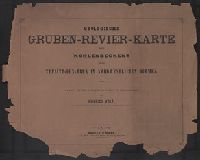
- Wolf, Heinrich, Geologe
- Published / Created:
- 1880
- Call Number:
- 435gbc 1880
- Container / Volume:
- BRBL_00763
- Image Count:
- 17
- Resource Type:
- Maps, Atlases & Globes
- Found in:
- Beinecke Rare Book and Manuscript Library > Geologische und Gruben-Revier-Karte des Kohlbeckens von Teplitz-Dux-Brüx / nach den neuesten Aufnahmen entworfen u. herausgegeben von Heinrich Wolf, k.k. Bergrath, Chef-Geolog der k.k. Geologischen Reichsanstalt in Wien.
- Creator:
- Hollar, Wenceslaus, 1607-1677.
- Call Number:
- 1980 458
- Image Count:
- 18
- Resource Type:
- Maps, Atlases & Globes
- Found in:
- Beinecke Rare Book and Manuscript Library > The kingdome of England & principality of Wales : exactly described whith euery sheere & the small townes in euery one of them, in six mappes, portable for euery mans pocket ... : vsefull for all gentlemen and travellors and all sorts of persons, that would be informed of the distance of places neuer so commodiously drawne before this, 1676, described by one that trauailed throughout the whole kingdome, for its purpose / W. Hollar, fecit.
- Published / Created:
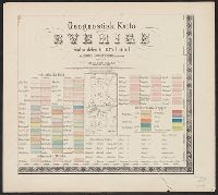
- 1838
- Call Number:
- 345ca 1838
- Container / Volume:
- BRBL_00097
- Image Count:
- 18
- Resource Type:
- Maps, Atlases & Globes
- Found in:
- Beinecke Rare Book and Manuscript Library > Geognostick Karta öfver Sverige, pa Bruks - Societetens anmodan, upprättad af J.H. af Forsselles under aren 1838-55. Lith. Inst. af J.F. Meyer & Co.,
- Creator:
- Wieser, Franz, Ritter von, 1848-1923
- Published / Created:
- [1870-1874]
- Call Number:
- BrSides 2019 102
- Image Count:
- 18
- Resource Type:
- Maps, Atlases & Globes
- Found in:
- Beinecke Rare Book and Manuscript Library > Generalstabs-Karte von Tirol / Dr. Franz Wieser.
- Published / Created:
- 1849]
- Call Number:
- 40 M72 1849
- Container / Volume:
- BRBL_00211
- Image Count:
- 12
- Resource Type:
- Maps, Atlases & Globes
- Found in:
- Beinecke Rare Book and Manuscript Library > Carta topografica del Ducato di Modena.
- Published / Created:
- [1800?]
- Call Number:
- 402 1800
- Container / Volume:
- BRBL_00705
- Image Count:
- 12
- Resource Type:
- Maps, Atlases & Globes
- Found in:
- Beinecke Rare Book and Manuscript Library > [Manuscript map of Lombardy]. Fratelli Bordiga inc.
- Creator:
- Cartes Taride (Firm)
- Published / Created:
- 1901-
- Call Number:
- Series 38gmb 1920
- Container / Volume:
- BRBL_00038B
- Image Count:
- 12
- Resource Type:
- Maps, Atlases & Globes
- Found in:
- Beinecke Rare Book and Manuscript Library > Carte routière pour automobilistes & cyclistes [cartographic material] : [France].
- Published / Created:
- 1788
- Call Number:
- 308 1788
- Container / Volume:
- BRBL_00036A
- Image Count:
- 12
- Resource Type:
- Maps, Atlases & Globes
- Found in:
- Beinecke Rare Book and Manuscript Library > Oesterreichisch-Russischturkischer Kriegs Atlas entworfen Von Herrn Abbé Max Schimek.
- Published / Created:
- [1692?]
- Call Number:
- 32 1692
- Container / Volume:
- BRBL_00042
- Image Count:
- 12
- Resource Type:
- Maps, Atlases & Globes
- Found in:
- Beinecke Rare Book and Manuscript Library > Angliae totius tabula cum distantius in itinerantium usum accomadata ... Philip Lea. Iohannes Adams ... descripsit. Thomas Burnford ... sculpsit.
- Published / Created:
- [1738]
- Call Number:
- BrSides Folio 2017 4
- Image Count:
- 12
- Resource Type:
- Maps, Atlases & Globes
- Found in:
- Beinecke Rare Book and Manuscript Library > The first [-twelfth] sheet of Chinese Tartary ...
- Creator:
- Morgan, William, -1690
- Published / Created:
- 1682] and 1904.
- Call Number:
- 32 L84 1682/1904
- Container / Volume:
- BRBL_00737
- Image Count:
- 12
- Resource Type:
- Maps, Atlases & Globes
- Found in:
- Beinecke Rare Book and Manuscript Library > London &c. actually surveyed, by Wm. Morgan, his ma[jes]ties cosmogr., 1681/2.
- Creator:
- Newcourt, Richard, d. 1679
- Published / Created:
- 1658. and 1905.
- Call Number:
- 32 L84 1658/1905
- Container / Volume:
- BRBL_00737
- Image Count:
- 12
- Resource Type:
- Maps, Atlases & Globes
- Found in:
- Beinecke Rare Book and Manuscript Library > An exact delineation of the cities of London and Westminster and the suburbs thereof, together wth. ye burrough of Sovthwark and all ye through-fares, highwaies, streetes, lanes & common allies wthin. ye same. Composed by a scale, and ichnographically described by Richard Newcovrt of Somerton in the countie of Somersett, gentleman. Willm. Faithorne, sculpsit.
- Published / Created:
- 1778]
- Call Number:
- 755 1778K
- Container / Volume:
- BRBL_00432
- Image Count:
- 12
- Resource Type:
- Maps, Atlases & Globes
- Found in:
- Beinecke Rare Book and Manuscript Library > Le Colonie Unite dell America Settentr.le ... / presso Antonio Zatta, Venezia 1778.
- Creator:
- Kip, Johannes, 1653-1722
- Published / Created:
- 1903
- Call Number:
- 32 L84 1720/1903
- Container / Volume:
- BRBL_00736
- Image Count:
- 12
- Resource Type:
- Maps, Atlases & Globes
- Found in:
- Beinecke Rare Book and Manuscript Library > A prospect of the city of London, Westminster and St. James Park = veue et perspective de la ville de Londre, Westminster et Parc St. Jacques / John Kip delineavit et sculpsit.
- Published / Created:
- [between 1733 and 1740]
- Call Number:
- 56 Fu1 18xx
- Image Count:
- 11
- Resource Type:
- Maps, Atlases & Globes
- Found in:
- Beinecke Rare Book and Manuscript Library > Haitan zuo you ying guan xia yu tu.
- Creator:
- Pissina, Giuseppe Antonio
- Published / Created:
- [1786]
- Call Number:
- BrSides Double Folio 2018 103
- Image Count:
- 11
- Resource Type:
- Maps, Atlases & Globes
- Found in:
- Beinecke Rare Book and Manuscript Library > Tipo dimostrativo delle acque, cavi, edificij, e fondi cadenti rapporto alle loro colature sotto il contratto di transazione sequito fra l'illmo. Sig. Marchese Cusani Livellario delle acque di Lunico, ed uniti della misericordia unitamente a ssri. Carpane
- Creator:
- Great Britain. Ordnance Survey
- Published / Created:
- 1920-21.
- Call Number:
- 32 1920B
- Container / Volume:
- BRBL_00745
- Image Count:
- 11
- Resource Type:
- Maps, Atlases & Globes
- Found in:
- Beinecke Rare Book and Manuscript Library > Ordnance Survey of Great Britain 1/4 inch to one mile.
- Creator:
- Jones, Lewis A
- Published / Created:
- 1915
- Call Number:
- 794gcf B48 1914
- Container / Volume:
- BRBL_00521
- Image Count:
- 11
- Resource Type:
- Maps, Atlases & Globes
- Found in:
- Beinecke Rare Book and Manuscript Library > A report on the methods and cost of reclaiming the overflowed lands along the Big Black River, Mississippi / by Lewis A. Jones ; assisted by W.J. Schlick and C.E. Ramser.
- Creator:
- Austro-Hungarian Monarchy. Militärgeographisches Institut
- Published / Created:
- 1869?]
- Call Number:
- 3564 1869
- Container / Volume:
- BRBL_00115
- Image Count:
- 11
- Resource Type:
- Maps, Atlases & Globes
- Found in:
- Beinecke Rare Book and Manuscript Library > General-Karte des Königreiches Galizien und des Herzogthumes Bukowina / herausgegeben vom k.k. militär-geographischen Institute im Jahre 1868.
- Published / Created:
- 1769
- Call Number:
- 32 1769
- Container / Volume:
- BRBL_00043
- Image Count:
- 11
- Resource Type:
- Maps, Atlases & Globes
- Found in:
- Beinecke Rare Book and Manuscript Library > England and Wales ... Engraved by Thos. Kitchin.
- Creator:
- Giunta, I.R
- Published / Created:
- 1847
- Call Number:
- 40 V55 1847C
- Container / Volume:
- BRBL_00225
- Image Count:
- 11
- Resource Type:
- Maps, Atlases & Globes
- Found in:
- Beinecke Rare Book and Manuscript Library > Mappa del comune censuario di Cannareggio : porzione della citta di Venezia, coll' Isola di S. Cristoforo e S. Michele, distretto I, provincia di Venezia, rettificata nell' anno 1842.
- Creator:
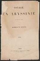
- Lejean, Guillaume, 1824-1871
- Published / Created:
- [1864?]
- Call Number:
- 62 1864
- Container / Volume:
- BRBL_00333
- Image Count:
- 11
- Resource Type:
- Maps, Atlases & Globes
- Found in:
- Beinecke Rare Book and Manuscript Library > Voyage en Abyssinie [cartographic material] : executé de 1862 a 1864 / par Guillaume Lejean.
- Published / Created:
- 1873
- Call Number:
- 11 1873
- Container / Volume:
- BRBL_00010
- Image Count:
- 11
- Resource Type:
- Maps, Atlases & Globes
- Found in:
- Beinecke Rare Book and Manuscript Library > Emisfero Oriental [and] Emisfero Occidentale. Ev. Azzi ... dis. e compilo. E. Bonatti ... corre. e completo.
- Published / Created:
- 1797]
- Call Number:
- 38 1797
- Container / Volume:
- BRBL_00153
- Image Count:
- 13
- Resource Type:
- Maps, Atlases & Globes
- Found in:
- Beinecke Rare Book and Manuscript Library > Carte geometrique des routes de postes de la Republique Francaise...
- Creator:
- Sanborn Map Company, issuing body
- Published / Created:
- 1931
- Call Number:
- 766 N472 1931
- Image Count:
- 11
- Resource Type:
- Maps, Atlases & Globes
- Found in:
- Beinecke Rare Book and Manuscript Library > New Milford, Litchfield County, Connecticut.
- Published / Created:
- [18--]
- Call Number:
- 11 1847A
- Image Count:
- 13
- Resource Type:
- Maps, Atlases & Globes
- Found in:
- Beinecke Rare Book and Manuscript Library > [Salisbury Collection of World Maps].
- Creator:
- Li, Mengquan (Cartographer), cartographer.
李蒙泉 (Cartographer), cartographer.
- Call Number:
- Covers 5626 +1880
- Image Count:
- 13
- Resource Type:
- Maps, Atlases & Globes
- Found in:
- Beinecke Rare Book and Manuscript Library > Su Sheng yu di ying wu quan tu / ji yong zhi xian Li Mengquan, Chen Jiaxun tong jian hua.
- Published / Created:
- [1940?-1941]
- Call Number:
- 42 1940
- Container / Volume:
- BRBL_00244
- Image Count:
- 13
- Resource Type:
- Maps, Atlases & Globes
- Found in:
- Beinecke Rare Book and Manuscript Library > [Topographical map of Austria. 1: 25,000].
- Published / Created:
- ca. 1810]
- Call Number:
- 38 V61 1810
- Container / Volume:
- BRBL_00166
- Image Count:
- 13
- Resource Type:
- Maps, Atlases & Globes
- Found in:
- Beinecke Rare Book and Manuscript Library > [La carte des environs de Versailles dite des Chasses du Roi] / gravé par Doudan, Bouclet et Tardieu l'ainé ; ecrit par Herault, Delahaye.
- Creator:
- Aa, Pieter van der, 1659-1733
- Published / Created:
- [1729?]
- Call Number:
- 1973 +32
- Image Count:
- 13
- Resource Type:
- Maps, Atlases & Globes
- Found in:
- Beinecke Rare Book and Manuscript Library > La galerie agreable du monde, ouíÛ l'on voit en un grand nombre de cartes tres-exactes et de belles tailles-douces, les principaux empires, roiíöaumes, republiques, provinces, villes, bourgs et forteresses ... dans les quatre parties de l'univers. Diviseí
- Published / Created:
- 1841
- Call Number:
- 36hc 1796
- Container / Volume:
- BRBL_00133
- Image Count:
- 13
- Resource Type:
- Maps, Atlases & Globes
- Found in:
- Beinecke Rare Book and Manuscript Library > Atlas Principes de la Strategie, par S.A.I. Le Prince Chartes, traduit de l'Allemand par le Général Jomini.
- Creator:
- Defoe, Daniel, 1661?-1731
- Published / Created:
- 1721-22.
- Call Number:
- Defoe 52 p721b
- Image Count:
- 13
- Resource Type:
- Books, Journals & Pamphlets
- Found in:
- Beinecke Rare Book and Manuscript Library > Het leven en de wonderbaare gevallen van Robinson Crusoe : behelzende onder andere ongehoorde uitkomsten een verhaal van zyn agt en twintig jaarig verblyf op een onbewoond eiland, gelegen op de kust van America by de mond van de rivier Oronooque. Alles door liem zelfs beschreven, nu uit het engels vertaald, en met figuren benevens een nette kaart zyner zwerving verrykt : Eerste [-derde] deel.
- Creator:
- Geo. W. Stadly & Co
- Published / Created:
- [186-?]
- Call Number:
- 754hc 1862C
- Container / Volume:
- BRBL_00421
- Image Count:
- 13
- Resource Type:
- Maps, Atlases & Globes
- Found in:
- Beinecke Rare Book and Manuscript Library > [13 maps showing positions of the Union and Confederate armies during the year 1862] / drawn and printed by Geo. W. Stadly & Co.
- Published / Created:
- [1920?]
- Call Number:
- 515 1920
- Container / Volume:
- BRBL_00707
- Image Count:
- 13
- Resource Type:
- Maps, Atlases & Globes
- Found in:
- Beinecke Rare Book and Manuscript Library > [Manuscript maps showing ruin sites etc. in the Transjordan and adjacent areas].
- Creator:
- Cartes Taride (Firm)
- Published / Created:
- 1901-
- Call Number:
- Series 38gmb 1920
- Container / Volume:
- BRBL_00038A
- Image Count:
- 20
- Resource Type:
- Maps, Atlases & Globes
- Found in:
- Beinecke Rare Book and Manuscript Library > Carte routière pour automobilistes & cyclistes [cartographic material] : [France].
- Published / Created:
- 1888
- Call Number:
- 32 Ox1 1768
- Container / Volume:
- BRBL_00052A
- Image Count:
- 20
- Resource Type:
- Maps, Atlases & Globes
- Found in:
- Beinecke Rare Book and Manuscript Library > Sixteen Old Maps of Properties in Oxfordshire (with one in Berkshire) ... Illustrating the open field system. 1605-1768.
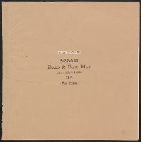
- Creator:
- Assam (India). Survey Office
- Published / Created:
- [1943?]
- Call Number:
- 59gm As72 1943
- Container / Volume:
- BRBL_00319
- Image Count:
- 21
- Resource Type:
- Maps, Atlases & Globes
- Found in:
- Beinecke Rare Book and Manuscript Library > Map of Assam showing roads & railways
- Creator:
- Dripps, M. (Matthew)
- Published / Created:
- 1868
- Call Number:
- 771 N49 1868D
- Container / Volume:
- BRBL_00487
- Image Count:
- 21
- Resource Type:
- Maps, Atlases & Globes
- Found in:
- Beinecke Rare Book and Manuscript Library > Plan of New York City from the Battery to Spuyten Duyvil Creek : showing every lot and building thereon; old farm lines, street numbers at the corners of blocks, railroads, steamboat landings, bulkhead and pier lines, etc., etc., etc. / based on the surve
- Creator:
- Woerl, Joseph Edmund, creator
- Call Number:
- 37 1835
- Container / Volume:
- BRBL_00148
- Image Count:
- 19
- Resource Type:
- Maps, Atlases & Globes
- Found in:
- Beinecke Rare Book and Manuscript Library > Karte der Schweiz / von Dr. I. Woerl.
- Creator:
- King, Nicholas, d. 1812
- Published / Created:
- [1888]
- Call Number:
- 779 W27 1803
- Container / Volume:
- BRBL_00505
- Image Count:
- 19
- Resource Type:
- Maps, Atlases & Globes
- Found in:
- Beinecke Rare Book and Manuscript Library > The King plats of the city of Washington in the District of Columbia 1803.
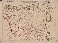
- Creator:
- Maury, Matthew Fontaine, 1806-1873
- Published / Created:
- [1847?]-1853.
- Call Number:
- 11cfk 1850A-3
- Container / Volume:
- BRBL_00768
- Image Count:
- 4
- Resource Type:
- Maps, Atlases & Globes
- Found in:
- Beinecke Rare Book and Manuscript Library > Wind and current chart of the South Atlantic [cartographic material] / by M.F. Maury, L.L.D.U.S. Navy, Superindt. of U.S.N. Observatory ; compiled from materials in the Bureau of Ordnance and Hydrography, Commodore Charles Morris, Chief of Bureau.
- Creator:
- Maury, Matthew Fontaine, 1806-1873
- Published / Created:
- 1852
- Call Number:
- 11cfk 1850D-2
- Container / Volume:
- BRBL_00773
- Image Count:
- 4
- Resource Type:
- Maps, Atlases & Globes
- Found in:
- Beinecke Rare Book and Manuscript Library > Wind and current chart of the South Atlantic [cartographic material] / by M.F. Maury, L.L.D. Lieut. U.S. Navy, Superint'dt. of U.S.N. Observatory ; compiled from materials in the Bureau of Ordnance and Hydrography, Commodore Charles Morris, Chief of Bureau.
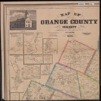
- Creator:
- Walling, Henry Francis, 1825-1888
- Published / Created:
- 1858, c1856.
- Call Number:
- 763 Or1 1858
- Container / Volume:
- BRBL_00452
- Image Count:
- 4
- Resource Type:
- Maps, Atlases & Globes
- Found in:
- Beinecke Rare Book and Manuscript Library > Map of Orange County, Vermont / from surveys under the direction of H.F. Walling ; engraved, printed, colored & mounted at H.F. Walling's map establishment.
- Published / Created:
- 1652?]
- Call Number:
- 11 1652
- Container / Volume:
- BRBL_00732
- Image Count:
- 4
- Resource Type:
- Maps, Atlases & Globes
- Found in:
- Beinecke Rare Book and Manuscript Library > Tabvla itineraria ex illustri Peutingerorum, bibliotheca quae Augustae Vindelicorum / beneficio Marci Velseri, septem-viri Augustani in lucem edita.
- Creator:
- Geological Survey (U.S.)
- Published / Created:
- 193-?]
- Call Number:
- 71 1755Q
- Container / Volume:
- BRBL_00364
- Image Count:
- 4
- Resource Type:
- Maps, Atlases & Globes
- Found in:
- Beinecke Rare Book and Manuscript Library > The Mitchell map of the British and French dominions in North America, 1755.
- Published / Created:
- [1790]
- Call Number:
- 352 K125 1790
- Container / Volume:
- BRBL_00702
- Image Count:
- 4
- Resource Type:
- Maps, Atlases & Globes
- Found in:
- Beinecke Rare Book and Manuscript Library > Plan von Königsberg Hauptstadt vom Königreich Preussen.
- Creator:
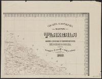
- Mexico. Comisión Geográfico-Exploradora
- Published / Created:
- 1920
- Call Number:
- 8861 1908
- Container / Volume:
- BRBL_00655
- Image Count:
- 4
- Resource Type:
- Maps, Atlases & Globes
- Found in:
- Beinecke Rare Book and Manuscript Library > Carta general del Estado de Tlaxcala / levantada á iniciativa del Sr. Secretario de Fomento, Lic. Olegario Molina, por la Comisión Geográfico-Exploradora.
- Published / Created:
- 1952
- Call Number:
- 281 1883
- Container / Volume:
- BRBL_00024
- Image Count:
- 4
- Resource Type:
- Maps, Atlases & Globes
- Found in:
- Beinecke Rare Book and Manuscript Library > Isla de Luzon y sus adjacentes / por D. Enrique d'Almonte y Muriel.
- Creator:
- Carvalho, Filipe Carlos Dias de
- Published / Created:
- 1914
- Call Number:
- 636 1914
- Container / Volume:
- BRBL_00337
- Image Count:
- 4
- Resource Type:
- Maps, Atlases & Globes
- Found in:
- Beinecke Rare Book and Manuscript Library > Carta do distrito de Quelimane (esboço) / elaborado pelo governador do distrito, Filipe Carlos Dias de Carvalho.
- Creator:
- Maury, Matthew Fontaine, 1806-1873
- Published / Created:
- 1852-[1859?]
- Call Number:
- 11cfk 1850A-2
- Container / Volume:
- BRBL_00767
- Image Count:
- 4
- Resource Type:
- Maps, Atlases & Globes
- Found in:
- Beinecke Rare Book and Manuscript Library > Maury's wind and current chart [cartographic material] : South Pacific / drawn by Lardner Gibbon, P.M. U.S.N.
- Published / Created:
- 1870
- Call Number:
- 774 1870H
- Container / Volume:
- BRBL_00730
- Image Count:
- 4
- Resource Type:
- Maps, Atlases & Globes
- Found in:
- Beinecke Rare Book and Manuscript Library > A map of the province of Pennsilvania ... / by Thomas Holme ...
- Published / Created:
- [19--]
- Call Number:
- 30f 1914
- Container / Volume:
- BRBL_00037B
- Image Count:
- 4
- Resource Type:
- Maps, Atlases & Globes
- Found in:
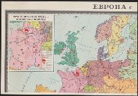
- Beinecke Rare Book and Manuscript Library > [Europe in 1870-1914].
- Creator:
- Wood, M. O
- Published / Created:
- 1911
- Call Number:
- 771 Ad47 1911
- Container / Volume:
- BRBL_00480
- Image Count:
- 4
- Resource Type:
- Maps, Atlases & Globes
- Found in:
- Beinecke Rare Book and Manuscript Library > Map of the Adirondack Forest and adjoining territory / compiled from maps and field notes on file in the state departments at Albany, N.Y., and from the topographical sheets of the U.S. Geological Survey by M.O. Wood, C.E., and Glenn S. Smith, topographer
- Creator:
- Austro-Hungarian Monarchy. Militärgeographisches Institut
- Published / Created:
- 1882-1886.
- Call Number:
- 304 1886
- Container / Volume:
- Series Box 1
- Image Count:
- 4
- Resource Type:
- Maps, Atlases & Globes
- Found in:
- Beinecke Rare Book and Manuscript Library > Übersichts-Karte von Mittel-Europa, im Masse 1:750.000 der Natur / bearbeitet und herausgegeben vom K.K. Militär-geographischen Institute.
- Creator:
- Visscher, Claes Jansz., 1586 or 1587-1652
- Published / Created:
- 1616. and 1883-1885.
- Call Number:
- 32 L84 1616/1883
- Container / Volume:
- BRBL_00736
- Image Count:
- 4
- Resource Type:
- Maps, Atlases & Globes
- Found in:
- Beinecke Rare Book and Manuscript Library > London. Visscher delineavit.
- Creator:
- Maury, Matthew Fontaine, 1806-1873
- Published / Created:
- 1852
- Call Number:
- 11cfk 1850F
- Container / Volume:
- BRBL_00774
- Image Count:
- 4
- Resource Type:
- Maps, Atlases & Globes
- Found in:
- Beinecke Rare Book and Manuscript Library > Whale chart of the world [cartographic material] / by M.F. Maury, L.L.D. Lieut. U.S. Navy, superin'dt. of U.S.N. Observatory ; compiled from materials in the Bureau of Ordnance and Hydrography by P.M. A.C. Jackson.
- Creator:
- Lotter, Matthäus Albrecht, 1741-1810
- Published / Created:
- 1784
- Call Number:
- 71 1784L
- Container / Volume:
- BRBL_00726
- Image Count:
- 4
- Resource Type:
- Maps, Atlases & Globes
- Found in:
- Beinecke Rare Book and Manuscript Library > A new and correct map of North America with the West India Islands : divided according to the last Treaty of Peace, concluded at Paris the 20th of Jan. 1783, wherein are particularly distinguished the Thirteen Provinces wich [sic] compose the United State
- Creator:
- Bien, Joseph R
- Published / Created:
- 1902
- Call Number:
- 766 1902
- Container / Volume:
- BRBL_00467
- Image Count:
- 4
- Resource Type:
- Maps, Atlases & Globes
- Found in:
- Beinecke Rare Book and Manuscript Library > The standard map of Connecticut / prepared under the direction of Joseph R. Bien, E.M., from original surveys and the triangulations and surveys of the U.S. Geological Survey and U.S. Coast and Geodetic Survey.
- Published / Created:
- 1902
- Call Number:
- 771 Ad47 1902
- Container / Volume:
- BRBL_00480
- Image Count:
- 4
- Resource Type:
- Maps, Atlases & Globes
- Found in:
- Beinecke Rare Book and Manuscript Library > Map of the Adirondack Forest and adjoining territory / compiled from the official maps and field notes on file in the state departments at Albany, N.Y. ; by authority of the Forest, Fish, and Game Commission.
- Published / Created:
- 1919 Nov 18
- Call Number:
- WA MSS S-1326
- Collection Title:
- Ernest Howe papers
- Container / Volume:
- BSD | Folder 269
- Image Count:
- 4
- Resource Type:
- Maps, Atlases & Globes
- Found in:
- Beinecke Rare Book and Manuscript Library > Oriental Mine report by Robert Bedford, maps
- Creator:
- Tanner, Henry Schenck, 1786-1858
- Published / Created:
- [1822 or 1823]
- Call Number:
- 71 1822
- Container / Volume:
- BRBL_00369
- Image Count:
- 4
- Resource Type:
- Maps, Atlases & Globes
- Found in:
- Beinecke Rare Book and Manuscript Library > A map of North America : constructed according to the latest information / engraved & published by H.S. Tanner, Philadelphia 1822.
- Published / Created:
- [1911?]
- Call Number:
- 32 1911
- Container / Volume:
- BRBL_00045
- Image Count:
- 4
- Resource Type:
- Maps, Atlases & Globes
- Found in:
- Beinecke Rare Book and Manuscript Library > Michelin Map of Great Britain.
- Creator:
- Maury, Matthew Fontaine, 1806-1873
- Published / Created:
- 1852
- Call Number:
- 11cfk 1850D-2
- Container / Volume:
- BRBL_00773
- Image Count:
- 4
- Resource Type:
- Maps, Atlases & Globes
- Found in:
- Beinecke Rare Book and Manuscript Library > Wind and current chart of the South Atlantic [cartographic material] / by M.F. Maury, L.L.D. Lieut. U.S. Navy, Superint'dt. of U.S.N. Observatory ; compiled from materials in the Bureau of Ordnance and Hydrography, Commodore Charles Morris, Chief of Bureau.
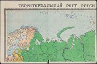
- Creator:
- Soviet Union. Glavnoe upravlenie geodezii i kartografii
Soviet Union. Главное управление геодезии и картографии
- Published / Created:
- [1962]
- Call Number:
- 35j 1914
- Container / Volume:
- BRBL_00103
- Image Count:
- 4
- Resource Type:
- Maps, Atlases & Globes
- Found in:
- Beinecke Rare Book and Manuscript Library > Territorialʹnyĭ rost Rossiĭskoĭ imperii s 1700 po 1914 g. / sostavleno Nauchno-redakt︠s︡ionnoĭ kartosostavitelʹskoĭ chastʹi︠u︡ GUGK ; otvetstvennyĭ redaktor--Kuchborskai︠a︡ E.P. ; tekhnicheskiĭ redaktor--Bukhanova N.I.
- Creator:
- Maury, Matthew Fontaine, 1806-1873
- Published / Created:
- 1850
- Call Number:
- 11cfk 1850D-1
- Container / Volume:
- BRBL_00773
- Image Count:
- 4
- Resource Type:
- Maps, Atlases & Globes
- Found in:
- Beinecke Rare Book and Manuscript Library > Wind and current chart of the North Atlantic [cartographic material] : thermal sheet / by M.F. Maury, A.M. Lieut. U.S. Navy, Superint'dt. of U.S.N. Observatory ; compiled from materials in the Bureau of Ordnance and Hydrography, Commodore Lewis Warrington, Chief of Bureau ; drawn by Lt. Benjn. S. Gantt, U.S.N.
- Published / Created:
- [1813]
- Call Number:
- 774 M193 1813
- Container / Volume:
- BRBL_00714
- Image Count:
- 4
- Resource Type:
- Maps, Atlases & Globes
- Found in:
- Beinecke Rare Book and Manuscript Library > [Manuscript map of McKean County].
- Creator:
- Istituto geografico militare (Italy)
- Published / Created:
- 1912
- Call Number:
- 69 1912
- Container / Volume:
- BRBL_00352
- Image Count:
- 4
- Resource Type:
- Maps, Atlases & Globes
- Found in:
- Beinecke Rare Book and Manuscript Library > Levate topografiche al 25 000 dei dintorni di Tripoli [cartographic material] / rilievo eseguito dal personale dell'Istituto geografico militare messo a disposizione del Comando del Corpo d'occupazione.
- Creator:
- Rizzi-Zannoni, Giovanni Antonio, 1736-1814, cartographer
- Published / Created:
- 1795
- Call Number:
- 402 1795
- Container / Volume:
- BRBL_00233
- Image Count:
- 4
- Resource Type:
- Maps, Atlases & Globes
- Found in:
- Beinecke Rare Book and Manuscript Library > Nuova carta della Lombardia e delle sue regioni aggiacenti / formata d'ordine di S.M. Siciliana dal Reg. Geogr. G.A. Rizzi-Zannoni ; Gius. Guerra Nap. Reg. inc.
- Published / Created:
- 1884]
- Call Number:
- 32ex Ab97 1884
- Container / Volume:
- BRBL_00075
- Image Count:
- 4
- Resource Type:
- Maps, Atlases & Globes
- Found in:
- Beinecke Rare Book and Manuscript Library > [Map of one hundred square miles round Abury; showing the British and Roman Stone and Earthworks of the Downs of North Wilts; by the Rev. A.C. Smith.
- Published / Created:
- [1870?]
- Call Number:
- 766 N46 1870H
- Container / Volume:
- BRBL_00712
- Image Count:
- 4
- Resource Type:
- Maps, Atlases & Globes
- Found in:
- Beinecke Rare Book and Manuscript Library > Manuscript maps of New Haven.
- Creator:
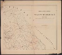
- McKinley Publishing Company
- Published / Created:
- [1912], ©1912.
- Call Number:
- 50cf 1906
- Container / Volume:
- BRBL_00274
- Image Count:
- 4
- Resource Type:
- Maps, Atlases & Globes
- Found in:
- Beinecke Rare Book and Manuscript Library > McKinley's wall outline maps, Asia.
- Published / Created:
- 1901
- Call Number:
- 4828ed 1901
- Container / Volume:
- BRBL_00265
- Image Count:
- 4
- Resource Type:
- Maps, Atlases & Globes
- Found in:
- Beinecke Rare Book and Manuscript Library > Karte ethnographique du vilayet de Salonique.
- Published / Created:
- [1920?].
- Call Number:
- 38gmb 1920A
- Container / Volume:
- BRBL_00170
- Image Count:
- 4
- Resource Type:
- Maps, Atlases & Globes
- Found in:
- Beinecke Rare Book and Manuscript Library > Carte routière de France de Dion-Bouton : spéciale pour automobiles / Dressée au Service Cartographique de Dion-Bouton.
- Creator:
- Hoebel, Paul
- Published / Created:
- 1910
- Call Number:
- 56 1901
- Container / Volume:
- BRBL_00296
- Image Count:
- 4
- Resource Type:
- Maps, Atlases & Globes
- Found in:
- Beinecke Rare Book and Manuscript Library > Hoebels Karte v. China [cartographic material] / gezeichnet und übersetzt von Paul Hoebel, Terrainzeichnung von F. Pilger.
- Creator:
- Ordnance Survey of Ireland
- Published / Created:
- [188-]
- Call Number:
- 327 1875
- Container / Volume:
- BRBL_00073
- Image Count:
- 4
- Resource Type:
- Maps, Atlases & Globes
- Found in:
- Beinecke Rare Book and Manuscript Library > A general map of Ireland : showing the county and barony boundaries, the rivers, railways, canals, leading roads and principal demesnes ... (New Edition).
- Published / Created:
- 1808
- Call Number:
- 89cea 1808
- Container / Volume:
- BRBL_00658
- Image Count:
- 4
- Resource Type:
- Maps, Atlases & Globes
- Found in:
- Beinecke Rare Book and Manuscript Library > A General Chart of the West Indies and Gulf of Mexico, describing the Gulf and Winward Passages, Coasts of Florida, Louisiana and Mexico, Bay of Honduras and Musquito Shore ... Drawn from the surveys taken by Mr. Geo Gaulo ... by Foss Dessiou.
- Published / Created:
- 1905
- Call Number:
- 771 Ad47 1905
- Container / Volume:
- BRBL_00480
- Image Count:
- 4
- Resource Type:
- Maps, Atlases & Globes
- Found in:
- Beinecke Rare Book and Manuscript Library > Map of the Adirondack Forest and adjoining territory / compiled from the official maps and field notes on file in the state departments at Albany, N.Y. ; by authority of the Forest, Fish, and Game Commission.
- Creator:
- American Geographical Society of New York
- Published / Created:
- 1918
- Call Number:
- 44cbd 1918
- Container / Volume:
- BRBL_00256
- Image Count:
- 4
- Resource Type:
- Maps, Atlases & Globes
- Found in:
- Beinecke Rare Book and Manuscript Library > Block diagram showing terrain of the Balkan Peninsula [cartographic material].
- Creator:
- Beers, S. N
- Published / Created:
- 1859
- Call Number:
- 771 On8 1859
- Container / Volume:
- BRBL_00490
- Image Count:
- 4
- Resource Type:
- Maps, Atlases & Globes
- Found in:
- Beinecke Rare Book and Manuscript Library > Map of Ontario County, New York : from actual surveys / by S.N. Beers, assisted by D.G. Beers.
- Creator:
- Maury, Matthew Fontaine, 1806-1873
- Published / Created:
- 1852
- Call Number:
- 11cfk 1850F
- Container / Volume:
- BRBL_00774
- Image Count:
- 4
- Resource Type:
- Maps, Atlases & Globes
- Found in:
- Beinecke Rare Book and Manuscript Library > Whale chart of the world [cartographic material] / by M.F. Maury, L.L.D. Lieut. U.S. Navy, superin'dt. of U.S.N. Observatory ; compiled from materials in the Bureau of Ordnance and Hydrography by P.M. A.C. Jackson.
- Creator:
- Pownall, Thomas, 1722-1805
- Published / Created:
- March 25th, 1776.
- Call Number:
- 71 1776N
- Container / Volume:
- BRBL_00726
- Image Count:
- 4
- Resource Type:
- Maps, Atlases & Globes
- Found in:
- Beinecke Rare Book and Manuscript Library > A map of the middle British colonies in North America [cartographic material] : First published by Lewis Evans, of Philadelphia, in 1755 ; and since corrected and improved, as also extended, with the addition of New England, and bordering parts of Canada
- Creator:
- Beer, Wilhelm, 1797-1850
- Published / Created:
- 1834
- Call Number:
- 4 1835
- Container / Volume:
- BRBL_00196
- Image Count:
- 4
- Resource Type:
- Maps, Atlases & Globes
- Found in:
- Beinecke Rare Book and Manuscript Library > Mappa selenographica [cartographic material] : totam lunae hemisphaeram visibilem complectens observationibus propriis : quatuor sectionibus constructa et delineata / Suae Majestati Friderico Sexto, regi daniae illustrissimo summa veneratione dedicata ; a
- Published / Created:
- 1913
- Call Number:
- 428 Ot9 1913
- Container / Volume:
- BRBL_00249
- Image Count:
- 4
- Resource Type:
- Maps, Atlases & Globes
- Found in:
- Beinecke Rare Book and Manuscript Library > Oetzthal & Stubai.
- Creator:
- Walling, Henry Francis, 1825-1888
- Published / Created:
- 1858
- Call Number:
- 764 B45 1858
- Container / Volume:
- BRBL_00454
- Image Count:
- 6
- Resource Type:
- Maps, Atlases & Globes
- Found in:
- Beinecke Rare Book and Manuscript Library > Map of the county of Berkshire, Massachusetts : based upon the trigonometrical survey of the state / the details from actual surveys under the direction of Henry F. Walling, supt. of the state map.