Search
You Searched For
Search Results
- Published / Created:
- [1874?]
- Call Number:
- 796gme 1874
- Container / Volume:
- BRBL_00531
- Image Count:
- 2
- Resource Type:
- Maps, Atlases & Globes
- Found in:
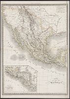
- Beinecke Rare Book and Manuscript Library > "Texas New Yorker's" railroad map of Texas : showing all completed and proposed routes, with principal rivers, county boundaries and county-seats, railroad stations and distances, congressional districts, United States military telegraph line, and frontie
- Published / Created:
- 1860?]
- Call Number:
- 796gme 1860
- Container / Volume:
- BRBL_00531
- Image Count:
- 1
- Resource Type:
- Maps, Atlases & Globes
- Found in:
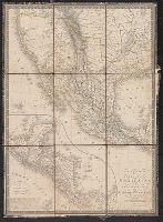
- Beinecke Rare Book and Manuscript Library > A geographically correct map of the Red River, Sabine & Western Railway (under construction) and connections : showing distribution of pine forests (compiled from maps of U.S. government), also location of coal, iron, and oil deposits.
- Creator:
- Seale, Richard William
- Published / Created:
- 1745?]
- Call Number:
- 71 1746
- Container / Volume:
- BRBL_00362
- Image Count:
- 1
- Resource Type:
- Maps, Atlases & Globes
- Found in:
- Beinecke Rare Book and Manuscript Library > A map of North America : with the European settlements & whatever else is remarkable in ye West Indies, from the latest and best observations / R.W. Seale, delin. et sculp.
- Creator:
- Staples, Stephen McL. (Stephen McLellan), 1800-1832
- Published / Created:
- 1828
- Call Number:
- 796ad 1828
- Container / Volume:
- BRBL_00716
- Image Count:
- 2
- Resource Type:
- Maps, Atlases & Globes
- Found in:
- Beinecke Rare Book and Manuscript Library > A map of northern part of Mexico, including Exter and Wilson's Grant / made from Legrand's notes and other documents by S. McL. Staples, A.M., surveyor general of Chihuahua.
- Published / Created:
- 1841 [i.e. 1842]
- Call Number:
- 796fab 1842
- Container / Volume:
- BRBL_00530
- Image Count:
- 1
- Resource Type:
- Maps, Atlases & Globes
- Found in:
- Beinecke Rare Book and Manuscript Library > A new map of Texas / Day & Haghe, lith.rs to the Queen.
- Creator:
- Asher & Adams
- Published / Created:
- [1878?]
- Call Number:
- 796fb 1878A
- Container / Volume:
- BRBL_00530
- Image Count:
- 1
- Resource Type:
- Maps, Atlases & Globes
- Found in:
- Beinecke Rare Book and Manuscript Library > Asher & Adams' Texas : eastern portion.
- Creator:
- Asher & Adams
- Published / Created:
- [1878?]
- Call Number:
- 796fb 1878
- Container / Volume:
- BRBL_00530
- Image Count:
- 1
- Resource Type:
- Maps, Atlases & Globes
- Found in:
- Beinecke Rare Book and Manuscript Library > Asher & Adams' Texas : western portion.
- Published / Created:
- 1830?]
- Call Number:
- 88 1830
- Container / Volume:
- BRBL_00644
- Image Count:
- 1
- Resource Type:
- Maps, Atlases & Globes
- Found in:
- Beinecke Rare Book and Manuscript Library > Carte des États-Unis du Méxique.
- Creator:
- Brué, A. (Adrien Hubert), 1786-1832
- Published / Created:
- 1825
- Call Number:
- 88 1825
- Container / Volume:
- BRBL_00644
- Image Count:
- 1
- Resource Type:
- Maps, Atlases & Globes
- Found in:
- Beinecke Rare Book and Manuscript Library > Carte générale des États-Unis Mexicains et des Provinces-Unies de l'Amérique Centrale / redigée par Brué ...
- Published / Created:
- [1859?]
- Call Number:
- 796 1859B
- Container / Volume:
- BRBL_00525
- Image Count:
- 2
- Resource Type:
- Maps, Atlases & Globes
- Found in:
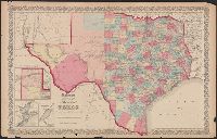
- Beinecke Rare Book and Manuscript Library > Colton's new map of the state of Texas.