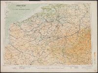
Great Britain. Army. Royal Engineers. Field Survey Coy., 512th
Published / Created:
1942
Call Number:
691 B43 1942
Container / Volume:
BRBL_00352
Image Count:
1
Resource Type:
Maps, Atlases & Globes
Alternative Title:
1:250,000 EGYPT AND CYRENAICA ; Sheet 1 Bengasi, 1:250,000 EGYPT AND CYRENAICA ; Sheet 1 Bengasi., and Sheet 1
Description:
"M.D.R. 1006/1646"., "Not to be published" printed along header., and Includes glossary, list of abbreviations, reliability diagram, and list of conventional signs.
General map showing the explorations and surveys of the Expedition, 1907-1909 and The Geographical journal.
Description:
Map showing the area explored by Ernest Shackleton's British Antarctic Expedition, 1907-1909. The routes shown cover the areas explored or surveyed along the eastern coast of South Victoria Land, including the route of the South Magnetic Pole Party, and along the southern coastline of the Ross Sea. Shackleton's route towards the South Pole is also shown, including the southern-most point at 162E̊, 88S̊23'. Land relief is indicated by spot heights, hachures and contours.
Publisher:
Royal Geographical Society,
Subject (Geographic):
Antarctica--Discovery and exploration--Maps, South Magnetic Pole (Antarctica)--Discovery and exploration--Maps, South Pole--Discovery and exploration--Maps, and South Victoria Land (Antarctica)--Discovery and exploration--Maps
Subject (Name):
British Antarctic Expedition (1907-1909)--Maps, Royal Geographical Society (Great Britain). Australian Antarctic Division, and Shackleton, Ernest Henry Sir, 1874-1922
Subject (Topic):
Scientific expeditions--Antartica--South Victoria Land--Maps and Scientific expeditions--South Pole--Maps
Route and surveys of the South Magnetic Polar Party, 1908-09 : and The Geographical journal.
Description:
At top right corner of sheet: Antarctic regions. Shackleton. and Map showing the route taken by the South Magnetic Pole Party in Shackleton's British Antarctic Expedition. The route is time-dated over late 1908 to early 1909. The map also includes the routes
Publisher:
Royal Geographical Society,
Subject (Geographic):
Antarctica--Discovery and exploration--Maps, South Magnetic Pole (Antarctica)--Discovery and exploration--Maps, and South Victoria Land--Discovery and exploration--Maps
Subject (Name):
British Antarctic Expedition (1907-1909)--Maps and Royal Geographical Society (Great Britain). Australian Antarctic Division
Subject (Topic):
Scientific expeditions--Antartica--South Victoria Land--Maps
Route and surveys of the Southern Journey Party, 1908-09 : and The Geographical journal.
Description:
Map showing the area explored by Ernest Shackleton's Southern Journey Party over the period 1908-1909 during the British Antarctic Expedition, 1907-1909. The route toward the South Pole is time-dated for the inward journey from Nov. 25, 1908-Jan. 9, 1909, and the southern-most point that the party reached is marked at 162E̊/88S̊23'. Land relief is indicated by spot heights, hachures and contours.
Publisher:
Royal Geographical Society,
Subject (Geographic):
Antarctica--Discovery and exploration--Maps and South Pole--Discovery and exploration--Maps
Subject (Name):
British Antarctic Expedition (1907-1909)--Maps, Royal Geographical Society (Great Britain). Australian Antarctic Division, and Shackleton, Ernest Henry Sir, 1874-1922