Includes population chart and index to ownership of electric railways., Inset: Map showing the lines of communication between New York, Boston and the West., and Relief shown by shading and spot heights.
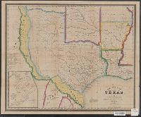
"Entered according to Act of Congress, in the Year 1845, by R.S. Fisher, in the Clerks Office of the District Court of the Southern District of New York.", Includes distances table., and Inset: Plan of the Port of Galveston / made by order of the Mexican govern
Publisher:
R.S. Fisher,
Subject (Geographic):
Galveston Bay (Tex.)--Maps, Texas--Administrative and political divisions--Maps, and Texas--Maps
Dominions of Turky in Europe in which are the governments of Romelia of the sea, of Buda, of Teme's war, and of Bosnia ... described by Sanson, corrected and amended by William Berry
Description:
Bar scales in Italian miles, common leagues of France, common leagues of Germany or great leagues of Poland, leagues of Hungary, and leagues that are of one hours travelling., Dedicated To the most serene and most sacred majesty Charles II ... by William Berry., No. 24 of 69 maps bound together in composite atlas., Relief shown pictorially., and Scale [ca. 1:3 500 000].
Publisher:
Sold by William Berry at the signe of the Globe between Charing-Cross and White-Hall
Subject (Geographic):
Balkan Peninsula --Maps --Early works to 1800, Italy --Maps --Early works to 1800, and Turkey --Maps --Early works to 1800
Below Baxter Springs: 1930., Below text: 13-4202., Includes text describing the land surface of Kansas and an inset of a geologic section of the state., and Relief shown by landform drawings.
2nd edition, 1st state, with entirely new plate from 1st edition that now shows all of Florida peninsula with title in cartouche., Below map is letterpress entitled: A compendious account of the British colonies in North America., Lower right corner of map includes Evan's polymetric table of America, with distances, and Thomas Templeman's survey of the size and area of the individual colonies., and Watermark.
Subject (Geographic):
North America--Maps--Early works to 1800 and United States--History--Revolution, 1775-1783--Maps
Subject (Name):
Jefferys, Thomas, -1771. and Robert Sayer and John Bennett (Firm)