Search
You Searched For
Search Results
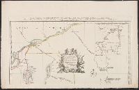
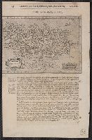
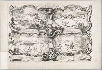
- Creator:
- Bowen, Emanuel, -1767
- Published / Created:
- 2d. July 1772.
- Call Number:
- 71 1763
- Container / Volume:
- BRBL_00364
- Image Count:
- 4
- Resource Type:
- Maps, Atlases & Globes
- Alternative Title:
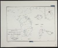
- Particular map of Baffin and Hudson's
- Description:
- map of Baffin and Hudson's Bay" and "The
- Subject (Geographic):
- North America--Maps--Early works to
- Subject (Topic):
- British--America--Maps--Early works to
- Found in:
- Beinecke Rare Book and Manuscript Library > An accurate map of North America [cartographic material] : Describing and distinguishing the British and Spanish dominions on this great continent; according to the definitive treaty concluded at Paris 10th Feby. 1763. Also all the West India Islands belo
- Creator:
- From the Collection: Lmanian, Alexander, 1925-1996
- Published / Created:
- 1968 April 13
- Call Number:
- GEN MSS 590
- Container / Volume:
- Box 1, folder 21-23
- Image Count:
- 8
- Found in:
- Beinecke Rare Book and Manuscript Library > Photographs of Washington, D.C., and New Haven, Connecticut (GEN MSS 590) > Series I: Negatives > Negatives from Negative Sleeve Book > Copy photograph of a map of and a tally of costs
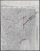
- Creator:
- Merrill, W. E. (William Emery), 1837-1891
- Published / Created:
- 1864]
- Call Number:
- 787hc 1864C
- Container / Volume:
- BRBL_00517A
- Image Count:
- 2
- Resource Type:
- Maps, Atlases & Globes
- Alternative Title:
- [Sherman map collection ; no. 22]
- Subject (Geographic):
- Alabama--Maps
- Found in:
- Beinecke Rare Book and Manuscript Library > Part of northern Georgia : / compiled under the direction of Capt. Wm. E. Merrill, Chief Top'l Eng'r, D.C.
- Call Number:
- 1976 1233
- Collection Title:
- Twenty four new and accurate maps of the several parts of Europe ... : all (except the last) new
- Image Count:
- 1
- Description:
- In pencil on verso: 22.
- Subject (Geographic):
- Switzerland --Maps --Early works to
- Found in:
- Beinecke Rare Book and Manuscript Library > Suisse or Switzerland together with their allies & subjects &c
- Call Number:
- 1976 1233
- Collection Title:
- Forty-two new maps of Asia, Africa, and America ... : all engrav’d, according to the latest
- Image Count:
- 1
- Description:
- In ink on verso: 22.
- Subject (Geographic):
- Ethiopia --Maps --Early works to 1800
- Found in:
- Beinecke Rare Book and Manuscript Library > Abissina and Anian &c
- Creator:
- Scull, Nicholas, 1686?-1761?
- Published / Created:
- 1759
- Call Number:
- 774 1759
- Container / Volume:
- BRBL_00497
- Image Count:
- 3
- Resource Type:
- Maps, Atlases & Globes
- Alternative Title:
- Map of the improved part of the
- Subject (Geographic):
- political divisions--Maps--Early works to 1800
- Found in:
- Beinecke Rare Book and Manuscript Library > To the honourable Thomas Penn and Richard Penn...this map of the improved part of the province of Pennsylvania is humbly dedicated / by Nicholas Scull ; engraved by Ja. Turner.
- Creator:
- From the Collection: Kissinger, Henry, 1923-2023
- Published / Created:
- 1967-1973
- Call Number:
- MS 2004
- Container / Volume:
- Box 206, folder 4
- Image Count:
- 58
- Found in:
- Manuscripts and Archives > Henry A. Kissinger papers, part III (MS 2004) > Series V: Writing and Research Materials > Research files for books > White House Years > Maps of Middle East
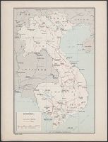
- Creator:
- From the Collection: Kissinger, Henry, 1923-2023
- Published / Created:
- 1970, undated
- Call Number:
- MS 2004
- Container / Volume:
- Box 206, folder 3
- Image Count:
- 76
- Found in:
- Manuscripts and Archives > Henry A. Kissinger papers, part III (MS 2004) > Series V: Writing and Research Materials > Research files for books > White House Years > Maps of Indochina
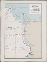
- Creator:
- United States. Office of Strategic Services. Research and Analysis Branch
- Published / Created:
- [1943]
- Call Number:
- 382 1943
- Container / Volume:
- BRBL_00175
- Image Count:
- 1
- Resource Type:
- Maps, Atlases & Globes
- Description:
- "22 November 1943."
- Subject (Geographic):
- Normandy (France)--Maps
- Subject (Topic):
- Beaches--France--Normandy--Maps
- Found in:
- Beinecke Rare Book and Manuscript Library > Beaches of Normandy - Vierville to Houlgate [cartographic material] / compiled and drawn in the Branch of Research and Analysis, OSS.
- Creator:
- United States. Office of Strategic Services. Research and Analysis Branch
- Published / Created:
- 1944
- Call Number:
- 28 1944C
- Container / Volume:
- BRBL_00023E
- Image Count:
- 1
- Resource Type:
- Maps, Atlases & Globes
- Description:
- "No. 3764--R & A, OSS; 22 June 1944."
- Subject (Geographic):
- Visayan Islands (Philippines)--Maps
- Subject (Topic):
- --Maps
- Found in:
- Beinecke Rare Book and Manuscript Library > Philippine Islands, transportation facilities of the southern Visayan Islands.
- Creator:
- United States. Office of Strategic Services. Research and Analysis Branch
- Published / Created:
- 1944
- Call Number:
- 28 1944D
- Container / Volume:
- BRBL_00023E
- Image Count:
- 1
- Resource Type:
- Maps, Atlases & Globes
- Description:
- "No. 3417--R & A, OSS; 22 June 1944."
- Subject (Geographic):
- Visayan Islands (Philippines)--Maps
- Subject (Topic):
- --Maps
- Found in:
- Beinecke Rare Book and Manuscript Library > Philippine Islands, transportation facilities of the northern Visayan Islands.
- Creator:
- From the Collection: Kissinger, Henry, 1923-2023
- Published / Created:
- 1970-1979, undated
- Call Number:
- MS 2004
- Container / Volume:
- Box 206, folder 2
- Image Count:
- 130
- Found in:
- Manuscripts and Archives > Henry A. Kissinger papers, part III (MS 2004) > Series V: Writing and Research Materials > Research files for books > White House Years > Maps and photographs for White House Years
- Published / Created:
- 1965-1966
- Call Number:
- GEN MSS 1319
- Container / Volume:
- Box 4
- Image Count:
- 1640
- Found in:
- Beinecke Rare Book and Manuscript Library > The Vinland Map and the Tartar Relation: proofs and subject files (GEN MSS 1319) > Series II: Subject files > Newspaper and magazine clippings
- Creator:
- Hart, Alfred A., 1816-1908.
- Published / Created:
- c1870.
- Call Number:
- Zc10 870hac
- Image Count:
- 67
- Description:
- Maps have 6 panels and are bound in at
- Subject (Topic):
- Railroads--Maps
- Found in:
- Beinecke Rare Book and Manuscript Library > The traveler's own book, a panorama of overland travel, from Chicago to San Francisco via the great and attractive route, Chicago Burlington & Quincy R.R. ... Burlington & Missouri River R.R. ... Union Pacific Railroad ... Utah Central Railroad ... Central Pacific Railroad ... Western Pacific Railroad ... containing complete traveler's maps ... By Alfred A. Hart.
- Creator:
- Moll, Herman, d. 1732
Salmon, Thomas, 1679-1767
- Published / Created:
- 1739
- Call Number:
- 1996 +91
- Image Count:
- 3
- Resource Type:
- Books, Journals & Pamphlets
- Description:
- Frontispiece map, 25 x 41 cm.
- Subject (Geographic):
- Madras (India)--Maps--Early works to
- Found in:
- Beinecke Rare Book and Manuscript Library > Modern history: or, The present state of all nations. Describing their respective situations, persons, habits, ... animals and minerals. ... By Mr. Salmon. Illustrated with cuts and maps ... by Herman Moll ...
- Creator:
- From the Collection: Kissinger, Henry, 1923-2023
- Published / Created:
- 2004
- Call Number:
- MS 1981
- Container / Volume:
- Box 745, folder 9
- Image Count:
- 176
- Found in:
- Manuscripts and Archives > Henry A. Kissinger papers, part II (MS 1981) > Series III: Post-Government Career > Speeches and writings > General > Testimony before Senate Foreign Relations Committee on "Middle East: Re-thinking the Road Map," Feb 24, 2004 [2 of 2]
- Creator:
- From the Collection: Kissinger, Henry, 1923-2023
- Published / Created:
- 2004
- Call Number:
- MS 1981
- Container / Volume:
- Box 745, folder 8
- Image Count:
- 318
- Found in:
- Manuscripts and Archives > Henry A. Kissinger papers, part II (MS 1981) > Series III: Post-Government Career > Speeches and writings > General > Testimony before Senate Foreign Relations Committee on "Middle East: Re-thinking the Road Map," Feb 24, 2004 [1 of 2]
- Creator:
- Faden, William, 1749-1836
Jefferys, Thomas, d. 1771, creator
- Published / Created:
- 1789 June 1
- Call Number:
- 1982 Folio 10
- Image Count:
- 1
- Description:
- No. 22 of 43 maps bound together in
- Subject (Geographic):
- Germany --Maps --Early works to 1800
- Found in:
- Beinecke Rare Book and Manuscript Library > A new map of the King of Great Britain's dominions in Germany or the electorate of Brunswick-Luneburg and its dependencies
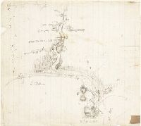
- Creator:
- From the Collection: Stenzel, Franz
- Published / Created:
- n.d.
- Call Number:
- WA MSS S-2368
- Container / Volume:
- Box 7, folder 134
- Image Count:
- 1
- Found in:
- Beinecke Rare Book and Manuscript Library > Franz R. and Kathryn M. Stenzel collection of western American art (WA MSS S-2368) > Series II: James G. Swan Artwork and Associated Material > > ARTWORK > Works by Swan > Views of Native American Life > [Map of coastal village Alekistet?] Pencil drawing, 19.1 x 22 cm.
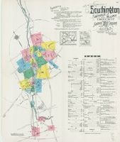
- Creator:
- Sanborn Map Company
- Published / Created:
- August, 1923.
- Call Number:
- 776 B764 1923
- Container / Volume:
- BRBL_00502
- Image Count:
- 4
- Resource Type:
- Maps, Atlases & Globes
- Abstract:
- Fire insurance map, colored to show
- Description:
- Coordinates not present on map and are
- Publisher:
- Sanborn Map Company,
- Subject (Geographic):
- Bridgeville (Del.)--Maps.
- Subject (Topic):
- --Bridgeville--Maps.
- Found in:
- Beinecke Rare Book and Manuscript Library > Bridgeville, Sussex County, Delaware.
- Creator:
- From the Collection: Fellows, Abraham Lincoln, 1864-1942
- Published / Created:
- 1901-1904, n.d.
- Call Number:
- WA MSS S-1296
- Container / Volume:
- Box 3, folder 28
- Image Count:
- 146
- Found in:
- Beinecke Rare Book and Manuscript Library > Abraham Lincoln Fellows papers (WA MSS S-1296) > Gunnison Tunnel Files > Photograph album: Gunnison Tunnel
- Creator:
- Sanborn Map Company, issuing body
- Published / Created:
- 1922
- Call Number:
- 766 F16 1922
- Image Count:
- 22
- Resource Type:
- Maps, Atlases & Globes
- Abstract:
- Sanborn fire insurance maps are a rich
- Description:
- "22 sheets (5093)."
- Subject (Geographic):
- Fairfield (Conn.)--Maps
- Subject (Topic):
- --Fairfield--Maps
- Found in:
- Beinecke Rare Book and Manuscript Library > Fairfield, Fairfield County, Connecticut.
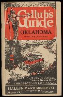
- Published / Created:
- [193-?]
- Call Number:
- Zc41 930ga
- Image Count:
- 28
- Alternative Title:
- Gallup's guide auto route & highway map
- Publisher:
- Gallup Map & Supply Co.
- Found in:
- Beinecke Rare Book and Manuscript Library > Gallup's guide Oklahoma, northern Texas southern Kansas : showing population and distance between towns, United States auto road map on back [of state map].
- Creator:
- Faden, William, 1749-1836
- Published / Created:
- 1777
- Call Number:
- 73 1777
- Container / Volume:
- BRBL_00373
- Image Count:
- 1
- Resource Type:
- Maps, Atlases & Globes
- Alternative Title:
- [American maps ; v. 3, no. 22]
- Subject (Geographic):
- Canada--Boundaries--United States--Maps
- Found in:
- Beinecke Rare Book and Manuscript Library > A map of the inhabited part of Canada from the French surveys, with the frontiers of New York and New England; from the large survey by Claude Joseph Sauthier. Engraved by Wm. Faden, 1777.
- Creator:
- Winterbotham, Harold St. John Loyd, 1878-1946.
- Published / Created:
- 1927-1929.
- Call Number:
- GEN MSS 583
- Image Count:
- 103
- Resource Type:
- Archives or Manuscripts
- Abstract:
- album by a map of the region with
- Found in:
- Beinecke Rare Book and Manuscript Library > Africa : a survey inspection tour.
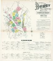
- Creator:
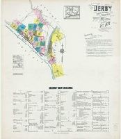
- Sanborn Map Company, issuing body
- Published / Created:
- 1912
- Call Number:
- 766 D444 1912
- Image Count:
- 22
- Resource Type:
- Maps, Atlases & Globes
- Abstract:
- Sanborn fire insurance maps are a rich
- Description:
- "22 sheets. (4763)."
- Subject (Geographic):
- Derby (Conn.)--Maps
- Subject (Name):
- Library of Congress. Map Division Stamp
- Subject (Topic):
- --Derby--Maps
- Found in:
- Beinecke Rare Book and Manuscript Library > Insurance maps of Derby and Shelton, New Haven County, Connecticut.
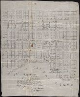
- Published / Created:
- 1847 February 22
- Call Number:
- WA MSS S-1882
- Image Count:
- 1
- Resource Type:
- Maps, Atlases & Globes
- Abstract:
- Autograph manuscript map, drawn on
- Description:
- Map has been repaired with two pieces
- Subject (Geographic):
- San Francisco (Calif.) --Maps
- Found in:
- Beinecke Rare Book and Manuscript Library > Map of San Francisco, Calif., 1847
- Creator:
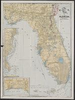
- C.S. Hammond & Company
- Published / Created:
- c1903.
- Call Number:
- 792 1903
- Container / Volume:
- BRBL_00519
- Image Count:
- 2
- Resource Type:
- Maps, Atlases & Globes
- Alternative Title:
- Hammonds 16 x 22 map of Florida
- Subject (Geographic):
- Florida--Maps
- Subject (Topic):
- Railroads--Florida--Maps
- Found in:
- Beinecke Rare Book and Manuscript Library > The Clyde Steamship Co. map of Florida : showing routes and railroad connections.
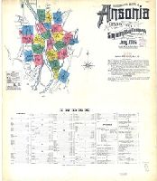
- Creator:
- Sanborn Map Company, issuing body
- Published / Created:
- 1906
- Call Number:
- 766 An81 1906
- Image Count:
- 22
- Resource Type:
- Maps, Atlases & Globes
- Abstract:
- Sanborn fire insurance maps are a rich
- Description:
- "22 sheets (8531)."
- Subject (Geographic):
- Ansonia (Conn.)--Maps
- Subject (Name):
- Library of Congress. Map Divison Stamp
- Subject (Topic):
- --Ansonia--Maps
- Found in:
- Beinecke Rare Book and Manuscript Library > Insurance maps of Ansonia, Connecticut, New Haven County.
- Creator:
- Sanborn Map Company, issuing body
- Published / Created:
- 1923
- Call Number:
- 766 So87 1923
- Image Count:
- 22
- Resource Type:
- Maps, Atlases & Globes
- Abstract:
- Sanborn fire insurance maps are a rich
- Description:
- "22 sheets. (5907)."
- Subject (Geographic):
- Southington (Conn.)--Maps
- Subject (Topic):
- --Southington--Maps
- Found in:
- Beinecke Rare Book and Manuscript Library > Southington, including Plantsville and Milldale, Hartford County, Connecticut.
- Creator:
- Seale, Richard William
- Published / Created:
- [1783?]
- Call Number:
- 1977 Folio 177
- Image Count:
- 4
- Resource Type:
- Maps, Atlases & Globes
- Description:
- measure 70.0 x 50.5 cm or smaller. No. 22 of
- Subject (Geographic):
- Great Britain--Maps--Early works to
- Found in:
- Beinecke Rare Book and Manuscript Library > England and Ireland : containing all the cities, boroughs, markettowns & principal villages : with the coast of France from Calais to Brest delineated and engraved from actual surveys / by Richard William Seale.
- Creator:
- Blanchard, Joseph, d. 1758
- Published / Created:
- 1761
- Call Number:
- 762 1761
- Container / Volume:
- BRBL_00450
- Image Count:
- 2
- Resource Type:
- Maps, Atlases & Globes
- Description:
- topography of North America. 1768. no. 22, plates
- Found in:
- Beinecke Rare Book and Manuscript Library > An accurate map of His Majesty's Province of New-Hampshire in New England, taken from actual surveys of all the inhabited part, and from the best information of what is uninhabited, together with the adjacent countries, which exhibits the theatre of this
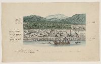
- Creator:
- Bacstrom, Sigismund
- Published / Created:
- 1792-1800, bulk 1792-1794.
- Call Number:
- WA MSS S-2405 (Oversize)
- Image Count:
- 130
- Abstract:
- Fitzhugh Sound. There are two maps of Queen
- Found in:
- Beinecke Rare Book and Manuscript Library > Drawings and sketches made during a voyage around the world, 1791-1795
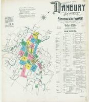
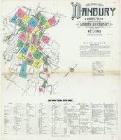
- Creator:
- Sanborn Map Company, issuing body
- Published / Created:
- 1904
- Call Number:
- 766 D19 1904
- Image Count:
- 23
- Resource Type:
- Maps, Atlases & Globes
- Abstract:
- Sanborn fire insurance maps are a rich
- Description:
- Partial cadastral map.
- Subject (Geographic):
- Danbury (Conn.)--Maps
- Subject (Name):
- Library of Congress. Map Division Stamp
- Subject (Topic):
- --Danbury--Maps
- Found in:
- Beinecke Rare Book and Manuscript Library > Insurance maps of Danbury, Fairfield County, Connecticut.
- Creator:
- Sanborn Map Company, issuing body
- Published / Created:
- 1923
- Call Number:
- 766 N22 1923
- Image Count:
- 23
- Resource Type:
- Maps, Atlases & Globes
- Abstract:
- Sanborn fire insurance maps are a rich
- Description:
- Partial cadastral map.
- Subject (Geographic):
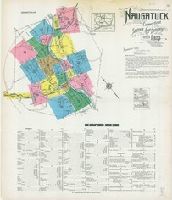
- Naugatuck (Conn.)--Maps
- Subject (Topic):
- --Naugatuck--Maps
- Found in:
- Beinecke Rare Book and Manuscript Library > Naugatuck, New Haven County, Connecticut.
- Creator:
- Sanborn Map Company, issuing body
- Published / Created:
- 1931
- Call Number:
- 766 W73 1931
- Image Count:
- 23
- Resource Type:
- Maps, Atlases & Globes
- Abstract:
- Sanborn fire insurance maps are a rich
- Description:
- Partial cadastral map.
- Subject (Geographic):
- Winsted (Conn.)--Maps
- Subject (Topic):
- --Winsted--Maps
- Found in:
- Beinecke Rare Book and Manuscript Library > Winsted, Litchfield County, Connecticut.
- Creator:
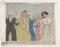
- Boydell, John, 1720-1804, printmaker
- Published / Created:
- 1753.
- Call Number:
- Topos M627 no. 16+
- Image Count:
- 1
- Resource Type:
- still image
- Description:
- No. 22, "Mr. and Mrs. George Morton
- Found in:
- Lewis Walpole Library > A view of Governour Pitts house at Twickenham Vüe de la maison du Governour Pitt a Twickenham / [graphic] =
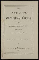
- Creator:
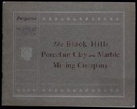
- Black Hills Porcelain Clay and Marble Mining Company
- Published / Created:
- 1900?]
- Call Number:
- Zc35 +900bL
- Image Count:
- 25
- Subject (Geographic):
- Black Hills (S.D. and Wyo.)--Maps
- Found in:
- Beinecke Rare Book and Manuscript Library > Prospectus : the Black Hills Porcelain Clay and Marble Mining Company (incorporated under laws of South Dakota) ...
- Creator:
- Sanborn Map Company, issuing body
- Published / Created:
- 1924
- Call Number:
- 766 B72 1924
- Image Count:
- 24
- Resource Type:
- Maps, Atlases & Globes
- Abstract:
- Sanborn fire insurance maps are a rich
- Description:
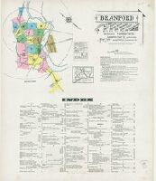
- Partial cadastral map.
- Subject (Geographic):
- Branford (Conn.)--Maps
- Subject (Topic):
- --Branford--Maps
- Found in:
- Beinecke Rare Book and Manuscript Library > Branford : including Short Beach, Indian Neck, Pine Orchard, Stony Creek and Pine Orchard West, New Haven Co., Connecticut.
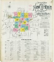
- Creator:
- Sanborn-Perris Map Co., issuing body
- Published / Created:
- 1895
- Call Number:
- 766 N42 1895
- Image Count:
- 24
- Resource Type:
- Maps, Atlases & Globes
- Abstract:
- Sanborn fire insurance maps are a rich
- Description:
- Partial cadastral map.
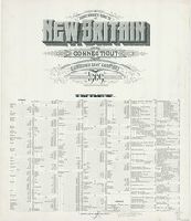
- Subject (Geographic):
- New Britain (Conn.)--Maps
- Subject (Topic):
- Britain--Maps
- Found in:
- Beinecke Rare Book and Manuscript Library > Insurance maps of New Britain, Hartford Co., Connecticut.
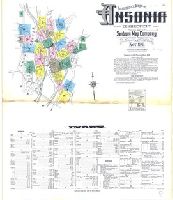
- Creator:
- Sanborn Map Company, issuing body
- Published / Created:
- 1911
- Call Number:
- 766 An81 1911
- Image Count:
- 25
- Resource Type:
- Maps, Atlases & Globes
- Abstract:
- Sanborn fire insurance maps are a rich
- Description:
- Partial cadastral map.
- Subject (Geographic):
- Ansonia (Conn.)--Maps
- Subject (Topic):
- --Ansonia--Maps
- Found in:
- Beinecke Rare Book and Manuscript Library > Insurance maps of Ansonia, Connecticut, New Haven County.
- Creator:
- Sanborn Map Company, issuing body
- Published / Created:
- 1919
- Call Number:
- 766 M31 1919
- Image Count:
- 25
- Resource Type:
- Maps, Atlases & Globes
- Abstract:
- Sanborn fire insurance maps are a rich
- Description:
- Partial cadastral map.
- Subject (Geographic):
- Manchester--Maps
- Subject (Topic):
- --Manchester--Maps
- Found in:
- Beinecke Rare Book and Manuscript Library > Insurance maps of Manchester and South Manchester, Hartford County, Connecticut.
- Creator:
- Sanborn Map Company, issuing body
- Published / Created:
- 1920
- Call Number:
- 766 Ea76 1920
- Image Count:
- 26
- Resource Type:
- Maps, Atlases & Globes
- Abstract:
- Sanborn fire insurance maps are a rich
- Description:
- Partial cadastral map.
- Subject (Geographic):
- East Hartford (Conn.)--Maps
- Subject (Topic):
- Hartford--Maps
- Found in:
- Beinecke Rare Book and Manuscript Library > East Hartford, Hartford County, Connecticut.
- Creator:
- Sanborn Map Company, issuing body
- Published / Created:
- 1911
- Call Number:
- 766 M31 1911
- Image Count:
- 27
- Resource Type:
- Maps, Atlases & Globes
- Abstract:
- Sanborn fire insurance maps are a rich
- Description:
- Partial cadastral map.
- Subject (Geographic):
- Manchester--Maps
- Subject (Topic):
- --Manchester--Maps
- Found in:
- Beinecke Rare Book and Manuscript Library > Insurance maps of Manchester, Hartford County, Connecticut.
- Creator:
- Sanborn-Perris Map Co., issuing body
- Published / Created:
- 1891
- Call Number:
- 766 M54 1891
- Image Count:
- 28
- Resource Type:
- Maps, Atlases & Globes
- Abstract:
- Sanborn fire insurance maps are a rich
- Description:
- Partial cadastral map.
- Subject (Geographic):
- Meriden (Conn.)--Maps
- Subject (Topic):
- --Meriden--Maps
- Found in:
- Beinecke Rare Book and Manuscript Library > Meriden, Connecticut.
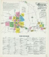
- Creator:
- Sanborn-Perris Map Co., issuing body
- Published / Created:
- 1901
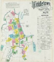
- Call Number:
- 766 M584 1901
- Image Count:
- 27
- Resource Type:
- Maps, Atlases & Globes
- Abstract:
- Sanborn fire insurance maps are a rich
- Description:
- Partial cadastral map.
- Subject (Geographic):
- Middletown (Conn.)--Maps
- Subject (Topic):
- --Middletown--Maps
- Found in:
- Beinecke Rare Book and Manuscript Library > Insurance maps of Middletown, Middlesex County, Connecticut.
- Creator:
- Sanborn Map Company, issuing body
- Published / Created:
- 1920
- Call Number:
- 766 M59 1920
- Image Count:
- 28
- Resource Type:
- Maps, Atlases & Globes
- Abstract:
- Sanborn fire insurance maps are a rich
- Description:
- Partial cadastral map.
- Subject (Geographic):
- Milford (Conn.)--Maps
- Subject (Topic):
- --Milford--Maps
- Found in:
- Beinecke Rare Book and Manuscript Library > Insurance maps of Milford, New Haven County, Connecticut.
- Creator:
- Sanborn-Perris Map Co., issuing body
- Published / Created:
- 1901
- Call Number:
- 766 N47 1901
- Image Count:
- 27
- Resource Type:
- Maps, Atlases & Globes
- Abstract:
- Sanborn fire insurance maps are a rich
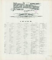
- Description:
- Partial cadastral map.
- Subject (Geographic):
- Groton (Conn.)--Maps
- Subject (Topic):
- --Groton--Maps
- Found in:
- Beinecke Rare Book and Manuscript Library > Insurance maps of New London, including Groton, New London County, Connecticut.
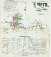
- Creator:
- Sanborn Map Company, issuing body
- Published / Created:
- 1911
- Call Number:
- 766 B77 1911
- Image Count:
- 26
- Resource Type:
- Maps, Atlases & Globes
- Abstract:
- Sanborn fire insurance maps are a rich
- Description:
- Partial cadastral map.
- Subject (Geographic):
- Bristol (Conn.)--Maps
- Subject (Topic):
- --Bristol--Maps
- Found in:
- Beinecke Rare Book and Manuscript Library > Insurance maps of Bristol, Hartford County, Connecticut.
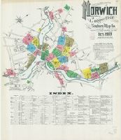
- Creator:
- Sanborn Map Company, issuing body
- Published / Created:
- 1903
- Call Number:
- 766 N835 1903
- Image Count:
- 26
- Resource Type:
- Maps, Atlases & Globes
- Abstract:
- Sanborn fire insurance maps are a rich
- Description:
- Partial cadastral map.
- Subject (Geographic):
- Norwich (Conn.)--Maps
- Subject (Topic):
- --Norwich--Maps
- Found in:
- Beinecke Rare Book and Manuscript Library > Insurance maps of Norwich, New London Co., Connecticut.
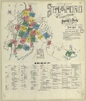
- Creator:
- Sanborn-Perris Map Co., issuing body
- Published / Created:
- 1901
- Call Number:
- 766 St22 1901
- Image Count:
- 26
- Resource Type:
- Maps, Atlases & Globes
- Abstract:
- Sanborn fire insurance maps are a rich
- Description:
- Partial cadastral map.
- Subject (Geographic):
- Stamford (Conn.)--Maps
- Subject (Topic):
- --Stamford--Maps
- Found in:
- Beinecke Rare Book and Manuscript Library > Insurance maps of Stamford, Fairfield Co., Connecticut.
- Creator:
- Sanborn Map Company, issuing body
- Published / Created:
- 1924
- Call Number:
- 766 W677 1924
- Image Count:
- 26
- Resource Type:
- Maps, Atlases & Globes
- Abstract:
- Sanborn fire insurance maps are a rich
- Description:
- Partial cadastral map.
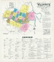
- Subject (Geographic):
- Coventry (Conn.)--Maps
- Subject (Topic):
- --Coventry--Maps
- Found in:
- Beinecke Rare Book and Manuscript Library > Willimantic, including South Coventry, Storrs, South Windham, and Mansfield Center, Windham County, Connecticut.
- Creator:
- Harrison, George.
- Published / Created:
- [1868?]
- Call Number:
- 1981 409
- Image Count:
- 42
- Resource Type:
- Books, Journals & Pamphlets
- Found in:
- Beinecke Rare Book and Manuscript Library > Two months in Brittany with my knapsack and fly rod / by George Harrison.
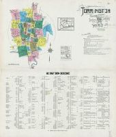
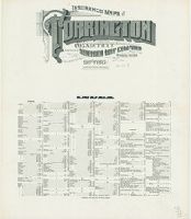
- Creator:
- Sanborn Map Company, issuing body
- Published / Created:
- 1924
- Call Number:
- 766 T63 1924
- Image Count:
- 36
- Resource Type:
- Maps, Atlases & Globes
- Abstract:
- Sanborn fire insurance maps are a rich
- Description:
- Partial cadastral map.
- Subject (Geographic):
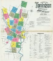
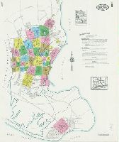
- Torrington (Conn.)--Maps
- Subject (Topic):
- --Torrington--Maps
- Found in:
- Beinecke Rare Book and Manuscript Library > Torrington, Litchfield County, Connecticut.
- Creator:
- Sanborn Map Company, issuing body
- Published / Created:
- 1919
- Call Number:
- 766 D19 1919
- Image Count:
- 29
- Resource Type:
- Maps, Atlases & Globes
- Abstract:
- Sanborn fire insurance maps are a rich
- Description:
- Partial cadastral map.
- Subject (Geographic):
- Danbury (Conn.)--Maps
- Subject (Topic):
- --Danbury--Maps
- Found in:
- Beinecke Rare Book and Manuscript Library > Insurance maps of Danbury, Fairfield County, Connecticut.
- Creator:
- Sanborn Map & Publishing Co., issuing body
- Published / Created:
- 1886
- Call Number:
- 766 N46 1886 Copy 2
- Image Count:
- 31
- Resource Type:
- Maps, Atlases & Globes
- Abstract:
- Sanborn fire insurance maps are a rich
- Description:
- Partial cadastral map.
- Subject (Geographic):
- New Haven (Conn.)--Maps
- Subject (Topic):
- Haven--Maps
- Found in:
- Beinecke Rare Book and Manuscript Library > Insurance maps of New Haven, Connecticut. Volume 1.
- Creator:
- Sanborn Map Company, issuing body
- Published / Created:
- 1912
- Call Number:
- 766 So885 1912
- Image Count:
- 28
- Resource Type:
- Maps, Atlases & Globes
- Abstract:
- Sanborn fire insurance maps are a rich
- Description:
- Partial cadastral map.
- Subject (Geographic):
- Norwalk (Conn.)--Maps
- Subject (Topic):
- --Norwalk--Maps
- Found in:
- Beinecke Rare Book and Manuscript Library > Insurance maps of South Norwalk, including East Norwalk, Rowayton, Bell Island, and Roton Point, Fairfield Co., Connecticut.
- Creator:
- Sanborn Map Company, issuing body
- Published / Created:
- 1909
- Call Number:
- 766 T63 1909
- Image Count:
- 28
- Resource Type:
- Maps, Atlases & Globes
- Abstract:
- Sanborn fire insurance maps are a rich
- Description:
- Partial cadastral map.
- Subject (Geographic):
- Torrington (Conn.)--Maps
- Subject (Topic):
- --Torrington--Maps
- Found in:
- Beinecke Rare Book and Manuscript Library > Insurance maps of Torrington, Litchfield Co., Connecticut.
- Creator:
- Sanborn Map Company, issuing body
- Published / Created:
- 1931
- Call Number:
- 766 T63 1931
- Image Count:
- 39
- Resource Type:
- Maps, Atlases & Globes
- Abstract:
- Sanborn fire insurance maps are a rich
- Description:
- Partial cadastral map.
- Subject (Geographic):
- Torrington (Conn.)--Maps
- Subject (Topic):
- --Torrington--Maps
- Found in:
- Beinecke Rare Book and Manuscript Library > Torrington, Litchfield County, Connecticut.
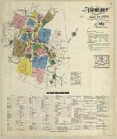
- Creator:
- Sanborn Map Company, issuing body
- Published / Created:
- 1924
- Call Number:
- 766 St82 1924
- Image Count:
- 41
- Resource Type:
- Maps, Atlases & Globes
- Abstract:
- Sanborn fire insurance maps are a rich
- Description:
- Partial cadastral map.
- Subject (Geographic):
- Stratford (Conn.)--Maps
- Subject (Topic):
- --Stratford--Maps
- Found in:
- Beinecke Rare Book and Manuscript Library > Insurance maps of Stratford, including Lordship Manor, Fairfield County, Connecticut.
- Creator:
- Hondius, Hendrik, 1597-1651
- Published / Created:
- 1625]
- Call Number:
- 343 1610
- Container / Volume:
- BRBL_00683
- Image Count:
- 2
- Resource Type:
- Maps, Atlases & Globes
- Alternative Title:
- Chap. 22, Discipline, honour, Island
- Description:
- Paginated 643-644; map on p. 644.
- Subject (Geographic):
- Iceland--Maps--Early works to 1800
- Found in:
- Beinecke Rare Book and Manuscript Library > Island [cartographic material].
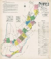
- Creator:
- Sanborn Map Company, issuing body
- Published / Created:
- 1925
- Call Number:
- 766 M59 1925
- Image Count:
- 31
- Resource Type:
- Maps, Atlases & Globes
- Abstract:
- Sanborn fire insurance maps are a rich
- Description:
- Partial cadastral map.
- Subject (Geographic):
- Milford (Conn.)--Maps
- Subject (Topic):
- --Milford--Maps
- Found in:
- Beinecke Rare Book and Manuscript Library > Insurance maps of Milford, New Haven County, Connecticut, including Woodmont, Merwin's Point, Bay View, Fort Trumbull Beach, Silver Sands, Seaside, Myrtle Beach, Meadows End, Walnut Beach, Wildmere Beach, Laurel Beach, Cedar Beach, Devon and Rivercliff.
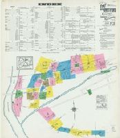
- Creator:
- Sanborn Map Company, issuing body
- Published / Created:
- 1924
- Call Number:
- 766 D444 1924
- Image Count:
- 30
- Resource Type:
- Maps, Atlases & Globes
- Abstract:
- Sanborn fire insurance maps are a rich
- Description:
- Partial cadastral map.
- Subject (Geographic):
- Derby (Conn.)--Maps
- Subject (Topic):
- --Derby--Maps
- Found in:
- Beinecke Rare Book and Manuscript Library > Derby, including East Derby, New Haven County, Connecticut.
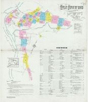
- Creator:
- Sanborn Map Company, issuing body
- Published / Created:
- 1927
- Call Number:
- 766 Ea76 1927
- Image Count:
- 30
- Resource Type:
- Maps, Atlases & Globes
- Abstract:
- Sanborn fire insurance maps are a rich
- Description:
- Partial cadastral map.
- Subject (Geographic):
- East Hartford (Conn.)--Maps
- Subject (Topic):
- Hartford--Maps
- Found in:
- Beinecke Rare Book and Manuscript Library > East Hartford, Hartford County, Connecticut.
- Creator:
- Sanborn Map Company, issuing body
- Published / Created:
- 1915
- Call Number:
- 766 T63 1915
- Image Count:
- 32
- Resource Type:
- Maps, Atlases & Globes
- Abstract:
- Sanborn fire insurance maps are a rich
- Description:
- Partial cadastral map.
- Subject (Geographic):
- Torrington (Conn.)--Maps
- Subject (Topic):
- --Torrington--Maps
- Found in:
- Beinecke Rare Book and Manuscript Library > Insurance maps of Torrington, Litchfield Co., Connecticut.
- Creator:
- Sanborn-Perris Map Co., issuing body
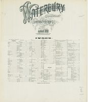
- Published / Created:
- 1890
- Call Number:
- 766 W29 1890
- Image Count:
- 31
- Resource Type:
- Maps, Atlases & Globes
- Abstract:
- Sanborn fire insurance maps are a rich
- Description:
- Partial cadastral map.
- Subject (Geographic):
- Waterbury (Conn.)--Maps
- Subject (Topic):
- --Waterbury--Maps
- Found in:
- Beinecke Rare Book and Manuscript Library > Waterbury, New Haven County, Connecticut.
- Creator:
- Sanborn Map Company, issuing body
- Published / Created:
- 1909
- Call Number:
- 766 D19 1909
- Image Count:
- 33
- Resource Type:
- Maps, Atlases & Globes
- Abstract:
- Sanborn fire insurance maps are a rich
- Description:
- Partial cadastral map.
- Subject (Geographic):
- Danbury (Conn.)--Maps
- Subject (Topic):
- --Danbury--Maps
- Found in:
- Beinecke Rare Book and Manuscript Library > Insurance maps of Danbury, Fairfield County, Connecticut.
- Creator:
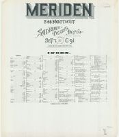
- Sanborn-Perris Map Co., issuing body
- Published / Created:
- 1896
- Call Number:
- 766 M54 1896
- Image Count:
- 32
- Resource Type:
- Maps, Atlases & Globes
- Abstract:
- Sanborn fire insurance maps are a rich
- Description:
- Partial cadastral map.
- Subject (Geographic):
- Meriden (Conn.)--Maps
- Subject (Topic):
- --Meriden--Maps
- Found in:
- Beinecke Rare Book and Manuscript Library > Insurance maps of Meriden, New Haven Co., Connecticut.
- Creator:
- Sanborn Map Company, issuing body
- Published / Created:
- 1907
- Call Number:
- 766 M584 1907
- Image Count:
- 32
- Resource Type:
- Maps, Atlases & Globes
- Abstract:
- Sanborn fire insurance maps are a rich
- Description:
- Partial cadastral map.
- Subject (Geographic):
- Middletown (Conn.)--Maps
- Subject (Name):
- Library of Congress. Map Division Stamp
- Subject (Topic):
- --Middletown--Maps
- Found in:
- Beinecke Rare Book and Manuscript Library > Insurance maps of Middletown, Middlesex County, Connecticut.
- Creator:
- Sanborn Map Company, issuing body
- Published / Created:
- 1916
- Call Number:
- 766 B77 1916
- Image Count:
- 32
- Resource Type:
- Maps, Atlases & Globes
- Abstract:
- Sanborn fire insurance maps are a rich
- Description:
- Partial cadastral map.
- Subject (Geographic):
- Bristol (Conn.)--Maps
- Subject (Topic):
- --Bristol--Maps
- Found in:
- Beinecke Rare Book and Manuscript Library > Insurance maps of Bristol, Hartford County, Connecticut.
- Creator:
- Sanborn Map Company, issuing body
- Published / Created:
- 1914
- Call Number:
- 766 N835 1914
- Image Count:
- 33
- Resource Type:
- Maps, Atlases & Globes
- Abstract:
- Sanborn fire insurance maps are a rich
- Description:
- Partial cadastral map.
- Subject (Geographic):
- Norwich (Conn.)--Maps
- Subject (Topic):
- --Norwich--Maps
- Found in:
- Beinecke Rare Book and Manuscript Library > Insurance maps of Norwich, New London Co., Connecticut.
- Creator:
- Baker, Anthony St. John, 1785-1854
- Published / Created:
- 1850
- Call Number:
- 2003 1141
- Container / Volume:
- 3
- Image Count:
- 257
- Found in:
- Beinecke Rare Book and Manuscript Library > Mémoires d'un voyageur qui se repose : with illustrations : in four parts
- Creator:
- Brokaw, S. E
- Published / Created:
- [1925]
- Call Number:
- 847 Se18 1922
- Container / Volume:
- BRBL_00627
- Image Count:
- 2
- Resource Type:
- Maps, Atlases & Globes
- Alternative Title:
- City map of Seattle
- Description:
- Text and map of "Business section of
- Subject (Geographic):
- Seattle (Wash.)--Maps
- Subject (Topic):
- (State)--Seattle--Maps
- Found in:
- Beinecke Rare Book and Manuscript Library > Route map of Seattle / compiled and published by Automobile Club of Washington ; drawn by S.E. Brokaw, 6-15-22, cor. 4-27-25.
- Creator:
- Sanborn Map Company, issuing body
- Published / Created:
- 1926
- Call Number:
- 766 M31 1926
- Image Count:
- 36
- Resource Type:
- Maps, Atlases & Globes
- Abstract:
- Sanborn fire insurance maps are a rich
- Description:
- Partial cadastral map.
- Subject (Geographic):
- Manchester--Maps
- Subject (Topic):
- --Manchester--Maps
- Found in:
- Beinecke Rare Book and Manuscript Library > Insurance maps of Manchester, including part of Highland Park and Manchester Green, Hartford Co., Connecticut.
- Creator:
- Sanborn-Perris Map Co., issuing body
- Published / Created:
- 1901
- Call Number:
- 766 N42 1901
- Image Count:
- 35
- Resource Type:
- Maps, Atlases & Globes
- Abstract:
- Sanborn fire insurance maps are a rich
- Description:
- Partial cadastral map.
- Subject (Geographic):
- New Britain (Conn.)--Maps
- Subject (Topic):
- Britain--Maps
- Found in:
- Beinecke Rare Book and Manuscript Library > Insurance maps of New Britain, Hartford County, Connecticut.
- Creator:
- Sanborn Map & Publishing Co., issuing body
- Published / Created:
- 1889
- Call Number:
- 766 B76 1889
- Image Count:
- 37
- Resource Type:
- Maps, Atlases & Globes
- Abstract:
- Sanborn fire insurance maps are a rich
- Description:
- Partial cadastral map.
- Subject (Geographic):
- Bridgeport (Conn.)--Maps
- Subject (Topic):
- --Bridgeport--Maps
- Found in:
- Beinecke Rare Book and Manuscript Library > Bridgeport, Connecticut.
- Creator:
- Bickham, George, 1706?-1771, printmaker
- Published / Created:
- [1741]
- Call Number:
- 741.00.00.06.1+
- Image Count:
- 1
- Resource Type:
- still image
- Description:
- -- Maps: capture of Porto Bello, November 22
- Found in:
- Lewis Walpole Library > A skit on Britain [graphic]
- Creator:
- Sanborn Map Company, issuing body
- Published / Created:
- 1930
- Call Number:
- 766 F16 1930
- Image Count:
- 37
- Resource Type:
- Maps, Atlases & Globes
- Abstract:
- Sanborn fire insurance maps are a rich
- Description:
- Partial cadastral map.
- Subject (Geographic):
- Fairfield (Conn.)--Maps
- Subject (Topic):
- --Fairfield--Maps
- Found in:
- Beinecke Rare Book and Manuscript Library > Fairfield including Stratfield, Fairfield County, Connecticut.
- Creator:
- Sanborn Map Company, issuing body
- Published / Created:
- 1913
- Call Number:
- 766 M584 1913
- Image Count:
- 38
- Resource Type:
- Maps, Atlases & Globes
- Abstract:
- Sanborn fire insurance maps are a rich
- Description:
- Partial cadastral map.
- Subject (Geographic):
- Middletown (Conn.)--Maps
- Subject (Topic):
- --Middletown--Maps
- Found in:
- Beinecke Rare Book and Manuscript Library > Insurance maps of Middletown, Middlesex County, Connecticut.
- Creator:
- Sanborn Map Company, issuing body
- Published / Created:
- 1921
- Call Number:
- 766 B77 1921
- Image Count:
- 37
- Resource Type:
- Maps, Atlases & Globes
- Abstract:
- Sanborn fire insurance maps are a rich
- Description:
- Partial cadastral map.
- Subject (Geographic):
- Bristol (Conn.)--Maps
- Subject (Topic):
- --Bristol--Maps
- Found in:
- Beinecke Rare Book and Manuscript Library > Insurance maps of Bristol, Hartford Co., Connecticut.
- Creator:
- Sanborn-Perris Map Co., issuing body
- Published / Created:
- 1895
- Call Number:
- 766 W29 1895
- Image Count:
- 37
- Resource Type:
- Maps, Atlases & Globes
- Abstract:
- Sanborn fire insurance maps are a rich
- Description:
- Partial cadastral map.
- Subject (Geographic):
- Waterbury (Conn.)--Maps
- Subject (Topic):
- --Waterbury--Maps
- Found in:
- Beinecke Rare Book and Manuscript Library > Insurance maps of Waterbury, New Haven County, Connecticut.
- Call Number:
- WA MSS S-1415
- Container / Volume:
- Box 1
- Image Count:
- 79
- Resource Type:
- unspecified
- Abstract:
- maps of the railroad routes. There is a
- Found in:
- Beinecke Rare Book and Manuscript Library > Diary of a voyage from New York to California and return trip by train, 1874-1875
- Creator:
- Manley, Roger, Sir, 1626?-1688
- Published / Created:
- 1683
- Call Number:
- DL192 M35 1683+ Oversize
- Image Count:
- 91
- Found in:
- Beinecke Rare Book and Manuscript Library > The history of the late wars in Denmark : comprising, all the transactions, both military and civil ... in the years, 1657, 1658, 1659, 1660 ... / by Sir Roger Manley
- Creator:
- Bickham, George, 1706?-1771, printmaker
- Published / Created:
- [1741]
- Call Number:
- Folio 724 C2 738
- Image Count:
- 1
- Resource Type:
- still image
- Description:
- -- Maps: capture of Porto Bello, November 22
- Found in:
- Lewis Walpole Library > A skit on Britain [graphic]
- Creator:
- Popple, Henry, -1743
- Published / Created:
- 1733
- Call Number:
- 89 1720
- Container / Volume:
- BRBL_00697
- Image Count:
- 1
- Resource Type:
- Maps, Atlases & Globes
- Description:
- . Popple's Map of America. 25 cm.
- Subject (Geographic):
- Great Britain--Colonies--America--Maps
- Found in:
- Beinecke Rare Book and Manuscript Library > A map of the British Empire in America, with the French and Spanish settlements adjacent thereto / by Henry Popple.
- Creator:
- Sanborn Map Company, issuing body
- Published / Created:
- 1924
- Call Number:
- 766 An81 1924
- Image Count:
- 39
- Resource Type:
- Maps, Atlases & Globes
- Abstract:
- Sanborn fire insurance maps are a rich
- Description:
- Partial cadastral map.
- Subject (Geographic):
- Ansonia (Conn.)--Maps
- Subject (Topic):
- --Ansonia--Maps
- Found in:
- Beinecke Rare Book and Manuscript Library > Ansonia, New Haven Co., Connecticut.
- Published / Created:
- 1922?]
- Call Number:
- 825ad An23 1922
- Container / Volume:
- BRBL_00575
- Image Count:
- 1
- Resource Type:
- Maps, Atlases & Globes
- Subject (Topic):
- --Maps
- Found in:
- Beinecke Rare Book and Manuscript Library > [Map of sections in townships 20 S and 21 S, and ranges 19 E and 20 E, Anderson County, Kansas] / F.S.T. 3/25/'22, Garnett, Kas.
- Creator:
- New York and Ione Silver Mining Company
- Published / Created:
- 1864
- Call Number:
- Zc69 864nf
- Image Count:
- 48
- Found in:
- Beinecke Rare Book and Manuscript Library > The New York and Ione Silver Mining Company ... [Prospectus]
- Creator:
- Sanborn Map Company, issuing body
- Published / Created:
- 1909
- Call Number:
- 766 N835 1909
- Image Count:
- 41
- Resource Type:
- Maps, Atlases & Globes
- Abstract:
- Sanborn fire insurance maps are a rich
- Description:
- Partial cadastral map.
- Subject (Geographic):
- Norwich (Conn.)--Maps
- Subject (Topic):
- --Norwich--Maps
- Found in:
- Beinecke Rare Book and Manuscript Library > Insurance maps of Norwich, New London Co., Connecticut.
- Creator:
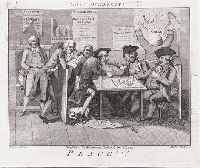
- Barlow, Inigo, printmaker
- Published / Created:
- Decr. 1st, 1790.
- Call Number:
- 790.12.01.06.1
- Image Count:
- 1
- Resource Type:
- still image
- Description:
- maps -- Newspapers: Gazetteer -- Newspapers
- Found in:
- Lewis Walpole Library > Peace!!! [graphic]
- Creator:
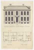
- Campbell, Colen, 1676-1729, artist
- Published / Created:
- [between 1715 and 1731]
- Call Number:
- Topos M627 no. 13+
- Image Count:
- 1
- Resource Type:
- still image
- Description:
- No. 22, "Mr. and Mrs. George Morton
- Found in:
- Lewis Walpole Library > The prospect to the gardens of The Honble. Iames Iohnston Esqr. his house at Twittenham in the county of Midlesex, 1710 Elevation du costé du jardin del la maison du Monsieur Monsr. Iohnston a Twittenham dans la comté de Midlesex ; The plan of the first floor = Plan de la premiere estage ; The Plan of the chamber floor = Plan de la seconde estage / [graphic] =
- Creator:
- Sanborn Map Company, issuing body
- Published / Created:
- 1907
- Call Number:
- 766 N47 1907
- Image Count:
- 43
- Resource Type:
- Maps, Atlases & Globes
- Abstract:
- Sanborn fire insurance maps are a rich
- Description:
- Partial cadastral map.
- Subject (Geographic):
- Groton (Conn.)--Maps
- Subject (Topic):
- --Groton--Maps
- Found in:
- Beinecke Rare Book and Manuscript Library > Insurance maps of New London, including Groton, Connecticut.
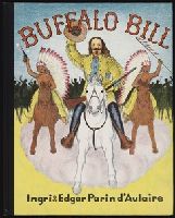
- Creator:
- D’Aulaire, Edgar Parin, 1898-1986
D’Aulaire, Ingri, 1904-1980
- Published / Created:
- c1952
- Call Number:
- Shirley +215
- Image Count:
- 34
- Found in:
- Beinecke Rare Book and Manuscript Library > Buffalo Bill
- Creator:
- Sanborn Map Company, issuing body
- Published / Created:
- 1921
- Call Number:
- 766 N47 1921
- Image Count:
- 73
- Resource Type:
- Maps, Atlases & Globes
- Abstract:
- Sanborn fire insurance maps are a rich
- Description:
- Partial cadastral map.
- Subject (Geographic):
- Groton (Conn.)--Maps
- Subject (Topic):
- --Groton--Maps
- Found in:
- Beinecke Rare Book and Manuscript Library > Insurance maps of New London, including Groton, Connecticut.
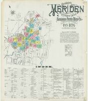
- Creator:
- Sanborn-Perris Map Co., issuing body
- Published / Created:
- 1901
- Call Number:
- 766 M54 1901
- Image Count:
- 51
- Resource Type:
- Maps, Atlases & Globes
- Abstract:
- Sanborn fire insurance maps are a rich
- Description:
- Partial cadastral map.
- Subject (Geographic):
- Meriden (Conn.)--Maps
- Subject (Topic):
- --Meriden--Maps
- Found in:
- Beinecke Rare Book and Manuscript Library > Insurance maps of Meriden, New Haven, Connecticut.
- Creator:
- Baker, Anthony St. John, 1785-1854
- Published / Created:
- 1850
- Call Number:
- 2003 1141
- Container / Volume:
- 4
- Image Count:
- 201
- Found in:
- Beinecke Rare Book and Manuscript Library > Mémoires d'un voyageur qui se repose : with illustrations : in four parts
- Creator:
- Brockedon, William, 1787-1854
- Published / Created:
- 1835.
- Call Number:
- Ed +835B
- Image Count:
- 272
- Found in:
- Beinecke Rare Book and Manuscript Library > Road-book from London to Naples
- Creator:
- Sanborn Map Company, issuing body
- Published / Created:
- 1909
- Call Number:
- 766 N42 1909
- Image Count:
- 58
- Resource Type:
- Maps, Atlases & Globes
- Abstract:
- Sanborn fire insurance maps are a rich
- Description:
- Partial cadastral map.
- Subject (Geographic):
- New Britain (Conn.)--Maps
- Subject (Topic):
- Britain--Maps
- Found in:
- Beinecke Rare Book and Manuscript Library > Insurance maps of New Britain, Hartford County, Connecticut.
- Published / Created:
- [1785?]
- Call Number:
- 785.00.00.01
- Image Count:
- 1
- Resource Type:
- still image
- Description:
- map: Operations of the siege of the
- Found in:
- Lewis Walpole Library > Consulting the physicians, or, Four to one against recovery [graphic].
- Creator:
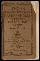
- Rand McNally and Company, cartographer
- Published / Created:
- c1921.
- Call Number:
- Covers 796 1921
- Image Count:
- 102
- Alternative Title:
- Indexed pocket map, tourists' and
- Description:
- On verso: Rand McNally main highway map
- Found in:
- Beinecke Rare Book and Manuscript Library > Rand McNally indexed pocket map, tourists' and shippers' guide of Texas