Search
You Searched For
Search Results
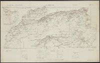
- Creator:
- Great Britain. War Office. General Staff. Geographical Section
- Published / Created:
- 1942
- Call Number:
- 66gmb 1942
- Container / Volume:
- BRBL_00348
- Image Count:
- 1
- Resource Type:
- Maps, Atlases & Globes
- Found in:
- Beinecke Rare Book and Manuscript Library > Africa road map 1:2,000,000 and 1:500,000, Maroc-Algerie-Tunisie.
- Published / Created:
- 1919
- Call Number:
- 383 1919
- Container / Volume:
- BRBL_00177
- Image Count:
- 1
- Resource Type:
- Maps, Atlases & Globes
- Found in:
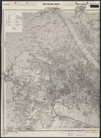
- Beinecke Rare Book and Manuscript Library > Alsace-Lorraine.
- Published / Created:
- 1944
- Call Number:
- 42 V67 1944
- Container / Volume:
- BRBL_00245
- Image Count:
- 1
- Resource Type:
- Maps, Atlases & Globes
- Found in:
- Beinecke Rare Book and Manuscript Library > Austria: Wien (Vienna). G.S.G.S. 4483 [cartographic material].
- Creator:
- G.W. Bacon & Co
- Published / Created:
- [between 1913 and 1925]
- Call Number:
- 32gm L84 1913
- Container / Volume:
- BRBL_00076
- Image Count:
- 1
- Resource Type:
- Maps, Atlases & Globes
- Found in:
- Beinecke Rare Book and Manuscript Library > Bacon's new map of London : divided into half-squares & circles from Charing-Cross.
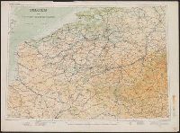
- Creator:
- Great Britain. War Office. General Staff. Geographical Section
- Published / Created:
- 1910
- Call Number:
- 335 1910
- Container / Volume:
- BRBL_00086
- Image Count:
- 1
- Resource Type:
- Maps, Atlases & Globes
- Found in:
- Beinecke Rare Book and Manuscript Library > Belgium and the north east of France G.S.G.S. 2517 [cartographic material].
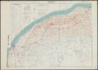
- Creator:
- Great Britain. Army. Royal Engineers. Field Survey Coy., 512th
- Published / Created:
- 1942
- Call Number:
- 691 B43 1942
- Container / Volume:
- BRBL_00352
- Image Count:
- 1
- Resource Type:
- Maps, Atlases & Globes
- Found in:
- Beinecke Rare Book and Manuscript Library > Bengasi, Sheet 1 / compiled, drawn, and reproduced by 512 Fd. Survey Coy., R.E., Nov., 1942.
- Published / Created:
- [1900?]
- Call Number:
- 45 1900
- Container / Volume:
- BRBL_00258
- Image Count:
- 1
- Resource Type:
- Maps, Atlases & Globes
- Found in:
- Beinecke Rare Book and Manuscript Library > Bessarabia.
- Creator:
- Royal Geographical Society (Great Britain)
- Published / Created:
- 1909
- Call Number:
- 19 1909A
- Container / Volume:
- BRBL_00013
- Image Count:
- 1
- Resource Type:
- Maps, Atlases & Globes
- Found in:
- Beinecke Rare Book and Manuscript Library > British Antarctic Expedition, 1907 [cartographic material] : general map showing the explorations and surveys of the Expedition, 1907-09.
- Creator:
- Mawson, Douglas Sir, 1882-1958
- Published / Created:
- 1909
- Call Number:
- 19 1909C
- Container / Volume:
- BRBL_00013
- Image Count:
- 1
- Resource Type:
- Maps, Atlases & Globes
- Found in:
- Beinecke Rare Book and Manuscript Library > British Antarctic Expedition, 1907 [cartographic material] : route and surveys of the South Magnetic Polar Party, 1908-09 : from triangulation and traverses / by Douglas Mawson.
- Creator:
- Marshall, Eric, 1879-1963
- Published / Created:
- 1909
- Call Number:
- 19 1909B
- Container / Volume:
- BRBL_00013
- Image Count:
- 1
- Resource Type:
- Maps, Atlases & Globes
- Found in:
- Beinecke Rare Book and Manuscript Library > British Antarctic Expedition, 1907 [cartographic material] : route and surveys of the Southern Journey Party, 1908-09 : from traverses and astronomical observations / Eric Marshall, cartographer.