Search
You Searched For
Search Results
- Creator:
- Geological Survey (U.S.)
- Published / Created:
- [1901]
- Call Number:
- 833gc N431 1899
- Container / Volume:
- BRBL_00586
- Image Count:
- 1
- Resource Type:
- Maps, Atlases & Globes
- Found in:
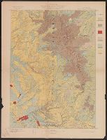
- Beinecke Rare Book and Manuscript Library > Wyoming-South Dakota, Newcastle quadrangle : land classification and density of standing timber / U.S. Geological Survey ; E.M. Douglas, geographer in charge ; triangulation by Frank Tweedy and R.H. Chapman ; topography by W.H. Herron ; Henry Gannett, geo
- Creator:
- Geological Survey (U.S.)
- Published / Created:
- [1912]
- Call Number:
- 833fcm Y38 1912
- Container / Volume:
- BRBL_00585
- Image Count:
- 1
- Resource Type:
- Maps, Atlases & Globes
- Found in:
- Beinecke Rare Book and Manuscript Library > Topographic map of the Yellowstone National Park, Wyoming-Montana-Idaho / from Geological Survey atlas sheets surveyed in 1883-85 ; partial revision in 1910 by E.P. Davis ; R.B. Marshall, chief geographer.
- Creator:
- Geological Survey (U.S.)
- Published / Created:
- [1900].
- Call Number:
- 833gc C625 1899
- Container / Volume:
- BRBL_00586
- Image Count:
- 1
- Resource Type:
- Maps, Atlases & Globes
- Found in:
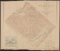
- Beinecke Rare Book and Manuscript Library > Wyoming, Cloud Peak quadrangle : land classification and density of standing timber / U.S. Geological Survey ; E.M. Douglas, geographer in charge ; triangulation by T.M. Bannon ; topography by H.S. Wallace and F.E. Matthes ; Henry Gannett, geographer in c
- Creator:
- Geological Survey (U.S.)
- Published / Created:
- 1898
- Call Number:
- 848 C793 1898
- Container / Volume:
- BRBL_00632
- Image Count:
- 1
- Resource Type:
- Maps, Atlases & Globes
- Found in:
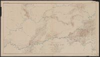
- Beinecke Rare Book and Manuscript Library > Alaska military expedition : in charge of Captain W.R. Abercrombie, U.S.A. Copper River and adjacent territory / topography by P.G. Lowe, F.C. Schrader, and Emil Mahlo.
- Creator:
- Geological Survey (U.S.)
- Published / Created:
- 1912
- Call Number:
- 848 G95 1912
- Container / Volume:
- BRBL_00632
- Image Count:
- 1
- Resource Type:
- Maps, Atlases & Globes
- Found in:
- Beinecke Rare Book and Manuscript Library > Geologic reconnaissance map of headwater region of Gulkana and Susitna Rivers, Alaska / U.S. Geological Survey. Alfred H. Brooks, geologist in charge of division, topography and triangulation by D.C. Witherspoon, C.E. Giffin and J.W. Bagley.
- Creator:
- Geological Survey (U.S.)
- Published / Created:
- [1908]
- Call Number:
- 848 F15 1908
- Container / Volume:
- BRBL_00632
- Image Count:
- 1
- Resource Type:
- Maps, Atlases & Globes
- Found in:
- Beinecke Rare Book and Manuscript Library > Alaska, Fairbanks special map / U.S. Geological Survey.
- Creator:
- Geological Survey (U.S.)
- Published / Created:
- 1916
- Call Number:
- 848 Y91 1916
- Container / Volume:
- BRBL_00634
- Image Count:
- 1
- Resource Type:
- Maps, Atlases & Globes
- Found in:
- Beinecke Rare Book and Manuscript Library > Reconnaissance map of Yukon-Koyukuk region, Alaska / U.S. Geological Survey; Alfred H. Brooks, geologist in charge of division, topography by H.M. Eakin [et al].
- Creator:
- Geological Survey (U.S.)
- Published / Created:
- 1922
- Call Number:
- 848 T15 1922
- Container / Volume:
- BRBL_00634
- Image Count:
- 1
- Resource Type:
- Maps, Atlases & Globes
- Found in:
- Beinecke Rare Book and Manuscript Library > Topographic reconnaissance map of Upper Tanana River Valley region, Alaska / U.S. Geological Survey; Alfred H. Brooks in charge of division; Control and topography by D.C. Witherspoon and J.W. Bagley; Upper Tanana River from boat traverses by W.J. Peters.
- Creator:
- Geological Survey (U.S.)
- Published / Created:
- 1922
- Call Number:
- 848 K84 1922
- Container / Volume:
- BRBL_00633
- Image Count:
- 1
- Resource Type:
- Maps, Atlases & Globes
- Found in:
- Beinecke Rare Book and Manuscript Library > Topographic map of Kotsina-Kuskulana District, Copper River region, Alaska.
- Creator:
- Geological Survey (U.S.)
- Published / Created:
- 1912
- Call Number:
- 71 1912
- Container / Volume:
- BRBL_00371
- Image Count:
- 1
- Resource Type:
- Maps, Atlases & Globes
- Found in:
- Beinecke Rare Book and Manuscript Library > Map of North America : reduced from map on scale of 1:5,000,000 / compiled by the U.S. Geological Survey.
- Creator:
- Geological Survey (U.S.)
- Published / Created:
- [1897]
- Call Number:
- 75BH 1897
- Container / Volume:
- BRBL_00407A
- Image Count:
- 1
- Resource Type:
- Maps, Atlases & Globes
- Found in:
- Beinecke Rare Book and Manuscript Library > Map showing condition and progress of topographic surveys and location of gaging stations for the fiscal year 1896-1897.
- Creator:
- Geological Survey (U.S.)
- Published / Created:
- 1909
- Call Number:
- 848 1909
- Container / Volume:
- BRBL_00630
- Image Count:
- 1
- Resource Type:
- Maps, Atlases & Globes
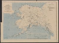
- Found in:
- Beinecke Rare Book and Manuscript Library > Map of Alaska / compiled chiefly from maps of the U.S. Geological Survey ... Alfred H. Brooks, geologist in charge, Division of Alaskan Mineral Resources.
- Creator:
- Geological Survey (U.S.)
- Published / Created:
- 1909
- Call Number:
- 848 C26 1909
- Container / Volume:
- BRBL_00632
- Image Count:
- 1
- Resource Type:
- Maps, Atlases & Globes
- Found in:
- Beinecke Rare Book and Manuscript Library > Alaska, Casadepaga quadrangle / U.S. Geological Survey.
- Creator:
- Geological Survey (U.S.)
- Published / Created:
- [1900]
- Call Number:
- 847gc T119 1897
- Container / Volume:
- BRBL_00628
- Image Count:
- 1
- Resource Type:
- Maps, Atlases & Globes
- Found in:
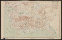
- Beinecke Rare Book and Manuscript Library > Land classification and density of standing timber, Washington, Tacoma quadrangle / U.S. Geological Survey.
- Creator:
- Geological Survey (U.S.)
- Published / Created:
- 1907
- Call Number:
- 848 Se87 1907A
- Container / Volume:
- BRBL_00634
- Image Count:
- 1
- Resource Type:
- Maps, Atlases & Globes
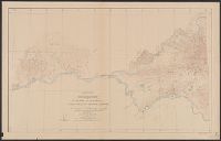
- Found in:
- Beinecke Rare Book and Manuscript Library > Reconnaissance map, southern part of Seward Peninsula, Alaska / topography by E.C. Barnard, D.L. Reaburn, J.G. Hefty ... [et al.].
- Creator:
- Geological Survey (U.S.)
- Published / Created:
- 1908
- Call Number:
- 848gbc 1908
- Container / Volume:
- BRBL_00635
- Image Count:
- 1
- Resource Type:
- Maps, Atlases & Globes
- Found in:
- Beinecke Rare Book and Manuscript Library > Map of Alaska showing the known distribution of mineral resources / U.S. Geological Survey, compiled under the direction of Alfred H. Brooks, Geologist in charge of Division of Alaskan Mineral Resources, U.S. Geological Survey.
- Creator:
- Geological Survey (U.S.)
- Published / Created:
- 1909
- Call Number:
- 848 R14 1909
- Container / Volume:
- BRBL_00634
- Image Count:
- 1
- Resource Type:
- Maps, Atlases & Globes
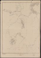
- Found in:
- Beinecke Rare Book and Manuscript Library > Reconnaissance map of Rampart quadrangle, Yukon-Tanana region, Alaska / U.S. Geological Survey ; Alfred H. Brooks, geologist in charge.
- Creator:
- Geological Survey (U.S.)
- Published / Created:
- 1921
- Call Number:
- 848 K96 1921
- Container / Volume:
- BRBL_00633
- Image Count:
- 1
- Resource Type:
- Maps, Atlases & Globes
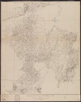
- Found in:
- Beinecke Rare Book and Manuscript Library > Reconnaissance map of the Lower Kuskokwim region, Alaska / U.S. Geological Survey ; Alfred H. Brooks, Geologist in charge of division, topography by A.G. Maddren, R.H. Sargent and W.S. Post.
- Creator:
- Geological Survey (U.S.)
- Published / Created:
- 1921
- Call Number:
- 848 R82 1921
- Container / Volume:
- BRBL_00634
- Image Count:
- 1
- Resource Type:
- Maps, Atlases & Globes
- Found in:
- Beinecke Rare Book and Manuscript Library > Reconnaissance map of Ruby district, Alaska / U.S. Geoogical Survey; Alfred H. Brooks, geologist in charge of division.
- Creator:
- Geological Survey (U.S.)
- Published / Created:
- [1918]
- Call Number:
- 848 J953 1918
- Container / Volume:
- BRBL_00633
- Image Count:
- 1
- Resource Type:
- Maps, Atlases & Globes
- Found in:
- Beinecke Rare Book and Manuscript Library > Juneau and vicinity, Alaska / Alfred H. Brooks, geologist in charge of division ; topography by D.C. Witherspoon.