Skip to search
Skip to main content
Skip to first result
Search
You Searched For
Extent of Digitization
Completely digitized
Creator
United States. Army Map Service
Search Results
Creator:
Published / Created:
1943
Call Number:
493 V24 1943
Container / Volume:
BRBL_00270
Image Count:
1
Resource Type:
Maps, Atlases & Globes
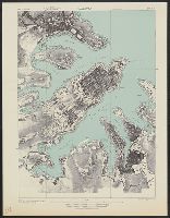
Alternative Title:
[Series] M991, Malta 1:7,500, Malta 1:7,500., and Valletta
Description:
"A.M.S. M991."
Publisher:
Army Map Service, U.S. Army,
Subject (Geographic):
Valletta (Malta)--Maps
Subject (Name):
Great Britain. Hydrographic Dept
Found in:
Beinecke Rare Book and Manuscript Library > Valletta city plan [cartographic material] / prepared under the direction of the Chief of Engineers, U.S. Army 1943.
Creator:
Published / Created:
1943
Call Number:
7391 1943
Container / Volume:
BRBL_00394
Image Count:
2
Resource Type:
Maps, Atlases & Globes
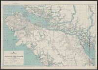
Alternative Title:
AMS ; A521 and Series (Standard map series designation system) ; A521.
Description:
Map originallly published by British Columbia Dept. of Lands.
Publisher:
U.S. Army Map Service,
Subject (Geographic):
Vancouver Island (B.C.)--Maps
Subject (Name):
British Columbia. Dept. of Lands
Found in:
Beinecke Rare Book and Manuscript Library > Vancouver Island / Army Map Service.
Creator:
Published / Created:
[1947]
Call Number:
7391 1947
Container / Volume:
BRBL_00394
Image Count:
2
Resource Type:
Maps, Atlases & Globes
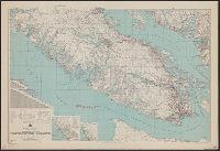
Alternative Title:
AMS ; A521, Northerly portion Vancouver Island, Series (Standard map series designation system) ; A521., and Southerly portion Vancouver Island
Description:
Map originallly published by B
Publisher:
U.S. Army Map Service,
Subject (Geographic):
Vancouver Island (B.C.)--Maps
Subject (Name):
British Columbia. Dept. of Lands
Found in:
Beinecke Rare Book and Manuscript Library > Vancouver Island.
Creator:
Published / Created:
1943
Call Number:
38 V66 1943
Container / Volume:
BRBL_00167
Image Count:
1
Resource Type:
Maps, Atlases & Globes
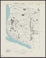
Alternative Title:
Army Map Service (Series) ; M961 and Army Map Service (Series) ; M961.
Description:
"4-43".
Publisher:
A.M.S.,
Subject (Geographic):
Vichy (France)--Maps
Found in:
Beinecke Rare Book and Manuscript Library > Vichy [cartographic material] : City plan.
Creator:
Published / Created:
[19]44.
Call Number:
269gmb 1945B
Container / Volume:
BRBL_00023A
Image Count:
1
Resource Type:
Maps, Atlases & Globes
Alternative Title:
AMS ; 9101 and Series (Standard map series designation system) ; 9101.
Description:
Relief shown by hachures and spot heights.
Publisher:
U.S. Army Map Service,
Subject (Geographic):
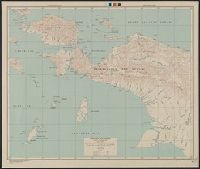
Papua (Indonesia)--Maps and Papua New Guinea--Maps
Found in:
Beinecke Rare Book and Manuscript Library > Western New Guinea : special strategic map / compiled by the Army Map Service.
Creator:
Published / Created:
1945
Call Number:
56 W48 1945
Container / Volume:
BRBL_00297
Image Count:
1
Resource Type:
Maps, Atlases & Globes
Alternative Title:
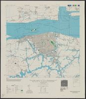
Its A.M.S. ; L901 and Series (Standard map series designation system) ; L901.
Description:
"Contour interval 20 meters."
Subject (Geographic):
Wenzhou (China)--Maps
Found in:
Beinecke Rare Book and Manuscript Library > Yung-chia (Wenchow) China, Chekiang Province [cartographic material].
Creator:
Published / Created:
1944
Call Number:
50 1945M
Container / Volume:
BRBL_00273
Image Count:
1
Resource Type:
Maps, Atlases & Globes
Alternative Title:
Eastern Asia, Kagoshima., and Nagasaki.
Description:
"A.M.S. 5301."
Publisher:
Amy Map Service,
Subject (Geographic):
East Asia--Maps
Subject (Name):
United States. Army Map Service
Subject (Topic):
Military geography--Japan--Kagoshima--Maps, Military geography--Japan--Nagasaki--Maps, Military maps, Military topography--Japan--Kagoshima--Maps, and Military topography--Japan--Nagasaki--Maps
Found in:
Beinecke Rare Book and Manuscript Library > [AAF cloth chart]. Eastern Asia [cartographic material].
Creator:
Published / Created:
1945
Call Number:
273 T171 1945
Container / Volume:
BRBL_00023B
Image Count:
1
Resource Type:
Maps, Atlases & Globes
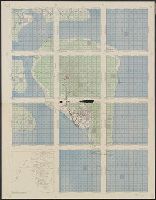
Alternative Title:
A.M.S. T736 A, Series (Standard map series designation system) ; T736 A., and Tarakan
Description:
Map of Tarakan Island divided into 11 charts overlayed with grids and ancillary "index map of air support charts, Tarakan".
Publisher:
The Service,
Subject (Geographic):
Tarakan Island (Indonesia)--Maps
Found in:
Beinecke Rare Book and Manuscript Library > [Air support charts, Tarakan] / prepared and reproduced by Army Map Service.
Creator:
Published / Created:
1943
Call Number:
533gm 1943
Container / Volume:
BRBL_00288
Image Count:
1
Resource Type:
Maps, Atlases & Globes
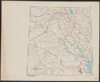
Alternative Title:
[Its A.M.S. ; 5207] and Its. A.M.S. ; 5207.
Description:
"Lambert conformal conic projection."
Publisher:
Army Map Service,
Subject (Geographic):
Iraq--Maps
Subject (Topic):
Transportation--Iraq--Maps
Found in:
Beinecke Rare Book and Manuscript Library > ʻIrāq [cartographic material] : special strategic map.
Branch:v1.68.6 ,Deployed:2025-07-02T08:09:49-04:00