
Search


Limit your search
- Public190
- cartographic✖[remove]190
- United States. Army Map Service✖[remove]190
- Great Britain. War Office. General Staff. Geographical Section9
- Manila Fire Insurance Association8
- U.S. Coast and Geodetic Survey3
- U.S. Lake Survey2
- United States. Aeronautical Chart Service2
- Geological Survey (U.S.)1
- Great Britain. War Office1
- United States. Army. Infantry Regiment, 17th1
- United States. Army. Philippine Scouts1
- Military maps7
- Railroads--Soviet Union--Maps6
- Aeronautical charts--East China Sea5
- Aeronautical charts--Japan, Sea of5
- Aeronautical charts--South China Sea5
- Ocean currents--China--Maps5
- Winds--China--Maps5
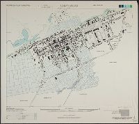
- Cities and towns--Korea (North)--Maps3
- Aeronautical charts--Japan2
- Cities and towns--Korea (South)--Maps2
- United States. Army Air Forces15
- United States. Aeronautical Chart Service12
- Great Britain. Hydrographic Dept3
- British Columbia. Dept. of Lands2
- United States. Army Map Service2
- United States. Army Map Service. Eastern Asia, 1:1,000,0002
- Egypt. Maṣlaḥat al-Misāḥah1
- Great Britain. War Office. General Staff. Geographical Section1
- Pneu Michelin (Firm)1
- Spain. Patronato Nacional de Turismo1
Current results range from 1941 to 1974