Skip to search
Skip to main content
Skip to first result
Search
You Searched For
Extent of Digitization
Completely digitized
Format
cartographic
New Search
Search Results
Creator:
Published / Created:
undated
Call Number:
WA MSS 328
Image Count:
1
Resource Type:
Maps, Atlases & Globes
Found in:
Beinecke Rare Book and Manuscript Library > Map of the ’Great Blue-Gravel Lead’ of Northern California /by J. P. Marker
Creator:
Call Number:
1973 Folio 30
Collection Title:
[Atlas factice of 32 maps and 1 distance table, produced by the Homann Erben firm]
Image Count:
2
Found in:
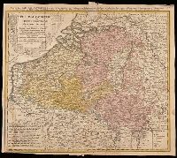
Beinecke Rare Book and Manuscript Library > Belgivm Catholicvm seu decem provinciae Germaniae inferioris : cum confiniis Germaniae svp. et Franciae legitime omnia delineata et ad ductum observationum astronomicarum, nec non geometricarum operationum a Cassinio Snellio Muschenbrokio aliisqve rite ha
Published / Created:
Undated
Call Number:
1973 Folio 10
Image Count:
1
Resource Type:
Maps, Atlases & Globes
Found in:
Beinecke Rare Book and Manuscript Library > A view of Prince Charles's passage over ye Rhine being a new and correct plan of that river from ye city of Maintz to Fort Louis
Creator:
Published / Created:
undated
Call Number:
Zc18 A11 856db
Image Count:
2
Resource Type:
Books, Journals & Pamphlets
Found in:
Beinecke Rare Book and Manuscript Library > D.B. Cooke & Cos great western railway guide : exhibiting all stations with distances from each other.
Creator:
Call Number:
WA Prints 157
Container / Volume:
Report upon United States Geographical surveys west of the one hundredth meridian in charge of First Lieut. Geo. M. Wheeler ... Vol. 1. Geographical report (Washington, Govt. Print. Off., 1875).
Image Count:
1
Found in:
Beinecke Rare Book and Manuscript Library > U.S. Geographical surveys west of the 100th meridian. Vol. I Geographical report. North American by Zaltieri, 1566
Creator:
Call Number:
WA Prints 156
Container / Volume:
Report upon United States Geographical surveys west of the one hundredth meridian in charge of First Lieut. Geo. M. Wheeler ... Vol. 1. Geographical report (Washington, Govt. Print. Off., 1875).
Image Count:
1
Found in:
Beinecke Rare Book and Manuscript Library > U.S. Geographical surveys west of the 100th meridian. Vol. I Geographical report. From map of North America by Abrahamus Ortelius, 1589. (reduced) [and] America from a globe in Frankfurt, about 1520. (reduced)
Published / Created:
n.d.
Call Number:
WA MSS S-1308
Collection Title:
Charles Augustus Ropes Dimon papers
Container / Volume:
Box 3 | Folder 82
Image Count:
4
Resource Type:
Archives or Manuscripts
Found in:
Beinecke Rare Book and Manuscript Library > Dakotah Territory; list of distances
Creator:
Call Number:
Art Storage 1980 156
Image Count:
2
Resource Type:
Maps, Atlases & Globes
Found in:
Beinecke Rare Book and Manuscript Library > [Portolan chart of the Mediterranean Sea, the North Atlantic Ocean, the Baltic Sea, and the West African coast].
Creator:
Call Number:
Art Storage 30cea 1555
Image Count:
2
Resource Type:
Maps, Atlases & Globes
Found in:
Beinecke Rare Book and Manuscript Library > [Portolan chart of the Mediterranean Sea, the North Atlantic Ocean, the Baltic Sea, and the northwestern African coast].
Creator:
Published / Created:
undated
Call Number:
WA MSS 303
Collection Title:
Lewis and Clark Expedition maps and receipt, ca. 1803-1810
Container / Volume:
Box 2 | Folder 59r
Image Count:
1
Found in:
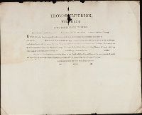
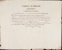
Beinecke Rare Book and Manuscript Library > Printed form used by Captains during the Expedition: "Thomas Jefferson, President of the United States of America. From the powers vested in us and [blank] by the above authority: To all who shall see these presents, Greeting: Know ye, that from the spec
Creator:
Published / Created:
undated
Call Number:
WA MSS 303
Collection Title:
Lewis and Clark Expedition maps and receipt, ca. 1803-1810
Container / Volume:
Box 2 | Folder 57r
Image Count:
1
Found in:
Beinecke Rare Book and Manuscript Library > Printed form used by Captains during the Expedition: "Thomas Jefferson, President of the United States of America. From the powers vested in us and [blank] by the above authority: To all who shall see these presents, Greeting: Know ye, that from the spec
Creator:
Published / Created:
undated
Call Number:
WA MSS 303
Collection Title:
Lewis and Clark Expedition maps and receipt, ca. 1803-1810
Container / Volume:
Box 2 | Folder 53v
Image Count:
1
Found in:
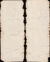
Beinecke Rare Book and Manuscript Library > Draft of the mouth of the Columbia River and fragmented view of the coast
Creator:
Published / Created:
undated
Call Number:
WA MSS 303
Collection Title:
Lewis and Clark Expedition maps and receipt, ca. 1803-1810
Container / Volume:
Box 2 | Folder 52
Image Count:
2
Found in:
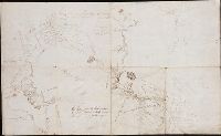
Beinecke Rare Book and Manuscript Library > Lewis's sketch-map of Vancouver's Island, Nootka Sound, etc
Creator:
Published / Created:
undated
Call Number:
WA MSS 303
Collection Title:
Lewis and Clark Expedition maps and receipt, ca. 1803-1810
Container / Volume:
Box 2 | Folder 51v
Image Count:
1
Found in:
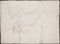
Beinecke Rare Book and Manuscript Library > Draft of the mouth of the Columbia River and Haleys Bay [and] Draft of the mouth of the Columbia River and Point William
Creator:
Published / Created:
undated
Call Number:
WA MSS 303
Collection Title:
Lewis and Clark Expedition maps and receipt, ca. 1803-1810
Container / Volume:
Box 2 | Folder 49
Image Count:
2
Found in:
Beinecke Rare Book and Manuscript Library > Coastline south of the mouth of the Columbia River
Creator:
Published / Created:
undated
Call Number:
WA MSS 303
Collection Title:
Lewis and Clark Expedition maps and receipt, ca. 1803-1810
Container / Volume:
Box 2 | Folder 48
Image Count:
2
Found in:
Beinecke Rare Book and Manuscript Library > Area of the mouth of the Columbia River, southern side
Creator:
Published / Created:
undated
Call Number:
WA MSS 303
Collection Title:
Lewis and Clark Expedition maps and receipt, ca. 1803-1810
Container / Volume:
Box 2 | Folder 47
Image Count:
2
Found in:
Beinecke Rare Book and Manuscript Library > Coastline north of the mouth of the Columbia River
Creator:
Published / Created:
undated
Call Number:
WA MSS 303
Collection Title:
Lewis and Clark Expedition maps and receipt, ca. 1803-1810
Container / Volume:
Box 2 | Folder 46
Image Count:
2
Found in:
Beinecke Rare Book and Manuscript Library > Area of the mouth of the Columbia River, northern side
Creator:
Published / Created:
undated
Call Number:
WA MSS 303
Collection Title:
Lewis and Clark Expedition maps and receipt, ca. 1803-1810
Container / Volume:
Box 2 | Folder 37
Image Count:
2
Found in:
Beinecke Rare Book and Manuscript Library > Route about October 11-13, 1805, and return camps for May 3 and 4, 1806
Creator:
Published / Created:
undated
Call Number:
WA MSS 303
Collection Title:
Lewis and Clark Expedition maps and receipt, ca. 1803-1810
Container / Volume:
Box 1 | Folder 4
Image Count:
2
Found in:
Beinecke Rare Book and Manuscript Library > Evans's Map 1 (the Expedition's route about August 13-September 10, 1804)
Creator:
Published / Created:
undated
Call Number:
WA MSS 303
Collection Title:
Lewis and Clark Expedition maps and receipt, ca. 1803-1810
Container / Volume:
Box 1 | Folder 3r
Image Count:
1
Found in:
Beinecke Rare Book and Manuscript Library > "A Memorandum of Articles in readiness for the Voyage," manuscript list
Creator:
Published / Created:
undated
Call Number:
WA MSS 303
Collection Title:
Lewis and Clark Expedition maps and receipt, ca. 1803-1810
Container / Volume:
Box 1 | Folder 2
Image Count:
2
Found in:
Beinecke Rare Book and Manuscript Library > The Upper Mississippi system, and the Missouri system as far as the Mandans
Creator:
Published / Created:
undated
Call Number:
WA MSS 303
Collection Title:
Lewis and Clark Expedition maps and receipt, ca. 1803-1810
Container / Volume:
Box 1 | Folder 1
Image Count:
2
Found in:
Beinecke Rare Book and Manuscript Library > Soulard's Map of 1795
Creator:
Call Number:
WA MSS 303
Collection Title:
Lewis and Clark Expedition maps and receipt, ca. 1803-1810
Container / Volume:
Box 2 | Folder 46
Image Count:
2
Found in:
Beinecke Rare Book and Manuscript Library > Area of the Mouth of the Columbia River, Northern Side
Creator:
Call Number:
3614 1792
Image Count:
1
Resource Type:
Maps, Atlases & Globes
Found in:
Beinecke Rare Book and Manuscript Library > The Kingdom of Bohemia, 1792 / Ferguson sculp.
Creator:
Call Number:
Manuscript 49 1577
Image Count:
2
Resource Type:
Maps, Atlases & Globes
Found in:
Beinecke Rare Book and Manuscript Library > Portolan chart of the Mediterranean and Black Seas.
Creator:
Call Number:
Manuscript 911cea 1789
Image Count:
2
Resource Type:
Maps, Atlases & Globes
Found in:
Beinecke Rare Book and Manuscript Library > Carta reduzida de hua parte de costa do Brasil : desde o Morro de S. Paulo athê Santos / por José Fernandes, Portugal na Bahia de Todos os Santos no Anno de 1789.
Call Number:
BrSides Folio 2019 56
Image Count:
1
Resource Type:
Maps, Atlases & Globes
Found in:
Beinecke Rare Book and Manuscript Library > Karta : opisi i promeru glubiny, chasti dnieprovskago Limana i reki Buga do Nikolaeva / sochinena flota gospodinom kapitanʺ leĭtnantomʺ Aleksandrom Savit︠s︡kimʺ 1793 goda.
Call Number:
BrSides Folio 2019 53
Image Count:
1
Resource Type:
Maps, Atlases & Globes
Found in:
Beinecke Rare Book and Manuscript Library > Charte der Krieges operation am Donn und Dniper ihro Russisch Kayserl. Maist. glorieusen Armeen, 1736.
Creator:
Call Number:
Double Covers 303cea +1645
Image Count:
7
Resource Type:
Maps, Atlases & Globes
Found in:
Beinecke Rare Book and Manuscript Library > [Chart of the Baltic Sea] / Siegismuntlus von Vogell fecit.
Creator:
Call Number:
BrSides Double Folio 2019 29
Image Count:
1
Resource Type:
Maps, Atlases & Globes
Found in:
Beinecke Rare Book and Manuscript Library > Belgivm Catholicvm seu decem provinciae Germaniae inferioris : cum confiniis Germaniae svp. et Franciae legitime omnia delineata et ad ductum observationum astronomicarum, nec non geometricarum operationum a Cassinio Snellio Muschenbrokio aliisqve rite ha
Creator:
Call Number:
BrSides Zc19 N82h 870na
Image Count:
1
Resource Type:
Maps, Atlases & Globes
Found in:
Beinecke Rare Book and Manuscript Library > Map of the Northern Pacific Railway and tributary country.
Creator:
Call Number:
Lanman 50 1676
Image Count:
2
Resource Type:
Maps, Atlases & Globes
Found in:
Beinecke Rare Book and Manuscript Library > A newe mape of Tartary / augmented by John Speed and are to be sold by Tho. Bassett in Fleet Street & Richard Chiswell in St. Pauls Churchyard ; Dirck Grÿp, sculp.
Creator:
Call Number:
Lanman 343 1587
Image Count:
1
Resource Type:
Maps, Atlases & Globes
Found in:
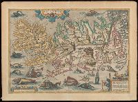
Beinecke Rare Book and Manuscript Library > Islandia.
Creator:
Call Number:
Lanman 32 1648
Image Count:
2
Resource Type:
Maps, Atlases & Globes
Found in:
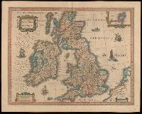
Beinecke Rare Book and Manuscript Library > Magna Britanniae et hiberniae tabvla / Guiljelmus Blaeuw excudit.
Creator:
Call Number:
Lanman 27 1666
Image Count:
1
Resource Type:
Maps, Atlases & Globes
Found in:
Beinecke Rare Book and Manuscript Library > Paskaerte zynde t'Oosterdeel van Oost Indien : met alle de Eylanden daer ontrendt geleegen van C. Comorin tot aen Iapan / by Pieter Goos, op't Waeter in de Vergulde Zeespiegel.
Creator:
Call Number:
Lanman 11 1693
Image Count:
1
Resource Type:
Maps, Atlases & Globes
Found in:
Beinecke Rare Book and Manuscript Library > [Terrestrial and celestial globe gore maps] / aut. il. P. Coronelli ad uso dell' Academia Cosmografica degli Argonauti.
Creator:
Call Number:
Lanman 11 1659A
Image Count:
1
Resource Type:
Maps, Atlases & Globes
Found in:
Beinecke Rare Book and Manuscript Library > A new and accvrat map of the world : drawne according to ye truest descriptions latest discoveries & best observations y[e]t have beene made by English or strangers.
Call Number:
BrSides Double Folio 2017 38
Image Count:
1
Resource Type:
Maps, Atlases & Globes
Found in:
Beinecke Rare Book and Manuscript Library > The theatre of war in North America, with the roads, and tables, of the superficial contents, distances, & ca. / by an American.
Call Number:
BrSides Double Folio 2017 26
Image Count:
1
Resource Type:
Maps, Atlases & Globes
Found in:
Beinecke Rare Book and Manuscript Library > New Haven in 1641.
Creator:
Call Number:
BrSides Double Folio 2019 116
Image Count:
1
Resource Type:
Maps, Atlases & Globes
Found in:
Beinecke Rare Book and Manuscript Library > Nova orbis tabvla in lvcem edita / a. F. de Wit.
Creator:
Call Number:
BrSides Double Folio 2019 115
Image Count:
1
Resource Type:
Maps, Atlases & Globes
Found in:
Beinecke Rare Book and Manuscript Library > Novissima et accuratissima septentrionalis ac meridionalis Americae : descriptio, multis locis recentibus aucta et correcté divisa in omnes partes hodiernas / per Fredericum de Witt ; F. de Wit excudit.
Creator:
Call Number:
11 1670A
Image Count:
1
Resource Type:
Maps, Atlases & Globes
Found in:
Beinecke Rare Book and Manuscript Library > Nova orbis tabvla in lvcem edita / a. F. de Wit.
Creator:
Call Number:
BrSides Zc39 888bp
Image Count:
1
Resource Type:
Maps, Atlases & Globes
Found in:
Beinecke Rare Book and Manuscript Library > Plan of property belonging to the Topeka Land & Development Co., Topeka, Kan. / Ernest W. Bowditch, engineer.
Creator:
Call Number:
BrSides Double Folio 2017 36
Image Count:
1
Resource Type:
Maps, Atlases & Globes
Found in:
Beinecke Rare Book and Manuscript Library > Limbourg : divisé en arrondissements et cantons de justice de paix / dressé et grave par C. van Baarsel et Fils.
Creator:
Call Number:
Covers 5615 +1857
Image Count:
2
Resource Type:
Maps, Atlases & Globes
Found in:
Beinecke Rare Book and Manuscript Library > Zhi li Da Qing He yuan liu zong tu / Qing he dao Dong Chun.
Creator:
Call Number:
Covers 5626 +1880
Image Count:
13
Resource Type:
Maps, Atlases & Globes
Found in:
Beinecke Rare Book and Manuscript Library > Su Sheng yu di ying wu quan tu / ji yong zhi xian Li Mengquan, Chen Jiaxun tong jian hua.
Creator:
Call Number:
766 C67 1884
Image Count:
2
Found in:
Beinecke Rare Book and Manuscript Library > Colchester, Conn.
Creator:
Call Number:
766 C67 1892
Image Count:
3
Found in:
Beinecke Rare Book and Manuscript Library > Colchester, New London Co., Conn.
Creator:
Call Number:
766 C67 1897
Image Count:
3
Found in:
Beinecke Rare Book and Manuscript Library > Colchester, New London Co., Conn.
Creator:
Call Number:
766 C67 1903
Image Count:
3
Found in:
Beinecke Rare Book and Manuscript Library > Colchester, New London Co., Connecticut.
Published / Created:
.
Call Number:
5684 1905
Container / Volume:
BRBL_00300
Image Count:
1
Resource Type:
Maps, Atlases & Globes
Found in:
Beinecke Rare Book and Manuscript Library > The Regent's Sword Peninsula.
Creator:
Call Number:
57 K99 1680
Container / Volume:
BRBL_00303
Image Count:
1
Resource Type:
Maps, Atlases & Globes
Found in:
Beinecke Rare Book and Manuscript Library > Miako.
Published / Created:
undated
Call Number:
WA MSS S-2162
Collection Title:
Frank Richard Oastler collection
Container / Volume:
Box 69 | Folder 71
Image Count:
1
Found in:
Beinecke Rare Book and Manuscript Library > Printed map previously in the envelope at the front of 1915 Wyoming Album I
Call Number:
766 N46 1917
Container / Volume:
BRBL_00473A
Image Count:
15
Resource Type:
Maps, Atlases & Globes
Found in:
Beinecke Rare Book and Manuscript Library > [City of New Haven] 1913-1917.
Creator:
Call Number:
766 N46 1910
Container / Volume:
BRBL_00473A
Image Count:
1
Resource Type:
Maps, Atlases & Globes
Found in:
Beinecke Rare Book and Manuscript Library > City of New Haven map.
Call Number:
774 P53 1794
Container / Volume:
BRBL_00499
Image Count:
1
Resource Type:
Maps, Atlases & Globes
Found in:
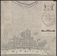
Beinecke Rare Book and Manuscript Library > To Thomas Mifflin / Governor and Commander in Chief of The State of Pennsylvania / This Plan of the City and Suburbs of Philadelphia Is respectfully inscribed by the Editor [Folie?] 1794.
Call Number:
734 M769 1906
Container / Volume:
BRBL_00380
Image Count:
1
Resource Type:
Maps, Atlases & Globes
Found in:
Beinecke Rare Book and Manuscript Library > Map of Montreal, Canada [cartographic material].
Creator:
Call Number:
38 P21 1918A
Container / Volume:
BRBL_00164A
Image Count:
1
Resource Type:
Maps, Atlases & Globes
Found in:
Beinecke Rare Book and Manuscript Library > Nouveau plan de Paris : 20 arrondissements, 80 quartiers / gravé par L. Poulmaire.
Call Number:
32cea 1550
Container / Volume:
BRBL_00701
Image Count:
2
Resource Type:
Maps, Atlases & Globes
Found in:
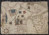
Beinecke Rare Book and Manuscript Library > [Section of a portolan chart spanning Great Britain in the west to the Adriatic Sea in the east.]
Call Number:
735 1790
Container / Volume:
BRBL_00689
Image Count:
1
Resource Type:
Maps, Atlases & Globes
Found in:
Beinecke Rare Book and Manuscript Library > A map shewing the communication of the lakes and the rivers between Lake Superior and Slave Lake in North America.
Creator:
Call Number:
71 1776
Container / Volume:
BRBL_00687
Image Count:
1
Resource Type:
Maps, Atlases & Globes
Found in:
Beinecke Rare Book and Manuscript Library > A map of the British Empire, in North America / by Samuel Dunn, mathematician, improved from the surveys of Capt. Carver.
Call Number:
11ba 1915
Container / Volume:
BRBL_00010A
Image Count:
1
Resource Type:
Maps, Atlases & Globes
Found in:
Beinecke Rare Book and Manuscript Library > [Philips' 12 inch terrestrial globe.]
Creator:
Call Number:
85 1745A
Container / Volume:
BRBL_00636
Image Count:
1
Resource Type:
Maps, Atlases & Globes
Found in:
Beinecke Rare Book and Manuscript Library > A chart of ye West-Indies or the islands of America in the North Sea &c., being ye present seat of war / by Herman Moll, geographer.
Creator:
Call Number:
848gmh 1950
Container / Volume:
BRBL_00635
Image Count:
1
Resource Type:
Maps, Atlases & Globes
Found in:
Beinecke Rare Book and Manuscript Library > Alaska Communications System : chart of Alaska showing stations to which commercial communication service is available / prepared by Alaska Communication System [and] Signal Corps, Department of the Army ; Cartography and format Northwest Mapping Service.
Published / Created:
.
Call Number:
9417 1913M
Container / Volume:
BRBL_00675
Image Count:
1
Resource Type:
Maps, Atlases & Globes
Found in:
Beinecke Rare Book and Manuscript Library > República Argentina : Informe sobre el estado de la minería en el territorio de los Andes / por ... Luciano Caplain.
Call Number:
94fb 1869
Container / Volume:
BRBL_00675
Image Count:
1
Resource Type:
Maps, Atlases & Globes
Found in:
Beinecke Rare Book and Manuscript Library > Proyecto de la limitacion de las Provincias de la Republica de Argentina y Demarcacion de los Territorios Nacionales presentado al Honorable Congreso por el Senador D. Nicasio Oroño,1869. Lit. á vapor, Moreno 130 Bs. As.
Published / Created:
.
Call Number:
90 1892
Container / Volume:
BRBL_00664
Image Count:
1
Resource Type:
Maps, Atlases & Globes
Found in:
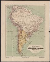
Beinecke Rare Book and Manuscript Library > Plano General de la America del Sud.
Creator:
Call Number:
844 Or6 1928
Container / Volume:
BRBL_00607
Image Count:
2
Resource Type:
Maps, Atlases & Globes
Found in:
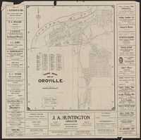
Beinecke Rare Book and Manuscript Library > Thomas Bros. map of Oroville / compiled and published by Thomas Bros. map specialties.
Creator:
Call Number:
834gfc Sp22 1873
Container / Volume:
BRBL_00590
Image Count:
2
Resource Type:
Maps, Atlases & Globes
Found in:
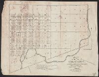
Beinecke Rare Book and Manuscript Library > Map of Spanish Bar District, Clear Creek Co., Colorado Territory : showing location of tunnel & mining claims, mill sites & water powers / surveyed & platted by F.F. Brunè, co. surveyor, Clear Creek Co., Colorado.
Creator:
Call Number:
833 1879
Container / Volume:
BRBL_00584
Image Count:
1
Resource Type:
Maps, Atlases & Globes
Found in:
Beinecke Rare Book and Manuscript Library > Territory of Wyoming : 1879 / compiled from the official records of the General Land Office and other sources by C. Roeser, Principal Draughtsman, G.L.O.
Creator:
Call Number:
816ad K134 1925
Container / Volume:
BRBL_00563
Image Count:
29
Resource Type:
Maps, Atlases & Globes
Found in:
Beinecke Rare Book and Manuscript Library > Atlas of Kansas City, Missouri, and environs, 1925.
Call Number:
8075cea 1848
Container / Volume:
BRBL_00551
Image Count:
1
Resource Type:
Maps, Atlases & Globes
Found in:
Beinecke Rare Book and Manuscript Library > A Chart of Lake Erie ... Buffalo, A. Burke, 1848.
Call Number:
805fcm C723 1841
Container / Volume:
BRBL_00546
Image Count:
1
Resource Type:
Maps, Atlases & Globes
Found in:
Beinecke Rare Book and Manuscript Library > Plat of the Town of Columbia ... Whitley county. Elihu Chauncey, Proprietor.
Call Number:
804 C599 1853
Container / Volume:
BRBL_00544
Image Count:
1
Resource Type:
Maps, Atlases & Globes
Found in:
Beinecke Rare Book and Manuscript Library > Survey of the Harbor of Cleveland Ohio [map]
Call Number:
803 1855
Container / Volume:
BRBL_00542
Image Count:
1
Resource Type:
Maps, Atlases & Globes
Found in:
Beinecke Rare Book and Manuscript Library > Sketch of the Ohio River at Cumberland Dam [map]
Creator:
Call Number:
796 B468 1879
Container / Volume:
BRBL_00527
Image Count:
1
Resource Type:
Maps, Atlases & Globes
Found in:
Beinecke Rare Book and Manuscript Library > Map of Bexar County.
Call Number:
787 1818
Container / Volume:
BRBL_00516
Image Count:
4
Resource Type:
Maps, Atlases & Globes
Found in:
Beinecke Rare Book and Manuscript Library > Map of the State of Georgia prepared from actual surveys and other documents for Eleazer Early [by] Daniel Sturges.
Call Number:
785cea H214 1837
Container / Volume:
BRBL_00514
Image Count:
1
Resource Type:
Maps, Atlases & Globes
Found in:
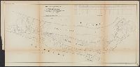
Beinecke Rare Book and Manuscript Library > No.1. Harbor Island Bar Entrance into Core Sound N.C. Surveyed under ... Drawn by T. J. Lee & L. Sitgreaves.
Call Number:
785cea C81 1837A
Container / Volume:
BRBL_00514
Image Count:
1
Resource Type:
Maps, Atlases & Globes
Found in:
Beinecke Rare Book and Manuscript Library > Core Sound North Carolina, surveyed under ...1837.
Call Number:
783hc 1781
Container / Volume:
BRBL_00511
Image Count:
4
Resource Type:
Maps, Atlases & Globes
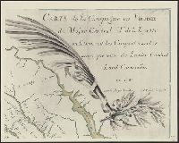
Found in:
Beinecke Rare Book and Manuscript Library > Campagne en Virginie du Major Général M. de La Fayette, ou se trouvent les Camps et Marches ainsy que ceux du Lieutenant Général Ld. Cornwallis, par le Major Capitaine, Aide de Camp de Gl. La Fayette en 1781.
Call Number:
783hc 1781
Container / Volume:
BRBL_00511
Image Count:
4
Resource Type:
Maps, Atlases & Globes
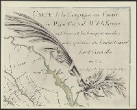
Found in:
Beinecke Rare Book and Manuscript Library > Campagne en Virginie du Major Général M. de La Fayette, ou se trouvent les Camps et Marches ainsy que ceux du Lieutenant Général Ld. Cornwallis, par le Major Capitaine, Aide de Camp de Gl. La Fayette en 1781.
Call Number:
783hc 1781
Container / Volume:
BRBL_00511
Image Count:
4
Resource Type:
Maps, Atlases & Globes
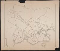
Found in:
Beinecke Rare Book and Manuscript Library > Campagne en Virginie du Major Général M. de La Fayette, ou se trouvent les Camps et Marches ainsy que ceux du Lieutenant Général Ld. Cornwallis, par le Major Capitaine, Aide de Camp de Gl. La Fayette en 1781.
Call Number:
783 R41 1866
Container / Volume:
BRBL_00510
Image Count:
2
Resource Type:
Maps, Atlases & Globes
Found in:
Beinecke Rare Book and Manuscript Library > Johnson's map of the vicinity of Richmond and peninsular campaing in Virginia ... By Johnson and Ward.
Call Number:
783 C899 1863B
Container / Volume:
BRBL_00510
Image Count:
1
Resource Type:
Maps, Atlases & Globes
Found in:
Beinecke Rare Book and Manuscript Library > Military and topographic map of region about Culpepper Courthouse, Va.
Call Number:
783 1809
Container / Volume:
BRBL_00508
Image Count:
1
Resource Type:
Maps, Atlases & Globes
Found in:
Beinecke Rare Book and Manuscript Library > The State of Virginia from the best Authorities, By Samuel Lewis. 1809.
Call Number:
783 1775
Container / Volume:
BRBL_00507
Image Count:
3
Resource Type:
Maps, Atlases & Globes
Found in:
Beinecke Rare Book and Manuscript Library > A map of the most inhabited part of Virginia part of Pensilvania, new Yersey & North Carolina.
Call Number:
783 1673D
Container / Volume:
BRBL_00507
Image Count:
1
Resource Type:
Maps, Atlases & Globes
Found in:
Beinecke Rare Book and Manuscript Library > virginia and Maryland. As it is planted and inhabited this present year 1670. Surveyed and Exactly Drawne by ... Augustin Herrman, 1673.
Call Number:
779hc W27 1861
Container / Volume:
BRBL_00505A
Image Count:
1
Resource Type:
Maps, Atlases & Globes
Found in:
Beinecke Rare Book and Manuscript Library > Plan of "Cantonment Spargue" near Washington D.C. occupied by 1st Regiment, R.I. Detached Militia. as laid out under the direction of Col. A.E. Burnside ... by Lieut. H.A. DeWitt, Engineer. May 1861.
Call Number:
779 W27 1792A
Container / Volume:
BRBL_00505
Image Count:
1
Resource Type:
Maps, Atlases & Globes
Found in:
Beinecke Rare Book and Manuscript Library > Plan of the City of Washington in the territory of Columbia. Ceded by the States of Virginia and Maryland to the United States of America and by them established as the Seat of their Government. After the year MDCCC.
Call Number:
777 C425 1799
Container / Volume:
BRBL_00503
Image Count:
1
Resource Type:
Maps, Atlases & Globes
Found in:
Beinecke Rare Book and Manuscript Library > A map of the head of the Chesapeake Bay and Susquehanna River shewing the navigation of the same with a topographical description of the surrounding country from an actual survey by C.P. Hauducoeur 1799.
Call Number:
776 1801
Container / Volume:
BRBL_00502
Image Count:
1
Resource Type:
Maps, Atlases & Globes
Found in:
Beinecke Rare Book and Manuscript Library > A map of Delaware and eastern shore of Maryland with the soundings of the Bay of Delaware from actual survey & soundings made in 1799, 1800 & 1801 by the Author.
Call Number:
774gme 1840B
Container / Volume:
BRBL_00501A
Image Count:
1
Resource Type:
Maps, Atlases & Globes
Found in:
Beinecke Rare Book and Manuscript Library > Map exhibiting that portion of the state of Pennsylvania traversed by the surveys for a continous railroad from Harrisburg to Pittsburg, 1839-40.
Call Number:
774CA AL53 1824
Container / Volume:
BRBL_00501
Image Count:
1
Resource Type:
Maps, Atlases & Globes
Found in:
Beinecke Rare Book and Manuscript Library > Plan and Profile of the Allegany Mountain between the head waters of Blair's Greek, a branch of the Juniata and the mountain branch of the Conemaugh 1824.
Call Number:
774 B856 1820
Container / Volume:
BRBL_00499
Image Count:
1
Resource Type:
Maps, Atlases & Globes
Found in:
Beinecke Rare Book and Manuscript Library > A map of Buck Mountain coal company mines exhibiting their relative position to the Lehigh slack water navigation and the different coal mines now opened in the region. Drawn by A.L. Foster of J. Collins 1820 (?) Lith.
Call Number:
771hc B796 1776A
Container / Volume:
BRBL_00495
Image Count:
1
Resource Type:
Maps, Atlases & Globes
Found in:
Beinecke Rare Book and Manuscript Library > [Map of Brooklyn, N.Y., showing the battle in this area in 1776, superimposed upon a modern street map.]
Call Number:
771gmb 1808
Container / Volume:
BRBL_00494
Image Count:
1
Resource Type:
Maps, Atlases & Globes
Found in:
Beinecke Rare Book and Manuscript Library > A map of the State of New York ... including the Turnpike Roads ... By Wm. McGalpin, Oxford, 1808.
Branch:v1.60.98 ,Deployed:2024-04-24T10:14:30-04:00