Search
You Searched For
Search Results
- Published / Created:
- [1738]
- Call Number:
- BrSides Folio 2017 4
- Image Count:
- 12
- Resource Type:
- Maps, Atlases & Globes
- Found in:
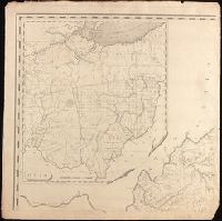
- Beinecke Rare Book and Manuscript Library > The first [-twelfth] sheet of Chinese Tartary ...
- Creator:
- Survey of India.
- Published / Created:
- 1827-1904.
- Call Number:
- Series 59 1827
- Image Count:
- 61
- Resource Type:
- Maps, Atlases & Globes
- Found in:
- Beinecke Rare Book and Manuscript Library > [Indian atlas 1:253 440, full sheets] / Survey of India.
- Creator:
- Homann Erben (Firm)
- Published / Created:
- 1777
- Call Number:
- 755 1777B
- Container / Volume:
- BRBL_00431
- Image Count:
- 1
- Resource Type:
- Maps, Atlases & Globes
- Found in:
- Beinecke Rare Book and Manuscript Library > America Septentrionalis a Domino d'Anville in Galliis edita nunc in Anglia : coloniis in interiorem Virginiam deductis nec non Fluvii Ohio cursu aucta notisque geographicis et historicis illustrata et ad bellum praesentis temporis accomodata / sumptibus Homannianorum Heredum.
- Creator:
- Dorman, Moses, author.
- Published / Created:
- 1830
- Call Number:
- 764 An23 1830
- Image Count:
- 1
- Resource Type:
- Maps, Atlases & Globes
- Found in:
- Beinecke Rare Book and Manuscript Library > A plan of Andover taken for the town / by Moses Dorman, Jr.
- Published / Created:
- [between 1652 and 1684]
- Call Number:
- BrSides Double Folio 2019 99
- Image Count:
- 1
- Resource Type:
- Maps, Atlases & Globes
- Found in:
- Beinecke Rare Book and Manuscript Library > Britannia prout divisa fuit temporibus Anglo-Saxonvm praesertim durante illorum heptarchia.
- Creator:
- Stokes, John Lort, 1811-1885, cartographer.
- Published / Created:
- Apr. 5, 1845.
- Call Number:
- BrSides Double Folio 2019 107
- Image Count:
- 1
- Resource Type:
- Maps, Atlases & Globes
- Found in:
- Beinecke Rare Book and Manuscript Library > The Victoria River : 1839 / surveyed by Commr. J.L. Stokes, R.N. ; J. & C. Walker, sculpt.
- Creator:
- Homann Erben (Firm), cartographer, publisher.
- Published / Created:
- 1756
- Call Number:
- 755 1756Ea
- Image Count:
- 1
- Resource Type:
- Maps, Atlases & Globes
- Found in:
- Beinecke Rare Book and Manuscript Library > America Septentrionalis a Domino d'Anville in Galliis edita nunc in Anglia : coloniis in interiorem Virginiam deductis nec non Fluvii Ohio cursu aucta notisque geographicis et historicis illustrata / sumptibus Homannianorum Heredum.
- Creator:
- Stokes, John Lort, 1811-1885, cartographer.
- Published / Created:
- April 10, 1845.
- Call Number:
- BrSides Double Folio 2019 108
- Image Count:
- 1
- Resource Type:
- Maps, Atlases & Globes
- Found in:
- Beinecke Rare Book and Manuscript Library > The Albert River : 1841 / surveyed by J.L. Stokes, R.N. ; J. & C. Walker, sculpt.
- Creator:
- Sides, William
- Published / Created:
- 1859
- Call Number:
- 777 B21 1859
- Container / Volume:
- BRBL_00503
- Image Count:
- 1
- Resource Type:
- Maps, Atlases & Globes
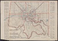
- Found in:
- Beinecke Rare Book and Manuscript Library > Map of Baltimore.
- Creator:
- Jefferys, Thomas, -1771, printmaker.
- Published / Created:
- 1755
- Call Number:
- 783 1755F
- Container / Volume:
- BRBL_00507
- Image Count:
- 1
- Resource Type:
- Maps, Atlases & Globes
- Found in:
- Beinecke Rare Book and Manuscript Library > A map of the most inhabited part of Virginia containing the whole province of Maryland with part of Pensilvania, New Jersey and North Carolina / drawn by Joshua Fry & Peter Jefferson in 1751.
- Creator:
- Automobile Club of America, cartographer.
- Published / Created:
- [1908]
- Call Number:
- 762gmb 1908
- Container / Volume:
- BRBL_00451
- Image Count:
- 1
- Resource Type:
- Maps, Atlases & Globes
- Found in:
- Beinecke Rare Book and Manuscript Library > Automobile map of New Hampshire / Automobile Club of America.
- Creator:
- Home Educator Company.
- Published / Created:
- c1905.
- Call Number:
- 76gm 1905
- Image Count:
- 1
- Resource Type:
- Maps, Atlases & Globes
- Found in:
- Beinecke Rare Book and Manuscript Library > The New England commercial and route survey [cartographic material] : showing all postoffices, railroads, electric roads in operation and proposed, good roads, population (showing latest Massachusetts census) and a comprehensive distance table.
- Published / Created:
- [1846?]
- Call Number:
- 796hc 1846
- Image Count:
- 1
- Resource Type:
- Maps, Atlases & Globes
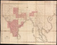
- Found in:
- Beinecke Rare Book and Manuscript Library > Map of Texas.
- Creator:
- Hughes, Andrew, 18th century
- Published / Created:
- [1780?]
- Call Number:
- 786 1780A
- Image Count:
- 1
- Resource Type:
- Maps, Atlases & Globes
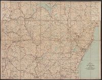
- Found in:
- Beinecke Rare Book and Manuscript Library > A draught of South Carolina and Georgia from Sewee to St. Estaca / by Andrew Hughes.
- Creator:
- E.P. Dutton (Firm)
- Published / Created:
- ©1860.
- Call Number:
- 764 B65 1860
- Image Count:
- 1
- Resource Type:
- Maps, Atlases & Globes
- Found in:
- Beinecke Rare Book and Manuscript Library > New map of the vicinity of Boston [cartographic material] : with the dates of settlement and distance from the capital / Boston Map Store, E.P. Dutton & Co.
- Creator:
- Bradshaw, George, 1801-1853
- Published / Created:
- [approximately 1850?]
- Call Number:
- 38 P21 1850A
- Image Count:
- 1
- Resource Type:
- Maps, Atlases & Globes
- Found in:
- Beinecke Rare Book and Manuscript Library > Bradshaw's plan of Paris, and map of the environs.
- Published / Created:
- Novr. 1800.
- Call Number:
- Small 32 L84 1666
- Image Count:
- 1
- Resource Type:
- Maps, Atlases & Globes
- Found in:
- Beinecke Rare Book and Manuscript Library > Sir Christopher Wren's design for re-building the City of London, after the great fire in 1666 : from an original drawing in the Library of All Soul's College, Oxford / J. Barlow sculp. ; Wm. Delamotte copy, 1800.
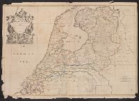
- Creator:
- Senex, John, -1740, cartographer.
- Published / Created:
- c 1709.
- Call Number:
- 2017 Folio 93
- Image Count:
- 1
- Resource Type:
- Maps, Atlases & Globes
- Found in:
- Beinecke Rare Book and Manuscript Library > The VII United Provinces : corrected from the observations communicated to the Royal Society at London & ye Royal Academy at Paris / Io. Senex, F.R.S.
- Creator:
- Johnson, J. Hugh (John Hugh)
- Published / Created:
- [1872?]
- Call Number:
- BrSides Folio 2019 97
- Image Count:
- 1
- Resource Type:
- Maps, Atlases & Globes
- Found in:
- Beinecke Rare Book and Manuscript Library > Algeria [cartographic material] = l'Algérie / drawn by J. Hugh Johnson ; engraved at Stanford's Geographical Establishment.
- Creator:
- Madison, James, 1751-1836, creator.
- Published / Created:
- March 4, 1807.
- Call Number:
- BrSides Double Folio 2019 110
- Image Count:
- 1
- Resource Type:
- Maps, Atlases & Globes
- Found in:
- Beinecke Rare Book and Manuscript Library > A map of Virginia [cartographic material] : Formed from actual surveys, and the latest as well as most accurate observations / by James Madison, D.D., president of Wm. & Mary College. ; Drawn by: Wm. Davis. ; Engraved by: Fred. Bossler, Ricmd.
- Creator:
- Senex, John, -1740, cartographer.
- Published / Created:
- 1709
- Call Number:
- 33 1728A
- Container / Volume:
- BRBL_00683
- Image Count:
- 1
- Resource Type:
- Maps, Atlases & Globes
- Found in:
- Beinecke Rare Book and Manuscript Library > The VII United Provinces : corrected from the observations communicated to the Royal Society at London & ye Royal Academy at Paris / Io. Senex, F.R.S.
- Creator:
- Munson, Samuel B., 1806-1880.
- Published / Created:
- 1845
- Call Number:
- 80 1845A
- Image Count:
- 1
- Resource Type:
- Maps, Atlases & Globes
- Found in:
- Beinecke Rare Book and Manuscript Library > A new map of the western rivers, or, Travellers guide : exhibiting the Mississippi, Missouri, Ohio, and Illinois rivers with all the principal towns, islands & distances / by Saml. B. Munson.
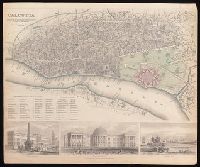
- Creator:
- Society for the Diffusion of Useful Knowledge (Great Britain)
- Published / Created:
- Novr. 1842.
- Call Number:
- BrSides Folio 2019 94
- Image Count:
- 1
- Resource Type:
- Maps, Atlases & Globes
- Found in:
- Beinecke Rare Book and Manuscript Library > Calcutta / published under the superintendence of the Society for the Diffusion of Knowledge.
- Creator:
- Cruchley, G. F.
- Published / Created:
- February 1st, 1842.
- Call Number:
- BrSides Folio 2019 90
- Image Count:
- 1
- Resource Type:
- Maps, Atlases & Globes
- Found in:
- Beinecke Rare Book and Manuscript Library > China.
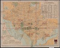
- Creator:
- Matthews-Northrup Company
- Published / Created:
- 1909, c1906.
- Call Number:
- 779 W27 1909
- Container / Volume:
- BRBL_00505A
- Image Count:
- 1
- Resource Type:
- Maps, Atlases & Globes
- Found in:
- Beinecke Rare Book and Manuscript Library > The "standard guide" ready reference map of Washington : to accompany the "Washington standard guide" / published by Foster & Reynolds.
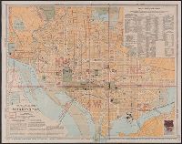
- Creator:
- Matthews-Northrup Company
- Published / Created:
- 1902, c1901.
- Call Number:
- 779 W27 1902
- Container / Volume:
- BRBL_00505A
- Image Count:
- 1
- Resource Type:
- Maps, Atlases & Globes
- Found in:
- Beinecke Rare Book and Manuscript Library > The "standard guide" ready reference map of Washington : to accompany the "Washington standard guide" / published by Foster & Reynolds.
- Creator:
- Matthews-Northrup Company
- Published / Created:
- 1904, c1901.
- Call Number:
- 779 W27 1904B
- Container / Volume:
- BRBL_00505A
- Image Count:
- 1
- Resource Type:
- Maps, Atlases & Globes
- Found in:
- Beinecke Rare Book and Manuscript Library > The "standard guide" ready reference map of Washington : to accompany the "Washington standard guide" / published by Foster & Reynolds.
- Creator:
- Swanston, George H.
- Published / Created:
- [1872?]
- Call Number:
- 352 1872
- Image Count:
- 1
- Resource Type:
- Maps, Atlases & Globes
- Found in:
- Beinecke Rare Book and Manuscript Library > Russia in Europe [cartographic material] / by G.H. Swanston.
- Creator:
- Walling, Henry Francis, 1825-1888, cartographer.
- Published / Created:
- 1885
- Call Number:
- 765 P94 1885
- Container / Volume:
- BRBL_00464
- Image Count:
- 1
- Resource Type:
- Maps, Atlases & Globes
- Found in:
- Beinecke Rare Book and Manuscript Library > Map of the city of Providence, Rhode Island / compiled from the most authentic sources by H.F. Walling, typographical engineer.
- Creator:
- Munson, Samuel B., 1806-1880, cartographer.
- Published / Created:
- 1844
- Call Number:
- 807 1844
- Image Count:
- 1
- Resource Type:
- Maps, Atlases & Globes
- Found in:
- Beinecke Rare Book and Manuscript Library > A new map of the western rivers, or, Travellers guide : exhibiting the Mississippi, Missouri, Ohio, and Illinois rivers with all the principal towns, islands & distances / by Saml. B. Munson.
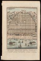
- Creator:
- Harris, John, 1667?-1719.
- Published / Created:
- [1744]
- Call Number:
- BrSides Folio 2017 33
- Image Count:
- 1
- Resource Type:
- Maps, Atlases & Globes
- Found in:
- Beinecke Rare Book and Manuscript Library > A plan of the city of Canton on the river Ta ho [cartographic material].
- Creator:
- Bowen, Emanuel, 1693 or 1694-1767, cartographer.
- Published / Created:
- [1747]
- Call Number:
- 655 1747
- Container / Volume:
- BRBL_00345
- Image Count:
- 1
- Resource Type:
- Maps, Atlases & Globes
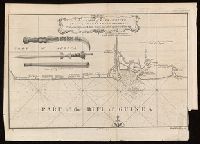
- Found in:
- Beinecke Rare Book and Manuscript Library > A new & accurate map of Negroland and the adjacent countries : also Upper Guinea, shewing the principal European settlements, & distinguishing w[hi]ch belong to England, Denmark, Holland &c., the sea coast & some of the rivers being drawn from surveys & t
- Published / Created:
- [between 1743-1747?]
- Call Number:
- BrSides Folio 2017 20
- Image Count:
- 1
- Resource Type:
- Maps, Atlases & Globes
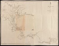
- Found in:
- Beinecke Rare Book and Manuscript Library > An accurate map of Kalbar River (commonly called Kalabar or Rio Real) and adjacent coast drawn on ye spot by several pilots, 1699 / G. Child, sculpt.
- Creator:
- Neele, Samuel John, 1758-1824.
- Published / Created:
- June 1st, 1790.
- Call Number:
- BrSides Folio 2017 23
- Image Count:
- 1
- Resource Type:
- Maps, Atlases & Globes
- Found in:
- Beinecke Rare Book and Manuscript Library > Present Poland, Prussia &c. / engrav'd by S.J. Neele.
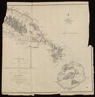
- Creator:
- Vancouver, George, 1757-1798
- Published / Created:
- [1798]
- Call Number:
- BrSides Folio 2017 57
- Collection Title:
- Voyage of discovery to the North Pacific ocean, and round the world.
- Image Count:
- 1
- Resource Type:
- Maps, Atlases & Globes
- Found in:
- Beinecke Rare Book and Manuscript Library > Views of parts of the coast of North West America / W. Alexander, delt. from sketches made on the spot ; J. Fittler sculp.
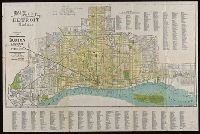
- Published / Created:
- [1912]
- Call Number:
- 811 D48 1912
- Container / Volume:
- BRBL_00553
- Image Count:
- 1
- Resource Type:
- Maps, Atlases & Globes
- Found in:
- Beinecke Rare Book and Manuscript Library > Map of the city of Detroit, Michigan.
- Creator:
- C.S. Hammond & Company.
- Published / Created:
- ©1913.
- Call Number:
- BrSides Double Folio 2017 10
- Image Count:
- 1
- Resource Type:
- Maps, Atlases & Globes
- Found in:
- Beinecke Rare Book and Manuscript Library > Hammond's new road map of Connecticut [cartographic material] / based on the surveys of the United States Geological Survey, United States Coast and Geodetic Survey and the various local surveys, revised and corrected ... C.S. Hammond & Company.
- Published / Created:
- [1782]
- Call Number:
- BrSides Folio 2017 24
- Image Count:
- 1
- Resource Type:
- Maps, Atlases & Globes
- Found in:
- Beinecke Rare Book and Manuscript Library > An accurate map of the islands of St. Christophers and Nevis in the West Indies / by an officer ; with the position of the English and French fleets, February 7th, 1782 ; J. Cary, sc.
- Creator:
- Bowen, Emanuel, 1693 or 1694-1767, creator.
- Published / Created:
- [1749]
- Call Number:
- 2016 1346
- Image Count:
- 1
- Resource Type:
- Maps, Atlases & Globes
- Found in:
- Beinecke Rare Book and Manuscript Library > An accurate map of the county of Huntingdon divided into its hundreds : drawn from surveys and illustrated with various additional improvements ; also historical extracts relating to its trade, manufactures, natural history &c. not extant in any other map
- Creator:
- Edward Stanford Ltd.
- Published / Created:
- [192-?]
- Call Number:
- 8555 1920
- Container / Volume:
- BRBL_00642
- Image Count:
- 1
- Resource Type:
- Maps, Atlases & Globes
- Found in:
- Beinecke Rare Book and Manuscript Library > Jamaica [cartographic material] / Stanford's Geographical Establishment.
- Creator:
- Vancouver, George, 1757-1798
- Published / Created:
- [1798]
- Call Number:
- BrSides Folio 2017 59
- Collection Title:
- Voyage of discovery to the North Pacific ocean, and round the world.
- Image Count:
- 1
- Resource Type:
- Maps, Atlases & Globes
- Found in:
- Beinecke Rare Book and Manuscript Library > Views of the headlands and islands on the coasts of North West and South America / W. Alexander, delt. from sketches made on the spot ; J. Fittler, sculp.
- Creator:
- J.H. Colton & Co
- Published / Created:
- 1855
- Call Number:
- BrSides Folio 2017 60
- Image Count:
- 1
- Resource Type:
- Maps, Atlases & Globes
- Found in:
- Beinecke Rare Book and Manuscript Library > The United States of America.
- Creator:
- Vancouver, George, 1757-1798
- Published / Created:
- [1798]
- Call Number:
- BrSides Folio 2017 56
- Collection Title:
- Voyage of discovery to the North Pacific ocean, and round the world.
- Image Count:
- 1
- Resource Type:
- Maps, Atlases & Globes
- Found in:
- Beinecke Rare Book and Manuscript Library > Views of parts of the coast of North West America / W. Alexander delt. from sketches made on the spot ; engraved by B.T. Pouncy.
- Creator:
- Vancouver, George, 1757-1798
- Published / Created:
- [1798]
- Call Number:
- BrSides Folio 2017 58
- Collection Title:
- Voyage of discovery to the North Pacific ocean, and round the world.
- Image Count:
- 1
- Resource Type:
- Maps, Atlases & Globes
- Found in:
- Beinecke Rare Book and Manuscript Library > Views of parts of the coast of North West America / W. Alexander, delt. from sketches made on the spot ; engraved by B.T. Pouncy.
- Creator:
- Phillips, R. (Richard), Sir, 1767-1840
- Published / Created:
- [1806]
- Call Number:
- BrSides Folio 2017 61
- Image Count:
- 1
- Resource Type:
- Maps, Atlases & Globes
- Found in:
- Beinecke Rare Book and Manuscript Library > A map of the country from Rariton River in East Jersey, to Elk Head in Maryland [cartographic material] : shewing the several operations of the American & British armies, in 1776 & 1777 / Neele sc., Strand.
- Creator:
- Mitchell, Samuel P.
- Published / Created:
- [1861]
- Call Number:
- BrSides Folio 2017 83
- Image Count:
- 1
- Resource Type:
- Maps, Atlases & Globes
- Found in:
- Beinecke Rare Book and Manuscript Library > Sketch of the country occupied by the Federal & Confederate Armies on the 18th & 21st July 1861 [cartographic material] / taken by Capt. Saml. P. Mitchell, of 1st Virginia Regiment ; lithographed by F.W. Bornemann.
- Creator:
- Rapkin, J
- Published / Created:
- [1857]
- Call Number:
- BrSides 2017 60
- Image Count:
- 1
- Resource Type:
- Maps, Atlases & Globes
- Found in:
- Beinecke Rare Book and Manuscript Library > United States / map drawn & engraved by J. Rapkin.
- Creator:
- Cram, George Franklin, 1841-1928
- Published / Created:
- [between 1920 and 1929?]
- Call Number:
- BrSides Folio 2017 3
- Image Count:
- 1
- Resource Type:
- Maps, Atlases & Globes
- Found in:
- Beinecke Rare Book and Manuscript Library > Connecticut.
- Creator:
- Neele, Samuel John, 1758-1824, cartographer.
- Published / Created:
- [1803]
- Call Number:
- BrSides Folio 2017 15
- Image Count:
- 1
- Resource Type:
- Maps, Atlases & Globes
- Found in:
- Beinecke Rare Book and Manuscript Library > Map of the course of the Nile from Thebes to Cairo : with the track of the Indian Army / S.I. Neele, sc., 352 Strand.
- Published / Created:
- [1886?]
- Call Number:
- BrSides Folio 2017 52
- Image Count:
- 1
- Resource Type:
- Maps, Atlases & Globes
- Found in:
- Beinecke Rare Book and Manuscript Library > Map of the environs of the City of Mexico [cartographic material] / authorized for publication with the Mexican guide by General Carlos Pacheco, Minister of Public Works, 1886.