Search
You Searched For
Search Results
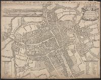
- Creator:
- Visscher, Claes Jansz., 1586 or 1587-1652
- Published / Created:
- 1616. and 1883-1885.
- Call Number:
- 32 L84 1616/1883
- Container / Volume:
- BRBL_00736
- Image Count:
- 4
- Resource Type:
- Maps, Atlases & Globes
- Found in:
- Beinecke Rare Book and Manuscript Library > London. Visscher delineavit.
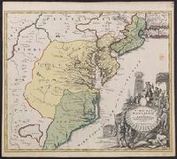
- Creator:
- Homann Erben (Firm)
- Published / Created:
- 1777
- Call Number:
- 755 1777B
- Container / Volume:
- BRBL_00431
- Image Count:
- 1
- Resource Type:
- Maps, Atlases & Globes
- Found in:
- Beinecke Rare Book and Manuscript Library > America Septentrionalis a Domino d'Anville in Galliis edita nunc in Anglia : coloniis in interiorem Virginiam deductis nec non Fluvii Ohio cursu aucta notisque geographicis et historicis illustrata et ad bellum praesentis temporis accomodata / sumptibus Homannianorum Heredum.
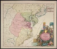
- Creator:
- Homann Erben (Firm)
- Published / Created:
- 1756
- Call Number:
- 71 1756H
- Container / Volume:
- BRBL_00726
- Image Count:
- 1
- Resource Type:
- Maps, Atlases & Globes
- Found in:
- Beinecke Rare Book and Manuscript Library > America Septentrionalis a Domino d'Anville in Galliis edita nunc in Anglia : coloniis in interiorem Virginiam deductis nec non Fluvii Ohio cursu aucta notisque geographicis et historicis illustrata / sumptibus Homannianorum Heredum.
- Published / Created:
- [between 1652 and 1684]
- Call Number:
- BrSides Double Folio 2019 99
- Image Count:
- 1
- Resource Type:
- Maps, Atlases & Globes
- Found in:
- Beinecke Rare Book and Manuscript Library > Britannia prout divisa fuit temporibus Anglo-Saxonvm praesertim durante illorum heptarchia.
- Creator:
- Homann Erben (Firm), cartographer, publisher.
- Published / Created:
- 1756
- Call Number:
- 755 1756Ea
- Image Count:
- 1
- Resource Type:
- Maps, Atlases & Globes
- Found in:
- Beinecke Rare Book and Manuscript Library > America Septentrionalis a Domino d'Anville in Galliis edita nunc in Anglia : coloniis in interiorem Virginiam deductis nec non Fluvii Ohio cursu aucta notisque geographicis et historicis illustrata / sumptibus Homannianorum Heredum.
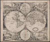
- Creator:
- Wit, Frederik de
- Published / Created:
- 1668]
- Call Number:
- 11 1668
- Container / Volume:
- BRBL_00680
- Image Count:
- 1
- Resource Type:
- Maps, Atlases & Globes
- Found in:
- Beinecke Rare Book and Manuscript Library > Nova totius terrarum orbis tabula / [cartographic material] / ex officina F. de Wit.
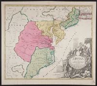
- Creator:
- Homann Erben (Firm)
- Published / Created:
- 1756
- Call Number:
- 755 1756B
- Container / Volume:
- BRBL_00428
- Image Count:
- 1
- Resource Type:
- Maps, Atlases & Globes
- Found in:
- Beinecke Rare Book and Manuscript Library > America Septentrionalis a Domino d'Anville in Galliis edita nunc in Anglia : coloniis in interiorem Virginiam deductis nec non Fluvii Ohio cursu aucta notisque geographicis et historicis illustrata / sumptibus Homannianorum Heredum.
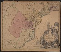
- Creator:
- Homann Erben (Firm)
- Published / Created:
- 1756
- Call Number:
- 755 1756Ea
- Container / Volume:
- BRBL_00428
- Image Count:
- 1
- Resource Type:
- Maps, Atlases & Globes
- Found in:
- Beinecke Rare Book and Manuscript Library > America Septentrionalis a Domino d'Anville in Galliis edita nunc in Anglia : coloniis in interiorem Virginiam deductis nec non Fluvii Ohio cursu aucta notisque geographicis et historicis illustrata / sumptibus Homannianorum Heredum.
- Creator:
- L'Isle, Guillaume de, 1675-1726
- Published / Created:
- 1720?]
- Call Number:
- 49 1740
- Container / Volume:
- BRBL_00684
- Image Count:
- 1
- Resource Type:
- Maps, Atlases & Globes
- Found in:
- Beinecke Rare Book and Manuscript Library > In notitiam ecclesiasticam Africae tabula geographica / auctore G. De L'Isle ...
- Creator:
- Homann Erben (Firm)
- Published / Created:
- 1756
- Call Number:
- 755 1756G
- Container / Volume:
- BRBL_00690
- Image Count:
- 1
- Resource Type:
- Maps, Atlases & Globes
- Found in:
- Beinecke Rare Book and Manuscript Library > America Septentrionalis a Domino d'Anville in Galliis edita nunc in Anglia : coloniis in interiorem Virginiam deductis nec non Fluvii Ohio cursu aucta notisque geographicis et historicis illustrata / sumptibus Homannianorum Heredum.
- Creator:
- Homann, Johann Baptist, 1663-1724
- Published / Created:
- ca. 1730]
- Call Number:
- 783 1759
- Container / Volume:
- BRBL_00691
- Image Count:
- 1
- Resource Type:
- Maps, Atlases & Globes
- Found in:
- Beinecke Rare Book and Manuscript Library > Virginia, Marylandia et Carolina in America septentrionali Brittannorum industria excultæ / repraesentatae à Ioh. Bapt. Homann, S.C.M. Geog.
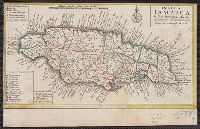
- Published / Created:
- 1737]
- Call Number:
- 8555 1737
- Container / Volume:
- BRBL_00695
- Image Count:
- 1
- Resource Type:
- Maps, Atlases & Globes
- Found in:
- Beinecke Rare Book and Manuscript Library > Insula Iamaica [cartographic material] : in suas parochias divisa et secundum exemplar primitivum Londinense excusa.
- Creator:
- Homann Erben (Firm)
- Published / Created:
- 1777
- Call Number:
- 71 1777H
- Container / Volume:
- BRBL_00726
- Image Count:
- 1
- Resource Type:
- Maps, Atlases & Globes
- Found in:
- Beinecke Rare Book and Manuscript Library > America Septentrionalis a Domino d'Anville in Galliis edita nunc in Anglia : coloniis in interiorem Virginiam deductis nec non Fluvii Ohio cursu aucta notisque geographicis et historicis illustrata et ad bellum praesentis temporis accomodata / sumptibus H
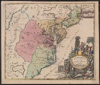
- Creator:
- Homann, Johann Baptist, 1663-1724
- Published / Created:
- ca. 1714]
- Call Number:
- 755 1759
- Container / Volume:
- BRBL_00728
- Image Count:
- 1
- Resource Type:
- Maps, Atlases & Globes
- Found in:
- Beinecke Rare Book and Manuscript Library > Virginia, Marylandia et Carolina in America septentrionali Brittannorum industria excultae / repraesentatae à Ioh. Bapt. Homann, S.C.M. Geog.
- Creator:
- Homann, Johann Baptist, 1663-1724
- Published / Created:
- ca. 1714]
- Call Number:
- 755 1714
- Container / Volume:
- BRBL_00425
- Image Count:
- 1
- Resource Type:
- Maps, Atlases & Globes
- Found in:
- Beinecke Rare Book and Manuscript Library > Virginia, Marylandia et Carolina in America septentrionali Brittannorum industria excultae / repraesentatae à Ioh. Bapt. Homann, S.C.M. Geog.
- Creator:
- Homann, Johann Baptist, 1663-1724
- Published / Created:
- ca. 1730]
- Call Number:
- 755 1714A
- Container / Volume:
- BRBL_00425
- Image Count:
- 1
- Resource Type:
- Maps, Atlases & Globes
- Found in:
- Beinecke Rare Book and Manuscript Library > Virginia, Marylandia et Carolina in America septentrionali Brittannorum industria excultæ / repraesentatae à Ioh. Bapt. Homann, S.C.M. Geog.
- Creator:
- Homann, Johann Baptist, 1663-1724
- Published / Created:
- ca. 1714]
- Call Number:
- 755 1714B
- Container / Volume:
- BRBL_00425
- Image Count:
- 1
- Resource Type:
- Maps, Atlases & Globes
- Found in:
- Beinecke Rare Book and Manuscript Library > Virginia, Marylandia et Carolina in America septentrionali Brittannorum industria excultae / repraesentatae à Ioh. Bapt. Homann, S.C.M. Geog.
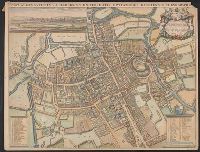
- Creator:
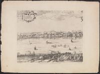
- Braun, Georg, 1540 or 1541-1622
- Published / Created:
- 1572. and 1882-1883.
- Call Number:
- 32 L84 1572/1882
- Container / Volume:
- BRBL_00736
- Image Count:
- 1
- Resource Type:
- Maps, Atlases & Globes
- Found in:
- Beinecke Rare Book and Manuscript Library > Londinvm feracissimi Angliae Regni metropolis.
- Creator:
- Hondius, Hendrik, 1597-1651
- Published / Created:
- [1621]
- Call Number:
- 217 1616
- Container / Volume:
- BRBL_00682
- Image Count:
- 2
- Resource Type:
- Maps, Atlases & Globes
- Found in:
- Beinecke Rare Book and Manuscript Library > Mappa Aestiuarum Insularum : alias Barmudas dictarum, ad Ostia Mexicani aestuarij jace[n]tium in latitudine graduum 32 minutorum 25. ab Anglia, Londino Scilicet versus Libonotum 3300 miliaribus Anglicanis et a Roanoeck (qui locus est in Virginia) versus E
- Creator:
- Speed, John, 1552?-1629
- Published / Created:
- [1612?]
- Call Number:
- 3191 1611
- Container / Volume:
- BRBL_00732
- Image Count:
- 2
- Resource Type:
- Maps, Atlases & Globes
- Found in:
- Beinecke Rare Book and Manuscript Library > Britain as it was devided in the tyme of the Englishe Saxons especially during their heptarchy / performed by Iohn Speede and are to be sold by John Sudbury & Georg. Humble, in Popes head alley at Londo[n].
- Creator:
- Blaeu, Willem Janszoon, 1571-1638
- Published / Created:
- 1645-1650]
- Call Number:
- 217 1630
- Container / Volume:
- BRBL_00732
- Image Count:
- 2
- Resource Type:
- Maps, Atlases & Globes
- Found in:
- Beinecke Rare Book and Manuscript Library > Mappa Aestivarum insularum, alias Barmudas dictarum : ad ostia Mexicani aestuarij jacentium in latitudine graduum 32 minutorum 25 ad Anglia, Londino scilicet versus Libonotum 3300 miliaribus Anglicanis, et a Roanoack (qui locus est in Virginia) versus Eur
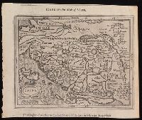
- Creator:
- Hondius, Jodocus, 1563-1612, cartographer
- Published / Created:
- [1625]
- Call Number:
- BrSides Box 2019 13
- Image Count:
- 2
- Resource Type:
- Maps, Atlases & Globes
- Found in:
- Beinecke Rare Book and Manuscript Library > China.
- Creator:
- Hollar, Wenceslaus, 1607-1677
- Published / Created:
- 1647. and 1906-1907.
- Call Number:
- 32 L84 1647/1906
- Container / Volume:
- BRBL_00737
- Image Count:
- 6
- Resource Type:
- Maps, Atlases & Globes
- Found in:
- Beinecke Rare Book and Manuscript Library > London. Wenceslaus Hollar delineavit et fecit Londini et Antverpiæ, 1647.
- Creator:
- Blaeu, Willem Janszoon, 1571-1638, cartographer
- Call Number:
- 217 1635
- Image Count:
- 1
- Resource Type:
- Maps, Atlases & Globes
- Found in:
- Beinecke Rare Book and Manuscript Library > Mappa Aestivarum insularum, alias Barmudas dictarum : ad ostia Mexicani aestuarij jacentium in latitudine graduum 32 minutorum 25 ab Anglia, Londino scilicet versus Libonotum 3300 miliaribus Anglicanis, et a Roanoack (qui locus est in Virginia) versus Eur
- Creator:
- Wells, Edward, 1667-1727
- Published / Created:
- [1701]
- Call Number:
- 3190 No. 2
- Collection Title:
- New sett of maps both of antient and present geography ...
- Container / Volume:
- BRBL_00041
- Image Count:
- 1
- Resource Type:
- Maps, Atlases & Globes
- Found in:
- Beinecke Rare Book and Manuscript Library > A new map of the Brittish Isles : shewing their antient people, cities and towns of note, in the time of the Romans.
- Creator:
- Horsley, John, 1675-1732, cartographer
Laurie, Richard Holmes
- Published / Created:
- 1821
- Call Number:
- 3190 No. 6
- Container / Volume:
- BRBL_00041
- Image Count:
- 1
- Resource Type:
- Maps, Atlases & Globes
- Found in:
- Beinecke Rare Book and Manuscript Library > Britanniæ Antiquæ [cartographic material] : tabula geographica ex ævi Romani monumentis / ab eruditissimo viro Johanne Horsley ... recentissinmus observationibus concinnata.
- Creator:
- Compton, Henry, 1632-1713, dedicatee
Loggan, David, 1635-1700?
Loggan, David, 1635-1700? Oxonia illustrata
Sheldonian Theatre
- Published / Created:
- 1675]
- Call Number:
- 32 Ox1 1675
- Container / Volume:
- BRBL_00052A
- Image Count:
- 1
- Resource Type:
- Maps, Atlases & Globes
- Found in:
- Beinecke Rare Book and Manuscript Library > Nova et accuratissima celeberrimæ universitatis civitatisque Oxoniensis scenographia / Dav. Loggan delin. et sculp ...
- Creator:
- Wells, Edward, 1667-1727
- Published / Created:
- 172-?]
- Call Number:
- 400 172XB
- Container / Volume:
- BRBL_00232
- Image Count:
- 1
- Resource Type:
- Maps, Atlases & Globes
- Found in:
- Beinecke Rare Book and Manuscript Library > A new map of antient Italy : together with the adjoyning islands of Sicily, Sardinia, and Corsica, shewing their principal divisions, cities, towns, rivers, mountains &c. / Sutton Nicholls sculp.
- Creator:
- Neele, Samuel John, 1758-1824
- Published / Created:
- 1790
- Call Number:
- 400 1790
- Container / Volume:
- BRBL_00233
- Image Count:
- 1
- Resource Type:
- Maps, Atlases & Globes
- Found in:
- Beinecke Rare Book and Manuscript Library > The northern part of ancient Italy / engrav'd by Samuel John Neele.
- Creator:
- Wells, Edward, 1667-1727
- Published / Created:
- 172-?]
- Call Number:
- 400 172XA
- Container / Volume:
- BRBL_00232
- Image Count:
- 1
- Resource Type:
- Maps, Atlases & Globes
- Found in:
- Beinecke Rare Book and Manuscript Library > A new map of Latium, Etruria, and as much of antient Italy as lay between Gallia Cisalpina and Graecia Magna, shewing their principal divisions, cities, towns, rivers, mountains, &c. / Sutton Nicholls sculp.
- Creator:
- Wells, Edward, 1667-1727
- Published / Created:
- 172-?]
- Call Number:
- 400 172X
- Container / Volume:
- BRBL_00232
- Image Count:
- 1
- Resource Type:
- Maps, Atlases & Globes
- Found in:
- Beinecke Rare Book and Manuscript Library > A new map of Gallia Cisalpina & Graecia Magna, shewing their cheif [sic] divisions, people, cities, towns &c. / Sutton Nicholls sculp.
- Creator:
- Visscher, Nicolaes, 1649-1702
- Published / Created:
- [ca. 1690?]
- Call Number:
- 731 1690
- Container / Volume:
- BRBL_00376A
- Image Count:
- 1
- Resource Type:
- Maps, Atlases & Globes
- Found in:
- Beinecke Rare Book and Manuscript Library > Nova tabula geographica complectens borealiorem Americae partem : in qua exacte delineatae sunt Canada sive Nova Francia, Nova Scotia, Nova Anglia, Novum Belgium, Pensylvania, Virginia, Carolina, et Terra Nova, cum omnibus littorum pulvinorumque profundit
- Creator:
- Homann, Johann Baptist, 1663-1724
Visscher, Nicolaes, 1649-1702
- Published / Created:
- [172-?]
- Call Number:
- 1983 Folio 23
- Collection Title:
- [Atlas factice of 50 maps, primarily by Johann Baptist Homann and/or issued by the Homann Erben
- Image Count:
- 1
- Found in:
- Beinecke Rare Book and Manuscript Library > Magnae Britanniae pars meridionalis in qua regnum Angliae tam in septem antiqua Anglo-Saxonum regna quom in omnes Hodiernas regiones accurate divisum hic ostenditur quam tabula ab archetypo Vischeriano desumptam exhibet [cartographic material] / Ioh. Bapt
- Creator:
- Homann, Johann Baptist, 1663-1724
Visscher, Nicolaes, 1649-1702
- Published / Created:
- 1715?
- Call Number:
- 1975 Folio 31
- Collection Title:
- [Atlas factice of 42 maps, produced by the Homann Erben firm]
- Image Count:
- 1
- Found in:
- Beinecke Rare Book and Manuscript Library > Hiberniae regnum tam in praecipuas Ultoniae, Connaciae, Laceniae et Momoniae [cartographic material] : quam in minores earundem provincias et ditiones divisum ex prototype Guil. Petty-Vischeriano deductu et exhibitum / a Joh. Bapt. Homanno
- Creator:
- Homann Erben (Firm)
Homann, Johann Baptist, 1663-1724
- Published / Created:
- 1729
- Call Number:
- 1975 Folio 31
- Collection Title:
- [Atlas factice of 42 maps, produced by the Homann Erben firm]
- Image Count:
- 1
- Found in:
- Beinecke Rare Book and Manuscript Library > Magna Britannia complectens Angliae, Scotiae, et Hyberniae regn [cartographic material] : in suas prov. et comitat. divisa et ex mappis Londinensibus designata / per Homannum
- Creator:
- Homann, Johann Baptist, 1663-1724
Visscher, Nicolaes, 1649-1702
- Published / Created:
- 1715?
- Call Number:
- 1975 Folio 31
- Collection Title:
- [Atlas factice of 42 maps, produced by the Homann Erben firm]
- Image Count:
- 1
- Found in:
- Beinecke Rare Book and Manuscript Library > Magnae Britanniae pars meridionalis in qua regnum Angliae tam in septem antiqua Anglo-Saxonum regna quom in omnes Hodiernas regiones accurate divisum hic ostenditur quam tabula ab archetypo Vischeriano desumptam exhibet / [cartographic material] / Ioh. Ba
- Creator:
- Homann, Johann Baptist, 1663-1724
Visscher, Nicolaes, 1649-1702
- Published / Created:
- 1715?
- Call Number:
- 1975 Folio 31
- Collection Title:
- [Atlas factice of 42 maps, produced by the Homann Erben firm]
- Image Count:
- 1
- Found in:
- Beinecke Rare Book and Manuscript Library > Magnae Britanniae pars septentrionalis qua regnum Scotiae [cartographic material] : in suas partes et subjacentes insulas divisum : accurata tabula ex archetypo Vischeriano desumta exhibetur imitatore / Johan. Bapt. Homanno
- Creator:
- Homann Erben (Firm)
Homann, Johann Baptist, 1663-1724
Meyer, Tobias
- Published / Created:
- 1749
- Call Number:
- 1973 Folio 30
- Collection Title:
- [Atlas factice of 32 maps and 1 distance table, produced by the Homann Erben firm]
- Image Count:
- 1
- Found in:
- Beinecke Rare Book and Manuscript Library > Regnorum Magnae Britanniae et Hiberniae mappa geographica : iuxta observationes astronomicas recentiores denuo correcta et ad formam legitimae projectionis reducta a Tobia Majero
- Creator:
- Waghenaer, Lucas Janszoon, 1534 or 5-1606
- Published / Created:
- ann. 1605.
- Call Number:
- 1976 Folio 46
- Image Count:
- 125
- Resource Type:
- Books, Journals & Pamphlets
- Found in:
- Beinecke Rare Book and Manuscript Library > The mariners mirrovr wherin may playnly be seen the courses, heights, distances, depths, sounding, flouds and ebs, risings of lands, rocks ... of the harbouroughs, havens and ports of the greatest part of Europe: ... together w.th the rules and instrumeíÄ
- Creator:
- Rogers, William, b. ca. 1545, engraver
- Published / Created:
- [1596?]
- Call Number:
- Taylor 216A
- Collection Title:
- John Huighen van Linschoten, his Discours of Voyages into ye Easte & West Indies
- Image Count:
- 1
- Found in:
- Beinecke Rare Book and Manuscript Library > Typus orarum maritimarum Guinae, Manicongo & Angolae ultra promontorium Bonae Spei ...
- Creator:
- Rogers, William, b. ca. 1545, engraver
- Published / Created:
- [1596]
- Call Number:
- Taylor 216A
- Collection Title:
- John Huighen van Linschoten, his Discours of Voyages into ye Easte & West Indies
- Image Count:
- 1
- Found in:
- Beinecke Rare Book and Manuscript Library > Delineatio omnium orarum totius Australis partis Americae, dictae Peruvianae, a R. de la Plata, Brasiliam, Pariam, & Castellam ...
- Creator:
- Rogers, William, b. ca. 1545, engraver
- Published / Created:
- [ca. 1598]
- Call Number:
- Taylor 216A
- Collection Title:
- John Huighen van Linschoten, his Discours of Voyages into ye Easte & West Indies
- Image Count:
- 1
- Found in:
- Beinecke Rare Book and Manuscript Library > Insvlae Molvccae ...
- Creator:
- Beckit, Robert, engraver
- Published / Created:
- 1598
- Call Number:
- Taylor 216A
- Collection Title:
- John Huighen van Linschoten, his Discours of Voyages into ye Easte & West Indies
- Image Count:
- 1
- Found in:
- Beinecke Rare Book and Manuscript Library > Delineatio orarum maritimarum, terrae vulgo indigitatae terra do Natal item Sofalae, Mozambicae & Melindae, insulaeq[ue] sancti Laurentij ...
- Creator:
- Beckit, Robert, engraver
- Published / Created:
- [1596]
- Call Number:
- Taylor 216A
- Collection Title:
- John Huighen van Linschoten, his Discours of Voyages into ye Easte & West Indies
- Image Count:
- 1
- Found in:
- Beinecke Rare Book and Manuscript Library > Deliniatur in hac tabula, Orae maritimae Abexiae, freti Mecani al Maris Rubri Arabiae ...
- Creator:
- Beckit, Robert, engraver
- Published / Created:
- 1598
- Call Number:
- Taylor 216A
- Collection Title:
- John Huighen van Linschoten, his Discours of Voyages into ye Easte & West Indies
- Image Count:
- 1
- Found in:
- Beinecke Rare Book and Manuscript Library > Exacta & accurata delineatio cum orarum maritimarum tum etiam locorum terrestrium quae in regionibus China, Cauchinchina, Camboia sive Champa, Syao, Malacca, Arracan & Pegu ...
- Creator:
- Rogers, William, b. ca. 1545, engraver
- Published / Created:
- Undated
- Call Number:
- Taylor 216A
- Collection Title:
- Iohn Huighen van Linschoten, his Discours of Voyages into ye Easte & West Indies : deuided into
- Image Count:
- 1
- Found in:
- Beinecke Rare Book and Manuscript Library > [Map of southern Africa and Madagascar]
- Published / Created:
- [1598?]
- Call Number:
- Taylor 216A
- Collection Title:
- John Huighen van Linschoten, his Discours of Voyages into ye Easte & West Indies
- Image Count:
- 1
- Found in:
- Beinecke Rare Book and Manuscript Library > A discripsion of Aegipt from Cair downeward
- Published / Created:
- 1612
- Call Number:
- Pequot G325
- Collection Title:
- Descriptio ac delineatio geographica detectionis freti, sive, transitus ad occasum supra terras
- Image Count:
- 1
- Found in:
- Beinecke Rare Book and Manuscript Library > Tabula nautica ...
- Creator:
- Waghenaer, Lucas Janszoon, 1534 or 5-1606
- Published / Created:
- ann. 1605.
- Call Number:
- 1976 Folio 46
- Image Count:
- 1
- Resource Type:
- Maps, Atlases & Globes
- Found in:
- Beinecke Rare Book and Manuscript Library > The mariners mirrovr wherin may playnly be seen the courses, heights, distances, depths, sounding, flouds and ebs, risings of lands, rocks ... of the harbouroughs, havens and ports of the greatest part of Europe: ... together w.th the rules and instrumeíÄ
- Creator:
- Visscher, Nicolaes, 1649-1702, creator
- Published / Created:
- [ca. 1689]
- Call Number:
- 1973 Folio 10
- Image Count:
- 1
- Resource Type:
- Maps, Atlases & Globes
- Found in:
- Beinecke Rare Book and Manuscript Library > Exactissima Regni Scotiae tabula tam in septentrionalem et meriodionalem quam in minores earundem provincias, insulasq[ue], ei undique praetensas accurate divisa
- Published / Created:
- 1612
- Call Number:
- Taylor 258
- Collection Title:
- Descriptio ac delineatio geographica detectionis freti, sive, transitus ad occasum supra terras
- Image Count:
- 1
- Found in:
- Beinecke Rare Book and Manuscript Library > Tabula nautica, qua repraesentantur orae maritimae, meatus, ac freta, noviter a H. Hudsono Anglo ad Caurum supra Novam Franciam