Search
You Searched For
Search Results
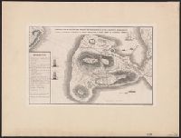
- Creator:
- Neff, N.A. Custer
- Published / Created:
- [1900]
- Call Number:
- BrSides Double Folio 2019 5
- Image Count:
- 8
- Resource Type:
- Maps, Atlases & Globes
- Found in:
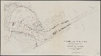
- Beinecke Rare Book and Manuscript Library > Town site of La Gloria, looking north : town site and plantations of La Gloria, Puerto Principe, Cuba / designed and drawn by M.A. Custer Neff, C.E. and Architect.
- Creator:
- League of American Wheelmen. New York State Division
- Published / Created:
- c1893.
- Call Number:
- 771gmb 1893
- Container / Volume:
- BRBL_00494
- Image Count:
- 8
- Resource Type:
- Maps, Atlases & Globes
- Found in:
- Beinecke Rare Book and Manuscript Library > Cyclists' road map of New York / compiled by the Road Book Committee of the N.Y. Div. L.A.W. ; lithographed by Robert L. Stillson.
- Creator:
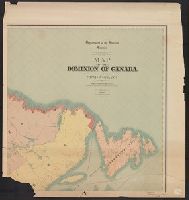
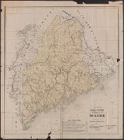
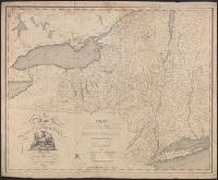
- White, James, 1863-1928
- Published / Created:
- 1903
- Call Number:
- 73 1903
- Container / Volume:
- BRBL_00375
- Image Count:
- 8
- Resource Type:
- Maps, Atlases & Globes
- Found in:
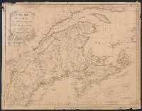
- Beinecke Rare Book and Manuscript Library > Map of the Dominion of Canada and Newfoundland / James White, geographer.
- Creator:
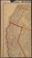
- Rand McNally and Company
- Published / Created:
- [1876?]
- Call Number:
- 80 1876
- Container / Volume:
- BRBL_00535
- Image Count:
- 8
- Resource Type:
- Maps, Atlases & Globes
- Found in:
- Beinecke Rare Book and Manuscript Library > Rand McNally & Co.'s new map of the territories and Pacific Coast.
- Creator:
- Agas, Ralph, 1545-1621
- Published / Created:
- 1905
- Call Number:
- 32 L84 1570/1905
- Container / Volume:
- BRBL_00737
- Image Count:
- 8
- Resource Type:
- Maps, Atlases & Globes
- Found in:
- Beinecke Rare Book and Manuscript Library > Civitas Londinum.
- Creator:
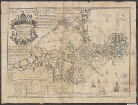
- Mitchell, John, 1711-1768
- Published / Created:
- [1755]
- Call Number:
- 71 1755D
- Container / Volume:
- BRBL_00363
- Image Count:
- 8
- Resource Type:
- Maps, Atlases & Globes
- Found in:
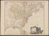
- Beinecke Rare Book and Manuscript Library > A map of the British and French dominions in North America : with the roads, distances, limits, and extent of the settlements, humbly inscribed to the Right Honourable the Earl of Halifax, and the other Right Honourable the Lords Commissioners for Trade &
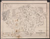
- Creator:
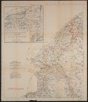
- Great Britain. Ordnance Survey
- Published / Created:
- Novr. 9th, 1843 [i.e. ca. 1853-1874?]
- Call Number:
- 32 1873
- Container / Volume:
- BRBL_00744
- Image Count:
- 8
- Resource Type:
- Maps, Atlases & Globes
- Found in:
- Beinecke Rare Book and Manuscript Library > [Old series Ordnance Survey maps of England and Wales] / engraved at the Ordnance Map Office, Southampton ...
- Creator:
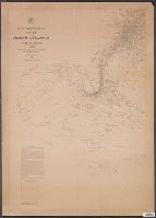
- Maury, Matthew Fontaine, 1806-1873
- Published / Created:
- 1850
- Call Number:
- 11cfk 1850D-1
- Container / Volume:
- BRBL_00773
- Image Count:
- 8
- Resource Type:
- Maps, Atlases & Globes
- Found in:
- Beinecke Rare Book and Manuscript Library > Wind and current chart of the North Atlantic [cartographic material] : thermal sheet / by M.F. Maury, A.M. Lieut. U.S. Navy, Superint'dt. of U.S.N. Observatory ; compiled from materials in the Bureau of Ordnance and Hydrography, Commodore Lewis Warrington, Chief of Bureau ; drawn by Lt. Benjn. S. Gantt, U.S.N.
- Creator:
- Maury, Matthew Fontaine, 1806-1873
- Published / Created:
- [1854?]-1856.
- Call Number:
- 11cfk 1850A-5
- Container / Volume:
- BRBL_00769
- Image Count:
- 8
- Resource Type:
- Maps, Atlases & Globes
- Found in:
- Beinecke Rare Book and Manuscript Library > Maury's wind and current chart, Indian Ocean [cartographic material].
- Creator:
- Mitchell, John, 1711-1768
- Published / Created:
- [1775?]
- Call Number:
- 71 1755A
- Container / Volume:
- BRBL_00363
- Image Count:
- 8
- Resource Type:
- Maps, Atlases & Globes
- Found in:
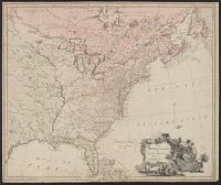
- Beinecke Rare Book and Manuscript Library > A map of the British colonies in North America : with the roads, distances, limits, and extent of the settlements, humbly inscribed to the Right Honourable the Earl of Halifax, and the other Right Honourable the Lords Commissioners for Trade & Plantations
- Creator:
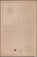
- Maury, Matthew Fontaine, 1806-1873
- Published / Created:
- 1849-[1856?]
- Call Number:
- 11cfk 1850A-1
- Container / Volume:
- BRBL_00767
- Image Count:
- 10
- Resource Type:
- Maps, Atlases & Globes
- Found in:
- Beinecke Rare Book and Manuscript Library > Wind and current chart of the North Pacific [cartographic material] / by M.F. Maury, A.M. Lieut. U.S. Navy, Superint'dt. of U.S.N. Observatory ; compiled from materials in the Bureau of Ordnance and Hydrography, Commodore Lewis Warrington ; drawn by P.M. Lardner Gibbon, U.S.N. ; tracks projected by Lieut. A.W. Johnson, U.S. Navy.
- Creator:
- Maury, Matthew Fontaine, 1806-1873
- Published / Created:
- 1851-1859.
- Call Number:
- 11cfk 1850C-6
- Container / Volume:
- BRBL_00771
- Image Count:
- 10
- Resource Type:
- Maps, Atlases & Globes
- Found in:
- Beinecke Rare Book and Manuscript Library > Pilot chart of the South Pacific [cartographic material] / by M.F. Maury, L.L.D., Lieut. U.S. Navy ; Superin'dt. of U.S.N. Observatory ; compiled from materials in the Bureau of Ordnance and Hydrography, Commodre Charles Morris, Chief of Bureau.
- Creator:
- Oliver, William T
- Published / Created:
- c1893.
- Call Number:
- 764gmb 1893
- Container / Volume:
- BRBL_00462
- Image Count:
- 10
- Resource Type:
- Maps, Atlases & Globes
- Found in:
- Beinecke Rare Book and Manuscript Library > Cyclists' road map of Massachusetts / prepared expressly for the Mass. Div. L.A.W., by William T. Oliver.
- Creator:
- Tuttle-Ayers-Woodward Co
- Call Number:
- 816ad K134 1925
- Container / Volume:
- BRBL_00563
- Image Count:
- 29
- Resource Type:
- Maps, Atlases & Globes
- Found in:
- Beinecke Rare Book and Manuscript Library > Atlas of Kansas City, Missouri, and environs, 1925.
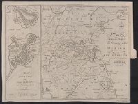
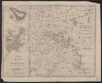
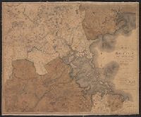
- Creator:
- Great Britain. Ordnance Survey
- Published / Created:
- Novr. 9th, 1843 [i.e. ca. 1853-1874?]
- Call Number:
- 32 1873
- Container / Volume:
- BRBL_00743
- Image Count:
- 35
- Resource Type:
- Maps, Atlases & Globes
- Found in:
- Beinecke Rare Book and Manuscript Library > [Old series Ordnance Survey maps of England and Wales] / engraved at the Ordnance Map Office, Southampton ...
- Creator:
- Chishitsu Chōsajo (Japan)
- Published / Created:
- 1912-15.
- Call Number:
- 57 1915
- Container / Volume:
- BRBL_00302
- Image Count:
- 24
- Resource Type:
- Maps, Atlases & Globes
- Found in:
- Beinecke Rare Book and Manuscript Library > Imperial Geological Survey of Japan topographical map : Division I-[V].
- Creator:
- James, Edwin, 1797-1861
- Call Number:
- Zc20 +822ja
- Image Count:
- 41
- Resource Type:
- Maps, Atlases & Globes
- Found in:
- Beinecke Rare Book and Manuscript Library > Account of an expedition from Pittsburgh to the Rocky Mountains : performed in the years 1819 and '20, by order of the Hon. J.C. Calhoun, Sec'y of War ; under the command of Major Stephen H. Long : from the notes of Major Long, Mr. T. Say, and other gentlemen of the exploring party / compiled by Edwin James, botanist and geologist for the expedition ; in two vols., with an atlas.
- Creator:
- Sanborn Map Company, issuing body
- Published / Created:
- 1926
- Call Number:
- 766 M31 1926
- Image Count:
- 36
- Resource Type:
- Maps, Atlases & Globes
- Found in:
- Beinecke Rare Book and Manuscript Library > Insurance maps of Manchester, including part of Highland Park and Manchester Green, Hartford Co., Connecticut.
- Published / Created:
- 1882
- Call Number:
- 812 1882
- Container / Volume:
- BRBL_00555
- Image Count:
- 27
- Resource Type:
- Maps, Atlases & Globes
- Found in:
- Beinecke Rare Book and Manuscript Library > Atlas of the geological survey of Wisconsin / T.C. Chamberlin, chief geologist ; R.D. Irving, Moses Strong, assistant geologists ; W.I.L. Nicodemus, topographical assistant ; T.B. Brooks ... [et al.], contributors.
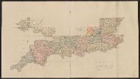
- Creator:
- Hollar, Wenceslaus, 1607-1677
- Call Number:
- 1973 265
- Image Count:
- 27
- Resource Type:
- Maps, Atlases & Globes
- Found in:
- Beinecke Rare Book and Manuscript Library > The kingdome of England & principality of Wales : exactly described whith euery sheere & the small townes in euery one of them, in six mappes, portable for euery mans pocket ... : vsefull for all comanders for quarteringe of souldiers, & all sorts of persons, that would be informed, where the armies be, neuer so commodiously drawne before this, 1644, described by one that trauailed throughout the whole kingdome, for its purpose / W. Hollar, fecit.
- Creator:
- Sanborn Map Company
- Published / Created:
- 1920
- Call Number:
- 783 P83 1920
- Container / Volume:
- BRBL_00510
- Image Count:
- 30
- Resource Type:
- Maps, Atlases & Globes
- Found in:
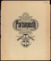
- Beinecke Rare Book and Manuscript Library > Insurance maps of Portsmouth, Virginia.
- Creator:
- Salway, Joseph.
- Published / Created:
- 1899-1903.
- Call Number:
- LTS 32 L84 1811/1903
- Image Count:
- 30
- Resource Type:
- Maps, Atlases & Globes
- Found in:
- Beinecke Rare Book and Manuscript Library > Plan of the road from Hyde Park Corner to Counter's Bridge / made for the Kensington Turnpike Trustees by their surveyor Joseph Salway in the year 1811.
- Published / Created:
- 1896
- Call Number:
- 777cbf B21 1894
- Container / Volume:
- BRBL_00504
- Image Count:
- 36
- Resource Type:
- Maps, Atlases & Globes
- Found in:
- Beinecke Rare Book and Manuscript Library > City of Baltimore topographical survey / made under the direction of H.T. Douglas, chief engineer.
- Creator:
- Sanborn Map Company, issuing body
- Published / Created:
- 1925
- Call Number:
- 766 M59 1925
- Image Count:
- 31
- Resource Type:
- Maps, Atlases & Globes
- Found in:
- Beinecke Rare Book and Manuscript Library > Insurance maps of Milford, New Haven County, Connecticut, including Woodmont, Merwin's Point, Bay View, Fort Trumbull Beach, Silver Sands, Seaside, Myrtle Beach, Meadows End, Walnut Beach, Wildmere Beach, Laurel Beach, Cedar Beach, Devon and Rivercliff.
- Creator:
- Rocque, John, -1762
- Published / Created:
- 1746. and 1913-1919.
- Call Number:
- 32 L84 1746/1919
- Container / Volume:
- BRBL_00738
- Image Count:
- 49
- Resource Type:
- Maps, Atlases & Globes
- Found in:
- Beinecke Rare Book and Manuscript Library > A plan of the cities of London and Westminster, and borough of Southwark, with the contiguous buildings; from an actual survey, taken by John Rocque and engraved by John Pine.
- Creator:
- Survey of India.
- Published / Created:
- 1827-1904.
- Call Number:
- Series 59 1827
- Image Count:
- 61
- Resource Type:
- Maps, Atlases & Globes
- Found in:
- Beinecke Rare Book and Manuscript Library > [Indian atlas 1:253 440, full sheets] / Survey of India.
- Published / Created:
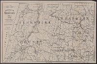
- ca. 1794
- Call Number:
- 2017 812
- Image Count:
- 62
- Found in:
- Beinecke Rare Book and Manuscript Library > [Plat book showing numbered lots of 27 townships of the (new) military tract in New York State].
- Creator:
- Hood, Washington, 1808-1840
- Published / Created:
- before 1835
- Call Number:
- WA MSS S-2687
- Collection Title:
- Washington Hood papers
- Container / Volume:
- 5 Broadside
- Image Count:
- 1
- Resource Type:
- Maps, Atlases & Globes
- Found in:
- Beinecke Rare Book and Manuscript Library > Manuscript map of Nebraska and Iowa
- Creator:
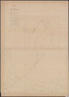
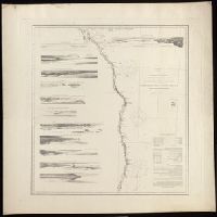
- Fairfax, Wilson M. C.
McMurtrie, W. B. (William Birch)
- Published / Created:
- 1853
- Call Number:
- WA MSS S-2369
- Collection Title:
- Franz R. and Kathryn M. Stenzel Research Files on Western American Art
- Container / Volume:
- bsd | Folder 1612
- Image Count:
- 1
- Resource Type:
- Maps, Atlases & Globes
- Found in:
- Beinecke Rare Book and Manuscript Library > McMurtrie, William B. "Reconnaissance of the Western Coast of the United States [Lower Sheet] San Francisco to San Diego." Engraving (in Series I)
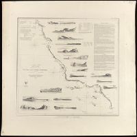
- Creator:
- Lindenkohl, A.
McMurtrie, W. B. (William Birch)
- Published / Created:
- 1854
- Call Number:
- WA MSS S-2369
- Collection Title:
- Franz R. and Kathryn M. Stenzel Research Files on Western American Art
- Container / Volume:
- bsd | Folder 1612
- Image Count:
- 1
- Resource Type:
- Maps, Atlases & Globes
- Found in:
- Beinecke Rare Book and Manuscript Library > McMurtrie, William B. "Reconnaissance of the Western Coast of the United States. Middle Sheet From San Francisco to Umpquah River." Engraving (in Series I)
- Creator:
- Lindenkohl, A
McMurtrie, W. B. (William Birch)
- Published / Created:
- 1855
- Call Number:
- WA MSS S-2369
- Collection Title:
- Franz R. and Kathryn M. Stenzel Research Files on Western American Art
- Container / Volume:
- bsd | Folder 1612
- Image Count:
- 1
- Resource Type:
- Maps, Atlases & Globes
- Found in:
- Beinecke Rare Book and Manuscript Library > McMurtrie, William B. "Reconnaissance of the Western Coast of the United States [Northern Sheet] From Umpquah River to the Boundary." Engraving (in Series I)
- Published / Created:
- [1796?]
- Call Number:
- 755 1800A
- Container / Volume:
- BRBL_00437
- Image Count:
- 1
- Resource Type:
- Maps, Atlases & Globes
- Found in:
- Beinecke Rare Book and Manuscript Library > Bowles's New one-sheet map of the United States of America; with the territories belonging to Great Britain and Spain.
- Published / Created:
- 1805
- Call Number:
- 755 1805B
- Container / Volume:
- BRBL_00437
- Image Count:
- 1
- Resource Type:
- Maps, Atlases & Globes
- Found in:
- Beinecke Rare Book and Manuscript Library > A new map of the United States of North America ... with Upper and Lower Canada &c ... by John Cary, Engraver.
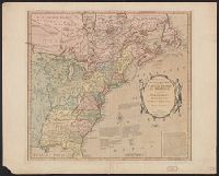
- Creator:
- Kitchin, Thomas, d. 1784
- Published / Created:
- 1780?]
- Call Number:
- 755 1760
- Container / Volume:
- BRBL_00428
- Image Count:
- 1
- Resource Type:
- Maps, Atlases & Globes
- Found in:
- Beinecke Rare Book and Manuscript Library > British dominions in America : drawn from the latest and best authorities / by Thos. Kitchin, hydrographer to his majesty.
- Published / Created:
- [1800?]
- Call Number:
- 755 1800E
- Container / Volume:
- BRBL_00437
- Image Count:
- 1
- Resource Type:
- Maps, Atlases & Globes
- Found in:
- Beinecke Rare Book and Manuscript Library > Bowles's new one-sheet map of the independent States of Virginia, ... Rhode Island, &c ... Habitations and hunting countries of the Confederate Indians; by Lewis Evans.
- Published / Created:
- 1805
- Call Number:
- 755 1805B
- Container / Volume:
- BRBL_00437
- Image Count:
- 1
- Resource Type:
- Maps, Atlases & Globes
- Found in:
- Beinecke Rare Book and Manuscript Library > A new map of the United States of North America ... with Upper and Lower Canada &c ... by John Cary, Engraver.
- Published / Created:
- 1813
- Call Number:
- 755 1813C
- Container / Volume:
- BRBL_00439
- Image Count:
- 1
- Resource Type:
- Maps, Atlases & Globes
- Found in:
- Beinecke Rare Book and Manuscript Library > An improved Map of the United States by Shelton & Kensett. Engraved by A. Doolittle, New Haven. AE 60. Copyright secured & entered according to Act of Congress, Nov. 8th 1813.
- Published / Created:
- 1806
- Call Number:
- 755 1806A
- Container / Volume:
- BRBL_00438
- Image Count:
- 1
- Resource Type:
- Maps, Atlases & Globes
- Found in:
- Beinecke Rare Book and Manuscript Library > A new map of part of the United States of North America ... by John Cary, Engraver.
- Published / Created:
- 1809
- Call Number:
- 755 1809
- Container / Volume:
- BRBL_00438
- Image Count:
- 1
- Resource Type:
- Maps, Atlases & Globes
- Found in:
- Beinecke Rare Book and Manuscript Library > The United States of North America : with the British territories and those of Spain.
- Published / Created:
- 1816
- Call Number:
- 755 1816
- Container / Volume:
- BRBL_00439
- Image Count:
- 1
- Resource Type:
- Maps, Atlases & Globes
- Found in:
- Beinecke Rare Book and Manuscript Library > Northern Section of the United States including Canada, etc., by John Melish. Second edition with Additions and improvements.
- Published / Created:
- 1817
- Call Number:
- 755 1817
- Container / Volume:
- BRBL_00439
- Image Count:
- 1
- Resource Type:
- Maps, Atlases & Globes
- Found in:
- Beinecke Rare Book and Manuscript Library > Northern Provinces of the United States. Hewitt Sc., London.
- Published / Created:
- July 6th 1813.
- Call Number:
- 755 1813B
- Container / Volume:
- BRBL_00438
- Image Count:
- 1
- Resource Type:
- Maps, Atlases & Globes
- Found in:
- Beinecke Rare Book and Manuscript Library > An improved map of the United States by Shelton & Kensett. Engraved by A. Doolittle, New Haven, & T. Kensett, Cheshire ...
- Published / Created:
- [1817?]
- Call Number:
- 755 1817A
- Container / Volume:
- BRBL_00439
- Image Count:
- 1
- Resource Type:
- Maps, Atlases & Globes
- Found in:
- Beinecke Rare Book and Manuscript Library > Southern provinces of the United States. [engr. for Thomson's "New General Atlas".]
- Published / Created:
- [1820?]
- Call Number:
- 755 1820A
- Container / Volume:
- BRBL_00439
- Image Count:
- 1
- Resource Type:
- Maps, Atlases & Globes
- Found in:
- Beinecke Rare Book and Manuscript Library > United States of America. J. & G. Menzies Sculpt. Edinr.
- Published / Created:
- 1823
- Call Number:
- 755 1823A
- Container / Volume:
- BRBL_00439
- Image Count:
- 1
- Resource Type:
- Maps, Atlases & Globes
- Found in:
- Beinecke Rare Book and Manuscript Library > United States of America. Neele & Son Sculpt.
- Published / Created:
- 1830
- Call Number:
- 755 1830
- Container / Volume:
- BRBL_00440
- Image Count:
- 1
- Resource Type:
- Maps, Atlases & Globes
- Found in:
- Beinecke Rare Book and Manuscript Library > Map of the territories of Michigan and Ouisconsin on a scale of 30 geographical miles to an inch by John Farmer of Detroit, Engraved by Rawdon Clark & Co., Albany, NY.
- Published / Created:
- 1819
- Call Number:
- 755 1819
- Container / Volume:
- BRBL_00439
- Image Count:
- 1
- Resource Type:
- Maps, Atlases & Globes
- Found in:
- Beinecke Rare Book and Manuscript Library > A new map of part of the United States, exhibiting the North West, Michigan, Indiana, and Illinois territory the States of Kentucky, Ohio, Virginia, Maryland and Pennsylvania ... John Cary, Engraver.
- Published / Created:
- [1820?]
- Call Number:
- 755 1820
- Container / Volume:
- BRBL_00439
- Image Count:
- 1
- Resource Type:
- Maps, Atlases & Globes
- Found in:
- Beinecke Rare Book and Manuscript Library > Map of North and South Carolina and Georgia, constructed from the latest authorities.
- Published / Created:
- 1817
- Call Number:
- 755 1817
- Container / Volume:
- BRBL_00439
- Image Count:
- 1
- Resource Type:
- Maps, Atlases & Globes
- Found in:
- Beinecke Rare Book and Manuscript Library > Northern Provinces of the United States. Hewitt Sc., London.
- Published / Created:
- 1832
- Call Number:
- 755 1832
- Container / Volume:
- BRBL_00440
- Image Count:
- 1
- Resource Type:
- Maps, Atlases & Globes
- Found in:
- Beinecke Rare Book and Manuscript Library > The United States of North America with the British Territories.
- Published / Created:
- [1778?]
- Call Number:
- 755 1778H
- Container / Volume:
- BRBL_00432
- Image Count:
- 1
- Resource Type:
- Maps, Atlases & Globes
- Found in:
- Beinecke Rare Book and Manuscript Library > The Theatere of War in North America, with the roads and a table of Distances.
- Published / Created:
- [1780?]
- Call Number:
- 755 1780D
- Container / Volume:
- BRBL_00433
- Image Count:
- 1
- Resource Type:
- Maps, Atlases & Globes
- Found in:
- Beinecke Rare Book and Manuscript Library > Bowles's new pocket map of the middle British Colonies in America, ... habitations and hunting countries of the confederate Indians: by Lewis Evans.
- Published / Created:
- 1781?]
- Call Number:
- 755 1781C
- Container / Volume:
- BRBL_00433
- Image Count:
- 1
- Resource Type:
- Maps, Atlases & Globes
- Found in:
- Beinecke Rare Book and Manuscript Library > Map for the Interior Travels through America, delineating the march of the army. T. Conder Sculpsit.
- Published / Created:
- 1786
- Call Number:
- 755 1786
- Container / Volume:
- BRBL_00435
- Image Count:
- 1
- Resource Type:
- Maps, Atlases & Globes
- Found in:
- Beinecke Rare Book and Manuscript Library > A new map of Nova Scotia and Cape Breton Island with the adjacent parts of New England and Canada ...
- Creator:
- Homann Erben (Firm)
- Published / Created:
- 1777
- Call Number:
- 755 1777B
- Container / Volume:
- BRBL_00431
- Image Count:
- 1
- Resource Type:
- Maps, Atlases & Globes
- Found in:
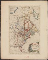
- Beinecke Rare Book and Manuscript Library > America Septentrionalis a Domino d'Anville in Galliis edita nunc in Anglia : coloniis in interiorem Virginiam deductis nec non Fluvii Ohio cursu aucta notisque geographicis et historicis illustrata et ad bellum praesentis temporis accomodata / sumptibus Homannianorum Heredum.
- Creator:
- Faden, William, 1749-1836, cartographer.
- Published / Created:
- 1777]
- Call Number:
- 755 1777E
- Image Count:
- 1
- Resource Type:
- Maps, Atlases & Globes
- Found in:
- Beinecke Rare Book and Manuscript Library > The British Colonies in North America. Engraved by William Faden.
- Published / Created:
- 1777]
- Call Number:
- 755 1777F
- Container / Volume:
- BRBL_00431
- Image Count:
- 1
- Resource Type:
- Maps, Atlases & Globes
- Found in:
- Beinecke Rare Book and Manuscript Library > The British Colonies in North America. Engraved by William Faden.
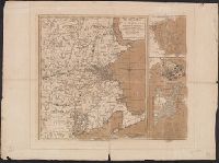
- Creator:
- Robert Sayer and John Bennett (Firm)
- Call Number:
- 755 1776K
- Container / Volume:
- BRBL_00430
- Image Count:
- 1
- Resource Type:
- Maps, Atlases & Globes
- Found in:
- Beinecke Rare Book and Manuscript Library > A general map of the northern British colonies in America : which comprehends the province of Quebec, the government of Newfoundland, Nova-Scotia, New-England and New-York, from the maps published by the Admiralty and Board of Trade, regulated by the astr
- Published / Created:
- 1776
- Call Number:
- 755 1776L
- Container / Volume:
- BRBL_00430
- Image Count:
- 1
- Resource Type:
- Maps, Atlases & Globes
- Found in:
- Beinecke Rare Book and Manuscript Library > A map of the British Empire, in North America. By Samuel Dunn, Mathematician, improved from the surveys of Capt. Carver.
- Published / Created:
- [1832?]
- Call Number:
- 764 B764 1832
- Container / Volume:
- BRBL_00456A
- Image Count:
- 1
- Resource Type:
- Maps, Atlases & Globes
- Found in:
- Beinecke Rare Book and Manuscript Library > Map of Bridgewater, Mass.
- Published / Created:
- 1776
- Call Number:
- 764 B65 1776B
- Container / Volume:
- BRBL_00455
- Image Count:
- 1
- Resource Type:
- Maps, Atlases & Globes
- Found in:
- Beinecke Rare Book and Manuscript Library > An accurate map of the country round Boston in New England ...
- Published / Created:
- 178-?]
- Call Number:
- 764 B65 1774
- Container / Volume:
- BRBL_00454
- Image Count:
- 1
- Resource Type:
- Maps, Atlases & Globes
- Found in:
- Beinecke Rare Book and Manuscript Library > A new and accurate plan of the town of Boston in New England ; A new plan of Boston Harbor from an actual survey.
- Published / Created:
- 1776
- Call Number:
- 764 B65 1776B
- Container / Volume:
- BRBL_00455
- Image Count:
- 1
- Resource Type:
- Maps, Atlases & Globes
- Found in:
- Beinecke Rare Book and Manuscript Library > An accurate map of the country round Boston in New England ...
- Published / Created:
- 1793
- Call Number:
- 764 B65 1793
- Container / Volume:
- BRBL_00455
- Image Count:
- 1
- Resource Type:
- Maps, Atlases & Globes
- Found in:
- Beinecke Rare Book and Manuscript Library > A plan of the Action at Bunker Hill, on the 17th of June 1775. Between His Majesty's troops, under the command of Major General Howe, and the American Forces: Engraved for Stedman's History of the American War.
- Published / Created:
- 1800
- Call Number:
- 764 B65 1800
- Container / Volume:
- BRBL_00455
- Image Count:
- 1
- Resource Type:
- Maps, Atlases & Globes
- Found in:
- Beinecke Rare Book and Manuscript Library > A new plan of Boston from Actual surveys by Osgood Carleton. With corrections, additions, & improvements.
- Published / Created:
- 1777
- Call Number:
- 764 B65 1777A
- Container / Volume:
- BRBL_00455
- Image Count:
- 1
- Resource Type:
- Maps, Atlases & Globes
- Found in:
- Beinecke Rare Book and Manuscript Library > A plan of the town of Boston, with the intrechments &c. of His Majestys Forces in 1775: from the observations of Lieut. Page of His Majesty's Corps of Engineers: and from the plans of other Gentlemen.
- Published / Created:
- 1814
- Call Number:
- 764 B65 1814
- Container / Volume:
- BRBL_00455
- Image Count:
- 1
- Resource Type:
- Maps, Atlases & Globes
- Found in:
- Beinecke Rare Book and Manuscript Library > Map of Boston in the State of Massachusetts. Surveyed by J.G. Hales Geogr. & surveyor. I.R. Penniman Del. Engraved by T. Wightman Jr.
- Published / Created:
- 1835
- Call Number:
- 764 B65 1835
- Container / Volume:
- BRBL_00455
- Image Count:
- 1
- Resource Type:
- Maps, Atlases & Globes
- Found in:
- Beinecke Rare Book and Manuscript Library > The South Cove territory, comprising every part which is coloured on this map.
- Published / Created:
- 1819
- Call Number:
- 764 B65 1819
- Container / Volume:
- BRBL_00455
- Image Count:
- 1
- Resource Type:
- Maps, Atlases & Globes
- Found in:
- Beinecke Rare Book and Manuscript Library > Map of Boston and its Vicinity by John G. Hales.
- Creator:
- Appalachian Mountain Club
- Published / Created:
- 1890
- Call Number:
- 764 B65 1890A
- Container / Volume:
- BRBL_00456
- Image Count:
- 1
- Resource Type:
- Maps, Atlases & Globes
- Found in:
- Beinecke Rare Book and Manuscript Library > Map of the country about Boston / Geo. S. Harris & Sons, lith.
- Creator:
- E.P. Dutton (Firm)
- Published / Created:
- 1865
- Call Number:
- 764 B65 1865
- Container / Volume:
- BRBL_00455
- Image Count:
- 1
- Resource Type:
- Maps, Atlases & Globes
- Found in:
- Beinecke Rare Book and Manuscript Library > Chart of Boston Harbor and Massachusetts Bay : with map of the adjacent country / published at the Boston Map Store.
- Creator:
- Sampson, Murdock & Co
- Published / Created:
- [1886], c1885.
- Call Number:
- 764 B65 1886
- Container / Volume:
- BRBL_00456
- Image Count:
- 1
- Resource Type:
- Maps, Atlases & Globes
- Found in:
- Beinecke Rare Book and Manuscript Library > Map of Boston for 1886.
- Creator:
- American Association for the Advancement of Science
- Published / Created:
- 1880
- Call Number:
- 764 B65 1880A
- Container / Volume:
- BRBL_00456
- Image Count:
- 1
- Resource Type:
- Maps, Atlases & Globes
- Found in:
- Beinecke Rare Book and Manuscript Library > Map of Boston and vicinity. Prepared for the use of members of the American Association for the Advancement of Science at the Boston meeting, August, 1880.
- Published / Created:
- 27 Novr. 1775.
- Call Number:
- 764 B65 1775G
- Container / Volume:
- BRBL_00454
- Image Count:
- 1
- Resource Type:
- Maps, Atlases & Globes
- Found in:
- Beinecke Rare Book and Manuscript Library > A plan of the battle on Bunkers Hill : fought on the 17th of June 1775, by an officer on the spot.
- Creator:
- Aitken, Robert, 1735-1802
- Published / Created:
- 1775]
- Call Number:
- 764 B65 1775N
- Container / Volume:
- BRBL_00455
- Image Count:
- 1
- Resource Type:
- Maps, Atlases & Globes
- Found in:
- Beinecke Rare Book and Manuscript Library > A new and correct plan of the town of Boston.
- Published / Created:
- 1775]
- Call Number:
- 764 B65 1775H
- Container / Volume:
- BRBL_00454
- Image Count:
- 1
- Resource Type:
- Maps, Atlases & Globes
- Found in:
- Beinecke Rare Book and Manuscript Library > A plan of the town and chart of the harbour of Boston : exhibiting a view of the islands, castle forts, and entrances into the said harbour.
- Published / Created:
- [1831?]
- Call Number:
- 764 B63 1831
- Container / Volume:
- BRBL_00454
- Image Count:
- 1
- Resource Type:
- Maps, Atlases & Globes
- Found in:
- Beinecke Rare Book and Manuscript Library > A Map of the Town of Bolton in the County of Worcester and the Commonwealth of Massachusetts. Surveyed by Silas Holman in the Year 1831.
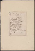
- Published / Created:
- 1775?]
- Call Number:
- 764 B65 1775B
- Container / Volume:
- BRBL_00454
- Image Count:
- 1
- Resource Type:
- Maps, Atlases & Globes
- Found in:
- Beinecke Rare Book and Manuscript Library > Sketch of the action on the heights of Charlestown 17 June 1775 between his majestys troops under the command of M. Gnl. Howe and a large body of American rebels.
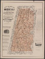
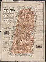
- Creator:
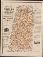
- Watson, Walter, civil engineer
- Published / Created:
- c1883.
- Call Number:
- 764 B45 1883
- Container / Volume:
- BRBL_00454
- Image Count:
- 1
- Resource Type:
- Maps, Atlases & Globes
- Found in:
- Beinecke Rare Book and Manuscript Library > Railway and highway map of the famous Berkshire Hills region, showing also villages and points of interest : from official records and other information / by Walter Watson, C.E. for the Berkshire Life Insurance Co. of Pittsfield, Mass., 1883.
- Creator:
- Watson, Walter, civil engineer
- Published / Created:
- c1883.
- Call Number:
- 764 B45 1883
- Container / Volume:
- BRBL_00454
- Image Count:
- 1
- Resource Type:
- Maps, Atlases & Globes
- Found in:
- Beinecke Rare Book and Manuscript Library > Railway and highway map of the famous Berkshire Hills region, showing also villages and points of interest : from official records and other information / by Walter Watson, C.E. for the Berkshire Life Insurance Co. of Pittsfield, Mass., 1883.
- Published / Created:
- [1831?]
- Call Number:
- 764 B63 1831
- Container / Volume:
- BRBL_00454
- Image Count:
- 1
- Resource Type:
- Maps, Atlases & Globes
- Found in:
- Beinecke Rare Book and Manuscript Library > A Map of the Town of Bolton in the County of Worcester and the Commonwealth of Massachusetts. Surveyed by Silas Holman in the Year 1831.
- Creator:
- Price, William, fl. 1725-1769
- Published / Created:
- [1743]
- Call Number:
- 764 B65 1743
- Container / Volume:
- BRBL_00454
- Image Count:
- 1
- Resource Type:
- Maps, Atlases & Globes
- Found in:
- Beinecke Rare Book and Manuscript Library > A new plan of ye great town of Boston in New England in America : with the many additionall buildings & new streets, to the year, 1743.
- Published / Created:
- 2 Septr. 1775.
- Call Number:
- 764 B65 1775D
- Container / Volume:
- BRBL_00454
- Image Count:
- 1
- Resource Type:
- Maps, Atlases & Globes
- Found in:
- Beinecke Rare Book and Manuscript Library > The seat of war in New England : with the marches of the several corps sent by the colonies towards Boston, with the attack on Bunkers-Hill / by an American volunteer.
- Creator:
- Price, William, fl. 1725-1769
- Published / Created:
- [1743]
- Call Number:
- 764 B65 1743
- Container / Volume:
- BRBL_00454
- Image Count:
- 1
- Resource Type:
- Maps, Atlases & Globes
- Found in:
- Beinecke Rare Book and Manuscript Library > A new plan of ye great town of Boston in New England in America : with the many additionall buildings & new streets, to the year, 1743.
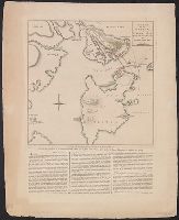
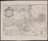
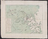
- Creator:
- De Costa, J
- Published / Created:
- July 29th, 1775.
- Call Number:
- 764 B65 1775
- Container / Volume:
- BRBL_00454
- Image Count:
- 1
- Resource Type:
- Maps, Atlases & Globes
- Found in:
- Beinecke Rare Book and Manuscript Library > A plan of the town and harbour of Boston and the country adjacent, with the road from Boston to Concord : shewing the place of the late engagement between the King's troops & the provincials, together with the several encampments of both armies in & about
- Published / Created:
- 1776
- Call Number:
- 764 B65 1776A
- Container / Volume:
- BRBL_00455
- Image Count:
- 1
- Resource Type:
- Maps, Atlases & Globes
- Found in:
- Beinecke Rare Book and Manuscript Library > A plan of Boston and its environs showing the true situation of His Majesty's Army. Also those of the Rebels ... 1775. Engraved by Jono. Lodge.
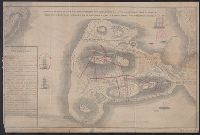
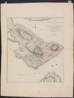
- Creator:
- Page, Thomas Hyde, Sir, 1746-1821
- Published / Created:
- [1775]
- Call Number:
- 764 B65 1775C
- Container / Volume:
- BRBL_00454
- Image Count:
- 1
- Resource Type:
- Maps, Atlases & Globes
- Found in:
- Beinecke Rare Book and Manuscript Library > A plan of the action at Bunkers-Hill, on the 17th. of June, 1775, between His Majesty's troops under the command of Major General Howe, and the rebel forces, by Lieut. Page, of the Engineers, who acted as aide de camp to General Howe in that action.
- Creator:
- Watson, Walter, civil engineer
- Published / Created:
- [1896].
- Call Number:
- 764 B45 1896
- Container / Volume:
- BRBL_00454
- Image Count:
- 1
- Resource Type:
- Maps, Atlases & Globes
- Found in:
- Beinecke Rare Book and Manuscript Library > Railway and highway map of the famous Berkshire Hills region, showing also villages and points of interest : from official records and other information / by Walter Watson, C.E. for the Berkshire Life Insurance Co. of Pittsfield, Mass., 1883 (Corrected 18
- Published / Created:
- 1775?]
- Call Number:
- 764 B65 1775B
- Container / Volume:
- BRBL_00454
- Image Count:
- 1
- Resource Type:
- Maps, Atlases & Globes
- Found in:
- Beinecke Rare Book and Manuscript Library > Sketch of the action on the heights of Charlestown 17 June 1775 between his majestys troops under the command of M. Gnl. Howe and a large body of American rebels.
- Published / Created:
- 1794
- Call Number:
- 3897 1794
- Container / Volume:
- BRBL_00183
- Image Count:
- 1
- Resource Type:
- Maps, Atlases & Globes
- Found in:
- Beinecke Rare Book and Manuscript Library > A new map of the Island and Kingdom of Corsica by Thomas Jefferys, Geographer to the King with additions and improvements.
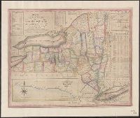
- Creator:
- Phelps, Humphrey
- Published / Created:
- 1832
- Call Number:
- 771 1833
- Container / Volume:
- BRBL_00478
- Image Count:
- 1
- Resource Type:
- Maps, Atlases & Globes
- Found in:
- Beinecke Rare Book and Manuscript Library > Map of the state of New York with the latest improvements / by H. Phelps.
- Creator:
- Great Britain. Hydrographic Department, author
- Call Number:
- 254cea 1886
- Container / Volume:
- BRBL_00021
- Image Count:
- 1
- Resource Type:
- Maps, Atlases & Globes
- Found in:
- Beinecke Rare Book and Manuscript Library > Australia, Coral Sea and Great Barrier Reefs, showing the Inner and Outer routes to Torres Strait. Sheet 2 / engraved by Edwd. Weller.
- Published / Created:
- 1835?
- Call Number:
- 766 M59 1835
- Container / Volume:
- BRBL_00469
- Image Count:
- 1
- Resource Type:
- Maps, Atlases & Globes
- Found in:
- Beinecke Rare Book and Manuscript Library > Map of the town of Milford, Ct. : from actual survey / by E. R. Lambert, September 1835.
- Published / Created:
- [1804?]
- Call Number:
- 771 1804
- Container / Volume:
- BRBL_00477
- Image Count:
- 1
- Resource Type:
- Maps, Atlases & Globes
- Found in:
- Beinecke Rare Book and Manuscript Library > Map of the State of New York by Simeon DeWitt, Surveyor General ...
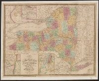
- Creator:
- Burr, David H., 1803-1875
- Published / Created:
- 1839]
- Call Number:
- 771 1839
- Container / Volume:
- BRBL_00478
- Image Count:
- 1
- Resource Type:
- Maps, Atlases & Globes
- Found in:
- Beinecke Rare Book and Manuscript Library > Map of New York exhibiting the post offices, post roads, canals, rail roads &c. By David H. Burr; (Late topographer to the Post Office.) Geographer to the House of Representatives of the U.S.
- Published / Created:
- 1893
- Call Number:
- 766 T57 1893
- Container / Volume:
- BRBL_00474
- Image Count:
- 1
- Resource Type:
- Maps, Atlases & Globes
- Found in:
- Beinecke Rare Book and Manuscript Library > Tolland [County].
- Published / Created:
- 1849
- Call Number:
- 771 1779
- Container / Volume:
- BRBL_00477
- Image Count:
- 1
- Resource Type:
- Maps, Atlases & Globes
- Found in:
- Beinecke Rare Book and Manuscript Library > A Chorographical map of the Province of New York in North America, divided into counties, manors towns, patents and townships ... by Claude J. Sauthier ... London ... William Faden,1779.
- Creator:
- Schuchman, William, b. 1823 or 4
- Published / Created:
- 1854
- Call Number:
- 758gme 1854
- Container / Volume:
- BRBL_00442
- Image Count:
- 1
- Resource Type:
- Maps, Atlases & Globes
- Found in:
- Beinecke Rare Book and Manuscript Library > Map of the Great Central Railway Line of the west and connecting lines.
- Published / Created:
- [1919?].
- Call Number:
- 11hcf 1919A-5
- Container / Volume:
- BRBL_00010N
- Image Count:
- 1
- Resource Type:
- Maps, Atlases & Globes
- Found in:
- Beinecke Rare Book and Manuscript Library > [Germany : the German propositions after World War I.]