Search
You Searched For
Search Results
- Creator:
- Királyi Magyar Térképészeti Intézet
- Published / Created:
- [1918?-1943?]
- Call Number:
- 304 1886A
- Container / Volume:
- BRBL_00740
- Image Count:
- 9
- Resource Type:
- Maps, Atlases & Globes
- Found in:
- Beinecke Rare Book and Manuscript Library > [Kelet-Európa térképe] [cartographic material].
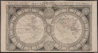
- Creator:
- Jaugeon, N
- Published / Created:
- 173-?]
- Call Number:
- 11 1670
- Container / Volume:
- BRBL_00680
- Image Count:
- 1
- Resource Type:
- Maps, Atlases & Globes
- Found in:
- Beinecke Rare Book and Manuscript Library > Mappe-monde celeste, terrestre et historique [cartographic material].
- Creator:
- Rossi, Giovanni Giacomo de, 17th cent
- Published / Created:
- 1674
- Call Number:
- 11 1674
- Container / Volume:
- BRBL_00680
- Image Count:
- 1
- Resource Type:
- Maps, Atlases & Globes
- Found in:
- Beinecke Rare Book and Manuscript Library > Mappa mondo o vero carta generale del globo terrestre [cartographic material] : rapresentato in due planisferi ... / da N. Sanson de Abbeville Giografo di sua Maesta Cristma ; intagliata da Gio. Lhuilier.
- Creator:
- Homann, Johann Baptist, 1663-1724
- Published / Created:
- 1716?]
- Call Number:
- 11 1716
- Container / Volume:
- BRBL_00680
- Image Count:
- 1
- Resource Type:
- Maps, Atlases & Globes
- Found in:
- Beinecke Rare Book and Manuscript Library > Planiglobii terrestris cum utroq hemisphaerio caelesti generalis repraesentatio [cartographic material] : quam ex novissimis probatissimisque recentium geographorum scriptis concinnatam, multisq[ue] phaenomenis illustratam / publice proponit Io. Bapt. Hom
- Published / Created:
- 1737
- Call Number:
- 11 1737
- Container / Volume:
- BRBL_00681
- Image Count:
- 1
- Resource Type:
- Maps, Atlases & Globes
- Found in:
- Beinecke Rare Book and Manuscript Library > A new and correct map of ye world [cartographic material] : laid down according to ye latest and best observations : to which is added several curious discourses on the tides, trade winds & monsoons ...
- Creator:
- Senex, John, d. 1740
- Published / Created:
- 1720]
- Call Number:
- 11 1720B
- Container / Volume:
- BRBL_00680
- Image Count:
- 1
- Resource Type:
- Maps, Atlases & Globes
- Found in:
- Beinecke Rare Book and Manuscript Library > A new map of the world [cartographic material] : from the latest observations / revised by I. Senex.
- Creator:
- Moll, Herman, d. 1732
- Published / Created:
- [after 1754]
- Call Number:
- 11 1728
- Container / Volume:
- BRBL_00680
- Image Count:
- 1
- Resource Type:
- Maps, Atlases & Globes
- Found in:
- Beinecke Rare Book and Manuscript Library > A new and correct map of the world laid down according to the newest discoveries and from the most exact observations / [cartographic material] / by Herman Moll, geographer.
- Creator:
- Cóvens et Mortier
- Published / Created:
- ca. 1730-ca. 1800]
- Call Number:
- 1973 Folio 71
- Image Count:
- 1
- Resource Type:
- Maps, Atlases & Globes
- Found in:
- Beinecke Rare Book and Manuscript Library > [Atlas nouveau contenant toutes les parties du monde ou sont exactement marqués les empires, monarchies, royaumes, états, republiques &c. Le tout recueilli par les meilleurs geógraphes.]
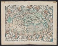
- Creator:
- Münster, Sebastian, 1489-1552
Münster, Sebastian, 1489-1552. Cosmographei
Ptolemy, fl. 2nd cent
- Published / Created:
- 1552?]
- Call Number:
- 13 1552
- Container / Volume:
- BRBL_00011
- Image Count:
- 2
- Resource Type:
- Maps, Atlases & Globes
- Found in:
- Beinecke Rare Book and Manuscript Library > La seconde table generale selon Ptol[omée].
- Creator:
- Wyld, James, 1812-1887, cartographer
- Call Number:
- 13 1873A
- Container / Volume:
- BRBL_00011
- Image Count:
- 1
- Resource Type:
- Maps, Atlases & Globes
- Found in:
- Beinecke Rare Book and Manuscript Library > Map of the countries between England & India : designed to shew the over-land and sea-routes to the east, and the relative position of Russia to England & Hindostan / by James Wyld.
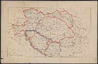
- Published / Created:
- 1919?]
- Call Number:
- 11hcf 1919C-3-4
- Container / Volume:
- BRBL_00010U
- Image Count:
- 1
- Resource Type:
- Maps, Atlases & Globes
- Found in:
- Beinecke Rare Book and Manuscript Library > [Map of Balkan Peninsula and Eastern Europe].
- Published / Created:
- 1919?]
- Call Number:
- 11hcf 1919C-3-5
- Container / Volume:
- BRBL_00010U
- Image Count:
- 1
- Resource Type:
- Maps, Atlases & Globes
- Found in:
- Beinecke Rare Book and Manuscript Library > [Map of Balkan Peninsula and Eastern Europe].
- Published / Created:
- 1919?]
- Call Number:
- 11hcf 1919C-3-8
- Container / Volume:
- BRBL_00010U
- Image Count:
- 1
- Resource Type:
- Maps, Atlases & Globes
- Found in:
- Beinecke Rare Book and Manuscript Library > Austria-Hungary.
- Published / Created:
- 1919?]
- Call Number:
- 11hcf 1919C-3-6
- Container / Volume:
- BRBL_00010U
- Image Count:
- 1
- Resource Type:
- Maps, Atlases & Globes
- Found in:
- Beinecke Rare Book and Manuscript Library > [Map of Balkan Peninsula and Eastern Europe].
- Published / Created:
- 1919?]
- Call Number:
- 11hcf 1919C-3-9
- Container / Volume:
- BRBL_00010U
- Image Count:
- 1
- Resource Type:
- Maps, Atlases & Globes
- Found in:
- Beinecke Rare Book and Manuscript Library > [Map of Eastern Europe and the Balkan Peninsula].
- Creator:
- Hole, William, d. 1624, engraver
- Published / Created:
- [ca. 1606]
- Call Number:
- Taylor 301
- Collection Title:
- The generall historie of Virginia, New-England, and the Summer Iles : with the names of the
- Image Count:
- 1
- Found in:
- Beinecke Rare Book and Manuscript Library > Virginia
- Published / Created:
- 1801
- Call Number:
- Zc90 801mab
- Collection Title:
- Voyages from Montreal, on the river St. Laurence, through the continent of North America, to the
- Image Count:
- 1
- Found in:
- Beinecke Rare Book and Manuscript Library > A map of America, between latitudes 40 and 70 north and longitudes 45 and 180 west, exhibiting Mackenzie's track from Montreal to Fort Chipewyan & from thence to the North Sea In 1789 & to the West Pacific Ocean in 1793
- Published / Created:
- 1783
- Call Number:
- Cb21 35B
- Collection Title:
- History of the war with America, France, Spain, and Holland; commencing in 1775 and ending in 1783
- Image Count:
- 1
- Found in:
- Beinecke Rare Book and Manuscript Library > A Map of the United States of America, as settled by the peace of 1783
- Creator:
- Dunn, Samuel
- Published / Created:
- 1774
- Call Number:
- Cb23 27
- Collection Title:
- The American military pocket atlas : being an approved collection of correct maps, both general and
- Image Count:
- 1
- Found in:
- Beinecke Rare Book and Manuscript Library > North America as divided amongst the European powers
- Published / Created:
- 1776
- Call Number:
- Cb23 27
- Collection Title:
- The American military pocket atlas : being an approved collection of correct maps, both general and
- Image Count:
- 1
- Found in:
- Beinecke Rare Book and Manuscript Library > A General map of the northern British colonies in America. which comprehends the province of Quebec, the government of Newfoundland, Nova-Scotia, New-England and New-York. From the maps published by the Admiralty and Board of Trade regulated by the astronomic and trigonometric observations of M. von Holland and corrected from Governor Pownall's late map 1776.
- Published / Created:
- 1776
- Call Number:
- Cb23 27
- Collection Title:
- The American military pocket atlas : being an approved collection of correct maps, both general and
- Image Count:
- 1
- Found in:
- Beinecke Rare Book and Manuscript Library > A general map of the middle British colonies in America. Containing Virginia, Maryland, the Delaware counties, Pennsylvania and New Jersey. With the addition of New York, and of the greatest part of New England, as also of the bordering parts of the province of Quebec, improved from several surveys made after the late war, and corrected from Governor Pownall's late map 1776.
- Creator:
- Romans, B
- Published / Created:
- 1776
- Call Number:
- Cb23 27
- Collection Title:
- The American military pocket atlas : being an approved collection of correct maps, both general and
- Image Count:
- 1
- Found in:
- Beinecke Rare Book and Manuscript Library > A General map of the southern British colonies, in America, comprehending North and South Carolina, Georgia, east and west Florida, with the neighbouring Indian countries. From the modern surveys of engineer de Brahm, Capt. Collet, Mouzon & others; and from the large hydrographical survey of the coasts of east and west Florida
- Creator:
- Brasier, William
- Published / Created:
- 1776
- Call Number:
- Cb23 27
- Collection Title:
- The American military pocket atlas : being an approved collection of correct maps, both general and
- Image Count:
- 1
- Found in:
- Beinecke Rare Book and Manuscript Library > A Survey of Lake Champlain, including Lake George, Crown Point and St. John. Surveyed by order of His Excellency Major General Sr. Jeffery Amherst, knight of the most honble. Order of the Bath, Commander in Chief of His Majesty's forces in North America (now Lord Amherst) by William Brassier, draughtsman, 1762
- Creator:
- Catlin, George, 1796-1872
- Published / Created:
- 1848
- Call Number:
- Zc12 +841cabj
- Image Count:
- 7
- Found in:
- Beinecke Rare Book and Manuscript Library > Illustrations of the manners, customs, and condition of the North American Indians : in a series of letters and notes written during eight years of travel and adventure among the wildest and most remarkable tribes now existing. : with three hundred and si
- Creator:
- Weller, Edward, d. 1884
- Call Number:
- Zc90 859ka
- Collection Title:
- Wanderings of an artist among the Indians of North America : from Canada to Vancouver's Island and
- Image Count:
- 1
- Found in:
- Beinecke Rare Book and Manuscript Library > Map to illustrate Mr. Kane's travels in the territory of the Hudson's Bay Company
- Creator:
- Sotzmann, D. F
- Call Number:
- Zm Sp79
- Collection Title:
- Allgemeines historisches Taschenbuch, oder, Abriss der merkwurdigsten neuen Welt-Begebenheiten
- Image Count:
- 1
- Found in:
- Beinecke Rare Book and Manuscript Library > Die Vereinigten Staaten von Nord America. nach der von Wm Faden 1783
- Creator:
- Wadsworth, James, 1730-1817
- Published / Created:
- 1748
- Call Number:
- ZZ35 5 1
- Image Count:
- 1
- Resource Type:
- Maps, Atlases & Globes
- Found in:
- Beinecke Rare Book and Manuscript Library > Plan of the city of New Haven taken in 1748
- Creator:
- Tanner, Henry Schenck, 1786-1858
- Published / Created:
- 1822
- Call Number:
- 2003 Folio 81
- Collection Title:
- The New American Atlas ...
- Container / Volume:
- No. IV [4]
- Image Count:
- 1
- Found in:
- Beinecke Rare Book and Manuscript Library > A Map of North America, Constructed According to the Latest Information by H. S. Tanner
- Creator:
- La Rue, Philippe de.
Mariette, Pierre, 1603-1657
Sommer, Jean, fl. 1651, engraver
- Published / Created:
- [1651]
- Call Number:
- 1983 Folio 19
- Collection Title:
- [Atlas factice of 96 maps by Blaeu, Visscher, Jansson, Hondius and others]
- Image Count:
- 1
- Found in:
- Beinecke Rare Book and Manuscript Library > Terra Promissa in sortes seu tribvs XII distincta seu tabula ad Librum Iosve / auctore Ph. de la Rue ...
- Creator:
- Jansson, Jan, 1588-1664
- Published / Created:
- [ca. 1641]
- Call Number:
- 1983 Folio 19
- Collection Title:
- [Atlas factice of 96 maps by Blaeu, Visscher, Jansson, Hondius and others]
- Image Count:
- 1
- Found in:
- Beinecke Rare Book and Manuscript Library > Silesiae Ducatus accurata et vera delineatio
- Creator:
- Wyld, James, 1812-1887
- Published / Created:
- [1845?]
- Call Number:
- 1977 Folio 193
- Collection Title:
- A new general atlas of modern geography, consisting of a complete collection of maps of the four
- Image Count:
- 1
- Resource Type:
- Maps, Atlases & Globes
- Found in:
- Beinecke Rare Book and Manuscript Library > Map of the United Kingdom of Great Britain and Ireland
- Creator:
- Marker, J. P
- Published / Created:
- undated
- Call Number:
- WA MSS 328
- Image Count:
- 1
- Resource Type:
- Maps, Atlases & Globes
- Found in:
- Beinecke Rare Book and Manuscript Library > Map of the ’Great Blue-Gravel Lead’ of Northern California /by J. P. Marker
- Published / Created:
- 1802
- Call Number:
- Im B388 Zz802B
- Collection Title:
- The imperial guide : with picturesque plans of the great post roads, containing miniatures
- Image Count:
- 1
- Found in:
- Beinecke Rare Book and Manuscript Library > [Map: Coventry to Stony Stratford]
- Published / Created:
- 1802
- Call Number:
- Im B388 Zz802B
- Collection Title:
- The imperial guide : with picturesque plans of the great post roads, containing miniatures
- Image Count:
- 1
- Found in:
- Beinecke Rare Book and Manuscript Library > [Map: Stafford to Coventry]
- Published / Created:
- 1802
- Call Number:
- Im B388 Zz802B
- Collection Title:
- The imperial guide : with picturesque plans of the great post roads, containing miniatures
- Image Count:
- 1
- Found in:
- Beinecke Rare Book and Manuscript Library > [Map: Talk on the Hill to Birmingham]
- Published / Created:
- 1802
- Call Number:
- Im B388 Zz802B
- Collection Title:
- The imperial guide : with picturesque plans of the great post roads, containing miniatures
- Image Count:
- 1
- Found in:
- Beinecke Rare Book and Manuscript Library > [Map: Lancaster to Worsley]
- Published / Created:
- 1802
- Call Number:
- Im B388 Zz802B
- Collection Title:
- The imperial guide : with picturesque plans of the great post roads, containing miniatures
- Image Count:
- 1
- Found in:
- Beinecke Rare Book and Manuscript Library > [Map: Carlisle to Bolton]
- Published / Created:
- 1802
- Call Number:
- Im B388 Zz802B
- Collection Title:
- The imperial guide : with picturesque plans of the great post roads, containing miniatures
- Image Count:
- 1
- Found in:
- Beinecke Rare Book and Manuscript Library > [Map: Islip to Paddington]
- Published / Created:
- circa 1899-1900
- Call Number:
- GEN MSS 571
- Image Count:
- 61
- Found in:
- Beinecke Rare Book and Manuscript Library > Muster and History of Browlia
- Creator:
- Boehme, August Gottlieb, 1719-1797
Hase, Johann Matthias, 1684-1742
Homann Erben (Firm)
- Published / Created:
- MDCCXXXXVI [i.e., 1759]
- Call Number:
- 1983 Folio 23
- Collection Title:
- [Atlas factice of 50 maps, primarily by Johann Baptist Homann and/or issued by the Homann Erben
- Image Count:
- 1
- Found in:
- Beinecke Rare Book and Manuscript Library > Americae mappa generalis : secundum legitimas projectionis stereographicae regulas, relationesque recentissimas et observationes sociorum Acad. reg. sc. quae Parisiis est aliorumque auctorum nec non secundum mentem D.I.M. Hasii ; M.P.P. in partes suas met
- Creator:
- Homann, Johann Baptist, 1663-1724
- Published / Created:
- [ca. 1715]
- Call Number:
- 1983 Folio 23
- Collection Title:
- [Atlas factice of 50 maps, primarily by Johann Baptist Homann and/or issued by the Homann Erben
- Image Count:
- 1
- Found in:
- Beinecke Rare Book and Manuscript Library > Tabula Ducatus Carnioliae, vindorum Marchiae et Histriae et mente Mustr. quondam J.B. Valvasorii / concinnatia et exhibita a Io. Bapt. Homanno, S.C.M. Geogr
- Creator:
- Guessefeld, F. L. (Franz Ludwig), 1744-1807
Homann Erben (Firm)
- Published / Created:
- 1775
- Call Number:
- 1983 Folio 23
- Collection Title:
- [Atlas factice of 50 maps, primarily by Johann Baptist Homann and/or issued by the Homann Erben
- Image Count:
- 1
- Found in:
- Beinecke Rare Book and Manuscript Library > Lubomeriae et Galliciae regni tabula geographica / [cartographic material] / F.I.G
- Creator:
- Homann Erben (Firm)
Mayer, Tobias, 1723-1762
- Published / Created:
- 1773
- Call Number:
- 1983 Folio 23
- Collection Title:
- [Atlas factice of 50 maps, primarily by Johann Baptist Homann and/or issued by the Homann Erben
- Image Count:
- 1
- Found in:
- Beinecke Rare Book and Manuscript Library > Mappa geographica Regni Poloniae [cartographic material] : ex novissimis quotquot sunt mappis specialibus composita et ad L.L. stereographicae projectionis / revocata a Tob. Mayero, S.C.S.
- Creator:
- Guessefeld, F. L. (Franz Ludwig), 1744-1807
Homann Erben (Firm)
Lopez, D. T.
- Published / Created:
- MDCCLXXXII [1782]
- Call Number:
- 1983 Folio 23
- Collection Title:
- [Atlas factice of 50 maps, primarily by Johann Baptist Homann and/or issued by the Homann Erben
- Image Count:
- 1
- Found in:
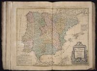
- Beinecke Rare Book and Manuscript Library > Regnorum Hispaniae et Portugalliae [cartographic material] : tabula generalis ad statum hodiernum in suas provincias / divisa per D.T. Lopez ; in nonnullis emendavit F.L. Guessefeld
- Creator:
- Gussefeld, F. L. (Franz Ludwig), 1744-1807
Homann Erben (Firm)
Schmidt, I. M.
- Published / Created:
- ao. 1784
- Call Number:
- 1983 Folio 23
- Collection Title:
- [Atlas factice of 50 maps, primarily by Johann Baptist Homann and/or issued by the Homann Erben
- Image Count:
- 1
- Found in:
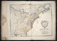
- Beinecke Rare Book and Manuscript Library > Charte ueber die XIII vereinigte Staaten von Nord-Amerika / [cartographic material] / entworfen durch F.L. Guessefeld ; und herausgegeben von den Homaennischen Erben
- Creator:
- Homann Erben (Firm)
- Published / Created:
- 1784
- Call Number:
- 1983 Folio 23
- Collection Title:
- [Atlas factice of 50 maps, primarily by Johann Baptist Homann and/or issued by the Homann Erben
- Image Count:
- 1
- Found in:
- Beinecke Rare Book and Manuscript Library > Neue Welt-Karte welch auf zwoo Klugelflaechen die Haupt-Theile der Erde, Inseln, Insel-Gruppen, Theile des Welt-Meers und der en Benennungen den fuensten Welt-theil und die neuesten Entdekkungen nach den Karten und Reisebeschreibungen der beruehmtesten Se
- Creator:
- Hase, Johann Matthias, 1684-1742
Homann Erben (Firm)
- Published / Created:
- [1743?]
- Call Number:
- 1983 Folio 23
- Collection Title:
- [Atlas factice of 50 maps, primarily by Johann Baptist Homann and/or issued by the Homann Erben
- Image Count:
- 1
- Found in:
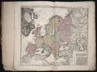
- Beinecke Rare Book and Manuscript Library > Europa, secundum legitimas projectionis stereographicae regulas [cartographic material] : et juxta recentissimas observationes aeque ac relationes adhibitis quoq[ue] veterum monumentorum subsidiis / descripta et in partes suas methodicas X divisa a Ioh. M
- Creator:
- Homann Erben (Firm)
Homann, Johann Baptist, 1663-1724
- Published / Created:
- [ca. 1730]
- Call Number:
- 1983 Folio 23
- Collection Title:
- [Atlas factice of 50 maps, primarily by Johann Baptist Homann and/or issued by the Homann Erben
- Image Count:
- 1
- Found in:
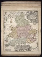
- Beinecke Rare Book and Manuscript Library > Magna Britannia complectens Angliae, Scotiae, et Hyberniae regn. [cartographic material] : in suas prov. et comitat. divisa et ex mappis Londinensibus designata / per Homannianos heredes
- Creator:
- Homann, Johann Baptist, 1663-1724
Visscher, Nicolaes, 1649-1702
- Published / Created:
- [172-?]
- Call Number:
- 1983 Folio 23
- Collection Title:
- [Atlas factice of 50 maps, primarily by Johann Baptist Homann and/or issued by the Homann Erben
- Image Count:
- 1
- Found in:
- Beinecke Rare Book and Manuscript Library > Magnae Britanniae pars meridionalis in qua regnum Angliae tam in septem antiqua Anglo-Saxonum regna quom in omnes Hodiernas regiones accurate divisum hic ostenditur quam tabula ab archetypo Vischeriano desumptam exhibet [cartographic material] / Ioh. Bapt
- Creator:
- Cassini, Cesar-Francois, 1714-1784
Mayer, Tobias, 1723-1762
Snellius, Willebrord, 1580-1626
- Published / Created:
- 1747
- Call Number:
- 1983 Folio 23
- Collection Title:
- [Atlas factice of 50 maps, primarily by Johann Baptist Homann and/or issued by the Homann Erben
- Image Count:
- 1
- Found in:
- Beinecke Rare Book and Manuscript Library > Belgivm Catholicvm seu decem provinciae Germaniae inferioris : cum confiniis Germaniae svp. et Franciae legitime omnia delineata et ad ductum observationum astronomicarum, nec non geometricarum operationum a Cassinio Snellio Muschenbrokio aliisqve rite ha