Search
You Searched For
Search Results
- Call Number:
- 1977 +392
- Collection Title:
- A survey of the cities of London and Westminster : containing the original, antiquity, increase
- Image Count:
- 1
- Resource Type:
- Maps, Atlases & Globes
- Found in:
- Beinecke Rare Book and Manuscript Library > Spittle Fields and places adjacent taken from the last survey with corrections
- Call Number:
- 1977 +392
- Collection Title:
- A survey of the cities of London and Westminster : containing the original, antiquity, increase
- Image Count:
- 1
- Resource Type:
- Maps, Atlases & Globes
- Found in:
- Beinecke Rare Book and Manuscript Library > Shoreditch, Norton Folgate, and Crepple Gate without, taken from the last survey with corrections
- Call Number:
- 1977 +392
- Collection Title:
- A survey of the cities of London and Westminster : containing the original, antiquity, increase
- Image Count:
- 1
- Resource Type:
- Maps, Atlases & Globes
- Found in:
- Beinecke Rare Book and Manuscript Library > Cow Cross being St. Sepulcher's parish without and the Charter House taken from the last survey with corrections
- Call Number:
- 1977 +392
- Collection Title:
- A survey of the cities of London and Westminster : containing the original, antiquity, increase
- Image Count:
- 1
- Resource Type:
- Maps, Atlases & Globes
- Found in:
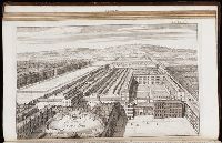
- Beinecke Rare Book and Manuscript Library > The Prospect of Grays Inn
- Call Number:
- 1977 +392
- Collection Title:
- A survey of the cities of London and Westminster : containing the original, antiquity, increase
- Image Count:
- 1
- Resource Type:
- Maps, Atlases & Globes
- Found in:
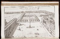
- Beinecke Rare Book and Manuscript Library > The Prospect of Lincoln's Inn
- Call Number:
- 1977 +392
- Collection Title:
- A survey of the cities of London and Westminster : containing the original, antiquity, increase
- Image Count:
- 1
- Resource Type:
- Maps, Atlases & Globes
- Found in:
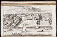
- Beinecke Rare Book and Manuscript Library > Somerset House
- Call Number:
- 1977 +392
- Collection Title:
- A survey of the cities of London and Westminster : containing the original, antiquity, increase
- Image Count:
- 1
- Resource Type:
- Maps, Atlases & Globes
- Found in:
- Beinecke Rare Book and Manuscript Library > A mapp of the parishes of St. Clements Danes, St. Mary Savoy; with the Rolls Liberty and Lincolns Inn, taken from the last survey with corrections and additions
- Call Number:
- 1977 +392
- Collection Title:
- A survey of the cities of London and Westminster : containing the original, antiquity, increase
- Image Count:
- 1
- Found in:
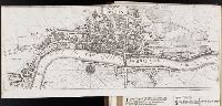
- Beinecke Rare Book and Manuscript Library > The city of London as in Q Elisabeth's time
- Call Number:
- 1977 +392
- Collection Title:
- A survey of the cities of London and Westminster : containing the original, antiquity, increase
- Image Count:
- 1
- Found in:
- Beinecke Rare Book and Manuscript Library > Billings Gate Ward and Bridge Ward within with it's division into parishes, taken from the last survey
- Call Number:
- 1977 +392
- Collection Title:
- A survey of the cities of London and Westminster : containing the original, antiquity, increase
- Image Count:
- 1
- Found in:
- Beinecke Rare Book and Manuscript Library > Creple Gate Ward with its division into parishes, taken from the last survey, with additions and corrections
- Call Number:
- 1977 +392
- Collection Title:
- A survey of the cities of London and Westminster : containing the original, antiquity, increase
- Image Count:
- 1
- Found in:
- Beinecke Rare Book and Manuscript Library > Alders Gate Ward and St. Martins le grand liberty taken from the last survey with corrections
- Call Number:
- 1977 +392
- Collection Title:
- A survey of the cities of London and Westminster : containing the original, antiquity, increase
- Image Count:
- 1
- Found in:
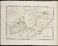
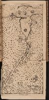
- Beinecke Rare Book and Manuscript Library > A map of St. Giles Cripple Gate without. With large additions and corrections
- Call Number:
- 1977 +392
- Collection Title:
- A survey of the cities of London and Westminster : containing the original, antiquity, increase
- Image Count:
- 2
- Resource Type:
- Maps, Atlases & Globes
- Found in:
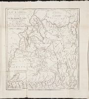
- Beinecke Rare Book and Manuscript Library > The parish of St. James Clerkenwell taken from [the] last survey with corrections
- Call Number:
- 1977 +392
- Collection Title:
- A survey of the cities of London and Westminster : containing the original, antiquity, increase
- Image Count:
- 1
- Found in:
- Beinecke Rare Book and Manuscript Library > A mapp of the parish of St. Giles's in the Fields taken from the last servey, with corrections and additions
- Creator:
- Seller, John, fl. 1658-1698
- Call Number:
- 1976 Folio 139
- Collection Title:
- The English pilot: describing the sea-coasts, capes, head-lands, soundings, sands, shoals, rocks
- Image Count:
- 1
- Found in:
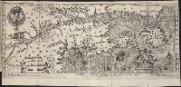
- Beinecke Rare Book and Manuscript Library > A large description of the two chanells in the River Dwina goeing up to the citty of Archangel by John Seller
- Creator:
- Chantry, John
- Call Number:
- Ee +633gb
- Collection Title:
- The voyages and travells of the ambassadors sent by Frederick, duke of Holstein, to the great Duke
- Image Count:
- 1
- Resource Type:
- Maps, Atlases & Globes
- Found in:
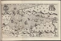
- Beinecke Rare Book and Manuscript Library > The course of the great River Wolga
- Creator:
- Pine, John, 1690-1756
- Published / Created:
- 1739
- Call Number:
- BBy33 44y
- Collection Title:
- The tapestry hangings of the House of lords representing the several engagements between the
- Image Count:
- 1
- Resource Type:
- Books, Journals & Pamphlets
- Found in:
- Beinecke Rare Book and Manuscript Library > [Untitled, unnumbered pl. depicting Dorsetshire, Hampshire, the Isle of Wight, the English and Spanish Naval fleets]
- Creator:
- Nolin, Jean Baptiste, 1648-1708
- Published / Created:
- 1691
- Call Number:
- 1984 Folio 3
- Collection Title:
- Atlas nouveau : contenant toutes les parties du monde ou sont exactement remarques les empires
- Image Count:
- 1
- Resource Type:
- Maps, Atlases & Globes
- Found in:
- Beinecke Rare Book and Manuscript Library > Les Etats de Savoye et de Piemont
- Creator:
- Jaillot, Alexis Hubert, 1632?-1712
- Published / Created:
- 1692
- Call Number:
- 1984 Folio 3
- Collection Title:
- Atlas nouveau : contenant toutes les parties du monde ou sont exactement remarques les empires
- Image Count:
- 1
- Resource Type:
- Maps, Atlases & Globes
- Found in:
- Beinecke Rare Book and Manuscript Library > Comte de Namur dresse sur les memoirs les plus nouveaux presente a sa Majeste pour le service de ses troupes par le service de ses troupes par le service de ses troupes ...
- Call Number:
- 1977 Folio 78
- Collection Title:
- A New and accurate chart of the West-India Islands and coast, with the gulf passage through the New
- Image Count:
- 1
- Resource Type:
- Maps, Atlases & Globes
- Found in:
- Beinecke Rare Book and Manuscript Library > A plan of the road of Port Paix in the island of Hispaniola, pl. 35.
- Call Number:
- 1977 Folio 78
- Collection Title:
- A New and accurate chart of the West-India Islands and coast, with the gulf passage through the New
- Image Count:
- 1
- Resource Type:
- Maps, Atlases & Globes
- Found in:
- Beinecke Rare Book and Manuscript Library > A plan of Monte-Christe Bay with the Seven Brothers on the north coast of St. Domingo, pl. 38
- Creator:
- Grange. J
- Call Number:
- 1998 995
- Collection Title:
- Voyage au pole sud et dans l'Oceanie sur les corvettes l'Astrolabe et la Zelee : execute par ordre
- Image Count:
- 1
- Found in:
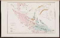
- Beinecke Rare Book and Manuscript Library > Carte geologique de la Patagonie et de la terre de feu
- Creator:
- Fee, Chas E
- Published / Created:
- c1891
- Call Number:
- Zc86 893scd
- Collection Title:
- Appletons' guide-book to Alaska and the northwest coast ...
- Image Count:
- 1
- Resource Type:
- Maps, Atlases & Globes
- Found in:
- Beinecke Rare Book and Manuscript Library > The route of the Alaska excursion steamers
- Creator:
- Fee, Chas E
- Published / Created:
- c1891
- Call Number:
- Zc86 893sc
- Collection Title:
- The guide-book to Alaska and the northwest coast, including the shores of Washington, British
- Image Count:
- 1
- Resource Type:
- Maps, Atlases & Globes
- Found in:
- Beinecke Rare Book and Manuscript Library > [Map of Alaska]
- Call Number:
- Zc86 893sc
- Collection Title:
- The guide-book to Alaska and the northwest coast, including the shores of Washington, British
- Image Count:
- 1
- Resource Type:
- Maps, Atlases & Globes
- Found in:
- Beinecke Rare Book and Manuscript Library > Chilkat and Chilkoot Bays
- Call Number:
- Zc20 697heg
- Collection Title:
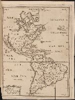
- A new discovery of a vast country in America : extending above four thousand miles, between New
- Image Count:
- 1
- Found in:
- Beinecke Rare Book and Manuscript Library > A map of a large country newly discovered in the northern America situated between New Mexico and the frozen sea, together with the course of the Great River Meschasipi. Dedicated to His Ma.ty William III King of Great Britain. By Father Lewis Hennepin, m
- Published / Created:
- 1793
- Call Number:
- CF352 I54 1793
- Collection Title:
- The discovery, settlement, and present state of Kentucky: and an essay towards the topography and
- Image Count:
- 1
- Found in:
- Beinecke Rare Book and Manuscript Library > A map of the state of Kentucky, drawn from the best authorities
- Creator:
- Jefferys, Thomas, d. 1771
- Call Number:
- Z6 70
- Collection Title:
- An enquiry into the causes of the alienation of the Delaware and Shawanese Indians from the British
- Image Count:
- 1
- Found in:
- Beinecke Rare Book and Manuscript Library > A map of the province of Pensylvania. intended chiefly to illustrate the account of the several Indian purchases made by the proprietaries of the said province the claims made by the Indians, on lands settled and not purchased of them and the tract they n
- Call Number:
- Egf 778Hb
- Collection Title:
- A topographical description of Virginia, Pennsylvania, Maryland and North Carolina : comprehending
- Image Count:
- 1
- Found in:
- Beinecke Rare Book and Manuscript Library > A plan of the several villages in the Illinois country, with part of the river Mississippi &c. by Thos. Hutchins
- Call Number:
- Pequot Ad12
- Collection Title:
- The history of the American Indians; particularly those nations adjoining to the Missisippi
- Image Count:
- 1
- Found in:
- Beinecke Rare Book and Manuscript Library > A map of the American Indian nations, adjoining to the Missisippi, west & east Florida, Georgia, S. & N. Carolina, Virginia, & c
- Call Number:
- C55 025
- Collection Title:
- Voyages and travels of an Indian interpreter and trader, describing the manners and customs of the
- Image Count:
- 1
- Found in:
- Beinecke Rare Book and Manuscript Library > Sketch of the western countries of Canada 1791
- Creator:
- Hole, William, d. 1624, engraver
- Published / Created:
- [ca. 1606]
- Call Number:
- Taylor 301
- Collection Title:
- The generall historie of Virginia, New-England, and the Summer Iles : with the names of the
- Image Count:
- 1
- Found in:
- Beinecke Rare Book and Manuscript Library > Virginia
- Published / Created:
- 1783
- Call Number:
- Cb21 35B
- Collection Title:
- History of the war with America, France, Spain, and Holland; commencing in 1775 and ending in 1783
- Image Count:
- 1
- Found in:
- Beinecke Rare Book and Manuscript Library > A Map of the United States of America, as settled by the peace of 1783
- Creator:
- Lescarbot, Marc
- Published / Created:
- [1609]
- Call Number:
- Taylor 245
- Collection Title:
- Histoire de la Novvelle France
- Image Count:
- 1
- Found in:
- Beinecke Rare Book and Manuscript Library > Figure de la terre neuue, grande riuiere de Canada, et cotes de l�ocean en la Nouuelle France
- Creator:
- Lescarbot, Marc
- Published / Created:
- 1609
- Call Number:
- Taylor 245
- Collection Title:
- Histoire de la Novvelle France
- Image Count:
- 1
- Found in:
- Beinecke Rare Book and Manuscript Library > Figure du Port Royal en la Nouuelle France
- Creator:
- Dunn, Samuel
- Published / Created:
- 1774
- Call Number:
- Cb23 27
- Collection Title:
- The American military pocket atlas : being an approved collection of correct maps, both general and
- Image Count:
- 1
- Found in:
- Beinecke Rare Book and Manuscript Library > North America as divided amongst the European powers
- Published / Created:
- 1776
- Call Number:
- Cb23 27
- Collection Title:
- The American military pocket atlas : being an approved collection of correct maps, both general and
- Image Count:
- 1
- Found in:
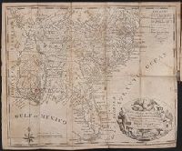
- Beinecke Rare Book and Manuscript Library > A General map of the northern British colonies in America. which comprehends the province of Quebec, the government of Newfoundland, Nova-Scotia, New-England and New-York. From the maps published by the Admiralty and Board of Trade regulated by the astronomic and trigonometric observations of M. von Holland and corrected from Governor Pownall's late map 1776.
- Published / Created:
- 1776
- Call Number:
- Cb23 27
- Collection Title:
- The American military pocket atlas : being an approved collection of correct maps, both general and
- Image Count:
- 1
- Found in:
- Beinecke Rare Book and Manuscript Library > A general map of the middle British colonies in America. Containing Virginia, Maryland, the Delaware counties, Pennsylvania and New Jersey. With the addition of New York, and of the greatest part of New England, as also of the bordering parts of the province of Quebec, improved from several surveys made after the late war, and corrected from Governor Pownall's late map 1776.
- Creator:
- Romans, B
- Published / Created:
- 1776
- Call Number:
- Cb23 27
- Collection Title:
- The American military pocket atlas : being an approved collection of correct maps, both general and
- Image Count:
- 1
- Found in:
- Beinecke Rare Book and Manuscript Library > A General map of the southern British colonies, in America, comprehending North and South Carolina, Georgia, east and west Florida, with the neighbouring Indian countries. From the modern surveys of engineer de Brahm, Capt. Collet, Mouzon & others; and from the large hydrographical survey of the coasts of east and west Florida
- Creator:
- Brasier, William
- Published / Created:
- 1776
- Call Number:
- Cb23 27
- Collection Title:
- The American military pocket atlas : being an approved collection of correct maps, both general and
- Image Count:
- 1
- Found in:
- Beinecke Rare Book and Manuscript Library > A Survey of Lake Champlain, including Lake George, Crown Point and St. John. Surveyed by order of His Excellency Major General Sr. Jeffery Amherst, knight of the most honble. Order of the Bath, Commander in Chief of His Majesty's forces in North America (now Lord Amherst) by William Brassier, draughtsman, 1762
- Published / Created:
- Undated
- Call Number:
- Ck44 23
- Collection Title:
- Kort beskrifning om provincien Nya Swerige uti America : som nu foertjden af the Engelske kallas
- Image Count:
- 1
- Found in:
- Beinecke Rare Book and Manuscript Library > Totius Americae descriptio
- Call Number:
- Ck44 23
- Collection Title:
- Kort beskrifning om provincien Nya Swerige uti America : som nu foertjden af the Engelske kallas
- Image Count:
- 1
- Found in:
- Beinecke Rare Book and Manuscript Library > Nova Suecia hodie dicta Pensylvania
- Call Number:
- Ck44 23
- Collection Title:
- Kort beskrifning om provincien Nya Swerige uti America : som nu foertjden af the Engelske kallas
- Image Count:
- 1
- Found in:
- Beinecke Rare Book and Manuscript Library > Virginiae N. Angliae N. Hollandiae nec non Nova Sueviae delineatio
- Call Number:
- Cm87 48th
- Collection Title:
- Histoire de Kentucke : nouvelle colonie a l'ouest de al Virginie: contenant, 1o, La decouverte
- Image Count:
- 1
- Found in:
- Beinecke Rare Book and Manuscript Library > Carte de Kentucke, d'apres les observations actuelles: dediee a L'Honorable Congres des Etats-Unis de l'Amerique et a Son Excellence George Washington, Commandant en chef de ses armees par leur tres humble serviteur, John Filson
- Call Number:
- Taylor 376
- Collection Title:
- The discoveries of John Lederer : in three several marches from Virginia, to the west of Carolina
- Image Count:
- 1
- Found in:
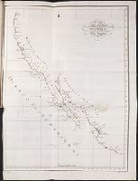
- Beinecke Rare Book and Manuscript Library > A Map of the whole territory traversed by John Lederer in his three marches
- Creator:
- Tiebout, Cornelius, 1777-1832
- Call Number:
- CF352 I54 1793
- Collection Title:
- A topographical description of the Western territory of North America; containing a succinct
- Image Count:
- 1
- Found in:
- Beinecke Rare Book and Manuscript Library > New map of the states of Georgia South and North Carolina Virginia and Maryland including the Spanish provinces of west and east Florida from the latest surveys
- Call Number:
- CF352 I54 1793
- Collection Title:
- A topographical description of the Western territory of North America; containing a succinct
- Image Count:
- 1
- Found in:
- Beinecke Rare Book and Manuscript Library > A plan of the rapids of the Ohio
- Creator:
- Hall, Sidney
- Published / Created:
- 1822 March
- Call Number:
- Egk30 Ed9 820W
- Collection Title:
- Two years' residence in the settlement on the English prairie, in the Illinois country ... : with
- Image Count:
- 1
- Found in:
- Beinecke Rare Book and Manuscript Library > Map of Illinois
- Creator:
- Hall, Sidney
- Published / Created:
- 1822 March
- Call Number:
- Egk30 Ed9 820W
- Collection Title:
- Two years' residence in the settlement on the English prairie, in the Illinois country ... : with
- Image Count:
- 1
- Found in:
- Beinecke Rare Book and Manuscript Library > Map of the allotments
- Creator:
- Cardano, Jose Maria
Morata, Antonio?
- Call Number:
- Zc70 +802ea
- Collection Title:
- Relacion del viage hecho por las goletas Sutil y Mexicana en el ano de 1792, para reconocer el
- Image Count:
- 1
- Found in:
- Beinecke Rare Book and Manuscript Library > Carta esferica de los reconocimientos hechos en la costa N.O. de America en 1791 y 92 por las goletas Sutil y Mexicana y otros buques de S.M. Map No. 1