Search
You Searched For
Search Results
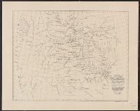
- Creator:
- Lewis, Samuel, 1753 or 1754-1822
- Published / Created:
- 1814
- Call Number:
- 80 1814
- Container / Volume:
- BRBL_00532
- Image Count:
- 1
- Resource Type:
- Maps, Atlases & Globes
- Found in:
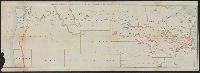
- Beinecke Rare Book and Manuscript Library > A map of Lewis and Clark's track across the western portion of North America, from the Mississippi to the Pacific Ocean : by order of the executive of the United States in 1804, 5 & 6 / copied by Samuel Lewis from the original drawing of Wm. Clark ; Neele
- Creator:
- Lewis, Meriwether, 1774-1809
- Published / Created:
- 1887].
- Call Number:
- 71 1806A
- Container / Volume:
- BRBL_00368
- Image Count:
- 1
- Resource Type:
- Maps, Atlases & Globes
- Found in:
- Beinecke Rare Book and Manuscript Library > A map of part of the continent of North America : between the 35th and 51st degrees of north latitude, and extending from 80 degrees of west longitude to the Pacific Ocean / compiled from the authorities of the best informed travellers by M. Lewis ; copie
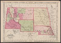
- Creator:
- Johnson, A. J. (Alvin Jewett), 1827-1884
- Published / Created:
- [187-?]
- Call Number:
- 824 187X
- Container / Volume:
- BRBL_00570
- Image Count:
- 1
- Resource Type:
- Maps, Atlases & Globes
- Found in:
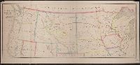
- Beinecke Rare Book and Manuscript Library > Johnson's Nebraska, Dakota, Idaho, Montana, and Wyoming.
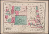
- Creator:
- Johnson, A. J. (Alvin Jewett), 1827-1884
- Published / Created:
- [between 1865 and 1868?]
- Call Number:
- 824fac 1865
- Container / Volume:
- BRBL_00572
- Image Count:
- 2
- Resource Type:
- Maps, Atlases & Globes
- Found in:
- Beinecke Rare Book and Manuscript Library > Johnson's Nebraska, Dakota, Idaho, Montana, and Wyoming.
- Creator:
- Johnson, A. J. (Alvin Jewett), 1827-1884
- Published / Created:
- [187-?]
- Call Number:
- 824fac 187XA
- Container / Volume:
- BRBL_00572
- Image Count:
- 2
- Resource Type:
- Maps, Atlases & Globes
- Found in:
- Beinecke Rare Book and Manuscript Library > Johnson's Nebraska, Dakota, Idaho, Montana, and Wyoming.
- Published / Created:
- 1868
- Call Number:
- 810 1868
- Container / Volume:
- BRBL_00552
- Image Count:
- 1
- Resource Type:
- Maps, Atlases & Globes
- Found in:
- Beinecke Rare Book and Manuscript Library > Map of the country from Lake Superior to the Pacific Ocean : From the latest explorations and surveys, to accompany the report of the New York Chamber of Commerce, April 1868.
- Creator:
- Morris, C. A. F
- Published / Created:
- [1864]
- Call Number:
- 80 1864A
- Container / Volume:
- BRBL_00535
- Image Count:
- 1
- Resource Type:
- Maps, Atlases & Globes
- Found in:
- Beinecke Rare Book and Manuscript Library > Minnesota route, the shortest and best to the Idaho gold mines / compiled by C.A.F. Morris.
- Creator:
- Rand McNally and Company
- Published / Created:
- [1912]
- Call Number:
- 80gme 1912B
- Container / Volume:
- BRBL_00540
- Image Count:
- 1
- Resource Type:
- Maps, Atlases & Globes
- Found in:
- Beinecke Rare Book and Manuscript Library > Outline map of the lines of the Chicago, Milwaukee & St. Paul Railway Company, Chicago, Milwaukee & Puget Sound Railway Company, and Tacoma Eastern Railway Company : June 30, 1912.
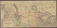
- Creator:
- Thayer, H. L
- Published / Created:
- 1877
- Call Number:
- 821 1877
- Container / Volume:
- BRBL_00566
- Image Count:
- 1
- Resource Type:
- Maps, Atlases & Globes
- Found in:
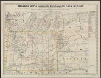
- Beinecke Rare Book and Manuscript Library > Thayer's map of the Black Hills and Big Horn Country.