
You Searched For
« Previous
| 1 - 100 of 13,181 |
Next »
Search Results
- Creator:
- A. & W. Mackinlay (Firm)
- Published / Created:
- 1899
- Call Number:
- 7325 1899
- Container / Volume:
- BRBL_00376A
- Image Count:
- 1
- Resource Type:
- Maps, Atlases & Globes
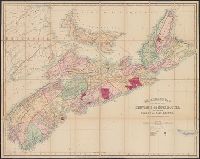
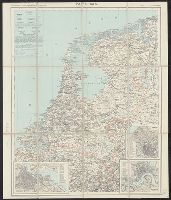
- Alternative Title:
- Mackinlay's map of Cape Breton Island and New map of Cape Breton
- Description:
- Covers also Prince Edward Island and Amherst. and Relief shown by hachures.
- Publisher:
- A. & W. Mackinlay,
- Subject (Geographic):
- Cape Breton Island (N.S.)--Maps
- Subject (Name):
- George Philip & Son
- Found in:
- Beinecke Rare Book and Manuscript Library > Mackinlay's new map of Cape Breton Island : compiled from recent surveys.

- Creator:
- A. B. Hirschfeld Press
- Published / Created:
- 1975
- Call Number:
- 833gmb 1976
- Container / Volume:
- BRBL_00586
- Image Count:
- 2
- Resource Type:
- Maps, Atlases & Globes
- Alternative Title:
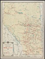
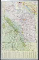
- Wyoming, 1976, official highway map and Wyoming, official highway map
- Description:
- At bottom of panel: Official highway map., Color photos, text, and area map on verso., Includes indexes, distance table, 7 local route maps, text, and ill., Panel title., and Relief shown by shading and spot heights.
- Publisher:
- Wyoming State Highway Commission,
- Subject (Geographic):
- Wyoming--Maps
- Subject (Name):
- Wyoming. State Highway Commission
- Subject (Topic):
- Roads--Wyoming--Maps
- Found in:
- Beinecke Rare Book and Manuscript Library > Wyoming, 1976 / prepared by The A.B. Hirschfeld Press.
- Creator:
- A. B. Hirschfeld Press
- Published / Created:
- 1977
- Call Number:
- 833gmb 1977
- Container / Volume:
- BRBL_00586
- Image Count:
- 2
- Resource Type:
- Maps, Atlases & Globes
- Alternative Title:
- Wyoming, official highway map
- Description:
- Color photos, text, and area map on verso., Includes indexes, distance table, 7 local route maps, text, and ill., and Relief shown by shading and spot heights.
- Publisher:
- Wyoming State Highway Commission,
- Subject (Geographic):
- Wyoming--Maps
- Subject (Name):
- Wyoming. State Highway Commission
- Subject (Topic):
- Roads--Wyoming--Maps
- Found in:
- Beinecke Rare Book and Manuscript Library > Wyoming, 1977, official highway map / prepared by The A.B. Hirschfeld Press.
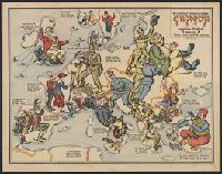
- Creator:
- A. K.
- Published / Created:
- 1915
- Call Number:
- 30 1915G
- Container / Volume:
- BRBL_00032A
- Image Count:
- 2
- Resource Type:
- Maps, Atlases & Globes
- Description:
- "Zensur Altona 603.", Caricature map., Caricatures represent international relations., and Includes text.
- Publisher:
- L. Gräfe,
- Subject (Geographic):
- Europe--Maps
- Subject (Topic):
- International relations--20th century--Maps, World War, 1914-1918--Caricatures and cartoons, and World War, 1914-1918--Maps
- Found in:
- Beinecke Rare Book and Manuscript Library > Sommerschau über Europa 1915 : erweiterte Massstab, 3 gegen 8 / A.K. gez. u. lith.
- Creator:
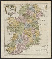
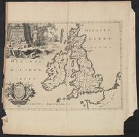
- A. and J. Churchill (Booksellers : London, England)
Morden, Robert, d. 1703
Swall, Abel - Published / Created:
- [1680?]
- Call Number:
- 327 1680
- Container / Volume:
- BRBL_00072
- Image Count:
- 1
- Resource Type:
- Maps, Atlases & Globes
- Publisher:
- Sold by Abel Swale Awnsham and John Churchill,
- Subject (Geographic):
- Ireland--Maps--Early works to 1800
- Found in:
- Beinecke Rare Book and Manuscript Library > The Kingdom of Ireland / by Robt. Morden.
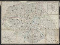
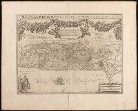
- Creator:
- A. and W. Galignani (Firm)
- Published / Created:
- 184-?]
- Call Number:
- 38 P21 1867B
- Container / Volume:
- BRBL_00163
- Image Count:
- 1
- Resource Type:
- Maps, Atlases & Globes
- Description:
- Coordinates not present on map and are approximated., Imperfect: index wanting., Includes inset map of Paris and surroundings and "Guide to the Principal Objects of Curiosity in Paris.", and Index to streets.
- Publisher:
- Calignani,
- Subject (Geographic):
- Paris (France)--Maps
- Subject (Name):
- Achin, Hacq, J. M., and Keeler, Charles Augustus, 1871-1937
- Found in:
- Beinecke Rare Book and Manuscript Library > Galignani's plan of Paris and environs / drawn by Achin ; engraved by Hacq.
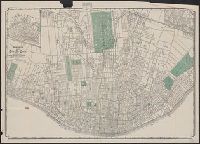
- Creator:
- A.C. Shewey & Co
- Published / Created:
- c1890.
- Call Number:
- 816 Sa24 1890
- Container / Volume:
- BRBL_00562
- Image Count:
- 1
- Resource Type:
- Maps, Atlases & Globes
- Alternative Title:
- City St. Louis and Map, city St. Louis
- Description:
- Includes inset of Carondelet area. and Oriented with north to right.
- Publisher:
- A.C. Shewey & Co.,
- Subject (Geographic):
- Saint Louis (Mo.)--Maps
- Subject (Topic):
- Streets--Missouri--Saint Louis--Maps
- Found in:
- Beinecke Rare Book and Manuscript Library > Shewey's map, city St. Louis.
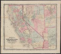
- Creator:
- A.L. Bancroft & Company
- Published / Created:
- 1876
- Call Number:
- 844 1876D
- Container / Volume:
- BRBL_00603
- Image Count:
- 1
- Resource Type:
- Maps, Atlases & Globes
- Alternative Title:
- Map of California, Nevada, Utah and Arizona
- Description:
- "Entered according to act of Congress by A.L. Bancroft & Company in the office of the Librarian of Congress, Washington, D.C.", Prime meridian: Washington, D.C., Relief shown by hachures and spot heights., and Shows wagon roads, proposed and completed railroads, mining districts, Indian reservations, etc.
- Publisher:
- A.L. Bancroft & Compy.,
- Subject (Geographic):
- California--Maps and Southwest, New--Maps
- Found in:
- Beinecke Rare Book and Manuscript Library > Bancroft's map of California, Nevada, Utah and Arizona.
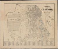
10.
- Creator:
- A.L. Bancroft & Company
- Published / Created:
- 1893
- Call Number:
- 844 Sa52 1893
- Container / Volume:
- BRBL_00609
- Image Count:
- 1
- Resource Type:
- Maps, Atlases & Globes
- Alternative Title:
- Official guide map of city and county of San Francisco
- Description:
- Includes "Reference list [i.e. index] of prominent places" and inset of "Skeleton map showing the relative position of San Francisco to the surrounding country" (scale [1:506,880], 8 miles to 1 in.) and Shows drainage, railroads, flumes, ranchos, original shore line, etc.
- Publisher:
- Bancroft Co.,
- Subject (Geographic):
- San Francisco (Calif.)--Maps and San Francisco Bay Area (Calif.)--Maps
- Found in:
- Beinecke Rare Book and Manuscript Library > Bancroft's official guide map of city and county of San Francisco : compiled from official maps in Surveyor's Office.
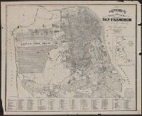
11.
- Creator:
- A.L. Bancroft & Company
- Published / Created:
- 1873
- Call Number:
- 844 Sa52 1873A
- Container / Volume:
- BRBL_00609
- Image Count:
- 1
- Resource Type:
- Maps, Atlases & Globes
- Alternative Title:
- Official guide map of city and county of San Francisco
- Description:
- Includes "Reference list [i.e. index] of prominent places" and inset of "Skeleton map showing the relative position of San Francisco to the surrounding country" (scale [1:506,880], 8 miles to 1 in.) and Shows drainage, railroads, flumes, ranchos, original shore line, etc.
- Publisher:
- A.L. Bancroft & Co.,
- Subject (Geographic):
- San Francisco (Calif.)--Maps and San Francisco Bay Area (Calif.)--Maps
- Found in:
- Beinecke Rare Book and Manuscript Library > Bancroft's official guide map of city and county of San Francisco: compiled from official maps in Surveyor's Office.
- Creator:
- Aa, Pieter van der, 1659-1733
- Published / Created:
- [1714?]
- Call Number:
- 3190 No. 4
- Container / Volume:
- BRBL_00041
- Image Count:
- 1
- Resource Type:
- Maps, Atlases & Globes
- Description:
- Appears in Pieter van der Aa's La Galerie Agréable du Monde [1714?]. and Prime meridian: Ferro.
- Publisher:
- Apud Peter um Vander Aa,
- Subject (Geographic):
- British Isles--Early works to 1800--Maps
- Found in:
- Beinecke Rare Book and Manuscript Library > Antiquorum Britanniae Episcopatuum geographica descriptio.
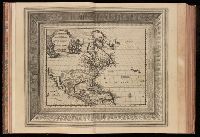
13.

- Creator:
- Aa, Pieter van der, 1659-1733
- Published / Created:
- [1714]
- Call Number:
- 73 1714
- Container / Volume:
- BRBL_00688
- Image Count:
- 1
- Resource Type:
- Maps, Atlases & Globes
- Alternative Title:
- Nouvelle France.
- Description:
- From Aa's Nouvel Atlas ... A Leide : Chez Pierre Van der Aa ..., [1714], Mounted on paper. Sheet measures 29.8 x 36 cm. Cross Collection no. 165., and Relief shown pictorially.
- Publisher:
- Chez Pierre vander Aa,
- Subject (Geographic):
- Canada--Maps--Early works to 1800
- Subject (Name):
- Aa, Pieter van der, 1659-1733. Nouvel Atlas
- Found in:
- Beinecke Rare Book and Manuscript Library > Canada, ou, Nouvelle France [cartographic material] : suivant les nouvelles observations de Mess'rs. de l'Academie Royale des Sciences, etc., augmentées de nouveau.
14.
- Creator:
- Aa, Pieter van der, 1659-1733
- Published / Created:
- [1729?]
- Call Number:
- 1973 +32
- Image Count:
- 13
- Resource Type:
- Maps, Atlases & Globes
- Description:
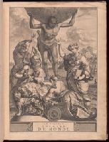
- "Table generale de l'ordre des feuilles et figures des LXVI tomes": t.1, p. [7]-37. Each section has also special table., 100 copies printed., t. 1. Portugal. -- t. [2-3] Espagne. -- t. 4-9. France. -- t. [10-12] Grande Bretagne & Irlande. --t. [13-16] Les Païs-Bas catholiques. -- t. [17-24] Les VII. Provinces Unies du Païs-Bas. -- t. [25-26] Suisse. -- t. [27-38] Italie. -- t. [39-42] L'empire d'Allemagne. -- t. [43] Danemarc, Norvegue & Suede. -- t. [44] Pologne, Prusse, Courlande, & Moscovie. -- t. [45-47] Hongrie, Turquie en Europe, Gréce, Archipel, Morée &c. -- t. [48-59] Asie. -- t. [60-62] Afrique. -- t. [63-66] Amerique. The prelminary descriptive leaves have continuous signatures., and Title-page in red and black; title vignette.
- Publisher:
- par Pierre vander Aa
- Subject (Topic):
- Atlases--Early works to 1800 and Geography--Pictorial works
- Found in:
- Beinecke Rare Book and Manuscript Library > La galerie agreable du monde, ouíÛ l'on voit en un grand nombre de cartes tres-exactes et de belles tailles-douces, les principaux empires, roiíöaumes, republiques, provinces, villes, bourgs et forteresses ... dans les quatre parties de l'univers. Diviseí
15.
- Creator:
- Aa, Pieter van der, 1659-1733
Ferrarius, Philippus, d. 1626
Gueudeville, Nicolas, ca. 1654-ca. 1721 - Published / Created:
- 1713
- Call Number:
- 1978 Folio 112
- Image Count:
- 1
- Resource Type:
- Maps, Atlases & Globes
- Alternative Title:
- Geographie royale
- Description:
- Title in red and black with vignette.
- Publisher:
- Chez Pierre vander Aa, marchand libraire,
- Subject (Topic):
- Atlases, French, Atlases--Early works to 1800, and Geography--Early works to 1800
- Found in:
- Beinecke Rare Book and Manuscript Library > Le nouveau theatre du monde. ou La geographie royale, composée de nouvelles cartes tres-exactes ... Avec une description geographique et historique des quatre parties de l'univers, desquelles l'Europe en detail est écrite par Mr. Gueudeville, & les trois autres parties par Mr. Ferrarius ...
- Creator:
- Abbot, Henry L
- Published / Created:
- 1862
- Call Number:
- 783hc 1862E
- Container / Volume:
- BRBL_00511
- Image Count:
- 3
- Resource Type:
- Maps, Atlases & Globes
- Description:
- no. 1. Yorktown to Williamsburg -- no. 2. Williamsburg to White House -- no. 3. White House to Harrison's Landing., Relief shown by hachures., and Yale copy: each sheet comprises 4 sections, mounted on linen. "Photographed at the Coast Survey office." Shows no
- Publisher:
- Corps of Engineers?]
- Subject (Geographic):
- Virginia Peninsula (Va.)--Maps
- Subject (Name):
- Dougal, William H., 1822-1895, Humphreys, A. A. (Andrew Atkinson), 1810-1883, Julius Bien & Co, United States Coast Survey., and United States. Army of the Potomac
- Subject (Topic):
- Peninsular Campaign, 1862--Maps and Williamsburg, Battle of, Williamsburg, Va., 1862--Maps
- Found in:
- Beinecke Rare Book and Manuscript Library > Campaign maps, Army of the Potomac / prepared by command of Maj. Gen. George B. McClellan ; compilation under the direction of Brig. Gen. A.A. Humphreys, by Capt. H.L. Abbot ; engraved by W.H. Dougal ; Julius Bien & Co., photo lith.
17.

- Creator:
- Abbot, Henry L
- Published / Created:
- 1862]
- Call Number:
- 783hc 1862F
- Container / Volume:
- BRBL_00511
- Image Count:
- 3
- Resource Type:
- Maps, Atlases & Globes
- Description:
- no. 1. Yorktown to Williamsburg -- no. 2. Williamsburg to White House -- no. 3. White House to Harrison's Landing. and Relief shown by hachures.
- Publisher:
- Corps of Topographical Engineers?
- Subject (Geographic):
- Virginia Peninsula (Va.)--Maps
- Subject (Name):
- Humphreys, A. A. (Andrew Atkinson), 1810-1883, United States. Army of the Potomac, United States. Army. Corps of Topographical Engineers, and Walker, L. E
- Subject (Topic):
- Peninsular Campaign, 1862--Maps
- Found in:
- Beinecke Rare Book and Manuscript Library > Campaign maps, Army of the Potomac / prepared by command of Maj. Gen. George B. McClellan [under direction of] A.A. Humphreys, Brig. Gen. and chief of Top. Engrs. ; compiled by Capt. H.L. Abbot, Top. Engrs., September 1862 ; photographic reduction by L.E.
18.

- Creator:
- Abbot, Henry L
- Published / Created:
- 1862?]
- Call Number:
- 783hc 1862K
- Container / Volume:
- BRBL_00511
- Image Count:
- 1
- Resource Type:
- Maps, Atlases & Globes
- Alternative Title:
- Siege of Yorktown Va.
- Description:
- Includes text., Oriented with north toward the upper right., Relief shown by hachures., and Yale copy annotated in black ink: Mr. Edwin Hale Abbot, Boston, Mass. Respect of Capt. Abbot, Top. Eng.
- Publisher:
- Corps of Topgraphical Engineers?,
- Subject (Geographic):
- Yorktown (Va.)--Maps
- Subject (Name):
- United States. Army. Corps of Topographical Engineers and United States.--Army of the Potomac
- Found in:
- Beinecke Rare Book and Manuscript Library > Official plan of the siege of Yorktown, Va. conducted by the Army of the Potomac under command of Maj. Gen. George B. McClellan U.S.A., April 5th to May 3rd 1862 / prepared under the direction of Brig. Gen. J.G. Barnard, Chief Engr. by Lieut. Henry L. Abb
19.

- Creator:
- Abbot, Henry L
- Published / Created:
- 1862]
- Call Number:
- 783hc 1862G
- Container / Volume:
- BRBL_00511
- Image Count:
- 1
- Resource Type:
- Maps, Atlases & Globes
- Description:
- Oriented with north to the right. and Relief shown by hachures.
- Publisher:
- Corps of Topographical Engineers?,
- Subject (Geographic):
- Yorktown (Va.)--Maps
- Subject (Name):
- Barnard, J. G. (John Gross), 1815-1882 and United States. Army. Corps of Topographical Engineers
- Subject (Topic):
- Peninsular Campaign, 1862--Maps
- Found in:
- Beinecke Rare Book and Manuscript Library > Plan of the rebel works and armament at Yorktown Va. captured by the Army of the Potomac under Maj. Gen. G.B. McClellan, U.S.A. on May 4, 1862 / made on May 4, 1862 by order of J.G. Barnard, chief engineer, A.P., by Henry L. Abbot, Corps T. Engineers.
20.

- Creator:
- Abbot, Henry L
- Published / Created:
- 1862?]
- Call Number:
- 783hc 1862H
- Container / Volume:
- BRBL_00511
- Image Count:
- 1
- Resource Type:
- Maps, Atlases & Globes
- Alternative Title:
- Reconnaissance of the battlefield at Bull Run, Va.
- Description:
- Oriented with north to the right., Relief shown by hachures and spot heights., Yale copy annotated in black ink: The property of Edwin Hale Abbot, Boston, Mass., and Yale copy annotated in red ink to show troop positions and movements.
- Publisher:
- Corps of Topographical Engineers?,
- Subject (Geographic):
- Manassas (Va.)--Maps
- Subject (Name):
- United States. Army. Corps of Topographical Engineers
- Subject (Topic):
- Bull Run, 1st Battle of, Va., 1861--Maps
- Found in:
- Beinecke Rare Book and Manuscript Library > Reconnaissance of the battle field at Bull Run, Va., fought July 21, 1861 / made on March 14, 1862 by Henry L. Abbot, 1st Lieut. Top. Engineers.

- Creator:
- Abbott & Chapman
- Published / Created:
- 1884
- Call Number:
- 814 M666 1886
- Container / Volume:
- BRBL_00558
- Image Count:
- 1
- Resource Type:
- Maps, Atlases & Globes
- Alternative Title:
- Pocket map of Minneapolis
- Description:
- Shows subdivided city blocks, wards, and additions.
- Publisher:
- C. Wright Davison,
- Subject (Geographic):
- Minneapolis (Minn.)--Maps
- Subject (Name):
- Davison, C. Wright, 1849-1925 and Johnson, Smith & Harrison
- Found in:
- Beinecke Rare Book and Manuscript Library > Davison's pocket map of Minneapolis / drawn by Abbott & Chapman, civil engineers.
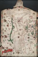
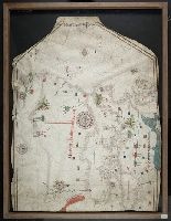
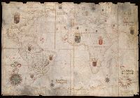
- Creator:
- Abenzara, Judah.
- Published / Created:
- [1505]
- Call Number:
- Art Storage 30cea 1505
- Image Count:
- 2
- Resource Type:
- Maps, Atlases & Globes
- Description:
- Contains six compass roses., Decoration: city views with banners; five side-view portraits., Imperfect: chipped along left, bottom and top edge, with some loss of map., Includes four bar scales., Pen-and-ink in black, red, blue and green., Portolan chart with seaport names given for all coastlines., and Title devised by cataloger.
- Subject (Geographic):
- Black Sea--Maps--Early works to 1800., Mediterranean Sea--Maps--Early works to 1800., and North Atlantic Ocean--Maps--Early works to 1800.
- Subject (Topic):
- Nautical charts--Black Sea--Early works to 1800., Nautical charts--Mediterranean Sea--Early works to 1800., and Nautical charts--North Atlantic Ocean--Early works to 1800.
- Found in:
- Beinecke Rare Book and Manuscript Library > Portolan chart of the Mediterranean Sea, the North Atlantic Ocean, the Black Sea, and the northwestern African coast.
23.

- Creator:
- Abraham Lundquist & Cie
Dunér, N. C. (Nils Christofer), 1839-1914
Nordenskiöld, A. E. (Adolf Erik), 1832-1901 - Published / Created:
- 1865
- Call Number:
- 186 1865
- Container / Volume:
- BRBL_00013
- Image Count:
- 1
- Resource Type:
- Maps, Atlases & Globes
- Publisher:
- Abrah. Lundquist & Cie.,
- Subject (Geographic):
- Svalbard (Norway)--Maps
- Found in:
- Beinecke Rare Book and Manuscript Library > Karta ofver Spetsbergen : hufvudsakligast enligt iakttagelser under de svneska expeditionera aren 1861 och 1864 af N. Duner och A.E. Nordenskiold.

- Creator:
- Abreu de Galindo, Juan de.
- Published / Created:
- MDCCLXIV [1764]
- Call Number:
- BrSides 2019 4
- Image Count:
- 9
- Resource Type:
- Maps, Atlases & Globes
- Alternative Title:
- Description of the Canary Islands, including the modern history of the inhabitants, and an account of their manners, customs, trade, &c. and Historia de la conquista de las siete islas de Gran Canaria. English
- Description:
- Imperfect: all but title page, pages 1-2, and leaves of plates wanting. Stamps on title page: American Geographical and Statistical Socy.; duplicate copy sold.
- Publisher:
- Printed for R. and J. Dodsley in Pall-mall, and T. Durham in the Strand,
- Subject (Geographic):
- Canary Islands--Description and travel--Early works to 1800 and Canary Islands--History--Early works to 1800
- Subject (Name):
- American Geographical and Statistical Society Stamp, Dodsley, James, 1724-1797, Dodsley, Robert, 1704-1764, Durham, Thomas (Bookseller), and Glas, Ge
- Subject (Topic):
- Ethnology, Natural history, and Travel
- Found in:
- Beinecke Rare Book and Manuscript Library > The history of the discovery and conquest of the Canary Islands : translated from a Spanish manuscript lately found in the island of Palma : with an enquiry into the origin of the ancient inhabitants : to which is added, A description of the Canary Island
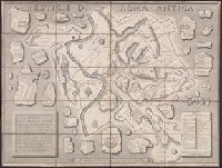
- Creator:
- Acquaroni, Giovanni, active 1816-approximately 1837, cartographer
- Published / Created:
- 1826
- Call Number:
- 400am R66 1826
- Container / Volume:
- BRBL_00233
- Image Count:
- 1
- Resource Type:
- Maps, Atlases & Globes
- Alternative Title:
- Vestigie di Roma antica
- Description:
- 400am R66 1826: Dissected and mounted on linen. Bookseller's label: Venance Monaldini ... Rome., Below lower right margin: "Paoli 15.", Includes index and notes., Relief shown by hachures., and Shows names of Ancient Roman sites, some in fragmentary form with floor plans.
- Publisher:
- Presso Venanzio Monaldini ... con approvazione e privilegio Pontificio,
- Subject (Geographic):
- Rome (Italy)--Maps and Rome--Antiquities--Maps
- Subject (Name):
- Monaldini, Venanzio, Monaldini, Venanzio, bookseller, Nibby, A. (Antonio), 1792-1839, and Romanis, Antonio de
- Subject (Topic):
- Antiquities, Architecture--Designs and plans, and Geography, Ancient--Maps
- Found in:
- Beinecke Rare Book and Manuscript Library > Pianta delle vestigia di Roma [cartographic material] : secondo le osservazioni di Antonio de Romanis ... / Gio Acquaroni dis. e inc.

- Creator:
- Adam and Charles Black (Firm)
Aikman, George, engraver
Barlow, Peter, 1776-1862 - Published / Created:
- 1854]
- Call Number:
- 11 1854
- Container / Volume:
- BRBL_00009
- Image Count:
- 1
- Resource Type:
- Maps, Atlases & Globes
- Description:
- In lower right margin: Engd. by G. Aikman., Plate III-I from: General atlas of the world. Edinburgh : A. and C. Black, 1854., Prime meridian: Greenwich., and World map showing magnetic curves.
- Publisher:
- A. & C. Black,
- Subject (Geographic):
- World--maps
- Subject (Topic):
- Magnetic declination--Maps and World maps
- Found in:
- Beinecke Rare Book and Manuscript Library > A chart of magnetic curves of equal variation / by Peter Barlow.
27.

- Creator:
- Adlum, John, 1759-1836
- Published / Created:
- [1791]
- Call Number:
- BrSides Folio 2009 68
- Image Count:
- 2
- Resource Type:
- Maps, Atlases & Globes
- Subject (Geographic):
- Delaware --Maps --Early works to 1800, New Jersey --Maps --Early works to 1800, New York (State) --Maps --Early works to 1800, and Pennsylvania --Maps --Early works to 1800
- Subject (Name):
- Mifflin, Thomas, 1744-1800 and Wallis, John, 1734-1793
- Subject (Topic):
- Canals --Pennsylvania --Maps --Early works to 1800 and Roads --Pennsylvania --Maps --Early works to 1800
- Found in:
- Beinecke Rare Book and Manuscript Library > A map exhibiting a general view of the roads and inland navigation of Pennsylvania, and part of the adjacent states : respectfully inscribed to Thomas Mifflin, governor, and the General Assembly of the commonwealth of Pennsylvania / by John Adlum, and John Wallis

- Creator:
- Adrichem, Christiaan van, 1533-1585
- Published / Created:
- 1590?]
- Call Number:
- 51 1590
- Container / Volume:
- BRBL_00278
- Image Count:
- 1
- Resource Type:
- Maps, Atlases & Globes
- Description:
- Appears in: Theatrum Terrae Sanctae et biblicarum historiarum / Christiaan van Adrichem. Colonia Agrippina : Birckmannica, 1590., Cartographer from dealer's notes., Has watermark., Oriented with north toward the left., Relief shown pictorially., and Shows portion
- Publisher:
- Birckmannica,
- Subject (Geographic):
- Palestine--History--To 70 A.D.--Maps and Palestine--Maps--Early works to 1800
- Subject (Topic):
- Bible.--O.T.--Geography--Maps
- Found in:
- Beinecke Rare Book and Manuscript Library > Tribus Gad nempe, ea Terrae Sanctae pars, quae obtigit in partitione regionis tribui Gad.

- Creator:
- Adrichem, Christiaan van, 1533-1585
- Published / Created:
- 1590?]
- Call Number:
- 51 1590A
- Container / Volume:
- BRBL_00278
- Image Count:
- 1
- Resource Type:
- Maps, Atlases & Globes
- Alternative Title:
- Tribvs Rvben
- Description:
- Appears in 1590 and 1682 eds. of Theatrum terrae., Laor contributes this map to Christian van Adrichom in Cologne, ca. 1590., Oriented to the east., Relief shown pictorially., and Shows portion of the Holy Land given to the Tribe of Reuben at the time of the divi
- Publisher:
- Birckmannica,
- Subject (Geographic):
- Palestine--History--To 70 A.D.--Maps and Palestine--Maps--Early works to 1800
- Subject (Name):
- Adrichem, Chirstiaan van, 1533-1585. Theatrum Terrae Sanctae and Birckmann, Johann, 1527-1572
- Found in:
- Beinecke Rare Book and Manuscript Library > Tribus Ruben hoc est, ea Terrae Sanctae regio, que in diuidendo tribui Ruben assignata est.
- Creator:
- Adrichem, Christiaan van, 1533-1585, cartographer.
- Published / Created:
- [between 1652 and 1684]
- Call Number:
- BrSides Double Folio 2019 97
- Image Count:
- 1
- Resource Type:
- Maps, Atlases & Globes
- Description:
- Coordinates not present on map and are approximated., Manuscript number in upper left corner: 42., Oriented with north to the lower left., Relief shown pictorially., and Verso blank.
- Publisher:
- Sumptibus Ioannis Ianssonii,
- Subject (Geographic):
- Palestine--Maps--Early works to 1800.
- Subject (Name):
- Hamersvelt, Evert Symontsz., Jansson, Jan, 1588-1664, publisher., and Rogiers, Salomon, engraver.
- Found in:
- Beinecke Rare Book and Manuscript Library > Situs Terrae Promissionis S.S. Bibliorum / intelligentiam exacte aperiens per Chr. Adrichom ; sculpserunt Everardus Sim. Hamers-veldt et Salomon Rogeri.

- Creator:
- Agas, Ralph, 1545-1621
- Published / Created:
- 1905
- Call Number:
- 32 L84 1570/1905
- Container / Volume:
- BRBL_00737
- Image Count:
- 8
- Resource Type:
- Maps, Atlases & Globes
- Alternative Title:
- Plan of London (circa 1560-1570) by Ralph Agas
- Description:
- Bird's-eye-view., Includes ill., text and coats-of-arms., and Relief shown pictorially.
- Publisher:
- London Topographical Society,
- Subject (Geographic):
- London (England)--Aerial views--Early works to 1800--Facsimiles
- Subject (Name):
- London Topographical Society
- Found in:
- Beinecke Rare Book and Manuscript Library > Civitas Londinum.
32.
- Creator:
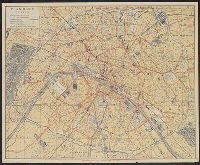
- Agnus, Aîné
- Published / Created:
- [1890?]
- Call Number:
- 38 P21 1895
- Container / Volume:
- BRBL_00164
- Image Count:
- 2
- Resource Type:
- Maps, Atlases & Globes
- Alternative Title:
- Omnibus-tramways plan-bijou de Paris on y trouve les rues instantanement, Plan-bijou de Paris, and Plan-bijou de Paris, les lignes d'omnibus et de tramways y sont tracées chacune séparément
- Description:
- Indexes to roads and places, bus lines, tramway lines and rail lines and lists of libraries, schools, museums, and government agencies in accompanying text. and On back cover of text: Itinéraires tracés chacun séparément métropolitains correspondances mo
- Publisher:
- Système Agnus Aîné,
- Subject (Topic):
- Buses--France--Paris--Maps, Local transit--France--Paris--Maps, Roads--France--Paris--Maps, and Street-railroads--France--Paris--Maps
- Found in:
- Beinecke Rare Book and Manuscript Library > Plan-bijou de Paris avec les lignes du métropolitain ; Plan-bijou de Paris, les lignes d'omnibus et de tramways y sont tracées chacune séparément [cartographic material].
- Creator:
- Aguilar, Jorge de.
- Published / Created:
- no anno dominus nostris Jh[es]u Xpi de 1492.
- Call Number:
- Art Storage 30cea 1492
- Image Count:
- 2
- Resource Type:
- Maps, Atlases & Globes
- Description:
- Contains seven compass roses., Decoration: armorial shields and city views with banners., In frame 88 x 115 cm., Pen-and-ink in brown, red, and green., Portolan chart with seaport names given for all coastlines., and Title devised by cataloger.
- Subject (Geographic):
- Black Sea--Maps--Early works to 1800., Mediterranean Sea--Maps--Early works to 1800., and North Atlantic Ocean--Maps--Early works to 1800.
- Subject (Topic):
- Nautical charts--Black Sea--Early works to 1800., Nautical charts--Mediterranean Sea--Early works to 1800., and Nautical charts--North Atlantic Ocean--Early works to 1800.
- Found in:
- Beinecke Rare Book and Manuscript Library > Portolan chart of the Mediterranean Sea, the North Atlantic Ocean, the Black Sea, and the West African coast as far south as Sierra Leone.

- Creator:
- Air Navigation Aids Co
- Published / Created:
- c1948.
- Call Number:
- 833gmp 1948
- Container / Volume:
- BRBL_00586
- Image Count:
- 2
- Resource Type:
- Maps, Atlases & Globes
- Description:
- Includes text., Publication place crossed out and written in ink: 1118 Rapids Street, Adel Iowa., and Relief shown by contours, gradient tints, and spot heights.
- Publisher:
- Air Navigation Aids Co.,
- Subject (Topic):
- Aeronautical charts--Wyoming
- Found in:
- Beinecke Rare Book and Manuscript Library > ANAC aviation chart of Wyoming.
- Creator:
- Aitken, Robert, 1735-1802
- Published / Created:
- 1775]
- Call Number:
- 764 B65 1775N
- Container / Volume:
- BRBL_00455
- Image Count:
- 1
- Resource Type:
- Maps, Atlases & Globes
- Alternative Title:
- Gentleman's magazine (London, England) and Plan of the town of Boston
- Description:
- "Charles Town in ruins" is indicated in the northern part of the map., By Robert Aitken; no engraver's signature., From: The gentleman's magazine, v. 45, Oct. 1775., Relief shown pictorially., and Shows streets, wharves, fortifications, and The Common.
- Publisher:
- Gentleman's magazine,
- Subject (Geographic):
- Boston (Mass.)--Buildings, structures, etc.--Maps--Early works to 1800 and Boston (Mass.)--Maps--Early works to 1800
- Subject (Topic):
- Fortification--Massachusetts--Boston--Maps--Early works to 1800
- Found in:
- Beinecke Rare Book and Manuscript Library > A new and correct plan of the town of Boston.
- Creator:
- Aitoff, D
Delaune, E
Dumas Vorzet, Ed
Dumas Vorzet, Er
Hachette (Firm)
Thuillier, L - Published / Created:
- [1885]
- Call Number:
- 331 1885
- Container / Volume:
- BRBL_00079
- Image Count:
- 1
- Resource Type:
- Maps, Atlases & Globes
- Description:
- In top margin: Atlas universel par Vivien de Saint Martin et Fr. Schrader., Insets, 1:62,500: La Haye -- Rotterdam -- Amsterdam., and Relief shown by hachures.
- Publisher:
- Hachette & Cie.,
- Subject (Geographic):
- Netherlands--Maps
- Found in:
- Beinecke Rare Book and Manuscript Library > Pays-Bas / dessiné, le trait par L. Thuillier, la lettre par Ed. Dumas Vorzet et D. Aitoff ; gravé par E. Delaune ; la lettre gravée par Er. Dumas Vorzet.
37.

- Creator:
- Akademii︠a︡ nauk SSSR
- Published / Created:
- 1766
- Call Number:
- 71BH 1758
- Container / Volume:
- BRBL_00371
- Image Count:
- 1
- Resource Type:
- Maps, Atlases & Globes
- Description:
- Below title: A St. Petersbourg à l'Academie Imperiale des Sciences, 1758., Includes notes., and Relief shown pictorially.
- Publisher:
- Marc Michel Rey,
- Subject (Geographic):
- Alaska--Maps--Early works to 1800 and Bering Sea--Maps--Early works to 1800
- Subject (Name):
- Marc Michel Rey (Firm) and Schenk, Leonard, fl. 1720-1746
- Found in:
- Beinecke Rare Book and Manuscript Library > Nouvelle carte des decouvertes faites par des vaisseaux Russiens aux côtes inconnues de l'Amerique septentrionale avec les pais adiacents / dressée sur des memoires authentiques de ceux qui ont assisté a ces decouvertes, et sur d'autres connoissances d
38.

- Creator:
- Akademii︠a︡ nauk SSSR
- Published / Created:
- 1766
- Call Number:
- 71BH 1758
- Container / Volume:
- BRBL_00371
- Image Count:
- 1
- Resource Type:
- Maps, Atlases & Globes
- Description:
- Below title: A St. Petersbourg à l'Academie Imperiale des Sciences, 1758., Includes notes., and Relief shown pictorially.
- Publisher:
- Marc Michel Rey,
- Subject (Geographic):
- Alaska--Maps--Early works to 1800 and Bering Sea--Maps--Early works to 1800
- Subject (Name):
- Marc Michel Rey (Firm) and Schenk, Leonard, fl. 1720-1746
- Found in:
- Beinecke Rare Book and Manuscript Library > Nouvelle carte des decouvertes faites par des vaisseaux Russiens aux côtes inconnues de l'Amerique septentrionale avec les pais adiacents / dressée sur des memoires authentiques de ceux qui ont assisté a ces decouvertes, et sur d'autres connoissances d
39.

- Creator:
- Alaska Communication System
- Call Number:
- 848gmh 1950
- Container / Volume:
- BRBL_00635
- Image Count:
- 1
- Resource Type:
- Maps, Atlases & Globes
- Alternative Title:
- Chart of Alaska showing stations to which commercial communication service is available
- Description:
- Includes "station index" list.
- Subject (Name):
- Northwest Mapping Service and United States. Army. Signal Corps
- Subject (Topic):
- Telecommunication--Alaska--Maps
- Found in:
- Beinecke Rare Book and Manuscript Library > Alaska Communications System : chart of Alaska showing stations to which commercial communication service is available / prepared by Alaska Communication System [and] Signal Corps, Department of the Army ; Cartography and format Northwest Mapping Service.
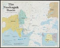
- Creator:
- Alaska Geographic Society
- Published / Created:
- c1990.
- Call Number:
- 848 1990
- Container / Volume:
- BRBL_00631
- Image Count:
- 1
- Resource Type:
- Maps, Atlases & Globes
- Description:
- "Supplement to The Nushagak Basin, Alaska Geographic Volume 17, Number 1, 1990 a quarterly publication of the Alaska Geographic Society."
- Publisher:
- Alaska Geographic,
- Subject (Geographic):
- Nushagak Basin (Alaska)--Maps
- Found in:
- Beinecke Rare Book and Manuscript Library > The Nushagak Basin / Alaska Geographic Society.
41.
- Creator:
- Albernaz, João Teixeira, active 1665-1681
- Published / Created:
- [1665]
- Call Number:
- 11 1665
- Image Count:
- 2
- Resource Type:
- Maps, Atlases & Globes
- Description:
- "Feita por João Teix[ei]ra Albernass Cosmographo los Reinos de Portugal por Sua Mag[esta]de. O anno de 1665. L[i]x[bo]a", Contains five compass roses., Decoration: coats of arms in territories., Imperfect: chipped along edges., Manuscript annotations on verso., Pen-and-ink in black, red, blue, yellow and green., Portolan chart with seaport names given for all coastlines., and Title devised by cataloger.
- Subject (Geographic):
- Atlantic Ocean--Maps--Early works to 1800., Indian Ocean--Maps--Early works to 1800., and Pacific Ocean--Maps--Early works to 1800.
- Subject (Topic):
- Nautical charts--Atlantic Ocean--Early works to 1800., Nautical charts--Indian Ocean--Early works to 1800., and Nautical charts--Pacific Ocean--Early works to 1800.
- Found in:
- Beinecke Rare Book and Manuscript Library > Portolan chart of the Atlantic, the western half of the Indian Ocean, and the extreme southeast of the Pacific.
42.
- Creator:
- Alberta, Northern
- Published / Created:
- 1919
- Call Number:
- 737FCM P312 1919
- Container / Volume:
- BRBL_00386
- Image Count:
- 1
- Resource Type:
- Maps, Atlases & Globes
- Alternative Title:
- Northern Alberta land districts
- Description:
- "Corrected to June 1919"
- Publisher:
- Canada. Dept. of the Interior,
- Subject (Geographic):
- Alberta, Northern--Cadastral Maps
- Found in:
- Beinecke Rare Book and Manuscript Library > Map of Northern Alberta land districts [map] : comprising agencies of Peace River, Grande Prairie & Edmonton, showing number of quarter-sections in each township available for homestead entry / Natural Resources Intelligence Branch ; F.C.C. Lynch, superin
- Creator:
- Alberta. Dept. of Public Works
- Published / Created:
- 1939
- Call Number:
- 737gmb 1939
- Container / Volume:
- BRBL_00386
- Image Count:
- 2
- Resource Type:
- Maps, Atlases & Globes
- Alternative Title:
- Highway map of Province of Alberta Canada
- Description:
- On verso: Maps of Edmonton and Calgary ; General information for tourists ; Official highway signs ; Alberta mileage chart ; Alphabetical index of cities, towns and villages.
- Publisher:
- Dept. of Public Works,
- Subject (Geographic):
- Alberta--Maps
- Subject (Topic):
- Roads--Alberta--Maps
- Found in:
- Beinecke Rare Book and Manuscript Library > Official road map Alberta Canada.
- Creator:
- Alberta. Dept. of Tourism
- Published / Created:
- 1964
- Call Number:
- 737gmb 1964
- Container / Volume:
- BRBL_00386
- Image Count:
- 2
- Resource Type:
- Maps, Atlases & Globes
- Description:
- Index to cities and towns at bottom., Inset: Alaska highway. Scale ca. 1:12,500,000., Maps on verso: Edmonton and vicinity, Calgary and vicinity, Medicine Hat, Lethbridge, Northern Alberta, Waterton Lakes National Park., and Tourist information and mileage chart
- Publisher:
- Alberta Government Travel Bureau.,
- Subject (Topic):
- Roads--Alberta--Maps
- Found in:
- Beinecke Rare Book and Manuscript Library > Official road map: Alberta.
45.
- Creator:
- Alcalá-Galiano, Dionisio, 1760-1805
- Published / Created:
- 1798?]
- Call Number:
- 739 1795
- Container / Volume:
- BRBL_00388
- Image Count:
- 1
- Resource Type:
- Maps, Atlases & Globes
- Alternative Title:
- Canal de la salida de las goletas, visto al este.
- Description:
- "Juan Moreno Tejada la grabó.", From Atlas marítimo español. 1789-1814., In upper right margin: Numo. Io., Includes text and inset of "Canal de la salida de las goletas, visto al este.", and Shows area around Vancouver Island (B.C.) and Strait of Juan de Fuca.
- Publisher:
- s.n.,
- Subject (Geographic):
- Juan de Fuca, Strait of (B.C. and Wash.)--Maps--Early works to 1800, Pacific Coast (B.C.)--Maps--Early works to 1800, Pacific Coast (Wash.)--Maps--Early works to 1800, and Vancouver Island (B.C.)--Maps--Early works to 1800
- Subject (Name):
- Arnold, Robert M.--Ownership, Moreno Tejada, Juan, Spain. Dirección de Hidrografía. Atlas marítimo español, and Valdés Flores Bazán y Peón, Cayetano, 1767-1835
- Found in:
- Beinecke Rare Book and Manuscript Library > Carta esferica de los reconocimientos hechos en 1792 en la costa N.O. de America para examinar la entrada de Juan de Fuca, y la internacion de sus canales navegables / levantada de orden del Rey Nuestro Señor abordo de las Goletas Sutil y Mexicana, por D
46.
- Creator:
- Alcalá-Galiano, Dionisio, 1760-1805
- Published / Created:
- 1798?]
- Call Number:
- 739 1795
- Container / Volume:
- BRBL_00388
- Image Count:
- 1
- Resource Type:
- Maps, Atlases & Globes
- Alternative Title:
- Canal de la salida de las goletas, visto al este.
- Description:
- "Juan Moreno Tejada la grabó.", From Atlas marítimo español. 1789-1814., From the collection of Robert M. Arnold., In upper right margin: Numo. Io., Includes text and inset of "Canal de la salida de las goletas, visto al este.", and Shows a
- Publisher:
- s.n.,
- Subject (Geographic):
- Juan de Fuca, Strait of (B.C. and Wash.)--Maps--Early works to 1800, Pacific Coast (B.C.)--Maps--Early works to 1800, Pacific Coast (Wash.)--Maps--Early works to 1800, and Vancouver Island (B.C.)--Maps--Early works to 1800
- Subject (Name):
- Arnold, Robert M.--Ownership, Moreno Tejada, Juan, Spain. Dirección de Hidrografía. Atlas marítimo español, and Valdés Flores Bazán y Peón, Cayetano, 1767-1835
- Found in:
- Beinecke Rare Book and Manuscript Library > Carta esferica de los reconocimientos hechos en 1792 en la costa N.O. de America para examinar la entrada de Juan de Fuca, y la internacion de sus canales navegables / levantada de orden del Rey Nuestro Señor abordo de las Goletas Sutil y Mexicana, por D
47.

- Creator:
- Alden, Edward C
- Published / Created:
- 1907
- Call Number:
- 32 Ox1 1907
- Container / Volume:
- BRBL_00053
- Image Count:
- 1
- Resource Type:
- Maps, Atlases & Globes
- Publisher:
- Alden & Co.,
- Subject (Geographic):
- Oxford (England)--Maps
- Subject (Name):
- University of Oxford--Maps
- Found in:
- Beinecke Rare Book and Manuscript Library > Plan of the city and University of Oxford / compiled by Edward C. Alden, Revised & Corrected Oct 1907.
- Creator:
- Alden, James, 1810-1877
- Published / Created:
- 1847
- Call Number:
- 88cea C632 1847
- Container / Volume:
- BRBL_00648
- Image Count:
- 1
- Resource Type:
- Maps, Atlases & Globes
- Description:
- Includes "View of the entrance of the Coatzacoalcos River. Distance about 1 1/2 miles. Bearing S.S.E." and Relief shown by hachures. Depths shown by soundings.
- Publisher:
- s.n.],
- Subject (Geographic):
- Coatzacoalcos River (Mexico)--Maps
- Subject (Name):
- Blunt, Edmund, 1799-1866, May, William, ca. 1815-1861, and Perry, Matthew Calbraith, 1794-1858
- Found in:
- Beinecke Rare Book and Manuscript Library > Sketch from the mouth of the Coatzacoalcos River, to the town of Mina-Titlan / by order of Commodore M.C. Perry, comdg. home squadron, Mexico ; by Lieut. Alden, Blunt, & May.
- Creator:
- Alden, James, 1810-1877
- Published / Created:
- 1847
- Call Number:
- 88cea C632 1847A
- Container / Volume:
- BRBL_00648
- Image Count:
- 1
- Resource Type:
- Maps, Atlases & Globes
- Description:
- Includes "View of the entrance of the Coatzacoalcos River. Distance about 1 1/2 miles. Bearing S.S.E." and Relief shown by hachures. Depths shown by soundings.
- Publisher:
- s.n.?],
- Subject (Geographic):
- Coatzacoalcos River (Mexico)--Maps
- Subject (Name):
- Blunt, Edmund, 1799-1866, May, William, ca. 1815-1861, and Perry, Matthew Calbraith, 1794-1858
- Found in:
- Beinecke Rare Book and Manuscript Library > Sketch from the mouth of the Coatzacoalcos River, to the town of Mina-Titlan / made by order of Commodore M.C. Perry, comdg. home squadron ; by lieut. Alden, Blunt, & May.

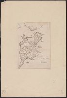
- Creator:
- Alexander, W. D. (William De Witt), 1833-1913, cartographer
Hawaii. Oihana Ana Aina Aupuni, author
Heliotype Printing Co., printer
Jackson, G. E. G., cartographer
Lyons, C. J., cartographer
Wall, - Call Number:
- 232cea H56 1884
- Container / Volume:
- BRBL_00021
- Image Count:
- 1
- Resource Type:
- Maps, Atlases & Globes
- Description:
- Coordinates not present and are approxiimated., Date "1884" in manuscript in lower left corner., and Relief shown by hachures. Depths shown by soundings.
- Subject (Geographic):
- Hilo Bay (Hawaii)--Maps
- Subject (Topic):
- Harbors--Hawaii--Hilo Bay--Maps
- Found in:
- Beinecke Rare Book and Manuscript Library > Hilo Bay, Hawaii / from a trigonometrical survey by C.J. Lyons ; hydrography by Lieut. G.E.G. Jackson, outise of reef from U.S. charts ; W.A. Wall, del.
51.

- Creator:
- Alexius Kiessling (Firm)
- Published / Created:
- [1920?]
- Call Number:
- 36 B45 1920A
- Container / Volume:
- BRBL_00122
- Image Count:
- 1
- Resource Type:
- Maps, Atlases & Globes
- Publisher:
- A. Kiessling ;
- Subject (Geographic):
- Berlin Region (Germany)--Maps
- Subject (Topic):
- Roads--Germany--Berlin Region--Maps
- Found in:
- Beinecke Rare Book and Manuscript Library > Kiessling's grosse Special-Karte der Umgegend von Berlin, im Massstabe 1:75 000 der natürl. Länge / auf Grund der Generalstabs-Aufnahmen bearbeitet und gezeichnet von Gustav Müller, Kartograph ; Stich d. lith. Anst. v. Franz Werner.
- Creator:
- Alexius Kiessling (Firm)
Delius, Thomas
Kraatz, Leopold - Published / Created:
- [ca. 1880]
- Call Number:
- 36 B45 1915
- Container / Volume:
- BRBL_00122
- Image Count:
- 1
- Resource Type:
- Maps, Atlases & Globes
- Description:
- Includes concentric rings showing distance from Dönhofsplatz, Berlin, in German half miles.
- Publisher:
- Verlag v. Alexius Kiessling,
- Subject (Geographic):
- Berlin Region (Germany)--Maps
- Found in:
- Beinecke Rare Book and Manuscript Library > Topographische Karte der Umgegend von Berlin : umfassend 19 grössere und kleinere Städte wie Potsdam, Freienwalde, Buckow, Fürstenwalde u.s.w. sowie sämmtliche Dörfer, Vorwerke, Mühlen, Ziegeleien, Colonien, Förstereien, etc. auf ca. 85 [Quadrat-]M

- Creator:
- Algermissen, Johann Ludwig
Meisenbach, George, 1841-1922
Riffarth, H., fl. 1888 - Published / Created:
- 1898
- Call Number:
- 36 C71 1898
- Container / Volume:
- BRBL_00123
- Image Count:
- 2
- Resource Type:
- Maps, Atlases & Globes
- Alternative Title:
- Köln und Deutz, Neuester Plan von Köln und Deutz, and Plan von Köln, nach amtl. Quellen bearbeitet
- Description:
- Index, advertising material on verso.
- Publisher:
- Verlag von Joh. Ludw. Algermissen,
- Subject (Geographic):
- Cologne (Germany)--Maps
- Found in:
- Beinecke Rare Book and Manuscript Library > Plan von Köln, nach amtl[ichen] Quellen bearbeitet / von J.L. Algermissen.
54.
- Creator:
- Allan Cartography (Firm)
- Published / Created:
- c1999.
- Call Number:
- 842 1999
- Container / Volume:
- BRBL_00599
- Image Count:
- 2
- Resource Type:
- Maps, Atlases & Globes
- Alternative Title:
- Southern Arizona's Santa Catalina Mountains, recreation, trail guide & Sky Island Scenic Byway :
- Description:
- English and Spanish., Includes text and location map., Relief shown by shading, gradient tints, and spot heights., and Text, map of "Sky Island Scenic Byway" with notes, 10 trail profiles with notes, and col. ill. on verso.
- Publisher:
- Time Traveler Maps,
- Subject (Geographic):
- Santa Catalina Mountains (Ariz.)--Maps
- Subject (Name):
- Moon Street Cartography (Firm) and Time Traveler Maps (Firm)
- Subject (Topic):
- Outdoor recreation--Arizona--Santa Catalina Mountains--Maps and Trails--Arizona--Santa Catalina Mountains--Maps
- Found in:
- Beinecke Rare Book and Manuscript Library > Southern Arizona's Santa Catalina Mountains / map development/design Allan Cartography, Medford, OR ; map overlay Moon St. Cartography Inc, Durango, CO.
55.

- Creator:
- Allard, Carel, 1648-ca. 1709
- Published / Created:
- 1690]
- Call Number:
- 60 1690A
- Container / Volume:
- BRBL_00322
- Image Count:
- 1
- Resource Type:
- Maps, Atlases & Globes
- Description:
- "Cum privilegio potentissimorum D.D. ordinum Hollandiae et Westfrisiae.", Includes decorative cartouche., Relief shown pictorially., and Sheet measures 52 x 60 cm. Ms. no. on recto: 170. Ms. nos. on verso: 169, 172.
- Publisher:
- s.n.,
- Subject (Geographic):
- Africa--Maps--Early works to 1800
- Subject (Name):
- Gouwen, Gilliam van der and Tidemann, Philipp, 1657-1705
- Found in:
- Beinecke Rare Book and Manuscript Library > Novissima et perfectissima Africae descriptio / ex formis Caroli Allard ; Ph. Tideman, del. ; G. v. Gouwen, sculp.
- Creator:
- Allard, Carel, 1648-ca. 1709.
- Published / Created:
- 1702]
- Call Number:
- 1973 Folio 18
- Image Count:
- 1
- Resource Type:
- Maps, Atlases & Globes
- Description:
- Backed with paper. Ms. no. "88" in upper right corner. Sheet measures 53.4 x 62.5 cm. No. 81 of 87 maps bound together., Inset: Tartariae pars. Scale not given., Map [51] from: Magnum theatrum belli, quousque se hodie in orbe extendit : continens novissimas et perfectissimas, tam particulares quam generales, Tabulas Geographicas : Germaniae, Beglii, Hungariae, Italiee, Galliae, Hispaniae, Magniae Britaniae, Scandinaviae, Poloniae, Moscoviae, Asiae, Americae et Africae : cum speciali indice, quo cujuslibet Tabulae notabilia exhibentur / opus collectum a Carolo Allard. Amstelo Batavo : [C. Allard?, 1702]., Prime meridian: Ferro., Relief shown pictorially., and The map covers most of Eurasia from the Middle East, the whole of Tartaria [i.e. China and the Russian Republic in the north], Iaponia [i.e. Japan] and an incomplete outline of Yedso [probably the islands of Hokkaido and Sakhalin] and all of South East Asia, including the East Indies. It incorporates Nicholas Witsen's Asian and Siberian cartography - Witsen was a prominent politician, Mayor of Amsterdam, scholar and cartographer. The decorative cartouche features an oriental courtesan with merchants of many nations presenting gifts. Relief is shown pictorially.
- Publisher:
- [Carel Allard,
- Subject (Geographic):
- Asia--Maps--Early works to 1800.
- Subject (Name):
- Allard, Carel, 1648-ca. 1709. Magnum theatrum belli., Gouwen, Gilliam van der, engraver., Tidemann, Philipp, 1657-1705., and Witsen, Nicolaas, 1641-1717.
- Found in:
- Beinecke Rare Book and Manuscript Library > Exactissima Asiae delineatio, in praecipuas regiones, ceterasq [cartographic material] : partes divisa, et denuo in lucem / edita per Carolum Allard, cum privilegio potentissimorum D.D. Ordinum Hollandiae & Westfriae ; extracta ex authenticis tabulis D. Nicolai Witsen, cos. Amst., et praecipuorum auctorum, cum consensu viri amplissimi ; Ph. Tiedeman, delin. ; G. v. Gouwen, sculp.
57.
- Creator:
- Allard, Carel, 1648-ca. 1709.
- Published / Created:
- [169-?]
- Call Number:
- 1973 Folio 18
- Image Count:
- 1
- Resource Type:
- Maps, Atlases & Globes
- Description:
- "Cum privilegio potentiss. D.D. ordin: Hollandiae et Westfrisiae.", Backed with paper. Ms. no. "65" in upper right corner. Sheet measures 53.7 x 62.5 cm. No. 60 of 87 maps bound together., Bar scales given in milliaria "Italica," "Germanica," and "Gallica.", Includes inset map of Sicily., Prime meridian: Ferro., and Relief shown pictorially.
- Publisher:
- Gedrukt by C. Allard ...,
- Subject (Geographic):
- Italy--Early works to 1800.
- Subject (Name):
- Deur, Johannes, engraver.
- Found in:
- Beinecke Rare Book and Manuscript Library > Italia [cartographic material] : in suos quoscunq[ue] status divisa, iiq[ue] iterum in particulares ditiones distributi, huic accedunt insulae Sicilia, Sardinia, Corsica & c. quae suos ad principes nominatim referuntur / auctore Carolo Allard, Amstelod. ; J. Deur delin. et sculp.
58.
- Creator:
- Allard, Carel, 1648-ca. 1709.
- Published / Created:
- 1696]
- Call Number:
- 1973 Folio 18
- Image Count:
- 1
- Resource Type:
- Maps, Atlases & Globes
- Alternative Title:
- Vlakke aard-kloot gemeenlyk genaamd de geheele waereld
- Description:
- Backed with paper. Sheet measures 53.6 x 61.9 cm. No. 1 of 87 maps bound together., Includes twelve ancillary maps., Relief shown pictorially., Scale determined by using graticule method., and Watermark.
- Publisher:
- s.n.,
- Subject (Topic):
- World maps--Early works to 1800.
- Found in:
- Beinecke Rare Book and Manuscript Library > Planisphaerium terrestre, sive terrarum orbis, planisphaericè constructi repraesentatio quintuplex [cartographic material] : adjunctis aliquibus astronomicae geographiae tyrociniis / auctore Carolo Allard, Amstelo-Batavo = Vlakke aard-kloot, gemeenlyk genaamd de geheele waereld, vysvoudiglyk in vlakke ronden verbeeld : mitsgaders eenige noodige ontwerpen des sterrekundigen aard-beschryvings / door Carel Allard, tot Amsterdam.
59.

- Creator:
- Allardt, G. F. (George Frederick)
- Published / Created:
- 1863
- Call Number:
- 837gfc R25 1863
- Container / Volume:
- BRBL_00595
- Image Count:
- 1
- Resource Type:
- Maps, Atlases & Globes
- Description:
- Includes distance table and inset of "Sketch showing the mining ground lying north of Austin." and Relief shown by hachures.
- Publisher:
- A. Gensoul,
- Subject (Geographic):
- Austin Region (Nev.)--Maps and Reese River Valley (Nev.)--Maps
- Subject (Name):
- Britton & Co and Gensoul, A. (Adrien)
- Subject (Topic):
- Mines and mineral resources--Nevada--Reese River Valley--Maps
- Found in:
- Beinecke Rare Book and Manuscript Library > Topographical map of the Reese River mines : located in the vicinity of the town of Austin, Lander County, N.T. / surveyed and drawn by G.F. Allardt ....
- Creator:
- Allen, F. D
- Published / Created:
- [1813]
- Call Number:
- 71 1813A
- Container / Volume:
- BRBL_00368
- Image Count:
- 1
- Resource Type:
- Maps, Atlases & Globes
- Description:
- Relief shown pictorially. and Shows parts of Canada and the United States.
- Publisher:
- J. Tiebout, no. 258 Water St.,
- Subject (Geographic):
- Canada--Maps and United States--Maps
- Subject (Name):
- Tiebout, John, 1772?-1826
- Found in:
- Beinecke Rare Book and Manuscript Library > A map of the British possessions in North America, including part of the United States / by F.D. Allen, 1815 ; J. Lewis sculpt.
- Creator:
- Allen, Lane & Scott
- Published / Created:
- 1880
- Call Number:
- 75gme 1880B
- Container / Volume:
- BRBL_00413
- Image Count:
- 2
- Resource Type:
- Maps, Atlases & Globes
- Alternative Title:
- General map of the Pennsylvania Railroad and its connections.
- Description:
- Inset: Round the World , Across the American Continent, via the Pennsylvania Railroad. and Text and tables on verso: Pennsylvania Railroad Great Trunk Line and U.S. Mail Route, July, 1880.
- Publisher:
- Allen, Lane & Scott,
- Subject (Geographic):
- United States--Railroads
- Subject (Name):
- Pennsylvania Railroad--Maps
- Subject (Topic):
- Railroads--United States--Maps
- Found in:
- Beinecke Rare Book and Manuscript Library > Pennsylvania Railroad : Great Trunk Line and U.S. Mail Route.
- Creator:
- Allen, Lane & Scott
- Published / Created:
- 1884
- Call Number:
- 75gme 1884
- Container / Volume:
- BRBL_00414
- Image Count:
- 2
- Resource Type:
- Maps, Atlases & Globes
- Alternative Title:
- General map of the Pennsylvania Railroad and its connections.
- Description:
- Text and tables on verso: Pennsylvania Railroad Great Trunk Line of the United States, January 10th, 1884.
- Publisher:
- Allen, Lane & Scott,
- Subject (Geographic):
- United States--Railroads
- Subject (Name):
- Pennsylvania Railroad--Maps
- Subject (Topic):
- Railroads--United States--Maps
- Found in:
- Beinecke Rare Book and Manuscript Library > Pennsylvania Railroad : Great Trunk Line of the United States / Chas. E. Pugh, General Manager ; J.R. Wood, General Passenger Agent.

- Creator:
- Allen, W. F
- Published / Created:
- 1883
- Call Number:
- 75bk 1883A
- Container / Volume:
- BRBL_00407A
- Image Count:
- 1
- Resource Type:
- Maps, Atlases & Globes
- Description:
- Covers also parts of Canada and Mexico., Relief shown by hachures., and Shows proposed time zones by color for railroad lines.
- Publisher:
- American Bank Note Co.,
- Subject (Name):
- General Time Convention and Southern Railway Time Convention
- Subject (Topic):
- Railroads--Time standards--Canada--Maps, Railroads--Time standards--United States--Maps, and Time--Systems and standards--United States--Maps
- Found in:
- Beinecke Rare Book and Manuscript Library > Map illustrating the proposed system of standard time as reported to the General and Southern Railway Time conventions : at their meetings held on April 11th and 18th, 1883, and unanimously recommended by the conventions for adoption by the railway lines
64.
- Creator:
- Allen, Willian A
- Published / Created:
- 1895 c1891
- Call Number:
- 761gme 1895
- Container / Volume:
- BRBL_00449
- Image Count:
- 1
- Resource Type:
- Maps, Atlases & Globes
- Description:
- Includes list of street railroads in Maine.
- Publisher:
- Railroad Commissioners,
- Subject (Geographic):
- Maine--Maps
- Subject (Name):
- Burleigh & Flynt and Maine. Railroad Commissioners
- Subject (Topic):
- Railroads--Maine--Maps
- Found in:
- Beinecke Rare Book and Manuscript Library > Map of the railroads of the state of Maine : accompanying the report of the Railroad Commissioners.

- Creator:
- Allied Forces
Great Britain. War Office. General Staff. Geographical Section - Published / Created:
- 1943-
- Call Number:
- 11hd 1942D-44
- Image Count:
- 14
- Resource Type:
- Maps, Atlases & Globes
- Alternative Title:
- [Series] M641, G.S.G.S ; no. 4416, and GSGS (Series) ; 4416.
- Description:
- Marginal maps: Index to adjoining sheets and incidence of grid letters [and] G.S.G.S. 4346, Germany 1:250,000.--Compilation diagram., Relief shown by contours and spot heights., and Sheet P-3. Detmold -- Sheet P-4. Hildesheim -- Sheet Q-3. Paderborn -- Sheet Q-
- Publisher:
- War Office,
- Subject (Geographic):
- Europe, Central--Maps and Germany--Maps
- Found in:
- Beinecke Rare Book and Manuscript Library > Central Europe 1:100,000.

- Creator:
- Allied Forces. South West Pacific Area
United States. Army. Corps of Engineers. Engineer Co (Topo), 67th - Published / Created:
- 1945
- Call Number:
- 11hd 1945D
- Container / Volume:
- BRBL_00010ZF
- Image Count:
- 1
- Resource Type:
- Maps, Atlases & Globes
- Description:
- "Cleared for mailing by AC of S G-2, Eighth Army." and Shows movement of Eighth Army and Sixth Army operations.
- Publisher:
- 67th Engineer Topo Co : and SWPA,
- Subject (Geographic):
- Philippines--Maps
- Subject (Topic):
- World War, 1939-1945--Campaigns--Philippines--Maps
- Found in:
- Beinecke Rare Book and Manuscript Library > Philippine campaign / reproduced by 67th Engineer Topo Co, SWPA.

- Creator:
- Allied Forces. Southeast Asia Command
- Published / Created:
- 1944
- Call Number:
- 276 K819 1944
- Container / Volume:
- BRBL_00023C
- Image Count:
- 1
- Resource Type:
- Maps, Atlases & Globes
- Publisher:
- Survey Dte. 11 Army Group SEA,
- Subject (Geographic):
- Kutaradja (Indonesia)--Maps
- Found in:
- Beinecke Rare Book and Manuscript Library > Town plan of Koetaradja / surveyed and drawn by No. 5 Ind. Air Survey Coy. I.E.
- Creator:
- Allied Land Forces. South-East Asia. Directorate of Surveys
Great Britain. Army. Royal Engineers. Indian Field Survey Company, 4th - Published / Created:
- 1944
- Call Number:
- 276 L268 1944
- Container / Volume:
- BRBL_00023C
- Image Count:
- 1
- Resource Type:
- Maps, Atlases & Globes
- Description:
- "HIND/SEA/S/1051.", "Refer to this map as: HIND 1051 Langsa first edition.", At top of map: North Sumatra., Includes reliability index and grid data., and Town plan of Langsa showing transportation, ground and water features, vegetation, cultivation, built-up are
- Publisher:
- Reproduced by Survey Dte., Main H.Q. ALFSEA,
- Subject (Geographic):
- Langsa (Indonesia)--Maps
- Found in:
- Beinecke Rare Book and Manuscript Library > Town plan of Langsa / surveyed and drawn by No. 4 Ind. Fd. Survey Coy., I.E.
- Creator:
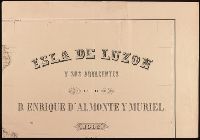
- Almonte y Muriel, Enrique d', 1858-1917, cartographer.
- Published / Created:
- 1883
- Call Number:
- BrSides Double Folio 2019 106
- Image Count:
- 8
- Resource Type:
- Maps, Atlases & Globes
- Description:
- Imperfect: southeastern sheet torn, with no loss of text., Prime meridian: Madrid., and Relief shown by hachures.
- Publisher:
- Publicado de Real Orden por el Ministerio de Ultramar, bajo la dirección de la Comisión del Mapa Geológico de España,
- Subject (Geographic):
- Luzon (Philippines)--Maps.
- Found in:
- Beinecke Rare Book and Manuscript Library > Isla de Luzon y sus adjacentes / por D. Enrique d'Almonte y Muriel ; grabado por José Mendez.
- Creator:
- Alpagot, Haydar
Ayasofya Kütüphanesi. Manuscript. 2612
Kurtoğlu, Fevzi
Pekol, Fehmi
Pirı̂ Reis, d. 1554?
Türk ve İslâm Eserleri Müzesi. Manuscript. Turkish 403 - Published / Created:
- 1935
- Call Number:
- 1977 +68
- Image Count:
- 2
- Resource Type:
- Maps, Atlases & Globes
- Alternative Title:
- Türk Tarihi Arastirma Kurumu yayinlarindan, no. 2
- Description:
- "Bahriye kitabinin metni, Istanbulda Ayasofya kitapsarayinda 2612 sayida kayitli nüshasindan faksimile edilmiştir. Onsöz ... Fevzi Kurdoglu ve Haydar Alpagot tarafindan yazilmis ve indeks ... Fehmi Pekol tarafindan yapilmiştir." -- from verso of t.p., "Bakilan kitablar": p. [lvii], "Bu kitabin kabi için, 1617 yilinda hattat Halit tarafindan yazilmiş ve Ahmet I. in türbesine konulmus olan yazma bir kuranin kabi örnek utulmuştur. Bu örnek simdi Istanbulda Türk Islâm eserleri müzesinde 403 numarada kayitlidir." -- from verso of leaf [1] following page f., and "Indeks": 72 p. at end.
- Publisher:
- Devlet Basimevi,
- Subject (Geographic):
- Marmara, Sea of (Turkey), Mediterranean Region--Description and travel, and Mediterranean Sea--Navigation
- Subject (Name):
- Columbus, Christopher
- Subject (Topic):
- Manuscripts, Turkish--Facsimiles and Nautical charts--Mediterranean Sea
- Found in:
- Beinecke Rare Book and Manuscript Library > Kitabi bahriye / Piri Reis.

- Creator:
- Alzate y Ramírez, José Antonio de, 1737-1799
- Published / Created:
- An[n]o de 1768.
- Call Number:
- BrSides Elephant Folio 2018 13
- Image Count:
- 1
- Resource Type:
- Maps, Atlases & Globes
- Description:
- Detached from cloth backing; manuscript note on verso of cloth backing, "Copie de la nouvelle carte manuscrite du nouveau Mexique.", Relief shown pictorially., Unidentified stamp in title cartouche, "Bibliotheque de [?].", Watermark., and With manuscript note in French in plain red cartouche signed "Grandjean De Fouchy" noting the copy was made for Jean-Baptiste Chappe d'Auteroche.
- Subject (Geographic):
- Mexico--Maps--Early works to 1800. and Southwest, Old--Maps--Early works to 1800.
- Subject (Name):
- Chappe d'Auteroche, abbé, 1728-1769 and Fouchy, Jean Paul Grandjean de.
- Found in:
- Beinecke Rare Book and Manuscript Library > Nuevo mapa geographico de la America Septentrional : perteneciente alvirreynato de Mexico / dedicado a los sabios miembros de lá Academia Real de la Ciencias de Paris, por sumy rendido servidor y capellan Don Josef Antonio de Alzate y Ramirez.

- Creator:
- Alzate y Ramírez, José Antonio de, 1737-1799
- Published / Created:
- 1768
- Call Number:
- 88 1768
- Container / Volume:
- BRBL_00644
- Image Count:
- 1
- Resource Type:
- Maps, Atlases & Globes
- Description:
- "Publicado bajo el privilegio de la Academia Real de las Ciencias de Paris.", "Se hattará en Madrid, calle de Atocha, frente la casa de los Gremios.", Includes notes., and Relief shown pictorially.
- Publisher:
- s.n.],
- Subject (Geographic):
- Mexico--Maps--Early works to 1800
- Found in:
- Beinecke Rare Book and Manuscript Library > Nuevo mapa geográfico de la América Septentrional, perteneciente al virreynato de Mexico / dedicado á los sabios miembros de la Academia Real de las Ciencias de Paris, por D. Josef Antonio de Alzate y Ramirez.

- Creator:
- Alʹftan, gvardeĭskīĭ kapitan
- Published / Created:
- 1860
- Call Number:
- 348 1860
- Container / Volume:
- BRBL_00099
- Image Count:
- 1
- Resource Type:
- Maps, Atlases & Globes
- Description:
- In Russian., Inset: Helsinki., and Joel Sumner Smith "Catalogue of Books" No. 578.
- Publisher:
- Military-Topographic Depot],
- Subject (Geographic):
- Finland--Maps
- Found in:
- Beinecke Rare Book and Manuscript Library > Karta Finli︠a︡ndīi / Alʹftanom.

- Creator:
- American Association for the Advancement of Science
- Published / Created:
- 1880
- Call Number:
- 764 B65 1880A
- Container / Volume:
- BRBL_00456
- Image Count:
- 1
- Resource Type:
- Maps, Atlases & Globes
- Description:
- "The district burnt in the great fire of November 1872 is shown by a series of parallel red lines." and "The original shore-line of the Boston Peninsula is shown by a red line."
- Publisher:
- s.n.,
- Subject (Topic):
- Maps--Massachusetts--Boston--1880
- Found in:
- Beinecke Rare Book and Manuscript Library > Map of Boston and vicinity. Prepared for the use of members of the American Association for the Advancement of Science at the Boston meeting, August, 1880.

- Creator:
- American Automobile Association
- Published / Created:
- c1917.
- Call Number:
- 76gmb 1917A
- Container / Volume:
- BRBL_00446
- Image Count:
- 2
- Resource Type:
- Maps, Atlases & Globes
- Alternative Title:
- Connecticut, Massachusetts, Rhode Island., Lower New England main-traveled routes :, and Southern New England.
- Description:
- "Copyright 1913, 1914, 1915, 1916, and 1917, by the American Automobile Association.", Includes table of principal mileages., and On verso: 10 ancillary maps, New England hotel listing, and advertising and illus.
- Publisher:
- The Association,
- Subject (Geographic):
- Connecticut--Maps, Massachusetts--Maps, New England--Maps, and Rhode Island--Maps
- Found in:
- Beinecke Rare Book and Manuscript Library > Lower New England / prepared by Touring Information Board American Automobile Association.

- Creator:
- American Automobile Association
- Published / Created:
- [1940]
- Call Number:
- 80gmb 1940
- Container / Volume:
- BRBL_00538
- Image Count:
- 2
- Resource Type:
- Maps, Atlases & Globes
- Alternative Title:
- Official road map, western states and Western states
- Description:
- "This map revised annually, next issue spring 1941.", In lower left: 4004-J., Includes ill. and text., Index, text, and advertisements on verso., and Relief shown by spot heights and pictorially.
- Publisher:
- American Automobile Association,
- Subject (Topic):
- Roads--West (U.S.)--Maps
- Found in:
- Beinecke Rare Book and Manuscript Library > Official AAA road map : western states.

- Creator:
- American Automobile Association
- Published / Created:
- [1928?]
- Call Number:
- 815gmb 1928
- Container / Volume:
- BRBL_00561
- Image Count:
- 1
- Resource Type:
- Maps, Atlases & Globes
- Alternative Title:
- Iowa, AAA official road map, Iowa, official AAA road map, and Iowa, official road map, AAA
- Description:
- Date inferred from stamp above legend: Jun 30 1928., In lower left: 3021., and Includes text.
- Publisher:
- American Automobile Association,
- Subject (Geographic):
- Iowa--Maps
- Subject (Topic):
- Roads--Iowa--Maps
- Found in:
- Beinecke Rare Book and Manuscript Library > Official AAA road map, Iowa.
- Creator:
- American Automobile Association
- Published / Created:
- c1946.
- Call Number:
- 80gmb 1945
- Container / Volume:
- BRBL_00538
- Image Count:
- 2
- Resource Type:
- Maps, Atlases & Globes
- Alternative Title:
- Map of south central states and South central states
- Description:
- Advertisement, index, text, and map of "Mexican highways" (scale [ca. 1:5,258,880]) on verso., Includes advertisements and inset of routes between San Antonio, Houston, Laredo, and Brownsville., and Relief shown by hachures and spot heights.
- Publisher:
- AAA,
- Subject (Topic):
- Roads--Mexico--Maps and Roads--Southern states--Maps
- Found in:
- Beinecke Rare Book and Manuscript Library > Official AAA road map, south central states.
79.
- Creator:
- American Automobile Association
- Published / Created:
- 1920
- Call Number:
- 76gmb 1920A
- Container / Volume:
- BRBL_00446
- Image Count:
- 2
- Resource Type:
- Maps, Atlases & Globes
- Alternative Title:
- Vermont New Hampshire
- Description:
- On verso: 13 ancillary maps of Vermont cities and towns, mileage tables, and hotel rates, advertising and illus.
- Publisher:
- The Association,
- Subject (Geographic):
- New Hampshire--Maps and Vermont--Maps
- Found in:
- Beinecke Rare Book and Manuscript Library > Vermont and New Hampshire / prepared by Touring Information Board American Automobile Association.
80.

- Creator:
- American Bank Note Company
- Published / Created:
- 1882?]
- Call Number:
- 73fcm 1882
- Container / Volume:
- BRBL_00375B
- Image Count:
- 2
- Resource Type:
- Maps, Atlases & Globes
- Alternative Title:
- Canadian Pacific Railway to Manitoba : and Prairie section of the Canadian Pacific Railway, showing the land grant along the prairie line in Manitoba and the Northwest Territories
- Description:
- Text, ill., "Map of the Dominion of Canada, showing the Canadian Pacific Railway from the Atlantic to the Pacific, with eastern connections," [Map showing route from Liverpool to Hong Kong], and distance tables on verso. and Yale's copy signed in ink in title
- Publisher:
- American Bank Note Co.?,
- Subject (Name):
- Brewer, Matt.--Autograph, Canadian Pacific Railway Company, and Canadian Pacific Railway Company--Maps
- Subject (Topic):
- Railroads--Prairie Provinces--Maps
- Found in:
- Beinecke Rare Book and Manuscript Library > Manitoba and the Northwest Territories / American Bank Note Co., map engravers, New York, U.S.A.
81.
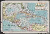
- Creator:
- American Bank Note Company
- Published / Created:
- c1913.
- Call Number:
- 85 1913
- Container / Volume:
- BRBL_00638
- Image Count:
- 1
- Resource Type:
- Maps, Atlases & Globes
- Alternative Title:
- National Geographic magazine map of Central America, Cuba, Porto Rico, and the islands of the Caribbean Sea
- Description:
- "Copyright ... by American Bank Note Company, New York.", Also shows distances between major, Copy 2 stamped in red "Prepared for distribution by the Pan-American Union" in bottom left margin., and Includes inset of Canal Zone and relief profile of Panama Canal.
- Publisher:
- National Geographic Magazine,
- Subject (Geographic):
- Caribbean Area--Maps, Central America--Maps, and West Indies--Maps
- Subject (Name):
- National Geographic Society (U.S.)
- Found in:
- Beinecke Rare Book and Manuscript Library > Map of Central America, Cuba, Porto Rico, and the islands of the Caribbean Sea / prepared by the American Bank Note Co. ; Gilbert H. Grosvenor, editor.
82.
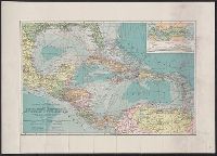
- Creator:
- American Bank Note Company
- Published / Created:
- c1913.
- Call Number:
- 85 1913
- Container / Volume:
- BRBL_00638
- Image Count:
- 1
- Resource Type:
- Maps, Atlases & Globes
- Alternative Title:
- National Geographic magazine map of Central America, Cuba, Porto Rico, and the islands of the Caribbean Sea
- Description:
- "Copyright ... by American Bank Note Company, New York.", Also shows distances between major points., At head of title: The National Geographic Magazine., Includes inset of Canal Zone and relief profile of Panama Canal., and Relief shown by hachures. Depths shown by contours and gradient tints.
- Publisher:
- National Geographic Magazine,
- Subject (Geographic):
- Caribbean Area--Maps, Central America--Maps, and West Indies--Maps
- Subject (Name):
- National Geographic Society (U.S.)
- Found in:
- Beinecke Rare Book and Manuscript Library > Map of Central America, Cuba, Porto Rico, and the islands of the Caribbean Sea / prepared by the American Bank Note Co. ; Gilbert H. Grosvenor, editor.
- Creator:
- American Council on Soviet Relations
- Published / Created:
- 1941]
- Call Number:
- 35 1941B
- Container / Volume:
- BRBL_00101
- Image Count:
- 2
- Resource Type:
- Maps, Atlases & Globes
- Alternative Title:
- American Soviet diplomatic relations and Eighth anniversary American Soviet diplomatic relations
- Description:
- Panel title.
- Publisher:
- American Council on Soviet Relations,
- Subject (Geographic):
- Soviet Union--Foreign relations--1917-1945, Soviet Union--Foreign relations--United States, Soviet Union--Maps, United States--Foreign relations--1933-1945, and United States--Foreign relations--Soviet Union
- Found in:
- Beinecke Rare Book and Manuscript Library > 8th anniversary American Soviet diplomatic relations.
- Creator:
- American Geographical Society of New York
- Published / Created:
- [1918?]
- Call Number:
- 11hcf 1919-14
- Container / Volume:
- BRBL_00010J
- Image Count:
- 1
- Resource Type:
- Maps, Atlases & Globes
- Description:
- Ms. notes showing Italian land claims following World War I.
- Publisher:
- American Geographical Society,
- Subject (Geographic):
- Adriatic Sea Region--Maps
- Subject (Topic):
- World War, 1914-1918--Maps
- Found in:
- Beinecke Rare Book and Manuscript Library > Adriatic [Sea region].

- Creator:
- American Geographical Society of New York
- Published / Created:
- [1914?]
- Call Number:
- 11hcf 1919B-13
- Container / Volume:
- BRBL_00010O
- Image Count:
- 3
- Resource Type:
- Maps, Atlases & Globes
- Description:
- Sheet 2 fragile, in 3 fragments.
- Publisher:
- American Geographical Society,
- Subject (Geographic):
- Austria--Maps and Europe, Eastern--Maps
- Found in:
- Beinecke Rare Book and Manuscript Library > Austria-Hungary [cartographic material].
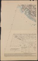
- Creator:
- American Geographical Society of New York
- Published / Created:
- 1918
- Call Number:
- 44cbd 1918
- Container / Volume:
- BRBL_00256
- Image Count:
- 4
- Resource Type:
- Maps, Atlases & Globes
- Description:
- "Topography is based particularly upon the Generalkarte von Mitteleuropa of the Austrian General Staff (Scale 1:300,000).", In addition to landforms, shows bodies of water, transportation infrastructure, towns, and cities., and Lists maps on which map is based.
- Publisher:
- The American Geographical Society,
- Subject (Geographic):
- Balkan Peninsula--Maps
- Subject (Topic):
- Slopes (Physical geography)--Balkan Peninsula--Maps
- Found in:
- Beinecke Rare Book and Manuscript Library > Block diagram showing terrain of the Balkan Peninsula [cartographic material].
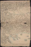
- Creator:
- American Geographical Society of New York
- Published / Created:
- [1918]
- Call Number:
- 11hcf 1919C-2
- Container / Volume:
- BRBL_00010T
- Image Count:
- 2
- Resource Type:
- Maps, Atlases & Globes
- Description:
- Relief shown by shading and spot heights.
- Publisher:
- The American Geographical Society,
- Subject (Geographic):
- Balkan Peninsula--Maps
- Subject (Topic):
- Slopes (Physical geography)--Balkan Peninsula--Maps
- Found in:
- Beinecke Rare Book and Manuscript Library > Block diagram showing terrain of the Balkan Peninsula.
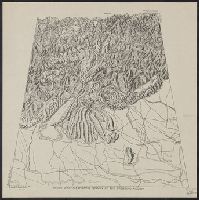
- Creator:
- American Geographical Society of New York
- Published / Created:
- 19--?]
- Call Number:
- 11hcf 1919D-8
- Container / Volume:
- BRBL_00010Y
- Image Count:
- 1
- Resource Type:
- Maps, Atlases & Globes
- Description:
- Copy, at reduced scale, of diagram issued by the American Geographical Society. and Railroads are shown.
- Subject (Geographic):
- Trentino-Alto Adige (Italy)--Block diagrams
- Found in:
- Beinecke Rare Book and Manuscript Library > Block diagram showing terrain of the Trentino region [cartographic material].
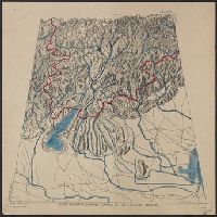
- Creator:
- American Geographical Society of New York
- Published / Created:
- 19--?]
- Call Number:
- 11hcf 1919E-26
- Container / Volume:
- BRBL_00010ZA
- Image Count:
- 1
- Resource Type:
- Maps, Atlases & Globes
- Description:
- Copy, at reduced scale, of diagram issued by the American Geographical Society. and Railroads are shown.
- Subject (Geographic):
- Trentino-Alto Adige (Italy)--Block diagrams
- Found in:
- Beinecke Rare Book and Manuscript Library > Block diagram showing terrain of the Trentino region [cartographic material].
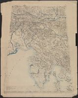
- Creator:
- American Geographical Society of New York
- Published / Created:
- 1918
- Call Number:
- 11hcf 1919E
- Image Count:
- 1
- Resource Type:
- Maps, Atlases & Globes
- Description:
- "Approximate scale in center of diagram 1:150,000, vertical exaggeration about 1 1/2 times.", 11hcf 1919E: Hand col. Sheet 1 with typed descriptive notes attached., and Relief shown by shading, land form drawing, hachures and spot heights.
- Publisher:
- American Geographical Society,
- Subject (Geographic):
- Friuli (Italy)--Maps, Istria (Croatia and Slovenia)--Maps, and Trieste Region (Italy)--Maps
- Subject (Topic):
- Block diagrams--Friuli (Italy : Province) and Block diagrams--Istria (Croatia and Slovenia)
- Found in:
- Beinecke Rare Book and Manuscript Library > Block diagram showing terrain of the Trieste-Isonzo region.
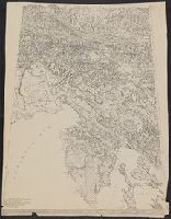
- Creator:
- American Geographical Society of New York
- Published / Created:
- [ca. 1914]
- Call Number:
- 403cbd 1900A
- Container / Volume:
- BRBL_00234
- Image Count:
- 1
- Resource Type:
- Maps, Atlases & Globes
- Description:
- "Approximate scale in center of diagram 1:150,000, vertical exaggeration about 1 1/2 times.", Relief shown by shading, land form drawing, hachures and spot heights., and Western sheet wanting.
- Publisher:
- American Geographical Society,
- Subject (Geographic):
- Friuli (Italy)--Maps, Istria (Croatia and Slovenia)--Maps, and Trieste Region (Italy)--Maps
- Subject (Topic):
- Block diagrams--Friuli (Italy : Province) and Block diagrams--Istria (Croatia and Slovenia)
- Found in:
- Beinecke Rare Book and Manuscript Library > Block diagram showing terrain of the Trieste-Isonzo region.
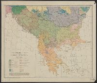
- Creator:
- American Geographical Society of New York
Briesemeister, William A
Cvijić, Jovan, 1865-1927 - Published / Created:
- c1918.
- Call Number:
- 11hcf 1919D-47
- Image Count:
- 1
- Resource Type:
- Maps, Atlases & Globes
- Description:
- "Drawn by Wm. Briesemeister." and Originally published in the Geographical review, vol. 5, no. 5, 1918, plate 3.
- Publisher:
- American Geographical Society of New York,
- Subject (Geographic):
- Balkan Peninsula--Maps
- Subject (Topic):
- Ethnology--Balkan Peninsula--Maps
- Found in:
- Beinecke Rare Book and Manuscript Library > Ethnographic map of the Balkan Peninsula / by Jovan Cvijić.
93.
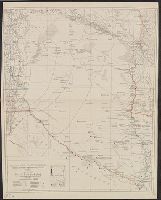
- Creator:
- American Geographical Society of New York
- Published / Created:
- 1929
- Call Number:
- 923 1929
- Container / Volume:
- BRBL_00673
- Image Count:
- 1
- Resource Type:
- Maps, Atlases & Globes
- Description:
- "Contours and altitudes in meters.", Relief shown by contours and spot heights. River depths shown by soundings., and Shows rivers - surveyed and unsurveyed, astronomical points, roads, trails, fortines/[bunkers] (Bolivian, Paraguayan or Argentine), settlements, indian settlements and mission stations.
- Publisher:
- American Geographical Society of New York,
- Subject (Geographic):
- Chaco Boreal (Paraguay and Bolivia)--Maps
- Subject (Topic):
- Chaco War, 1932-1935--Maps
- Found in:
- Beinecke Rare Book and Manuscript Library > Map of the Chaco Boreal [cartographic material] / compiled by the American Geographical Society of New York.

- Creator:
- American Geographical Society of New York
- Published / Created:
- 1915]
- Call Number:
- 11hcf 1919A-10
- Container / Volume:
- BRBL_00010M
- Image Count:
- 3
- Resource Type:
- Maps, Atlases & Globes
- Alternative Title:
- Russian empire
- Description:
- "WAB"--Botto, Affixed to upper right corner of map, 2 undated sheets titled "The Territorial Expansion of Russia since the accession of Peter the Great" with notes explaining col. ms. markings on body of map., and Relief shown by gradient tints.
- Publisher:
- American Geographical Society,
- Subject (Geographic):
- Russia--Maps
- Found in:
- Beinecke Rare Book and Manuscript Library > Map of the Russian Empire.

- Creator:
- American Geographical Society of New York
- Published / Created:
- 1918
- Call Number:
- 11hcf 1919B-42
- Image Count:
- 1
- Resource Type:
- Maps, Atlases & Globes
- Description:
- "Boundary according to the Treaty of Bucharest, May 7, 1918."
- Publisher:
- American Geographical Society,
- Subject (Geographic):
- Romania--Maps and Romania--Maps--1918
- Found in:
- Beinecke Rare Book and Manuscript Library > Roumania [cartographic material].
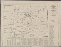
- Creator:
- American Map Company (New York, N.Y.)
- Published / Created:
- [1931].
- Call Number:
- 834 1931A
- Container / Volume:
- BRBL_00588
- Image Count:
- 1
- Resource Type:
- Maps, Atlases & Globes
- Alternative Title:
- County-town map of Colorado
- Description:
- Below title: Map no. 405., Copyright: American Map Company, New York., Date from stamp: Mar 20 1931., Indexed., and Shows county seats and boundaries, with few other towns.
- Publisher:
- American Map Company,
- Subject (Geographic):
- Colorado--Administrative and political divisions--Maps and Colorado--Maps
- Found in:
- Beinecke Rare Book and Manuscript Library > Cleartype county-town map of Colorado.
97.

- Creator:
- American Publishing Co. (Milwaukee, Wis.)
- Published / Created:
- 1890
- Call Number:
- 831 H36 1890
- Container / Volume:
- BRBL_00580
- Image Count:
- 1
- Resource Type:
- Maps, Atlases & Globes
- Description:
- Includes index to points of interest, 16 illus. of important buildings and areas, and inset "Lenox and Corbin east side additions."
- Publisher:
- American Publishing Co.,
- Subject (Geographic):
- Helena (Mont.)--Aerial views
- Found in:
- Beinecke Rare Book and Manuscript Library > Perspective map of the city of Helena, Mont. : capital of state, county seat of Lewis & Clarke Co. / compliments of Kessler's Brewery.
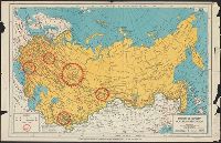
- Creator:
- American Russian Institute
C.S. Hammond & Company - Published / Created:
- [1940?]
- Call Number:
- 35gf 1954
- Container / Volume:
- BRBL_00103
- Image Count:
- 1
- Resource Type:
- Maps, Atlases & Globes
- Alternative Title:
- Soviet Russia today and Soviet Russia Today.
- Description:
- "44111.", "Prepared by the magazine 'Soviet Russia To-Day'"., and Shows major industrial areas.
- Publisher:
- C.S. Hammond,
- Subject (Geographic):
- Soviet Union--Maps
- Subject (Topic):
- Industries--Soviet Union--Maps
- Found in:
- Beinecke Rare Book and Manuscript Library > Union of Soviet Socialist Republics / American Russian Institute.
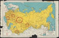
- Creator:
- American Russian Institute
C.S. Hammond & Company - Published / Created:
- [1941?]
- Call Number:
- 35g 1940
- Container / Volume:
- BRBL_00103
- Image Count:
- 1
- Resource Type:
- Maps, Atlases & Globes
- Alternative Title:
- Soviet Russia Today.
- Description:
- "44111.", "Borders as established August 1940.", and Shows major industrial areas.
- Publisher:
- C.S. Hammond,
- Subject (Geographic):
- Soviet Union--Maps
- Subject (Topic):
- Industries--Soviet Union--Maps
- Found in:
- Beinecke Rare Book and Manuscript Library > Union of Soviet Socialist Republics / American Russian Institute.
100.
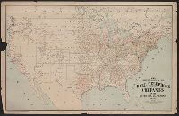
- Creator:
- American Telephone and Telegraph Company
- Published / Created:
- 1904
- Call Number:
- 75gmk 1904
- Container / Volume:
- BRBL_00414A
- Image Count:
- 1
- Resource Type:
- Maps, Atlases & Globes
- Publisher:
- The Company,
- Subject (Topic):
- Telephone lines--United States--Maps and Telephone systems--United States--Maps
- Found in:
- Beinecke Rare Book and Manuscript Library > Map showing lines of the Bell telephone companies in the United States and Canada : July 1st, 1904 / American Telephone & Telegraph Company.