Search
You Searched For
Search Results
- Creator:
- United States. Congress. House. Committee on the Public Lands
- Published / Created:
- [1878?].
- Call Number:
- 75 1878
- Container / Volume:
- BRBL_00406
- Image Count:
- 16
- Resource Type:
- Maps, Atlases & Globes
- Found in:
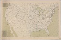
- Beinecke Rare Book and Manuscript Library > 1876 Centennial map of the United States and territories : showing the extent of public surveys, indian and military reservations, land grant R.R. rail roads, canals, cities, towns & other details / compiled from the official surveys of the General Land O
- Creator:
- Geological Survey (U.S.)
- Published / Created:
- 1890, 1891.
- Call Number:
- 75CBF 1891A
- Container / Volume:
- BRBL_00408
- Image Count:
- 9
- Resource Type:
- Maps, Atlases & Globes
- Found in:
- Beinecke Rare Book and Manuscript Library > United States / compiled under the direction of Henry Gannett, chief topographer, by Harry King, chief draughtsman.
- Published / Created:
- 1809
- Call Number:
- 755 1809
- Container / Volume:
- BRBL_00438
- Image Count:
- 1
- Resource Type:
- Maps, Atlases & Globes
- Found in:
- Beinecke Rare Book and Manuscript Library > The United States of North America : with the British territories and those of Spain.
- Published / Created:
- 1899
- Call Number:
- 807gmb 1899
- Container / Volume:
- BRBL_00551
- Image Count:
- 1
- Resource Type:
- Maps, Atlases & Globes
- Found in:
- Beinecke Rare Book and Manuscript Library > Illinois Central Railroad : and Yazoo & Mississippi Valley Railroad.
- Creator:
- United States. Department of Agriculture. Division of Publications
- Published / Created:
- 1910
- Call Number:
- 75fb 1910
- Container / Volume:
- BRBL_00410
- Image Count:
- 1
- Resource Type:
- Maps, Atlases & Globes
- Found in:
- Beinecke Rare Book and Manuscript Library > Outline map of the United States by counties / engraved and printed by the U.S. Geological Survey.
- Creator:
- Goode, J. Paul, 1862-1932
- Published / Created:
- c1910.
- Call Number:
- 75fb 1910A
- Container / Volume:
- BRBL_00410
- Image Count:
- 1
- Resource Type:
- Maps, Atlases & Globes
- Found in:
- Beinecke Rare Book and Manuscript Library > America (U.S.) by counties.
- Published / Created:
- 1936, [1860?].
- Call Number:
- 75am 1860
- Container / Volume:
- BRBL_00407A
- Image Count:
- 1
- Resource Type:
- Maps, Atlases & Globes
- Found in:
- Beinecke Rare Book and Manuscript Library > The Traveler's 1936 Calendar reproduced from Currier and Ives Prints for.
- Creator:
- Geological Survey (U.S.)
- Published / Created:
- 1911
- Call Number:
- 75cbf 1911S
- Container / Volume:
- BRBL_00408
- Image Count:
- 1
- Resource Type:
- Maps, Atlases & Globes
- Found in:
- Beinecke Rare Book and Manuscript Library > United States relief map / U.S. Geological Survey, Department of the Interior ; compiled by Henry Gannett.
- Creator:
- Geological Survey (U.S.)
- Published / Created:
- 1910
- Call Number:
- 75cbf 1910
- Container / Volume:
- BRBL_00408
- Image Count:
- 1
- Resource Type:
- Maps, Atlases & Globes
- Found in:
- Beinecke Rare Book and Manuscript Library > United States relief map / compiled by Henry Gannett.
- Published / Created:
- 1920
- Call Number:
- 75ak 1920
- Container / Volume:
- BRBL_00407A
- Image Count:
- 1
- Resource Type:
- Maps, Atlases & Globes
- Found in:
- Beinecke Rare Book and Manuscript Library > [Outline Map of the United States] / engraved and printed by the U.S. Geological Survey.
- Creator:
- United States. Bureau of Indian Affairs
- Published / Created:
- 1907
- Call Number:
- 75ea 1907A
- Container / Volume:
- BRBL_00409
- Image Count:
- 1
- Resource Type:
- Maps, Atlases & Globes
- Found in:
- Beinecke Rare Book and Manuscript Library > Map showing Indian reservations within the limits of the United States / compiled under the direction of the Hon. F.E. Leupp, Commissioner of Indian Affairs.
- Published / Created:
- 1834]
- Call Number:
- 75 1834E
- Container / Volume:
- BRBL_00398
- Image Count:
- 1
- Resource Type:
- Maps, Atlases & Globes
- Found in:
- Beinecke Rare Book and Manuscript Library > Estados Unidos de la América Septentrional / Pablo Alabern lo grabo 1834.
- Published / Created:
- 1909
- Call Number:
- 75cfe 1909
- Container / Volume:
- BRBL_00409
- Image Count:
- 1
- Resource Type:
- Maps, Atlases & Globes
- Found in:
- Beinecke Rare Book and Manuscript Library > United States, Contour Map.
- Creator:
- Geological Survey (U.S.)
- Published / Created:
- 1913
- Call Number:
- 75ed 1913
- Container / Volume:
- BRBL_00410
- Image Count:
- 1
- Resource Type:
- Maps, Atlases & Globes
- Found in:
- Beinecke Rare Book and Manuscript Library > Map showing Indian Reservations within the Limits of the United States, 1913 / engraved and printed by the U.S. Geological Survey.
- Published / Created:
- c1901.
- Call Number:
- 75 1901
- Container / Volume:
- BRBL_00407
- Image Count:
- 1
- Resource Type:
- Maps, Atlases & Globes
- Found in:
- Beinecke Rare Book and Manuscript Library > The United States / by Rand, McNally & Co.
- Creator:
- Geological Survey (U.S.)
- Published / Created:
- [1916]
- Call Number:
- 75cbf 1916
- Container / Volume:
- BRBL_00408
- Image Count:
- 1
- Resource Type:
- Maps, Atlases & Globes
- Found in:
- Beinecke Rare Book and Manuscript Library > United States contour map / Department of the Interior, U.S. Geological Survey.
- Published / Created:
- 1912
- Call Number:
- 75 1912
- Container / Volume:
- BRBL_00407
- Image Count:
- 1
- Resource Type:
- Maps, Atlases & Globes
- Found in:
- Beinecke Rare Book and Manuscript Library > The United States.
- Published / Created:
- 1909
- Call Number:
- 75ak 1909
- Container / Volume:
- BRBL_00407A
- Image Count:
- 1
- Resource Type:
- Maps, Atlases & Globes
- Found in:
- Beinecke Rare Book and Manuscript Library > United States Base Map / engraved by U.S.G.S.
- Published / Created:
- 1848
- Call Number:
- 75EG 1848L
- Container / Volume:
- BRBL_00410
- Image Count:
- 1
- Resource Type:
- Maps, Atlases & Globes
- Found in:
- Beinecke Rare Book and Manuscript Library > Lewis' free soil, slavery, and territorial map of the United States.
- Published / Created:
- 1919
- Call Number:
- 75ED 1818
- Container / Volume:
- BRBL_00410
- Image Count:
- 1
- Resource Type:
- Maps, Atlases & Globes
- Found in:
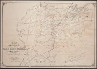
- Beinecke Rare Book and Manuscript Library > Territory of the States of Georgia and Alabama illustrating the Geographical Distribution and Movements of the Tribes and Towns of the Creek Confederacy. Compiled by J.R. Swanton. Bureau of American Ethnology
- Published / Created:
- 1856
- Call Number:
- 75F 1856
- Container / Volume:
- BRBL_00410
- Image Count:
- 1
- Resource Type:
- Maps, Atlases & Globes
- Found in:
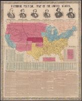
- Beinecke Rare Book and Manuscript Library > National political map of the United States.
- Published / Created:
- 1856
- Call Number:
- 75F 1856A
- Container / Volume:
- BRBL_00410
- Image Count:
- 1
- Resource Type:
- Maps, Atlases & Globes
- Found in:
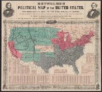
- Beinecke Rare Book and Manuscript Library > Reynolds's political map of the United States ... Electrotyped by Filner & Co.
- Published / Created:
- 1878
- Call Number:
- 75GM 1878
- Container / Volume:
- BRBL_00410
- Image Count:
- 1
- Resource Type:
- Maps, Atlases & Globes
- Found in:
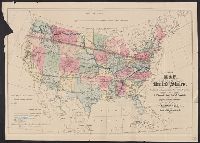
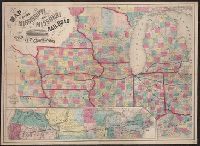
- Beinecke Rare Book and Manuscript Library > Map of the United States : exhibiting the grants of lands made by the General government to aid the construction of railroads and wagon roads / Dept. of the Interior. U.S. Geographical and Geological Survey of the Rocky Mountain Region J.W. Powell, in Cha
- Creator:
- Waddell, J. H. (John Hunter)
- Published / Created:
- 1868
- Call Number:
- 75GBC 1868
- Container / Volume:
- BRBL_00410
- Image Count:
- 1
- Resource Type:
- Maps, Atlases & Globes
- Found in:
- Beinecke Rare Book and Manuscript Library > Map of the United States / constructed on the rectangular tangential projection by J.H. Waddell ... ; prepared under the instructions M. F. Maury ...
- Published / Created:
- 1850
- Call Number:
- 75GM 1850B
- Container / Volume:
- BRBL_00410
- Image Count:
- 1
- Resource Type:
- Maps, Atlases & Globes
- Found in:
- Beinecke Rare Book and Manuscript Library > A new map for travellers through the United States of America showing the railways, canals & stage roads with the distances.
- Creator:
- Burr, Henry A
- Published / Created:
- 1853
- Call Number:
- 75GM 1853
- Container / Volume:
- BRBL_00410
- Image Count:
- 1
- Resource Type:
- Maps, Atlases & Globes
- Found in:
- Beinecke Rare Book and Manuscript Library > Disturnell's new map of the United States and Canada : showing all the canals, rail roads, telegraph lines and principal stage routes / Drawn by Henry A. Burr.
- Published / Created:
- 1853
- Call Number:
- 754gme 1853
- Container / Volume:
- BRBL_00419
- Image Count:
- 1
- Resource Type:
- Maps, Atlases & Globes
- Found in:
- Beinecke Rare Book and Manuscript Library > Map of the Delaware, Lackawanna & Western railroad : with its principal connections.
- Creator:
- J.H. Colton & Co.
- Published / Created:
- 1858
- Call Number:
- 754gme 1858
- Container / Volume:
- BRBL_00420
- Image Count:
- 1
- Resource Type:
- Maps, Atlases & Globes
- Found in:
- Beinecke Rare Book and Manuscript Library > Map of the Mississippi and Missouri Railroad : and its connections.
- Published / Created:
- [1857?]
- Call Number:
- 754gme 1857
- Container / Volume:
- BRBL_00419
- Image Count:
- 1
- Resource Type:
- Maps, Atlases & Globes
- Found in:
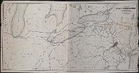
- Beinecke Rare Book and Manuscript Library > Map showing position of the Lake Erie and Pacific rail road : and its connections / [by] Chas. E. Hore, mechanical and topographical draftsman, 308 Broadway, N.Y.
- Creator:
- H. H. Lloyd & Co. (New York, N.Y)
- Published / Created:
- 188-.
- Call Number:
- 754gme 1881
- Container / Volume:
- BRBL_00420
- Image Count:
- 1
- Resource Type:
- Maps, Atlases & Globes
- Found in:
- Beinecke Rare Book and Manuscript Library > Map showing the connections of the Illinois Central Railroad : with the railway lines to the Gulf ports.
- Creator:
- H.H. Lloyd & Co
- Published / Created:
- 1861
- Call Number:
- 777hc 1861
- Container / Volume:
- BRBL_00504A
- Image Count:
- 1
- Resource Type:
- Maps, Atlases & Globes
- Found in:
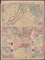
- Beinecke Rare Book and Manuscript Library > Lloyd's military maps : showing the principal places of interest / compiled from official data by Egbert L. Viele and Charles Haskins.
- Creator:
- Poole Brothers
- Published / Created:
- [1901?], c1893.
- Call Number:
- 73eu 1901
- Container / Volume:
- BRBL_00375B
- Image Count:
- 1
- Resource Type:
- Maps, Atlases & Globes
- Found in:
- Beinecke Rare Book and Manuscript Library > Map of the Canadian Pacific Railway, the Minneapolis, St. Paul and Sault Ste. Marie Railway, the Duluth, South Shore and Atlantic Railway and connections / Poole Bros, engravers.
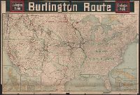
- Published / Created:
- c1902.
- Call Number:
- 75gme 1915
- Container / Volume:
- BRBL_00414A
- Image Count:
- 1
- Resource Type:
- Maps, Atlases & Globes
- Found in:
- Beinecke Rare Book and Manuscript Library > [United States] Burlington Route / Burlington R.R.
- Published / Created:
- 1919, c1918.
- Call Number:
- 75gm 1918A
- Container / Volume:
- BRBL_00411
- Image Count:
- 1
- Resource Type:
- Maps, Atlases & Globes
- Found in:
- Beinecke Rare Book and Manuscript Library > Lines of Transportation / compiled and drawn by R. Baxter Blair.
- Published / Created:
- c1914.
- Call Number:
- 75gme 1914
- Container / Volume:
- BRBL_00414A
- Image Count:
- 1
- Resource Type:
- Maps, Atlases & Globes
- Found in:
- Beinecke Rare Book and Manuscript Library > New Official Railroad Map of the United States and Dominion of Canada.
- Creator:
- Berthrong, I. P
- Published / Created:
- 1908
- Call Number:
- 75j 1908
- Container / Volume:
- BRBL_00414A
- Image Count:
- 1
- Resource Type:
- Maps, Atlases & Globes
- Found in:
- Beinecke Rare Book and Manuscript Library > United States showing routes of principal explorers and early roads and highways [map] / from data prepared by Frank Bond ; by I. B. Berthrong.
- Published / Created:
- c1917.
- Call Number:
- 75gme 1917
- Container / Volume:
- BRBL_00414A
- Image Count:
- 1
- Resource Type:
- Maps, Atlases & Globes
- Found in:
- Beinecke Rare Book and Manuscript Library > Railroad Distance Map of the United States, Mexico, and Canada.
- Creator:
- Berthrong, I. P
- Published / Created:
- 1908
- Call Number:
- 75gmb 1908
- Container / Volume:
- BRBL_00411
- Image Count:
- 1
- Resource Type:
- Maps, Atlases & Globes
- Found in:
- Beinecke Rare Book and Manuscript Library > United States showing routes of principal explorers and early roads and highways [map] / from data prepared by Frank Bond ; by I. B. Berthrong.
- Creator:
- United States. Office of Farm Management
- Published / Created:
- 1915
- Call Number:
- 75gce 1915
- Container / Volume:
- BRBL_00410
- Image Count:
- 1
- Resource Type:
- Maps, Atlases & Globes
- Found in:
- Beinecke Rare Book and Manuscript Library > Irrigation map of the United States / engraved and printed by the U.S. Geological Survey ; outline of irrigated areas based upon data collected by the Bureau of the Census, 1910 ; revised by Irrigation Division, Office of Experimental Stations, and by the
- Published / Created:
- 1907
- Call Number:
- 75gme 1907
- Container / Volume:
- BRBL_00414
- Image Count:
- 1
- Resource Type:
- Maps, Atlases & Globes
- Found in:
- Beinecke Rare Book and Manuscript Library > Map of the Chicago, St. Paul, Minneapolis & Omaha Ry. and Chicago & North Western Ry.
- Creator:
- Berthrong, I. P
- Published / Created:
- 1908
- Call Number:
- 75j 1908
- Container / Volume:
- BRBL_00414A
- Image Count:
- 1
- Resource Type:
- Maps, Atlases & Globes
- Found in:
- Beinecke Rare Book and Manuscript Library > United States showing routes of principal explorers and early roads and highways [map] / from data prepared by Frank Bond ; by I. B. Berthrong.
- Creator:
- Gannett, Henry, 1846-1914
- Published / Created:
- [1904]
- Call Number:
- 754cbf 1904
- Container / Volume:
- BRBL_00417
- Image Count:
- 1
- Resource Type:
- Maps, Atlases & Globes
- Found in:
- Beinecke Rare Book and Manuscript Library > United States contour map / U.S. Geological Survey ; compiled by Henry Gannett.
- Published / Created:
- 1896
- Call Number:
- 75gme 1896
- Container / Volume:
- BRBL_00414
- Image Count:
- 1
- Resource Type:
- Maps, Atlases & Globes
- Found in:
- Beinecke Rare Book and Manuscript Library > Map showing points and territory where the Car Sevice Rules of the American Railway Association are enforced / drawn and engraved by the American Bank Note Co., New York.
- Published / Created:
- [1880?].
- Call Number:
- 75gme 1880M
- Container / Volume:
- BRBL_00413
- Image Count:
- 1
- Resource Type:
- Maps, Atlases & Globes
- Found in:
- Beinecke Rare Book and Manuscript Library > General railroad map of the United States and Canada, showing the Macon & Brunswick Railroad and its connections.
- Creator:
- Rand McNally and Company
- Published / Created:
- 1888
- Call Number:
- 75gme 1888
- Container / Volume:
- BRBL_00414
- Image Count:
- 1
- Resource Type:
- Maps, Atlases & Globes
- Found in:
- Beinecke Rare Book and Manuscript Library > The Duluth daily news map of the Duluth railway system : Showing lines completed, under construction, and projected, Jan. 1st, 1888.
- Published / Created:
- [ca. 1865].
- Call Number:
- 75gme 1865
- Container / Volume:
- BRBL_00412
- Image Count:
- 1
- Resource Type:
- Maps, Atlases & Globes
- Found in:
- Beinecke Rare Book and Manuscript Library > Neueste Eisenbahn- Kanal- u. Post-Karte für Reisende in den Vereinigten Staaten von Nord-Amerika, Canada, Texas sowie Californien, Mexiko und den westlichen Staaten u. Gebieten / nach J. Calvin Smith, H.S. Tanner und anderen neuesten Quellen bearbeitet.
- Published / Created:
- [1840?]
- Call Number:
- 75gme 1840F
- Container / Volume:
- BRBL_00411
- Image Count:
- 1
- Resource Type:
- Maps, Atlases & Globes
- Found in:
- Beinecke Rare Book and Manuscript Library > Map of the United States of America to accompany Doggett's Railroad Guide.
- Published / Created:
- [185-?]
- Call Number:
- 75gme 1850D
- Container / Volume:
- BRBL_00411
- Image Count:
- 1
- Resource Type:
- Maps, Atlases & Globes
- Found in:
- Beinecke Rare Book and Manuscript Library > Map showing the great central trunk line between the Atlantic cities and the city of St. Louis, Mo.
- Published / Created:
- [1855?].
- Call Number:
- 75gme 1855
- Container / Volume:
- BRBL_00411
- Image Count:
- 1
- Resource Type:
- Maps, Atlases & Globes
- Found in:
- Beinecke Rare Book and Manuscript Library > Map of the Clinton Line Railroad and its connections.
- Published / Created:
- 1822
- Call Number:
- 75 1822
- Container / Volume:
- BRBL_00398
- Image Count:
- 1
- Resource Type:
- Maps, Atlases & Globes
- Found in:
- Beinecke Rare Book and Manuscript Library > United States of America Compiled from the latest & best Authorities. Engraved by Saml. Harrison.