Skip to search
Skip to main content
Skip to first result
Yale University Library
Ask Yale Library
Reserve Rooms
Places to Study
Research
Quicksearch
Search Library Catalog (Orbis)
Search Law Library Catalog (MORRIS)
Search Borrow Direct
Search WorldCat
Search Articles+
Search Digital Collections
Search Archives at Yale
Research Guides
Find Databases by Title
Find eJournals by Title
Guide to Using Special Collections
Services
Your Personal Librarian
Subject Specialists
Research Support and Workshops
Citation Tools
OverDrive: Popular Audio and eBooks
Get It @ Yale (Borrow Direct, Interlibrary Loan, Scan & Deliver)
Course Reserves
Off-Campus Access
EliScholar
OverDrive: Popular Audio and eBooks
Bass Media Equipment
Libraries & Collections
Arts Library
Bass Library
Beinecke Library
Classics Library
Divinity Library
Film Study Center
Fortunoff Archive
Humanities Collections
International Collections
Law Library
Lewis Walpole Library
Library Collection Services
Manuscripts & Archives
Map Collection
Marx Science & Social Science Library
Medical Library
Music Library
Sterling Library
Yale Center for British Art
Information & Policies
Library Hours
Departments & Staff
Borrowing & Circulation
Services for Persons with Disabilities
Copyright Basics
Scanning, Printing & Copying
Computers & Wireless
Library Policies
About the Library
Giving to the Library
Purchase Request
Working at the Library
Terms Governing Use of Materials
Search in
All Fields
Creator
Title
Call Number
Date
Subject
Orbis ID
Full Text
Description
Full text
search for
Search
Search
Advanced Search
Digital Collections
Search
You Searched For
Extent of Digitization
Unspecified
Genre
Maps
New Search
« Previous
|
1
-
100
of
721
|
Next »
Sort
by Creator (A --> Z)
relevance
Creator (A --> Z)
Creator (Z --> A)
Title (A --> Z)
Title (Z --> A)
Year (ascending)
Year (descending)
Number of results to display per page
100
per page
9
per page
30
per page
60
per page
99
per page
View results as:
List
List
Gallery
Gallery
Search Results
Map of the Seat of War in East Florida, Compiled from various data in the U.S. topl. Bureau, under
The marches of the British armies in the peninsula of India during the campaigns of 1790, and 1791
A map of China : with the surrounding states, correctly copied from Monsr. d'Anville : engraved for
A map of South America : containing Tierra-Firma, Guayana, New Granada, Amazonia, Brasil, Peru
A new map of the whole continent of America : divided into North and South and West Indies wherein
Africa : with all its states, kingdoms, republics, regions, islands, & ca., improved and inlarged
Amerique Septentrionale: publiee sous les auspices de Monseigneur le Duc d'Orleans preÌÎåmier
Amerique meridionale : publiee sous les auspices de Monseigneur le Duc d'Orleans preå«mier prince
Asia and its islands according to d'Anville : divided into empires, kingdoms, states, regions, & ca
Canada, Louisiane et terres angloises
Carte de la Louisiane
Egypt : called in the country Missir
L'Italie : publiee sous les auspices de Monseigneur le Duc d'Orleans, Premier Prince du Sang
Section of D'Anville's map of Mexico and of New Spain, 1779.
The western coast of Africa, from Cape Blanco to Cape Virga, exhibiting Senegambia proper
Louisiana
[Color plan of the 1942 Rome World's Fair.]
Map of the United States The British Provinces Mexico & c. Showing the Routes of the U.S. Mail
Mapa : Del Pais de los Comanches Formado por el Ciudado [!] Estevan F. Austin Pa. Explicar el Plan
New map of the Pikes Peak gold region. Showing all the routes from the Mississippi & Missouri
Map of the Pacific Railroad, with its connections, and the central route to the gold region
Deliniatio Cartae trium navagationum ...
A Chart of the World, according to Mercators Projection, shewing the latest Discoveries of Capt
Plan of Carthagena Harbour and city
Plan of the fortification now finishing in the port of St. Fernando de Omoa
Plan of the harbour and city of Havanah
A new map of Ireland, civil and ecclesiastical
Delineatio orarum maritimarum, terrae vulgo indigitatae terra do Natal item Sofalae, Mozambicae
Deliniatur in hac tabula, Orae maritimae Abexiae, freti Mecani al Maris Rubri Arabiae ...
Exacta & accurata delineatio cum orarum maritimarum tum etiam locorum terrestrium quae in
Typvs orbis terrarvm
(MONTANA) Bischoff, A. Map of North- West part of Montana...Great Northern Line St. Paul
Carte de l'Isle Saint Pierre: dressee au Depost des Cartes et Plans de la marine pour le service
Carte de l'isle de Sainte Lucie
Carte de l'isle de la Grenade
Carte de la Guyane francoise et l'isle de Cayenne
Carte de la Louisiane et des pays voisins: dediee a M. Rouille, secretaire d'Etat, ayant le
Carte des isles de Saint Pierre et Miquelon: levee par ordre de M. Le Duc du Choiseul, Colonel
Carte du cours de l'Ohyo ou la belle riviere : depuis sa source jusqu'a sa jonction avec celle
Carte du cours du fleuve de Saint Laurent depuis Quebec jusqu'a la mer en deux feuilles: 1re
Carte hydrographique de la baye de la Havane: avec le plan de la ville et de ses forts pour joindre
Carte reduite de l'isle d'Antigue: dressee au Depost des cartes, plans et journaux de la marine
Carte reduite de l'isle de Cube
Carte reduite de l'isle de Saint Christophe: dressee des cartes, plans et journaux de la marine
Carte reduite de l'isle de la Martinique
Carte reduite des costes de la Guyane: depuis la riviere d'Orenoque jusqu'au Cap de Nord a l'entree
Carte reduite des isles de la Guadeloupe, Marie Galante, et les Saintes
[Map of Borneo]
A map of the sea coast of England France and Holland ...
Lotharingia Ducatus, vulgo Lorraine
A plan of the town of Newport in Rhode Island
A topographical chart of the bay of Narraganset in the province of New England : with all the isles
Connecticut / entworfen von D.F. Sotzmann ; P. Schmidt, sculp.
Maine / entworfen von D.F. Sotzmann ; Sander, sc.
New Hampshire / entworfen von D.F. Sotzmann ; P. Schmidt, sculpsit.
New Jersey / entworfen von D.F. Sotzmann.
New York / entworfen von D.F. Sotzmann.
Rhode Island / entworfen von D.F. Sotzmann ; gestochen von H. Kliewer.
Pennsylvania / entworfen von D.F. Sotzman[n].
Vermont / entworfen von D.F. Sotzmann ; P. Schmidt sc. zu Berlin.
A draught of Port Royal Harbour in South Carolina: with the marks for going in : most humbly
A draught of the harbour of Halifax and the adjacent coast in Nova Scotia: surveyed by order of
An accurate map of North America: describing and distinguishing the British, Spanish and French
The harbour of Casco Bay and islands adjacent
Plan of Black River on the Mosquito Shore
Plan of Blewfields Harbour on the Mosquito Shore
To His Royal Highness. George Augustus Frederick. Prince of Wales &c. &c. &c. this chart of the
View of Truxillo Bay and city on the coast of Honduras
A general map of the middle British colonies in America
A map of North America
A new map of Jamaica: in which the several towns, forts, & settlements are accurately laid down, as
A Survey of Lake Champlain, including Lake George, Crown Point and St. John. Surveyed by order of
Mining map of Inyo County
Occidentalis Americae partis, vel earum regionum quas Christophorus Columbus primu[m] detexit
Non Urban Recreational Areas in California
Carta esferica de los reconocimientos hechos en la costa N.O. de America en 1791 y 92 por las
Contiuacion de los reconocimientos hechos en la costa NO. de America por los buques de S.M. en
Plano del puerto de S. Diego en la costa setentl. de Californs. Levantado por el 2o. piloto de la
Plano del puerto y bahia de Monte Rey situado en la costa de Californs. Trabajado a bordo de las
A map of the district of Maine : drawn from the latest surveys and other best authorities / by
Distant view of the ruins & Santa Cruz del Quiche
A new & exact map of the island of Barbadoes in America: according to an actual & accurate survey
To his excellency the Count of Czernichew, commander in chief of her Majesty the Empress of all the
New England.
New England.
For Pike's Peak and the gold mines, via Cleveland & Toledo Rail Road. A direct and all rail road
Exploration for wagon road from Fort Ellis, M.T., to mouth of Muscleshell River / by Capt. E.W
Map of the Missouri; of the higher parts of the Mississippi; and of the elevated Plain, where the
A chart of part of the south coast of Newfoundland: including the islands St. Peters and Miquelon
A chart of the Straights of Bellisle: with part of the coast of Newfoundland and Labradore from
A draught of west Florida : with part of the river Mississippi
Mississippi
Mississippi
Chartam Mediterraneam antea magna obrutam falsitate ...
Carte des environs de Valencienne, Maubeuge, Cambray, Le Quenoi Landrecy, Bouchain, Condeí, Avesne
Carte des environs de Dunkerque, Bergue, Gravelines, St. Omer, Aire, Lille, Menin, Ypres, Dixmude
Carte particuliere des environs d'Abbeville, Montreuil [cartographic material] : avec les
Isle de New York. 1781
Reconnoissance de la partie de l'isle de Newyork qui repond a l'entree de Sound
PREVIOUS
«
1
2
3
4
5
…
7
8
»
NEXT
Limit your search
Extent of Digitization
Unspecified
✖
[remove]
721
Access
Public
720
Yale Community Only
1
Repository
Beinecke Rare Book and Manuscript Library
712
Lewis Walpole Library
5
Sterling Memorial Library
4
Format
cartographic
667
still image
27
text
15
mixed material
2
Genre
Maps
✖
[remove]
721
Maps in books
544
Engravings
411
Hand coloring
166
Illustrations
98
Prints (Visual works)
84
Atlases
43
Woodcuts
34
Intaglio prints
30
Building plans
19
more
Genre
»
Resource Type
Maps, Atlases & Globes
51
Prints & Photographs
1
still image
1
unspecified
1
Language
English
332
Latin
67
French
60
Portuguese
27
Dutch; Flemish
19
German
14
Spanish; Castilian
12
Italian
5
Russian
2
Irish
1
more
Language
»
Creator
Bellin, Jacques Nicolas, 1703-1772, creator
15
Greber, Jacques
14
Anville, Jean Baptiste Bourguignon d', 1697-1782
13
Faden, William, 1749-1836, creator
13
Faden, William, 1749-1836
9
France, Depot des cartes et plans de la marine
9
Sayer, Robert, 1725-1794
9
Sotzmann, D. F
9
Ebeling, Christophe Daniel, 1741-1817. Erdbeschreibung und Geschichte von Amerika
8
Thornton, John, 1641-1708
8
more
Creator
»
Subject (Topic)
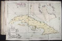
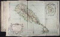
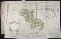
Pilot guides --Caribbean Area --Early works to 1800
129
Navigation --Early works to 1800
108
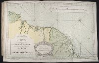
Pilot guides --Atlantic Coast (U.S.) --Early works to 1800
102
Atlases --Early works to 1800
66
Voyages and travels --Early works to 1800
44
Harbors --Atlantic Coast (North America) --Maps --Early works to 1800
27
Nautical charts --Atlantic Coast (North America) --Early works to 1800
27
Nautical charts --Caribbean Area --Early works to 1800
27
Nautical charts --West Indies --Early works to 1800
27
Pilot guides --Atlantic Coast (North America) --Early works to 1800
27
more
Subject (Topic)
»
Subject (Name)
Nicholson, John, d. ca. 1717, bookseller
66
Barker, B. (Benjamin), d. 1764, bookseller
24
Clements, Henry, d. 1719, bookseller
24
King, Charles, d. 1735, bookseller
24
Parker, Richard, fl. 1692-1725, bookseller
24
Tooke, Benjamin, d. 1716, bookseller
24
Exposition internationale (1937 : Paris, France)
14
Elzevier, Gillis, bookseller
7
Hendricksz, Aelbrecht, fl. 1573-1605, printer
7
Villegaignon, Nicolas Durand de, 1510-1571?
7
more
Subject (Name)
»
Publication Place
London
77
In Venetia
31
Paris
30
Hamburg :
8
A Paris :
6
Amsterdam
6
London :
6
Paris?
6
New York
5
Philadelphia
4
more
Publication Place
»
Date Created
View distribution
Current results range from
1509
to
1959
Date Created range begin
Date Created range end
View larger »
[Missing]
291
Full Text Available
Yes
4