
Search


Limit your search
- Public53
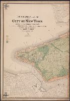
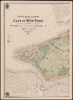
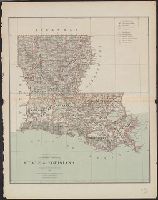
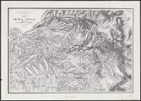
- Maps✖[remove]53
- English53
- United States. General Land Office19
- Geological Survey of California6
- Roeser, C. (Charles)6
- Bogart, James P.3
- United States. Surveyor General3
- Gardner, J. T2
- Viele, Egbert L. (Egbert Ludovicus), 1825-19022
- Warren, Gouverneur Kemble, 1830-18822
- Geographical Surveys West of the 100th Meridian (U.S.)1
- Leicht, F. von (Ferdinand von)1
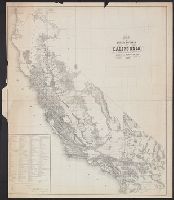
- Land grants--California--Maps4
- Harbors--Connecticut--New Haven--Maps.3
- Streets--Connecticut--New Haven--Maps.3
- Buildings--New York (State)--New York--Maps2
- Fills (Earthwork)--New York (State)--New York--Maps2
- Piers--New York (State)--New York--Maps2
- Ponds--New York (State)--New York--Maps2
- Railroads--New York (State)--Ne2
- Canals--United States--Maps1
- Geology--United States--Maps1
- Bien, Julius, 1826-1909✖[remove]53
- Roeser, C. (Charles)16
- United States. General Land Office8
- Hoffmann, C. F. (Charles Frederick), 1838-19135
- Whitney, J. D. (Josiah Dwight), 1819-18964
- Geological Survey of California3
- U.S. Coast and Geodetic Survey.3
- Andrews, Horace, cartographer, publisher.2
- King, Clarence, 1842-19012
- Quackenbush, Eugene2