Search
You Searched For
Search Results
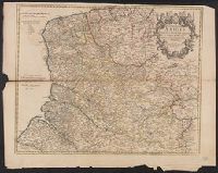
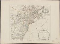
- Published / Created:
- 1806
- Call Number:
- 755 1806B
- Container / Volume:
- BRBL_00438
- Image Count:
- 1
- Resource Type:
- Maps, Atlases & Globes
- Found in:
- Beinecke Rare Book and Manuscript Library > A new map of the United States of America ... by John Cary, Engraver.
- Creator:
- Jefferys, Thomas, d. 1771
- Published / Created:
- 20 Feby. 1775.
- Call Number:
- 792cea 1775
- Container / Volume:
- BRBL_00519
- Image Count:
- 1
- Resource Type:
- Maps, Atlases & Globes
- Found in:
- Beinecke Rare Book and Manuscript Library > The coast of West Florida and Louisiana [cartographic material] : the Peninsula and Gulf of Florida or Channel of Bahama with the Bahama Islands / by Thos. Jefferys ...
- Creator:
- Wilkes, Charles, 1798-1877
- Published / Created:
- [1845?]
- Call Number:
- 80 1841A
- Container / Volume:
- BRBL_00533
- Image Count:
- 1
- Resource Type:
- Maps, Atlases & Globes
- Found in:
- Beinecke Rare Book and Manuscript Library > Map of the Oregon Territory / by the U.S. Ex. Ex., Charles Wilkes ... Commander, 1841 ; republished by James Wyld.
- Published / Created:
- April 15, 1832.
- Call Number:
- 816 1832
- Container / Volume:
- BRBL_00561
- Image Count:
- 1
- Resource Type:
- Maps, Atlases & Globes
- Found in:
- Beinecke Rare Book and Manuscript Library > Map of the states of Missouri and Illinois / engraved & printed by Fenner Sears & Co.
- Creator:
- Cary, John, ca. 1754-1835
- Published / Created:
- June 1st, 1805.
- Call Number:
- 61 1805
- Container / Volume:
- BRBL_00685
- Image Count:
- 1
- Resource Type:
- Maps, Atlases & Globes
- Found in:
- Beinecke Rare Book and Manuscript Library > A new map of Egypt, from the latest authorities / by John Cary, engraver.
- Creator:
- Lodge, John, -1796
- Published / Created:
- 30th Septr. 1780.
- Call Number:
- 27 1780
- Container / Volume:
- BRBL_00683
- Image Count:
- 1
- Resource Type:
- Maps, Atlases & Globes
- Found in:
- Beinecke Rare Book and Manuscript Library > A map of the East Indies [cartographic material] : from the best authorities.
- Creator:
- L'Isle, Guillaume de, 1675-1726
- Published / Created:
- 1713
- Call Number:
- 3825 1713
- Container / Volume:
- BRBL_00684
- Image Count:
- 1
- Resource Type:
- Maps, Atlases & Globes
- Found in:
- Beinecke Rare Book and Manuscript Library > The province of Artois and the country adjacent / [cartographic material] / by William de l'Isle ...
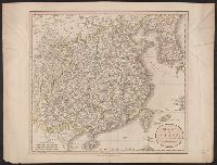
- Creator:
- Cary, John, ca. 1754-1835
- Published / Created:
- Apr. 28, 1811.
- Call Number:
- 52 1811
- Container / Volume:
- BRBL_00684
- Image Count:
- 1
- Resource Type:
- Maps, Atlases & Globes
- Found in:
- Beinecke Rare Book and Manuscript Library > A new map of Arabia, including Egypt, Abyssinia, the Red Sea &c. &c [electronic resource] : from the latest authorities / by John Cary, engraver.
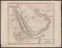
- Creator:
- Cary, John, ca. 1754-1835
- Published / Created:
- Apr. 28, 1811.
- Call Number:
- 56 1811
- Container / Volume:
- BRBL_00685
- Image Count:
- 1
- Resource Type:
- Maps, Atlases & Globes
- Found in:
- Beinecke Rare Book and Manuscript Library > A new map of China, from the latest authorities / by John Cary, engraver.
- Creator:
- Dunn, Samuel, d. 1794
- Call Number:
- 71 1776
- Container / Volume:
- BRBL_00687
- Image Count:
- 1
- Resource Type:
- Maps, Atlases & Globes
- Found in:
- Beinecke Rare Book and Manuscript Library > A map of the British Empire, in North America / by Samuel Dunn, mathematician, improved from the surveys of Capt. Carver.
- Creator:
- Jefferys, Thomas, -1771
- Published / Created:
- 25th March, 1775.
- Call Number:
- 7345cea 1775A
- Container / Volume:
- BRBL_00689
- Image Count:
- 1
- Resource Type:
- Maps, Atlases & Globes
- Found in:
- Beinecke Rare Book and Manuscript Library > A chart of the Gulf of St. Laurence [cartographic material] : composed from a great number of actual surveys and other materials, regulated and connected by astronomical observations.
- Creator:
- Chabert, Joseph Bernard, marquis de, 1724-1805
- Published / Created:
- 25th, March 1775.
- Call Number:
- 72cea 1775
- Container / Volume:
- BRBL_00688
- Image Count:
- 1
- Resource Type:
- Maps, Atlases & Globes
- Found in:
- Beinecke Rare Book and Manuscript Library > A chart of the Banks of Newfoundland / drawn from a great number of hydrographical surveys, chiefly from those of Chabert, Cook, and Fleurieu, connected and ascertained by astronomical observations.
- Creator:
- Jefferys, Thomas, d. 1771
- Published / Created:
- 25 May, 1775.
- Call Number:
- 7345cea 1775
- Container / Volume:
- BRBL_00689
- Image Count:
- 1
- Resource Type:
- Maps, Atlases & Globes
- Found in:
- Beinecke Rare Book and Manuscript Library > An exact chart of the river St. Laurence : from Fort Frontenac to the island of Anticosti shewing the soundings, rocks, shoals & c with views of the lands and all necessary instructions for navigating that river to Quebec / by ... Thos. Jefferys.
- Creator:
- W. Mount and T. Page
- Published / Created:
- [between 1732 and 1749]
- Call Number:
- 71cea 1723
- Container / Volume:
- BRBL_00688
- Image Count:
- 1
- Resource Type:
- Maps, Atlases & Globes
- Found in:
- Beinecke Rare Book and Manuscript Library > A chart of the sea coast of New Found Land, New Scotland, New England, New York, New Jersey, with Virginia and Maryland.
- Published / Created:
- 1794 May 12
- Call Number:
- 71 1794A
- Container / Volume:
- BRBL_00687
- Image Count:
- 1
- Resource Type:
- Maps, Atlases & Globes
- Found in:
- Beinecke Rare Book and Manuscript Library > A new and correct map of the British colonies in North America comprehending eastern Canada with the province of Quebec, New Brunswick, Nova Scotia, and the Government of Newfoundland [cartographic material] : with the adjacent states of New England, Verm
- Creator:
- Jefferys, Thomas, d. 1771
- Published / Created:
- 10th, May 1775.
- Call Number:
- 72 1775
- Container / Volume:
- BRBL_00688
- Image Count:
- 1
- Resource Type:
- Maps, Atlases & Globes
- Found in:
- Beinecke Rare Book and Manuscript Library > A general chart of the island of Newfoundland with the rocks & soundings / [cartographic material] / drawn from surveys taken by order of the Right Honourable the Lords Commissioners of the Admiralty by James Cook and Michael Lane, surveyors, and others.
- Published / Created:
- 1755
- Call Number:
- 75 1755
- Container / Volume:
- BRBL_00689
- Image Count:
- 1
- Resource Type:
- Maps, Atlases & Globes
- Found in:
- Beinecke Rare Book and Manuscript Library > A map of Virginia, North and South Carolina, Georgia, Maryland with part of New Jersey &c [cartographic material].
- Creator:
- Russell, John, fl. 1733-1795
- Published / Created:
- Jan. 10, 1795.
- Call Number:
- 781 1795
- Container / Volume:
- BRBL_00691
- Image Count:
- 1
- Resource Type:
- Maps, Atlases & Globes
- Found in:
- Beinecke Rare Book and Manuscript Library > Map of the southern states of America [cartographic material] : comprehending Maryland, Virginia, Kentucky, Territory s'th of the Ohio, North Carolina, Tennessee Governm't., South Carolina, & Georgia / by J. Russell.
- Creator:
- Read, Herbert Edward, Sir, 1893-1968.
- Published / Created:
- 1931
- Call Number:
- 2004 1169
- Image Count:
- 1
- Found in:
- Beinecke Rare Book and Manuscript Library > The meaning of art / by Herbert Read.
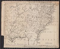
- Creator:
- Clark, J., engraver
Hall, Sidney, engraver
James, Edwin, 1797-1861
Long, Stephen Harriman, 1784-1864
Say, Thomas, 1787-1834
Seymour, Samuel, fl. 1797-1822, ill
United States. War Dept
- Published / Created:
- 1823
- Call Number:
- Zc20 822jab
- Image Count:
- 1
- Found in:
- Beinecke Rare Book and Manuscript Library > Account of an expedition from Pittsburgh to the Rocky Mountains, performed in the years 1819 and 1820 : by order of the Hon. J.C. Calhoun, Secretary of War, under the command of Maj. S.H. Long, of the U.S. Top. Engineers : compiled from the notes of Major Long, Mr. T. Say, and other gentlemen of the party / by Edwin James, botanist and geologist to the expedition ; in three volumes.
- Published / Created:
- 1850-1859.
- Call Number:
- Gimbel/Dickens E113 Set 1
- Image Count:
- 1
- Resource Type:
- Books, Journals & Pamphlets
- Found in:
- Beinecke Rare Book and Manuscript Library > Household words ...
- Creator:
- Spenser, Edmund, 1552?-1599
- Published / Created:
- 1591
- Call Number:
- Ig Sp35 591
- Image Count:
- 1
- Resource Type:
- Books, Journals & Pamphlets
- Found in:
- Beinecke Rare Book and Manuscript Library > Complaints : Containing sundrie small Poemes of the Worlds Vanitie : VVhereof the next page maketh mention.
- Published / Created:
- 1847
- Call Number:
- J571 +847M
- Image Count:
- 1
- Resource Type:
- Books, Journals & Pamphlets
- Found in:
- Beinecke Rare Book and Manuscript Library > Mappæ clavicula : a manuscript treatise on the preparation of pigments, and on various processes of the decorative arts practised during the Middle Ages / communicated to the Society of Antiquaries by Sir Thomas Phillipps.
- Published / Created:
- 1880-
- Call Number:
- Gimbel/Dickens +H673
- Image Count:
- 1
- Resource Type:
- Books, Journals & Pamphlets
- Found in:
- Beinecke Rare Book and Manuscript Library > The pen.
- Creator:
- Dalzel, Archibald
- Published / Created:
- 1793
- Call Number:
- 1997 +192
- Image Count:
- 1
- Resource Type:
- Books, Journals & Pamphlets
- Found in:
- Beinecke Rare Book and Manuscript Library > The history of Dahomy, an inland kingdom of Africa / compiled from authentic memoirs; with an introduction and notes, by Archibald Dalzel, Esq., governor at Cape-Coast Castle.
- Published / Created:
- 1831
- Call Number:
- 1988 482
- Image Count:
- 1
- Resource Type:
- Maps, Atlases & Globes
- Found in:
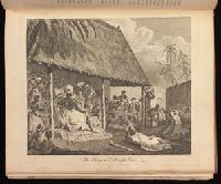
- Beinecke Rare Book and Manuscript Library > Description of a view of Hobart Town, Van Dieman's Land, and the surrounding country : now exhibiting at the Panorama, Strand / painted by the proprietor, Mr. R. Burford.
- Creator:
- Longfellow, Henry Wadsworth, 1807-1882
- Published / Created:
- 1859
- Call Number:
- Za L860 858Ceb
- Image Count:
- 1
- Resource Type:
- Books, Journals & Pamphlets
- Found in:
- Beinecke Rare Book and Manuscript Library > The courtship of Miles Standish, and other poems / by Henry Wadsworth Longfellow ; with twenty-five illustrations by John Gilbert, engraved by the brothers Dalziel.
- Creator:
- Franklin, Benjamin, 1706-1790.
- Published / Created:
- 1751
- Call Number:
- Franklin 467 1751 1
- Image Count:
- 1
- Resource Type:
- Books, Journals & Pamphlets
- Found in:
- Beinecke Rare Book and Manuscript Library > Experiments and observations on electricity made at Philadelphia in America / by Mr. Benjamin Franklin ; and communicated in several letters to Mr. P. Collinson, of London, F.R.S.
- Published / Created:
- [1760?]
- Call Number:
- 76 1760
- Container / Volume:
- BRBL_00443
- Image Count:
- 1
- Resource Type:
- Maps, Atlases & Globes
- Found in:
- Beinecke Rare Book and Manuscript Library > A map of the most inhabited part of New England ...
- Creator:
- Evans, Lewis, 1700?-1756
- Published / Created:
- 1771
- Call Number:
- 755 1771C
- Container / Volume:
- BRBL_00429
- Image Count:
- 1
- Resource Type:
- Maps, Atlases & Globes
- Found in:
- Beinecke Rare Book and Manuscript Library > A general map of the middle British colonies in America : viz. Virginia, Maryland, Delaware, Pensilvania, New-Jersey, New York, Connecticut & Rhode-Island : of Aquanishuonigy the country of the confederate Indians comprehending Aquanishuonigy proper, thei
- Creator:
- Dunn, Samuel, d. 1794
- Published / Created:
- Augst. 17th. 1776.
- Call Number:
- 755 1776F
- Container / Volume:
- BRBL_00430
- Image Count:
- 1
- Resource Type:
- Maps, Atlases & Globes
- Found in:
- Beinecke Rare Book and Manuscript Library > A map of the British empire in North America / by Samuel Dunn, mathematician, improved from the surveys of Capt. Carver.
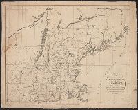
- Published / Created:
- 1771
- Call Number:
- 76 1771
- Container / Volume:
- BRBL_00443
- Image Count:
- 1
- Resource Type:
- Maps, Atlases & Globes
- Found in:
- Beinecke Rare Book and Manuscript Library > A map of the most inhabited part of New England ...
- Published / Created:
- [1767?]
- Call Number:
- 755 1767
- Container / Volume:
- BRBL_00429
- Image Count:
- 1
- Resource Type:
- Maps, Atlases & Globes
- Found in:
- Beinecke Rare Book and Manuscript Library > The British & French Dominions in North America. Particularly showing the French Enroachments through all the British Plantations from Nova Scotia down to the Gulf of Mexico.
- Published / Created:
- 1776
- Call Number:
- 76 1776A
- Container / Volume:
- BRBL_00443
- Image Count:
- 1
- Resource Type:
- Maps, Atlases & Globes
- Found in:
- Beinecke Rare Book and Manuscript Library > Bowles's Map of the Seat of War in New England ...
- Published / Created:
- 1776
- Call Number:
- 755 1776D
- Container / Volume:
- BRBL_00430
- Image Count:
- 1
- Resource Type:
- Maps, Atlases & Globes
- Found in:
- Beinecke Rare Book and Manuscript Library > A map of the Province of New York ... by Claude Joseph Sauthier ... New Jersey ... Engraved by Wm. Faden.
- Published / Created:
- 1771
- Call Number:
- 76 1771
- Container / Volume:
- BRBL_00443
- Image Count:
- 1
- Resource Type:
- Maps, Atlases & Globes
- Found in:
- Beinecke Rare Book and Manuscript Library > A map of the most inhabited part of New England ...
- Published / Created:
- 1768
- Call Number:
- 755 1768A
- Container / Volume:
- BRBL_00429
- Image Count:
- 1
- Resource Type:
- Maps, Atlases & Globes
- Found in:
- Beinecke Rare Book and Manuscript Library > A new and Accurate map of North America drawn ... Mr. D'Anville with improvements from the best English maps ... Also the new divisions according to the late Treaty of Peace by Peter Bell ... Engraved by R.W. Seale.
- Published / Created:
- 1771
- Call Number:
- 755 1771A
- Container / Volume:
- BRBL_00429
- Image Count:
- 1
- Resource Type:
- Maps, Atlases & Globes
- Found in:
- Beinecke Rare Book and Manuscript Library > A new and accurate map of North America, Drawn from the famous Mr. D'Anville with improvements from the best English maps; and engraved by R.W. Seale; Also the New Divisions according to the late treaty of Peace, by Peter Bell Geor.
- Published / Created:
- [1804?]
- Call Number:
- 76 1804
- Container / Volume:
- BRBL_00443
- Image Count:
- 1
- Resource Type:
- Maps, Atlases & Globes
- Found in:
- Beinecke Rare Book and Manuscript Library > Bowles's New one-sheet map of New England; ...
- Published / Created:
- [1776?]
- Call Number:
- 755 1776B
- Container / Volume:
- BRBL_00430
- Image Count:
- 1
- Resource Type:
- Maps, Atlases & Globes
- Found in:
- Beinecke Rare Book and Manuscript Library > The Seat of War in the middle British Colonies. A General map of the middle British Colonies in America ... from Governor Pownall's late map 1776.
- Published / Created:
- 1768
- Call Number:
- 755 1768
- Container / Volume:
- BRBL_00429
- Image Count:
- 1
- Resource Type:
- Maps, Atlases & Globes
- Found in:
- Beinecke Rare Book and Manuscript Library > A new and Accurate map of North America drawn from the famous Mr. D'Anville with improvements from the best English maps ... Also the new divisions according to the late Treaty of Peace by Peter Bell ... Engraved by R.W. Seale.
- Published / Created:
- 1776
- Call Number:
- 755 1776A
- Container / Volume:
- BRBL_00430
- Image Count:
- 1
- Resource Type:
- Maps, Atlases & Globes
- Found in:
- Beinecke Rare Book and Manuscript Library > A General Map of the Southern British Colonies in America, comprehending North and South Carolina, Georgia, East and West Florida, with the Neighboring Indian Countries ... by B. Romans, 1776.
- Creator:
- Robert Sayer and John Bennett (Firm)
- Published / Created:
- 1776
- Call Number:
- 755 1776
- Container / Volume:
- BRBL_00430
- Image Count:
- 1
- Resource Type:
- Maps, Atlases & Globes
- Found in:
- Beinecke Rare Book and Manuscript Library > A general map of the middle British colonies, in America [cartographic material] : Containing Virginia, Maryland, the Delaware counties, Pennsylvania and New Jersey. With the addition of New York, and the greatest part of New England, as also of the borde
- Published / Created:
- 1775
- Call Number:
- 755 1775
- Container / Volume:
- BRBL_00429
- Image Count:
- 1
- Resource Type:
- Maps, Atlases & Globes
- Found in:
- Beinecke Rare Book and Manuscript Library > North America from the French of Mr. D'Anville improved with the English surveys made since the Peace.
- Published / Created:
- 1795
- Call Number:
- 76 1795
- Container / Volume:
- BRBL_00443
- Image Count:
- 1
- Resource Type:
- Maps, Atlases & Globes
- Found in:
- Beinecke Rare Book and Manuscript Library > Map of the Northern, or, New England States of America ... by T. Russell.
- Published / Created:
- 1776
- Call Number:
- 755 1776D
- Container / Volume:
- BRBL_00430
- Image Count:
- 1
- Resource Type:
- Maps, Atlases & Globes
- Found in:
- Beinecke Rare Book and Manuscript Library > A map of the Province of New York ... by Claude Joseph Sauthier ... New Jersey ... Engraved by Wm. Faden.
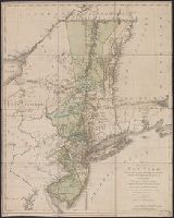
- Published / Created:
- 1776
- Call Number:
- 771 C358 1776C
- Container / Volume:
- BRBL_00482
- Image Count:
- 1
- Resource Type:
- Maps, Atlases & Globes
- Found in:
- Beinecke Rare Book and Manuscript Library > A Survey of Lake Champlain including Lake George, Crown Point, and St. John ... by William Brassier, Draughtsman. 1762.
- Published / Created:
- 1776
- Call Number:
- 771 C358 1776
- Container / Volume:
- BRBL_00482
- Image Count:
- 1
- Resource Type:
- Maps, Atlases & Globes
- Found in:
- Beinecke Rare Book and Manuscript Library > A Survey of Lake Champlain including Lake George, Crown Point, and St. John : surveyed by order of his Excellency major General Sr. Jeffery Amherst ... / by William Brassier, Draughtsman, 1762.
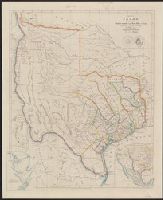
- Creator:
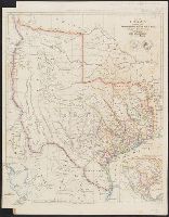
- Arrowsmith, John, 1790-1873
- Published / Created:
- 8th June, 1843.
- Call Number:
- 796 1843B
- Container / Volume:
- BRBL_00524
- Image Count:
- 1
- Resource Type:
- Maps, Atlases & Globes
- Found in:
- Beinecke Rare Book and Manuscript Library > Map of Texas / compiled from surveys recorded in the land office of Texas, and other official surveys, by John Arrowsmith.
- Creator:
- Arrowsmith, John, 1790-1873
- Published / Created:
- Feb.y 1841.
- Call Number:
- 796 1841B
- Container / Volume:
- BRBL_00524
- Image Count:
- 1
- Resource Type:
- Maps, Atlases & Globes
- Found in:
- Beinecke Rare Book and Manuscript Library > Map of Texas / compiled from surveys recorded in the land office of Texas, and other official surveys, by John Arrowsmith.