Skip to search
Skip to main content
Skip to first result
Search
You Searched For
Resource Type
Maps, Atlases & Globes
New Search
Search Results
Creator:
Call Number:
41 1830
Container / Volume:
BRBL_00241
Image Count:
1
Resource Type:
Maps, Atlases & Globes
Found in:
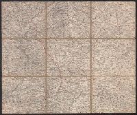
Beinecke Rare Book and Manuscript Library > Grätz.
Call Number:
406 1855
Container / Volume:
BRBL_00236
Image Count:
1
Resource Type:
Maps, Atlases & Globes
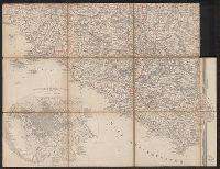
Found in:
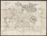
Beinecke Rare Book and Manuscript Library > Pianta Della Campagna Romana Nello Stato Antico e Moderno / To the Right Hon'ble Lord George John Warren Vernon ... this plate is respectfully dedicated by His Lordship's most obed't serv't Luigi Piale ; Domenico Feltrini scrisse ; Augusto Fornari incise,
Creator:
Call Number:
400 1764
Container / Volume:
BRBL_00233
Image Count:
1
Resource Type:
Maps, Atlases & Globes
Found in:
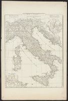
Beinecke Rare Book and Manuscript Library > Tabula Italiae antiquae geographica : quam excellentissimus dominus Dux de la Rochefoucauld in aere incidi curavit / auctor d'Anville ....
Creator:
Call Number:
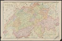
37 1835
Container / Volume:
BRBL_00148
Image Count:
2
Resource Type:
Maps, Atlases & Globes
Found in:
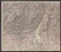
Beinecke Rare Book and Manuscript Library > Karte der Schweiz / von Dr. I. Woerl.
Creator:
Call Number:
37 1835
Container / Volume:
BRBL_00148
Image Count:
2
Resource Type:
Maps, Atlases & Globes
Found in:
Beinecke Rare Book and Manuscript Library > Karte der Schweiz / von Dr. I. Woerl.
Creator:
Call Number:
37 1835
Container / Volume:
BRBL_00148
Image Count:
19
Resource Type:
Maps, Atlases & Globes
Found in:
Beinecke Rare Book and Manuscript Library > Karte der Schweiz / von Dr. I. Woerl.
Creator:
Call Number:
40 1830
Container / Volume:
BRBL_00199
Image Count:
1
Resource Type:
Maps, Atlases & Globes
Found in:
Beinecke Rare Book and Manuscript Library > Rom.
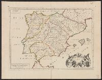
Creator:
Call Number:
390 1640
Container / Volume:
BRBL_00192
Image Count:
1
Resource Type:
Maps, Atlases & Globes
Found in:
Beinecke Rare Book and Manuscript Library > Antiquorum Hispaniae episcopatuum geographica descriptio.
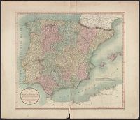
Creator:
Call Number:
39 1852
Collection Title:
[London atlas of universal geography]
Container / Volume:
BRBL_00188
Image Count:
1
Resource Type:
Maps, Atlases & Globes
Found in:
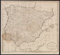
Beinecke Rare Book and Manuscript Library > Spain & Portugal [cartographic material] / by J. Arrowsmith.
Creator:
Call Number:
39 1801
Container / Volume:
BRBL_00186
Image Count:
1
Resource Type:
Maps, Atlases & Globes
Found in:
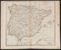
Beinecke Rare Book and Manuscript Library > A new map of Spain and Portugal : divided into their respective kingdoms and provinces from the latest authorities / by John Cary, engraver.
Call Number:
39 1795
Container / Volume:
BRBL_00186
Image Count:
1
Resource Type:
Maps, Atlases & Globes
Found in:
Beinecke Rare Book and Manuscript Library > Spain and Portugal, from the best authorities.
Call Number:
39 1795
Container / Volume:
BRBL_00186
Image Count:
1
Resource Type:
Maps, Atlases & Globes
Found in:
Beinecke Rare Book and Manuscript Library > Spain and Portugal, from the best authorities.
Creator:
Call Number:
3614 1799
Container / Volume:
BRBL_00135
Image Count:
1
Resource Type:
Maps, Atlases & Globes
Found in:
Beinecke Rare Book and Manuscript Library > A new map of the Kingdom of Prussia : with its divisions into provinces and governments ; from the latest authorities / by John Cary, engraver, 1799.
Creator:
Call Number:
38hc P21 1850
Container / Volume:
BRBL_00173
Image Count:
1
Resource Type:
Maps, Atlases & Globes
Found in:
Beinecke Rare Book and Manuscript Library > Paris illustré et ses fortifications / dressé́ par Maillard, geograph.
Creator:
Call Number:
369 1650
Container / Volume:
BRBL_00146
Image Count:
2
Resource Type:
Maps, Atlases & Globes
Found in:
Beinecke Rare Book and Manuscript Library > Turingiae noviss. descript [cartographic material] / per Iohannem Mellinger Halens. Misniae et Lusatiae tabula / descripta à M. Bartholeme̦o, sculteto Gorlit.
Creator:
Call Number:
3635 1752
Collection Title:
Atlas universel
Container / Volume:
BRBL_00142
Image Count:
1
Resource Type:
Maps, Atlases & Globes
Found in:
Beinecke Rare Book and Manuscript Library > Cercle de Basse Saxe : où sont distingués les Etats de Brunswich, les Duchés de Holstien [sic], de Mecklenbourg et des Evêchés d'Hildesheim, et d'Halberstadt / par le Sr. Robert, Géographe ordinaire du Roy. Avec privilege, 1752.
Creator:
Call Number:
3614 1794
Collection Title:
New universal atlas.
Container / Volume:
BRBL_00135
Image Count:
1
Resource Type:
Maps, Atlases & Globes
Found in:
Beinecke Rare Book and Manuscript Library > The kingdom of Prussia, and its newly incorporated province of Polish Prussia now named Western Prussia : with the territory of Dantzick / by John Roberts, Geographer.
Creator:
Call Number:
361 1817
Container / Volume:
BRBL_00135
Image Count:
1
Resource Type:
Maps, Atlases & Globes
Found in:
Beinecke Rare Book and Manuscript Library > Prussian Dominions / drawn and engraved for Thomson's New General atlas.
Creator:
Call Number:
36 R34 1699
Container / Volume:
BRBL_00126
Image Count:
1
Resource Type:
Maps, Atlases & Globes
Found in:
Beinecke Rare Book and Manuscript Library > Exactissima Tabula Sedis Belli Palatinatus ad Rhenum : Vormaciensis et Spirensis Episcopatus Bipontini ducatus. sed etiam plurimae Moguntini Archiepiscopatus, et aliae adjacentes et insertae Regiones, distincté ostenduntur / per Nic. Visscher.
Creator:
Call Number:
36 1794B
Container / Volume:
BRBL_00119
Image Count:
2
Resource Type:
Maps, Atlases & Globes
Found in:
Beinecke Rare Book and Manuscript Library > Map of the Empire of Germany : including all the states comprehended under that name: with the Kingdom of Prussia, &c. / by L. Delarochette ; T. Kitchin sculpt.
Creator:
Call Number:
36 1792
Container / Volume:
BRBL_00118
Image Count:
1
Resource Type:
Maps, Atlases & Globes
Found in:
Beinecke Rare Book and Manuscript Library > Carte de l'empire d'Allemagne : dessinée d'après les cartes nationales et assujetties aux observations astronomiques par Robert de Vaugondy ; corrigée et divisée en IX cercles, suivant les divisions politiques actuelles, avec les parties adjacentes et
Creator:
Call Number:
36 1706
Container / Volume:
BRBL_00117
Image Count:
1
Resource Type:
Maps, Atlases & Globes
Found in:
Beinecke Rare Book and Manuscript Library > Archiepiscopatus ac Electoratus Trevirensis Ditio [cartographic material] : in ejusdem praefecturas et alias subjacentes ditiones, una cum adjacentibus / per Nicolaum Visscher ; G. v. Gouwen, schulp.
Creator:
Call Number:
3531 Oc56 1737
Container / Volume:
BRBL_00111
Image Count:
1
Resource Type:
Maps, Atlases & Globes
Found in:
Beinecke Rare Book and Manuscript Library > Ichnographia munitissimae Arcis Otchakow quae Anno 1737 die 3 Iulij auspiciis Supremi Campi Mareschalli Comitis de Münnich ab exercitu Russorum vi occupata / aeri incisa et excusa â M. Seuttero, S.C. et R. Cath. M. Geogr.
Creator:
Call Number:
35 1587
Container / Volume:
BRBL_00099
Image Count:
2
Resource Type:
Maps, Atlases & Globes
Found in:
Beinecke Rare Book and Manuscript Library > Rvssiae, Moscoviae et Tartariae descriptio / auctore Antonio Ienkensono, Anglo ; edita Londini anno 1562 et dedicate illus. Fris. D. Henrico Sijdneo Walliei presidi.
Creator:
Call Number:
35 1562
Container / Volume:
BRBL_00099
Image Count:
1
Resource Type:
Maps, Atlases & Globes
Found in:
Beinecke Rare Book and Manuscript Library > Rvssiae, Moscoviae et Tartariae descriptio / auctore Antonio Ienkensono, Anglo ; edita Londini anno 1562 et dedicate illus. Fris. D. Henrico Sijdneo Walliei presidi.
Creator:
Published / Created:
n.d.]
Call Number:
345 1941
Container / Volume:
BRBL_00096
Image Count:
2
Resource Type:
Maps, Atlases & Globes
Found in:
Beinecke Rare Book and Manuscript Library > Svenska Turistföreningens översiktskarta över Sverige [cartographic material] / Redigerad av Carl-Julius Anrick, Magnus Lundqvist.
Creator:
Call Number:
3324 1650
Container / Volume:
BRBL_00081
Image Count:
1
Resource Type:
Maps, Atlases & Globes
Found in:
Beinecke Rare Book and Manuscript Library > Transisalania Provincia : vulgo Over-Yssel / Aucto r N. Ten-Have Sch. Zwol. Conrect. ; edita vero per Nicolaum Visscher.
Call Number:
3321 1680
Container / Volume:
BRBL_00081
Image Count:
1
Resource Type:
Maps, Atlases & Globes
Found in:
Beinecke Rare Book and Manuscript Library > Tabulae Dominii Groeningae quae et. ... Drentiae Emendata A.F. De Wit.
Creator:
Call Number:
32fbc 1885
Container / Volume:
BRBL_00075
Image Count:
1
Resource Type:
Maps, Atlases & Globes
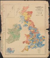
Found in:
Beinecke Rare Book and Manuscript Library > Stanford's Parliamentary election map of the British Isles : shewing the counties, divisions of counties & boroughs according to the Redistribution of Seats Act, 1885 / edited by E. Shaw Lefevre.
Creator:
Call Number:
3243 1690
Container / Volume:
BRBL_00066
Image Count:
1
Resource Type:
Maps, Atlases & Globes
Found in:
Beinecke Rare Book and Manuscript Library > Cambridge shire / Sutton Nicholls sculp.
Creator:
Call Number:
32 L84 1888
Container / Volume:
BRBL_00051
Image Count:
1
Resource Type:
Maps, Atlases & Globes
Found in:
Beinecke Rare Book and Manuscript Library > Environs of London.
Creator:
Call Number:
32 L84 1879
Container / Volume:
BRBL_00051
Image Count:
1
Resource Type:
Maps, Atlases & Globes
Found in:
Beinecke Rare Book and Manuscript Library > Reduced ordnance map of London.
Creator:
Call Number:
32 L84 1766
Container / Volume:
BRBL_00048
Image Count:
1
Resource Type:
Maps, Atlases & Globes
Found in:
Beinecke Rare Book and Manuscript Library > A new plan of the city and liberty of Westminster ... / drawn & engraved by Thomas Jefferys ...
Creator:
Call Number:
30fb 1720
Container / Volume:
BRBL_00037B
Image Count:
1
Resource Type:
Maps, Atlases & Globes
Found in:
Beinecke Rare Book and Manuscript Library > The noble play of ye heraldry and geography of Europe = Le noble jeu des armories de l'Europe enrichy de cartes geographiques.
Creator:
Call Number:
30 1840B
Container / Volume:
BRBL_00031
Image Count:
1
Resource Type:
Maps, Atlases & Globes
Found in:
Beinecke Rare Book and Manuscript Library > Constanz.
Creator:
Published / Created:
[n.d.]
Call Number:
30 1920E
Container / Volume:
BRBL_00032A
Image Count:
2
Resource Type:
Maps, Atlases & Globes
Found in:
Beinecke Rare Book and Manuscript Library > Rand McNally standard map of Europe.
Creator:
Call Number:
30 1939
Container / Volume:
BRBL_00032B
Image Count:
1
Resource Type:
Maps, Atlases & Globes
Found in:
Beinecke Rare Book and Manuscript Library > Mittel- und Nordeuropa.
Creator:
Call Number:
304 1712
Container / Volume:
BRBL_00033
Image Count:
1
Resource Type:
Maps, Atlases & Globes
Found in:
Beinecke Rare Book and Manuscript Library > A new map of Germany, Hungary, Transilvania & the Suisse cantons : with many remarks not extant in any map : according to ye newest and most exact observations / by Herman Moll, geographer.
Creator:
Call Number:
303cea 1680
Container / Volume:
BRBL_00033
Image Count:
1
Resource Type:
Maps, Atlases & Globes
Found in:
Beinecke Rare Book and Manuscript Library > Nieuwe groote paskaart van de geheele Noord-Zee : vertoonende in sig alle de rivieren, havens, baye, dieptens daar in geleegen = The new sea map of the whole North Sea : sheuwing all the rivers,, harbours, bays et havens et dephts, et showles = Nouvelle c
Creator:
Call Number:
11hc 1917Q
Container / Volume:
BRBL_00010E
Image Count:
1
Resource Type:
Maps, Atlases & Globes
Found in:
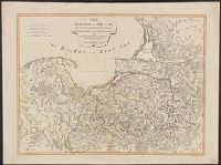
Beinecke Rare Book and Manuscript Library > Stanford's half-inch map of the battle front between the Somme and Soissons.
Creator:
Call Number:
232cea H56 1884
Container / Volume:
BRBL_00021
Image Count:
1
Resource Type:
Maps, Atlases & Globes
Found in:
Beinecke Rare Book and Manuscript Library > Hilo Bay, Hawaii / from a trigonometrical survey by C.J. Lyons ; hydrography by Lieut. G.E.G. Jackson, outise of reef from U.S. charts ; W.A. Wall, del.
Creator:
Call Number:
23cea 1886
Container / Volume:
BRBL_00021
Image Count:
2
Resource Type:
Maps, Atlases & Globes
Found in:
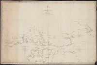
Beinecke Rare Book and Manuscript Library > Western Pacific. Chart No. 2 / compiled by James F. Imray F.R.G.S.
Creator:
Call Number:
23cea 1884
Container / Volume:
BRBL_00021
Image Count:
2
Resource Type:
Maps, Atlases & Globes
Found in:
Beinecke Rare Book and Manuscript Library > South and east coasts of Australia [in four charts]. Chart no. 2, Cape Northumberland to Cape Howe / compiled by James F. Imray F.R.G.S.
Creator:
Call Number:
23cea 1858
Container / Volume:
BRBL_00021
Image Count:
1
Resource Type:
Maps, Atlases & Globes
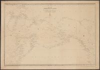
Found in:
Beinecke Rare Book and Manuscript Library > Karta Ledovitago mori︠a︡ i Vostochnago okeana / sostavlena s novi︠e︡ĭshikh opiseĭ v Geograficheskom departamenti︠e︡ Morskago ministerstva.
Creator:
Call Number:
217 1635
Image Count:
1
Resource Type:
Maps, Atlases & Globes
Found in:
Beinecke Rare Book and Manuscript Library > Mappa Aestivarum insularum, alias Barmudas dictarum : ad ostia Mexicani aestuarij jacentium in latitudine graduum 32 minutorum 25 ab Anglia, Londino scilicet versus Libonotum 3300 miliaribus Anglicanis, et a Roanoack (qui locus est in Virginia) versus Eur
Creator:
Call Number:
13 1873A
Container / Volume:
BRBL_00011
Image Count:
1
Resource Type:
Maps, Atlases & Globes
Found in:
Beinecke Rare Book and Manuscript Library > Map of the countries between England & India : designed to shew the over-land and sea-routes to the east, and the relative position of Russia to England & Hindostan / by James Wyld.
Creator:
Call Number:
13 1761
Container / Volume:
BRBL_00011
Image Count:
1
Resource Type:
Maps, Atlases & Globes
Found in:
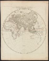
Beinecke Rare Book and Manuscript Library > Heḿisphère oriental ou de l'ancien monde : publié sous les auspices de Monseigneur Louis Philippe duc d'Orléans, prémier prince du sang / par le Sr. d'Anville, de l'Académie Royales des Belles-Lettres, et de celles des sc̨iences de Pétersbourg ...
Creator:
Call Number:
11 1784
Container / Volume:
BRBL_00006
Image Count:
1
Resource Type:
Maps, Atlases & Globes
Found in:
Beinecke Rare Book and Manuscript Library > Carte réduite des parties connues du globe terrestre : dressée au dépost des cartes plans et journaux de la marine pour le service des vaisseaux du roy / par ordre de M. de Machault ... MDCCLV.
Creator:
Call Number:
18 1896
Container / Volume:
BRBL_00013
Image Count:
2
Resource Type:
Maps, Atlases & Globes
Found in:
Beinecke Rare Book and Manuscript Library > The arctic regions : with the tracks of search parties and the progress of discovery / compiled from the latest information; published at Washington, D.C., Apr. 1896, at the Hydrographic Office, Charles D. Sigsbee, Commander, U.S.N. Hydrographer
Creator:
Call Number:
18cea 1852
Container / Volume:
BRBL_00013
Image Count:
1
Resource Type:
Maps, Atlases & Globes
Found in:
Beinecke Rare Book and Manuscript Library > Discoveries in the Arctic Sea up to MDCCCLI.
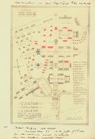
Published / Created:
1918
Call Number:
RG 14
Collection Title:
Archives of the Trustees of Lingnan University
Container / Volume:
Box 51 | Folder 573
Image Count:
1
Resource Type:
Maps, Atlases & Globes
Found in:
Yale Divinity Library > Architect's Map of Campus
Creator:
Call Number:
28 1832
Container / Volume:
BRBL_00023E
Image Count:
1
Resource Type:
Maps, Atlases & Globes
Found in:
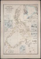
Beinecke Rare Book and Manuscript Library > Reduzirte Karte von den Philippinen und den Sulu Inseln : den Manen Don Alexandro's Malaspina und Don Espinoza y Tello's, so wie dem Obersten Don Aldefonso de Aragon ... / Gest. v. Selmar Siebert.
Creator:
Call Number:
30 1610
Container / Volume:
BRBL_00029
Image Count:
1
Resource Type:
Maps, Atlases & Globes
Found in:
Beinecke Rare Book and Manuscript Library > Europa, ad magnae Europae Gerardi Mercatoris P. imitationem / Rumoldi Mercatoris F. cura, edita ...
Creator:
Published / Created:
before 1835
Call Number:
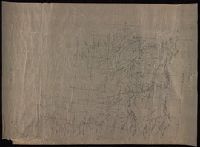
WA MSS S-2687
Collection Title:
Washington Hood papers
Container / Volume:
5 Broadside
Image Count:
1
Resource Type:
Maps, Atlases & Globes
Found in:
Beinecke Rare Book and Manuscript Library > Manuscript map of Nebraska and Iowa
Creator:
Published / Created:
June 1923
Call Number:
766 N83 1922
Image Count:
2
Resource Type:
Maps, Atlases & Globes
Found in:
Beinecke Rare Book and Manuscript Library > Insurance maps of Norwalk, Connecticut., Insurance maps of Norwalk, Connecticut: [New sheets].
Creator:
Published / Created:
December 1923
Call Number:
766 B76 1913
Image Count:
3
Resource Type:
Maps, Atlases & Globes
Found in:
Beinecke Rare Book and Manuscript Library > Insurance maps of Bridgeport, Connecticut., Insurance maps of Bridgeport, Connecticut: [New and additional sheets].
Creator:
Published / Created:
May 1918
Call Number:
766 W29 1901
Image Count:
3
Resource Type:
Maps, Atlases & Globes
Found in:
Beinecke Rare Book and Manuscript Library > Insurance maps of Waterbury, New Haven Co., Connecticut., Insurance maps of Waterbury, New Haven Co., Connecticut: [New and additional sheets].
Creator:
Published / Created:
January 1918
Call Number:
766 St22 1901
Image Count:
4
Resource Type:
Maps, Atlases & Globes
Found in:
Beinecke Rare Book and Manuscript Library > Insurance maps of Stamford, Fairfield Co., Connecticut., Insurance maps of Stamford, Fairfield Co., Connecticut: [New and additional sheets].
Creator:
Published / Created:
September 1916
Call Number:
766 St22 1901
Image Count:
4
Resource Type:
Maps, Atlases & Globes
Found in:
Beinecke Rare Book and Manuscript Library > Insurance maps of Stamford, Fairfield Co., Connecticut., Insurance maps of Stamford, Fairfield Co., Connecticut: [New and additional sheets].
Creator:
Published / Created:
August 1917
Call Number:
766 N46 1901
Image Count:
2
Resource Type:
Maps, Atlases & Globes
Found in:
Beinecke Rare Book and Manuscript Library > Insurance maps of New Haven, Connecticut., Insurance maps of New Haven, Connecticut: [New and additional sheets].
Creator:
Published / Created:
July 1921
Call Number:
766 N42 1909
Image Count:
2
Resource Type:
Maps, Atlases & Globes
Found in:
Beinecke Rare Book and Manuscript Library > Insurance maps of New Britain, Hartford County, Connecticut., Insurance maps of New Britain, Hartford County, Connecticut: [New and additional sheets].
Creator:
Published / Created:
December 1921
Call Number:
766 M54 1901
Image Count:
2
Resource Type:
Maps, Atlases & Globes
Found in:
Beinecke Rare Book and Manuscript Library > Insurance maps of Meriden, New Haven, Connecticut., Insurance maps of Meriden, New Haven, Connecticut: [New and additional sheets].
Creator:
Published / Created:
1920
Call Number:
766 H26 1900
Image Count:
5
Resource Type:
Maps, Atlases & Globes
Found in:
Beinecke Rare Book and Manuscript Library > Insurance maps of Hartford, Connecticut., Insurance maps of Hartford, Connecticut: [New and additional sheets].
Creator:
Published / Created:
May 1918
Call Number:
766 H26 1900
Image Count:
7
Resource Type:
Maps, Atlases & Globes
Found in:
Beinecke Rare Book and Manuscript Library > Insurance maps of Hartford, Connecticut., Insurance maps of Hartford, Connecticut: [New and additional sheets].
Creator:
Published / Created:
1916
Call Number:
766 H26 1900
Image Count:
2
Resource Type:
Maps, Atlases & Globes
Found in:
Beinecke Rare Book and Manuscript Library > Insurance maps of Hartford, Connecticut., Insurance maps of Hartford, Connecticut: [Additional sheets].
Creator:
Published / Created:
May 1922
Call Number:
766 B76 1913
Image Count:
4
Resource Type:
Maps, Atlases & Globes
Found in:
Beinecke Rare Book and Manuscript Library > Insurance maps of Bridgeport, Connecticut., Insurance maps of Bridgeport, Connecticut: [New sheets].
Creator:
Published / Created:
1918
Call Number:
766 B76 1913
Image Count:
3
Resource Type:
Maps, Atlases & Globes
Found in:
Beinecke Rare Book and Manuscript Library > Insurance maps of Bridgeport, Connecticut., Insurance maps of Bridgeport, Connecticut: [Additional sheets].
Creator:
Published / Created:
December 1921
Call Number:
766 St22 1901
Image Count:
1
Resource Type:
Maps, Atlases & Globes
Found in:
Beinecke Rare Book and Manuscript Library > Insurance maps of Stamford, Fairfield Co., Connecticut., Insurance maps of Stamford, Fairfield Co., Connecticut: [Additional sheet].
Creator:
Published / Created:
Oct. 1916
Call Number:
766 N42 1909
Image Count:
1
Resource Type:
Maps, Atlases & Globes
Found in:
Beinecke Rare Book and Manuscript Library > Insurance maps of New Britain, Hartford County, Connecticut., Insurance maps of New Britain, Hartford County, Connecticut: [Additional sheet].
Creator:
Published / Created:
Oct. 1919
Call Number:
766 M54 1901
Image Count:
1
Resource Type:
Maps, Atlases & Globes
Found in:
Beinecke Rare Book and Manuscript Library > Insurance maps of Meriden, New Haven, Connecticut., Insurance maps of Meriden, New Haven, Connecticut: [Additional sheet].
Creator:
Published / Created:
June 1920
Call Number:
766 B76 1913
Image Count:
2
Resource Type:
Maps, Atlases & Globes
Found in:
Beinecke Rare Book and Manuscript Library > Insurance maps of Bridgeport, Connecticut., Insurance maps of Bridgeport, Connecticut: [Additional sheet].
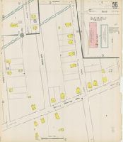
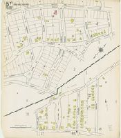
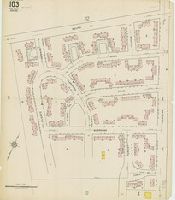
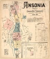
Creator:
Published / Created:
1884
Call Number:
766 An81 1884
Image Count:
8
Resource Type:
Maps, Atlases & Globes
Found in:
Beinecke Rare Book and Manuscript Library > Ansonia, Conn.
Creator:
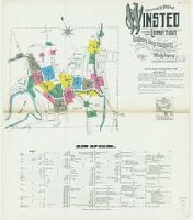
Published / Created:
1931
Call Number:
766 W73 1931
Image Count:
23
Resource Type:
Maps, Atlases & Globes
Found in:
Beinecke Rare Book and Manuscript Library > Winsted, Litchfield County, Connecticut.
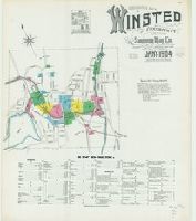
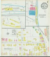
Creator:
Published / Created:
1919
Call Number:
766 W73 1919
Image Count:
22
Resource Type:
Maps, Atlases & Globes
Found in:
Beinecke Rare Book and Manuscript Library > Winsted, Litchfield County, Connecticut.
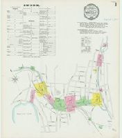
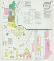
Creator:
Published / Created:
1909
Call Number:
766 W73 1909
Image Count:
18
Resource Type:
Maps, Atlases & Globes
Found in:
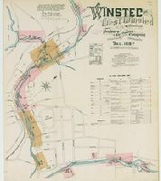
Beinecke Rare Book and Manuscript Library > Insurance maps of Winsted, Litchfield County, Connecticut.
Creator:
Published / Created:
1904
Call Number:
766 W73 1904
Image Count:
13
Resource Type:
Maps, Atlases & Globes
Found in:
Beinecke Rare Book and Manuscript Library > Insurance maps of Winsted, Litchfield County, Connecticut.
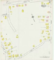
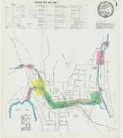
Creator:
Published / Created:
1897
Call Number:
766 W73 1897
Image Count:
9
Resource Type:
Maps, Atlases & Globes
Found in:
Beinecke Rare Book and Manuscript Library > Winsted and West Winsted, Connecticut.
Creator:
Published / Created:
1892
Call Number:
766 W73 1892
Image Count:
7
Resource Type:
Maps, Atlases & Globes
Found in:
Beinecke Rare Book and Manuscript Library > Winsted and West Winsted, Connecticut.
Creator:
Published / Created:
1887
Call Number:
766 W73 1887
Image Count:
6
Resource Type:
Maps, Atlases & Globes
Found in:
Beinecke Rare Book and Manuscript Library > Winsted and West Winsted, Connecticut.
Creator:
Published / Created:
1925
Call Number:
766 W728 1925
Image Count:
7
Resource Type:
Maps, Atlases & Globes
Found in:
Beinecke Rare Book and Manuscript Library > Windsor Locks, Hartford County, Connecticut.
Creator:
Published / Created:
1912
Call Number:
766 W728 1912
Image Count:
6
Resource Type:
Maps, Atlases & Globes
Found in:
Beinecke Rare Book and Manuscript Library > Windsor Locks, Hartford County, Connecticut.
Creator:
Published / Created:
1905
Call Number:
766 W728 1905
Image Count:
3
Resource Type:
Maps, Atlases & Globes
Found in:
Beinecke Rare Book and Manuscript Library > Windsor Locks, Hartford Co., Connecticut.
Creator:
Published / Created:
1897
Call Number:
766 W728 1897
Image Count:
2
Resource Type:
Maps, Atlases & Globes
Found in:
Beinecke Rare Book and Manuscript Library > Windsor Locks, Hartford Co., Conn.
Creator:
Published / Created:
1892
Call Number:
766 W728 1892
Image Count:
2
Resource Type:
Maps, Atlases & Globes
Found in:
Beinecke Rare Book and Manuscript Library > Windsor Locks, Hartford Co., Conn.
Creator:
Published / Created:
1885
Call Number:
766 W728 1885
Image Count:
2
Resource Type:
Maps, Atlases & Globes
Found in:
Beinecke Rare Book and Manuscript Library > Windsor Locks, Conn.
Creator:
Published / Created:
1927
Call Number:
766 W725 1927
Image Count:
11
Resource Type:
Maps, Atlases & Globes
Found in:
Beinecke Rare Book and Manuscript Library > Windsor, Hartford County, Connecticut.
Creator:
Published / Created:
1921
Call Number:
766 W725 1921
Image Count:
9
Resource Type:
Maps, Atlases & Globes
Found in:
Beinecke Rare Book and Manuscript Library > Windsor, Hartford County, Connecticut.
Creator:
Published / Created:
1924
Call Number:
766 W677 1924
Image Count:
26
Resource Type:
Maps, Atlases & Globes
Found in:
Beinecke Rare Book and Manuscript Library > Willimantic, including South Coventry, Storrs, South Windham, and Mansfield Center, Windham County, Connecticut.
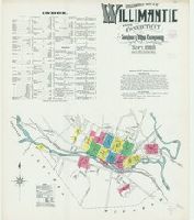
Creator:
Published / Created:
1914
Call Number:
766 W677 1914
Image Count:
19
Resource Type:
Maps, Atlases & Globes
Found in:
Beinecke Rare Book and Manuscript Library > Insurance maps of Willimantic, Windham County, Connecticut.
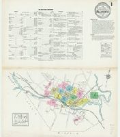
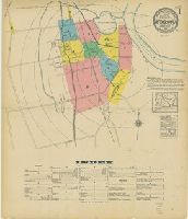
Creator:
Published / Created:
1908
Call Number:
766 W677 1908
Image Count:
15
Resource Type:
Maps, Atlases & Globes
Found in:
Beinecke Rare Book and Manuscript Library > Insurance maps of Willimantic, Windham County, Connecticut.
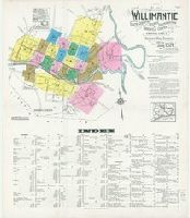
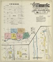
Creator:
Published / Created:
1903
Call Number:
766 W677 1903
Image Count:
14
Resource Type:
Maps, Atlases & Globes
Found in:
Beinecke Rare Book and Manuscript Library > Insurance maps of Willimantic, Windham County, Connecticut.
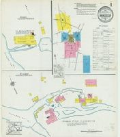
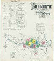
Creator:
Published / Created:
1897
Call Number:
766 W677 1897
Image Count:
11
Resource Type:
Maps, Atlases & Globes
Found in:
Beinecke Rare Book and Manuscript Library > Insurance maps of Willimantic, Windham Co., Conn.
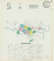
Creator:
Published / Created:
1892
Call Number:
766 W677 1892
Image Count:
10
Resource Type:
Maps, Atlases & Globes
Found in:
Beinecke Rare Book and Manuscript Library > Insurance maps of Willimantic, Windham Co., Connecticut.
Creator:
Published / Created:
1887
Call Number:
766 W677 1887
Image Count:
7
Resource Type:
Maps, Atlases & Globes
Found in:
Beinecke Rare Book and Manuscript Library > Willimantic, Connecticut.
Creator:
Published / Created:
1930
Call Number:
766 W53 1930
Image Count:
18
Resource Type:
Maps, Atlases & Globes
Found in:
Beinecke Rare Book and Manuscript Library > Wethersfield, Hartford County Connecticut.
Creator:
Published / Created:
1922
Call Number:
766 W53 1922
Image Count:
11
Resource Type:
Maps, Atlases & Globes
Found in:
Beinecke Rare Book and Manuscript Library > Wethersfield, Hartford County Connecticut.
Creator:
Published / Created:
1940
Call Number:
766 W5281 1940
Image Count:
22
Resource Type:
Maps, Atlases & Globes
Found in:
Beinecke Rare Book and Manuscript Library > Insurance maps of Westport, Fairfield County, Connecticut.
Creator:
Published / Created:
1931
Call Number:
766 W527 1931
Image Count:
15
Resource Type:
Maps, Atlases & Globes
Found in:
Beinecke Rare Book and Manuscript Library > Westport, Fairfield County, Connecticut.
Creator:
Published / Created:
1923
Call Number:
766 W527 1923
Image Count:
12
Resource Type:
Maps, Atlases & Globes
Found in:
Beinecke Rare Book and Manuscript Library > Westport, Fairfield County, Connecticut.
Creator:
Published / Created:
1910
Call Number:
766 W527 1910
Image Count:
7
Resource Type:
Maps, Atlases & Globes
Found in:
Beinecke Rare Book and Manuscript Library > Westport, Fairfield County, Connecticut.
Branch:v1.60.98 ,Deployed:2024-05-18T20:59:25-04:00