Search
You Searched For
Search Results
- Published / Created:
- 1776
- Call Number:
- 771hc C358 1776
- Container / Volume:
- BRBL_00495
- Image Count:
- 1
- Resource Type:
- Maps, Atlases & Globes
- Found in:
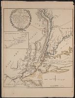
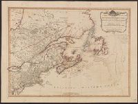
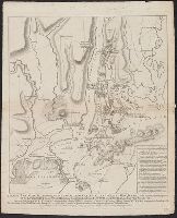
- Beinecke Rare Book and Manuscript Library > The attack and defeat of the American Fleet under Benedict Arnold by the King's Fleet Champlain by Captn. Thos. Pringle upon Lake Champlain the 11th. of Oct. 1776. From a sketch taken by an officer on the spot.
- Published / Created:
- 1776
- Call Number:
- 771hc 1776B
- Container / Volume:
- BRBL_00495
- Image Count:
- 1
- Resource Type:
- Maps, Atlases & Globes
- Found in:
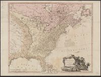
- Beinecke Rare Book and Manuscript Library > The Seat of Action between the British and American Forces ... the Western part of Long Island ... Staten Island ... Amboy and New York ... Hudson's river from Courtland to Sandy Hook .... Surveys of Major Holland.
- Published / Created:
- 1784
- Call Number:
- 771hc H864 1777A
- Container / Volume:
- BRBL_00495
- Image Count:
- 1
- Resource Type:
- Maps, Atlases & Globes
- Found in:
- Beinecke Rare Book and Manuscript Library > Plan of the attack of the forts Clinton & Montgomery, upon Hudson's river, which were stormed by his majesty's forces, under the command of Sir Henry Clinton, K.B., on the 6th of Octr., 1777. Drawn from the surveys of Verplank, Holland & Metcalfe. By John
- Published / Created:
- 1776
- Call Number:
- 792cea Am32 1776
- Container / Volume:
- BRBL_00519
- Image Count:
- 1
- Resource Type:
- Maps, Atlases & Globes
- Found in:
- Beinecke Rare Book and Manuscript Library > A Plan of Amelia Harbour and Barr in east Florida ...
- Creator:
- Jefferys, Thomas, d. 1771
- Published / Created:
- 1794
- Call Number:
- 795cea 1794
- Container / Volume:
- BRBL_00523
- Image Count:
- 1
- Resource Type:
- Maps, Atlases & Globes
- Found in:
- Beinecke Rare Book and Manuscript Library > The western coast of Louisiana and the coast of New Leon / by Thos. Jefferys, geographer to His Majesty.
- Creator:
- Jefferys, Thomas, -1771
- Published / Created:
- 20 Feby., 1775.
- Call Number:
- 792cea 1775C
- Container / Volume:
- BRBL_00519
- Image Count:
- 1
- Resource Type:
- Maps, Atlases & Globes
- Found in:
- Beinecke Rare Book and Manuscript Library > The island of Cuba with part of the Bahama banks & the Martyrs / by Thos. Jefferys.
- Creator:
- Scott, Shafto
- Published / Created:
- [ca. 1883]
- Call Number:
- Gimbel/Dickens C145
- Image Count:
- 1
- Found in:
- Beinecke Rare Book and Manuscript Library > My unknown friend : a drama, in three acts / by Shafto Scott ; being a dramatized version of the novel "Great expectations" by the late Charles Dickens.
- Creator:
- Lewis, Samuel, 1753 or 1754-1822
- Published / Created:
- 1814
- Call Number:
- 80 1814
- Container / Volume:
- BRBL_00532
- Image Count:
- 1
- Resource Type:
- Maps, Atlases & Globes
- Found in:
- Beinecke Rare Book and Manuscript Library > A map of Lewis and Clark's track across the western portion of North America, from the Mississippi to the Pacific Ocean : by order of the executive of the United States in 1804, 5 & 6 / copied by Samuel Lewis from the original drawing of Wm. Clark ; Neele
- Creator:
- Ross, Lieut
- Published / Created:
- 1 June 1775.
- Call Number:
- 807 1775
- Container / Volume:
- BRBL_00550
- Image Count:
- 1
- Resource Type:
- Maps, Atlases & Globes
- Found in:
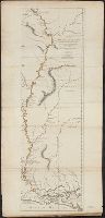
- Beinecke Rare Book and Manuscript Library > Course of the river Mississippi from the Balise to Fort Chartres : taken on an expedition to the Illinois, in the latter end of the year 1765 / by Lieut. Ross of the 34th Regiment ; improved from the surveys of the river made by the French.
- Creator:
- Ross, Lieut
- Published / Created:
- 1 June 1775.
- Call Number:
- 807 1775A
- Container / Volume:
- BRBL_00550
- Image Count:
- 1
- Resource Type:
- Maps, Atlases & Globes
- Found in:
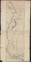
- Beinecke Rare Book and Manuscript Library > Course of the river Mississippi from the Balise to Fort Chartres : taken on an expedition to the Illinois, in the latter end of the year 1765 / by Lieut. Ross of the 34th Regiment ; improved from the surveys of the river made by the French.
- Creator:
- Ross, Lieut
- Published / Created:
- 1 June 1775.
- Call Number:
- 807 1775A
- Container / Volume:
- BRBL_00550
- Image Count:
- 1
- Resource Type:
- Maps, Atlases & Globes
- Found in:
- Beinecke Rare Book and Manuscript Library > Course of the river Mississippi from the Balise to Fort Chartres : taken on an expedition to the Illinois, in the latter end of the year 1765 / by Lieut. Ross of the 34th Regiment ; improved from the surveys of the river made by the French.
- Published / Created:
- 1775
- Call Number:
- 966 1775
- Container / Volume:
- BRBL_00676
- Image Count:
- 1
- Resource Type:
- Maps, Atlases & Globes
- Found in:
- Beinecke Rare Book and Manuscript Library > A chart of the Straits of Magellan. Inlarged from a chart published at Madrid in 1769, by Don Juan de la Cruz Cano y Olmedilla ... and improved from the observations and surveys of Captns. Byron, Wallis and Carteret ...
- Creator:
- Edward Stanford Ltd
- Published / Created:
- [1912?]
- Call Number:
- 96 1912
- Container / Volume:
- BRBL_00676
- Image Count:
- 1
- Resource Type:
- Maps, Atlases & Globes
- Found in:
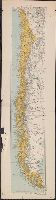
- Beinecke Rare Book and Manuscript Library > Chile.
- Published / Created:
- [1920?].
- Call Number:
- 911 1920
- Container / Volume:
- BRBL_00669
- Image Count:
- 1
- Resource Type:
- Maps, Atlases & Globes
- Found in:
- Beinecke Rare Book and Manuscript Library > Official map of Brazil / by Joao Chrockatt de Sa, John Pereira de Castro and Eduardo A.G. Thompson.
- Published / Created:
- 1900
- Call Number:
- 935 1900
- Container / Volume:
- BRBL_00674
- Image Count:
- 1
- Resource Type:
- Maps, Atlases & Globes
- Found in:
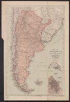
- Beinecke Rare Book and Manuscript Library > Map of Argentina and adjoining states : to illustrate "Argentina" by W.A. Hirst.
- Published / Created:
- 1755
- Call Number:
- 97 L62 1755
- Container / Volume:
- BRBL_00678
- Image Count:
- 1
- Resource Type:
- Maps, Atlases & Globes
- Found in:
- Beinecke Rare Book and Manuscript Library > A Scenographic Plan of the City of the Kings, otherwise called Lima, the capital of the Kingdonm of Peru ... as it was before the late earthquakes.
- Published / Created:
- 1849
- Call Number:
- 844cea 1849
- Container / Volume:
- BRBL_00613
- Image Count:
- 1
- Resource Type:
- Maps, Atlases & Globes
- Found in:
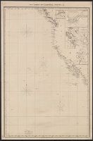
- Beinecke Rare Book and Manuscript Library > The coasts of California, Oregon, &c.
- Published / Created:
- 1873
- Call Number:
- 9713 1873
- Container / Volume:
- BRBL_00678
- Image Count:
- 1
- Resource Type:
- Maps, Atlases & Globes
- Found in:
- Beinecke Rare Book and Manuscript Library > Mapa del Peru, Departamento de Anchachs : con la nueva provincia Dos de Mayo del Departo. de Huanuco / por A. Raimondi.
- Published / Created:
- 1798
- Call Number:
- 27cea 1798
- Container / Volume:
- BRBL_00700
- Image Count:
- 1
- Resource Type:
- Maps, Atlases & Globes
- Found in:
- Beinecke Rare Book and Manuscript Library > A New Chart of the Eastern Straits or the Straits of the East of Java, with a part of the Banda Sea; corrected and improved chiefly from the observation of Captn. - Williams.
- Published / Created:
- 1738
- Call Number:
- 583 1738
- Container / Volume:
- BRBL_00707
- Image Count:
- 1
- Resource Type:
- Maps, Atlases & Globes
- Found in:
- Beinecke Rare Book and Manuscript Library > Part of Malaya. Part of Tanasary.
- Published / Created:
- 1787
- Call Number:
- 21 1787
- Container / Volume:
- BRBL_00724
- Image Count:
- 1
- Resource Type:
- Maps, Atlases & Globes
- Found in:
- Beinecke Rare Book and Manuscript Library > The Atlantic Ocean / by Governor Pownall F.R.S.
- Published / Created:
- 1797
- Call Number:
- 70 1797
- Container / Volume:
- BRBL_00725
- Image Count:
- 1
- Resource Type:
- Maps, Atlases & Globes
- Found in:
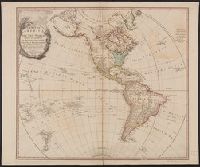
- Beinecke Rare Book and Manuscript Library > A map of America, or the new world, wherein are introduced all the known parts of the western hemisphere, from the map of d'Anville ...
- Published / Created:
- 1774
- Call Number:
- 71 1774
- Container / Volume:
- BRBL_00726
- Image Count:
- 1
- Resource Type:
- Maps, Atlases & Globes
- Found in:
- Beinecke Rare Book and Manuscript Library > A map of the British empire in North America / by Samuel Dunn, mathematician.
- Published / Created:
- 1776
- Call Number:
- 71 1776M
- Container / Volume:
- BRBL_00726
- Image Count:
- 1
- Resource Type:
- Maps, Atlases & Globes
- Found in:
- Beinecke Rare Book and Manuscript Library > A map of the British empire in North America / by Samuel Dunn, mathematician ; improved from the surveys of Capt. Carver.
- Creator:
- Pownall, Thomas, 1722-1805
- Published / Created:
- March 25th, 1776.
- Call Number:
- 71 1776N
- Container / Volume:
- BRBL_00726
- Image Count:
- 1
- Resource Type:
- Maps, Atlases & Globes
- Found in:
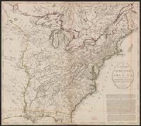
- Beinecke Rare Book and Manuscript Library > A map of the middle British colonies in North America [cartographic material] : First published by Lewis Evans, of Philadelphia, in 1755 ; and since corrected and improved, as also extended, with the addition of New England, and bordering parts of Canada
- Creator:
- Prideaux, Humphrey, 1648-1724.
- Published / Created:
- 1697
- Call Number:
- Mhc9 P932 T6 1697
- Image Count:
- 1
- Resource Type:
- Books, Journals & Pamphlets
- Found in:
- Beinecke Rare Book and Manuscript Library > The true nature of imposture fully display'd in the life of Mahomet : with a discourse annexed, for the vindicating of Christianity from this charge : offered to the consideration of the deists ... / by Humphrey Prideaux ...
- Creator:
- Fitzball, Edward, 1792-1873.
- Published / Created:
- [1838?]
- Call Number:
- Plays 885
- Image Count:
- 1
- Resource Type:
- Books, Journals & Pamphlets
- Found in:
- Beinecke Rare Book and Manuscript Library > The Negro of Wapping, or, The boat-builder's hovel! : a melo drama, in two acts ...
- Creator:
- Rochester, John Wilmot, Earl of, 1647-1680.
- Published / Created:
- 1709
- Call Number:
- Ij R586 B707C
- Image Count:
- 1
- Resource Type:
- Books, Journals & Pamphlets
- Found in:
- Beinecke Rare Book and Manuscript Library > The works of the Right Honourable the Earls of Rochester, and Roscommon : with some memoirs of the Earl of Rochester's life, by Monsieur St. Evremont: in a letter to the Dutchess of Mazarine.
- Creator:
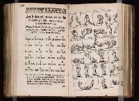
- J. B. (John Bulwer), fl. 1648-1654.
- Published / Created:
- 1644
- Call Number:
- 1998 867
- Image Count:
- 1
- Resource Type:
- Books, Journals & Pamphlets
- Found in:
- Beinecke Rare Book and Manuscript Library > Chirologia, or, The naturall language of the hand : composed of the speaking motions, and discoursing gestures thereof : whereunto is added Chironomia, or, the art of manuall rhetoricke : consisting of the naturall expressions, digested by art in the hand, as the chiefest instrument of eloquence / by J.B. Gent. philochirosophus.
- Creator:
- Defoe, Daniel, 1661?-1731
- Published / Created:
- 1720
- Call Number:
- 1971 782
- Image Count:
- 1
- Resource Type:
- Books, Journals & Pamphlets
- Found in:
- Beinecke Rare Book and Manuscript Library > The king of pirates : being an account of the famous enterprises of Captain Avery, the Mock King of Madagascar, with his rambles and piracies; wherein all the sham accounts farmerly publish'd of his, are detected, in two letters from himself; one during his stay at Madagascar, and one since his escape from thence.
- Creator:
- Defoe, Daniel, 1661?-1731
- Published / Created:
- 1720
- Call Number:
- Z78 53
- Image Count:
- 1
- Resource Type:
- Books, Journals & Pamphlets
- Found in:
- Beinecke Rare Book and Manuscript Library > The life, adventures, and pyracies, of the famous Captain Singleton : containing an account of his being set on shore in the island of Madagascar, his settlement there, with a description of the place and inhabitants ... As also Captain Singleton's return to sea, with an account of his many adventures and pyracies with the famous Captain Avery and others.
- Creator:
- Heywood, Thomas, approximately 1574-1641.
- Published / Created:
- 1635
- Call Number:
- Ih H519 +635
- Image Count:
- 1
- Resource Type:
- Books, Journals & Pamphlets
- Found in:
- Beinecke Rare Book and Manuscript Library > The hierarchie of the blessed angells : their names, orders and offices : the fall of Lucifer with his angells / written by Tho. Heywood.
- Creator:
- Swift, Jonathan, 1667-1745.
- Published / Created:
- 1727
- Call Number:
- Ik Sw55 C727 3
- Image Count:
- 1
- Resource Type:
- Books, Journals & Pamphlets
- Found in:
- Beinecke Rare Book and Manuscript Library > Miscellanies : the last volume.
- Creator:
- Shakespeare, William, 1564-1616.
- Published / Created:
- 1695
- Call Number:
- Ih D272 673Md
- Image Count:
- 1
- Resource Type:
- Books, Journals & Pamphlets
- Found in:
- Beinecke Rare Book and Manuscript Library > Macbeth : a tragedy. With all the alterations, amendments, additions, and new songs. As it is now acted at the Theatre Royal.
- Creator:
- Fry, Roger, 1866-1934
- Published / Created:
- 1927
- Call Number:
- 1998 1139
- Image Count:
- 1
- Resource Type:
- Books, Journals & Pamphlets
- Found in:
- Beinecke Rare Book and Manuscript Library > Cézanne : a study of his development / [by] Roger Fry.
- Creator:
- Thucydides
- Published / Created:
- 1634
- Call Number:
- Gft66 +bg628b
- Image Count:
- 1
- Resource Type:
- Books, Journals & Pamphlets
- Found in:
- Beinecke Rare Book and Manuscript Library > Eight bookes of the Peloponnesian Warre / written by Thvcydides, the sonne of Olorvs ; interpreted with faith and diligence immediately out of the Greeke by Thomas Hobbes.
- Creator:
- Cotton, Charles, 1630-1687
- Published / Created:
- 1686
- Call Number:
- Ij C829 675C
- Image Count:
- 1
- Resource Type:
- Books, Journals & Pamphlets
- Found in:
- Beinecke Rare Book and Manuscript Library > Burlesque upon burlesque, or, The scoffer scoft : being some of Lucians dialogues, newly put into English fustian : for the consolation of those who had rather laugh and be merry, than be merry and wise / by Charles Cotton, esq.
- Creator:
- Bridgens, Richard
Cooper, T. S
Day & Haghe
Ducôté, A., fl. 1829-1832
- Published / Created:
- 1836
- Call Number:
- 2003 Folio 16
- Image Count:
- 1
- Resource Type:
- Books, Journals & Pamphlets
- Found in:
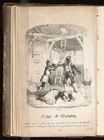
- Beinecke Rare Book and Manuscript Library > West India scenery : with illustrations of Negro character, the process of making sugar, &c. from sketches taken during a voyage to, and residence of seven years in, the island of Trinidad / by R. Bridgens.
- Creator:
- Stokes, John Lort, 1811-1885, cartographer.
- Published / Created:
- Apr. 5, 1845.
- Call Number:
- BrSides Double Folio 2019 107
- Image Count:
- 1
- Resource Type:
- Maps, Atlases & Globes
- Found in:
- Beinecke Rare Book and Manuscript Library > The Victoria River : 1839 / surveyed by Commr. J.L. Stokes, R.N. ; J. & C. Walker, sculpt.
- Creator:
- Stokes, John Lort, 1811-1885, cartographer.
- Published / Created:
- April 10, 1845.
- Call Number:
- BrSides Double Folio 2019 108
- Image Count:
- 1
- Resource Type:
- Maps, Atlases & Globes
- Found in:
- Beinecke Rare Book and Manuscript Library > The Albert River : 1841 / surveyed by J.L. Stokes, R.N. ; J. & C. Walker, sculpt.
- Creator:
- Wyld, James, 1812-1887
- Published / Created:
- 1861
- Call Number:
- 754hc 1861E
- Container / Volume:
- BRBL_00420
- Image Count:
- 1
- Resource Type:
- Maps, Atlases & Globes
- Found in:
- Beinecke Rare Book and Manuscript Library > Wyld's military map of the United States, the northern states, and the southern confederate states: with the forts, harbours, arsenals, and military positions.
- Published / Created:
- 1783
- Call Number:
- 755 1783E
- Container / Volume:
- BRBL_00434
- Image Count:
- 1
- Resource Type:
- Maps, Atlases & Globes
- Found in:
- Beinecke Rare Book and Manuscript Library > Bowles's New Pocket map of the United States of America with the British possessions ... French and Spanish ... Louisiana and Florida according to Versailles ... 1783.
- Published / Created:
- 1783
- Call Number:
- 755 1783C
- Container / Volume:
- BRBL_00434
- Image Count:
- 1
- Resource Type:
- Maps, Atlases & Globes
- Found in:
- Beinecke Rare Book and Manuscript Library > A new map of the United States of North America with the British Dominions on the Continent &c. By Samuel Dunn, Mathematician; improved from the Surveys of Capt. Carver.
- Published / Created:
- 1794
- Call Number:
- 755 1794D
- Container / Volume:
- BRBL_00436
- Image Count:
- 1
- Resource Type:
- Maps, Atlases & Globes
- Found in:
- Beinecke Rare Book and Manuscript Library > A new and general map of the Southern dominions belonging to the United States of America, ... Indian countries, and the Spanish Possessions of Louisiana and Florida.
- Published / Created:
- 1798
- Call Number:
- 755 1798
- Container / Volume:
- BRBL_00436
- Image Count:
- 1
- Resource Type:
- Maps, Atlases & Globes
- Found in:
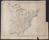
- Beinecke Rare Book and Manuscript Library > Part of the United States of North America.
- Published / Created:
- 1783
- Call Number:
- 755 1783F
- Container / Volume:
- BRBL_00434
- Image Count:
- 1
- Resource Type:
- Maps, Atlases & Globes
- Found in:
- Beinecke Rare Book and Manuscript Library > The United States of America with the British possessions of ... divided with the French; ... Spanish ... Louisiana and Florida according to ... Versailles ... 1783.
- Published / Created:
- 1794
- Call Number:
- 755 1794
- Container / Volume:
- BRBL_00436
- Image Count:
- 1
- Resource Type:
- Maps, Atlases & Globes
- Found in:
- Beinecke Rare Book and Manuscript Library > A new and general map of the middle dominions belonging to the United States of America, ...
- Creator:
- Kitchin, Thomas, d. 1784
- Published / Created:
- June 1st. 1789.
- Call Number:
- 755 1789
- Container / Volume:
- BRBL_00435
- Image Count:
- 1
- Resource Type:
- Maps, Atlases & Globes
- Found in:
- Beinecke Rare Book and Manuscript Library > North America, wherein are particularly distinguished the British dominions, the United States, and the adjacent Spanish territories / by Thomas Kitchin, hydrographer to His Majesty.
- Creator:
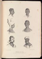
- Covarrubias, Miguel, 1904-1957
- Published / Created:
- 1927
- Call Number:
- JWJ Za C837 927N
- Image Count:
- 1
- Found in:
- Beinecke Rare Book and Manuscript Library > Negro drawings / by Miguel Covarrubias ; with a preface by Ralph Barton and an introduction by Frank Crowninshield.
- Published / Created:
- 1794
- Call Number:
- 755 1794
- Container / Volume:
- BRBL_00436
- Image Count:
- 1
- Resource Type:
- Maps, Atlases & Globes
- Found in:
- Beinecke Rare Book and Manuscript Library > A new and general map of the middle dominions belonging to the United States of America, ...
- Published / Created:
- 1786
- Call Number:
- 755 1786A
- Container / Volume:
- BRBL_00435
- Image Count:
- 1
- Resource Type:
- Maps, Atlases & Globes
- Found in:
- Beinecke Rare Book and Manuscript Library > A new map of the United States of North America with the British Dominions ... By Samuel Dunn, Mathematician; Improved from the surveys of Capt. Carver.
- Published / Created:
- 1784
- Call Number:
- 755 1784E
- Container / Volume:
- BRBL_00435
- Image Count:
- 1
- Resource Type:
- Maps, Atlases & Globes
- Found in:
- Beinecke Rare Book and Manuscript Library > Bowles's new pocket map of the United States of America ... as settled by the preliminary articles of peace signed at Versailles the 20th Jany. 1783.
- Published / Created:
- 1794
- Call Number:
- 755 1794F
- Container / Volume:
- BRBL_00436
- Image Count:
- 1
- Resource Type:
- Maps, Atlases & Globes
- Found in:
- Beinecke Rare Book and Manuscript Library > The United States of America with the British Possessions of Canada, Nova Scotia, New Brunswick, and Newfoundland divided with the French, also the Spanish. Territories of Louisiana and Florida according to ... Versailles ... 1783.
- Published / Created:
- 1794 May 12
- Call Number:
- 755 1794G
- Container / Volume:
- BRBL_00436
- Image Count:
- 1
- Resource Type:
- Maps, Atlases & Globes
- Found in:
- Beinecke Rare Book and Manuscript Library > A new and correct map of the British colonies in North America comprehending eastern Canada with the province of Quebec, New Brunswick, Nova Scotia, and the Government of Newfoundland [cartographic material] : with the adjacent states of New England, Verm
- Published / Created:
- 1794
- Call Number:
- 755 1794C
- Container / Volume:
- BRBL_00436
- Image Count:
- 1
- Resource Type:
- Maps, Atlases & Globes
- Found in:
- Beinecke Rare Book and Manuscript Library > An accurate Map of the United States of America according to the Treaty of Peace of 1783. Russell del et Sculp.
- Published / Created:
- 1794
- Call Number:
- 755 1794A
- Container / Volume:
- BRBL_00436
- Image Count:
- 1
- Resource Type:
- Maps, Atlases & Globes
- Found in:
- Beinecke Rare Book and Manuscript Library > A new and general map of the middle dominions belonging to the United States of America, viz. Virginia, Maryland, the Delaware-Counties, Pennsylvania, New Jersey &c., with the addition of New York, & of the greatest part of New England &c. as also of the
- Creator:
- Evans, Lewis, 1700?-1756
- Published / Created:
- [1796]
- Call Number:
- 755 1796B
- Container / Volume:
- BRBL_00436
- Image Count:
- 1
- Resource Type:
- Maps, Atlases & Globes
- Found in:
- Beinecke Rare Book and Manuscript Library > Bowles's new one-sheet map of the independent states of Virginia, Maryland, Delaware, Pensylvania, New Jersey, New York, Connecticut, Rhode Island, &c. : comprehending also the habitations & hunting countries of the confederate Indians / by Lewis Evans.
- Published / Created:
- 1796
- Call Number:
- 755 1796
- Container / Volume:
- BRBL_00436
- Image Count:
- 1
- Resource Type:
- Maps, Atlases & Globes
- Found in:
- Beinecke Rare Book and Manuscript Library > The United States of America: with the British Territories and those of Spain, according to the Treaty of 1784. Engraved by Wm. Faden.
- Published / Created:
- 1794
- Call Number:
- 755 1794
- Container / Volume:
- BRBL_00436
- Image Count:
- 1
- Resource Type:
- Maps, Atlases & Globes
- Found in:
- Beinecke Rare Book and Manuscript Library > A new and general map of the middle dominions belonging to the United States of America, ...
- Published / Created:
- 1794 May 12
- Call Number:
- 755 1794E
- Container / Volume:
- BRBL_00436
- Image Count:
- 1
- Resource Type:
- Maps, Atlases & Globes
- Found in:
- Beinecke Rare Book and Manuscript Library > A new and correct map of the British colonies in North America comprehending eastern Canada with the province of Quebec, New Brunswick, Nova Scotia, and the Government of Newfoundland [cartographic material] : with the adjacent states of New England, Verm
- Published / Created:
- 1783
- Call Number:
- 755 1783G
- Container / Volume:
- BRBL_00434
- Image Count:
- 1
- Resource Type:
- Maps, Atlases & Globes
- Found in:
- Beinecke Rare Book and Manuscript Library > An accurate map of the United States of America with part of the Surrounding Provinces agreeable to the treaty of Peace of 1783. By Ino. Cary.
- Published / Created:
- 1785
- Call Number:
- 755 1785
- Container / Volume:
- BRBL_00435
- Image Count:
- 1
- Resource Type:
- Maps, Atlases & Globes
- Found in:
- Beinecke Rare Book and Manuscript Library > The United States of North America with the British & Spanish Territories ... Treay of 1784.
- Published / Created:
- 1794
- Call Number:
- 755 1794C
- Container / Volume:
- BRBL_00436
- Image Count:
- 1
- Resource Type:
- Maps, Atlases & Globes
- Found in:
- Beinecke Rare Book and Manuscript Library > An accurate Map of the United States of America according to the Treaty of Peace of 1783. Russell del et Sculp.
- Published / Created:
- [1764?]
- Call Number:
- 76cea 1764
- Container / Volume:
- BRBL_00446
- Image Count:
- 1
- Resource Type:
- Maps, Atlases & Globes
- Found in:
- Beinecke Rare Book and Manuscript Library > A New and Correct Chart of the Sea Coast of New-England, from Cape Codd to Casco Bay. Lately Surbey'd by Capt. Henry Barnsley.
- Creator:
- Faden, William, 1749-1836
- Published / Created:
- Octr. 19th, 1776.
- Call Number:
- 771 N49 1776K
- Container / Volume:
- BRBL_00484
- Image Count:
- 1
- Resource Type:
- Maps, Atlases & Globes
- Found in:
- Beinecke Rare Book and Manuscript Library > A plan of New York Island, with part of Long Island, Staten Island & east New Jersey : with a particular description of the engagement on the woody heights of Long Island, between Flatbush and Brooklyn, on the 27th of August 1776 between His Majesty's for
- Published / Created:
- 1776
- Call Number:
- 775cea 1776B
- Container / Volume:
- BRBL_00502
- Image Count:
- 1
- Resource Type:
- Maps, Atlases & Globes
- Found in:
- Beinecke Rare Book and Manuscript Library > A chart of Delaware Bay and River. Contains a full and exact description of the shores, creeks, harbours, soundings, shoals, sands and bearings of the most considerable landmarks from the Capes to Philadelphia taken from the original chart.
- Published / Created:
- 1784
- Call Number:
- 774hc G22 1777
- Container / Volume:
- BRBL_00502
- Image Count:
- 1
- Resource Type:
- Maps, Atlases & Globes
- Found in:
- Beinecke Rare Book and Manuscript Library > Sketch of the surprise of German Town. by the American forces commanded by General Washington. October 4th 1777; by J. Hills,lt.23d Regt. & Asst. Eng.
- Published / Created:
- 1776
- Call Number:
- 775cea 1776
- Container / Volume:
- BRBL_00502
- Image Count:
- 1
- Resource Type:
- Maps, Atlases & Globes
- Found in:
- Beinecke Rare Book and Manuscript Library > A chart of Delaware Bay and River ... by joshua Fisher.
- Creator:
- Jefferys, Thomas, -1771, printmaker.
- Published / Created:
- 1755
- Call Number:
- 783 1755F
- Container / Volume:
- BRBL_00507
- Image Count:
- 1
- Resource Type:
- Maps, Atlases & Globes
- Found in:
- Beinecke Rare Book and Manuscript Library > A map of the most inhabited part of Virginia containing the whole province of Maryland with part of Pensilvania, New Jersey and North Carolina / drawn by Joshua Fry & Peter Jefferson in 1751.
- Creator:
- Fry, Joshua, approximately 1700-1754
- Published / Created:
- 1794
- Call Number:
- 783 1794
- Container / Volume:
- BRBL_00507
- Image Count:
- 1
- Resource Type:
- Maps, Atlases & Globes
- Found in:
- Beinecke Rare Book and Manuscript Library > A map of the most inhabited part of Virginia containing the whole province of Maryland with part of Pensilvania, New Jersey and North Carolina / drawn by Joshua Fry & Peter Jefferson in 1775.
- Published / Created:
- 1640
- Call Number:
- Ih C317 640
- Image Count:
- 1
- Found in:
- Beinecke Rare Book and Manuscript Library > The pleasant history of Cawwood the rooke, or, The assembly of birds : with the several speeches which the birds made to the eagle ...
- Creator:
- Milton, John, 1608-1674
- Published / Created:
- 1688
- Call Number:
- Z77 069n
- Image Count:
- 1
- Resource Type:
- Books, Journals & Pamphlets
- Found in:
- Beinecke Rare Book and Manuscript Library > Paradise lost : a poem in twelve books / The authour John Milton.
- Creator:
- Edward Stanford Ltd
- Published / Created:
- 1919
- Call Number:
- 2732 1919
- Container / Volume:
- BRBL_00023B
- Image Count:
- 1
- Resource Type:
- Maps, Atlases & Globes
- Found in:
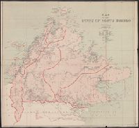
- Beinecke Rare Book and Manuscript Library > Map of the State of North Borneo, without hills.
- Published / Created:
- 1737
- Call Number:
- 11 1737
- Container / Volume:
- BRBL_00681
- Image Count:
- 1
- Resource Type:
- Maps, Atlases & Globes
- Found in:
- Beinecke Rare Book and Manuscript Library > A new and correct map of ye world [cartographic material] : laid down according to ye latest and best observations : to which is added several curious discourses on the tides, trade winds & monsoons ...
- Creator:
- Moll, Herman, d. 1732
- Published / Created:
- [after 1754]
- Call Number:
- 11 1728
- Container / Volume:
- BRBL_00680
- Image Count:
- 1
- Resource Type:
- Maps, Atlases & Globes
- Found in:
- Beinecke Rare Book and Manuscript Library > A new and correct map of the world laid down according to the newest discoveries and from the most exact observations / [cartographic material] / by Herman Moll, geographer.
- Published / Created:
- 1886
- Call Number:
- 582 1886
- Container / Volume:
- BRBL_00314
- Image Count:
- 1
- Resource Type:
- Maps, Atlases & Globes
- Found in:
- Beinecke Rare Book and Manuscript Library > Parts of Burma, Siam and the Shan States : illustrating the explorations of Holt S. Hallett, C.E.
- Creator:
- Edward Stanford Ltd
- Published / Created:
- August 1st, 1901.
- Call Number:
- 642 1901A
- Container / Volume:
- BRBL_00339
- Image Count:
- 1
- Resource Type:
- Maps, Atlases & Globes
- Found in:
- Beinecke Rare Book and Manuscript Library > Stanford's new map of the Orange River Colony, the southern part of the Transvaal, the northern frontier of Cape Colony, Natal, Basutoland, and Delagoa Bay in Portuguese East Africa / Stanford's Geographical Establishment, London.
- Creator:
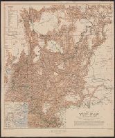
- Davies, Henry Rodolph, 1865-
- Published / Created:
- 1908
- Call Number:
- 5631 1908
- Container / Volume:
- BRBL_00299
- Image Count:
- 1
- Resource Type:
- Maps, Atlases & Globes
- Found in:
- Beinecke Rare Book and Manuscript Library > Map of Yün-nan / compiled by Major H.R. Davies.
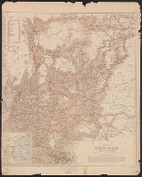
- Creator:
- Davies, Henry Rodolph, 1865-
- Published / Created:
- 1908
- Call Number:
- 5631 1908
- Container / Volume:
- BRBL_00299
- Image Count:
- 1
- Resource Type:
- Maps, Atlases & Globes
- Found in:
- Beinecke Rare Book and Manuscript Library > Map of Yün-nan / compiled by Major H.R. Davies.
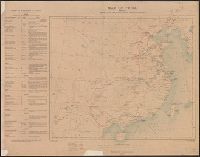
- Creator:
- Great Britain. Ordnance Survey
- Published / Created:
- 1910
- Call Number:
- 56gm 1910
- Container / Volume:
- BRBL_00298
- Image Count:
- 1
- Resource Type:
- Maps, Atlases & Globes
- Found in:
- Beinecke Rare Book and Manuscript Library > Map of China [cartographic material] : shewing railways, telegraphs and treaty ports.
- Creator:
- George Philip & Son
- Published / Created:
- [1910?]
- Call Number:
- 731 1910
- Container / Volume:
- BRBL_00376A
- Image Count:
- 1
- Resource Type:
- Maps, Atlases & Globes
- Found in:
- Beinecke Rare Book and Manuscript Library > Dominion of Canada : E. Quebec, New Brunswick, Nova Scotia, Prince Edward Id. and Newfoundland / George Philip & Son.
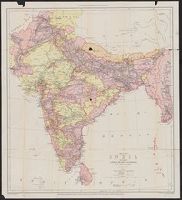
- Published / Created:
- [1912?]
- Call Number:
- 59gm 1912
- Container / Volume:
- BRBL_00318
- Image Count:
- 1
- Resource Type:
- Maps, Atlases & Globes
- Found in:
- Beinecke Rare Book and Manuscript Library > Map of India : shewing the lines of railways, telegraphs, and dawk routes.
- Creator:
- Society for the Diffusion of Useful Knowledge (Great Britain)
- Published / Created:
- 1832
- Call Number:
- 755 1832A
- Container / Volume:
- BRBL_00440
- Image Count:
- 1
- Resource Type:
- Maps, Atlases & Globes
- Found in:
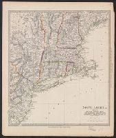
- Beinecke Rare Book and Manuscript Library > North America. Sheet VI, New-York, Vermont, Maine, New-Hampshire, Massachusetts, Connecticut, Rhode-Island, and New-Jersey / published by the Society for the Diffusion of Useful Knowledge.
- Published / Created:
- 1904
- Call Number:
- 2005 +S25
- Image Count:
- 1
- Found in:
- Beinecke Rare Book and Manuscript Library > Photograms of the year, 1904
- Creator:
- Greene, Robert, 1558?-1592.
- Published / Created:
- 1622
- Call Number:
- Osborn pb169
- Image Count:
- 1
- Found in:
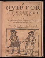
- Beinecke Rare Book and Manuscript Library > A quip for an vpstart courtier, or, A quaint dispute betweene veluet breeches and cloth breeches : wherein is plainely set downe the disorders in all estates and trades.
- Creator:
- Wadström, Carl Bernhard, 1746-1799.
- Published / Created:
- 1794-95.
- Call Number:
- Oyb25 +794w
- Image Count:
- 1
- Found in:
- Beinecke Rare Book and Manuscript Library > An essay on colonization, particularly applied to the western coast of Africa, with some free thoughts on cultivation and commerce; also brief descriptions of the colonies already formed, or attempted, in Africa, including those of Sierra Leona and Bulama. By C.B. Wadstrom. In two parts; illustrated with a nautical map (from lat. 5⁰ 30' to lat. 14⁰ N.) and other plates.
- Creator:
- Garrick, David, 1717-1779.
- Published / Created:
- 1794
- Call Number:
- Ib74 T794M 3
- Collection Title:
- Minor theatre : being a collection of the most approved farces, operas, and comedies, in one, two
- Image Count:
- 1
- Resource Type:
- Books, Journals & Pamphlets
- Found in:
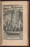
- Beinecke Rare Book and Manuscript Library > The Irish widow : a comedy, in two acts as performed at the Theatres Royal, Drury Lane and Covent Garden / written by David Garrick.
- Creator:
- Hughes, Andrew, 18th century
- Published / Created:
- [1780?]
- Call Number:
- 786 1780A
- Image Count:
- 1
- Resource Type:
- Maps, Atlases & Globes
- Found in:
- Beinecke Rare Book and Manuscript Library > A draught of South Carolina and Georgia from Sewee to St. Estaca / by Andrew Hughes.
- Published / Created:
- 1806
- Call Number:
- 32cea 1806
- Image Count:
- 1
- Resource Type:
- Maps, Atlases & Globes
- Found in:
- Beinecke Rare Book and Manuscript Library > Harbours and islands in the British Channel : engraved to accompany the general chart of R. Adml. Knight, &c. / John Purdy, delint. ; J. Bye sculpt.
- Creator:
- Dodsley, Robert, 1703-1764.
- Published / Created:
- [1761]
- Call Number:
- 32 L84 1761
- Image Count:
- 1
- Resource Type:
- Maps, Atlases & Globes
- Found in:
- Beinecke Rare Book and Manuscript Library > A new and correct plan of London, Westminster and Southwark [cartographic material] : with several additional improvements not in any former survey.
- Creator:
- Jefferys, Thomas, -1771
- Published / Created:
- 25 May, 1775.
- Call Number:
- BrSides Double Folio 2018 82
- Image Count:
- 1
- Resource Type:
- Maps, Atlases & Globes
- Found in:
- Beinecke Rare Book and Manuscript Library > An exact chart of the river St. Laurence : from Fort Frontenac to the island of Anticosti shewing the soundings, rocks, shoals &c. with views of the lands and all necessary instructions for navigating that river to Quebec / by ... Thos. Jefferys.
- Creator:
- Arrowsmith, John, 1790-1873, cartographer
- Published / Created:
- 1846
- Call Number:
- BrSides 2019 95
- Image Count:
- 1
- Resource Type:
- Maps, Atlases & Globes
- Found in:
- Beinecke Rare Book and Manuscript Library > Part of the west coast of Australia, surveyed by the officers of H.M.S. Beagle [cartographic material] : with Captn. J. Lort Stokes' route into the interior Decr. 1841 / J. Arrowsmith.
- Creator:
- Arrowsmith, John, 1790-1873, cartographer
- Published / Created:
- Apl. 1st 1846.
- Call Number:
- BrSides 2019 93
- Image Count:
- 1
- Resource Type:
- Maps, Atlases & Globes
- Found in:
- Beinecke Rare Book and Manuscript Library > Australia [cartographic material] / by John Arrowsmith.
- Creator:
- Stokes, John Lort, 1811-1885, cartographer
- Published / Created:
- Feby 18th 1846.
- Call Number:
- BrSides 2019 96
- Image Count:
- 1
- Resource Type:
- Maps, Atlases & Globes
- Found in:
- Beinecke Rare Book and Manuscript Library > Chart of Bass' Strait [cartographic material] / surveyed by Capt. I. Lort Stokes & the Officers of H.M.S. Beagle, 1843.
- Creator:
- Edward Stanford Ltd.
- Published / Created:
- [1878]
- Call Number:
- BrSides Folio 2019 91
- Image Count:
- 1
- Resource Type:
- Maps, Atlases & Globes
- Found in:
- Beinecke Rare Book and Manuscript Library > A language map of further India and the Indian archipelago [cartographic material].
- Creator:
- Stokes, John Lort, 1811-1885, cartographer
- Published / Created:
- 1846
- Call Number:
- BrSides 2019 98
- Image Count:
- 1
- Resource Type:
- Maps, Atlases & Globes
- Found in:
- Beinecke Rare Book and Manuscript Library > Southern part of the Gulf of Carpentaria [cartographic material] / surveyed by Captn. I. Lort Stokes and the officers of H.M.S. Beagle, 1841.
- Creator:
- Johnson, J. Hugh (John Hugh)
- Published / Created:
- [1872?]
- Call Number:
- BrSides Folio 2019 97
- Image Count:
- 1
- Resource Type:
- Maps, Atlases & Globes
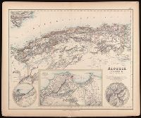
- Found in:
- Beinecke Rare Book and Manuscript Library > Algeria [cartographic material] = l'Algérie / drawn by J. Hugh Johnson ; engraved at Stanford's Geographical Establishment.
- Creator:
- Bowles, Carington, 1724-1793, cartographer.
- Published / Created:
- May 1780.
- Call Number:
- 11 1780B
- Image Count:
- 1
- Resource Type:
- Maps, Atlases & Globes
- Found in:
- Beinecke Rare Book and Manuscript Library > Bowles's new pocket map of the world : laid down from the latest observations and comprehending the new discoveries to the present time, particularly those lately made in the southern seas, by Byron, Wallis, Cook, Bougainville, and others.
- Published / Created:
- 1801
- Call Number:
- 755 1801
- Container / Volume:
- BRBL_00437
- Image Count:
- 1
- Resource Type:
- Maps, Atlases & Globes
- Found in:
- Beinecke Rare Book and Manuscript Library > Map of the United States, Canada, the Rriver St. Lawrence, the Lakes &e.
- Creator:
- Overton, Henry, 1675 or 6-1751
- Published / Created:
- [1755?]
- Call Number:
- 755 1756F
- Container / Volume:
- BRBL_00428
- Image Count:
- 1
- Resource Type:
- Maps, Atlases & Globes
- Found in:
- Beinecke Rare Book and Manuscript Library > An accurate map of the British colonies in North America bordering on the river Ohio.