Search
You Searched For
Search Results
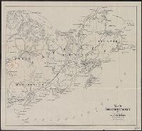
- Creator:
- Geo. W. Stadly & Co
- Published / Created:
- [186-?]
- Call Number:
- 754hc 1862C
- Container / Volume:
- BRBL_00421
- Image Count:
- 13
- Resource Type:
- Maps, Atlases & Globes
- Found in:
- Beinecke Rare Book and Manuscript Library > [13 maps showing positions of the Union and Confederate armies during the year 1862] / drawn and printed by Geo. W. Stadly & Co.
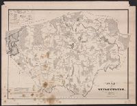
- Creator:
- Walling, Henry Francis, 1825-1888
- Published / Created:
- 1858
- Call Number:
- 764 B45 1858
- Container / Volume:
- BRBL_00454
- Image Count:
- 6
- Resource Type:
- Maps, Atlases & Globes
- Found in:
- Beinecke Rare Book and Manuscript Library > Map of the county of Berkshire, Massachusetts : based upon the trigonometrical survey of the state / the details from actual surveys under the direction of Henry F. Walling, supt. of the state map.
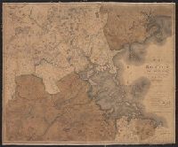
- Creator:
- Walling, Henry Francis, 1825-1888
- Published / Created:
- 1858
- Call Number:
- 764 N76 1858
- Container / Volume:
- BRBL_00458
- Image Count:
- 6
- Resource Type:
- Maps, Atlases & Globes
- Found in:
- Beinecke Rare Book and Manuscript Library > Map of the county of Norfolk, Massachusetts / based upon the details of the trigonometrical survey of the state; the details from actual surveys under the direction of Henry F. Walling. Supt. of the state map.
- Published / Created:
- [1832?]
- Call Number:
- 764 B764 1832
- Container / Volume:
- BRBL_00456A
- Image Count:
- 1
- Resource Type:
- Maps, Atlases & Globes
- Found in:
- Beinecke Rare Book and Manuscript Library > Map of Bridgewater, Mass.
- Published / Created:
- 1800
- Call Number:
- 764 B65 1800
- Container / Volume:
- BRBL_00455
- Image Count:
- 1
- Resource Type:
- Maps, Atlases & Globes
- Found in:
- Beinecke Rare Book and Manuscript Library > A new plan of Boston from Actual surveys by Osgood Carleton. With corrections, additions, & improvements.
- Published / Created:
- 1835
- Call Number:
- 764 B65 1835
- Container / Volume:
- BRBL_00455
- Image Count:
- 1
- Resource Type:
- Maps, Atlases & Globes
- Found in:
- Beinecke Rare Book and Manuscript Library > The South Cove territory, comprising every part which is coloured on this map.
- Published / Created:
- 1819
- Call Number:
- 764 B65 1819
- Container / Volume:
- BRBL_00455
- Image Count:
- 1
- Resource Type:
- Maps, Atlases & Globes
- Found in:
- Beinecke Rare Book and Manuscript Library > Map of Boston and its Vicinity by John G. Hales.
- Creator:
- E.P. Dutton (Firm)
- Published / Created:
- 1865
- Call Number:
- 764 B65 1865
- Container / Volume:
- BRBL_00455
- Image Count:
- 1
- Resource Type:
- Maps, Atlases & Globes
- Found in:
- Beinecke Rare Book and Manuscript Library > Chart of Boston Harbor and Massachusetts Bay : with map of the adjacent country / published at the Boston Map Store.
- Creator:
- Sampson, Murdock & Co
- Published / Created:
- [1886], c1885.
- Call Number:
- 764 B65 1886
- Container / Volume:
- BRBL_00456
- Image Count:
- 1
- Resource Type:
- Maps, Atlases & Globes
- Found in:
- Beinecke Rare Book and Manuscript Library > Map of Boston for 1886.
- Published / Created:
- [1831?]
- Call Number:
- 764 B63 1831
- Container / Volume:
- BRBL_00454
- Image Count:
- 1
- Resource Type:
- Maps, Atlases & Globes
- Found in:
- Beinecke Rare Book and Manuscript Library > A Map of the Town of Bolton in the County of Worcester and the Commonwealth of Massachusetts. Surveyed by Silas Holman in the Year 1831.
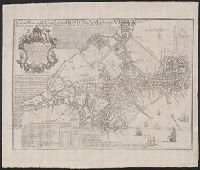
- Creator:
- Price, William, fl. 1725-1769
- Published / Created:
- [1743]
- Call Number:
- 764 B65 1743
- Container / Volume:
- BRBL_00454
- Image Count:
- 1
- Resource Type:
- Maps, Atlases & Globes
- Found in:
- Beinecke Rare Book and Manuscript Library > A new plan of ye great town of Boston in New England in America : with the many additionall buildings & new streets, to the year, 1743.
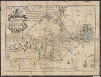
- Published / Created:
- 1893
- Call Number:
- 766 T57 1893
- Container / Volume:
- BRBL_00474
- Image Count:
- 1
- Resource Type:
- Maps, Atlases & Globes
- Found in:
- Beinecke Rare Book and Manuscript Library > Tolland [County].
- Creator:
- Hughes & Bailey
- Published / Created:
- [1919]
- Call Number:
- 766am Se96 1919
- Container / Volume:
- BRBL_00474
- Image Count:
- 1
- Resource Type:
- Maps, Atlases & Globes
- Found in:
- Beinecke Rare Book and Manuscript Library > Aero view of Seymour, Connecticut, 1919.
- Creator:
- Boardman, Harvey
- Published / Created:
- c1858.
- Call Number:
- 762 W588 1858
- Container / Volume:
- BRBL_00451
- Image Count:
- 1
- Resource Type:
- Maps, Atlases & Globes
- Found in:
- Beinecke Rare Book and Manuscript Library > Map of the White Mountains, New Hampshire : from original surveys / by Harvey Boardman, 1858 / engraved by Smith Knight & Tappan, Boston.
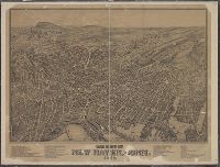
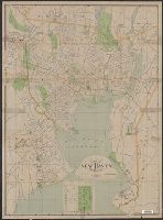
- Published / Created:
- 1879
- Call Number:
- 766am N46 1879V
- Container / Volume:
- BRBL_00474
- Image Count:
- 1
- Resource Type:
- Maps, Atlases & Globes
- Found in:
- Beinecke Rare Book and Manuscript Library > The city of New Haven, Conn.
- Published / Created:
- 1887
- Call Number:
- 762 W588 1887
- Container / Volume:
- BRBL_00451
- Image Count:
- 1
- Resource Type:
- Maps, Atlases & Globes
- Found in:
- Beinecke Rare Book and Manuscript Library > Map of the White Mountains of New Hamshire.
- Creator:
- Perkins, Frederic B. (Frederic Beecher), 1828-1899
- Published / Created:
- 1880
- Call Number:
- 75FCB 1880G
- Container / Volume:
- BRBL_00410
- Image Count:
- 1
- Resource Type:
- Maps, Atlases & Globes
- Found in:
- Beinecke Rare Book and Manuscript Library > Congressional district vote map of the United States / designed by Fred B. Perkins ; drawn by Whitman & Breck.
- Creator:
- Bouvé, Ephraim W., 1817-1897
- Published / Created:
- [185-?]
- Call Number:
- 754gme 1850A
- Container / Volume:
- BRBL_00419
- Image Count:
- 1
- Resource Type:
- Maps, Atlases & Globes
- Found in:
- Beinecke Rare Book and Manuscript Library > Map of the Alton & Springfield railroad, in Illinois : showing its connection with other roads and proposed roads leading to the eastern cities / lith. of E.W. Bouvé.
- Creator:
- National Publishing Company (Boston, Mass.)
- Published / Created:
- 1898
- Call Number:
- 76 1898
- Container / Volume:
- BRBL_00445
- Image Count:
- 1
- Resource Type:
- Maps, Atlases & Globes
- Found in:
- Beinecke Rare Book and Manuscript Library > New post office, township, county and railroad map of New England : with distances.
- Published / Created:
- 1893
- Call Number:
- 776cea 1893
- Container / Volume:
- BRBL_00502
- Image Count:
- 1
- Resource Type:
- Maps, Atlases & Globes
- Found in:
- Beinecke Rare Book and Manuscript Library > Eldridge's Chart No. 11 : Delaware Bay and river / from the U.S. Coast and George Elridge's surveys.
- Published / Created:
- 1905
- Call Number:
- 762 1905
- Container / Volume:
- BRBL_00450
- Image Count:
- 1
- Resource Type:
- Maps, Atlases & Globes
- Found in:
- Beinecke Rare Book and Manuscript Library > Map of New Hampshire.
- Creator:
- Burwell, Elliot Noël
- Published / Created:
- c1907.
- Call Number:
- 762 W73 1907
- Container / Volume:
- BRBL_00451
- Image Count:
- 1
- Resource Type:
- Maps, Atlases & Globes
- Found in:
- Beinecke Rare Book and Manuscript Library > A map of Lake Winnipesaukee, New Hampshire / author, Elliot Noël Burwell.
- Published / Created:
- 1912
- Call Number:
- 763gmb 1917
- Container / Volume:
- BRBL_00452
- Image Count:
- 1
- Resource Type:
- Maps, Atlases & Globes
- Found in:
- Beinecke Rare Book and Manuscript Library > Road map of Vermont.
- Creator:
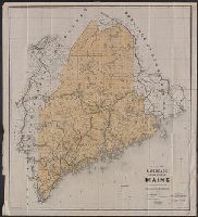
- Maine. Board of Railroad Commissioners
- Published / Created:
- c1891.
- Call Number:
- 761gme 1891
- Container / Volume:
- BRBL_00449
- Image Count:
- 1
- Resource Type:
- Maps, Atlases & Globes
- Found in:
- Beinecke Rare Book and Manuscript Library > Map of the railroads of the state of Maine accompanying the report of the railroad commissioners, 1892 / prepared for the Board of Railroad Commissioners under the direction of William A. Allen ; H.C. Robinson, E.A. Boothby, draughtsmen.
- Published / Created:
- [186-]
- Call Number:
- 754gme 1867
- Container / Volume:
- BRBL_00420
- Image Count:
- 1
- Resource Type:
- Maps, Atlases & Globes
- Found in:
- Beinecke Rare Book and Manuscript Library > Map of the Boston, Hartford & Erie Rail Road.
- Creator:
- Rand Avery Supply Co
- Published / Created:
- [ca 1900?]
- Call Number:
- 754gme 1900
- Container / Volume:
- BRBL_00420
- Image Count:
- 1
- Resource Type:
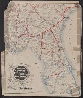
- Maps, Atlases & Globes
- Found in:
- Beinecke Rare Book and Manuscript Library > Map of the Charleston & Savannah Ry., Savannah Florida & Western Ry., South Florida Ry. : and all of the routes operated by the peoples line of steamers and plant steamship line known as the plant system / Rand Avery Supply Co.
- Creator:
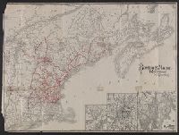
- Rand Avery Supply Co
- Published / Created:
- [1911?]
- Call Number:
- 76gme 1910
- Container / Volume:
- BRBL_00446A
- Image Count:
- 1
- Resource Type:
- Maps, Atlases & Globes
- Found in:
- Beinecke Rare Book and Manuscript Library > Boston & Maine Railroad and connections / Rand Avery Supply Co.
- Creator:
- Geo. H. Walker & Co
- Published / Created:
- c1909.
- Call Number:
- 761 R16 1909
- Container / Volume:
- BRBL_00449
- Image Count:
- 1
- Resource Type:
- Maps, Atlases & Globes
- Found in:
- Beinecke Rare Book and Manuscript Library > Map of Maine : Rangeley and Megantic district / published by Walker Lithograph & Publishing Co.
- Published / Created:
- 1909
- Call Number:
- 763gmb 1909
- Container / Volume:
- BRBL_00452
- Image Count:
- 1
- Resource Type:
- Maps, Atlases & Globes
- Found in:
- Beinecke Rare Book and Manuscript Library > Southern Part, Map of Vermont.
- Creator:
- Geo. H. Walker & Co
- Published / Created:
- 1903, c1893.
- Call Number:
- 762 1903
- Container / Volume:
- BRBL_00450
- Image Count:
- 1
- Resource Type:
- Maps, Atlases & Globes
- Found in:
- Beinecke Rare Book and Manuscript Library > Map of New Hampshire, southern part : cycling routes shown in red / by Geo. H. Walker & Co.
- Creator:
- Hill, A. B
- Published / Created:
- c1896.
- Call Number:
- 766 N46 1896A
- Container / Volume:
- BRBL_00473
- Image Count:
- 1
- Resource Type:
- Maps, Atlases & Globes
- Found in:
- Beinecke Rare Book and Manuscript Library > City of New Haven, Connecticut / A.B. Hill ; engraved by Geo. H. Walker & Co.
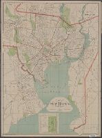
- Creator:
- Hill, A. B., civil engineer
- Published / Created:
- c1893.
- Call Number:
- 766 N46 1893J
- Container / Volume:
- BRBL_00473
- Image Count:
- 1
- Resource Type:
- Maps, Atlases & Globes
- Found in:
- Beinecke Rare Book and Manuscript Library > City of New Haven, Connecticut / A.B. Hill, c.e.
- Published / Created:
- 1893
- Call Number:
- 766 W72 1893
- Container / Volume:
- BRBL_00474
- Image Count:
- 1
- Resource Type:
- Maps, Atlases & Globes
- Found in:
- Beinecke Rare Book and Manuscript Library > Windham County
- Published / Created:
- 1900
- Call Number:
- 771 Ad47 1900
- Container / Volume:
- BRBL_00480
- Image Count:
- 1
- Resource Type:
- Maps, Atlases & Globes
- Found in:
- Beinecke Rare Book and Manuscript Library > Map of the Adirondack Region, southern part.
- Published / Created:
- 1830
- Call Number:
- 764 C74 1830
- Container / Volume:
- BRBL_00456A
- Image Count:
- 1
- Resource Type:
- Maps, Atlases & Globes
- Found in:
- Beinecke Rare Book and Manuscript Library > Plan of the Town of Concord, Mass. Surveyed by John G. Hales
- Published / Created:
- [1831?]
- Call Number:
- 764 D728 1831
- Container / Volume:
- BRBL_00457
- Image Count:
- 1
- Resource Type:
- Maps, Atlases & Globes
- Found in:
- Beinecke Rare Book and Manuscript Library > Map of the towns of Dorchester and Milton, 1831. Edmund J. Baker.
- Creator:
- Walling, Henry Francis, 1825-1888
- Published / Created:
- 1869
- Call Number:
- 764 B65 1869
- Container / Volume:
- BRBL_00455
- Image Count:
- 1
- Resource Type:
- Maps, Atlases & Globes
- Found in:
- Beinecke Rare Book and Manuscript Library > Map of Boston and the country adjacent, from actual surveys / by H.F. Walling.
- Published / Created:
- [1830?]
- Call Number:
- 764 H59 1830
- Container / Volume:
- BRBL_00457
- Image Count:
- 1
- Resource Type:
- Maps, Atlases & Globes
- Found in:
- Beinecke Rare Book and Manuscript Library > A Map of Hingham surveyed by Jedediah Lincon and Reuben hersey Jr. in 1830.
- Published / Created:
- [1832?]
- Call Number:
- 764 H71 1832
- Container / Volume:
- BRBL_00457
- Image Count:
- 1
- Resource Type:
- Maps, Atlases & Globes
- Found in:
- Beinecke Rare Book and Manuscript Library > Map of the Town of Holden ... by Charles Chofin 1832.
- Published / Created:
- 1830
- Call Number:
- 764 L552 1830
- Container / Volume:
- BRBL_00457
- Image Count:
- 1
- Resource Type:
- Maps, Atlases & Globes
- Found in:
- Beinecke Rare Book and Manuscript Library > Map of Leominster containing 16602 acres.
- Published / Created:
- [1832?]
- Call Number:
- 764 L95 1832
- Container / Volume:
- BRBL_00457
- Image Count:
- 1
- Resource Type:
- Maps, Atlases & Globes
- Found in:
- Beinecke Rare Book and Manuscript Library > Plan of the town of Lowell and Belvidere Village, Taken by measurement by Benjn. Mather, 1832.
- Published / Created:
- 1892
- Call Number:
- 764 C15 1892
- Container / Volume:
- BRBL_00456A
- Image Count:
- 1
- Resource Type:
- Maps, Atlases & Globes
- Found in:
- Beinecke Rare Book and Manuscript Library > Map of the town of Canton, Mass. : (Formerly part of Dorchester) / drawn from actual survey by Joseph Hodges, surveyor. Published March, 1831. Copied February, 1892 by Fredric Endicott.
- Published / Created:
- 1829
- Call Number:
- 764 EA77 1829
- Container / Volume:
- BRBL_00457
- Image Count:
- 1
- Resource Type:
- Maps, Atlases & Globes
- Found in:
- Beinecke Rare Book and Manuscript Library > Map of East Bridgewater, Mass.
- Creator:
- Brown, Charles D
- Published / Created:
- 1897
- Call Number:
- 764 G515 1897
- Container / Volume:
- BRBL_00457
- Image Count:
- 1
- Resource Type:
- Maps, Atlases & Globes
- Found in:
- Beinecke Rare Book and Manuscript Library > Map of Gloucester & vicinity / published for Chas. D. Brown, Gloucester, Mass.
- Published / Created:
- 1859
- Call Number:
- 764 SH85 1859
- Container / Volume:
- BRBL_00459
- Image Count:
- 1
- Resource Type:
- Maps, Atlases & Globes
- Found in:
- Beinecke Rare Book and Manuscript Library > Map of the Town of Shrewsbury, Mass.
- Published / Created:
- [1831?]
- Call Number:
- 764 P369 1831
- Container / Volume:
- BRBL_00458
- Image Count:
- 1
- Resource Type:
- Maps, Atlases & Globes
- Found in:
- Beinecke Rare Book and Manuscript Library > Map of the Town of Pembroke ... in 1831, by John G. Hales
- Published / Created:
- [1830?]
- Call Number:
- 764 N81411 1830
- Container / Volume:
- BRBL_00458
- Image Count:
- 1
- Resource Type:
- Maps, Atlases & Globes
- Found in:
- Beinecke Rare Book and Manuscript Library > Map of North Brookfield, ... By Bonum Nye in 1830.
- Published / Created:
- 1843
- Call Number:
- 764 B65 1843
- Container / Volume:
- BRBL_00455
- Image Count:
- 1
- Resource Type:
- Maps, Atlases & Globes
- Found in:
- Beinecke Rare Book and Manuscript Library > Sketch of the Battle of Bunker Hill by a British Officer.