Skip to search
Skip to main content
Skip to first result
Search
You Searched For
Format
cartographic
Publication Place
London
New Search
Search Results
Creator:
Published / Created:
[between 1890 and 1900]
Call Number:
BrSides Double Folio 2019 10
Image Count:
1
Resource Type:
Maps, Atlases & Globes
Found in:
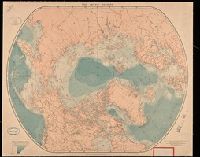
Beinecke Rare Book and Manuscript Library > The arctic regions.
Creator:
Published / Created:
[1862?]
Call Number:
754 1861B
Container / Volume:
BRBL_00416
Image Count:
1
Resource Type:
Maps, Atlases & Globes
Found in:
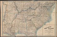
Beinecke Rare Book and Manuscript Library > Map of the southern states of North America with the forts, harbours & military positions James Wyld, Geographer to the Queen.
Published / Created:
1704
Call Number:
Cxb e678ge
Collection Title:
The history of the bucaniers of America : from the first original down to this time; written in
Image Count:
1
Resource Type:
Maps, Atlases & Globes
Found in:
Beinecke Rare Book and Manuscript Library > A Map of the Countrey and Citty of Panama. Part 3: Chap: 5.
Creator:
Published / Created:
1756
Call Number:
Efd 726S
Collection Title:
A new voyage to Guinea: describing the customs, manners, soil, climate, habits, buildings
Image Count:
1
Resource Type:
Maps, Atlases & Globes
Found in:
Beinecke Rare Book and Manuscript Library > A General Map of Senegal, Corrected and Improved with several particulars by Mr. Adanson, correspondent of the Royal Academy of Sciences. Drawn and executed by Philip Buache, 1756
Published / Created:
1801
Call Number:
Zc90 801mab
Collection Title:
Voyages from Montreal, on the river St. Laurence, through the continent of North America, to the
Image Count:
1
Found in:
Beinecke Rare Book and Manuscript Library > A map of America, between latitudes 40 and 70 north and longitudes 45 and 180 west, exhibiting Mackenzie's track from Montreal to Fort Chipewyan & from thence to the North Sea In 1789 & to the West Pacific Ocean in 1793
Creator:
Published / Created:
1774
Call Number:
Cb23 27
Collection Title:
The American military pocket atlas : being an approved collection of correct maps, both general and
Image Count:
1
Found in:
Beinecke Rare Book and Manuscript Library > North America as divided amongst the European powers
Published / Created:
1776
Call Number:
Cb23 27
Collection Title:
The American military pocket atlas : being an approved collection of correct maps, both general and
Image Count:
1
Found in:
Beinecke Rare Book and Manuscript Library > A General map of the northern British colonies in America. which comprehends the province of Quebec, the government of Newfoundland, Nova-Scotia, New-England and New-York. From the maps published by the Admiralty and Board of Trade regulated by the astronomic and trigonometric observations of M. von Holland and corrected from Governor Pownall's late map 1776.
Published / Created:
1776
Call Number:
Cb23 27
Collection Title:
The American military pocket atlas : being an approved collection of correct maps, both general and
Image Count:
1
Found in:
Beinecke Rare Book and Manuscript Library > A general map of the middle British colonies in America. Containing Virginia, Maryland, the Delaware counties, Pennsylvania and New Jersey. With the addition of New York, and of the greatest part of New England, as also of the bordering parts of the province of Quebec, improved from several surveys made after the late war, and corrected from Governor Pownall's late map 1776.
Creator:
Published / Created:
1776
Call Number:
Cb23 27
Collection Title:
The American military pocket atlas : being an approved collection of correct maps, both general and
Image Count:
1
Found in:
Beinecke Rare Book and Manuscript Library > A General map of the southern British colonies, in America, comprehending North and South Carolina, Georgia, east and west Florida, with the neighbouring Indian countries. From the modern surveys of engineer de Brahm, Capt. Collet, Mouzon & others; and from the large hydrographical survey of the coasts of east and west Florida
Creator:
Published / Created:
1776
Call Number:
Cb23 27
Collection Title:
The American military pocket atlas : being an approved collection of correct maps, both general and
Image Count:
1
Found in:
Beinecke Rare Book and Manuscript Library > A Survey of Lake Champlain, including Lake George, Crown Point and St. John. Surveyed by order of His Excellency Major General Sr. Jeffery Amherst, knight of the most honble. Order of the Bath, Commander in Chief of His Majesty's forces in North America (now Lord Amherst) by William Brassier, draughtsman, 1762
Creator:
Published / Created:
1822 March
Call Number:
Egk30 Ed9 820W
Collection Title:
Two years' residence in the settlement on the English prairie, in the Illinois country ... : with
Image Count:
1
Found in:
Beinecke Rare Book and Manuscript Library > Map of Illinois
Creator:
Published / Created:
1822 March
Call Number:
Egk30 Ed9 820W
Collection Title:
Two years' residence in the settlement on the English prairie, in the Illinois country ... : with
Image Count:
1
Found in:
Beinecke Rare Book and Manuscript Library > Map of the allotments
Creator:
Published / Created:
1624
Call Number:
2003 +39
Collection Title:
The generall historie of Virginia, New-England, and the Summer Iles ...
Image Count:
1
Found in:
Beinecke Rare Book and Manuscript Library > New England
Creator:
Published / Created:
1794 July 26
Call Number:
1986 102
Collection Title:
An historical, geographical, commercial, and philosophical view of the American United States, and
Image Count:
1
Found in:
Beinecke Rare Book and Manuscript Library > A General map of North America drawn from the best sources
Creator:
Published / Created:
1794 October 18
Call Number:
1986 102
Collection Title:
An historical, geographical, commercial, and philosophical view of the American United States, and
Image Count:
1
Found in:
Beinecke Rare Book and Manuscript Library > An Accurate map of the United States of America. according to the Treaty of Peace of 1783
Creator:
Published / Created:
1795 February 7
Call Number:
1986 102
Collection Title:
An historical, geographical, commercial, and philosophical view of the American United States, and
Image Count:
1
Found in:
Beinecke Rare Book and Manuscript Library > Map of the northern, or, New England states of America. Comprehending Vermont, New Hampshire, District of Main, Massachusetts, Rhode-Island, and Connecticut
Published / Created:
1705
Call Number:
1977 +394
Collection Title:
Navigantium atque itinerantium bibliotheca: or, A compleat collection of voyages and travels
Container / Volume:
Volume 2
Image Count:
1
Found in:
Beinecke Rare Book and Manuscript Library > [Map of] Asia
Creator:
Published / Created:
1752
Call Number:
1978 Folio 142
Collection Title:
A complete atlas, or distinct view of the known world; exhibited in sixty-eight maps ... in which
Image Count:
1
Found in:
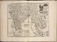
Beinecke Rare Book and Manuscript Library > A new and accurate mapof the Empire of the Great Mogul, together with India on both sides the Ganges, and the adjacent countries. Drawn fromt he most approved modern maps and charts: The whole being regulated by Astron's observations by Eman. Bowen
Creator:
Published / Created:
1844
Call Number:
Zc74 844gra
Collection Title:
The history of Oregon and California & the other territories of the northwest coast of North
Image Count:
1
Found in:
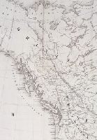
Beinecke Rare Book and Manuscript Library > [Detail showng mouth of the Columbia River in the south to just north of Queen Charlotte Island from the "Map of the Western & Middle Portions of North America, to illustrate the History of California, Oregon and other countries on the North-West coast of
Creator:
Published / Created:
1828
Call Number:
Speck En G7 828
Collection Title:
St. Petersburgh : a journal of travels to and from that capital : through Flanders, the Rhenish
Container / Volume:
Volume 1
Image Count:
1
Found in:
Beinecke Rare Book and Manuscript Library > St. Petersburg, drawn from a plan published at the Etat -Major, from a Trigonometrical survey, 1827
Published / Created:
March 1, 1809
Call Number:
1978 226
Collection Title:
A new royal atlas, illustrative of the various divisions which comprise the surface of the globe...
Image Count:
1
Resource Type:
Maps, Atlases & Globes
Found in:
Beinecke Rare Book and Manuscript Library > Asia. Engraved for Evans's Geographical Grammar
Published / Created:
March 1, 1809
Call Number:
1978 226
Collection Title:
A new royal atlas, illustrative of the various divisions which comprise the surface of the globe...
Image Count:
1
Resource Type:
Maps, Atlases & Globes
Found in:
Beinecke Rare Book and Manuscript Library > Hindoostan
Published / Created:
1808
Call Number:
1978 Folio 34
Collection Title:
Smith's New general atlas, containing distinct maps of all the principal empires, kingdoms
Image Count:
1
Resource Type:
Maps, Atlases & Globes
Found in:
Beinecke Rare Book and Manuscript Library > Eastern Hemisphere
Published / Created:
January 6, 1808
Call Number:
1978 Folio 34
Collection Title:
Smith's New general atlas, containing distinct maps of all the principal empires, kingdoms
Image Count:
1
Resource Type:
Maps, Atlases & Globes
Found in:
Beinecke Rare Book and Manuscript Library > Hindoostan
Creator:
Published / Created:
August 24, 1824 [i.e. 1825?]
Call Number:
1977 Folio 65
Collection Title:
A general atlas of modern geography, consisting of a complete collection of the most approved maps ...
Image Count:
1
Found in:
Beinecke Rare Book and Manuscript Library > Hind, Hindoostan, or India
Creator:
Published / Created:
April 1, 1824 [i.e. 1825?]
Call Number:
1977 Folio 65
Collection Title:
A general atlas of modern geography, consisting of a complete collection of the most approved maps ...
Image Count:
1
Found in:
Beinecke Rare Book and Manuscript Library > A Map of Bengal, Bahar, Oude & Allahabad with Part of Agra and Delhi exhibiting the Course of the Ganges from Hurdwar to the Sea
Published / Created:
[1823?]
Call Number:
1978 Folio 104
Collection Title:
A new and elegant imperial atlas: comprehending general and particular maps of every part of the
Image Count:
1
Found in:
Beinecke Rare Book and Manuscript Library > A New general map of the East Indies, exhibiting in the Peninsula on this side of the Ganges or Hindoostan, the several partitions of the Mogul's Empire ...
Creator:
Published / Created:
[1766]
Call Number:
ByzL 79t
Collection Title:
A new and accurate history and survey of London, Westminster, Southwark, and places adjacent
Image Count:
1
Resource Type:
Maps, Atlases & Globes
Found in:
Beinecke Rare Book and Manuscript Library > The London guide, or, a pocket plan of the cities of London & Westminster and Borough of Southwark; with the new buildings, &c. to the present year
Creator:
Published / Created:
1673
Call Number:
1998 Folio 71
Image Count:
1
Resource Type:
Books, Journals & Pamphlets
Found in:
Beinecke Rare Book and Manuscript Library > An embassy from the East-India Company of the United Provinces, to the Grand Tartar Cham, Emperor of China : deliverd by their excellencies, Peter de Goyer and Jacob de Keyzer, at his imperial city of Peking : wherein the cities, towns, villages, ports, r
Creator:
Published / Created:
1775 Feb 20
Call Number:
1973 Folio 80
Collection Title:
The West-India atlas: or, A compendious description of the West-Indies: illustrated with forty
Image Count:
1
Resource Type:
Prints & Photographs
Found in:
Beinecke Rare Book and Manuscript Library > The Virgin Islands from English and Danish surveys
Creator:
Published / Created:
1775 Feb 20
Call Number:
1973 Folio 80
Collection Title:
The West-India atlas: or, A compendious description of the West-Indies: illustrated with forty
Image Count:
1
Resource Type:
Prints & Photographs
Found in:
Beinecke Rare Book and Manuscript Library > Curacao from the Dutch originals of Gerard Van Keulen
Creator:
Published / Created:
1682
Call Number:
Taylor 384
Image Count:
50
Found in:
Beinecke Rare Book and Manuscript Library > Atlas maritimus, or, A sea-atlas : describing the sea-coasts in most of the known parts of the world / by John Seller, hydrographer to the King
Creator:
Published / Created:
November 29th 1755
Call Number:
2003 Folio 85
Image Count:
1
Found in:
Beinecke Rare Book and Manuscript Library > A map of the most inhabited part of New England: containing the provinces of Massachusets Bay and New Hampshire, with the colonies of Conecticut and Rhode Island : divided into counties and townships : the whole composed from actual surveys and its situat
Creator:
Published / Created:
1722
Call Number:
2003 Folio 85
Image Count:
1
Found in:
Beinecke Rare Book and Manuscript Library > A new & exact map of the island of Barbadoes in America: according to an actual & accurate survey made in the years 1717 to 1721, approved by the Royal Society & authorized by His Majesty's royal licence
Creator:
Published / Created:
1755
Call Number:
2003 Folio 85
Image Count:
1
Found in:
Beinecke Rare Book and Manuscript Library > A new map of Nova Scotia, and Cape Britain: With the adjacent parts of New England and Canada, composed from a great number of actual surveys; and other materials regulated by many new astronomical observations of the longitude as well as latitude; with a
Creator:
Published / Created:
1761
Call Number:
2003 Folio 85
Image Count:
1
Found in:
Beinecke Rare Book and Manuscript Library > Dominica
Creator:
Published / Created:
1758
Call Number:
2003 Folio 85
Image Count:
1
Found in:
Beinecke Rare Book and Manuscript Library > A general map of the middle British colonies in America: viz. Virginia, Maryland, Delaware, Pensilvania, New-Jersey, New-York, Connecticut and Rhode-Island : of Aquanishuonigy the country of the confederate Indians comprehending Aquanishuonigy proper, the
Creator:
Published / Created:
[1755]
Call Number:
2003 Folio 85
Image Count:
1
Found in:
Beinecke Rare Book and Manuscript Library > A map of the most inhabited part of Virginia containing the whole province of Maryland: with part of Pensilvania, New Jersey and North Carolina
Creator:
Published / Created:
1765
Call Number:
2003 Folio 85
Image Count:
1
Found in:
Beinecke Rare Book and Manuscript Library > A map of North America
Creator:
Published / Created:
Decr. 1766
Call Number:
2003 Folio 85
Image Count:
1
Found in:
Beinecke Rare Book and Manuscript Library > A draught of Port Royal Harbour in South Carolina: with the marks for going in : most humbly inscribed to the publick
Creator:
Published / Created:
December 1766
Call Number:
2003 Folio 85
Image Count:
1
Found in:
Beinecke Rare Book and Manuscript Library > A draught of west Florida : with part of the river Mississippi
Creator:
Published / Created:
Decem'r. 1766
Call Number:
2003 Folio 85
Image Count:
1
Found in:
Beinecke Rare Book and Manuscript Library > A draught of the harbour of Halifax and the adjacent coast in Nova Scotia: surveyed by order of Commodore Spry
Creator:
Published / Created:
1766
Call Number:
2003 Folio 85
Image Count:
1
Found in:
Beinecke Rare Book and Manuscript Library > A chart of the Straights of Bellisle: with part of the coast of Newfoundland and Labradore from actual surveys. Taken by order of Commodore Pallisser, Governor of Newfoundland, Labrador, &ca
Creator:
Published / Created:
1766. NB. With a book of directions
Call Number:
2003 Folio 85
Image Count:
1
Found in:
Beinecke Rare Book and Manuscript Library > A chart of part of the south coast of Newfoundland: including the islands St. Peters and Miquelon : from an actual survey taken by order of Commodore Pallisser, Governor of Newfoundland, Labrador, &c
Creator:
Published / Created:
[ca. 1762]
Call Number:
2003 Folio 85
Image Count:
1
Found in:
Beinecke Rare Book and Manuscript Library > A new map of Jamaica: in which the several towns, forts, & settlements are accurately laid down, as well as the situations & depths of the most noted harbours and anchoring places
Creator:
Published / Created:
[between 1755 and 1775?]
Call Number:
2003 Folio 85
Image Count:
1
Found in:
Beinecke Rare Book and Manuscript Library > An accurate map of North America: describing and distinguishing the British, Spanish and French dominions on this great continent; exhibiting the present seat of war, and the French encroachments. Also all the West India Islands belonging to, and possesse
Creator:
Published / Created:
[1768]
Call Number:
2003 Folio 85
Image Count:
1
Found in:
Beinecke Rare Book and Manuscript Library > A correct plan of the environs of Quebec, and of the battle fought on the 13th September, 1759: together with a particular detail of the French lines and batteries, and also of the encampments, batteries and attacks of the British army, and the investitur
Published / Created:
1763 April
Call Number:
Z17 299b
Collection Title:
Universal museum; or, Gentleman's and ladies polite magazine of history politicks and literature.
Image Count:
1
Resource Type:
Books, Journals & Pamphlets
Found in:
Beinecke Rare Book and Manuscript Library > Theodolite's Pattern, shewing the advantages obtained by the peace to England, particularly in North America.
Creator:
Published / Created:
1832
Call Number:
1978 Folio 106
Collection Title:
Maps of the Orinoco-Essequibo region, South America. Compiled for the Commission appointed by the
Image Count:
1
Resource Type:
Maps, Atlases & Globes
Found in:
Beinecke Rare Book and Manuscript Library > Part of a map of Colombia by J. Arrowsmith, London, 1832
Creator:
Published / Created:
1795
Call Number:
Osborn pc259
Image Count:
4
Resource Type:
Maps, Atlases & Globes
Found in:
Beinecke Rare Book and Manuscript Library > Bowles's European geographical amusement, or, Game of geography ; designed from The grand tour of Europe, by Dr. Nugent
Creator:
Published / Created:
1786 January 11
Call Number:
1982 Folio 10
Image Count:
1
Found in:
Beinecke Rare Book and Manuscript Library > The sea of Marmara or Propontis: with the straits of Constantinople and of Gallipoli
Creator:
Published / Created:
1785 March 1
Call Number:
1982 Folio 10
Image Count:
2
Found in:
Beinecke Rare Book and Manuscript Library > A map of the Mediterranean Sea, with the adjacent regions and seas in Europe, Asia, and Africa
Creator:
Published / Created:
1786
Call Number:
1982 Folio 10
Image Count:
2
Found in:
Beinecke Rare Book and Manuscript Library > A new map of the whole continent of America : divided into North and South and West Indies wherein are exactly described the United States of North America as well as the several European possessions according to the preliminaries of peace signed at Versa
Creator:
Published / Created:
1787 January 1
Call Number:
1982 Folio 10
Image Count:
1
Found in:
Beinecke Rare Book and Manuscript Library > A new general chart of the world : exhibiting the whole of the discoveries made by the late Captain James Cook, F.R.S. with the tracks of the ships under his command : also those of Cap'n Phipps (now Lord Mulgrave) in his expedition to the North Pole
Creator:
Published / Created:
1786 October 28
Call Number:
1982 Folio 10
Image Count:
1
Found in:
Beinecke Rare Book and Manuscript Library > New world or western hemisphere : old world or eastern hemisphere
Creator:
Published / Created:
1787 January 1
Call Number:
1982 Folio 10
Image Count:
2
Found in:
Beinecke Rare Book and Manuscript Library > Europe divided into its empires, kingdoms, states, republics, & ca
Creator:
Published / Created:
1787 January 1
Call Number:
1982 Folio 10
Image Count:
2
Found in:
Beinecke Rare Book and Manuscript Library > South Britain or England & Wales : drawn from several surveys &c. on the new projection, corrected from astronomical observations, & the places marked where the observat. were made
Creator:
Published / Created:
1778 December 1
Call Number:
1982 Folio 10
Image Count:
1
Found in:
Beinecke Rare Book and Manuscript Library > North Britain, or Scotland, divided into its counties : corrected from the best surveys & astronomical observations
Creator:
Published / Created:
1792
Call Number:
1982 Folio 10
Image Count:
2
Found in:
Beinecke Rare Book and Manuscript Library > A new map of Ireland, civil and ecclesiastical
Creator:
Published / Created:
1781 January 1
Call Number:
1982 Folio 10
Image Count:
1
Found in:
Beinecke Rare Book and Manuscript Library > A chart of the islands of Jersey and Guernsey, Sark, Herm and Alderney, with the adjacent coast of France
Creator:
Published / Created:
1789 January 1
Call Number:
1982 Folio 10
Image Count:
1
Found in:
Beinecke Rare Book and Manuscript Library > A map of the seven united provinces, with the land of Drent, and the generality Lands
Creator:
Published / Created:
1789 January 1
Call Number:
1982 Folio 10
Image Count:
1
Found in:
Beinecke Rare Book and Manuscript Library > A map of the Austrian possessions in the Netherlands or Low Countries, with the principalities of Liege and Stavelo, & ca : reduced from the trigonometric survey made by order of H.R.H. the Prince Charles of Lorraine
Creator:
Published / Created:
1772 March 2
Call Number:
1982 Folio 10
Image Count:
1
Found in:
Beinecke Rare Book and Manuscript Library > The post roads of France
Creator:
Published / Created:
1780 June 28
Call Number:
1982 Folio 10
Image Count:
1
Found in:
Beinecke Rare Book and Manuscript Library > A chart of the coasts of Spain and Portugal, with the Balearic Islands, and part of the coast of Barbary
Creator:
Published / Created:
1772 March 2
Call Number:
1982 Folio 10
Image Count:
2
Found in:
Beinecke Rare Book and Manuscript Library > The kingdoms of Spain and Portugal : divided into their Great Provinces
Creator:
Published / Created:
1783 January 26
Call Number:
1982 Folio 10
Image Count:
1
Found in:
Beinecke Rare Book and Manuscript Library > Plan of the bay, rock and town of Gibraltar : from an actual survey by an officer who was at Gibraltar from 1769 to 1775 : with the works, batteries, and incampment of the Spanish Army on the 19th of Octor. 1782, the position of the combined fleet, and th
Creator:
Published / Created:
1788 June 24
Call Number:
1982 Folio 10
Image Count:
2
Found in:
Beinecke Rare Book and Manuscript Library > A new map of the German empire and the neighbouring states with their principal post roads : originally published by the Royal Academy of Berlin
Creator:
Published / Created:
1789 June 1
Call Number:
1982 Folio 10
Image Count:
1
Found in:
Beinecke Rare Book and Manuscript Library > A new map of the King of Great Britain's dominions in Germany or the electorate of Brunswick-Luneburg and its dependencies
Creator:
Published / Created:
1787 January 1
Call Number:
1982 Folio 10
Image Count:
1
Found in:
Beinecke Rare Book and Manuscript Library > A new map of the Kingdom of Poland with its dismembered provinces
Creator:
Published / Created:
1788 May 1
Call Number:
1982 Folio 10
Image Count:
2
Found in:
Beinecke Rare Book and Manuscript Library > The European part of the Russian empire : from the maps published by the Imperial Academy at St. Petersburg, with the new provinces on the Black Sea ; The Asiatic part of the Russian empire : from the maps published by the Imperial Academy of St. Petersbu
Creator:
Published / Created:
1790 January 1
Call Number:
1982 Folio 10
Image Count:
1
Found in:
Beinecke Rare Book and Manuscript Library > Greece, Archipelago and part of Anadoli
Creator:
Published / Created:
1787 January 6
Call Number:
1982 Folio 10
Image Count:
2
Found in:
Beinecke Rare Book and Manuscript Library > Asia and its islands according to d'Anville : divided into empires, kingdoms, states, regions, & ca. with the European possessions and settlements in the East Indies and an exact delineation of all the discoveries made in the eastern parts by the English
Creator:
Published / Created:
1788 January 1
Call Number:
1982 Folio 10
Image Count:
1
Found in:
Beinecke Rare Book and Manuscript Library > Hind, Hindoostan, or India
Creator:
Published / Created:
1786 January 1
Call Number:
1982 Folio 10
Image Count:
1
Found in:
Beinecke Rare Book and Manuscript Library > A map of Bengal, Bahar, Oude & Allahabad with part of Agra and Delhi : exhibiting the course of the Ganges from Hurdwar to the sea
Creator:
Published / Created:
1788 February 8
Call Number:
1982 Folio 10
Image Count:
1
Found in:
Beinecke Rare Book and Manuscript Library > The southern countries of India from Madrass to Cape Comorin : describing the routes of the armies commanded by Colonels Fullerton and Humberston, during the campaigns of 1782, 1783 & 1784, surveyed by Col. Kelly & Capt. Wersebe and others
Creator:
Published / Created:
1784
Call Number:
1982 Folio 10
Image Count:
1
Found in:
Beinecke Rare Book and Manuscript Library > Chart of the N.W. coast of America and the N.E. coast of Asia, explored in the years 1778 and 1779
Creator:
Published / Created:
1787 January 6
Call Number:
1982 Folio 10
Image Count:
2
Found in:
Beinecke Rare Book and Manuscript Library > Africa : with all its states, kingdoms, republics, regions, islands, & ca., improved and inlarged from D'Anville's map : to which have been added a particular chart of the Gold Coast wherein are distinguished all the European forts and factories
Creator:
Published / Created:
1789 January 1
Call Number:
1982 Folio 10
Image Count:
1
Found in:
Beinecke Rare Book and Manuscript Library > The western coast of Africa, from Cape Blanco to Cape Virga, exhibiting Senegambia proper
Creator:
Published / Created:
1784 March 1
Call Number:
1982 Folio 10
Image Count:
1
Found in:
Beinecke Rare Book and Manuscript Library > A chart of the Antilles, or, Charibbee, or, Caribs Islands, with the Virgin Isles
Creator:
Published / Created:
1787 July 1
Call Number:
1982 Folio 10
Image Count:
2
Found in:
Beinecke Rare Book and Manuscript Library > A map of South America : containing Tierra-Firma, Guayana, New Granada, Amazonia, Brasil, Peru, Paraguay, Chaco, Tucuman, Chili and Patagonia : from Mr. d'Anville with several improvements and additions, and the newest discoveries
Creator:
Published / Created:
1783 December 1
Call Number:
1982 Folio 10
Image Count:
1
Found in:
Beinecke Rare Book and Manuscript Library > Northern Hemisphere : Southern Hemisphere
Creator:
Published / Created:
1780 June 17
Call Number:
1982 Folio 10
Image Count:
1
Found in:
Beinecke Rare Book and Manuscript Library > A chart of the British Channel and the Bay of Biscay with a part of the North Sea, and the entrance of St. George's Channel
Creator:
Published / Created:
1788 October 10
Call Number:
1982 Folio 10
Image Count:
1
Found in:
Beinecke Rare Book and Manuscript Library > A new map of the Northern States containing the Kingdoms of Sweden, Denmark, and Norway, with the western parts of Russia, Livonia, Courland &ca
Creator:
Published / Created:
1787 October 24
Call Number:
1982 Folio 10
Image Count:
1
Found in:
Beinecke Rare Book and Manuscript Library > To his excellency the Count of Czernichew, commander in chief of her Majesty the Empress of all the Russia's fleet and gallies ... : map of the present seat of war, between the Russians, Poles, and Turks is most humbly inscribed
Creator:
Published / Created:
1782 March 20
Call Number:
1982 Folio 10
Image Count:
1
Found in:
Beinecke Rare Book and Manuscript Library > The Dutch colony of the Cape of Good Hope
Creator:
Published / Created:
1680
Call Number:
1973 Folio 10
Image Count:
1
Resource Type:
Maps, Atlases & Globes
Found in:
Beinecke Rare Book and Manuscript Library > A mapp of all the world in two hemispheres in which are exactly described all the parts of the earth and seas
Creator:
Published / Created:
1680
Call Number:
1973 Folio 10
Image Count:
1
Resource Type:
Maps, Atlases & Globes
Found in:
Beinecke Rare Book and Manuscript Library > Europe divided into its principall states, which are subdivided into their principall provinces
Creator:
Published / Created:
[ca. 1700]
Call Number:
1973 Folio 10
Image Count:
1
Resource Type:
Maps, Atlases & Globes
Found in:
Beinecke Rare Book and Manuscript Library > A new mapp of the sea coasts of England, Scotland, and Ireland: with the adjacent coasts of France, Holand, Denmark & Norway, shewing the scituation and distance of the several ports, harbors, havens, creeks, sands &c
Creator:
Published / Created:
[1689?]
Call Number:
1973 Folio 10
Image Count:
1
Resource Type:
Maps, Atlases & Globes
Found in:
Beinecke Rare Book and Manuscript Library > A new mapp of the kingdome of England and Wales: containing all the cities, market towns, with the roades from town to town, and the numbers of reputed miles between them, are given by inspection without scale or compass
Creator:
Published / Created:
1700
Call Number:
1973 Folio 10
Image Count:
1
Resource Type:
Maps, Atlases & Globes
Found in:
Beinecke Rare Book and Manuscript Library > This actuall survey of London, Westminster & Southwark is humbly dedicated to ye Ld. Mayor [and] Court of Aldermen by Ro. Morden, Phil. Lea, Chr. Browne
Creator:
Published / Created:
[169-?]
Call Number:
1973 Folio 10
Image Count:
1
Resource Type:
Maps, Atlases & Globes
Found in:
Beinecke Rare Book and Manuscript Library > A new chart of the sea coasts of France: together with the English Chanell describing ye severall harbors, sands, rocks, and anchoridges, etc. on the said coasts
Creator:
Published / Created:
[1704?]
Call Number:
1973 Folio 10
Image Count:
1
Resource Type:
Maps, Atlases & Globes
Found in:
Beinecke Rare Book and Manuscript Library > The war in Portugall and Spain: with the harbours of the Groyne, Vigo & Bayonna, Porto, Lisbon [and] St. Ubes, Cadiz, and a chart from England to the streights
Creator:
Published / Created:
[1682]
Call Number:
1973 Folio 10
Image Count:
1
Resource Type:
Maps, Atlases & Globes
Found in:
Beinecke Rare Book and Manuscript Library > Spain divided into its severall kingdoms and principalities, according as they are comprehended under the crowns of Castile and Aragon, in the possession of his Catholick Majesty and under the crown of Portugal, in the possession of the king of Portugal
Creator:
Published / Created:
[168-]
Call Number:
1973 Folio 10
Image Count:
1
Resource Type:
Maps, Atlases & Globes
Found in:
Beinecke Rare Book and Manuscript Library > Principality of Catalonia: in which are comprehended the counties of Rossillion and of Cerdagne divided into its severall vigueries or provost-ship
Creator:
Published / Created:
[168-]
Call Number:
1973 Folio 10
Image Count:
1
Resource Type:
Maps, Atlases & Globes
Found in:
Beinecke Rare Book and Manuscript Library > The kingdom of France: distinguished according to the extent of all its provinces and conquests in Spain, Italy, Germany, Flanders, Artoise, Haynoult, Namur, and Luxembourg, provinces of the low countries
Creator:
Published / Created:
1682
Call Number:
1973 Folio 10
Image Count:
1
Resource Type:
Maps, Atlases & Globes
Found in:
Beinecke Rare Book and Manuscript Library > Italy: distinguished according to the extent of all the states, kingdoms, republicks, dukedoms, principalities etc. that doe at present divide it
Creator:
Published / Created:
[168-?]
Call Number:
1973 Folio 10
Image Count:
1
Resource Type:
Maps, Atlases & Globes
Found in:
Beinecke Rare Book and Manuscript Library > A new map of the estates of Savoy [and] Piedmont: with the countries adjacent
Creator:
Published / Created:
[ca. 1701]
Call Number:
1973 Folio 10
Image Count:
1
Resource Type:
Maps, Atlases & Globes
Found in:
Beinecke Rare Book and Manuscript Library > H. Jalliots map of the seat of war in Italy cont. ye duchyes of Milan, Mantua, Parma, etc. with the Venetian territoryes
Creator:
Published / Created:
[ca. 1700?]
Call Number:
1973 Folio 10
Image Count:
1
Resource Type:
Maps, Atlases & Globes
Found in:
Beinecke Rare Book and Manuscript Library > A new mapp of Rome shewing its antient and present scituation
Creator:
Published / Created:
[ca. 1680]
Call Number:
1973 Folio 10
Image Count:
1
Resource Type:
Maps, Atlases & Globes
Found in:
Beinecke Rare Book and Manuscript Library > Mediterranean Sea divided into its principal parts or seas
Branch:v1.60.98 ,Deployed:2024-05-01T09:16:19-04:00