Search
You Searched For
Search Results
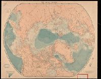
- Creator:
- Edward Stanford Ltd.
- Published / Created:
- [between 1890 and 1900]
- Call Number:
- BrSides Double Folio 2019 10
- Image Count:
- 1
- Resource Type:
- Maps, Atlases & Globes
- Found in:
- Beinecke Rare Book and Manuscript Library > The arctic regions.
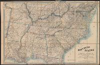
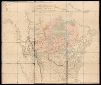
- Creator:
- Wyld, James, 1812-1887
- Published / Created:
- [1862?]
- Call Number:
- 754 1861B
- Container / Volume:
- BRBL_00416
- Image Count:
- 1
- Resource Type:
- Maps, Atlases & Globes
- Found in:
- Beinecke Rare Book and Manuscript Library > Map of the southern states of North America with the forts, harbours & military positions James Wyld, Geographer to the Queen.
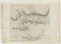
- Creator:
- Blaskowitz, Charles
- Published / Created:
- 1777.
- Call Number:
- 777.09.01.05++
- Image Count:
- 1
- Found in:
- Lewis Walpole Library > A plan of the town of Newport in Rhode Island
- Published / Created:
- 1784]
- Call Number:
- 784.00.00.78+
- Image Count:
- 1
- Found in:
- Lewis Walpole Library > A Representation, of the sea fight, on the 5th of Sepr. 1781, between Rear Admiral Graves and the Count de Grasse
- Creator:
- Blaskowitz, Charles
- Published / Created:
- 1777.
- Call Number:
- Drawer 777.07.22.01+
- Image Count:
- 1
- Found in:
- Lewis Walpole Library > A topographical chart of the bay of Narraganset in the province of New England : with all the isles contained therein, among which Rhode Island and Connonicut have been particularly surveyed, shewing the true position & bearings of the banks, shoals, rocks &c. as likewise the soundings: To which have been added the several works & batteries raised by the Americans. Taken by order of the principal farmers on Rhode Island
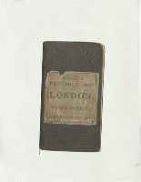
- Creator:
- G.W. Bacon & Co.
- Published / Created:
- [187-?]
- Call Number:
- Purdy 155
- Image Count:
- 9
- Found in:
- Beinecke Rare Book and Manuscript Library > Bacon's central London : divided into half mile squares & circles
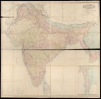
- Creator:
- Walker, John, 1786-1873, cartographer
- Published / Created:
- 1882.
- Call Number:
- Covers 59 +1882
- Image Count:
- 2
- Resource Type:
- cartographic image
- Found in:
- Beinecke Rare Book and Manuscript Library > Map of India : shewing the British territories, subdivided into collectorates and including British Burmah, with the position and boundary of each native state
- Creator:
- Arrowsmith, Aaron, 1750-1823, cartographer
- Published / Created:
- [1820]
- Call Number:
- 71 1820B
- Image Count:
- 1
- Resource Type:
- cartographic image
- Found in:
- Beinecke Rare Book and Manuscript Library > A map exhibiting all the new discoveries in the interior parts of North America : inscribed by permission to the honorable governor and company of adventurers of England trading into Hudsons Bay, in testimony of their liberal communications to their most obedient and very humble servant, A. Arrowsmith, Hydrographer to His Majesty
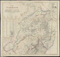
- Creator:
- Jeppe, Frederick, cartographer
- Published / Created:
- [1878?]
- Call Number:
- Covers 643 1878
- Image Count:
- 2
- Found in:
- Beinecke Rare Book and Manuscript Library > Map of the Transvaal and the surrounding territories
- Published / Created:
- 1704
- Call Number:
- Cxb e678ge
- Collection Title:
- The history of the bucaniers of America : from the first original down to this time; written in
- Image Count:
- 1
- Resource Type:
- Maps, Atlases & Globes
- Found in:
- Beinecke Rare Book and Manuscript Library > A Map of the Countrey and Citty of Panama. Part 3: Chap: 5.
- Published / Created:
- 1801
- Call Number:
- Zc90 801mab
- Collection Title:
- Voyages from Montreal, on the river St. Laurence, through the continent of North America, to the
- Image Count:
- 1
- Found in:
- Beinecke Rare Book and Manuscript Library > A map of America, between latitudes 40 and 70 north and longitudes 45 and 180 west, exhibiting Mackenzie's track from Montreal to Fort Chipewyan & from thence to the North Sea In 1789 & to the West Pacific Ocean in 1793
- Creator:
- Dunn, Samuel
- Published / Created:
- 1774
- Call Number:
- Cb23 27
- Collection Title:
- The American military pocket atlas : being an approved collection of correct maps, both general and
- Image Count:
- 1
- Found in:
- Beinecke Rare Book and Manuscript Library > North America as divided amongst the European powers
- Published / Created:
- 1776
- Call Number:
- Cb23 27
- Collection Title:
- The American military pocket atlas : being an approved collection of correct maps, both general and
- Image Count:
- 1
- Found in:
- Beinecke Rare Book and Manuscript Library > A General map of the northern British colonies in America. which comprehends the province of Quebec, the government of Newfoundland, Nova-Scotia, New-England and New-York. From the maps published by the Admiralty and Board of Trade regulated by the astronomic and trigonometric observations of M. von Holland and corrected from Governor Pownall's late map 1776.
- Published / Created:
- 1776
- Call Number:
- Cb23 27
- Collection Title:
- The American military pocket atlas : being an approved collection of correct maps, both general and
- Image Count:
- 1
- Found in:
- Beinecke Rare Book and Manuscript Library > A general map of the middle British colonies in America. Containing Virginia, Maryland, the Delaware counties, Pennsylvania and New Jersey. With the addition of New York, and of the greatest part of New England, as also of the bordering parts of the province of Quebec, improved from several surveys made after the late war, and corrected from Governor Pownall's late map 1776.
- Creator:
- Romans, B
- Published / Created:
- 1776
- Call Number:
- Cb23 27
- Collection Title:
- The American military pocket atlas : being an approved collection of correct maps, both general and
- Image Count:
- 1
- Found in:
- Beinecke Rare Book and Manuscript Library > A General map of the southern British colonies, in America, comprehending North and South Carolina, Georgia, east and west Florida, with the neighbouring Indian countries. From the modern surveys of engineer de Brahm, Capt. Collet, Mouzon & others; and from the large hydrographical survey of the coasts of east and west Florida
- Creator:
- Brasier, William
- Published / Created:
- 1776
- Call Number:
- Cb23 27
- Collection Title:
- The American military pocket atlas : being an approved collection of correct maps, both general and
- Image Count:
- 1
- Found in:
- Beinecke Rare Book and Manuscript Library > A Survey of Lake Champlain, including Lake George, Crown Point and St. John. Surveyed by order of His Excellency Major General Sr. Jeffery Amherst, knight of the most honble. Order of the Bath, Commander in Chief of His Majesty's forces in North America (now Lord Amherst) by William Brassier, draughtsman, 1762
- Creator:
- Hall, Sidney
- Published / Created:
- 1822 March
- Call Number:
- Egk30 Ed9 820W
- Collection Title:
- Two years' residence in the settlement on the English prairie, in the Illinois country ... : with
- Image Count:
- 1
- Found in:
- Beinecke Rare Book and Manuscript Library > Map of Illinois
- Creator:
- Hall, Sidney
- Published / Created:
- 1822 March
- Call Number:
- Egk30 Ed9 820W
- Collection Title:
- Two years' residence in the settlement on the English prairie, in the Illinois country ... : with
- Image Count:
- 1
- Found in:
- Beinecke Rare Book and Manuscript Library > Map of the allotments
- Creator:
- Vaughan, Robert, 17th cent., engraver
- Published / Created:
- 1624
- Call Number:
- 2003 +39
- Collection Title:
- The generall historie of Virginia, New-England, and the Summer Iles ...
- Image Count:
- 1
- Found in:
- Beinecke Rare Book and Manuscript Library > A description of part of the adventures of Cap. Smith in Virginia
- Creator:
- Lowe, George, fl. 1613?-ca. 1615?, printer
Pass, Simon van de, 1595?-1647, engraver.
- Published / Created:
- 1624
- Call Number:
- 2003 +39
- Collection Title:
- The generall historie of Virginia, New-England, and the Summer Iles ...
- Image Count:
- 1
- Found in:
- Beinecke Rare Book and Manuscript Library > New England
- Creator:
- Russell, John, fl. 1733-1795
- Published / Created:
- 1794 July 26
- Call Number:
- 1986 102
- Collection Title:
- An historical, geographical, commercial, and philosophical view of the American United States, and
- Image Count:
- 1
- Found in:
- Beinecke Rare Book and Manuscript Library > A General map of North America drawn from the best sources
- Creator:
- Russell, John, fl. 1733-1795
- Published / Created:
- 1794 October 18
- Call Number:
- 1986 102
- Collection Title:
- An historical, geographical, commercial, and philosophical view of the American United States, and
- Image Count:
- 1
- Found in:
- Beinecke Rare Book and Manuscript Library > An Accurate map of the United States of America. according to the Treaty of Peace of 1783
- Creator:
- Russell, John, fl. 1733-1795
- Published / Created:
- 1795 February 7
- Call Number:
- 1986 102
- Collection Title:
- An historical, geographical, commercial, and philosophical view of the American United States, and
- Image Count:
- 1
- Found in:
- Beinecke Rare Book and Manuscript Library > Map of the northern, or, New England states of America. Comprehending Vermont, New Hampshire, District of Main, Massachusetts, Rhode-Island, and Connecticut
- Published / Created:
- 1705
- Call Number:
- 1977 +394
- Collection Title:
- Navigantium atque itinerantium bibliotheca: or, A compleat collection of voyages and travels
- Container / Volume:
- Volume 2
- Image Count:
- 1
- Found in:
- Beinecke Rare Book and Manuscript Library > [Map of] Asia
- Creator:
- Hall, Sydney
- Published / Created:
- 1828
- Call Number:
- Speck En G7 828
- Collection Title:
- St. Petersburgh : a journal of travels to and from that capital : through Flanders, the Rhenish
- Container / Volume:
- Volume 1
- Image Count:
- 1
- Found in:
- Beinecke Rare Book and Manuscript Library > St. Petersburg, drawn from a plan published at the Etat -Major, from a Trigonometrical survey, 1827
- Published / Created:
- March 1, 1809
- Call Number:
- 1978 226
- Collection Title:
- A new royal atlas, illustrative of the various divisions which comprise the surface of the globe...
- Image Count:
- 1
- Resource Type:
- Maps, Atlases & Globes
- Found in:
- Beinecke Rare Book and Manuscript Library > Asia. Engraved for Evans's Geographical Grammar
- Published / Created:
- March 1, 1809
- Call Number:
- 1978 226
- Collection Title:
- A new royal atlas, illustrative of the various divisions which comprise the surface of the globe...
- Image Count:
- 1
- Resource Type:
- Maps, Atlases & Globes
- Found in:
- Beinecke Rare Book and Manuscript Library > Hindoostan
- Published / Created:
- 1808
- Call Number:
- 1978 Folio 34
- Collection Title:
- Smith's New general atlas, containing distinct maps of all the principal empires, kingdoms
- Image Count:
- 1
- Resource Type:
- Maps, Atlases & Globes
- Found in:
- Beinecke Rare Book and Manuscript Library > Eastern Hemisphere
- Published / Created:
- January 6, 1808
- Call Number:
- 1978 Folio 34
- Collection Title:
- Smith's New general atlas, containing distinct maps of all the principal empires, kingdoms
- Image Count:
- 1
- Resource Type:
- Maps, Atlases & Globes
- Found in:
- Beinecke Rare Book and Manuscript Library > Hindoostan
- Creator:
- De La Rochette, L. S
- Published / Created:
- August 24, 1824 [i.e. 1825?]
- Call Number:
- 1977 Folio 65
- Collection Title:
- A general atlas of modern geography, consisting of a complete collection of the most approved maps ...
- Image Count:
- 1
- Found in:
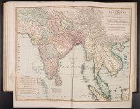
- Beinecke Rare Book and Manuscript Library > Hind, Hindoostan, or India
- Creator:
- Rennell, James
- Published / Created:
- April 1, 1824 [i.e. 1825?]
- Call Number:
- 1977 Folio 65
- Collection Title:
- A general atlas of modern geography, consisting of a complete collection of the most approved maps ...
- Image Count:
- 1
- Found in:
- Beinecke Rare Book and Manuscript Library > A Map of Bengal, Bahar, Oude & Allahabad with Part of Agra and Delhi exhibiting the Course of the Ganges from Hurdwar to the Sea
- Published / Created:
- [1823?]
- Call Number:
- 1978 Folio 104
- Collection Title:
- A new and elegant imperial atlas: comprehending general and particular maps of every part of the
- Image Count:
- 1
- Found in:
- Beinecke Rare Book and Manuscript Library > A New general map of the East Indies, exhibiting in the Peninsula on this side of the Ganges or Hindoostan, the several partitions of the Mogul's Empire ...
- Creator:
- Manley, Roger, Sir, 1626?-1688
- Published / Created:
- 1683
- Call Number:
- DL192 M35 1683+ Oversize
- Image Count:
- 91
- Found in:
- Beinecke Rare Book and Manuscript Library > The history of the late wars in Denmark : comprising, all the transactions, both military and civil ... in the years, 1657, 1658, 1659, 1660 ... / by Sir Roger Manley
- Creator:
- Tachard, Guy, 1651-1712
- Published / Created:
- 1688
- Call Number:
- 1977 1538
- Image Count:
- 195
- Found in:
- Beinecke Rare Book and Manuscript Library > A relation of the voyage to Siam. Performed by six Jesuits, sent by the French king, to the Indies and China, in the year, 1685 : With their astrological observations, and their remarks of natural philosophy, geography, hydrography, and history ... / Publ
- Creator:
- Debord, Guy, 1931-
- Published / Created:
- [1962]
- Call Number:
- 2008 1369
- Image Count:
- 9
- Found in:
- Beinecke Rare Book and Manuscript Library > [Sur la Commune. English]
- Creator:
- Bowles, Carington, 1724-1793
- Published / Created:
- [1766]
- Call Number:
- ByzL 79t
- Collection Title:
- A new and accurate history and survey of London, Westminster, Southwark, and places adjacent
- Image Count:
- 1
- Resource Type:
- Maps, Atlases & Globes
- Found in:
- Beinecke Rare Book and Manuscript Library > The London guide, or, a pocket plan of the cities of London & Westminster and Borough of Southwark; with the new buildings, &c. to the present year
- Creator:
- Jefferys, Thomas, d. 1771
- Published / Created:
- 1775 Feb 20
- Call Number:
- 1973 Folio 80
- Collection Title:
- The West-India atlas: or, A compendious description of the West-Indies: illustrated with forty
- Image Count:
- 1
- Resource Type:
- Prints & Photographs
- Found in:
- Beinecke Rare Book and Manuscript Library > The Virgin Islands from English and Danish surveys
- Creator:
- Jefferys, Thomas, d. 1771.
Keulen, Gerard van
- Published / Created:
- 1775 Feb 20
- Call Number:
- 1973 Folio 80
- Collection Title:
- The West-India atlas: or, A compendious description of the West-Indies: illustrated with forty
- Image Count:
- 1
- Resource Type:
- Prints & Photographs
- Found in:
- Beinecke Rare Book and Manuscript Library > Curacao from the Dutch originals of Gerard Van Keulen
- Creator:
- Vaughan, Robert, 17th cent., engraver
- Published / Created:
- 1624
- Call Number:
- Pequot +Sm4
- Collection Title:
- The generall historie of Virginia, New-England, and the Summer Isles : with the names of the
- Image Count:
- 1
- Found in:
- Beinecke Rare Book and Manuscript Library > A description of part of the adventures of Cap. Smith in Virginia
- Creator:
- Jefferys, Thomas, d. 1771, creator
Mellon, Paul
- Published / Created:
- November 29th 1755
- Call Number:
- 2003 Folio 85
- Image Count:
- 1
- Found in:
- Beinecke Rare Book and Manuscript Library > A map of the most inhabited part of New England: containing the provinces of Massachusets Bay and New Hampshire, with the colonies of Conecticut and Rhode Island : divided into counties and townships : the whole composed from actual surveys and its situat
- Creator:
- Chandos, James Brydges, Duke of, 1674-1744
Mayo, William., creator
Senex, John, d. 1740
- Published / Created:
- 1722
- Call Number:
- 2003 Folio 85
- Image Count:
- 1
- Found in:
- Beinecke Rare Book and Manuscript Library > A new & exact map of the island of Barbadoes in America: according to an actual & accurate survey made in the years 1717 to 1721, approved by the Royal Society & authorized by His Majesty's royal licence
- Creator:
- Jefferys, Thomas, d. 1771, creator
- Published / Created:
- 1755
- Call Number:
- 2003 Folio 85
- Image Count:
- 1
- Found in:
- Beinecke Rare Book and Manuscript Library > A new map of Nova Scotia, and Cape Britain: With the adjacent parts of New England and Canada, composed from a great number of actual surveys; and other materials regulated by many new astronomical observations of the longitude as well as latitude; with a
- Creator:
- Jefferys, Thomas, d. 1771, creator
Ross, David
- Published / Created:
- 1761
- Call Number:
- 2003 Folio 85
- Image Count:
- 1
- Found in:
- Beinecke Rare Book and Manuscript Library > Dominica
- Creator:
- Evans, Lewis, 1700?-1756
Gibson, J. (John), creator
Jefferys, Thomas, d. 1771
- Published / Created:
- 1758
- Call Number:
- 2003 Folio 85
- Image Count:
- 1
- Found in:
- Beinecke Rare Book and Manuscript Library > A general map of the middle British colonies in America: viz. Virginia, Maryland, Delaware, Pensilvania, New-Jersey, New-York, Connecticut and Rhode-Island : of Aquanishuonigy the country of the confederate Indians comprehending Aquanishuonigy proper, the
- Creator:
- Fry, Joshua, 1700 (ca.)-1754, creator
Halifax, George Montagu-Dunk, Earl of, 1716-1771
Jefferson, Peter, 1708-1757
Jefferys, Thomas, d. 1771
- Published / Created:
- [1755]
- Call Number:
- 2003 Folio 85
- Image Count:
- 1
- Found in:
- Beinecke Rare Book and Manuscript Library > A map of the most inhabited part of Virginia containing the whole province of Maryland: with part of Pensilvania, New Jersey and North Carolina
- Creator:
- Bowles, Carington, 1724-1793
Bowles, John, 1701-1779
Delarochette, L. (Louis), 1731-1802, creator
Palairet, Jean, 1697-1774
- Published / Created:
- 1765
- Call Number:
- 2003 Folio 85
- Image Count:
- 1
- Found in:
- Beinecke Rare Book and Manuscript Library > A map of North America
- Creator:
- Bowen, Emanuel, d. 1767
Cook, James, fl. 1766, creator
- Published / Created:
- Decr. 1766
- Call Number:
- 2003 Folio 85
- Image Count:
- 1
- Found in:
- Beinecke Rare Book and Manuscript Library > A draught of Port Royal Harbour in South Carolina: with the marks for going in : most humbly inscribed to the publick
- Creator:
- Cook, James, 1728-1779, creator
- Published / Created:
- December 1766
- Call Number:
- 2003 Folio 85
- Image Count:
- 1
- Found in:
- Beinecke Rare Book and Manuscript Library > A draught of west Florida : with part of the river Mississippi
- Creator:
- Bowen, Emanuel, d. 1767
Cook, James, 1728-1779, creator
- Published / Created:
- Decem'r. 1766
- Call Number:
- 2003 Folio 85
- Image Count:
- 1
- Found in:
- Beinecke Rare Book and Manuscript Library > A draught of the harbour of Halifax and the adjacent coast in Nova Scotia: surveyed by order of Commodore Spry
- Creator:
- Cook, James, 1728-1779, creator
Larken, sculpt
- Published / Created:
- 1766
- Call Number:
- 2003 Folio 85
- Image Count:
- 1
- Found in:
- Beinecke Rare Book and Manuscript Library > A chart of the Straights of Bellisle: with part of the coast of Newfoundland and Labradore from actual surveys. Taken by order of Commodore Pallisser, Governor of Newfoundland, Labrador, &ca