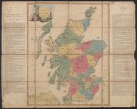
Search
You Searched For
Search Results
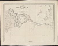
- Creator:
- Ordnance Survey of Great Britain and Ireland
Royal Geographical Society (Great Britain). Geographical Section
- Published / Created:
- 1915
- Call Number:
- 11hcf 1919E-5
- Container / Volume:
- BRBL_00010ZA
- Image Count:
- 1
- Resource Type:
- Maps, Atlases & Globes
- Found in:
- Beinecke Rare Book and Manuscript Library > (Vienna) Wien : North M 33. / compiled at the Royal Geographical Society under the direction of the Geographical Section ; drawn and printed by Ordnance Survey.
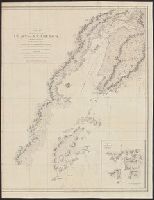
- Creator:
- Ordnance Survey of Great Britain and Ireland
Royal Geographical Society (Great Britain). Geographical Section
- Published / Created:
- 1918
- Call Number:
- 11hcf 1919E-6
- Container / Volume:
- BRBL_00010ZA
- Image Count:
- 1
- Resource Type:
- Maps, Atlases & Globes
- Found in:
- Beinecke Rare Book and Manuscript Library > (Vienna) Wien : North M 33. / compiled at the Royal Geographical Society under the direction of the Geographical Section ; drawn and printed by Ordnance Survey.
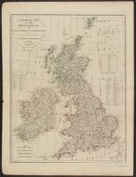
- Creator:
- Ordnance Survey of Great Britain and Ireland
Royal Geographical Society (Great Britain). Geographical Section
- Published / Created:
- 1915
- Call Number:
- 11hcf 1919E-5
- Container / Volume:
- BRBL_00010ZA
- Image Count:
- 1
- Resource Type:
- Maps, Atlases & Globes
- Found in:
- Beinecke Rare Book and Manuscript Library > (Vienna) Wien : North M 33. / compiled at the Royal Geographical Society under the direction of the Geographical Section ; drawn and printed by Ordnance Survey.
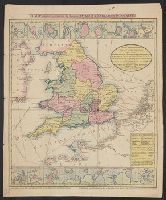
- Creator:
- Ordnance Survey of Great Britain and Ireland
Royal Geographical Society (Great Britain). Geographical Section
- Published / Created:
- 1915
- Call Number:
- 11hcf 1919E-12
- Image Count:
- 1
- Resource Type:
- Maps, Atlases & Globes
- Found in:
- Beinecke Rare Book and Manuscript Library > (Warsaw) Varshava : North N. 34. / compiled at the Royal Geographical Society under the direction of the Geographical Section; drawn and printed by Ordnance Survey.
- Published / Created:
- [1730?]
- Call Number:
- 894 1730
- Container / Volume:
- BRBL_00659
- Image Count:
- 1
- Resource Type:
- Maps, Atlases & Globes
- Found in:
- Beinecke Rare Book and Manuscript Library > ... This draught. being part of ye Spanish & Musketor Shore & the Bay of Honduras with. ye Islands adjacent; ... by ... Samuel Penthalow.
- Published / Created:
- 1841
- Call Number:
- 32 L84 1841
- Container / Volume:
- BRBL_00050
- Image Count:
- 1
- Resource Type:
- Maps, Atlases & Globes
- Found in:
- Beinecke Rare Book and Manuscript Library > 24 miles round London.
- Published / Created:
- 1782
- Call Number:
- 21cea 1782
- Container / Volume:
- BRBL_00016
- Image Count:
- 1
- Resource Type:
- Maps, Atlases & Globes
- Found in:
- Beinecke Rare Book and Manuscript Library > A Chart of the Atlantic Ocean.
- Published / Created:
- 1746
- Call Number:
- 307cea 1746
- Container / Volume:
- BRBL_00036
- Image Count:
- 1
- Resource Type:
- Maps, Atlases & Globes
- Found in:
- Beinecke Rare Book and Manuscript Library > A Chart of the English Channel, the Bay of Biscay, with part of the Ocean and Mediterranean ... By T. Kitchin.
- Published / Created:
- 1812
- Call Number:
- 29 1812
- Container / Volume:
- BRBL_00028
- Image Count:
- 1
- Resource Type:
- Maps, Atlases & Globes
- Found in:
- Beinecke Rare Book and Manuscript Library > A Chart of the Great Ethiopian Archipelago in the Indian Seas ... M.D. Apres. For the History of Mauritus by Ch. Grant ... 1801 S.J. Neele Sculp. 1812.
- Published / Created:
- 1779
- Call Number:
- 771 1779A
- Container / Volume:
- BRBL_00477
- Image Count:
- 3
- Resource Type:
- Maps, Atlases & Globes
- Found in:
- Beinecke Rare Book and Manuscript Library > A Chorographical map of the Province of New York ... Mayor General William Tryon, by Claude Joseph Sauthier Esqr.
- Creator:
- Stirling, Edward, 1807-1894
- Published / Created:
- [1844?]
- Call Number:
- Gimbel/Dickens C75
- Image Count:
- 35
- Found in:
- Beinecke Rare Book and Manuscript Library > A Christmas carol, or, Past, present, and future : in three staves / founded on the celebrated work, as performed at the Theatre Royal, Adelphi, by Edward Stirling ; correctly printed from the prompt book, with exits, entrances, etc. ... plots of the scenery, properties, calls, incidents, copy of original bill, etc.
- Published / Created:
- 1732
- Call Number:
- NZ Z732c
- Image Count:
- 42
- Resource Type:
- Books, Journals & Pamphlets
- Found in:
- Beinecke Rare Book and Manuscript Library > A Comparison between the British sugar colonies and New England, as they relate to the interest of Great Britain : with some observations on the state of the case of New England; to which is added A letter to a member of Parliament.
- Published / Created:
- 1770
- Call Number:
- 785 1770
- Container / Volume:
- BRBL_00513
- Image Count:
- 1
- Resource Type:
- Maps, Atlases & Globes
- Found in:
- Beinecke Rare Book and Manuscript Library > A Compleat Map of North-Carolina from an actual Survey. By Capnt. [John A. ] Collet, Governor of Fort Johnson, Engraved by I. Bayly. Published according to Act of Parliament May the 1st. 1770, by S. Hooper Nọ 25 Ludgate Hill, London.
- Published / Created:
- 1808
- Call Number:
- 89cea 1808
- Container / Volume:
- BRBL_00658
- Image Count:
- 4
- Resource Type:
- Maps, Atlases & Globes
- Found in:
- Beinecke Rare Book and Manuscript Library > A General Chart of the West Indies and Gulf of Mexico, describing the Gulf and Winward Passages, Coasts of Florida, Louisiana and Mexico, Bay of Honduras and Musquito Shore ... Drawn from the surveys taken by Mr. Geo Gaulo ... by Foss Dessiou.
- Published / Created:
- 1776
- Call Number:
- 755 1776A
- Container / Volume:
- BRBL_00430
- Image Count:
- 1
- Resource Type:
- Maps, Atlases & Globes
- Found in:
- Beinecke Rare Book and Manuscript Library > A General Map of the Southern British Colonies in America, comprehending North and South Carolina, Georgia, East and West Florida, with the Neighboring Indian Countries ... by B. Romans, 1776.
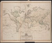
- Published / Created:
- 1787
- Call Number:
- 11 1787
- Container / Volume:
- BRBL_00006
- Image Count:
- 2
- Resource Type:
- Maps, Atlases & Globes
- Found in:
- Beinecke Rare Book and Manuscript Library > A General Map of the World or Terraqueous globe with all the new discoveries ... by Sam'l Dunn ...
- Published / Created:
- [1750?]
- Call Number:
- 3211cea 1750
- Container / Volume:
- BRBL_00055
- Image Count:
- 2
- Resource Type:
- Maps, Atlases & Globes
- Found in:
- Beinecke Rare Book and Manuscript Library > A Large Chart of the Channel between England and France ... by Capt. Edmund Halley ...
- Published / Created:
- 1774
- Call Number:
- 62 1774
- Container / Volume:
- BRBL_00333
- Image Count:
- 1
- Resource Type:
- Maps, Atlases & Globes
- Found in:
- Beinecke Rare Book and Manuscript Library > A Map of Abyssinia and Nubia, By Samuel Dunn.
- Published / Created:
- 1801
- Call Number:
- 3191 1801
- Container / Volume:
- BRBL_00041
- Image Count:
- 1
- Resource Type:
- Maps, Atlases & Globes
- Found in:
- Beinecke Rare Book and Manuscript Library > A Map of England, Wales, & Scotland ... by W. Faden ...
- Published / Created:
- [1775?]
- Call Number:
- 76cea 1775A
- Container / Volume:
- BRBL_00446
- Image Count:
- 1
- Resource Type:
- Maps, Atlases & Globes
- Found in:
- Beinecke Rare Book and Manuscript Library > A Map of the Coast of New England from Staten Island to the Island of Breton; as it was actualy survey'd by Capt Cyprian Southback.
- Published / Created:
- 1866
- Call Number:
- 304 1866
- Container / Volume:
- BRBL_00033
- Image Count:
- 1
- Resource Type:
- Maps, Atlases & Globes
- Found in:
- Beinecke Rare Book and Manuscript Library > A Map of the Germanic Confederation as it existed in June, 1866 and of Central Europe.
- Published / Created:
- 1757
- Call Number:
- 36hc P88 1756
- Container / Volume:
- BRBL_00134
- Image Count:
- 1
- Resource Type:
- Maps, Atlases & Globes
- Found in:
- Beinecke Rare Book and Manuscript Library > A Map of the country round Prague ... : A Plan of the city of Prague ...
- Published / Created:
- 1798
- Call Number:
- 27cea 1798
- Container / Volume:
- BRBL_00700
- Image Count:
- 1
- Resource Type:
- Maps, Atlases & Globes
- Found in:
- Beinecke Rare Book and Manuscript Library > A New Chart of the Eastern Straits or the Straits of the East of Java, with a part of the Banda Sea; corrected and improved chiefly from the observation of Captn. - Williams.
- Published / Created:
- 1794
- Call Number:
- 11 1794A
- Container / Volume:
- BRBL_00006
- Image Count:
- 1
- Resource Type:
- Maps, Atlases & Globes
- Found in:
- Beinecke Rare Book and Manuscript Library > A New Chart of the World ... with the tracks of the British Circumnavigators Bryon, Wallis, Carteret and Cook, &c.
- Published / Created:
- 1792
- Call Number:
- 326 1792
- Container / Volume:
- BRBL_00069
- Image Count:
- 1
- Resource Type:
- Maps, Atlases & Globes
- Found in:
- Beinecke Rare Book and Manuscript Library > A New Geographical Game exhibiting a complete Tour through Scotland and the Western Isles. Neele Sc.
- Published / Created:
- 1750
- Call Number:
- 3218 1750A
- Container / Volume:
- BRBL_00057
- Image Count:
- 1
- Resource Type:
- Maps, Atlases & Globes
- Found in:
- Beinecke Rare Book and Manuscript Library > A New Improved Map of Oxfordshire ... Thos. Kitchin ... 1750.
- Published / Created:
- 1811
- Call Number:
- 3247 1811
- Container / Volume:
- BRBL_00066
- Image Count:
- 1
- Resource Type:
- Maps, Atlases & Globes
- Found in:
- Beinecke Rare Book and Manuscript Library > A New Map of Northamptonshire, Divided Into Hundreds ... by John Cary.
- Published / Created:
- 1811
- Call Number:
- 3251 1811
- Container / Volume:
- BRBL_00067
- Image Count:
- 1
- Resource Type:
- Maps, Atlases & Globes
- Found in:
- Beinecke Rare Book and Manuscript Library > A New Map of Rutlandshire, Divided into Hundreds ... By John Cary.
- Published / Created:
- 1801
- Call Number:
- 501 1801
- Container / Volume:
- BRBL_00276
- Image Count:
- 1
- Resource Type:
- Maps, Atlases & Globes
- Found in:
- Beinecke Rare Book and Manuscript Library > A New Map of Turkey in Asia divided into its provinces, from the best authorities. By John Cary, Engraver.
- Published / Created:
- 1811
- Call Number:
- 27 1811
- Container / Volume:
- BRBL_00023A
- Image Count:
- 1
- Resource Type:
- Maps, Atlases & Globes
- Found in:
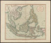
- Beinecke Rare Book and Manuscript Library > A New Map of the East India Isles ... John Cary, Engraver.
- Published / Created:
- 1801
- Call Number:
- 27 1801
- Container / Volume:
- BRBL_00023A
- Image Count:
- 1
- Resource Type:
- Maps, Atlases & Globes
- Found in:
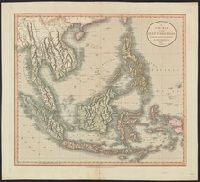
- Beinecke Rare Book and Manuscript Library > A New Map of the East India Isles. From the Latest Authorities. By John Cary, Engraver.
- Published / Created:
- 1794
- Call Number:
- 534 1794
- Container / Volume:
- BRBL_00289
- Image Count:
- 1
- Resource Type:
- Maps, Atlases & Globes
- Found in:
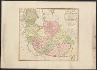
- Beinecke Rare Book and Manuscript Library > A New Map of the Empire of Persia from Monsr. DAnville ... with several Additions and Emendations.
- Published / Created:
- 1794
- Call Number:
- 534 1794
- Container / Volume:
- BRBL_00289
- Image Count:
- 1
- Resource Type:
- Maps, Atlases & Globes
- Found in:
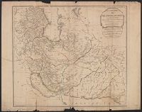
- Beinecke Rare Book and Manuscript Library > A New Map of the Empire of Persia from Monsr. DAnville ... with several Additions and Emendations.
- Published / Created:
- [ca. 1789]
- Call Number:
- 6555cea 1789
- Container / Volume:
- BRBL_00708
- Image Count:
- 3
- Resource Type:
- Maps, Atlases & Globes
- Found in:
- Beinecke Rare Book and Manuscript Library > A New Survey of that part of the Coast of Africa comprised between Cape Verga and Cape Formoso, including chiefly the Windward and Gold Coasts in which the Latitudes of all the Principal Places are determined by Actual observations, the bearings and cours
- Published / Created:
- 1794
- Call Number:
- 755cea 1794
- Container / Volume:
- BRBL_00441
- Image Count:
- 4
- Resource Type:
- Maps, Atlases & Globes
- Found in:
- Beinecke Rare Book and Manuscript Library > A New and Correct Chart of the Coast of New England and New York with the adjacent parts of Nova Scotia and New Brunswick from Cape Sable to the entrance of Hudsons or North River by Captain Holland.
- Published / Created:
- [1764?]
- Call Number:
- 76cea 1764
- Container / Volume:
- BRBL_00446
- Image Count:
- 1
- Resource Type:
- Maps, Atlases & Globes
- Found in:
- Beinecke Rare Book and Manuscript Library > A New and Correct Chart of the Sea Coast of New-England, from Cape Codd to Casco Bay. Lately Surbey'd by Capt. Henry Barnsley.
- Published / Created:
- 1794
- Call Number:
- 303cea 1794
- Container / Volume:
- BRBL_00033
- Image Count:
- 1
- Resource Type:
- Maps, Atlases & Globes
- Found in:
- Beinecke Rare Book and Manuscript Library > A New and Correct chart of the Gulf of Finland ... Published by command of the Empress of all the Russias.
- Published / Created:
- 1743
- Call Number:
- 319 1743
- Container / Volume:
- BRBL_00040
- Image Count:
- 1
- Resource Type:
- Maps, Atlases & Globes
- Found in:
- Beinecke Rare Book and Manuscript Library > A New and exact map of Great Britain ... [Including Ireland].
- Published / Created:
- in the year. 1681.
- Call Number:
- BrSides By6 1681
- Image Count:
- 1
- Found in:
- Beinecke Rare Book and Manuscript Library > A New ballad of London's loyalty : to a pleasant new tune, called Burton-Hall ...
- Published / Created:
- 1681
- Call Number:
- BrSides By6 1681
- Image Count:
- 2
- Resource Type:
- Books, Journals & Pamphlets
- Found in:
- Beinecke Rare Book and Manuscript Library > A New ballad upon Dr. Oates his retreat from White-Hall into the city : to the tune of I'le tell thee Dick where I have been.
- Published / Created:
- 1681
- Call Number:
- BrSides By6 1681
- Image Count:
- 1
- Found in:
- Beinecke Rare Book and Manuscript Library > A New ignoramus being the second new song, to the same old tune, Law lyes a bleeding.
- Published / Created:
- 1811
- Call Number:
- 319 1811
- Container / Volume:
- BRBL_00040
- Image Count:
- 1
- Resource Type:
- Maps, Atlases & Globes
- Found in:
- Beinecke Rare Book and Manuscript Library > A New map of the British Isles ... By John Cary, Engraver.
- Published / Created:
- 1793
- Call Number:
- 304gmd 1793
- Container / Volume:
- BRBL_00034B
- Image Count:
- 1
- Resource Type:
- Maps, Atlases & Globes
- Found in:
- Beinecke Rare Book and Manuscript Library > A New map of the Emperor's Dominions exhibiting the Post Roads of Germany, Hungary, and the Netherlands ... parts of France, Italy, Switzerland and Poland ...
- Published / Created:
- 1683
- Call Number:
- BrSides By6 1683
- Image Count:
- 1
- Found in:
- Beinecke Rare Book and Manuscript Library > A New narrative of the old plot : being a new ballad, to the tune of, Some say the papists had a plot, &c ...
- Published / Created:
- 1828
- Call Number:
- 38GMD 1828
- Container / Volume:
- BRBL_00171
- Image Count:
- 1
- Resource Type:
- Maps, Atlases & Globes
- Found in:
- Beinecke Rare Book and Manuscript Library > A Physical and Topographical map of France ... the post Roads & Relays ... inland Navigation &c. Pickett Sculp. J. Smith Delin.
- Published / Created:
- 1776
- Call Number:
- 792cea Am32 1776
- Container / Volume:
- BRBL_00519
- Image Count:
- 1
- Resource Type:
- Maps, Atlases & Globes
- Found in:
- Beinecke Rare Book and Manuscript Library > A Plan of Amelia Harbour and Barr in east Florida ...
- Published / Created:
- 1776
- Call Number:
- 786cea P838 1776
- Container / Volume:
- BRBL_00516
- Image Count:
- 1
- Resource Type:
- Maps, Atlases & Globes
- Found in:
- Beinecke Rare Book and Manuscript Library > A Plan of Port Royal in South Carolina ...
- Published / Created:
- 1755
- Call Number:
- 97 L62 1755
- Container / Volume:
- BRBL_00678
- Image Count:
- 1
- Resource Type:
- Maps, Atlases & Globes
- Found in:
- Beinecke Rare Book and Manuscript Library > A Scenographic Plan of the City of the Kings, otherwise called Lima, the capital of the Kingdonm of Peru ... as it was before the late earthquakes.
- Creator:
- Arlidge, Abraham
- Published / Created:
- 1983
- Call Number:
- 32 L84 1694/1983
- Container / Volume:
- BRBL_00739
- Image Count:
- 2
- Resource Type:
- Maps, Atlases & Globes
- Found in:
- Beinecke Rare Book and Manuscript Library > A Survey of Hatton Garden : a suruey of Hatton-Garden belonging to ... Barron Hatton of Kirby / by Abraham Arlidge.
- Published / Created:
- 1776
- Call Number:
- 771 C358 1776C
- Container / Volume:
- BRBL_00482
- Image Count:
- 1
- Resource Type:
- Maps, Atlases & Globes
- Found in:
- Beinecke Rare Book and Manuscript Library > A Survey of Lake Champlain including Lake George, Crown Point, and St. John ... by William Brassier, Draughtsman. 1762.
- Published / Created:
- 1776
- Call Number:
- 771 C358 1776
- Container / Volume:
- BRBL_00482
- Image Count:
- 1
- Resource Type:
- Maps, Atlases & Globes
- Found in:
- Beinecke Rare Book and Manuscript Library > A Survey of Lake Champlain including Lake George, Crown Point, and St. John : surveyed by order of his Excellency major General Sr. Jeffery Amherst ... / by William Brassier, Draughtsman, 1762.
- Published / Created:
- 1776
- Call Number:
- 771 H864 1776A
- Container / Volume:
- BRBL_00483
- Image Count:
- 1
- Resource Type:
- Maps, Atlases & Globes
- Found in:
- Beinecke Rare Book and Manuscript Library > A Topographical map of Hudsons River ... Communication with Canada by Lake George and lake Champlain ... by Claude Joseph Sauthier ...
- Published / Created:
- 1776
- Call Number:
- 771 H864 1776
- Container / Volume:
- BRBL_00483
- Image Count:
- 1
- Resource Type:
- Maps, Atlases & Globes
- Found in:
- Beinecke Rare Book and Manuscript Library > A Topographical map of Hudsons River ... Communication with Canada by Lake George and lake Champlain ... by Claude Joseph Sauthier ...
- Published / Created:
- 1777
- Call Number:
- 765cea N16 1777
- Container / Volume:
- BRBL_00464
- Image Count:
- 1
- Resource Type:
- Maps, Atlases & Globes
- Found in:
- Beinecke Rare Book and Manuscript Library > A Topological Chart of the Bay of Narragansett in the Province of New englannd ... by Charles Blaskowitz.
- Published / Created:
- 1776
- Call Number:
- 775cea 1776
- Container / Volume:
- BRBL_00502
- Image Count:
- 1
- Resource Type:
- Maps, Atlases & Globes
- Found in:
- Beinecke Rare Book and Manuscript Library > A chart of Delaware Bay and River ... by joshua Fisher.
- Published / Created:
- 1776
- Call Number:
- 775cea 1776B
- Container / Volume:
- BRBL_00502
- Image Count:
- 1
- Resource Type:
- Maps, Atlases & Globes
- Found in:
- Beinecke Rare Book and Manuscript Library > A chart of Delaware Bay and River. Contains a full and exact description of the shores, creeks, harbours, soundings, shoals, sands and bearings of the most considerable landmarks from the Capes to Philadelphia taken from the original chart.
- Creator:
- Sayer, Robert, 1725-1794
- Published / Created:
- 20 Feby. 1782.
- Call Number:
- BrSides Folio 2019 82
- Image Count:
- 1
- Resource Type:
- Maps, Atlases & Globes
- Found in:
- Beinecke Rare Book and Manuscript Library > A chart of the Atlantic Ocean : I. sheet.
- Creator:
- Chabert, Joseph Bernard, marquis de, 1724-1805
- Published / Created:
- 25th, March 1775.
- Call Number:
- 72cea 1775
- Container / Volume:
- BRBL_00688
- Image Count:
- 1
- Resource Type:
- Maps, Atlases & Globes
- Found in:
- Beinecke Rare Book and Manuscript Library > A chart of the Banks of Newfoundland / drawn from a great number of hydrographical surveys, chiefly from those of Chabert, Cook, and Fleurieu, connected and ascertained by astronomical observations.
- Creator:
- Chabert, Joseph Bernard, marquis de, 1724-1805
- Published / Created:
- 25th, March 1775.
- Call Number:
- 72cea 1775
- Container / Volume:
- BRBL_00373
- Image Count:
- 1
- Resource Type:
- Maps, Atlases & Globes
- Found in:
- Beinecke Rare Book and Manuscript Library > A chart of the Banks of Newfoundland / drawn from a great number of hydrographical surveys, chiefly from those of Chabert, Cook, and Fleurieu, connected and ascertained by astronomical observations.
- Creator:
- Jefferys, Thomas, -1771
- Published / Created:
- 25th March, 1775.
- Call Number:
- 7345cea 1775A
- Container / Volume:
- BRBL_00689
- Image Count:
- 1
- Resource Type:
- Maps, Atlases & Globes
- Found in:
- Beinecke Rare Book and Manuscript Library > A chart of the Gulf of St. Laurence [cartographic material] : composed from a great number of actual surveys and other materials, regulated and connected by astronomical observations.
- Published / Created:
- 1775
- Call Number:
- 966 1775
- Container / Volume:
- BRBL_00676
- Image Count:
- 1
- Resource Type:
- Maps, Atlases & Globes
- Found in:
- Beinecke Rare Book and Manuscript Library > A chart of the Straits of Magellan. Inlarged from a chart published at Madrid in 1769, by Don Juan de la Cruz Cano y Olmedilla ... and improved from the observations and surveys of Captns. Byron, Wallis and Carteret ...
- Creator:
- Delarochette, L. (Louis), 1731-1802
- Published / Created:
- June 28th, 1780.
- Call Number:
- 39cea 1780
- Container / Volume:
- BRBL_00192
- Image Count:
- 1
- Resource Type:
- Maps, Atlases & Globes
- Found in:
- Beinecke Rare Book and Manuscript Library > A chart of the coasts of Spain and Portugal, with the Balearic Islands, and part of the coast of Barbary / by L.S. De la Rochette.
- Creator:
- Morris, Charles, fl. 1749, cartographer
- Published / Created:
- 1759?]
- Call Number:
- 732cea H13 1759
- Container / Volume:
- BRBL_00378
- Image Count:
- 1
- Resource Type:
- Maps, Atlases & Globes
- Found in:
- Beinecke Rare Book and Manuscript Library > A chart of the harbour of Halifax, in Nova Scotia : with Jebucto Bay and Cape Sambrô, also the islands, ledges of rocks, shoals & soundings / survey'd, by order of His Excellency Brigadier General Lawrence, Governour of the Province of Nova Scotia, by Ch
- Creator:
- Lodge, John, -1796
- Published / Created:
- 31 Augst. 1780.
- Call Number:
- 8555 1780A
- Container / Volume:
- BRBL_00695
- Image Count:
- 1
- Resource Type:
- Maps, Atlases & Globes
- Found in:
- Beinecke Rare Book and Manuscript Library > A chart of the island of Jamaica [cartographic material] : with its bays, harbours, rocks, soundings, &c. / Jno. Lodge, sculp.
- Creator:
- W. Mount and T. Page
- Published / Created:
- [between 1732 and 1749]
- Call Number:
- 71cea 1723
- Container / Volume:
- BRBL_00688
- Image Count:
- 1
- Resource Type:
- Maps, Atlases & Globes
- Found in:
- Beinecke Rare Book and Manuscript Library > A chart of the sea coast of New Found Land, New Scotland, New England, New York, New Jersey, with Virginia and Maryland.
- Creator:
- Seller, John, fl. 1658-1698
- Published / Created:
- [1671?]
- Call Number:
- 319cea 1671
- Container / Volume:
- BRBL_00042
- Image Count:
- 1
- Resource Type:
- Maps, Atlases & Globes
- Found in:
- Beinecke Rare Book and Manuscript Library > A chart of ye narrow seas / newly corrected by John Seller, hydrographer to the kings most excellent majestie.
- Creator:
- Vancouver, George, 1757-1798
- Published / Created:
- 1798
- Call Number:
- 845 1798A
- Container / Volume:
- BRBL_00619
- Image Count:
- 1
- Resource Type:
- Maps, Atlases & Globes
- Found in:
- Beinecke Rare Book and Manuscript Library > A chart shewing part of the coast of N.W. America : with the tracks of His Majesty's sloop Discovery and armed tender Chatham / commanded by George Vancouver, esqr. and prepared under his immediate inspection by Lieut. Joseph Baker, in which the continent
- Creator:
- Vancouver, George, 1757-1798
- Published / Created:
- 1798
- Call Number:
- 845 1798C
- Container / Volume:
- BRBL_00619
- Image Count:
- 1
- Resource Type:
- Maps, Atlases & Globes
- Found in:
- Beinecke Rare Book and Manuscript Library > A chart shewing part of the coast of N.W. America, with the tracks of His Majesty's sloop Discovery and armed tender Chatham / commanded by George Vancouver, esq. and prepared under his immediate inspection by Lieut. Joseph Baker, in which the continental
- Creator:
- Vancouver, George, 1757-1798
- Published / Created:
- 1798
- Call Number:
- 845 1798H
- Container / Volume:
- BRBL_00619
- Image Count:
- 1
- Resource Type:
- Maps, Atlases & Globes
- Found in:
- Beinecke Rare Book and Manuscript Library > A chart shewing part of the coast of N.W. America, with the tracks of His Majesty's sloop Discovery and armed tender Chatham / commanded by George Vancouver, esq. and prepared under his immediate inspection by Lieut. Joseph Baker, in which the continental
- Creator:
- Vancouver, George, 1757-1798
- Published / Created:
- 1798
- Call Number:
- 845 1798B
- Container / Volume:
- BRBL_00619
- Image Count:
- 1
- Resource Type:
- Maps, Atlases & Globes
- Found in:
- Beinecke Rare Book and Manuscript Library > A chart shewing part of the coast of N.W. America, with the tracks of His Majesty's sloop Discovery and armed tender Chatham / commanded by George Vancouver, esqr. and prepared from the foregoing surveys under his immediate inspection by Lieut. Edwd. Robe
- Creator:
- Vancouver, George, 1757-1798
- Published / Created:
- 1798
- Call Number:
- 845 1798G
- Container / Volume:
- BRBL_00619
- Image Count:
- 1
- Resource Type:
- Maps, Atlases & Globes
- Found in:
- Beinecke Rare Book and Manuscript Library > A chart shewing part of the coast of N.W. America, with the tracks of His Majesty's sloop Discovery and armed tender Chatham / commanded by George Vancouver, esqr. and prepared under his immediate inspection by Lieut. Joseph Baker, in which the continenta
- Creator:
- Vancouver, George, 1757-1798
- Published / Created:
- 1798
- Call Number:
- 845 1798F
- Container / Volume:
- BRBL_00619
- Image Count:
- 1
- Resource Type:
- Maps, Atlases & Globes
- Found in:
- Beinecke Rare Book and Manuscript Library > A chart shewing part of the coast of N.W. America, with the tracks of His Majesty's sloop Discovery and armed tender Chatham / commanded by George Vancouver, esqr. and prepared under his immediate inspection by Lieut. Joseph Baker, in which the continenta
- Creator:
- Vancouver, George, 1757-1798
- Published / Created:
- 1798
- Call Number:
- 845 1798D
- Container / Volume:
- BRBL_00619
- Image Count:
- 1
- Resource Type:
- Maps, Atlases & Globes
- Found in:
- Beinecke Rare Book and Manuscript Library > A chart shewing part of the coast of N.W. America, with the tracks of His Majesty's sloop Discovery and armed tender Chatham / commanded by George Vancouver, esqr. and prepared under his immediate inspection by Lieut. Joseph Baker, in which the continenta
- Creator:
- Vancouver, George, 1757-1798
- Published / Created:
- 1798
- Call Number:
- 845 1798E
- Container / Volume:
- BRBL_00619
- Image Count:
- 1
- Resource Type:
- Maps, Atlases & Globes
- Found in:
- Beinecke Rare Book and Manuscript Library > A chart shewing part of the coast of N.W. America, with the tracks of His Majesty's sloop Discovery and armed tender Chatham / commanded by George Vancouver, esqu. and prepared under his immediate inspection by Lieut. Joseph Baker, in which the continenta
- Published / Created:
- 1788
- Call Number:
- 319 1788
- Container / Volume:
- BRBL_00040
- Image Count:
- 1
- Resource Type:
- Maps, Atlases & Globes
- Found in:
- Beinecke Rare Book and Manuscript Library > A compleat map of the British Isles ...
- Published / Created:
- 1804
- Call Number:
- 32 1804
- Container / Volume:
- BRBL_00044
- Image Count:
- 1
- Resource Type:
- Maps, Atlases & Globes
- Found in:
- Beinecke Rare Book and Manuscript Library > A complete representation of the Coast of England ... intended for the invasion of England, By John Luffman Geog.
- Creator:
- Taylor, John, 1580-1653.
- Published / Created:
- 1699.
- Call Number:
- Ih T215 641Pb
- Image Count:
- 45
- Resource Type:
- Books, Journals & Pamphlets
- Found in:
- Beinecke Rare Book and Manuscript Library > A dialogue between a pedler and a popish priest : in a very hot discourse full of mirth, truth, wit, folly and plain dealing / by John Taylor, the water-poet. Tract I ; reviv'd, review'd and reprinted.
- Published / Created:
- 1770
- Call Number:
- 219cea 1770
- Image Count:
- 1
- Resource Type:
- Maps, Atlases & Globes
- Found in:
- Beinecke Rare Book and Manuscript Library > A draught of Falklands Islands in the latitude of 51° 22' South, longitude 64° 30' West.
- Published / Created:
- [1780?]
- Call Number:
- 786 1780A
- Container / Volume:
- BRBL_00515
- Image Count:
- 1
- Resource Type:
- Maps, Atlases & Globes
- Found in:
- Beinecke Rare Book and Manuscript Library > A draught of South Carolina and Georgia from Sewee to St. Estaca / by Andrew Hughes
- Creator:
- Hughes, Andrew, 18th century
- Published / Created:
- [1780?]
- Call Number:
- 786 1780A
- Image Count:
- 1
- Resource Type:
- Maps, Atlases & Globes
- Found in:
- Beinecke Rare Book and Manuscript Library > A draught of South Carolina and Georgia from Sewee to St. Estaca / by Andrew Hughes.
- Creator:
- Delarochette, L. (Louis), 1731-1802
- Published / Created:
- September 22d, 1796.
- Call Number:
- 85 1796A
- Container / Volume:
- BRBL_00693
- Image Count:
- 1
- Resource Type:
- Maps, Atlases & Globes
- Found in:
- Beinecke Rare Book and Manuscript Library > A general chart of the West India Islands with the adjacent coasts of the Spanish continent [cartographic material] / by L.S. de la Rochette.
- Creator:
- Jefferys, Thomas, d. 1771
- Published / Created:
- 10th, May 1775.
- Call Number:
- 72 1775
- Container / Volume:
- BRBL_00688
- Image Count:
- 1
- Resource Type:
- Maps, Atlases & Globes
- Found in:
- Beinecke Rare Book and Manuscript Library > A general chart of the island of Newfoundland with the rocks & soundings / [cartographic material] / drawn from surveys taken by order of the Right Honourable the Lords Commissioners of the Admiralty by James Cook and Michael Lane, surveyors, and others.
- Creator:
- Evans, Lewis, 1700?-1756
- Published / Created:
- 1771
- Call Number:
- 755 1771C
- Container / Volume:
- BRBL_00429
- Image Count:
- 1
- Resource Type:
- Maps, Atlases & Globes
- Found in:
- Beinecke Rare Book and Manuscript Library > A general map of the middle British colonies in America : viz. Virginia, Maryland, Delaware, Pensilvania, New-Jersey, New York, Connecticut & Rhode-Island : of Aquanishuonigy the country of the confederate Indians comprehending Aquanishuonigy proper, thei
- Creator:
- Robert Sayer and John Bennett (Firm)
- Published / Created:
- 1776
- Call Number:
- 755 1776
- Container / Volume:
- BRBL_00430
- Image Count:
- 1
- Resource Type:
- Maps, Atlases & Globes
- Found in:
- Beinecke Rare Book and Manuscript Library > A general map of the middle British colonies, in America [cartographic material] : Containing Virginia, Maryland, the Delaware counties, Pennsylvania and New Jersey. With the addition of New York, and the greatest part of New England, as also of the borde
- Published / Created:
- 1794
- Call Number:
- 11 1794
- Container / Volume:
- BRBL_00724
- Image Count:
- 2
- Resource Type:
- Maps, Atlases & Globes
- Found in:
- Beinecke Rare Book and Manuscript Library > A general map of the world, or terraqueous globe ... / by Saml. Dunn, mathematician.
- Published / Created:
- March 15, 1832
- Call Number:
- 75 1850
- Container / Volume:
- BRBL_00689
- Image Count:
- 2
- Resource Type:
- Maps, Atlases & Globes
- Found in:
- Beinecke Rare Book and Manuscript Library > A geological map of the United States [cartographic material].
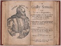
- Creator:
- Hart, John, D.D
- Published / Created:
- 1663
- Call Number:
- Mhc9 H252 C46
- Image Count:
- 11
- Found in:
- Beinecke Rare Book and Manuscript Library > A godly sermon of Peters repentance : after he had denyed his lord and master Jesus Christ ...
- Published / Created:
- 1846
- Call Number:
- 32 L84 1846
- Container / Volume:
- BRBL_00050
- Image Count:
- 1
- Resource Type:
- Maps, Atlases & Globes
- Found in:
- Beinecke Rare Book and Manuscript Library > A guide through London and the surrounding boroughs. Engraved S.I. Russell.
- Creator:
- Inett, John, 1647-1717
- Published / Created:
- 1700
- Call Number:
- Mhc9 In3 G7 1700
- Image Count:
- 184
- Found in:
- Beinecke Rare Book and Manuscript Library > A guide to the devout Christian : in three parts ... to which is added, a prayer for Ash-Wednesday, or any other time in Lont : for Good-Friday, and any day of publick fasting.
- Creator:
- Liddell, George, fl. 1700
- Published / Created:
- 1700. Price 2 d.
- Call Number:
- Mhc9 L619 H7
- Image Count:
- 14
- Found in:
- Beinecke Rare Book and Manuscript Library > A honey-comb to refresh weary travellers / gathered by Geor. Liddell in Edinburgh ...
- Creator:
- Edward Stanford Ltd.
- Published / Created:
- [1878]
- Call Number:
- BrSides Folio 2019 91
- Image Count:
- 1
- Resource Type:
- Maps, Atlases & Globes
- Found in:
- Beinecke Rare Book and Manuscript Library > A language map of further India and the Indian archipelago [cartographic material].
- Creator:
- Fairfax, Ferdinando Fairfax, Baron, 1584-1648
- Published / Created:
- May 19, 1642.
- Call Number:
- Z45 90 5
- Image Count:
- 5
- Found in:
- Beinecke Rare Book and Manuscript Library > A letter from the Right Honourable Ferdinando, Lord Fairfax, Sir Hugh Cholmley, Sir Philip Stapleton, Sir Henry Cholmley, Committees of the Commons House of Parliament residing at York: together with a relation of all the passages at the great meeting at York on Thursday the 12 of this instant May : with the votes from the Lords in Parliament, concerning His Majesties resolution for the adjourning of the next term from Westminster to Yorke, May 17, 1642 ...
- Creator:
- Standfast, Richard, 1608?-1684
- Published / Created:
- 1657
- Call Number:
- Mhc9 St22 L5 1657
- Image Count:
- 64
- Found in:
- Beinecke Rare Book and Manuscript Library > A little handful of cordial comforts, scattered thorowout several answers, to sixteen questions and objections ... / by Richard Standfast ...
- Published / Created:
- 1768
- Call Number:
- 755FD 1768
- Container / Volume:
- BRBL_00442
- Image Count:
- 1
- Resource Type:
- Maps, Atlases & Globes
- Found in:
- Beinecke Rare Book and Manuscript Library > A map ... of the English rights relative to the Ancient limits of Acadia ...
- Creator:
- Arrowsmith, Aaron, 1750-1823
- Published / Created:
- [1818]
- Call Number:
- 71 1818A
- Container / Volume:
- BRBL_00368
- Image Count:
- 4
- Resource Type:
- Maps, Atlases & Globes
- Found in:
- Beinecke Rare Book and Manuscript Library > A map exhibiting all the new discoveries in the interior parts of North America : inscribed by permission to the honourable governor and company of adventurers of England trading into Hudsons Bay in testimony of their liberal communications to their most
- Creator:
- Mackenzie, Alexander, 1764-1820
- Published / Created:
- 1801
- Call Number:
- 73 1801
- Container / Volume:
- BRBL_00374
- Image Count:
- 1
- Resource Type:
- Maps, Atlases & Globes
- Found in:
- Beinecke Rare Book and Manuscript Library > A map of America between latitudes 40 and 70 north and longitudes 45 and 180 west exhibiting Mackenzie's track from Montreal to Fort Chipewyan & from thence to the north sea in 1789 & to the west Pacific Ocean in 1793.
- Published / Created:
- 1797
- Call Number:
- 70 1797
- Container / Volume:
- BRBL_00725
- Image Count:
- 1
- Resource Type:
- Maps, Atlases & Globes
- Found in:
- Beinecke Rare Book and Manuscript Library > A map of America, or the new world, wherein are introduced all the known parts of the western hemisphere, from the map of d'Anville ...
- Creator:
- Edward Stanford Ltd
- Published / Created:
- 1903
- Call Number:
- 2732 1903
- Container / Volume:
- BRBL_00023B
- Image Count:
- 1
- Resource Type:
- Maps, Atlases & Globes
- Found in:
- Beinecke Rare Book and Manuscript Library > A map of British North Borneo / compiled from the English Admiralty charts and from the surveys and explorations of F.X. Witti, W.B. Pryer, F. Hatton, Henry Walker, D.D. Daly, and R.D. Beeston in the service of the British North Borneo Company.
- Creator:
- China Inland Mission
- Published / Created:
- 1911
- Call Number:
- 56 1911
- Container / Volume:
- BRBL_00296
- Image Count:
- 1
- Resource Type:
- Maps, Atlases & Globes
- Found in:
- Beinecke Rare Book and Manuscript Library > A map of China [cartographic material] : prepared for the China Inland Mission.